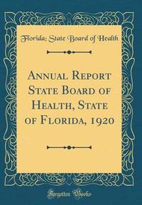
Florida; State Board of HealthBiblio.com
2 245 résultats
0656140992.Ghardcover. Good. Access codes and supplements are not guaranteed with used items. May be an ex-library book. hardcover
0243170645.Gpaperback. Good. Access codes and supplements are not guaranteed with used items. May be an ex-library book. paperback
1333830920.Gpaperback. Good. Access codes and supplements are not guaranteed with used items. May be an ex-library book. paperback
1355541514.Ghardcover. Good. Access codes and supplements are not guaranteed with used items. May be an ex-library book. hardcover
1342778367.Ghardcover. Good. Access codes and supplements are not guaranteed with used items. May be an ex-library book. hardcover
A magazine for collectors and others interested in times past and in articles of daily use and adornment devised by the forefathers. Features: Living with antiques - The Hacienda, Florida residence of H. Rodney Sharp; Eighteenth-century porcelain in Seattle; Smithsonian preview; The Nine Colonial Sugar Boxes; English Furniture Exports to America 1697-1830; Marine paintings by Two Buttersworths - James E. and Thomas; An American triangular turned Chair?; The Bed Rug in Colonial America; and more. Many pages of nostalgic ads from a broad assortment of prominent dealers. Profusely illustrated with excellent black and white photos. 134 pages. Printed upon glossy stock. Unmarked with average wear. A worthy reference copy of this informative issue. Book
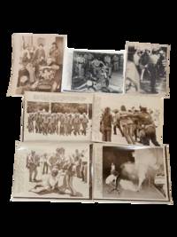
1972234431972. Florida antiwar protest press archive documenting demonstrations in Miami Beach during the 1972 Republican National Convention when activists targeted President Richard Nixon's renomination after years of bombing troop deployments and stalled peace negotiations in Vietnam. Protesters gathered outside convention sites government buildings and public streets to oppose the war challenge Nixon's reelection campaign and confront the heavy police and military security presence surrounding the convention.<br /> <br /> Photo archive of 7 Large silver gelatin press photographs each approx 8 x 10" Miami Beach Florida 1972. Military police march toward convention stations carrying riot clubs and wearing helmets and flak suits; demonstrators are pushed back by uniformed personnel; a seated protester is restrained on the grass by police; and tear gas fills a street as a demonstrator crouches near a smoking canister. Additional scenes show antiwar organizers seated indoors with signs reading "Stop the War Now" helmeted police standing over demonstrators in the street and a protester being taken away during a confrontation. Captions identify Miami Beach the Republican National Convention police preparations arrests and disruption threats tied to convention proceedings.<br /> <br /> The archive records the 1972 convention as a flashpoint in the late Vietnam War when Nixon campaigned on strength abroad while antiwar activists challenged the bombing of North Vietnam the mining of Haiphong Harbor and the continuation of U.S. military policy despite troop withdrawals. Miami Beach became a controlled political theater where nomination ceremonies unfolded behind lines of police National Guard and military personnel while demonstrators used sit-ins marches and street actions to force the war into public view. Press stamps caption slips editorial envelopes and agency markings preserve the photographs as working news files from the confrontation. Light handling wear caption attachments editorial markings toning and minor edge wear. Overall in good condition. unknown
191640717Washington D.C.: Published by the United States Coast and Geodetic Survey 1916. Large folding nautical chart printed on heavy paper stock. Uncolored. Rare original coastal survey of Florida's Apalachee bay.<br/> <br/> Established by President Thomas Jefferson in 1807 as the Survey of the Coast the U.S. Coast and Geodetic Survey was the United States' first civilian scientific agency. This agency has followed its mission to survey the U.S. coastline create nautical charts of the coast and help increase maritime safety since its founding and has often played fascinating roles in significant chapters of U.S. history. It served in all theaters of the Civil War in the service of the Union Army and Navy pioneered acoustic exploration in the wake of the sinking of the Titanic and during WWI it worked to detect enemy submarines. In addition this agency worked to survey and produce detailed maps and renderings of the U.S. coast. These nautical survey maps commonly referred to as "T-sheets" provide fascinating insights into the history of the United States coastline which has and will continue to shift. These maps are the most important data source for understanding the physical and ecological characteristics of the U.S. shoreline. The present map of the Florida coastline is notable for the inclusion of St Marks light house built at the head of the St Marks River to assist in navigation to and from the important 19th century agricultural port of St Marks. This map is a highly detailed and accurate sea chart of the Apalachee Bay from Fish Creek to Alligator Point and an important historical view of a developing Florida. Published by the United States Coast and Geodetic Survey unknown
191640680Washington D.C.: Published by the United States Coast and Geodetic Survey 1916. Large folding nautical chart printed on heavy paper stock. Colored. A rare coastal survey of Apalachee Bay including Alligator Point and St. George Island.<br/> <br/> Established by President Thomas Jefferson in 1807 as the Survey of the Coast the U.S. Coast and Geodetic Survey was the United States' first civilian scientific agency. This agency has followed its mission to survey the U.S. coastline create nautical charts of the coast and help increase maritime safety since its founding and has often played fascinating roles in significant chapters of U.S. history. It served in all theaters of the Civil War in the service of the Union Army and Navy pioneered acoustic exploration in the wake of the sinking of the Titanic and during WWI it worked to detect enemy submarines. In addition this agency worked to survey and produce detailed maps and renderings of the U.S. coast. These nautical survey maps commonly referred to as "T-sheets" provide fascinating insights into the history of the United States coastline which has and will continue to shift. These maps are the most important data source for understanding the physical and ecological characteristics of the U.S. shoreline. The present map is a highly detailed and accurate sea chart of the Apalachee Bay and an important historical view of a developing Florida. Published by the United States Coast and Geodetic Survey unknown
192040721Washington D.C.: Published by the United States Coast and Geodetic Survey 1920. Large folding nautical chart printed on heavy paper stock. Uncolored. A rare original coastal survey of Apalachicola Bay and Cape San Blas including St. George Island.<br/> <br/> Established by President Thomas Jefferson in 1807 as the Survey of the Coast the U.S. Coast and Geodetic Survey was the United States' first civilian scientific agency. This agency has followed its mission to survey the U.S. coastline create nautical charts of the coast and help increase maritime safety since its founding and has often played fascinating roles in significant chapters of U.S. history. It served in all theaters of the Civil War in the service of the Union Army and Navy pioneered acoustic exploration in the wake of the sinking of the Titanic and during WWI it worked to detect enemy submarines. In addition this agency worked to survey and produce detailed maps and renderings of the U.S. coast. These nautical survey maps commonly referred to as "T-sheets" provide fascinating insights into the history of the United States coastline which has and will continue to shift. These maps are the most important data source for understanding the physical and ecological characteristics of the U.S. shoreline. The present map of the Florida coastline precedes the development of the town of Eastpoint and the building of the John Gorrie Memorial Bridge which connects Eastpoint with Apalachicola. The current site of Eastpoint is marked as Godleys Bluff on the present map. This map is a highly detailed and accurate sea chart of the coastal Florida and an important historical view of the developing state. Published by the United States Coast and Geodetic Survey unknown
ria9780271078656_inpHardback. New. New Book; Fast Shipping from UK; Not signed; Not First Edition; Studies the illustration of Revelation in manuscripts from the ninth to the fifteenth century. Examines how twenty-five of the most important illustrated Apocalypses illustrate the biblical text and interpret it for diverse audiences. hardcover
19952144487Atlanta: Scholars Press 1995. X, 255, (9) Seiten. 8° (17,5-22,5 cm) Orig.-Leinenband. [Hardcover / fest gebunden].
19962144486Atlanta: Scholars Press 1996. X, 250, (14) Seiten. 8° (17,5-22,5 cm) Orig.-Leinenband. [Hardcover / fest gebunden].
ria9780521746274_inpPaperback / softback. New. New Book; Fast Shipping from UK; Not signed; Not First Edition; This text introduces the archaeology of Native North Americans to a new generation of students and laypeople who demand more than stereotypes and sterile facts. Not just an evolutionary outline this book presents a rich cultural histor paperback
224 pages. Features: Novel take for a creative couple in Beverly Hills; Spinning the Bahamian colonial cottage of old into a design of its own place and time; Author Barbara Goldsmith's Park Avenue home; The 98-room Carolands is finally a home; The art of deco in Florida - invoking the jazz age in a dramatically redesigned Palm Beach residence; Neoclassical edge for an Austrian retreat; Modernizing a waterfront home in Greenwich, Connecticut; Jewels on the go; Outside the box in Vancouver, BC; Carleton Varney gives his son's New York apartment an infusion of color; A West Palm beach pool and theatre make it worth staying home to watch a movie. Moderate wear. Unmarked. A sound copy. Magazine
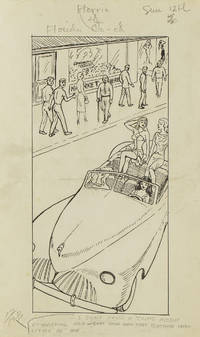
1949313357Gainesville Fla 1949. Aprox 77 pen and ink drawings with the newspaper cliping done generally for Wednesdays and Sundays. 8vo & 4to. In spiral rink notebook. Aprox 77 pen and ink drawings with the newspaper cliping done generally for Wednesdays and Sundays. 8vo & 4to. unknown
1949313357Gainesville Fla 1949. Aprox 77 pen and ink drawings with the newspaper cliping done generally for Wednesdays and Sundays. 8vo & 4to. In spiral rink notebook. Aprox 77 pen and ink drawings with the newspaper cliping done generally for Wednesdays and Sundays. 8vo & 4to. unknown books
199026721Tallahassee FL: Gallery & Museum School of Visual Arts & Dance Florida State University. New. 1990. Paperback. FREE UPGRADE to Courier/Priority Shipping Upon Request - IN STOCK AND IMMEDIATELY AVAILABLE FOR SHIPMENT - FLAWLESS COPY BRAND NEW PRISTINE NEVER OPENED -- with a bonus offer-- . Gallery & Museum School of Visual Arts & Dance, Florida State University paperback
199026722Tallahassee FL: Florida State University Gallery & Museum. New. 1990. Paperback. FREE UPGRADE to Courier/Priority Shipping Upon Request - IN STOCK AND IMMEDIATELY AVAILABLE FOR SHIPMENT - -- with a bonus offer-- . Florida State University Gallery & Museum paperback
0526602163.Ghardcover. Good. Access codes and supplements are not guaranteed with used items. May be an ex-library book. hardcover
0265973643.Ghardcover. Good. Access codes and supplements are not guaranteed with used items. May be an ex-library book. hardcover
0267061668.Ghardcover. Good. Access codes and supplements are not guaranteed with used items. May be an ex-library book. hardcover
0365693588.Gpaperback. Good. Access codes and supplements are not guaranteed with used items. May be an ex-library book. paperback
0365693626.Ghardcover. Good. Access codes and supplements are not guaranteed with used items. May be an ex-library book. hardcover
0483459984.Gpaperback. Good. Access codes and supplements are not guaranteed with used items. May be an ex-library book. paperback