Floride GérardLivre Rare Book
2 245 résultats
19794000454681979 1979.
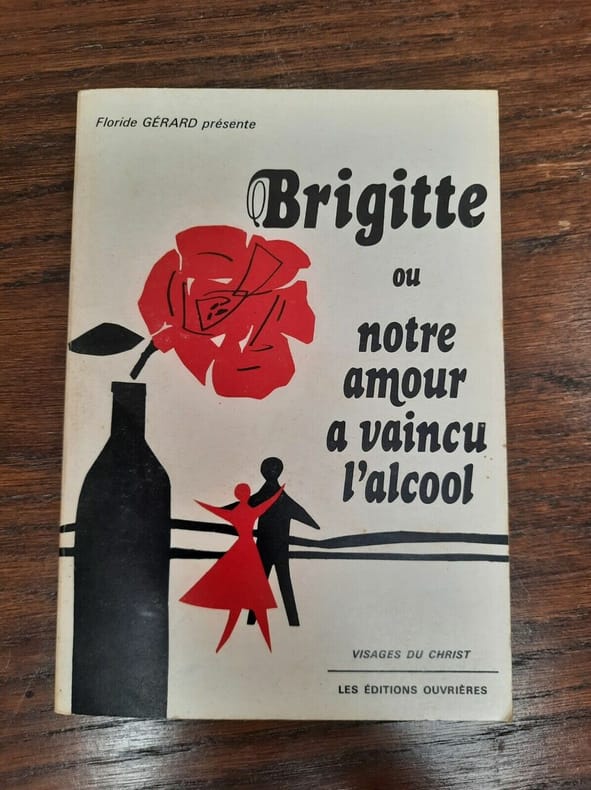
1979R200027063LES EDITIONS OUVRIERES. 1979. In-12. Broché. Etat d'usage, Couv. légèrement passée, Dos satisfaisant, Intérieur acceptable. 116 pages.. . . . Classification Dewey : 200-RELIGION
Book is in excellent condition with very light edge wear only. Binding is solid and square, covers have sharp corners, text/interior is clean and free of marking of any kind and is in impressively fine condition with tipped-in color plates and b&w prints, map endpapers showing the locations of the text. Dust jacket is price clipped and is extensively repaired at edges with scotch tape. Contents include The pleasure gardens, White conduit house, Marylebone gardens, Jenny's whim, Bagnigge wells, Islington spa, Sadler's wells, Highbury barn, Bermondsey spa, The English grotto, Finch's grotto gardens, Florida gardens, The Yorkshire stingo, etc.
18116624AWien, Bauer, 1810/1811. 8°. Bde. 1 und 2 von 3 Bdn. 336, 360 Seiten. Mit 2 gestochenen Frontispizen. Pappbände der Zeit mit Rückenschildern. Rücken etwas angestaubt, sonst tadellos.
ria9781285774770_inpHardback. New. New Book; Fast Shipping from UK; Not signed; Not First Edition; Designed for the three-semester engineering calculus course this book offers instructors and students teaching and learning resources. hardcover
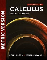
ria9781337616195_inpPaperback / softback. New. New Book; Fast Shipping from UK; Not signed; Not First Edition; Larson/Edwards’ CALCULUS 11E INTERNATIONAL METRIC EDITION expertly combines the printed textbook and technology to deliver everything you need to master the material and pass the class. Stepped-out solution videos with instruction a paperback
ria9780357908129_inpPaperback / softback. New. New Book; Fast Shipping from UK; Not signed; Not First Edition; With a long history of innovation in the market Larson/Edwards’ Calculus International Metric Edition has been widely praised by a generation of students and professors for solid and effective pedagogy that addresses the needs of a paperback
44397322like new. unknown
44397322-nnew. unknown
2022__0357908120Cengage Learning Inc 2022. Paperback / Softback. New. 12 ed edition. 1280 pages. 10.79x8.62x1.73 inches. Cengage Learning, Inc paperback
Features include: The lumber industry in Canada; Life Insurance in Canada; The State of Florida. Nostalgic advertisements. Excellent black and white photography. Musty. Book
216 pages. Features: Swaths of colour and pattern bathe a traditional family home; Jane Hess mixes period and place, modern with antique; Bringing a refined air to a Florida vacation home; Designer Michelle Crowley-Crawford and rustic living; Hotel Chick checks into the bath; Three professional stylist homes on display; Mary Janigan's shady city plot; Sheer fabric projects; 5 recipes go buffet-style; and more. Small clipping from lower corner of first few pages. Moderate wear. Unmarked. A quality copy. Book
0813003571.Ghardcover. Good. Access codes and supplements are not guaranteed with used items. May be an ex-library book. hardcover
191640727Washington D.C.: Published by the United States Coast and Geodetic Survey 1916. Large folding nautical chart printed on heavy paper stock. Colored. A rare original coastal survey of Cape Canaveral to Key West including Jupiter West Palm Beach Boca Raton Fort Lauderdale Hollywood Miami the Keys the Everglades Naples and the Bahamas.<br/> <br/> Established by President Thomas Jefferson in 1807 as the Survey of the Coast the U.S. Coast and Geodetic Survey was the United States' first civilian scientific agency. This agency has followed its mission to survey the U.S. coastline create nautical charts of the coast and help increase maritime safety since its founding and has often played fascinating roles in significant chapters of U.S. history. It served in all theaters of the Civil War in the service of the Union Army and Navy pioneered acoustic exploration in the wake of the sinking of the Titanic and during WWI it worked to detect enemy submarines. In addition this agency worked to survey and produce detailed maps and renderings of the U.S. coast. These nautical survey maps commonly referred to as "T-sheets" provide fascinating insights into the history of the United States coastline which has and will continue to shift. These maps are the most important data source for understanding the physical and ecological characteristics of the U.S. shoreline. The present map is a highly detailed and accurate sea chart of Florida's Coast and Keys region and an important historical view of the developing state. Published by the United States Coast and Geodetic Survey unknown
191540691Washington D.C.: Published by the United States Coast and Geodetic Survey 1915. Large folding nautical chat printed on heavy paper stock. Colored. A rare coastal survey of Cape Canaveral including the Kennedy Space Center Cocoa Beach Merritt Island and Satellite Beach.<br/> <br/> Established by President Thomas Jefferson in 1807 as the Survey of the Coast the U.S. Coast and Geodetic Survey was the United States' first civilian scientific agency. This agency has followed its mission to survey the U.S. coastline create nautical charts of the coast and help increase maritime safety since its founding and has often played fascinating roles in significant chapters of U.S. history. It served in all theaters of the Civil War in the service of the Union Army and Navy pioneered acoustic exploration in the wake of the sinking of the Titanic and during WWI it worked to detect enemy submarines. In addition this agency worked to survey and produce detailed maps and renderings of the U.S. coast. These nautical survey maps commonly referred to as "T-sheets" provide fascinating insights into the history of the United States coastline which has and will continue to shift. These maps are the most important data source for understanding the physical and ecological characteristics of the U.S. shoreline. The present map is a highly detailed and accurate sea chart of Cape Canaveral and an important historical view of a developing Florida. Published by the United States Coast and Geodetic Survey unknown
191640732Washington D.C.: Published by the United States Coast and Geodetic Survey 1916. Large folding nautical chart printed on heavy paper stock. Colored. A rare original coastal survey of Cape Sable and Everglades National Park.<br/> <br/> Established by President Thomas Jefferson in 1807 as the Survey of the Coast the U.S. Coast and Geodetic Survey was the United States' first civilian scientific agency. This agency has followed its mission to survey the U.S. coastline create nautical charts of the coast and help increase maritime safety since its founding and has often played fascinating roles in significant chapters of U.S. history. It served in all theaters of the Civil War in the service of the Union Army and Navy pioneered acoustic exploration in the wake of the sinking of the Titanic and during WWI it worked to detect enemy submarines. In addition this agency worked to survey and produce detailed maps and renderings of the U.S. coast. These nautical survey maps commonly referred to as "T-sheets" provide fascinating insights into the history of the United States coastline which has and will continue to shift. These maps are the most important data source for understanding the physical and ecological characteristics of the U.S. shoreline. The present map is a highly detailed and accurate sea chart of the Everglades and an important historical view of a developing Florida. Published by the United States Coast and Geodetic Survey unknown
192140729Washington D.C.: Published by the United States Coast and Geodetic Survey 1921. Large folding nautical chart printed on heavy paper stock. Colored. A rare original coastal survey of the Northern Gulf coast from Florida to Louisiana encompassing Panama City Rosemary Beach Seaside Grayton Destin Pensacola Gulf Shores Mobile Gulfport and the Mississippi Delta.<br/> <br/> Established by President Thomas Jefferson in 1807 as the Survey of the Coast the U.S. Coast and Geodetic Survey was the United States' first civilian scientific agency. This agency has followed its mission to survey the U.S. coastline create nautical charts of the coast and help increase maritime safety since its founding and has often played fascinating roles in significant chapters of U.S. history. It served in all theaters of the Civil War in the service of the Union Army and Navy pioneered acoustic exploration in the wake of the sinking of the Titanic and during WWI it worked to detect enemy submarines. In addition this agency worked to survey and produce detailed maps and renderings of the U.S. coast. These nautical survey maps commonly referred to as "T-sheets" provide fascinating insights into the history of the United States coastline which has and will continue to shift. These maps are the most important data source for understanding the physical and ecological characteristics of the U.S. shoreline. The present map is a highly detailed and accurate sea chart of the Gulf coasts of Florida Alabama Mississippi and Louisiana and an important historical view of the developing states. Published by the United States Coast and Geodetic Survey unknown
1469160110.Ghardcover. Good. Access codes and supplements are not guaranteed with used items. May be an ex-library book. hardcover
36 pages. Features: B.C.'s Contribution to Northwest Defences - 21 Miles of Mud Road - the worst section in the 6,000 miles of roads connecting Florida to Fairbanks!; B.C. Truckers Are Losing $1,000,,000 Per Year - due to antiquated customs regulations; From Montana to the Klondyke (conclusion) - the experiences of Frank R. Miles - this part covers an expedition to the head of the White River in 1900 and the discovery of native copper - article with photos and map; Proposed Cost Highway to Alaska of Great International Importance; Should we make Canada and the US into One Country?; Modern Tugs Ply Upper Fraser - photos with captions of the Westply III and IV; Central B.C. Airways Inaugurates Daily East-West Service - photos with captions; Political article by O.R. Baxter who thinks one of our few remaining freedoms is to think; Beans for Busbies - an appeal has been made to prospectors to search for Manganese; Nice Finning Caterpillar ad on back cover with illustration of a cat pulling a loaded arch through the woods; Dozens of nostalgic ads for local businesses. Average wear. A sound copy. Magazine
Madrid, Iberoamericana, 2002. 4to.; 293 pp. Con 10 láminas a toda plana. Cubiertas originales.
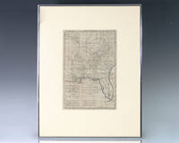
1797139014Paris: Rigobert Bonne 1797. Rare 18th century map of North America by Royal Hydrographer Rigobert Bonne. One page the engraved map extends from Illinois to Florida with one of the earliest insets of Kansas City. Born in the Lorraine region of France French cartographer Rigobert Bonne 1727-1794 was a skilled cartographer and hydrographer and succeeded Jacques Nicolas Bellin as Royal Hydrographer at the Depot de la Marine in 1773. He published many charts for the Depot including some of those for the Atlas Maritimeof 1762. In near fine condition. Matted and framed. The entire piece measures 17 inches by 16 inches. La Louisiane named after Louis XIV of France became a colony of the Kingdom of France in 1682 before passing to Spain in 1763. Louisiana was formed in part of the became part of the Louisiana Purchase from France in 1803. The U.S. would divide that area into two territories the Territory of Orleans which formed what would become the boundaries of Louisiana and the District of Louisiana. Louisiana was admitted as the 18th state of the United States on April 30 1812. Appointed hydrographer of the French Navy at the age of eighteen Jacques-Nicolas Bellin was appointed Hydrographer to the King in 1741. He published numerous sea atlases and charts which would be reprinted into the nineteenth century as well as many maps depicting French colonial territories in the New World. His craftsmanship and commitment to accuracy earned him a distinguished reputation as one of the world's leading cartographers and many other European mapmakers turned to him for source material. Rigobert Bonne unknown
Paris, Didot, 1768, 21 x 31,5 cm, contornos coloreados de época, reverso en blanco. (Este raro mapa fue grabado para la "Descripción de Débouquements Qui Sont au Nord de l'île de Saint Domingue", 1768, una pequeña guía de navegación con 152 páginas y 34 cartas náuticas del Norte del Mar Caribe. Como se indica en la cartela, está claramente influenciado por los recientes esfuerzos cartográficos británicos de su nueva posesión [en el primer tratado de París de 1763, al concluir la guerra de los franceses e indios, Inglaterra recibió Florida de España a cambio de la retrocesión de La Habana y El norte de Cuba para los españoles]. En particular, el mapa de John Gibson para la revista Caballeros de 1763, famoso por su descripción de la península de Florida como un archipiélago, parece haber sido una fuente importante para este trabajo. Excepcionalmente, el norte está en el lado derecho del mapa]).
19981307840PN. New. 1998. Soft Cover. Date is original print. This is a reprint edition . PN paperback
1021001058.Ghardcover. Good. Access codes and supplements are not guaranteed with used items. May be an ex-library book. hardcover
1247164640.Gpaperback. Good. Access codes and supplements are not guaranteed with used items. May be an ex-library book. paperback