Florida, Nancy KBiblio.com

403 résultats
1995Q-0822316226Duke University Press Books 1995-08-24. Paperback. New. New. In shrink wrap. Looks like an interesting title! Duke University Press Books paperback
1995DADAX0822316226Duke University Press Books 1995-08-24. paperback. New. 6.13x1.18x9.25. Buy with confidence. Excellent Customer Service & Return policy. Duke University Press Books paperback
1995x-0822316226Duke University Press 1995. Paperback. New. 464 pages. 9.50x6.25x1.25 inches. Duke University Press paperback
193661098bdJacksonville: Florida Works Progress Administration 1936. Intended as a monthly update just eight issues were produced between May and December 1936. This issue is entitled “The Master Builder.†Quarto self-wrappers stapled 20 pp. Photos of projects including streets and roads schools; charts of accident causes and frequency rates. Very Good. Florida Works Progress Administration, 1936. Intended as a monthly update, just eight issues were produced between May and Dece unknown books
19297002221FL: Florida Dept. Of Agriculture 1929. Bound in stiff illustrated wraps. A beatiful 32 pp. book on tourism in Florida. Color photos throughout. Only 5 copies on OCLC/Worldcat. Scarce -- especially in this protected condition. . First Edition. Soft Cover. Near Fine/No Jacket - As Published. Illus. by Photo Illustrated. 12mo - over 6¾" - 7¾" tall. Florida Dept. Of Agriculture Paperback
1981299451981. Softcover. VG light scuffing to cover. White ill. stapled wraps. 37 pp. Profuse bw and color plates. paperback books
198126725Tallahassee FL: University. As New. 1981. Paperback. FREE UPGRADE to Courier/Priority Shipping Upon Request - IN STOCK AND IMMEDIATELY AVAILABLE FOR SHIPMENT - -- with a bonus offer-- . University paperback
192140736Washington D.C.: Published by the United States Coast and Geodetic Survey 1921. Large folding nautical chart printed on heavy paper stock. Colored. A rare original coastal survey of Florida and Alabama from Pensacola Bay showing Perdido Bay including Pensacola Perdido Key and Orange Beach.<br/> <br/> Established by President Thomas Jefferson in 1807 as the Survey of the Coast the U.S. Coast and Geodetic Survey was the United States' first civilian scientific agency. This agency has followed its mission to survey the U.S. coastline create nautical charts of the coast and help increase maritime safety since its founding and has often played fascinating roles in significant chapters of U.S. history. It served in all theaters of the Civil War in the service of the Union Army and Navy pioneered acoustic exploration in the wake of the sinking of the Titanic and during WWI it worked to detect enemy submarines. In addition this agency worked to survey and produce detailed maps and renderings of the U.S. coast. These nautical survey maps commonly referred to as "T-sheets" provide fascinating insights into the history of the United States coastline which has and will continue to shift. These maps are the most important data source for understanding the physical and ecological characteristics of the U.S. shoreline. The present map is a highly detailed and accurate sea chart of the coastal border between Florida and Alabama and an important historical view of the developing states. Published by the United States Coast and Geodetic Survey unknown
198994521989. Softcover. VG. Wraps. 32 pp. 62 bw 10 color plates. Essay by Bradford R. Collins. Exhibition curated by Patrick McCune. Lists and details 48 artists and their relationship with watercolor. Wonderful color plates. unknown books
191640722Washington D.C.: Published by the United States Coast and Geodetic Survey 1916. Large folding nautical chart printed on heavy paper stock. Uncolored. A rare original coastal survey of the central Florida coast around Cedar Keys.<br/> <br/> Established by President Thomas Jefferson in 1807 as the Survey of the Coast the U.S. Coast and Geodetic Survey was the United States' first civilian scientific agency. This agency has followed its mission to survey the U.S. coastline create nautical charts of the coast and help increase maritime safety since its founding and has often played fascinating roles in significant chapters of U.S. history. It served in all theaters of the Civil War in the service of the Union Army and Navy pioneered acoustic exploration in the wake of the sinking of the Titanic and during WWI it worked to detect enemy submarines. In addition this agency worked to survey and produce detailed maps and renderings of the U.S. coast. These nautical survey maps commonly referred to as "T-sheets" provide fascinating insights into the history of the United States coastline which has and will continue to shift. These maps are the most important data source for understanding the physical and ecological characteristics of the U.S. shoreline. The present map of the Florida coastline precedes the inclusion of Yankeetown; chartered in 1923 and the site of one of only two completed sections of the proposed Cross Florida Barge Canal. This map is a highly detailed and accurate sea chart of the central Florida coastal region and an important historical view of a developing Florida. Published by the United States Coast and Geodetic Survey unknown
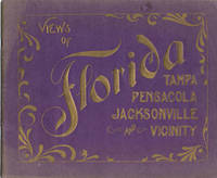
190637024Portland: L.H. Nelson Co. 1906. 1906. FLORIDA. 8" x 9-3/4" oblong printed purple wrappers with gilt stamped title. 36pp including wrappers. No pagination. Many illustrations. Published exclusively for S.H. Kress & Company. "Beautiful Florida." "In this little volume we present a series of views covering the enterprising cities of Jacksonville Tampa and Pensacola-representative communities of this great State-which is destined by the individuality and picturesqueness of her scenery and from the enterprise and loyalty of her citizens to enjoy forever a unique and honorable position in the American Union." Black and white illustrations with captions and some with brief descriptions listed below to include the Windsor Hotel Jacksonville; a Bird's-Eye View of Jacksonville; many churches; a Florida Ostrich Farm Jacksonville; Tampa Bay Hotel Tampa; One of Tampa's Fine Residences; De Soto Park Tampa; Famous Old Houses of Pensacola; Barracks at Fort Barrancas; Pensacola Lighthouse et. al. Fading to lightly worn wrappers including residue from what appears to be the removal of a very small sticker to top of front wrapper a price written in ink to top forecorner of rear wrapper eight center pages loosened from the staples else a good copy. L.H. Nelson Co., 1906. unknown
19894840Stuttgart, Union Verlag, 1989. 8°, 311 S., Bibl. Ex. St.a.T, Buchsig.a.Rücken, sauber in Folie eingebunden, Buchlaufzettel a. Nachsatz, Gebr,sp., Pappband, lumback
199059228ABHamburg, VSA-Verl., 1990. 8°. 351 S. Ill., OK., Deck.-Illustr., sauber u. gut erhalten. Besitzerverm. a. Vors.
1996293022PN. New. 1996. Soft Cover. Date is original print. This is a reprint edition . PN paperback
19908117BBMünchen, Droemer Knaur, 1990. 8° 493 S., Ill. Pp. u. or. Umschl. innen etw. gebräunt u. schwach fleckig, Titelbl. leicht angerissen, sonst guter Zust.
199510277München: Droemersche Verlagsanstalt Th. Knaur Nachf., 1995. 460 Seiten , 18 cm, kart.,
1992254154PN. New. 1992. Soft Cover. Date is original print. This is a reprint edition . PN paperback
199722976Cismar, 1997. 8 SS., 2 Tafeln. 8°, klammergeheftet.
194635488Ohne Ort 1946. Farb. Reiseprospekt im Format 23x20 cm. Mit zahlr. s/w. Abb., 1 s/w. Karte u. 7 S. Verzeichnis v. Hotels, Boarding Houses u. Appartements. OBrosch. geheftet. Faltmaß 23x10 cm.
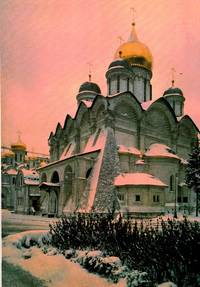
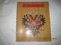
1995009479Booth-Clibborn Editions London 1995 1995. Hardcover. Fine/Fine. 256 pages : illustrations some color color map ; 28 cm ; ISBN 9781873968512 9781873968864 1873968515 1873968868 OCLC 38496781 ; LCCN 97172343 ; LC NK975 .T68 1995 ; Catalog of an exhibition at the Florida International Museum St. Petersburg Fla ; Includes index ; Translated from the Russian ; This book features many of the remarkable works of art housed in the former armoury and other museums of the Moscow Kremlin including Peter the Great's coronation crown and Faberge's Tricentennial Easter Egg commissioned in 1913 by Nicholas II to celebrate 300 years of Romanov rule. ; FINE/FINE <br/> <br/> Booth-Clibborn Editions, London, 1995 hardcover
1995#204-111918<p>Appears as unread/unopened copy Near fine in near fine wraps. Collectible.</p><p>Contains photos and text of the Florida International Museum's Exhibit of Russian art and collectibles. Chapters cover: the Romanof dynasty: biographies of historical figures; the consecration of the Czar; private life of the Czars in the 17th century: royal parades & ceremonial arms in the 17th century; ambassadorial ceremony in the 17th century; the royal court in the 17th century; the coronation of the Russian emperors; court life in the 18th century; orders of knights & their feast days; the Imperial court in the 19th century; the Russian Orthodox Church from the 18th to the 20th century.</p><p><strong>Insurance & handling is included free. Extra Charges/Fees apply on Shipments Outside The U.S. and Expedited Shipments. Oversize and/or heavy books may require additional fees. Will advise. Changed Boxes to July 2022 Updated 3.23.2025 Biblio #204-111918</strong></p> paperback
199012390München und Berlin: Verlag C. J. Bucher, 1990. Lizenzausgabe 56 Seiten , 29 cm, kart.,
191740713Washington D.C.: Published by the United States Coast and Geodetic Survey 1917. Large folding nautical chart printed on heavy paper stock. Uncolored. Coastal survey map of Tortugas Harbor and approaches with an inset map in the upper left corner of Fort Jefferson.<br/> <br/> Established by President Thomas Jefferson in 1807 as the Survey of the Coast the U.S. Coast and Geodetic Survey was the United States' first civilian scientific agency. This agency has followed its mission to survey the U.S. coastline create nautical charts of the coast and help increase maritime safety since its founding and has often played fascinating roles in significant chapters of U.S. history. It served in all theaters of the Civil War in the service of the Union Army and Navy pioneered acoustic exploration in the wake of the sinking of the Titanic and during WWI it worked to detect enemy submarines. In addition this agency worked to survey and produce detailed maps and renderings of the U.S. coast. These nautical survey maps commonly referred to as "T-sheets" provide fascinating insights into the history of the United States coastline which has and will continue to shift. These maps are the most important data source for understanding the physical and ecological characteristics of the U.S. shoreline. The present map is inset with a detailed view of Fort Jefferson on Garden Key. Fort Jefferson was an ambitious civil war era coastal defence site which became the largest brick structure in the US. This map is a highly detailed and accurate sea chart of Tortugas Harbor and an important historical view of a developing Florida. Published by the United States Coast and Geodetic Survey unknown
19783619bdTallahassee: Florida Department of Commerce Division of Tourism 1978. Quarto stiff illustrated wrappers spiral bound 41 leaves. Photos. Very Good. Florida Department of Commerce, Division of Tourism, 1978. unknown books
1901116721901. Small 8vo pp. 27. Lacking about 1/3 of the front wrap. Clean otherwise with 2 photos. Includes a detailed report of the activities of the Ybor City Missionary school and reports from chapters throughout Florida. unknown books