[Florida]Biblio.com
2 245 résultats
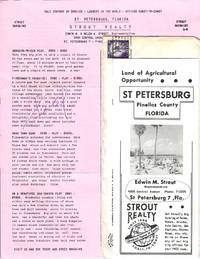
77880Small packet of materials concerning investment opportunities in St. Petersburg Florida mailed by Strout Realty to Mr. and Mrs. Ray Spencer of Delavan Wisconsin on March 22 1957. The contents consist of an informational brochure about the city and a detailed list with pricing information for fifteen "Strout Bargains" in St. Petersburg. Four of the properties are marked "Sold" and there is a holographic correction to the price of the final listing: "A Retirement Gem" for $3950. Located on the Pinellas peninsula between Tampa Bay and the Gulf of Mexico "St. Pete" experienced a population boom during the 1950s with the return of retiree resettlement which had declined precipitously during the Great Depression. At this same time as the brochure notes there was "increasing demand for Florida citrus products" which attracted many small farmers to the region. unknown
0666154732.Ghardcover. Good. Access codes and supplements are not guaranteed with used items. May be an ex-library book. hardcover
192140694Washington D.C.: Published by the United States Coast and Geodetic Survey 1921. Nautical chart printed on heavy paper stock. Colored. A rare coastal survey of Florida including Laguna beach Panama City Mexico Beach and Cape San Blas.<br/> <br/> Established by President Thomas Jefferson in 1807 as the Survey of the Coast the U.S. Coast and Geodetic Survey was the United States' first civilian scientific agency. This agency has followed its mission to survey the U.S. coastline create nautical charts of the coast and help increase maritime safety since its founding and has often played fascinating roles in significant chapters of U.S. history. It served in all theaters of the Civil War in the service of the Union Army and Navy pioneered acoustic exploration in the wake of the sinking of the Titanic and during WWI it worked to detect enemy submarines. In addition this agency worked to survey and produce detailed maps and renderings of the U.S. coast. These nautical survey maps commonly referred to as "T-sheets" provide fascinating insights into the history of the United States coastline which has and will continue to shift. These maps are the most important data source for understanding the physical and ecological characteristics of the U.S. shoreline. The present map is a highly detailed and accurate sea chart of BLANK and an important historical view of a developing Florida. Published by the United States Coast and Geodetic Survey unknown
192040728Washington D.C.: Published by the United States Coast and Geodetic Survey 1920. Large folding nautical chart printed on heavy paper stock. Colored with minor wear and small loss to the top margin. A rare original coastal survey of the St Johns River and Lake George in north-central Florida bisected into two parts.<br/> <br/> Established by President Thomas Jefferson in 1807 as the Survey of the Coast the U.S. Coast and Geodetic Survey was the United States' first civilian scientific agency. This agency has followed its mission to survey the U.S. coastline create nautical charts of the coast and help increase maritime safety since its founding and has often played fascinating roles in significant chapters of U.S. history. It served in all theaters of the Civil War in the service of the Union Army and Navy pioneered acoustic exploration in the wake of the sinking of the Titanic and during WWI it worked to detect enemy submarines. In addition this agency worked to survey and produce detailed maps and renderings of the U.S. coast. These nautical survey maps commonly referred to as "T-sheets" provide fascinating insights into the history of the United States coastline which has and will continue to shift. These maps are the most important data source for understanding the physical and ecological characteristics of the U.S. shoreline. The present map is a highly detailed and accurate sea chart of the Lake George region and an important historical view of a developing Florida. Published by the United States Coast and Geodetic Survey unknown
191640686Washington D.C.: Published by the United States Coast and Geodetic Survey 1916. Nautical chart printed on heavy paper stock. Colored. A rare coastal survey of the St. Johns River near Orlando with an inset map of the river continuation in the bottom left corner.<br/> <br/> Established by President Thomas Jefferson in 1807 as the Survey of the Coast the U.S. Coast and Geodetic Survey was the United States' first civilian scientific agency. This agency has followed its mission to survey the U.S. coastline create nautical charts of the coast and help increase maritime safety since its founding and has often played fascinating roles in significant chapters of U.S. history. It served in all theaters of the Civil War in the service of the Union Army and Navy pioneered acoustic exploration in the wake of the sinking of the Titanic and during WWI it worked to detect enemy submarines. In addition this agency worked to survey and produce detailed maps and renderings of the U.S. coast. These nautical survey maps commonly referred to as "T-sheets" provide fascinating insights into the history of the United States coastline which has and will continue to shift. These maps are the most important data source for understanding the physical and ecological characteristics of the U.S. shoreline. The present map is a highly detailed and accurate sea chart of the St Johns River and an important historical view of a developing Florida. Published by the United States Coast and Geodetic Survey unknown
191640716Washington D.C.: Published by the United States Coast and Geodetic Survey 1916. Large folding nautical chart printed on heavy paper stock. Uncolored. A rare original coastal survey of the St. Johns River from Jacksonville to Fleming Island.<br/> <br/> Established by President Thomas Jefferson in 1807 as the Survey of the Coast the U.S. Coast and Geodetic Survey was the United States' first civilian scientific agency. This agency has followed its mission to survey the U.S. coastline create nautical charts of the coast and help increase maritime safety since its founding and has often played fascinating roles in significant chapters of U.S. history. It served in all theaters of the Civil War in the service of the Union Army and Navy pioneered acoustic exploration in the wake of the sinking of the Titanic and during WWI it worked to detect enemy submarines. In addition this agency worked to survey and produce detailed maps and renderings of the U.S. coast. These nautical survey maps commonly referred to as "T-sheets" provide fascinating insights into the history of the United States coastline which has and will continue to shift. These maps are the most important data source for understanding the physical and ecological characteristics of the U.S. shoreline. The present map is a highly detailed and accurate sea chart of St. Johns River around Jacksonville and an important historical view of a developing Florida. Published by the United States Coast and Geodetic Survey unknown
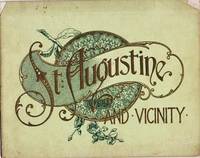
a75478NY 1891 A. Wittemann. Hardcover. Oblong sm.4to. 3 pages of text plus 36 photo views of St. Augustine cloth. All edge gilt. Inner hinges reinforced. Good binding secure. Pictures available on request. . hardcover
192040702Washington D.C.: Published by the United States Coast and Geodetic Survey 1920. Large folding nautical chart printed on heavy paper stock. Colored with minor wear. A rare coastal survey of Florida around St. Augustine including Vilano Beach St. Augustine Beach Butler Beach Crescent Beach Palm Coast and Ormond Beach.<br/> <br/> Established by President Thomas Jefferson in 1807 as the Survey of the Coast the U.S. Coast and Geodetic Survey was the United States' first civilian scientific agency. This agency has followed its mission to survey the U.S. coastline create nautical charts of the coast and help increase maritime safety since its founding and has often played fascinating roles in significant chapters of U.S. history. It served in all theaters of the Civil War in the service of the Union Army and Navy pioneered acoustic exploration in the wake of the sinking of the Titanic and during WWI it worked to detect enemy submarines. In addition this agency worked to survey and produce detailed maps and renderings of the U.S. coast. These nautical survey maps commonly referred to as "T-sheets" provide fascinating insights into the history of the United States coastline which has and will continue to shift. These maps are the most important data source for understanding the physical and ecological characteristics of the U.S. shoreline. The present map is a highly detailed and accurate sea chart of St. Augustine area and an important historical view of a developing Florida. Published by the United States Coast and Geodetic Survey unknown
1528009711.Gpaperback. Good. Access codes and supplements are not guaranteed with used items. May be an ex-library book. paperback
1905037517Philadelphia: J. Murray Jordan 1905. Early edition. Decorated Wrappers. Good. 24pp views from photographs. View include: City Gates; Sea Wall; Oldest House; Treasury Street; St. George Street; Charlotte Street; Hotel Ponce de Leon; The Alcazar; Fort Marion; &c. Bound in gilt-embossed green wrappers; upper corners of cover chipped. 7.75" x 9.75 J. Murray Jordan unknown
026693059X.Ghardcover. Good. Access codes and supplements are not guaranteed with used items. May be an ex-library book. hardcover
1958ABE-165220704065584 PAGES-26,5 CM X 32 CM-EN COUVERTURE: DOMINIQUE COLONNA-PIERRE SCHULL MATADOR FRANCAIS, 4 PAGES-CE QUE SONT DEVENUS LES HEROS DE L'ANNAPURNA, 2 PAGES DONT PHOTO MONTAGE PLEINE PAGE-CHARLES HUMEZ LUI A DIT: "TU N'AURAS JAMAIS A ROUGIR DE TON PAPA!", 2 PAGES, 2 PHOTOS-TERECHKOVITCH LE PLUS SPORTIF DES PEINTRES, 4 PAGES PAR DENIS LALANNE, 2 PHOTOS, REPRODUCTION "TENNIS A ROLAND GARROS" SUR 1 PAGE-LA GRANDE FIEVRE DU CALCIO, 12 PAGES-ELLIOTT COMME LANDY PEUT PERDRE LE TITRE OLYMPIQUE DU 1500 M, 2 PAGES PAR GASTON MEYER-HARY: DEUXIEME 100 M. EN 10'' SI LE STARTER NE L'AVAIT PAS RAPPELE, 2P, 3 PHOTOS-CHEVAL D'AUTEUIL, PAR FERNAND ALBARET, 5 PAGES-ROBERT VIGIER: SON DERNIER ESSAI, 4 PAGES PAR HENRI GARCIA, 6 PHOTOS-PILOTE SUR LA CARAVELLE, PAR MAURICE MAUREL, 3P, 2 PHOTOS-LA CARAVELLE ET MOI JOURNAL TENU PAR ANDRE LESIEUR COMMANDANT DE BORD A AIR FRANCE, 3 PAGES-PARIS CONQUIS PAR LE HORS BORD, 4 PAGES-COMME DES MILLIERS DE VISITEURS DU SALON: ILS ONT AIME LA FLORIDE, 3 PAGES, 7 PHOTOS (JEAN BEHRA, JUST FONTAINE, .)-ILS ONT TUE LE TENNIS AMATEUR, 4 PAGES, 7 PHOTOS (TONY TRABERT, PANCHO GONZALES,.)-PECHE AU THON AU LARGE DE ST JEAN DE LUZ, 4 PAGES-LES AIGLES A TROIS TETES, ETUDE PAR PIERRE CHANY, 4 PAGES, 3 PHOTOS (ANQUETIL, RIVIERE, BOBET)-CENTRE SPORTIF GILLETTE AN II: UNE PROMOTION DE FUTURS CHAMPIONS, 2P, 4 PHOTOS-SPORTS D'HIVER TOUTE L'ANNEE AU MONT BLANC, PAR PHILIPPE GAUSSOT, 4 PAGES-(SPO20)
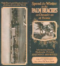
34507West Palm Beach: City of West Palm Beach Florida n.d. Brochure. Good. Folded brochure. Vintage brochure measures 9" x 4" when folded. 28 pages. Illustrated with black and white photographs of hotels buildings the beach etc. Color illustration on the front cover and aerial photograph of the city on the back cover. A few spots to the contents. Good condition. City of West Palm Beach, Florida unknown
201388489o. O., o. V., 2013. 76 S. 8° Oktav, Hardcover/Pappeinband
a81325New York 1882 1st Wittemann Bros. Oblong 12mo. 5 pages of text plus 12 photo illustrations finely embossed stiff tan cardboard cover with title in copper lettering on front. Photos presented accordion-style. VG plus. . unknown
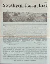
36210Washington DC: Southern Railway n.d. Brochure. Good. Brochure. 4 pages. Illustrated with photograph top of page 1. This is an advertisement promotional brochure for selling Farm property. Southern Railway lists their offices and agents on page 1. Brochure has two horizontal folds with light edge wear at the folds. Contents are clean and unmarked. Southern Railway describes 75 representative farm properties for sale in the South including Virginia Alabama North Carolina South Carolina Georgia Florida Mississippi Tennessee and Kentucky. Southern Indiana and Southern Illinois are also referenced. Detailed descriptions include location number of acres price buildings suitable crops trees soil and more. Southern Railway unknown
1935Embry 179568The Grabhorn Press 1935. Number 48 of the author's edition. Some offsetting to front endpapers from previously laid in article slight bowing to front board else fine in very good publisher's plain brown dust jacket with a small chip to head of spine and 3/4 inch chip to front panel in mylar cover. Olive cloth backed orange boards. Inscribed by the author to legendary bookseller John Howell. Includes perspectus. The Grabhorn Press, 1935. Number 48 of the author's edition. hardcover books
19355566San Francisco: Grabhorn Press 1935 Book. Fine. Hardcover. Limited Edition. Limited to 450 copies printed by The Grabhorn Press. Quarto. viii 48pp. Portraits and facsimile letters. Printed in red and black. Handset Lutetia type. Orange boards black cloth spine orange paper spine label printed in black. A very fine copy. Reminiscences by a friend of San Francisco's most famous volunteer firewoman and honorary member of Knickerbocker Engine Company No. 5. Grabhorn: 221. Grabhorn Press hardcover
0267496133.Ghardcover. Good. Access codes and supplements are not guaranteed with used items. May be an ex-library book. hardcover
0260085782.Ghardcover. Good. Access codes and supplements are not guaranteed with used items. May be an ex-library book. hardcover
1992158546Malabar, Florida: Krieger 1992. XII, 291 Seiten. Gr. 8° (22,5-25 cm). Orig.-Kunstlederband. [Hardcover / fest gebunden].
19890146801989 United States Department of Agriculture, soil Consevervation Service Soft cover
1991014758USA 1991 United States Department of Agriculture Soft cover
1979014798USA 1979 United States Department of Agriculture Soft cover
1979014799USA 1979 United States Department of Agriculture Soft cover