Livre Rare Book
129 résultats
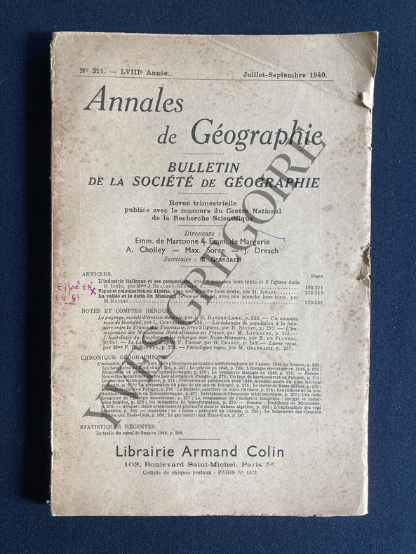
1949ABE-1554718736112IN 8-PAGINATION DE 193 A 288-L'INDUSTRIE ITALIENNE ET SES PERSPECTIVES, 21P PAR JACQUELINE BEAUJEU GARNIER, 2 PLANCHES HT, 3 FIGURES-VIGNE ET COLONISATION EN ALGERIE, 10P PAR HILDEBERT ISNARD, 1 PLANCHE HORS TEXTE (QUELQUES ANNOTATIONS)-LA VALLEE ET LE DELTA DU MISSISSIPI (PREMIER ARTICLE), 13P PAR HENRI BAULIG-LES ECHANGES DE POPULATION A LA FRONTIERE ENTRE LA FRANCE ET LE TOURNAISIS, 8P PAR RENE SEVRIN-L'IMMIGRATION DES MUSULMANS NORDS-AFRICAINS EN FRANCE D'APRES LOUIS CHEVALIER, 3P PAR MARCEL LARNAUDE-(ETACA)
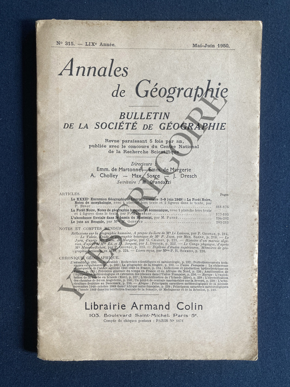
1950ABE-1934458399LES MONTS DU FOREZ RECHERCHES MORPHOLOGIQUES/18P-LE RELIEF DES CORBIERES ORIENTALES/12P-LE PROBLEME ACTUEL DU RAIL ET DE LA ROUTE EN FRANCE/5P-LES VARIATIONS FLUVIALES DANS LE BASSIN DU MISSISSIPI/9P-EN PARTIE NON COUPEE
1950ABE-4703696221LA FORET NOIRE NOTES DE MORPHOLOGIE/PAR P. BIROT/16P-LA FORET NOIRE NOTES DE GEOGRAPHIE HUMAINE ET ECONOMIQUE/PAR P. MARTHELOT/17P-L'ABONDANCE FLUVIALE DANS LE BASSIN DU MISSISSIPI/PAR M. PARDE/9P-LE JUTE AU BENGALE/PAR M. GODFRYD/14P-NON COUPE
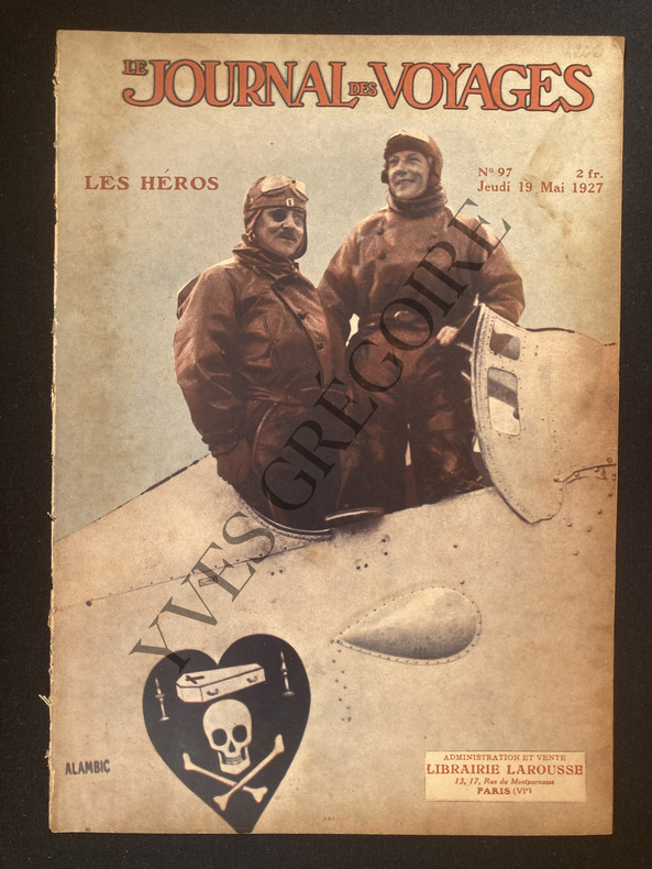
1927ABE-12237326686FORMAT 21 CM X 29 CM-COUVERTURE COULEURS "LES HEROS", NUNGESSER ET COLI DEBOUTS DANS LA CARLINGUE DE LEUR AVION L'OISEAU BLANC-L'ENVOL VERS LE MYSTERE DE L'ATLANTIQUE,2P PAR JACQUES MORTANE,3 PHOTOS NUNGESSER ET COLI-A MOTOCYCLETTE AUTOUR DU MONDE,3P-UN FILM SUR TAHITI AVEC ALLOCUTION ET COMMENTAIRES,3P PAR E.DESDEMAINES HUGON,6 PHOTOS-LA MYSTERIEUSE ILE DE PAQUES,2P-L'AIR ET SA CONQUETE,4P-LES GRANDES EPREUVES CYCLISTES LE 20e PARIS-TOURS,2P PAR MAURICE SCHNEIDER,3 PHOTOS,CHATEAUDUN-LES MISSIONS SPECIALES AERIENNES PENDANT LA GUERRE,3P,3 PHOTOS PINSARD-NOTRE EMPIRE COLONIAL-LES CHASSEURS DE DANSES,4P PAR GASTON LEROUX-LA COLERE DU PERE DES EAUX,INONDATIONS MISSISSIPI ET TENNESSEE,3 PHOTOS
1981014843USA 1981 United States Department of Agriculture Soft cover
195212938N.p. likely Braxton MS 1952. 24pp. Profusely illustrated. Quarto. Original pictorial wrappers printed in green brown and red. Minor edge wear and foxing to wrappers. Light toning to text. Very good condition. A scarce and wonderfully-informative history of the first forty years of the Piney Woods Country Life School Laurence C. Jones's school for African American youth in Braxton Mississippi. The work is amply illustrated with photographs documenting the life and people of the school since its inception in 1910 to the moment of the pamphlet's publication. There are pages devoted to celebrating notable graduates of the school the "blind and the lame orphans and half-orphans" who've attended "internationally known visitors" "present-day buildings" five pages displaying the "industry" of the school the dairy and farm the "human and material progress" of the school and more. OCLC reports just ten total copies of this vital midcentury history of a notable southern school devoted to African-American youth. unknown
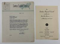
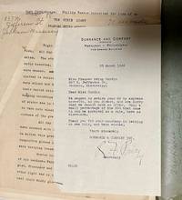
19465498Atlanta; Cleveland MS 1946. Very good. Two typed letters totaling 3pp. plus printed form completed in manuscript. Previously folded. Minor edge wear. Light tanning. A pair of typed letters that comprise an inquiry from Guy B. Johnson President of the Southern Regional Council and a response from Mrs. E.H. Green a resident of Bolivar County Mississippi concerning Black voting there in the July 1946 primary election. In his letter Johnson asks Green if she can corroborate stories in the Jackson Advocate that "all Negro votes were challenged" in Bolivar despite the fact that "Large numbers of Negroes were qualified to vote." Green responds that the votes of 241 qualified Blacks in Mound Bayou "the all Negro town" were all challenged on the basis that eligible African Americans had previously voted only in November general elections not primary elections. She also adds several observations from other districts in the county including the second where the votes of registered Blacks who appeared were also challenged and set aside. As a matter of prudence Green asks that "You do not give my name any publicity in this matter." The Southern Regional Council was a multiracial group founded in 1944 that sought equality and an end to racial violence. Also included with the two letters is a printed invitation for Mrs. E.H. Green to join the council with some information on its founding and goals. unknown
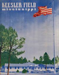
194233861San Antonio: Universal Press 1942. Soft cover. Very good. Stapled illustrated soft cover. 36 pages. Inside covers are illustrated. Illustrated with photographs of the training facility engineers downtown Biloxi barracks planes social life recreation etc. Photograph of the Biloxi Lighthouse on the back cover. From Keesler Air Force Base: ".In mid-1942 the Army Air Forces directed Keesler to focus upon the training of mechanics for B-24 Liberator heavy bombers. The school received its first B 24 in late September 1942. Six more arrived shortly thereafter and specialized B 24 maintenance training began on 19 October. Universal Press unknown
192241198Washington D.C.: Published by the United States Coast and Geodetic Survey 1922. Large folding nautical chart printed on heavy paper stock. Colored. A rare original coastal survey of the border between Mississippi and Alabama including the Mississippi Sound Gulfport Biloxi Pascagoula and a series of barrier islands: Cat Island Ship Island Horn Island Petit Bois Island Dauphin Island and Island Aux Herbes.<br/> <br/> Established by President Thomas Jefferson in 1807 as the Survey of the Coast the U.S. Coast and Geodetic Survey was the United States' first civilian scientific agency. This agency has followed its mission to survey the U.S. coastline create nautical charts of the coast and help increase maritime safety since its founding and has often played fascinating roles in significant chapters of U.S. history. It served in all theaters of the Civil War in the service of the Union Army and Navy pioneered acoustic exploration in the wake of the sinking of the Titanic and during WWI it worked to detect enemy submarines. In addition this agency worked to survey and produce detailed maps and renderings of the U.S. coast. These nautical survey maps commonly referred to as "T-sheets" provide fascinating insights into the history of the United States coastline which has and will continue to shift. These maps are the most important data source for understanding the physical and ecological characteristics of the U.S. shoreline. The present map is notable for its inclusion of Gulfport Biloxi and Pascagoula as they were gridded in 1922 and Cat Island a barrier island used for an undercover WWII program Dogs for Defense. Cat Island was chosen as the training camp dedicated to a specialized training program based off the untrue belief that dogs could differentiate humans by smell based on their cultural heritage. The top secret program attempted to train dogs to track and attack Japanese soldiers in the Pacific Theater and was held at Cat Island because of its similar terrain to that of the Pacific Islands and its uninhabited status. This operation was unsuccessful due to the incorrect assumption and shut down in 1944. This map is a highly detailed and accurate sea chart of the coastal border between Mississippi and Alabama and an important historical view of the developing states. Published by the United States Coast and Geodetic Survey unknown
192140729Washington D.C.: Published by the United States Coast and Geodetic Survey 1921. Large folding nautical chart printed on heavy paper stock. Colored. A rare original coastal survey of the Northern Gulf coast from Florida to Louisiana encompassing Panama City Rosemary Beach Seaside Grayton Destin Pensacola Gulf Shores Mobile Gulfport and the Mississippi Delta.<br/> <br/> Established by President Thomas Jefferson in 1807 as the Survey of the Coast the U.S. Coast and Geodetic Survey was the United States' first civilian scientific agency. This agency has followed its mission to survey the U.S. coastline create nautical charts of the coast and help increase maritime safety since its founding and has often played fascinating roles in significant chapters of U.S. history. It served in all theaters of the Civil War in the service of the Union Army and Navy pioneered acoustic exploration in the wake of the sinking of the Titanic and during WWI it worked to detect enemy submarines. In addition this agency worked to survey and produce detailed maps and renderings of the U.S. coast. These nautical survey maps commonly referred to as "T-sheets" provide fascinating insights into the history of the United States coastline which has and will continue to shift. These maps are the most important data source for understanding the physical and ecological characteristics of the U.S. shoreline. The present map is a highly detailed and accurate sea chart of the Gulf coasts of Florida Alabama Mississippi and Louisiana and an important historical view of the developing states. Published by the United States Coast and Geodetic Survey unknown
190840737Washington D.C.: Published by the United States Coast and Geodetic Survey 1908. Large folding nautical chart printed on heavy paper stock. Colored. A rare original coastal survey of the Gulf coasts of Florida Alabama Mississippi and Louisiana including the Keys Fort Myers Sarasota Tampa Panama City Destin Pensacola Gulf Shores Mobile Biloxi Gulfport New Orleans and the Mississippi Delta.<br/> <br/> Established by President Thomas Jefferson in 1807 as the Survey of the Coast the U.S. Coast and Geodetic Survey was the United States' first civilian scientific agency. This agency has followed its mission to survey the U.S. coastline create nautical charts of the coast and help increase maritime safety since its founding and has often played fascinating roles in significant chapters of U.S. history. It served in all theaters of the Civil War in the service of the Union Army and Navy pioneered acoustic exploration in the wake of the sinking of the Titanic and during WWI it worked to detect enemy submarines. In addition this agency worked to survey and produce detailed maps and renderings of the U.S. coast. These nautical survey maps commonly referred to as "T-sheets" provide fascinating insights into the history of the United States coastline which has and will continue to shift. These maps are the most important data source for understanding the physical and ecological characteristics of the U.S. shoreline. The present map is a highly detailed and accurate sea chart of the coasts Florida Alabama Mississippi and Louisiana along the Gulf of Mexico and an important historical view of the developing states. Published by the United States Coast and Geodetic Survey unknown
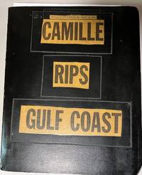
196934699Unknown: n/a 1969. Album. Good. Scrapbook. Approx. 9.5" x 11.5" three ring black binder with title pasted down on the front cover. Back cover of the album has some scuff marks. Contents clean.<br /> <br /> Contents include 43 photographs mounted on black paper magazine and newspaper clippings a Gulf Coast map by Shell Gas Company and a written essay on the hurricane. Original photographs depict scenes of devastated buildings properties etc. A unique collection of visual and printed material regarding one of the most powerful and destructive hurricanes to hit the Gulf coast. n/a unknown
192041182Washington D.C.: Published by the United States Coast and Geodetic Survey 1920. Large folding nautical chart printed on heavy paper stock. Colored. A rare original coastal survey of coast between Louisiana and Mississippi and includes Lake Borgne Lake Ponchartrain the Mississippi Sound St Louis Bay Cat Island Long Beach and Gulfport.<br/> <br/> Established by President Thomas Jefferson in 1807 as the Survey of the Coast the U.S. Coast and Geodetic Survey was the United States' first civilian scientific agency. This agency has followed its mission to survey the U.S. coastline create nautical charts of the coast and help increase maritime safety since its founding and has often played fascinating roles in significant chapters of U.S. history. It served in all theaters of the Civil War in the service of the Union Army and Navy pioneered acoustic exploration in the wake of the sinking of the Titanic and during WWI it worked to detect enemy submarines. In addition this agency worked to survey and produce detailed maps and renderings of the U.S. coast. These nautical survey maps commonly referred to as "T-sheets" provide fascinating insights into the history of the United States coastline which has and will continue to shift. These maps are the most important data source for understanding the physical and ecological characteristics of the U.S. shoreline. The present map is notable for its inclusion of Gulfport as it was gridded in 1920 and Cat Island a barrier island used for an undercover WWII program Dogs for Defense. Cat Island was chosen as the training camp dedicated to a specialized training program based off the untrue belief that dogs could differentiate humans by smell based on their cultural heritage. The top secret program attempted to train dogs to track and attack Japanese soldiers in the Pacific Theater and was held at Cat Island because of its similar terrain to that of the Pacific Islands and its uninhabited status. This operation was unsuccessful due to the incorrect assumption and shut down in 1944. This map is a highly detailed and accurate sea chart of the coastal border between Louisiana and Mississippi and is an important historical view of the developing Louisiana and Mississippi. Published by the United States Coast and Geodetic Survey unknown
191063830New York: G.P. Putnam’s Sons 1910. Tall thick 8vo. xvi 308 pp. plus 8 pp. publisher’s ads. Photo frontisp. photo plates maps 1 folding. Blue ribbed publisher’s cloth photo illust. mounted front cover decorative gilt lettering front cover & spine t.e.g. minor shelfwear slight bumping to foot of spine couple corners still VG bright copy. First edition of this installment in the American Waterways Series describing the great Mississippi River the area’s role in the opening of the American West including the Lewis & Clark Expedition acquisition of the Louisiana Purchase and impact of the Civil War. G.P. Putnam’s Sons, hardcover
194234721Jackson Mississippi: n.p. 1942. Manuscript. Good. Unpublished typed manuscript. 242 pages typed on the rectos only. 1942 rejection letter from the publisher signed by the secretary is included. Manuscript housed in torn and chipped paper folder with author's Jackson Mississippi address on the front side. Manuscript inscription on the first page. Contents clean and in good condition. n.p. unknown
19851597282471MISSISSIPPI DEPARTMENT OF AGRICULTURE AND COMMERCE 1985. Hardcover. Good. Pages can have notes/highlighting. Spine may show signs of wear. ~ ThriftBooks: Read More Spend Less.Shelf and handling wear to cover and binding with general signs of previous use. Secure packaging for safe delivery.Dust jacket quality is not guaranteed. MISSISSIPPI DEPARTMENT OF AGRICULTURE AND COMMERCE hardcover
190421167New York:: Mississippi Wire Glass Co. ca. 1904. original red gilt cloth. Near fine. 8vo. Illustrated throughout from photographs. Excerpts from newspaper commentaries mostly relating to why the fires spread with a pitch for wire glass windows at the end. Mississippi Wire Glass Co., hardcover
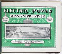
19135027Keokuk Ia: Mississippi River Power Company 1913. Very good. Ten volumes complete. Profusely illustrated. Oblong folio. Each issue measuring 9 x 12 inches in original pictorial wrappers two holes punched along spines and bound together in a later gray cloth Tatum-style Y binder with leather corners. Minor edge wear and staining to boards. Light edge wear to contents. A couple of panoramic photographs detached but present. A complete run of bulletins tracking the progress of construction on the Keokuk Dam & Power Plant which was then the longest monolithic concrete dam in the world and a pioneering effort in large-scale low-head hydroelectric power. Still in operation today the dame served as a prototype for many future power plants harnessing the power of the Mississippi River between Keokuk Iowa and Hamilton Illinois generating clean low cost and reliable energy enough to power 75000 homes. The present bulletins are chock full of facts figures photographs renderings and progress reports intended to familiarize the public with the project by illustrating the methods employed in its construction from beginning to completion. The bulletins are about equal parts text and photographs providing an easy-to-follow format for learning about the Keokuk project. Some of the issues also have folding maps or larger-format photographs which provide further visual accompaniment to the explanatory text.<br /> <br /> Known as a "run-of-river" plant the Keokuk Dam uses the natural energy of falling water to generate electricity. The power of this part of the river was identified by none other than Robert E. Lee in 1836 when he was serving as a surveyor for the U.S. War Department. Lee called attention to the turbulent waters but found no way to control it. In 1899 a group of leaders from Keokuk and Hamilton teamed up raised the backing funds received governmental approval for the dam and hired Hugh L. Cooper to oversee the project. Cooper had previously engineered construction of a hydroelectric plant at Niagara Falls. Interestingly an observation tower was also built on both sides of the river to allow the public to watch the progress of the Keokuk project then the largest privately-funded construction effort in the world. In addition to the dam a powerhouse and a new lock and dry system to accommodate river traffic were also built. The final bulletin includes comments from the chief engineer who noted that in the first bulletin it was stated that the project would be completed by July 1 1913. He remarks: "It is naturally a source of great satisfaction to all concerned with construction to see this prediction fulfilled."<br /> <br /> An informative and substantial production relating to a major construction project on the Mississippi River in the early-20th century. OCLC records a smattering of institutional holdings but complete runs appear to be rather rare. Mississippi River Power Company unknown
19246015CA: N.p. 1924. First edition. 19x13cm 45pp. Photographs. Printed in two colors throughout. Stapled white glossy wrappers. Foxing to covers few small edge tears single interior signature loose likely originally not stapled all the way through. Very good. <br /> <br /> Copiously illustrated record of the USS Mississippi's fifth consecutive victory in the "Iron Man" competition the Navy Department General Excellence Athletic Trophy. Includes photos and short descriptions of events from the Seattle and Bremerton Cups to the Whale Boat Crews baseball basket ball sic track and field wrestling boxing football tug o' war and many others. Apparently unrecorded as we find no mention of this booklet in OCLC. N.p. unknown
1964List1009Atlanta: The Student Voice Inc. 1964. Single page measuring 12 ¾ x 7 ¾ inches folded. An exceptional copy very fine with no noted flaws. Fine. Offered here is a pristine copy of a fundraising pamphlet for the Mississippi Summer Project likely printed in in February of 1964 at the beginning of the fundraising and organization efforts by The Student Voice Inc. the separately incorporated publishing company for the SNCC. Over 1000 volunteers would travel to Mississippi and join thousands of local participants in what would eventually be known more commonly as Freedom Summer. The brochure lays out the scope of the effort which includes voter registration Freedom Schools community centers a research project a white community project and a law student project. The iconic photographs by Danny Lyon and Norris McNamara were taken during the Freedom Day protests at Hattiesburg Mississippi in January of 1964. [The Student Voice, Inc.] unknown books
196365959Olten - Freiburg i. Breisgau, Walter-Verlag AG, 1963, Auflage: 1. Leinen, gebunden; weinroter Einband, violettes, silbergeprägtes Rückenschild, Farbkopfschnitt, mit Schutzumschlag und Cellophanumschlag / Anz. Seiten: 256 / 13 x 21 cm / Zustand: gut, geringe bis leichte Gebrauchsspuren; Einband geringfügig berieben, Schnitt geringfügig gebräunt und gering fleckig, Schutzumschlag minimal randlädiert, Cellophanumschlag leicht berieben und etwas lädiert, Besitzereintrag auf Vorsatz
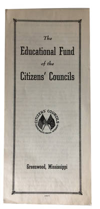
195788278Greenwood MI: Educational Fund of the Citizens' Councils 1957. Near Fine. illustration 5p Softcover pamphlet. Narrow 23 cm. White supremacist organization. Educational Fund of the Citizens' Councils unknown
1954105255M. Lassleben, Kallmünz 1954. 67 S. mit 10 Abbildungen,und 3 Tabellen, Groß 8°, Original-Broschur, Name auf Titel, 'einband leicht randgebräunt, innen sauber,
1963105230Kiel 1963. 287 S. mit zahlreichen Abbildungen, Groß 8°, Original-Karton (Softcover), Rücken leicht verblichen, gutes Exemplar mit Verfasserwidmung,
199250442München, Wilhelm Heyne Verlag, 1992. 669 Seiten , 22 cm Pappeinband mit Schutzumschlag