[Mississippi River]. [Hydroelectricity]Biblio.com
129 résultats
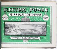
19135027Keokuk Ia: Mississippi River Power Company 1913. Very good. Ten volumes complete. Profusely illustrated. Oblong folio. Each issue measuring 9 x 12 inches in original pictorial wrappers two holes punched along spines and bound together in a later gray cloth Tatum-style Y binder with leather corners. Minor edge wear and staining to boards. Light edge wear to contents. A couple of panoramic photographs detached but present. A complete run of bulletins tracking the progress of construction on the Keokuk Dam & Power Plant which was then the longest monolithic concrete dam in the world and a pioneering effort in large-scale low-head hydroelectric power. Still in operation today the dame served as a prototype for many future power plants harnessing the power of the Mississippi River between Keokuk Iowa and Hamilton Illinois generating clean low cost and reliable energy enough to power 75000 homes. The present bulletins are chock full of facts figures photographs renderings and progress reports intended to familiarize the public with the project by illustrating the methods employed in its construction from beginning to completion. The bulletins are about equal parts text and photographs providing an easy-to-follow format for learning about the Keokuk project. Some of the issues also have folding maps or larger-format photographs which provide further visual accompaniment to the explanatory text.<br /> <br /> Known as a "run-of-river" plant the Keokuk Dam uses the natural energy of falling water to generate electricity. The power of this part of the river was identified by none other than Robert E. Lee in 1836 when he was serving as a surveyor for the U.S. War Department. Lee called attention to the turbulent waters but found no way to control it. In 1899 a group of leaders from Keokuk and Hamilton teamed up raised the backing funds received governmental approval for the dam and hired Hugh L. Cooper to oversee the project. Cooper had previously engineered construction of a hydroelectric plant at Niagara Falls. Interestingly an observation tower was also built on both sides of the river to allow the public to watch the progress of the Keokuk project then the largest privately-funded construction effort in the world. In addition to the dam a powerhouse and a new lock and dry system to accommodate river traffic were also built. The final bulletin includes comments from the chief engineer who noted that in the first bulletin it was stated that the project would be completed by July 1 1913. He remarks: "It is naturally a source of great satisfaction to all concerned with construction to see this prediction fulfilled."<br /> <br /> An informative and substantial production relating to a major construction project on the Mississippi River in the early-20th century. OCLC records a smattering of institutional holdings but complete runs appear to be rather rare. Mississippi River Power Company unknown
192140729Washington D.C.: Published by the United States Coast and Geodetic Survey 1921. Large folding nautical chart printed on heavy paper stock. Colored. A rare original coastal survey of the Northern Gulf coast from Florida to Louisiana encompassing Panama City Rosemary Beach Seaside Grayton Destin Pensacola Gulf Shores Mobile Gulfport and the Mississippi Delta.<br/> <br/> Established by President Thomas Jefferson in 1807 as the Survey of the Coast the U.S. Coast and Geodetic Survey was the United States' first civilian scientific agency. This agency has followed its mission to survey the U.S. coastline create nautical charts of the coast and help increase maritime safety since its founding and has often played fascinating roles in significant chapters of U.S. history. It served in all theaters of the Civil War in the service of the Union Army and Navy pioneered acoustic exploration in the wake of the sinking of the Titanic and during WWI it worked to detect enemy submarines. In addition this agency worked to survey and produce detailed maps and renderings of the U.S. coast. These nautical survey maps commonly referred to as "T-sheets" provide fascinating insights into the history of the United States coastline which has and will continue to shift. These maps are the most important data source for understanding the physical and ecological characteristics of the U.S. shoreline. The present map is a highly detailed and accurate sea chart of the Gulf coasts of Florida Alabama Mississippi and Louisiana and an important historical view of the developing states. Published by the United States Coast and Geodetic Survey unknown
1964List1009Atlanta: The Student Voice Inc. 1964. Single page measuring 12 ¾ x 7 ¾ inches folded. An exceptional copy very fine with no noted flaws. Fine. Offered here is a pristine copy of a fundraising pamphlet for the Mississippi Summer Project likely printed in in February of 1964 at the beginning of the fundraising and organization efforts by The Student Voice Inc. the separately incorporated publishing company for the SNCC. Over 1000 volunteers would travel to Mississippi and join thousands of local participants in what would eventually be known more commonly as Freedom Summer. The brochure lays out the scope of the effort which includes voter registration Freedom Schools community centers a research project a white community project and a law student project. The iconic photographs by Danny Lyon and Norris McNamara were taken during the Freedom Day protests at Hattiesburg Mississippi in January of 1964. [The Student Voice, Inc.] unknown books
190840737Washington D.C.: Published by the United States Coast and Geodetic Survey 1908. Large folding nautical chart printed on heavy paper stock. Colored. A rare original coastal survey of the Gulf coasts of Florida Alabama Mississippi and Louisiana including the Keys Fort Myers Sarasota Tampa Panama City Destin Pensacola Gulf Shores Mobile Biloxi Gulfport New Orleans and the Mississippi Delta.<br/> <br/> Established by President Thomas Jefferson in 1807 as the Survey of the Coast the U.S. Coast and Geodetic Survey was the United States' first civilian scientific agency. This agency has followed its mission to survey the U.S. coastline create nautical charts of the coast and help increase maritime safety since its founding and has often played fascinating roles in significant chapters of U.S. history. It served in all theaters of the Civil War in the service of the Union Army and Navy pioneered acoustic exploration in the wake of the sinking of the Titanic and during WWI it worked to detect enemy submarines. In addition this agency worked to survey and produce detailed maps and renderings of the U.S. coast. These nautical survey maps commonly referred to as "T-sheets" provide fascinating insights into the history of the United States coastline which has and will continue to shift. These maps are the most important data source for understanding the physical and ecological characteristics of the U.S. shoreline. The present map is a highly detailed and accurate sea chart of the coasts Florida Alabama Mississippi and Louisiana along the Gulf of Mexico and an important historical view of the developing states. Published by the United States Coast and Geodetic Survey unknown
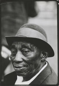
1965162963Forest Hills NY: Photo-Graphics 1965. Vintage satin finish portrait photograph of influential country blues musician Mississippi John Hurt 1965. Stamp of photographer Bernard Gotfryd on the verso along with annotations in manuscript pencil relating to same.<br /> <br /> Although Hurt's initial recordings with Okeh Records in the 1920s were commercial failures driving Hurt back into sharecropping he experienced a brief period of renewed interest in the early 1960s after his rediscovery by musicologist Dick Spottswood. He would travel and perform extensively recording for the Library of Congress in 1964 and recording four albums in as many years but would pass away in 1966 of a heart attack. Material recorded by Hurt has been covered by numerous artists including Bob Dylan Gillian Welch Beck Dave Van Ronk Taj Mahal Jerry Garcia and many others. <br /> <br /> Polish-American photographer Bernard Gotfryd worked as a staff photojournalist for "Newsweek" operating out of New York for over three decades. His photographs serve as a document of American popular culture politics and art in the 1960s and 1970s and his work is today held in the Library of Congress Brooklyn Public Library and the New York Historical Society. <br /> <br /> From the archive of the PIX Agency an American photo house that acted as an intermediary between emigre photographers as well as those still living in Europe and the American magazine and newspaper market between 1935-1969. <br /> <br /> 6.5 x 9.5 inches archivally matted in a 11 x 14 inch 8-ply white mat. About Near Fine with a small crease at the top left corner. Photo-Graphics unknown
19071873Southeastern Missouri 1907. About very good. Seventy-six silver gelatin photographs on twenty grey card leaves each image approximately 3.75 x 2.25 inches. Square grey cloth album string-tied. Light wear and soiling to covers. Contemporary ink inscription on front pastedown. Light foxing and soiling to leaves heaviest on first three leaves. Leaves lightly warped. Two images excised. A charming vernacular photograph album depicting life along the Mississippi River in the vicinity of the declining town of Gayoso Missouri. The caption on the front pastedown reads "These pictures made in the year of 1907 by Tom Pierce & Ed Cappoc at Goyaso Mo." Gayoso located on the banks of the Mississippi in the southeasternmost tip of the state was settled in 1799 and incorporated in 1851 as the county seat of Pemiscot County. By 1898 the movement of the river threatened to swamp the town and the county seat was moved to several miles south to Caruthersville. Though the river changed course and briefly spared Gayoso by 1900 its post office closed and today any remnants are buried deep in the silt of the Gayoso Bend Conservation Area. The present images show the town disappearing as the river eats away at large swathes of its surrounding land.<br/><br/>Several of the images depict flooding and high water -- trees standing in water men wading to cut lumber riverbank erosion and one image seems to show a collapsed pier. Other views show boats traveling up and down the Mississippi some ferrying lumber several large paddlewheelers and men poling lumber on rafts. One image shows a horse and buggy on what we presume to be the main street of Gayoso with a storefront visible behind the rig. Many of the images show the hardy folk who are still living in the remains of the dying town -- a woman and child in front of a clapboard house with a rotting porch and crumbling roof; a group of boys and three dogs all laughing in front of a building that may be the schoolhouse; one man apparently giving a haircut to his friend seated in front of some steps high water visible amongst the trees in the background; and several images which show men and boys logging and lumbering some of them standing in waist-high water while they fell doomed stands of trees. The album captures a slice of life on the Mississippi River at the turn of the century with all its attendant hardships commercial opportunities and dangers. unknown books
195212938N.p. likely Braxton MS 1952. 24pp. Profusely illustrated. Quarto. Original pictorial wrappers printed in green brown and red. Minor edge wear and foxing to wrappers. Light toning to text. Very good condition. A scarce and wonderfully-informative history of the first forty years of the Piney Woods Country Life School Laurence C. Jones's school for African American youth in Braxton Mississippi. The work is amply illustrated with photographs documenting the life and people of the school since its inception in 1910 to the moment of the pamphlet's publication. There are pages devoted to celebrating notable graduates of the school the "blind and the lame orphans and half-orphans" who've attended "internationally known visitors" "present-day buildings" five pages displaying the "industry" of the school the dairy and farm the "human and material progress" of the school and more. OCLC reports just ten total copies of this vital midcentury history of a notable southern school devoted to African-American youth. unknown
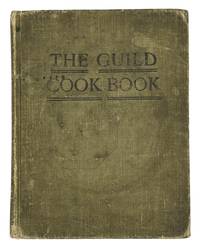
190710723Meridian Mississippi 1907. 7 x 5.5" tan cloth with black lettering 111 33 pp including 28 pages of local advertisements at the end. A rare Mississippi community cookbook. According to the foreword the recipes were "gathered from our friends and from other reliable sources" including The Delineator a women's magazine of the period. Many of the recipes are attributed to local women while several recipes submitted by celebrities of the era are attributed to The Delineator; the book also contains three bean recipes "Written expressly for the Junior Guild's Cook Book" by Miles Bradford editor of The Delineator. Other recipes include Gopher Soup Gumbo five recipes and Vegetarian Mince Meat; the book also contains around a dozen recipes for alcoholic drinks including Brandy Punch Whiskey Cocktail Old Fashioned Absinthe Cocktail Coffee Cocktail and Mint Julep. Staining and wear to covers staining/spattering to some pages in good condition overall. hardcover
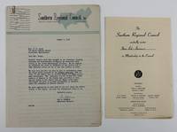
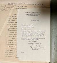
19465498Atlanta; Cleveland MS 1946. Very good. Two typed letters totaling 3pp. plus printed form completed in manuscript. Previously folded. Minor edge wear. Light tanning. A pair of typed letters that comprise an inquiry from Guy B. Johnson President of the Southern Regional Council and a response from Mrs. E.H. Green a resident of Bolivar County Mississippi concerning Black voting there in the July 1946 primary election. In his letter Johnson asks Green if she can corroborate stories in the Jackson Advocate that "all Negro votes were challenged" in Bolivar despite the fact that "Large numbers of Negroes were qualified to vote." Green responds that the votes of 241 qualified Blacks in Mound Bayou "the all Negro town" were all challenged on the basis that eligible African Americans had previously voted only in November general elections not primary elections. She also adds several observations from other districts in the county including the second where the votes of registered Blacks who appeared were also challenged and set aside. As a matter of prudence Green asks that "You do not give my name any publicity in this matter." The Southern Regional Council was a multiracial group founded in 1944 that sought equality and an end to racial violence. Also included with the two letters is a printed invitation for Mrs. E.H. Green to join the council with some information on its founding and goals. unknown
192041182Washington D.C.: Published by the United States Coast and Geodetic Survey 1920. Large folding nautical chart printed on heavy paper stock. Colored. A rare original coastal survey of coast between Louisiana and Mississippi and includes Lake Borgne Lake Ponchartrain the Mississippi Sound St Louis Bay Cat Island Long Beach and Gulfport.<br/> <br/> Established by President Thomas Jefferson in 1807 as the Survey of the Coast the U.S. Coast and Geodetic Survey was the United States' first civilian scientific agency. This agency has followed its mission to survey the U.S. coastline create nautical charts of the coast and help increase maritime safety since its founding and has often played fascinating roles in significant chapters of U.S. history. It served in all theaters of the Civil War in the service of the Union Army and Navy pioneered acoustic exploration in the wake of the sinking of the Titanic and during WWI it worked to detect enemy submarines. In addition this agency worked to survey and produce detailed maps and renderings of the U.S. coast. These nautical survey maps commonly referred to as "T-sheets" provide fascinating insights into the history of the United States coastline which has and will continue to shift. These maps are the most important data source for understanding the physical and ecological characteristics of the U.S. shoreline. The present map is notable for its inclusion of Gulfport as it was gridded in 1920 and Cat Island a barrier island used for an undercover WWII program Dogs for Defense. Cat Island was chosen as the training camp dedicated to a specialized training program based off the untrue belief that dogs could differentiate humans by smell based on their cultural heritage. The top secret program attempted to train dogs to track and attack Japanese soldiers in the Pacific Theater and was held at Cat Island because of its similar terrain to that of the Pacific Islands and its uninhabited status. This operation was unsuccessful due to the incorrect assumption and shut down in 1944. This map is a highly detailed and accurate sea chart of the coastal border between Louisiana and Mississippi and is an important historical view of the developing Louisiana and Mississippi. Published by the United States Coast and Geodetic Survey unknown
19081144960State of Mississippi 1908. Hinge starting between ffep and frontis. Crease of spine. Presentation card signed by Dunbar Rowland Director of the Dept. of Archives and History tipped in at title page. Owner's name. 1911 date written on ffep. Hardcover. Good/No Jacket as Issued. Thick Large Octavo. Book. State of Mississippi Hardcover
192241198Washington D.C.: Published by the United States Coast and Geodetic Survey 1922. Large folding nautical chart printed on heavy paper stock. Colored. A rare original coastal survey of the border between Mississippi and Alabama including the Mississippi Sound Gulfport Biloxi Pascagoula and a series of barrier islands: Cat Island Ship Island Horn Island Petit Bois Island Dauphin Island and Island Aux Herbes.<br/> <br/> Established by President Thomas Jefferson in 1807 as the Survey of the Coast the U.S. Coast and Geodetic Survey was the United States' first civilian scientific agency. This agency has followed its mission to survey the U.S. coastline create nautical charts of the coast and help increase maritime safety since its founding and has often played fascinating roles in significant chapters of U.S. history. It served in all theaters of the Civil War in the service of the Union Army and Navy pioneered acoustic exploration in the wake of the sinking of the Titanic and during WWI it worked to detect enemy submarines. In addition this agency worked to survey and produce detailed maps and renderings of the U.S. coast. These nautical survey maps commonly referred to as "T-sheets" provide fascinating insights into the history of the United States coastline which has and will continue to shift. These maps are the most important data source for understanding the physical and ecological characteristics of the U.S. shoreline. The present map is notable for its inclusion of Gulfport Biloxi and Pascagoula as they were gridded in 1922 and Cat Island a barrier island used for an undercover WWII program Dogs for Defense. Cat Island was chosen as the training camp dedicated to a specialized training program based off the untrue belief that dogs could differentiate humans by smell based on their cultural heritage. The top secret program attempted to train dogs to track and attack Japanese soldiers in the Pacific Theater and was held at Cat Island because of its similar terrain to that of the Pacific Islands and its uninhabited status. This operation was unsuccessful due to the incorrect assumption and shut down in 1944. This map is a highly detailed and accurate sea chart of the coastal border between Mississippi and Alabama and an important historical view of the developing states. Published by the United States Coast and Geodetic Survey unknown
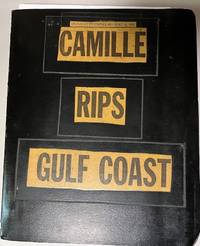
196934699Unknown: n/a 1969. Album. Good. Scrapbook. Approx. 9.5" x 11.5" three ring black binder with title pasted down on the front cover. Back cover of the album has some scuff marks. Contents clean.<br /> <br /> Contents include 43 photographs mounted on black paper magazine and newspaper clippings a Gulf Coast map by Shell Gas Company and a written essay on the hurricane. Original photographs depict scenes of devastated buildings properties etc. A unique collection of visual and printed material regarding one of the most powerful and destructive hurricanes to hit the Gulf coast. n/a unknown
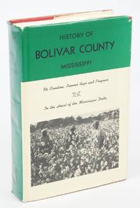
1976078391South Carolina: The Reprint Company 1976. paperback. Fine/Very Good. 0x0x0. Red cloth covers with gilt lettering. 634 pp. Features black and white photographs of places in Bolivar County. Dust jacket has general wear a few small tears and light discoloration. Full refund if not satisfied. The Reprint Company paperback
1910WRCAM41659Cleveland Ms 1910. Single card 2 x 3 3/4 inches. Minor soiling and creasing. Very good. A business card for the Gordin House in Cleveland Mississippi Mrs. S.S. Floyd proprietress. The card indicates: "Special attention paid to traveling men." Patrons can stay for a mere two dollars per day. In all likelihood the advertised establishment was in fact a whorehouse. Cleveland Mississippi established in 1887 and named for President Grover Cleveland is a small town in the Mississippi Delta. unknown books
1996290264PN. New. 1996. Soft Cover. Date is original print. This is a reprint edition . PN paperback
192625684Washington, Carnegie Institution, Department of Historical Research, 1926, in-4°, xvi-889 pp, reliure pleine percaline havane éditeur, bon état. Premier volume seul (sur 2)
1996290263PN. New. 1996. Soft Cover. Date is original print. This is a reprint edition . PN paperback
1989ZB2800031989. softcover ex library else text clean & binding tight. - If you are reading this this item is actually physically in our stock and ready for shipment once ordered. We are not bookjackers. Buyer is responsible for any additional duties taxes or fees required by recipient's country. Photos available upon request. paperback
194234721Jackson Mississippi: n.p. 1942. Manuscript. Good. Unpublished typed manuscript. 242 pages typed on the rectos only. 1942 rejection letter from the publisher signed by the secretary is included. Manuscript housed in torn and chipped paper folder with author's Jackson Mississippi address on the front side. Manuscript inscription on the first page. Contents clean and in good condition. n.p. unknown
191041493McComb City MS: Hays the Printer 1910. Vol. iv no. 1 January 1910. 8vo. 8 pp. Ads. Original printed tan wrappers stapled. Very good. This issue only of the 'house organ' for Hays the Printer a printing and ad-writing company in McComb City. Extensive descriptions for all of the company's services with examples of recently filled orders. Not recorded on OCLC by the NUC or in UNION LIST OF SERIALS. <br/><br/> Hays, the Printer unknown books
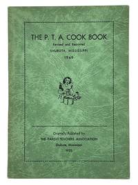
194910727Meridian Mississippi: Dement Printing Company 1949. 7.5 x 5.5" green wrappers with black lettering 49 15 pp with blank pages for notes and local advertisements at the end. This edition revised and reprinted from the 1925 edition. The recipes are attributed to local women and include Prickly Porcupines a kind of meat ball Chicken Gumbo Shrimp Jambolay Cheese Balls Ireland Mold Salad Marshmallow Salad and Pepper Mangoes. A nice copy with corner creased bit of damp staining to upper edge of pages old tape residue and few paper abrasions to rear wrapper. Dement Printing Company unknown
1994440778PN. New. 1994. Soft Cover. Date is original print. This is a reprint edition. . PN paperback
1994440716PN. New. 1994. Soft Cover. Date is original print. This is a reprint edition. . PN paperback
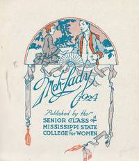
1924009467Published by the Senior Class of Mississippi State College for Women Mississippi University for Women Columbus Mississippi 1924 1924. Hardcover. Good. illustrations 31 cm ; LCCN 73641784 ; OCLC 5141018 ISSN 0090-9408 ; brown textured flexible leather with gold designs ; some wear else G; very scarce ; Eudora Welty was to begin classes here the very next year. Many of these students attending in 1925 would have been known to her. <br/> <br/> Published by the Senior Class of Mississippi State College for Women [Mississippi University for Women], Columbus Mississippi, 1 hardcover