[African Americana]: [Louisiana]Biblio.com
1 088 résultats
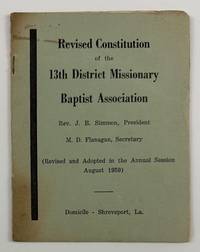
19594635Shreveport La 1959. Very good. 8pp. Original printed wrappers stapled. Minor toning around the edges short split to spine. A very rare if not unrecorded African American religious pamphlet from Jim Crow Louisiana. This revised constitution was printed to govern the Thirteenth District Missionary Baptist Association in Shreveport in 1959. The purpose of the organization is "to promote and support Home and Foreign Missions contribute to Christian Education to develop and maintain Christian Unity and to give AID to struggling churches also to foster Charitable Institutions." The constitution provides rules for membership officers the duties of officers meetings departments within the association the presbytery and more. No copies listed in OCLC. unknown
192041169Washington D.C.: Published by the United States Coast and Geodetic Survey 1920. Large folding nautical chart printed on heavy paper stock. Colored. A rare original coastal survey of the Barataria Bay area and includes Grand Isle Grand Terre Island and the Mississippi River.<br/> <br/> Established by President Thomas Jefferson in 1807 as the Survey of the Coast the U.S. Coast and Geodetic Survey was the United States' first civilian scientific agency. This agency has followed its mission to survey the U.S. coastline create nautical charts of the coast and help increase maritime safety since its founding and has often played fascinating roles in significant chapters of U.S. history. It served in all theaters of the Civil War in the service of the Union Army and Navy pioneered acoustic exploration in the wake of the sinking of the Titanic and during WWI it worked to detect enemy submarines. In addition this agency worked to survey and produce detailed maps and renderings of the U.S. coast. These nautical survey maps commonly referred to as "T-sheets" provide fascinating insights into the history of the United States coastline which has and will continue to shift. These maps are the most important data source for understanding the physical and ecological characteristics of the U.S. shoreline. The present map of the Louisiana coastline is notable for the inclusion of Grand Isle the only inhabited barrier isle of Louisiana and of Barataria Bay which used to be frequented by pirates including Privateer Jean Lafitte. It is a highly detailed and accurate sea chart of the Barataria Bay and an important historical view of the developing Louisiana. Published by the United States Coast and Geodetic Survey unknown
19192278Crowley 1919. About very good. 31pp. 16mo. Original printed wrappers stapled. Moderate soiling to covers contemporary pencil ownership notation on front cover. Doodle inside front cover. Minor soiling internally. "The city that sets the pace in the race for prosperity in the rice belt takes nobody's dust and keeps her head turned always in the direction of success." A promotional work for the city of Crowley Louisiana located in the south-central portion of the state. The work is extensively illustrated with views of the city as well as scenes of rice fields and a map of the state showing Crowley's location and all of the railroads that connect it to the wider world. We locate four copies in OCLC -- University of Alabama Yale University of Louisiana at Lafayette and the Louisiana state library. unknown
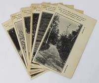
19203617Hammond La: Vindicator Job Print 1920. Very good. Six photographically-illustrated postcards each 5.5 x 3.5 inches. Minor edge wear some toning around the edges and at corners one slightly misprinted with very minor loss of text. A visually-interesting group of a half dozen promotional postcards picturing various locations around Hammond Louisiana issued by the Hammond Real Estate & Investment Company Limited. The company encourages potential emigrants and investors to contact them: "If you want to know about Hammond and vicinity write to the Hammond Real Estate & Investment Company Limited." The photographs on the postcards feature distinct locations and each is printed with a different caption at lower right. These captions read: "A Country Road" "Pines and Palmettoes" "A River Drive" "The Tangipahoa River" "The 'Hammond Oak'" and "Oak Street." The printer Vindicator Job Print was the local newspaper started in 1892 as the Hammond Graphic and by 1919 was known as the Hammond Vindicator. No results found in OCLC. Vindicator Job Print unknown
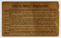
19143424N.p. likely near Bogalusa La 1914. Very good. 5pp. on a single folded sheet of cardstock. Oblong 12mo. Some toning and dust-soiling light chipping to one edge. A seemingly unrecorded promotional item touting the economic advantages of Bogalusa Louisiana located near the Mississippi border in the northeastern portion of the state. The population of the town is given as "10000 of which 6500 are whites and 3500 colored." The text primarily promotes the lumber industry as well as the mills railroads schools hotels and other amenities offered by the town. One item brags that "Every house occupied by a white person in Bogalusa has modern sanitary conveniences and electric lights." The last two lines highlight Bogalusa's "fine Base Ball Park" and that fact that "There were 363 babies born in Bogalusa in the year 1913" the only date listed anywhere on the item. No copies of the present publication in OCLC - just a similarly titled but more official publication produced by the Bogalusa Chamber of Commerce a dozen years later. unknown
192041182Washington D.C.: Published by the United States Coast and Geodetic Survey 1920. Large folding nautical chart printed on heavy paper stock. Colored. A rare original coastal survey of coast between Louisiana and Mississippi and includes Lake Borgne Lake Ponchartrain the Mississippi Sound St Louis Bay Cat Island Long Beach and Gulfport.<br/> <br/> Established by President Thomas Jefferson in 1807 as the Survey of the Coast the U.S. Coast and Geodetic Survey was the United States' first civilian scientific agency. This agency has followed its mission to survey the U.S. coastline create nautical charts of the coast and help increase maritime safety since its founding and has often played fascinating roles in significant chapters of U.S. history. It served in all theaters of the Civil War in the service of the Union Army and Navy pioneered acoustic exploration in the wake of the sinking of the Titanic and during WWI it worked to detect enemy submarines. In addition this agency worked to survey and produce detailed maps and renderings of the U.S. coast. These nautical survey maps commonly referred to as "T-sheets" provide fascinating insights into the history of the United States coastline which has and will continue to shift. These maps are the most important data source for understanding the physical and ecological characteristics of the U.S. shoreline. The present map is notable for its inclusion of Gulfport as it was gridded in 1920 and Cat Island a barrier island used for an undercover WWII program Dogs for Defense. Cat Island was chosen as the training camp dedicated to a specialized training program based off the untrue belief that dogs could differentiate humans by smell based on their cultural heritage. The top secret program attempted to train dogs to track and attack Japanese soldiers in the Pacific Theater and was held at Cat Island because of its similar terrain to that of the Pacific Islands and its uninhabited status. This operation was unsuccessful due to the incorrect assumption and shut down in 1944. This map is a highly detailed and accurate sea chart of the coastal border between Louisiana and Mississippi and is an important historical view of the developing Louisiana and Mississippi. Published by the United States Coast and Geodetic Survey unknown
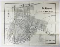
19062664New Orleans 1906. Very good. Sheet map 22 x 28 inches. Old folds. Minor soiling and wear. Scarce map of New Orleans issued by the Times Picayune. The map shows the city spread between Lake Pontchartrain to the north and the Mississippi River to the south with details of streets drainage railroads electric car lines and other points of interest. A numbered legend highlights various important locales such as the Picayune's offices City Hall different squares and parks the French Market and the railroad hubs. unknown
192141179Washington D.C.: Published by the United States Coast and Geodetic Survey 1921. Large folding nautical chart printed on heavy paper stock. Uncolored. A rare original coastal survey of Vermillion Parish including Vermilion Bay Marsh Island Pecan Island White Lake Cote Blanche Bay and Trinity Shoal.<br/> <br/> Established by President Thomas Jefferson in 1807 as the Survey of the Coast the U.S. Coast and Geodetic Survey was the United States' first civilian scientific agency. This agency has followed its mission to survey the U.S. coastline create nautical charts of the coast and help increase maritime safety since its founding and has often played fascinating roles in significant chapters of U.S. history. It served in all theaters of the Civil War in the service of the Union Army and Navy pioneered acoustic exploration in the wake of the sinking of the Titanic and during WWI it worked to detect enemy submarines. In addition this agency worked to survey and produce detailed maps and renderings of the U.S. coast. These nautical survey maps commonly referred to as "T-sheets" provide fascinating insights into the history of the United States coastline which has and will continue to shift. These maps are the most important data source for understanding the physical and ecological characteristics of the U.S. shoreline. The present map of the Louisiana coastline is notable for the inclusion of Marsh Island which was deeded to the state in 1920 the year this map was produced. It is a highly detailed and accurate sea chart of the Vermilion Parish and an important historical view of the developing Louisiana. Published by the United States Coast and Geodetic Survey unknown
182829714New Orleans: John Gibson- State Printer 1828. 211 1 blank; 199 1 blank pp. The 1827 Acts are bound in later cloth with morocco spine labels and an old law library gilt stamp at base of spine; bookplate on front pastedown; text lightly to moderately toned or foxed. Good. The 1828 Acts are bound in original attractive full calf with gilt-lettered morocco spine label. A couple of rubberstamps bookplate on front pastedown front and rear pastedowns worn. Good. <br /> <br /> English and French are on facing pages in each volume. The First Session passed acts prescribing the mode of private emancipation an act relative to runaway slaves the organization of the City of New Orleans into wards; establishment of a consolidated planters association of Louisiana; and various laws on internal improvements civil and criminal law. <br /> The Second Session repealed an Act which had prohibited entry of slaves into the State for purposes of sale and passed several statutes improving river and canal transportation incorporating "a society of Israelites" incorporating other associations like the New Orleans Jockey Club. Each Session includes an Index and Titles of Acts.<br /> Jumonville 600 625. AI 29537 3 33906 3. John Gibson- State Printer unknown
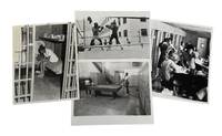
1973209341973. Archive of four press photographs produced between 1973 and 1976 documenting inmate life prison reform efforts and conditions within Orleans Parish Prison in New Orleans Louisiana a carceral institution whose origins extended back to the antebellum era and the policing of enslaved African Americans. The material documents systems of incarceration and institutional control through visual and textual evidence revealing recreational programs women's detention facilities inmate education initiatives and efforts to address violence within one of the nation's most criticized prison systems. Built in 1837 the prison historically functioned both as a municipal jail and as a site of punishment for enslaved people where imprisoned Black individuals could be subjected to whipping solitary confinement and deprivation. By the twentieth century the institution had become nationally associated with overcrowding violence and inmate abuse generating lawsuits and public scrutiny over prison conditions. These photographs provide primary-source evidence for the study of incarceration race prison reform and the lived experience of prisoners in the American South during the post-Civil Rights era.<br /> Archive consists of four black-and-white silver gelatin press photographs each approximately 8 x 10 inches many retaining original press captions or pasted articles on the verso or printed margins. One 1973 photograph depicts two Black inmates playing pool inside a sparse recreation area containing a single billiards table surrounded by concrete walls and rows of metal lockers illustrating the limited recreational infrastructure available to prisoners. A 1974 image captures two inmates identified as Perry Nelson and DeLyons boxing within an outdoor prison ring while correctional officers and inmates observe nearby; the accompanying article discusses prison efforts to channel inmate violence into organized athletic programming intended to improve morale and reduce assaults. A 1975 photograph shows a barefoot female inmate awaiting trial inside a dimly lit cell decorated with greeting cards small personal items and a cross placed on a shelf overhead while the accompanying article references public criticism and reforms intended to improve conditions for incarcerated women. Another photograph from the women's division dated circa 1976 documents female inmates and prison workers gathered in a classroom environment associated with "CONCEPT" a volunteer-led educational initiative established in 1973 offering counseling Black history courses creative writing sewing drawing music programs and lectures on topics including women's liberation and drug abuse.<br /> The archive reflects broader national debates surrounding incarceration and prison reform during the 1970s when increasing public attention focused on prison violence racial inequality within the criminal justice system and rehabilitation initiatives following the Attica uprising and other prison protests. Orleans Parish Prison became emblematic of deteriorating urban jail systems in the United States particularly regarding the treatment of poor and predominantly African American inmates. These photographs preserve both the punitive realities of the institution and the emergence of educational and rehabilitative efforts within the prison environment. Minor edge wear and occasional editor's markings. Very good condition overall. Historically significant visual record of incarceration race and reform efforts within one of the most notorious prison systems in the American South. unknown
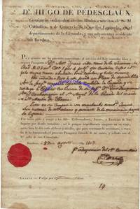
6238HUGO PEDESCLAUX 1751-1834. Pedesclaux served as consul of Spain at Bordeaux from 1796 to 1808. DS. 10 x 12. August 27 1803. Bordeaux. A partially printed document signed Juan Estrada in Spanish; the translation states: DON HUGO DE PDESCLAUX commanding Commissary for His Catholic Majestys Royal armies and the trade of the nation of Spain in the Department of Gironde and its vicinity residing at Bordeaux. Whereas I have deemed it beneficial to the Kings service to grant free and secure passage to Don Antonio Ignacio Silva a resident of Louisiana 32 years of age 5 feet 4 inches in height eyes brown eyebrows the same hair black nose bulbous mouth regular and complexion dark; the said individual arrived in this port with the rank of second officer on the Spanish merchant frigate named La Eugenia and is returning to Spain by leave of his Captain Don Luis Dauquemenil on the chasse-mare El Santo ngel de la Guarde Don Martn de Ybarra master; having as his companion a youth named Jacinto Len a native of New Orleans and arriving on the aforesaid frigate La Eugenia; I therefore pray and beseech the Lords Governors Judges and Peace Officers in the places through which he may travel to impose no obstruction to his journey but rather to afford him whatever favor and assistance he may require to continue. To this end I have granted the present passport signed by my hand and sealed with the Royal seal of this consulate. On the version the following is written in another hand in reply and signed Antonio Argote Villalobos: Having appeared with this passport at this Consulate of Spain in Virginia it is granted him to take passage to Louisiana on the vessel that suits him Norfolk 14 December 1803. This document is a passport for Don Antonio Ignacio Silva to enter the colony of Louisiana on the orders of Don Hugo de Pedesclaux the Spanish consul in French Bordeaux. It was issued during a time of great transition for Louisiana as it had just been purchased from France by the United States in the Louisiana Purchase. In return for fifteen million dollars about eighteen dollars per square mile the United States acquired 530000000 acres from France. Napoleon had hoped to re-establish a French colonial empire in North America as they had in the 18th century. France had only reacquired some of that territory the Louisiana Territory from Spain in 1800 having lost it in the Seven Years War in 1762 and explaining how a Spanish citizen like Silva could have lived there for so long. However France's failure to suppress a revolt in Saint-Domingue now Haiti plus the prospect of European warfare prompted Napoleon to sell off Frances North American possessions. Given that this document makes no mention of American control at either date and given how slow communication was in the early 19th century it is likely that none of the parties to this document knew of the Louisiana Purchase. In fact France would not turn over New Orleans their colonial capital until December 20 1803 after both signatures; and this was only three weeks after Spanish officials had belatedly formally turned over administration of the colony to France! The intertwined early 19th century histories of France and Spain would affect Pedesclaux. When Napoleon put his brother Joseph on the Spanish throne in 1808 Pedesclaux defected and swore loyalty to Joseph. He was not pardoned by Spain for this action until 1833. The document is in very good condition with some minor stains and folds. An English-language translation is included. unknown
192041173Washington D.C.: Published by the United States Coast and Geodetic Survey 1920. Large folding nautical chart printed on heavy paper stock. Colored. A rare original coastal survey of the Texas-Louisiana border area from Sabine Pass to Calcasieu Lake and Pass and includes Mud Lake Holly Beach Johnson Bayou and Sabine National Wildlife Refuge.<br/> <br/> Established by President Thomas Jefferson in 1807 as the Survey of the Coast the U.S. Coast and Geodetic Survey was the United States' first civilian scientific agency. This agency has followed its mission to survey the U.S. coastline create nautical charts of the coast and help increase maritime safety since its founding and has often played fascinating roles in significant chapters of U.S. history. It served in all theaters of the Civil War in the service of the Union Army and Navy pioneered acoustic exploration in the wake of the sinking of the Titanic and during WWI it worked to detect enemy submarines. In addition this agency worked to survey and produce detailed maps and renderings of the U.S. coast. These nautical survey maps commonly referred to as "T-sheets" provide fascinating insights into the history of the United States coastline which has and will continue to shift. These maps are the most important data source for understanding the physical and ecological characteristics of the U.S. shoreline. The present map is a highly detailed and accurate sea chart of the Texas-Louisiana southern border and an important historical view of the developing Louisiana. Published by the United States Coast and Geodetic Survey unknown
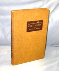
193927182Baton Rouge:: Louisiana State University Press 1939. First Printing of the First US Edition. A Very Good plus copy in brown cloth binding with some rubbing to the spine lettering though still readable. The author worked both alone and with Allan Lomax collecting songs "in the field". Some of the lyrics in this rare volume are in Cajun French some in "regular" French and some in a curious combination of the two. All of which is to say that they are typical folksongs. Includes a Bibliography and an Index of Songs. Louisiana State University Press, hardcover
192041174Washington D.C.: Published by the United States Coast and Geodetic Survey 1920. Large folding nautical chart printed on heavy paper stock. Uncolored. A rare original coastal survey of the Atchafalaya Basin area including Marsh Island Cote Blanche Bays Atchafalaya Bay and River.<br/> <br/> Established by President Thomas Jefferson in 1807 as the Survey of the Coast the U.S. Coast and Geodetic Survey was the United States' first civilian scientific agency. This agency has followed its mission to survey the U.S. coastline create nautical charts of the coast and help increase maritime safety since its founding and has often played fascinating roles in significant chapters of U.S. history. It served in all theaters of the Civil War in the service of the Union Army and Navy pioneered acoustic exploration in the wake of the sinking of the Titanic and during WWI it worked to detect enemy submarines. In addition this agency worked to survey and produce detailed maps and renderings of the U.S. coast. These nautical survey maps commonly referred to as "T-sheets" provide fascinating insights into the history of the United States coastline which has and will continue to shift. These maps are the most important data source for understanding the physical and ecological characteristics of the U.S. shoreline. The present map of the Louisiana coastline is notable for the inclusion of the Atchafalaya Basin the nation's largest river swamp containing 1 million acres of America's most significant bottomland hardwoods swamps bayous and backwater lakes. It also is home to a diverse wildlife population containing 65 species of reptiles and amphibians 100 species of fish and 250 species of birds containing the largest nesting concentration of bald eagles in the south central United States. The map also notes Marsh Island which was deeded to the state in 1920 the year this map was produced. It is a highly detailed and accurate sea chart of the Atchafalaya Basin and an important historical view of the developing Louisiana. Published by the United States Coast and Geodetic Survey unknown
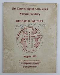
19764649Shreveport La 1976. Good. 34pp. Original pictorial cream wrappers stapled. Moderate staining and noticeable insect damage to wrappers some pen notations on covers. A few ink notations and underlinings in the text but mostly clean with center gathering detached. An unrecorded pamphlet containing numerous "historical sketches" of the various groups within the 13th District Baptist Association Women's Auxiliary in Shreveport Louisiana. The work contains a history of the Antioch Baptist Church Missionary Society which began in 1889 and sketches on the women of the Broadway Missionary Church Mission Band the Lakeside Baptist Church the Little Union Missionary Baptist Church Mission Society and Woman's Missionary Union and many many more groups from area churches. The text is illustrated throughout with dozens of photographs of notable officers members and other figures within the groups various churches and more. An excellent snapshot of Shreveport-area women's church groups with no copies in OCLC. unknown
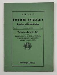
19384099Baton Rouge La: January 1938. Very good. 32pp. Original green printed wrappers stapled. Minor wear and dust-soiling. Pencil notations to a few pages otherwise internally clean. The rare first issue of the bulletin of Southern University in Baton Rouge. The issue was devoted to the Southern University Rally and printed rules and regulations for the tournaments of the Louisiana Interscholastic Athletic and Literary Association. These events included the state football championship basketball games music and literary contests the state dramatic festival and the state track meet. The work also includes the "Aims and Purposes of the Association" which are "adapted from the Texas Interscholastic League for Colored Schools" a history of interscholastic activities "among Negro Schools in Louisiana" and lists of the officers of the organization. The previous owner of the present copy of the bulletin had a keen interest in the section on the rules for music contests with numerous light pencil notes written in the outer margins of the first two pages of that section. January unknown
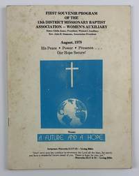
19784648Shreveport La 1978. Very good. 56pp. Original pictorial wrappers stapled. Moderate foxing creasing light edge wear with a few pen notations to rear wrapper. Light occasional foxing to text. A wonderful combination of souvenir program for a notable women's religious organization and overall celebration of African-American church life in Shreveport in the late-1970s. Chiefly the program contains the schedule of events for the 1978 conference of the 13th District Missionary Baptist Association Women's Auxiliary which took place over five days in August. The work also opens with a Dedication "In memory of The Black Mother" by the auxiliary's president Sister Eddie Jones and includes photographic collages of the organization's officers "Some Past President of the 13th District Association and Pioneers of Faith" other photo-collages of "Pioneers of Faith" a group photograph of the Baptist Men's Council of Louisiana" and much more. The text is supplemented with a wealth of greetings and well wishes from a legion of local citizens and religious organizations along with a number of advertisements for local businesses. One greeting that also doubles as an advertisement for the African-American newspaper The Shreveport Sun is printed in memory of the founder of the paper M.L. Collins. No copies in OCLC. unknown
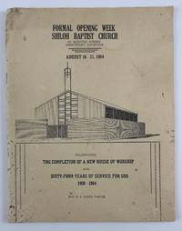
19644637Shreveport La 1964. Good. 48pp. Quarto. Original pictorial wrappers stapled. Noticeable staining and edge wear head of spine chipped. The very rare if not unrecorded program issued by the Shiloh Baptist Church "celebrating the completion of a new house of worship and sixty-four years of service for God 1900-1964." The work contains a schedule of events for the week-long service and dedication of the new building as well as a wealth of information on the Shiloh church along with numerous photographs of groups within the church including the Deaconess Board the Matrons Officers Sunday School classes the "Angelic Choir" and many more. The material on the church is supplemented by dozens of congratulatory messages and advertisements for local businesses supportive of the African-American community in Shreveport. No copies listed in OCLC. unknown
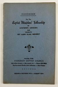
19744634Shreveport La 1974. Very good. 29pp. Original blue printed wrappers stapled. Minor discoloration around edges minor wear. Previous owner's signature on inside front cover ink notation on first page. An unrecorded pamphlet containing the details of Baptist church events in Shreveport for 1974. The work includes a listing of the ministers in charge of the Fellowship as well as the program calendar of events order of events the schedule for the Christian Doctrine Lectures assignments of Sunday School teachers listings of committees and members of each and the Constitution and By-Laws of the Fellowship. The final eleven pages are comprised of a Membership Directory of the Baptist Ministers' Fellowship listing each minister's name home address church affiliation and the address and phone numbers for the church. We could locate no other copies of this rare handbook which offers ample study of the African American religious community in Shreveport in the early-1970s. unknown
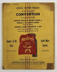
19484638St. Louis Mo 1948. Good plus. 40pp. Original yellow wrappers printed in red and black. Some uneven sunning a few ink notations moderate dust-soiling and edge wear to wrappers soft central vertical crease throughout. Minor dust-soiling to most of text a few ink notations. The official souvenir program for the 1948 national convention of the Imperial Council Ancient Egyptian Arabic Order of Nobles of the Mystic Shrine an African-American shriner's organization. The program begins with a Foreword by the group's Imperial Potentate Raymond E. Jackson followed by photographic portraits of the Imperial Council portraits of the women of the Imperial Court greetings and notices with photographic portraits from dozens of chapters and two pages of greetings from the Grand Chapter of Missouri. The two-page centerfold prints the schedule of events for the convention which took place from August 15-20 and included dozens of sessions run by the Imperial Council and Court as well as the Heroines of Jericho Eastern Stars and Royal Arch Masons. Among the more casual events held during the convention were a "Shriners Bathing Suit & Talent Pageant" held in Kiel Auditorium a baseball game at Sportsman's Park and a tour of the Anheuser-Busch brewery. The last half of the program as well as the inside rear cover and back cover are comprised of advertisements from local Black-owned businesses and those who catered to the Black community. unknown
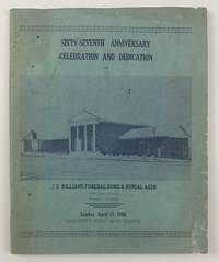
19654642Shreveport La 1965. Good. 64pp. Original pictorial light blue wrappers printed in dark blue stapled. Text printed in blue. Moderate staining and soiling to wrappers and text minor insect damage to wrappers. An unrecorded program celebrating the anniversary and the dedication of a new building for the African-American-owned J.S. Williams Funeral Home & Burial Association in Louisiana. Williams is described on the front wrapper as "Shreveport's Oldest Negro Business." The celebration took place Sunday April 11 1965 and the program includes a schedule of events for the day. The present work contains a history of the business portraits of the company's embalmers and other staff memorial messages addressed to some deceased former employees and more. Most of the work is taken up with advertisements largely from the African-American community in and around Shreveport. The advertisers include other Black churches local African-American schools like George Washington Carver High School organizations such as the Supreme Colored Helpers Society of America and the Colored Association of Louisiana and businesses including Booker T. Washington Nursing Home Shreveport Mutual Funeral Home and the Mays Printing Company. The wealth of ads practically add up to a de facto African-American community directory of contemporary Shreveport. We could locate no other copies of this work in OCLC or elsewhere. unknown
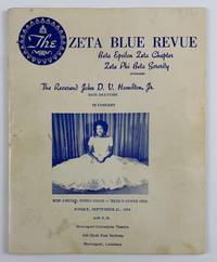
19754636Shreveport La 1975. Very good. 36pp. Original cream pictorial wrappers printed in blue stapled. Text printed in blue. Minor wear and some soiling to wrappers. A few blue pen marks to wrappers and a few text pages. An unrecorded program for a bass baritone performance by Reverend John D.V. Hamilton Jr. hosted by the Shreveport chapter of the Zeta Phi Beta Sorority. The program includes the schedule of events for the night of the performance which took place at the Shreveport Convention Theatre on September 21 1975 but also includes much more information on the African American community of the area. The program is profusely illustrated with photographs of sorority members Hamilton himself local Black political candidates and more and includes lists of the Blue Revue Committee the chapter members a biographical sketch of Hamilton and much more. In addition the work contains a great many well wishes from various parties and numerous advertisements for local businesses serving the Black community in Shreveport such as the Shreveport Sun newspaper the Benevolent Life Insurance Company Armanda's Beauty Salon J.S. Williams & Son Funeral Home and many others. Hamilton's musical performances included pieces by Handel Tchaikovsky Rodgers and Hammerstein Gershwin and one of his own compositions as part of a section of songs called "God in the Black Experience." We could locate no other copies of this program in OCLC or elsewhere. unknown
192041180Washington D.C.: Published by the United States Coast and Geodetic Survey 1920. Large folding nautical chart printed on heavy paper stock. Uncolored. A rare original coastal survey of Barataria Bay area and includes Grand Isle and other barrier islands Fifi island Grande Terre Island Port Fourchon and Terrebone Bay.<br/> <br/> Established by President Thomas Jefferson in 1807 as the Survey of the Coast the U.S. Coast and Geodetic Survey was the United States' first civilian scientific agency. This agency has followed its mission to survey the U.S. coastline create nautical charts of the coast and help increase maritime safety since its founding and has often played fascinating roles in significant chapters of U.S. history. It served in all theaters of the Civil War in the service of the Union Army and Navy pioneered acoustic exploration in the wake of the sinking of the Titanic and during WWI it worked to detect enemy submarines. In addition this agency worked to survey and produce detailed maps and renderings of the U.S. coast. These nautical survey maps commonly referred to as "T-sheets" provide fascinating insights into the history of the United States coastline which has and will continue to shift. These maps are the most important data source for understanding the physical and ecological characteristics of the U.S. shoreline. The present map of the Louisiana coastline is notable for the inclusion of Grand Isle the only inhabited barrier isle of Louisiana and for the Barataria Bay which was frequented by many pirates including Privateer Jean Lafitte. It is worth noting how much of the geography has shifted in this delicate environment in the 100 years since this map was produced. It is a highly detailed and accurate sea chart of the Barataria Bay Area and an important historical view of the developing Louisiana. Published by the United States Coast and Geodetic Survey unknown
192041172Washington D.C.: Published by the United States Coast and Geodetic Survey 1920. Large folding nautical chart printed on heavy paper stock. Uncolored. A rare original coastal survey of Caillou Bay area and including Isle Dernieres.<br/> <br/> Established by President Thomas Jefferson in 1807 as the Survey of the Coast the U.S. Coast and Geodetic Survey was the United States' first civilian scientific agency. This agency has followed its mission to survey the U.S. coastline create nautical charts of the coast and help increase maritime safety since its founding and has often played fascinating roles in significant chapters of U.S. history. It served in all theaters of the Civil War in the service of the Union Army and Navy pioneered acoustic exploration in the wake of the sinking of the Titanic and during WWI it worked to detect enemy submarines. In addition this agency worked to survey and produce detailed maps and renderings of the U.S. coast. These nautical survey maps commonly referred to as "T-sheets" provide fascinating insights into the history of the United States coastline which has and will continue to shift. These maps are the most important data source for understanding the physical and ecological characteristics of the U.S. shoreline. The present map of the Louisiana coastline is notable for the inclusion of Isle Derniere which translates to "last island" the westernmost of a string of islands along the basin of the Mississippi. This 24 mile stretch of land was Louisiana's southernmost outpost of civilization: a resort island for the wealthy complete with hotels ballrooms carousels and summer homes until an unnamed hurricane in 1856 flattened the island killing hundreds and fragmenting Isle Dernier into five smaller islands: East Trinity Whiskey Raccoon and Wine. These new names are not noted on this map still notated as Isle Dernier. This map is a highly detailed and accurate sea chart of the Caillou Bay and an important historical view of the developing Louisiana. Published by the United States Coast and Geodetic Survey unknown
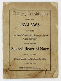
19014227New Orleans: A.M. Escudier Book and Job Printers 1901. About good. 19pp. Original printed front wrapper rear wrapper not present. Front wrapper a bit chipped and creased old adhesive repairs to closed tears bottom corner reinforced with tissue partially split along spine. Text block a bit toned foxed and creased. A seemingly unrecorded turn-of-the-20th century New Orleans imprint recording the founding and governing documents of the Ladies' Catholic Benevolent Association of the Sacred Heart of Mary of the Fifth District of New Orleans. The work contains the group's charter letters of support from various Louisiana officials the constitution and by-laws of the New Orleans chapter. The LCBA was organized in 1890 in Titusville Pennsylvania as a mutual aid society to provide insurance to women as most insurance companies of the time considered women uninsurable. The members of the association would pool their money together in order to cover various insurance needs as they arose from the membership. The group is actually still in operation today now known as the Loyal Christian Benefit Association. Though social action by Catholic women is more prevalent today it was uncommon in the 19th and early-20th century but the present group was strong-willed and often clashed with the hierarchy including some Bishops. No copies listed in OCLC. A.M. Escudier, Book and Job Printers unknown