1 088 résultats
025994095X.Gpaperback. Good. Access codes and supplements are not guaranteed with used items. May be an ex-library book. paperback
2000Q-0738505811Arcadia Publishing 2000-07-28. Paperback. New. In shrink wrap. Looks like an interesting title! Arcadia Publishing paperback
ria9781399508322_inpHardback. New. New Book; Fast Shipping from UK; Not signed; Not First Edition; Jeffrey Bell develops a critical existentialism and provides a new way of integrating the concerns of existentialist writers into contemporary political and social debates. hardcover
Georg Baselitz, HeinrichIn Pristine Condition. unknown
ria9780470627693_inpHardback. New. New Book; Fast Shipping from UK; Not signed; Not First Edition; This resource presents accessible coverage for designers of equipment that focuses on the basics through advanced design techniques for thermal stresses. hardcover
0259479586.Gpaperback. Good. Access codes and supplements are not guaranteed with used items. May be an ex-library book. paperback
1333363958.Gpaperback. Good. Access codes and supplements are not guaranteed with used items. May be an ex-library book. paperback
1527864529.Gpaperback. Good. Access codes and supplements are not guaranteed with used items. May be an ex-library book. paperback
0265103622.Gpaperback. Good. Access codes and supplements are not guaranteed with used items. May be an ex-library book. paperback
1528307526.Gpaperback. Good. Access codes and supplements are not guaranteed with used items. May be an ex-library book. paperback
1528516540.Gpaperback. Good. Access codes and supplements are not guaranteed with used items. May be an ex-library book. paperback
46306392-nnew. unknown
47037133-nnew. unknown
46961000-nnew. unknown
45304507-nnew. unknown
45218764like new. unknown
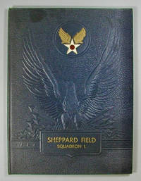
1945000016894<p>Baton Rouge: Army and Navy Publishing Company of Louisiana 1945. hardcover. near Fine . Folio 78 pages. Illustrated with black and white photo reproductions. Wings Over America United States Army Air Forces. 122615B <br /><br /></p> Army and Navy Publishing Company of Louisiana hardcover
1527725049.Gpaperback. Good. Access codes and supplements are not guaranteed with used items. May be an ex-library book. paperback
ria9781399536332_inpHardback. New. New Book; Fast Shipping from UK; Not signed; Not First Edition; Provides new solutions to the central problems of the philosophy of mathematics by reconstructing Deleuze’s metaphysics hardcover
1334152942.Gpaperback. Good. Access codes and supplements are not guaranteed with used items. May be an ex-library book. paperback
191941193Washington D.C.: Published by the United States Coast and Geodetic Survey 1919. Large folding nautical chart printed on heavy paper stock. Colored. A rare original coastal survey of Gulf Coast from the Rio Grande to the Mississippi River and includes Mexico Corpus Christi Galveston and New Orleans.<br/> <br/> Established by President Thomas Jefferson in 1807 as the Survey of the Coast the U.S. Coast and Geodetic Survey was the United States' first civilian scientific agency. This agency has followed its mission to survey the U.S. coastline create nautical charts of the coast and help increase maritime safety since its founding and has often played fascinating roles in significant chapters of U.S. history. It served in all theaters of the Civil War in the service of the Union Army and Navy pioneered acoustic exploration in the wake of the sinking of the Titanic and during WWI it worked to detect enemy submarines. In addition this agency worked to survey and produce detailed maps and renderings of the U.S. coast. These nautical survey maps commonly referred to as "T-sheets" provide fascinating insights into the history of the United States coastline which has and will continue to shift. These maps are the most important data source for understanding the physical and ecological characteristics of the U.S. shoreline. The present map is notable for the inclusion of an international border at the Rio Grande River as well as for showing a miniature grid of the city of New Orleans with the Radio Station notated. It is a highly detailed and accurate sea chart of the Gulf Coasts of Mexico Texas and Louisiana and is an important historical view of the developing states along the Gulf of Mexico. Published by the United States Coast and Geodetic Survey unknown
192041197Washington D.C.: Published by the United States Coast and Geodetic Survey 1920. Large folding nautical chart printed on heavy paper stock. Colored. A rare original coastal survey of Gulf Coast of Texas and Louisiana including Galveston Beaumont Sabine Lake Marsh Island Barrier Islands New Orleans Lake Pontchartrain and the Mississippi River.<br/> <br/> Established by President Thomas Jefferson in 1807 as the Survey of the Coast the U.S. Coast and Geodetic Survey was the United States' first civilian scientific agency. This agency has followed its mission to survey the U.S. coastline create nautical charts of the coast and help increase maritime safety since its founding and has often played fascinating roles in significant chapters of U.S. history. It served in all theaters of the Civil War in the service of the Union Army and Navy pioneered acoustic exploration in the wake of the sinking of the Titanic and during WWI it worked to detect enemy submarines. In addition this agency worked to survey and produce detailed maps and renderings of the U.S. coast. These nautical survey maps commonly referred to as "T-sheets" provide fascinating insights into the history of the United States coastline which has and will continue to shift. These maps are the most important data source for understanding the physical and ecological characteristics of the U.S. shoreline. The present map is starts with the city of Beaumont and the state border with Louisiana at Sabine Lake and Pass and covers the coastline until the Mississippi River past New Orleans. In the bottom left corner an enlarged map of Galveston is included. This map is a highly detailed and accurate sea chart of the Gulf Coasts of Texas and Louisiana and is an important historical view of the developing states along the Gulf of Mexico. Published by the United States Coast and Geodetic Survey unknown
192041166Washington D.C.: Published by the United States Coast and Geodetic Survey 1920. Large folding nautical chart printed on heavy paper stock. Colored. A rare original coastal survey of the Texas-Louisiana border area along the Sabine Lake and Pass into the Gulf of Mexico encompassing a portion of the Golden Triangle Area including Port Arthur and Sabine Lake.<br/> <br/> Established by President Thomas Jefferson in 1807 as the Survey of the Coast the U.S. Coast and Geodetic Survey was the United States' first civilian scientific agency. This agency has followed its mission to survey the U.S. coastline create nautical charts of the coast and help increase maritime safety since its founding and has often played fascinating roles in significant chapters of U.S. history. It served in all theaters of the Civil War in the service of the Union Army and Navy pioneered acoustic exploration in the wake of the sinking of the Titanic and during WWI it worked to detect enemy submarines. In addition this agency worked to survey and produce detailed maps and renderings of the U.S. coast. These nautical survey maps commonly referred to as "T-sheets" provide fascinating insights into the history of the United States coastline which has and will continue to shift. These maps are the most important data source for understanding the physical and ecological characteristics of the U.S. shoreline. The present map of the Texas-Louisiana coastline is notable for the inclusion of railroad founder Arthur Stillwell's Experimental Farm outside of Port Arthur on Lake Stillwell. It is a highly detailed and accurate sea chart of the southernmost border region between Texas and Louisiana and an important historical view of the developing states. Published by the United States Coast and Geodetic Survey unknown
190460713Boston MA & St. Louis MO: Boston & Maine Railroad 1904. 8vo. 4 x 8 in. which folds out into 4to. 8 x 8 in. printed in double columns 40 i.e. 20 pp. photo illustrations throughout w/ 1 large folding colour “Map of the St. Louis Exposition Grounds.†Colour-illustrated softcovers minor edgewear rubbing old discrete tape repair to inner spine still VG- copy. First edition of this very scarce railroad passenger guide to the St. Louis Worlds Fair Louisiana Purchase Exposition offering photos of the exhibits and attractions. As depicted on the large folding map the Louisiana Purchase Exposition spread over 1200 acres and incorporated education into all aspects of the exhibitors. Founded originally in 1835 the Boston & Maine Railroad expanded through New England with subsidiary connections into the Great Lakes and Midwest by the 1904 World’s Fair and continued to expand ridership until after World War I. Worldcat locates 1 copy Northwestern. Boston & Maine Railroad, paperback