1 088 résultats
ria9780323878159_inpPaperback / softback. New. New Book; Fast Shipping from UK; Not signed; Not First Edition; N/A paperback
2010BN194549Edizioni Scolastiche Bruno Mondadori 2010. 2010. Softcover. Matematica intorno a te. Numeri-Figure. Con quaderno. Per la Scuola media. Con espansione online Vol. 3 <br/><br/>Matematica intorno a te. Numeri-Figure. Con quaderno. Per la Scuola media. Con espansione online Vol. 3 Zarattini Manuela; Aicardi Luisiana; Cerofolini Mara Edizioni Scolastiche Bruno Mondadori paperback
180428737Paris: Ballard 1804. viii 18 31-176pp. plus folding table. Library label on front cover from Shwartz Historical Library. Minor rubbing and edge wear. Bookplate on front pastedown. Loss to portions of thirteen leaves affecting some text reinforced with tape dust-soiling to titlepage dampstaining to some leaves toward the end of the text. Lacking pp.19-30. Later 19th-century marbled wrappers.<br/> <br/> An extraordinarily rare account of travels in Louisiana the Mississippi Valley and the Illinois-Ohio country especially interesting in that the travels practically coincide with the Louisiana Purchase: a battered copy of a great rarity.<br/> <br/> An extraordinarily rare account of travels in Louisiana the Mississippi Valley and the Illinois-Ohio country especially interesting in that the travels practically coincide with the Louisiana Purchase. The work has been attributed to either Wante or G. Boucher de la Richardiere. "The author - whoever he was - travelled extensively throughout the lower Mississippi Valley" Howes. "There is also much on the Illinois-Ohio country but the body of the work has to do with the Louisiana Cession" Eberstadt. Incomplete but quite rare as Howes accorded it a "b" rating. The great Simon Shwartz library of Louisiana material had a copy sold for $15 in 1926 in blue morocco with an inked name on the titlepage. This is perhaps an additional Shwartz copy not auctioned at the time. The only other copy we can find any record of selling is the one listed by the Eberstadts in 1953.<br/> <br/> Eberstadt 132:412; Howes W87 "b."; Sabin 101246; Shwartz Sale 622. Ballard unknown
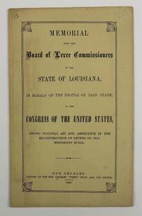
18663572New Orleans 1866. Very good. 12pp. Original printed wrappers sewn. Minimal soiling light edge wear to wrappers. Vertical center crease throughout. Light even toning to text otherwise very clean. A scarce work issued by the Reconstruction government of the state of Louisiana seeking funds from the United States Congress to make repairs to the Mississippi River levees "together with its tributaries the Arkansas and Red rivers." The Board of Levee Commissioners was seeking federal aid because the state of Louisiana had become so impoverished by the end of the Civil War stating here that "The State crippled as she is in her resources is still making herculean efforts to protect her citizens." Before the war argues the Board the state as well as the proprietors of the lands along the Mississippi River were able to maintain the levees albeit "at an immense outlay of labor and money" but "at a time of general prosperity when labor was abundant and cheap." In other words slave labor was formerly employed to maintain the levees and now that the people of Louisiana can no longer use slaves the state wants make the federal government pay literally. One passage in the work even discusses in detail the impact of slaves and free persons of color who have abandoned thirteen parishes which are now "almost altogether desolated." The report cites census and crop yield data to make the point that without this practically free labor force as well as the cotton sugar molasses and corn they produced the labor and economic impact on Louisiana of taking away a free labor force was onerous.<br /> <br /> Works by the Board of Levee Commissioners are rather rare in institutions with just eight copies of the present work in OCLC at LSU Tulane the University of Alabama the Library of Congress the Minnesota Historical Society Library Duke the Rutherford B. Hayes Presidential Center and UT-Austin. unknown
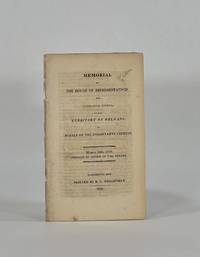
18109018Washington City: R. C. Weightman 1810. Disbound. Very Good binding. Octavo. 9 1 pp. Removed from volume. Respined with archival tape and all leaves reinforced at the inner margin in the same fashion. Petition for statehood addressed to "the Senate and House of Representatives of the United States." The memorialists solicit information on how they may become truly a part o f the United States. They explain their past attempts and past services to the United States and promise equal loyalty in the future. Shaw & Shoemaker 21724. R. C. Weightman unknown
0260084999.Ghardcover. Good. Access codes and supplements are not guaranteed with used items. May be an ex-library book. hardcover
1356884113.Ghardcover. Good. Access codes and supplements are not guaranteed with used items. May be an ex-library book. hardcover
0484580221.Ghardcover. Good. Access codes and supplements are not guaranteed with used items. May be an ex-library book. hardcover
0365817864.Gpaperback. Good. Access codes and supplements are not guaranteed with used items. May be an ex-library book. paperback
036604513X.Gpaperback. Good. Access codes and supplements are not guaranteed with used items. May be an ex-library book. paperback
0428090214.Gpaperback. Good. Access codes and supplements are not guaranteed with used items. May be an ex-library book. paperback
0428033903.Gpaperback. Good. Access codes and supplements are not guaranteed with used items. May be an ex-library book. paperback
0365920762.Gpaperback. Good. Access codes and supplements are not guaranteed with used items. May be an ex-library book. paperback
0366260707.Ghardcover. Good. Access codes and supplements are not guaranteed with used items. May be an ex-library book. hardcover
192041175Washington D.C.: Published by the United States Coast and Geodetic Survey 1920. Large folding nautical chart printed on heavy paper stock. Colored. A rare original coastal survey of the end of the Mississippi River as it splits into passes of the Bird's Foot Delta into the Gulf of Mexico.<br/> <br/> Established by President Thomas Jefferson in 1807 as the Survey of the Coast the U.S. Coast and Geodetic Survey was the United States' first civilian scientific agency. This agency has followed its mission to survey the U.S. coastline create nautical charts of the coast and help increase maritime safety since its founding and has often played fascinating roles in significant chapters of U.S. history. It served in all theaters of the Civil War in the service of the Union Army and Navy pioneered acoustic exploration in the wake of the sinking of the Titanic and during WWI it worked to detect enemy submarines. In addition this agency worked to survey and produce detailed maps and renderings of the U.S. coast. These nautical survey maps commonly referred to as "T-sheets" provide fascinating insights into the history of the United States coastline which has and will continue to shift. These maps are the most important data source for understanding the physical and ecological characteristics of the U.S. shoreline. The present map of the Louisiana coastline is notable for the inclusion of the Bird's Foot Delta the mouth of the Mississipi River as it splits into smaller passes. This map is fascinating because this is the youngest lobe of the Mississippi Delta and has seen notable changes in the past 100 years. This map is a highly detailed and accurate sea chart of the Mississippi River and an important historical view of the developing Louisiana. Published by the United States Coast and Geodetic Survey unknown
192041197Washington D.C.: Published by the United States Coast and Geodetic Survey 1920. Large folding nautical chart printed on heavy paper stock. Colored. A rare original coastal survey of Gulf Coast of Texas and Louisiana including Galveston Beaumont Sabine Lake Marsh Island Barrier Islands New Orleans Lake Pontchartrain and the Mississippi River.<br/> <br/> Established by President Thomas Jefferson in 1807 as the Survey of the Coast the U.S. Coast and Geodetic Survey was the United States' first civilian scientific agency. This agency has followed its mission to survey the U.S. coastline create nautical charts of the coast and help increase maritime safety since its founding and has often played fascinating roles in significant chapters of U.S. history. It served in all theaters of the Civil War in the service of the Union Army and Navy pioneered acoustic exploration in the wake of the sinking of the Titanic and during WWI it worked to detect enemy submarines. In addition this agency worked to survey and produce detailed maps and renderings of the U.S. coast. These nautical survey maps commonly referred to as "T-sheets" provide fascinating insights into the history of the United States coastline which has and will continue to shift. These maps are the most important data source for understanding the physical and ecological characteristics of the U.S. shoreline. The present map is starts with the city of Beaumont and the state border with Louisiana at Sabine Lake and Pass and covers the coastline until the Mississippi River past New Orleans. In the bottom left corner an enlarged map of Galveston is included. This map is a highly detailed and accurate sea chart of the Gulf Coasts of Texas and Louisiana and is an important historical view of the developing states along the Gulf of Mexico. Published by the United States Coast and Geodetic Survey unknown
1355270936.Ghardcover. Good. Access codes and supplements are not guaranteed with used items. May be an ex-library book. hardcover
ria9781473756540_inpPaperback / softback. New. New Book; Fast Shipping from UK; Not signed; Not First Edition; For over 30 years this text has provided students with the information they need to understand and apply multivariate data analysis. The eighth edition of Multivariate Data Analysis provides an updated perspective on the analysis of al paperback
2018__1473756545Cengage Learning Emea 2018. Paperback. New. 8th ed edition. 832 pages. 10.39x7.80x1.34 inches. Cengage Learning Emea paperback
20182-1473756545Cengage Learning Emea 2018. Paperback. New. 8th ed edition. 832 pages. 10.39x7.80x1.34 inches. Cengage Learning Emea paperback
193163793New Orleans LA: New Orleans Association of Commerce 1931. 4to. 16 pp unpaginated. photo illustrated throughout double-page centerfold colour pictorial map. Self-printed colour-illustrated softcovers Art Deco wraparound cover art minor shelfwear creasing at spine slight edgewear still VG bright copy. Fourth printing of this unusually scarce land promotion and pictorial map extolling the advantages of New Orleans port facilities manufacturing and distribution hubs as well as historic travel amenities and recreational opportunities. The pictorial centerfold map depicts sites such as the parks country clubs race track grain banana and coffee terminals as well as a nice inset map of the French Quarter or “Vieux Carre.†Worldcat locates 1 copy UCLA. [New Orleans Association of Commerce, paperback
47050802-nnew. unknown
1258558823.Ghardcover. Good. Access codes and supplements are not guaranteed with used items. May be an ex-library book. hardcover
1258567164.Gpaperback. Good. Access codes and supplements are not guaranteed with used items. May be an ex-library book. paperback
1390524175.Gpaperback. Good. Access codes and supplements are not guaranteed with used items. May be an ex-library book. paperback