Die Eisenbahn-Technik der GegenwartAntiquariat.de

1 692 résultats
19024955Erste Hälfte: Die Unterhaltung der Eisenbahnen. Bearb. von Bathmann, Fränkel, Garbe u.a. - Zweite Hälfte: Betrieb, statistische Ergebnisse und wirthschaftliche Verhältnisse der Eisenbahnen. Bearb. von v. Beyer, Blum, v. Borries u.a. 2 Teile in 2 Bänden. Mit zus. 239 Abb. u. 3 lithogr. Tafeln. Wiesbaden, C. W. Kreidel, 1901 u. 1902. Gr.-8vo. (26,2 x 17,5 cm). 1: XV, 243 S. 2: XII, (245)-571 S. Bibl.-Halblederbände d. Zt.
19034950Erster Abschnitt: Die Eisenbahn-Betriebsmittel. Erster Theil: Die Lokomotiven. Zweite, umgearbeitete Auflage. Bearb. von Borries, Brückmann, Courtin u.a. Mit 672 Abb. im Text u. 6 doppelblattgr. lithogr. Tafeln. Wiesbaden, C. W. Kreidel, 1903. Gr.-8vo. (26,1 x 17,4 cm). 16 S. Anzeigen, XVIII, 523 S. Orig.-Halblederband mit Rückenvergoldung.
19024533Spurweiten, Bau und Betrieb. Berlin, F. Siemenroth, 1902. Gr.-8vo. (23,0 x 15,2 cm). VIII, 241 S., (3 S. Anzeigen). Orig.-Leinwandband mit Farbprägung.
19011389DBBern, Buchdruckerei Ott & Bolliger, 1901. 4°. 74 S. Orig.-Broschur + Wichtig: Für unsere Kunden in der EU erfolgt der Versand alle 14 Tage verzollt ab Deutschland / Postbank-Konto in Deutschland vorhanden + (mit hinterlegten Einrissen und Papierverlust).
1937750Meister Kursbehelf. (Hrsg.: Bundesfachleitung der Kameradschaft der österr. B. B. Bediensteten. Für den Inhalt verantwortlich: Karl Mrazek, Wien). Vervielfältigtes Typoskript. 4 Teile in 2 Bdn. mit 3 Beilagen-Heften mit zahlr. Abb. sowie 1 mehrf. gefalt. Tafel. (Wien, um 1937). 4to. Orig.-Pappbände u. Orig.-Umschläge.
19141132DBBern, Gustav Grunau, 1914. Gr.-8°. 338 S. Mit 37 Tafeln. Illustr. Orig.-Leinenband + Wichtig: Für unsere Kunden in der EU erfolgt der Versand alle 14 Tage verzollt ab Deutschland / Postbank-Konto in Deutschland vorhanden + (leicht bestossen u. fleckig).
1923129963Mülheim sobre el Ruhr, Hamborn, Dinslaken, Duisburgo-Meiderich, Düsseldorf-Reisholz, Berlin, Rüdersdorf. 1923. 564 pages. With a lot of Illustrations and partially two coloured drawings. Origjnal red leather binding. (Binding partially demaged and used. Inside in very good condition). 19x13 cm
1919ZB530297NP: 1919. Volume 29 only; 1019 pp. illustrated including folding plates; library markings original cloth detached and worn but text block still sound. - If you are reading this this item is actually physically in our stock and ready for shipment once ordered. We are not bookjackers. Buyer is responsible for any additional duties taxes or fees required by recipient's country. NP: hardcover
193627989Canada: Canadian Pacific 1936. A color map showing the world wide service of Canadian Pacific railway and steamship lines. <br /> <br /> 21 3/4 x 9 1/4" folds to 4 1/4 x 9 1/2" tan card covers black text. Cover slt. dusty otherwise fine condition. Canadian Pacific unknown
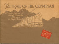
192439864Chicago: Poole Bros. Printers 1924. 1924. 6 1/4" x 8 1/2" colored pictorial wrappers. 40 pages plus wrappers with map of the Chicago Milwaukee & St. Paul Railway and its connecting lines profusely illustrated with black and white photographs of the awe-inspiring scenery along The Olympian Route. Views of "The Dells" in Wisconsin State Capitol Building in St. Paul Minnehaha Falls in Minnesota Montana Canyon the St. Joe River in Idaho the Cascades Rainier National Park Pinnacle Glacier the Olympian etc. Fine bright clean copy. Poole Bros., Printers, 1924]. unknown
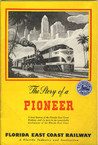
194638206St. Augustine: Private printing 1946. 1946. FLORIDA. 9" x 6" colorful pictorial wrappers. Foreword. 44pp. including wrappers. Black and white map of Florida high-lighting the Florida East Coast Railway from Jacksonville to Miami. Black and white photographs include a portrait of Henry Morrison Flagler the builder of the Florida East Coast Railway Flagler System Hotels and associated enterprises. A pioneer of the East Coast of Florida. "Linking the entire east coast of Florida with a transportation system and establishing tourism and agriculture as the basis of the state’s economy at the time was largely an uninhabited frontier demanded a great deal of foresight and perseverance. More than a century later the mainstays of Florida’s economy are still agriculture and tourism and Flagler’s incredible legacy as the inventor of modern Florida can still clearly be seen throughout Florida." This booklet is well written and provides an interesting summarized history of the Florida East Coast Railway and the development of the area it served. Soiling to wrappers a "Railroadians of America" sticker to front wrapper else a good copy of an informative booklet. Private printing, 1946. unknown
191039114Holyoke: Holyoke Street Railway Co. n.d. ca 1910. 1910. MASSACHUSETTS. First edition. 9" x 6 3/4" in color pictorial wrappers. 24pp. illustrations. 17 full-page tinted views to include Summit House Mt. Tom; View of Mt. Tom from Easthampton Car Leaving Lower Station for Summit; Kenilworth Castle with Mt. Tom in Distance; Mt. Tom Railroad and Summit House; Going Through Rock Cut; Upper Station; Southerly View From Mt. Tom; Rustic Arch at Mountain Park etc. followed by text which offers information about Mt. Tom the Summit House the street-cars of Holyoke the views from Mt. Tom etc. Most photographs include people. Over-sized wrappers lightly worn at corners. Very good. A very attractive booklet. Holyoke Street Railway Co., n.d. [ca 1910]. unknown
190917272Boston: The General Passenger Department Boston and Maine RR. Good. 1909. First Edition. Softcover. Damp wrinkling at the bottom and the staples are rusted. Bottom of the front wrapper is chipped. Large map in the rear is intact. ; tall 8vo 9" - 10" tall; 110 pages . The General Passenger Department, Boston and Maine RR paperback
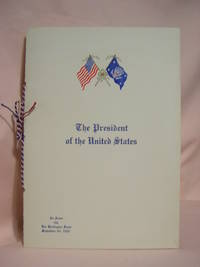
193746932Chicago Burlington & Quincy Railroad/CB&Q 1937. Menu. Fine. Franklin D. Roosevelt campaign train dinner menu bound with twisted red white and blue silk cord. Cover emblazoned with color United States and Presidential flags on the front. A fine and bright copy. <br/> <br/> Chicago, Burlington & Quincy Railroad/CB&Q unknown
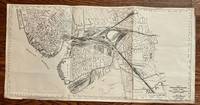
1948464Boston: Chief Engineer Boston & Maine Railroad 1948. 24 x 11 3/4 inches. Very good. This is a highly detailed map of the Boston & Maine trackage in Boston Cambridge Somerville Everett and Medford. The main terminal is shown center left. The rails are individually shown yielding a spellbinding visual presentation. The combination of multiple railroads yielded complex patterns of railroad penetration. Boston Harbor is in the lower left. The Navy Yard receives several rails split off from the main ganglion. Overall this is a graphic presentation of post WWII rail commerce in the city of Boston. Chief Engineer, Boston & Maine Railroad unknown
1941314088Great Northern Railway 1941. Soft Cover - ORIGINAL 1941 Edition -- Very Good -- INCLUDES the required large fold-out map -- Clean and tight with only light wear -- Photography throughout -- Direct to the Vacation Gateway -- Glacier National Park / Waterton Lakes Park / Nearby Parks in Canadian Rockies. Soft Cover. Very Good. Great Northern Railway Paperback
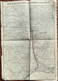
1913552Buffalo: Mathews-Northrup Works 1913. 16 1/2 x 10 1/2 inches. Very good with several marginal tears not going into the map. Dated and in the style of the nineteen hundred and teens. The map shows the route from KCMO to Lake Charles and Port Arthur. The railroad was founded in 1887. B7 1897 the railroad had reached the Gulf of Mexico at Port Arthur. This map shows that and additional spurs to Fort Smith and Waldron Arkansas. Additionally the map shows the sours to Independence And Sugar Creek MO. This is a very nice snapshot of the railway and its morphology in the beginning era of the twentieth century. Map comes from a company timetable. Mathews-Northrup Works unknown
1907BOOKS323129Self Published . Used-Very Good/NO DUSTJACKET. 1907. Paperback. 4to. 53 pp. . ***** Self Published ***** paperback
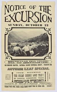
1961300423Richmond VA: Old Dominion Chapter NRHS 1961. 14†x 8 1/2†two-sided flyer advertising a private train excursion leaving from Main Street Station in Richmond traveling the historic Kanawha Canal Route. Organized by the Old Dominion Chapter of the National Railway Historical Society to benefit public-interest projects. The trip was scheduled to take advantage of fall color on open-top observation cars. Tickets were sold at Miller and Rhoads Galeski Photo Centers Bob’s Hobby Center and The Toy Store on Patterson. ~A unique and charming relic of 60s Richmond.~~Tear to top left and pen scribble on back folds from being mailed and gently yellowed. Overall good. Old Dominion Chapter, NRHS unknown
191218584Saint Paul MN: McGill-Warner Company. Very Good. 1912. First Edition. Flexible leather. 6 1/2"; 160 pages . McGill-Warner Company hardcover
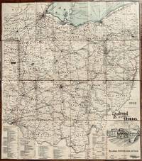
1909567Columbus OH: Columbus Lithograph Company 1909. 32 1/2 x 28 1/2 inches. Very good condition. This is a beautifully composed map of Ohio showing the railroadscape of the state. Bounded by the Ohio River and Lake Erie the layout across the state is vividly presented. The prominent cities of the state are well connected. Toledo and Cleveland in the north are central railroad towns as is Columbus in the center of the state. In the south is Cincinnati and Northeast is centered on Youngstown. There were 45 steam railroads operating in Ohio in 1909. Additionally there were 58 electric railways in operation. Needless to say it was not difficult to get from here to there in the State of Ohio in1909. It is of significant note that the state of Ohio was connected to both the Great Lakes trading system and the Mississippi River trading system. Farmers had the option of moving produce north into the Great Lakes system or south into the Mississippi River system via the Ohio River. In 1850 when there were significant shortages of grains and produce in the South the Ohio State trading mechanism shipped to the south before the new crops were harvested. Flexibility followed price. Columbus Lithograph Company unknown
1956568Wabash Railroad Company 1956. 31 x 17 3/4 inches. Very good. This is a well composed map. The use of Blue for water enhances the internal markings of the railroads footprint. The Wabash Railroad had its beginnings in the northern Cross Railroad in Illinois in the early 1830s. The dream of connecting Toledo to the Mississippi River came through by connecting with the Great Western Railroad before the Civil War. This map was published in April of 1956 and shows the pre-interstate highway layout of the railroad. Non-line agencies were marked by the iconic Wabash flag logo. This is a superior railroad map at the end of the passenger service era of great railroads. Wabash Railroad Company unknown