5 209 résultats
0011609Denver And Rio Grande Railroad System No date. Map. Very Good. Measures approximately 14 x 17.5 inches on onionskin paper three breaks at the horizontal fold at left. Extracted from its tourist guide book. <br/><br/>Estimated date of 1895. This map 17" x 14" oddly uses crude overprinting in red to insert some town names including Durango La Plata Montrose Gunnison Salt Lake City Pueblo and - oddly - Denver. The maps extend from Las Vegas New Mexico in the southeast to Salt Lake City and Ogden in the extreme northwest. Overprinted color is used to indicate Standard Gauge Narrow Gauge and Three Rail lines. The Inset map shows the main route to San Francisco. This map is attributed to S. K. Hooker. Next to the cartouche is an emblem for the Denver & Rio Grande R.R. Scenic Line of the World. Denver And Rio Grande Railroad System unknown
192138667American Railway Association. VG. ca. 1921. Hardcover. Hardback in Very Good condition without dust jacket. . 8vo 8" - 9" tall. 379 pages. Quick Shipping All Books Mailed in Boxes Free Tracking Provided . American Railway Association hardcover
343761 vols. 12 x 9 inches image size. Framed and glazed. 1 vols. 12 x 9 inches image size. This fine illustration was done for "The Express Messenger" the employee magazine of American Railway Express precursor to American Express. unknown
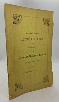
18518220Boston: Eastburn's Press 1851. Sewn binding. Good. Octavo 29pp. A good copy in the publisher's yellow sewn wraps. Front wrap detached but present otherwise a clean bright example with mild chipping to wrapper extremities. Very faint flattened vertical crease throughout. Scarce and ephemeral volume loaded with forensic accounting of this railroad; one of the earliest commercial rail systems in the US. OCLC notes a single physical holding naturally at AAS. Eastburn's Press unknown
188276255San Francisco: J. Winterburn & Co. 1882. First edition. Twelvemo. 47 9 including Membership Appication pp. Publisher's printed pale salmon wrappers. Excellent condition."Rail Road Flat is a Gold Rush era mining town that was settled by gold seekers in 1849 named for a wooden track which conveyed ore cars with waste rock to and from the diggings. A post office was established in 1857 and the first stamp mill erected in 1866. By 1872 five or six mills were operating and at the turn of the century two stamp mills and one arrastra were still in operation. The Clark Ditch was constructed to supply the placer mines of Rail Road Flat in 1856 and soon extended to the mines of Glencoe and Rich Gulch. Originating near Blue Mountain it carried water from the South Fork of the Mokelumne over 55 miles servicing two reservoirs and numerous downstream communities" Calaveras History. It was the site of an Indian council as well as the center of rich placer and quartz mining. Its largest producer was the Petticoat Mine. J. Winterburn & Co. unknown
526001940. 3 original colour maps each c. 110 x 110 cm 40 x 45 inches folding to 20 x 12.5 cm. Natural fold creases generally very fresh and clean. Shows anchorage Big delta Blying Sound Circle fairbanks Gulkana Healy Kantishna River Kenai Livengood Mount Hayes Mount McKinley Seldovia Seward Talkeetna Talketna Mountains Tanan Tyonek Valdez etc. 1940 unknown
1870354322San Francisco: Thomas Houseworth & Co 1870. Single stereocard 3½ x 7 inches. Stereo image mounted onto printed orange cardstock. Slight wear at edges. Very good. Single stereocard 3½ x 7 inches. A very attractive single stereocard image of the Central Pacific Railroad's "Long Ravine Trestle Bridge." The bridge is located in Nevada County California in the Sierra Nevada mountain range just west of the Nevada state line. The image comes from a set sixty-two stereocards created by Thomas Houseworth & Company for the railroad some time after the railroads completion in 1869. According to the website of the Central Pacific Railroad www.cprr.org the Houseworth company produced more than one hundred such stereocards for the railroad including more than a dozen views of the 878-foot long Trestle Bridge. A nice early stereoscopic image of an engineering wonder from an important American railroad. Thomas Houseworth & Co unknown
1870354323New York: E. & H.T. Anthony & Co 1870. Single stereocard 3½ x 7 inches. Stereo image mounted onto printed orange cardstock. Slight wear at edges. Very good. Single stereocard 3½ x 7 inches. An appealing stereocard image showing several long stretches of railroad track heading into the small town of Ogden Utah. It is a view of an important point crossing point in American railroad history as Ogden is the point at which the Union Pacific Railroad ends and the Central Pacific begins. A train can be seen on the tracks in the far distance as well as a few clapboard buildings. The New York photographic firm of E. & H.T. Anthony & Co. produced several stereoscopic views for the Central Pacific Railroad though few are known today. A nice image of an important railroad intersection. E. & H.T. Anthony & Co unknown
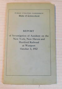
191299538<p>Hartford Connecticut: Public Utilities Commission State of Connecticut 1912. 1912. Fair. - Octavo 9 inches high by 5-1/2 inches wide. Softcover bound in printed light blue wraps titled in darker blue. There is a chip to the top corner of the front cover. The rear cover which is also a folding plate is chipped with a large portion out from the top inner edge a tear to the bottom edge and chipping along the spine. 15 pages plus the folding rear cover plate depicting the "Plan of Crossover at Westport Conn. Showing scene of derailment" with 8 pages of illustrations mostly from photographs. Ex-library with the libray's stamp on the rear cover. The corners of several pages are bumped and there are a few chips and tiny tears to the edges of a few pages. A good complete copy of this RARE book.</p><p>"Report of Chief Engineer and Inspector of his Examination into the Causes of and Circumstances connected with the Accident occurring at Westport on the 3d Day of October 1912 in the Operation of the plant or equipment of the New York New Haven and Hartford Railroad Company resulting in the Death of Elizabeth H. Brady Flora M.B. Gavit Mary Hamilton Jessie H. Hanson George L. Clark J.J. Mokler and Mark Wheeler and Injuries to Sundry Other Persons".</p> Hartford, Connecticut: Public Utilities Commission, State of Connecticut, 1912. paperback
40769n.p.: Nashville Chattanooga & St. Louis Railway n.d. Full color chromolithograph with printed caption. 1 vols. Image 14 x 19 inches; matted to 21-1/2 x 26 inches overall. Small portion of blank lower right corner missing well away from image and caption and covered by mat; a few spots of almost imperceptible abrasion to surface else fine and handsome. Full color chromolithograph with printed caption. 1 vols. Image 14 x 19 inches; matted to 21-1/2 x 26 inches overall. An absolutely brilliant chromolithograph printed on heavy coated stock its clarity of detail putting most examples of this medium to shame. Caption states: "The 'General' was captured at Big Shanty now Kennesaw Ga. April 12 1862 by the 'Andrews' Raiders' and recaptured near Ringgold Ga. by W.A. Fuller Conductor and Anthony Murphy Shop Foreman for the Railroad Company assisted by Confederates and others after an exciting chase of about ninety miles." Illustrated here in repose the elegant engine glows as a work of art. Nashville, Chattanooga & St. Louis Railway unknown
0918654785.Ghardcover. Good. Access codes and supplements are not guaranteed with used items. May be an ex-library book. hardcover
0918654149.Ghardcover. Good. Access codes and supplements are not guaranteed with used items. May be an ex-library book. hardcover
1898354324Meadville Pennsylvania: Keystone View Company 1898. Single stereocard 3½ x 7 inches. Stereo image mounted onto printed peach cardstock. Paper lightly soiled at edges image clean and crisp. Very good. Single stereocard 3½ x 7 inches. A nice stereocard image of a locomotive steaming across a high railroad bridge in the Colorado Rockies. Another railroad track is shown crossing underneath the bridge and a snow-capped mountain is visible in the distance. Georgetown is located just west of Denver along the route of what is now Interstate 70. Keystone View Company unknown
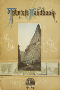
192245446Denver: The Van Noy Inter-State Company 1922. Paperback. Wide small 4to. Stiff calf-textured wrappers and large ornate gilt lettering string-tied. 40pp. Numerous large sepia-tone photographs. Very good. Faint wear to outer wrappers only. Tight and attractive first edition of this oversize promotional vehicle for the storied Denver & Rio Grande Railroad featuring full-page images of the major tourism sites such as Mesa Verde Bryce Canyon Great Salt Lake Pike's Peak etc. The Van Noy Inter-State Company paperback
1895250835Chicago: Poole Brothers 1895. Denoted the "thirteenth edition two hundredth thousand" on title page. With illustrations. Plus folding map. 56 pp. 8vo. Original pictorial wrappers. Wrappers worn along spine. Some neat early pencil marginalia. Very good. In a half morocco and cloth folding case spine gilt. Denoted the "thirteenth edition two hundredth thousand" on title page. With illustrations. Plus folding map. 56 pp. 8vo. A useful turn of the century tourists' guide for places along the railroad's routes. This copy has pencil marginalia beside entries for five cities including Salt Lake City giving the impressions of a traveller in 1898. <br/><br/> Poole Brothers] hardcover
a56581NY 1919 Electric Railway Association. 8vo. 416pp. photo illustrated frontis photo illustrations power generators and equipment many foldout charts and diagrams index errata original hardcover. Owner signed inside front cover old ink price on front free blank. VG light soiling old dry stain at margin not near text of first few leaves. . hardcover
1946K307615London: The Electric Railway Society 1946-51. 1st edition. Nice copy. octavo. cloth binding c. 550pp b/w pls tables index The Electric Railway magazine vols. I -VI No. 1-60 lacks No.9 59 issues bound in green cloth. The Electric Railway Society hardcover
19482080502106504082Asahi Shimbun Tokyo Head Office 1948. Soft Cover. Fine. Volume: 1 Asahi Shimbun Tokyo Head Office paperback
192175087St. Paul: Great Northern Railway Company 1921-1926. The first two reports are octavo in size 6 x 9 inches; the remaining reports are folios 9 1/4 x 12 inches. All reports are in their original printed wrappers and are bound into a three-brad binding of black faux-morocco cloth. Each report is variously paginated and with many charts but no illustrations. Each report has its accompanying large color folding map for a total of seven maps; these large maps have colors for different features and they are all extremely detailed. With each year the tracks and land owned by the Great Northern changed and these changes are all reflected in the maps. Great Northern Railway Company hardcover
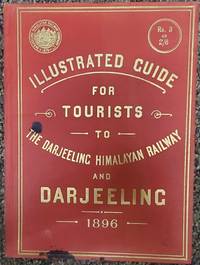
189675179London: McCorquodale & Co. Limited 1896. First edition of this elusive yet important publication. Quarto 7 x 9 7/8 inches. 46 2 ad for the photographer of the book Fred. Ahrle and printer's slug. pp. including 15 full page photographic illustrations by Ahrle and 5 double page plates the first one is a map printed in gold of the railway route used as a frontispiece and one is an gradient diagram and the remainder are plans. Publisher's flexible scarlet cloth with large gilt cover lettering along with the device of the railway. Aside from a couple of ink drops on the corner an exemplary copy. Only a handful of copies located by OCLC. and no copies have appeared at auction according to RBH.The Darjeeling Himalayan Railway is the first and foremost instance of a mountain passenger railway. Opened in 1881 it introduced bold and imaginative engineering approaches to the challenge of rail links on a hilly terrain of excellent beauty this is the first guide book to this fabled railway.The settlement at Darjeeling really began in 1828 with British interest. By 1835 it was separated from Sikkim for establishing a Sanatorium for the invalid servants of the East India Company. It then consisted of a monastery on observatory hill clustered with about 20 huts and a population of about 100 people. Planning began in 1839 to lay out the Darjeeling town and construct a hill road connecting Siliguri Pankhabari Kurseong and Darjeeling. At the same time evolution of hotels began the first being The Darjeeling Family Hotel’s followed by other hotels. By 1840 Darjeeling town had about 30 buildings and a few respectable houses.I n the year 1878 Franklin Prestage Agent of the Eastern Bengal Railway foresaw the utility of a rail link between the hills of Darjeeling and the plains. His scheme was mainly driven by hard economic considerations viz. the huge difference in the cost of essential commodities between Darjeeling and Siliguri the need to carry out tea for export and the inability of the existing road to handle the growing traffic. He submitted a scheme for the construction of a two feet gauge railway line from Siliguri to Darjeeling.In a detailed scheme submitted to the Government of Bengal and approved by the Lt. Governor Sir Ashley Eden he pointed out how a railway could substantially reduce the cost of transport between Darjeeling and the plains. Rice which sold at 98 a ton at Siliguri Cost 238 at Darjeeling! He was also convinced that the cost of construction of the 2 feet gauge rail-line would not be prohibitive and locomotives small but powerful enough to climb steep gradients could be designed Prestage received final sanction for his project on April 8 1879 and formed the Darjeeling Steam Tramway Co. However the idea of operating the line as a steam tramway was soon abandoned and on September 15 1881 the company adopted the designation of Darjeeling Himalayan Railway Co. DHR which remained effective until it was taken over by the Government of free India on October 20 1948. Throughout that period Gillanders Artbuthnot & Co. one of the oldest managing houses in Calcutta handled its financial legal and purchasing interests.abaa-ny-2022 McCorquodale & Co., Limited hardcover
1906GE16404New York: P.H. Burmett/ Lehigh Valley Railroad Industrial Department 1906. Softcover. Near Fine. Octavo in stiff printed wrappers. 182 pp. Folding color tinted industrial map of the Lehigh Valley System showing the mineral and natural resource locations along the route. Illustrated with photographs. Publication produced to review the features of the Lehigh Valley Railroad from an industrial standpoint. A tight near fine example some loss along the lower portion of the spine. <br/><br/> P.H. Burmett/ Lehigh Valley Railroad Industrial Department paperback
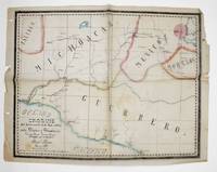
1881372908Mexico 1881. Manuscript map pen-and-ink and wash on onion skin paper. 15-1/2 x 20 inches. Folds and creases. Manuscript map pen-and-ink and wash on onion skin paper. 15-1/2 x 20 inches. Depicts the route of a railroad from Mexico City to Puente de Ixtla then north west to Toluca and west to Tancitaro with proposed transecting routes to connect the railroad from Pazo on the Atoyac River to Gihuatenejo on the Pacific coast. Pawel Primer evidently served as an engineer on the proposed railroad and this manuscript map was likely an addenda to a report issued to solicit investment in the project. The BNF holds two manuscript plans by Primer relating to archaeological sites. unknown
1900373823St. Louis 1900. 34 photographs mounted recto and verso on 17 cards with printed album title on each the images captioned in the negative on linen guards. Oblong small folio 10-1/8x12-1/2 inches. Contemporary half calf and cloth covered boards titled in gilt on the upper cover leather perished contents loose. The images generally dark printings in good condition. Provenance: Battery Park Hotel Asheville NC presentation in gilt on the upper cover from H. C. Townsend Gen'l Pass'r and Ticket Agent St. Louis. 34 photographs mounted recto and verso on 17 cards with printed album title on each the images captioned in the negative on linen guards. Oblong small folio 10-1/8x12-1/2 inches. The images by an unindentifed photographer comprise lovely compositions of buildings and scenes along the route in Missouri Kansas Nebraska and Arkansas. OCLC locates only a single example at University of Texas Austin. unknown
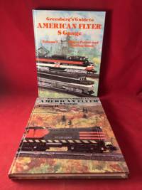
19917721Sykesville MD: Greenberg Publishing Company 1991. Early Edition. Hardcover. Very Good. 8 5/8 X 11 1/4 Inches. Volumes one and two of this important "American Flyer" model railroad train set reference. Volume one is a fourth edition and volume two is a stated first edition copy. Profusely illustrated with photos throughout. Some light wear and bumping to edges. Greenberg Publishing Company hardcover
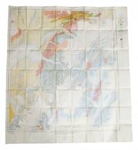
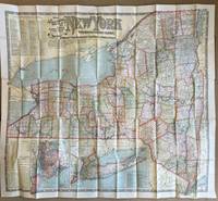
1901013098Boston: National Publishing Company 1901. Hardcover. As New. Amazingly preserved 1901 map of all railroads in New York State in almost new condition. We unfolded it just once to take image and get measurement approx 48 x 42". 55 panels 11 arcoss 5 down with middle outer panel affixed - as issued - to panel folder which itself is as new - brown paper over board with gilt titles. In color as bright as issued. The only blemish are two small brownish curved spots that occur on close examionation in the middle of Lake Ontario. A collectible copy. National Publishing Company hardcover