5 209 résultats
1902000110<p><strong>29 × 20 cm. Comprising 158 text plates including 95 photographs produced by the committee of which 42 photographs appear on separate plates measuring approximately 23 × 15 cm.</strong></p><p>The work documents the Photography Committee's journey from Istanbul to MaÊ¿Än in Transjordan. The accompanying text was compiled from articles originally published without illustrations in various issues of the newspaper <em>Vakit</em> "Time" in 1902.</p><p>This is a unique work prepared for publication with photographs taken by a private committee that included prominent figures such as the German general Karl Auler Pasha who served as an adviser on Hejaz affairs until the fall of Medina in 1918.</p> hardcover
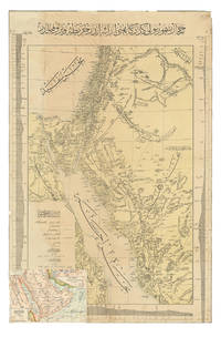
1904ABC_47091Constantinople: Matba a-i Bahriye 1904. Colour-lithographed map 76.5 x 49.5 cm trimmed to neat line. A rare separately issued official railway map with the entire text in Ottoman Turkish depicting the route of the Hejaz Railway. Following a route proposed by the eminent Turkish engineer Mukhtar Bey and surveyed by the cavalry officers Umar Zaki and Hasan Mu'ayyin the epic project funded by subscriptions from the global Islamic faithful completed a rail link from Damascus to Medina by 1908. The present map shows the intended continuation to Mecca never completed. Although it went no further south than Medina the railway nevertheless briefly allowed many thousands of pilgrims to make the Hajj in relative comfort bringing them to Medina and within about 300 km of Mecca. It shows the northern half of the Red Sea the Sinai peninsula the southeast corner of the Mediterranean Sea and what were to become Palestine most of Jordan and parts of Lebanon and Syria.A contemporary Ottoman colour-lithographed map of the Arabian Peninsula has been pasted over the lower left corner below the key like an inset map hiding only a tiny bit of the main maps topographic image. Old folds and creases some small tears repaired tiny chips to neat line some light stains. Some remnants of tape and old private collector's stamps on the back. Still in good condition. Matba a-i Bahriye, unknown
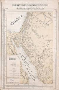
1903163825Constantinople: Matba'a-i Bahriye "The Press of the Navy" 1319 Rumi 1903. Mapping the great Hejaz Railway the embodiment of Hamidian Pan-Islamism A rare and important official map depicting the route of the Hejaz Railway based on a manuscript drafted under the supervision of the "brilliant Turkish engineer" Hadji Mukhtar Bey Maunsell p. 585 who served as chief of operations. It was issued in 1903 while the main line from Damascus to Medina was still under construction but after its final route had been established. This imposing and finely detailed large-format map depicts a very broad area extending from just north of Hama Syria all the way south a little way past Mecca in the Hejaz; it covers most of Syria all of Palestine the Sinai Peninsula the Suez Canal and all the north-western Arabian Peninsula. It clearly delineates those parts of the railway that are in place and those under construction employing a bold orange line land with each station labelled. Additionally it depicts the two alternative routes proposed for extending the line to Mecca employing broken lines while another line traces the proposed but unrealized route of a rail line from Mecca to the port of Jeddah. The map also labels important roads and caravan routes. In September 1907 four years after publication of this map the railway reached AlUla. Although AlUla is not marked here Mada'in Salih modern al-Hijr/Hegra is present which was a significant station responsible for the maintenance of locomotives. Today it is the site of one of two Hejaz railway museums the other being at Medina. Mada'in Salih was UNESCO's first World Heritage Site in Saudi Arabia and comprises "a major site of the Nabataean civilization in the south zone of its influence. The site is located at a meeting point between various civilizations of late antiquity on a trade route between the Arabian Peninsula the Mediterranean world and Asia. It bears outstanding witness to important cultural exchanges in architecture decoration language use and the caravan trade. Although the Nabataean city was abandoned during the pre-Islamic period the route continued to play its international role for caravans and then for the pilgrimage to Mecca up to its modernisation by the construction of the railway at the start of the 20th century" UNESCO. Construction of the Hejaz Railway began in 1901 and by 1908 had reached Medina 400 km short of Mecca where for various political reasons it had to be terminated. Nevertheless until the outbreak of the First World War it allowed hundreds of thousands of pilgrims to make the hajj in safety and with relative ease. Moreover for the first time branch lines provided a rapid link from Syria to Palestine. The moving figure behind this map was the veteran military engineer Hadji Mukhtar Bey who had conducted "military-scientific expeditions in east Africa Harrar and the Somali coast in the 1870s and early 1880s producing the first 'correct' cartographic maps of the region" El Shakry p. 42. It was he along with fellow officer Ali Rida al-Rikabi later first prime minister of modern Syria who originally assessed the route when they joined the 1900 hajj. Initial field surveys for the present map were conducted by two Ottoman cavalry officers Captain Umar Zaki and Lieutenant Hasan Mu'ayyin. In an interesting article in Jerusalem Quarterly Zeynep Celik and Zeinab Azarbadegan pay particular attention to this map and note that the Ottoman Navy "produced different versions of the map in Arabic and Ottoman Turkish pointing to the multiple purposes and audiences targeted within and beyond the empire. The mass production of maps demonstrates the Ottoman state's attempt to disseminate cartographic knowledge about the empire to the public. This speaks to the third and final aspect of analysis of the Hejaz Railway: its use as a tool of Ottoman state propaganda during the Hamidian era". There are at least two states of this map with slightly different titles. Colour lithographic map 800 x 520 mm coastal profiles of the Red Sea in left and right margins script in Ottoman Turkish. Light vertical creasing throughout minor foxing publisher's stamp in the cartouche marginal small tears repaired with old paper. A very good example. Zeynep Celik & Zeinab Azarbadegan "Late Ottoman Visions of Palestine: Railroads Maps and Aerial Photography" Jerusalem Quarterly 82 Summer 2020; Lieut.-Col. F. R. Maunsell "The Hejaz Railway" The Geographical Journal Vol. 32 No. 6 Dec. 1908; Omnia El Shakry The Great Social Laboratory: Subjects of Knowledge in Colonial and Postcolonial Egypt 2007. unknown
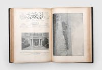
1900164829Istanbul: Ahmed hsan 1900-06. The birth of the Hejaz railway First editions first printings of 82 issues of this influential Ottoman magazine notably with illustrated reports covering the establishment of the Hejaz Railway between 1901 and 1906. Striking images include the transportation of the track itself from Beirut Issue 547 the inauguration of the line between Dar'a and Muzayrib Issue 553 and an inspection of the line by the governor of Damascus Issue 555. Numerous issues contain images charting the progress of the construction. The documentary quality of these pictures is particularly unusual. In Issue 688 for example the front cover depicts a group of Ottoman soldiers at work at Haifa station on the railway's Palestinian branch line while the cover of Issue 701 shows Sultan Abdülhamid II inspecting the section from Damascus to Ma'an on the anniversary of his accession. These latter images were taken by a special reporter appointed by the magazine. Servet-i funün began to be published in 1891 under the direction of its owner Ahmed hsan and continued its activities until 1944. It occupies a special place within the history of Turkish periodicals of which it was considered the most intellectual. Initially an illustrated supplement of the newspaper Servet it took on a more literary character from 1895 when the editorship was handed to Tevfik Fikret and printed the work of famous contemporary writers including Cenab ehabeddin Halit Ziya Mehmed Rauf and Ali Ekrem. Despite these literary leanings the magazine maintained robust coverage of current affairs as is evinced by the political supplements and the many documentary images of contemporary events in the Ottoman Empire which are found in these issues. Volume 22 contains the consecutive issues 547-572 and the unnumbered volume holds issues 599-625 followed by the political supplements to issues 599-624. The last bound volume contains the consecutive issues 781-806 followed by the political supplements to each issue. The unbound issues are 507 687 688 696 and 701. Folio 335 x 235 mm 3 bound vols and 5 unbound issues. Bound vols: one vol. in contemporary half brown morocco rebacked retaining original title lettering piece spine with raised bands unnumbered cloth sides; two vols in contemporary sheep spines with raised bands gilt lettered direct both numbered in gilt in third compartment "22" and "31" cloth sides. Unbound issues: spines hand stitched and sometime strengthened with paper. Gilt stamp of "Doctor Essad" at foot of spine of vol. 31. Lacking a few leaves only: pp. 211-2 from supplement to vol. 31; pp. 133-4 161-2 and 187-8 from political supplements of unnumbered volume. Unnumbered volume: Judiciously restored contents with faint damp stains at ends and margins creased in places repair to p.41 with clear tape. Numbered vols: Extremities judiciously repaired and strengthened scuffed and recoloured in places some stripping of leather and wear to edges minor loss to spine of vol. 31 some issues printed on lighter paper stock. Unbound issues: four issues with neat recent repairs to spines occasional light damp staining one issue with repaired tear to front wrapper and a few small holes throughout. Overall some toning mild scattered foxing or staining and a few marginal tears or chips. A good set overall. hardcover
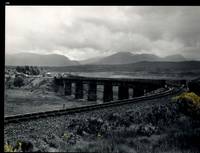
32483AB1974. Scotland 1974-2002. Oblong-Folio 44 cm wide x 36 cm high. Hardcover / Original Full-Leather Folders with stong black cardboards and original tissue-guards. Excellent condition with only minor signs of wear. With hundreds of manuscript annotations on the photography the photography-technique film used and with extensive elaborations on each photograph in these albums. More images on request ! Album 1: Covers the years 1974 1977 and 1978. The West Highland Line is walked from Arrochar a 1977 driving and camping holiday and a 1978 seventeen day touring holiday with many nights sleeping in a car fill the leaves with c. 200 b/w original photographs. Album 2: Covers the years 1991 and 1992. It is noted that 1990 is the fourth year that returning locomotives from the Mallaig line will work south over the West Highland main line. Images of Corrour Summit Glasgow to Fort William trains and many many more bridges viaducts tunnels stations and signalling equipment fill the leaves. c.182 b/w original photographs. Album 3: Covers 1993. More colour photographs now fill the leaves and annotations cease to second half of album. c 270 b/w colour and tinted original photographs. Album 4: Covers 1999 and 2002. Many images from The Highlands Rail Festival in Sept 1999. c.250 b/w and colour original photographs. An extraordinary photographic record and passion project presented in 4 huge well-bound albums containing over 900 fine photographs taken curated and annotated by an unidentified railway enthusiast and talented photographer. The albums span 4 decades recording trips to some of the most scenic and famous rail locations in the UK. The West Highland Line is returned to again and again over the decades and our photographer captures Scotlands most dramatic landscapes and railways as the route passes on its way from Glasgow to Mallaig through sections including Corrour and Rannoch Moor. Albums and contents in fine condition. A tissue guard between every leaf protects the photographs within. A single photograph of a middle aged man among every other photograph which records a detail of the railway is the only clue to the albums previous ownership and perhaps authorship. Partial description by our colleague Dr.Christian White from Christian White Rare Books in Ilkley UK. __________________________________________________________________________________________________________ The West Highland Line Scottish Gaelic: Rathad Iarainn nan Eilean "Iron Road to the Isles" is a railway line linking the ports of Mallaig and Oban in the Scottish Highlands to Glasgow in Central Scotland. The line was voted the top rail journey in the world by readers of independent travel magazine Wanderlust in 2009 ahead of the notable Trans-Siberian line in Russia and the Cuzco to Machu Picchu line in Peru. The ScotRail website has since reported that the line has been voted the most scenic railway line in the world for the second year running. The West Highland Line is one of two railway lines that access the remote and mountainous west coast of Scotland the other being the Kyle of Lochalsh Line which connects Inverness with Kyle of Lochalsh. The line is the westernmost railway line in Great Britain. At least in part the West Highland Line is the same railway line as that referred to as the West Highland Railway. History: The route was built in several sections: Glasgow Queen Street to Cowlairs Junction - Edinburgh and Glasgow Railway Cowlairs Junction to Bowling - Glasgow Dumbarton and Helensburgh Railway later absorbed into the Edinburgh and Glasgow Railway Bowling to Dumbarton Central - Lanarkshire and Dumbartonshire Railway operated by the Caledonian Railway Dumbarton Central to Dalreoch - Caledonian and Dumbartonshire Junction Railway Dalreoch to Craigendoran - Glasgow Dumbarton and Helensburgh Railway Craigendoran to Fort William opened 11 August 1894 - West Highland Railway sponsored by the North British Railway Crianlarich to Oban - Callander and Oban Railway operated by the Caledonian Railway. There is an additional section from Fort William or a junction near Fort William to Mallaig built as the Mallaig Extension Railway. The West Highland Railway approved the construction of the line at their annual meeting in January 1895. The line faced potential closure as part of the Beeching cuts in 1963 and again in 1995 due to reduced revenues. Route description: Shortly after leaving Glasgow Queen Street station and beyond Queen Street Tunnel the line diverges from the main trunk route to Edinburgh Waverley and Perth at Cowlairs and follows a northwesterly course through the suburbs of Maryhill and Kelvindale. Between Westerton and Dumbarton the route is shared with the North Clyde Line to Helensburgh Central before branching northward at Craigendoran Junction towards Garelochhead the section where the West Highland Line itself is generally accepted to begin. It gives high-level views of the Gare Loch and Loch Long before emerging alongside the northwesterly shores of Loch Lomond then climbs Glen Falloch to Crianlarich. The branch to Oban diverges at Crianlarich an important Highland junction of both road and rail and runs through Glen Lochy to Dalmally and through the Pass of Brander to reach salt water at Taynuilt and Connel Ferry before a final climb over a hill to Oban. About three miles five kilometres from Crianlarich the Mallaig and Oban routes both pass through the village of Tyndrum but they are served by separate stations making it an unusually small settlement to be served by more than one railway station. After Bridge of Orchy the line to Mallaig climbs onto Rannoch Moor past the former crossing point at Gorton Crossing to Rannoch station. In winter the moor is often covered with snow and deer may be seen running from the approaching train. The station at Corrour on the moor is one of the most remote stations in Britain and is not accessible by any public road. This is the summit of the line at 1347 ft 410 m above sea level. Carrying on northwards the line descends above the shores of Loch Treig and through the narrow Monessie Gorge. The final stop before Fort William is Spean Bridge. The section between Fort William and Mallaig passes over the Glenfinnan Viaduct through Arisaig with its views of the Small Isles of Rùm Eigg Muck and Canna and the white sands of Morar before coming to Mallaig itself. With the exception of the route between Glasgow Queen Street and Helensburgh Upper and the short section between Fort William Junction and Fort William station the railway is signalled using the Radio Electronic Token Block controlled from the signal box at Banavie station. Notable railway-related features Glenfinnan Viaduct The Horse Shoe Curve between Upper Tyndrum and Bridge of Orchy The Cruach Rock snowshed between Rannoch and Corrour Glenfinnan Viaduct between Locheilside and Glenfinnan The Pass of Brander stone signals between Dalmally and Taynuilt Arisaig is the most westerly railway station in Great Britain West Highland Line in film: Train crossing bridge at Banavie The summit of the line just north of Corrour Glenfinnan Viaduct on the line between Fort William and Mallaig is a filming location for the Hogwarts Express in the Harry Potter series of films. Eddie McConnell's poetic documentary A Line for All Seasons 1970 showcases the line and its history set against the scenery of the western highlands as it changes through the seasons. Corrour features in Trainspotting 1996 directed by Danny Boyle. Source: Wikipedia hardcover
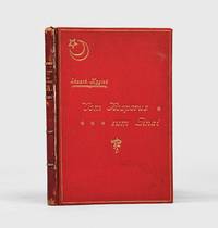
1905164559Leipzig & Istanbul: Otto Keil 1905. Western eyes on the Hejaz Railway First and sole contemporary edition of this eyewitness account of the opening of the Damascus-Ma'an section of the Hejaz Railway on 1 September 1904 four years before the line's official completion. It is the first such narrative published separately in the West. No copies are traced in Middle Eastern institutions; 13 are held worldwide. Eduard Mygind a Danish-born reporter for the Berlin Tageblatt served for a time as Tehran correspondent - his reports on Persian trade and oil attracting British official attention - before covering events in Ethiopia and the Adana massacres of 1909. Based in Istanbul from at least 1902 he was even accused of attempting to blackmail the Ottoman sultan with critical military reports an allegation that did not prevent continued access to Ottoman official circles. The book opens in a lightly humorous discursive mode recounting preparations in Istanbul and the journey to Damascus then turns to the railway's engineering achievement and its political meaning within pan-Islamic unification. Mygind emphasizes the role of German technical expertise and presents Sultan Abdulhamid II as the project's driving force describing the carefully staged inauguration at Ma'an attended by Ottoman elites and invited foreign officials and journalists whose travel and accommodation were funded by the empire. Octavo 220 x 150 mm. With half-tone frontispiece 8 half-tone plates illustrations in the text folding map of Hejaz Railway folding relief chart. Original red pebble-grain cloth red roan spine lettered in gilt gilt-lettered front cover with star-and-crescent motif gilt ornamental cartouche on rear cover white moiré endpapers top edge gilt. Housed in a custom red cloth flat-back box by the Chelsea Bindery. Spine rubbed head a little worn front joint cracked but holding slight red stain from cloth to fore edge of book block hygroscopically transferred from the cloth boards; yet this remains a very good copy the binding in bright condition. S. Chase Gummer The Politics of Sympathy: German Turcophilism and the Ottoman Empire in the Age of the Mass Media 1871-1914 doctoral dissertation 2010 available online; Murat Ozyuksel The Hejaz Railway and the Ottoman Empire: Modernity Industrialisation and Ottoman Decline 2014. hardcover
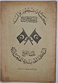
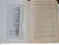
1913000166Very rare brochure printed in Armenian house in İstanbul 1913. In English Ottoman Turkish Arabic Russian and Urdu. 10 p. Text with 11 plates. In the printer wrappers. Archak Garoyan paperback
1900000209<p>10 p. Of text in English Ottoman Turkish Arabic Urdu and Russian with 9 full page plates. A hajj travel brochure printed in İstanbul supposed to be by an Armenian press in c. 1900. Rare</p> An Armenian press paperback
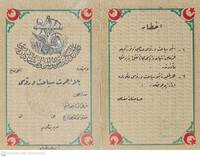
000177<p>Ottoman Turkish script with crescent figures and map on the back of the Ottoman Railway. A free boarding pass should be declared on demand. Holder can carry up to 30 kg . 14.5 x 11 cm.</p> Seruchin (?) An Armenian press
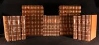
1839965Z28DLondon: The Railway Times Office 1839-63. First edition. Leather. Very Good Indeed. 11" by 9". None stated. An impressive run of early issues of the 'Railway Times' periodical an important railway periodical which documented developments and current news in the railway industry during the 1800s. A beautifully bound set of a very scarce periodical. An extensive twenty-nine volume set featuring a collection of the 'Railway Times' periodical from 1839-1863. All being the first edition. The periodical provides an impressive historical account of the current news and developments in the railway industry during the early to mid nineteenth century. The articles range from finances stock information new patents and inventions accidents and updates on railways from across the globe. Notable articles include; an article on Mr Robert Stephenson's new 1842 locomotive which proposed to use less fuel and a Testimonial to Isambard Kingdom Brunel the legendary engineer. This set includes; '1839' Vol II No. 71-72 85-94 and '1840' Vol III No. 27-41 and Vol II No. 52 of the 'Railways Magazine & Commercial Journal' bound into one volume. The rest of the years are bound over two volumes and feature complete runs of the magazine for that year with these being; '1841' Vol I- No.157 Vol III No. 1 - No.182 Vol Iv-No. 26. Vol II- No.183 Vol IV No.27 - No. 208 Vol IV No.52. '1842' Vol I- No. 209 Vol IV No.1 - No.234 Vol V-No.26. Vol II- No.235 Vol V No.27 - No.261 Vol V No.53. '1846' Vol I- No.418 Vol IX No.1 - No.443 Vol IX No.26. Vol II- nO.44 Vol IX No.27 - No.469 Vol IX No. 52. '1847' Vol I- No.470 Vol X No.1 - No.495 Vol X No.26. Vol II- No.496. Vol X No.27 - No.521 Vol X No.52. '1854' Vol I - No.836 Vol XVII No.1 - No.860 Vol XVII No.25.Vol II - No.861 Vol XXII No.26 - No.887 Vol XVII No. 52. '1855' Vol I - No.888 Vol xviii No.1 - No.913 Vol xviii No.26. Vol II - No. 914 Vol XVII No.27-No.939 Vol XVIII No. 52. '1856' Vol I - No. 940 Vol XIX No.1 - No.965 Vol XIX No.26.Vol II - No. 966 Vol XIX No.27 - No.991 Vol XIX No.52. '1857' Vol I- No.992 Vol XX No.1 - No.1017 Vol XX No.26. Vol II - No.1018 Vol XX No.27 - No.1043 Vol XX No.52. No. 18-22 have been misnumbered with No.18 numbered twice and missing No.21 however the work is complete with the pagination continuous as is expected. '1858' Vol I-No.1044 Vol XXI No.1 - No.1069 Vol XXI No.26. Two of the issues are numbered '23' but nothing is lacking. Vol II- No.1070 Vol XXI No.27-No.1094 Vol XXI No.52. '1859' Vol I- No.1095 Vol XXII No.1 - No.1120 Vol XXII No.26. Vol II - No.1121 Vol XXII No.27 - No.1147 Vol XXII No.53. '1860' Vol I- No.1148 Vol XXIII No.1 - No.1173 XXIII No.26. Vol II- No.1174 XXIII No.27 - No.1199 Vol XXIII No.52. '1861' Vol I- No.1200 Vol XXIV No.1 - No.1225 Vol XXIV No.26.Vol II - No.1251 Vol XXIV No.27 - No.1251 XXIV No.52.'1862' Vol I - No.1252 Vol XXV No.1 - No.1277 Vol XXV No.26. Vol II - No.1278 Vol XXV No.27 - No.1303 Vol XXV No.52. '1863' Vol I - No.1305 Vol XXVI No.1 - No.1329 Vol XXVI No.26.Vol II - No.1330 Vol XXVI No.27 - No.1355 Vol XXVI No.52. Illustrated heavily with numerous monochrome vignettes and the occasional full page illustration. Volume '1854' contains a folding map to pp. 356. A very scarce and important periodical with this being some of the earliest examples of the magazine currently on the market. A beautifully bound and uniform set. Bound in modern crushed quarter morocco with cloth to the boards. Endpapers renewed.All pages and issues present after the 1839-40 volumes. The occasional article clipped. Bound in modern crushed quarter morocco with cloth to the boards. Endpapers renewed. Externally lovely with only very minimal edge wear and slight leans to the odd volume. Internally generally firmly bound with the title page to pp.22 to '1854' tender and minimal strain in places otherwise firmly bound. Pages generally bright with only light age toning to the odd volume. Pages generally clean with only the odd spot slightly heavier to '1855' the occasional ink mark to '1841' and a more significant tidemark to '1856' pp. 569. Very minimal handling marks and occasional 'Railway Times' stamps to all the volumes. The odd page closely cropped to '1839-40' and the odd small closed tear and chip to the extremities. Several articles have been clipped from the pages heavier to the earlier volumes. Minor ink notations to '1847'. Hand written notes written on separate papers inserted into the odd volume. All in all a beautifully bound set with generally clean and bright pages with only the odd clipped article and mark. Very Good Indeed The Railway Times Office hardcover
19069347London 1906. Edwardian station map approx 40 x 60 inches this example 101 x 150.5 cm printed in colours some restoration with small areas of loss along the folds made good blank verso. Un-titled undated and without a printer this exceptionally scarce early poster was created for display in stations but establishing which ones presents a challenge. We can date it with reasonable confidence to 1906 or perhaps a fraction earlier. Our map predates the western extension of the Central London Railway to Wood Lane which opened for the Franco-British Exhibition in 1908. Angel is still shown as the terminus of the City & South London Railway but the western extension to Euston which opened in May 1907 is under construction. The use of a green border appears to be a nod to the successful series of green-bordered UERL Underground Group maps but as those were introduced in 1907 it might be the other way around. Another unusual design feature is the two tone shading in line colours of the names of interchange stations such as The Bank. The Bakerloo Line which opened in March 1906 appears to be shown as a thin dotted black line but as it was owned by the rival UERL its use for dating purposes cannot be guaranteed: this is most emphatically not a UERL map. Just three underground lines are highlighted none of which was under the UERL umbrella in 1906: The Central London Railway the City & South London Railway and the Great Northern & City Railway the first two purchased by the UERL and the latter by the Metropolitan Railway all in 1913. Two mainline companies are featured: the Great Northern Railway with its terminus at Finsbury Park and the Great Western Railway which served Paddington. Of these two the GWR is far more prominent with an inset showing the route to Reading. The map promotes travel across London using the highlighted routes at the expense of all others including the UERL: all are razor thin black and unobtrusive with no further differentiation between underground mainline and suburban services and seemingly haphazard naming of stations. It seems likely that our map was a joint response by three of the independent underground railway companies to the growing power of the UERL possibly in co-operation with the GWR and was created for display in any of their stations. We have been unable to locate another example. Map unknown
161959078Anchorage & Seward A.T.: Alaska Engineering Commission AEC Phinney S. Hunt ca. 1916-1917. 4to. 86 silver print photographs sized 6.25 x 8.25 in. nearly all w/ photographer’s imprint w/in negative at lower fore-edge as well as caption negative number and AEC some w/ occasional pencil annotations on verso all preserved in mylar sleeves occasional creasing at corners a couple w/ slight loss at corners in the small blank margin. Recent 3-ring clamshell binder an excellent set of photos with all retaining bright strong contrast. This outstanding photo archive provides not only some of the earliest photographs of Anchorage Alaska Territory but also this immense railroad project first authorized by the US Congress in 1912. The few existing privately-run railroads operating in Alaska at the time including the Alaska Northern Railway and the Tanana Valley Railroad primarily fulfilled the needs of the mining companies carrying resources to sea ports and very little allowance was made for passenger traffic and it was impossible to travel by rail from Ship’s Creek at the Cook Inlet north to Fairbanks. Through an April 1915 executive order President Wilson directed that the newly created Alaska Engineering Commission construct a railroad along the surveyed “Western Route†from Seward or Portage Bay along the Turnagain & Knik Arms of Cook Inlet North through the Suitna Valley and then follow the Nenana River until it joined the Tanana with the intent it would connect eventually to Fairbanks. Employing discarded surplus railroad equipment from the Panama Canal Railroad project and under the direction of engineer Mears who had worked on both the Panama Canal and Great Northern Railroads the tiny tent city of Ship’s Creek swelled to 5500 people within two years and was officially labeled by the Post Office as “Anchorage.†Photos included here reveal the barren original landscape of Ship’s Creek with one of the photos showing the steam launches “Alaska†& “Seagull†who carried cargo and passengers from ships offshore. In addition there are views of the construction of the immense AEC Railway machine shop by Sept. 1916 as well as the newly completed first Railroad Depot in Anchorage with the progression of buildings erected beyond. These early views of the fast developing project portray the Commissary Hospital Bunkhouses finished machine shop interiors of the powder house for blasting along with a view of the AEC’s photo studio and the completed electrical power house. Early street views of the nascent city are quite scarce and one of particular interest shows Fourth Ave. looking East with newly built stores and homes built along both sides of the roadway stretching into the distance. Brutal working conditions continually interfered with the pace of the project with one of the images showing the AEC’s “Electric Thawing Machine†on a sled whie others depict piles of snow work camps in snow and even sternwheeler and docks trapped in an ice flow in March 1917. A couple of the photographs feature the sternwheeler SS Omineca underway which had been originally constructed in 1909 for the Grand Trunk Railway running the Skeena River from 1909-1912 and powered by the original SS Caledonia’s engines. By the end of 1916 60 miles of track had been laid 100 miles were graded and right-of-way cleared for 230 miles with photos in this archive showing AEC Construction camps at various mile markers blasting activity and track laying. At the same time they rehabilitated the bankrupt Alaska Northern Railroad tracks and by Oct. 24 1917 the first AEC Railway train reached the Chickaloon coal mines 74 miles North of Anchorage. The railroad would actually not be finished until 1923 when the Tanana River Bridge was completed and last 57 miles of track to Fairbank converted to standard gauge. Photos also show the Anchorage Baseball Field which featured games for the Cook Inlet Baseball League composed at the time of Matanuska Anchorage and Turnagain Arm teams. There’s also a very fine series of the Decoration Day parade held May 30 1917 depicting many of the main streets and businesses in the background. In addition several photographs show the ocean docks completed which allowed ships to directly dock at Anchorage rather than lightering passengers and cargo to shore prior to 1917. Hunt 1866-1917 originally worked as a California optician before trekking to Valdez Alaska as a gold rush prospector but quickly established himself as a photographer opening his studio and documenting Valdez and development of the region. He would bring his wife and children to Alaska by 1907. He later secured work as one of the AEC’s official photographers shooting some of the early survey work by 1914 and through the project until suffering a heart attack Oct. 14 1917 in Seward AK. Hunt’s son A.O. Hunt also worked as an assistant photographer for the AEC. A few of these images appear as negatives in the Alaska State Library Historical Collections with a couple shown in their Digital Archives and some appear in the Alaska Engineering Commission archive at the U of W Collect. No. PH0495 but the bulk of that collection features photographs by James McPherson H.G. Kaiser and A.J. Johnson who were the other official photographers on the project; See: Phinney S. Hunt Photographs of Alaska 1902-1909 Photographs in and around Valdez and Sitka Alaska University of Washington Special Collections; Phinney S. Hunt Obituary Alaska Railroad Record Vol. I No. 49 Oct. 16 1917 p. 389. Alaska Engineering Commission, AEC, Phinney S. Hunt, unknown
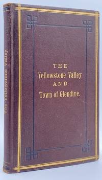
188210945St. Paul MN: The Pioneer Press Co 1882. First Edition First State. 100pp. Octavo 24 cm Presentation binding. Publisher's full grained brown leather with the title gilt stamped on the front board and backstrip. A.E.G. Satin moire endsheets. Near fine. Inscribed on the front free endsheet. 'Mr. Minnie with compliments of the author. Map of the Yellowstone Valley 42 cm x 70 cm and the Plat map of Glendive 40 cm x 56 cm present and both linen backed and in nice condition. Presentation copy. The trade edition of this work was bound in green printed wrappers with 10 pages of advertisements in the front and 3 to 10 pages of advertisements in the rear. Map of transcontinental was attached to the rear free endsheet. Our copy predates the various issues with advertisements and the map attached to the rear free endsheet. Eberstadt and Yale copies and others only list the plat and cattle trails maps. Early Montana promotional item from the Northern Pacific Railroad a year before they opened the Gardiner Gateway at the north end of Yellowstone Park. An important descriptive tract of the new country at the time of its settlement with a fine large map showing the towns and cattle trails. Eberstadt 132: 478. Howes Y8. Rampaging Herd 1535. This is the first time that we've handled or encountered this title. Rare. The Pioneer Press Co unknown
186895331868. <p>The Transcontinental Railroad made possible the winning settlement and development of the American West. It led to a revolution in interstate and international trade opening the markets of the west coast and Asia to the east and Europe while bringing products of eastern or European industry to the growing populace west of the Mississippi and beyond. The railroad caused a great production boom and was in a sense America’s first technology corridor. As it encouraged the growth of American trade and business so too did the railroad impact the nation's public discourse and intellectual life by making it possible to come and go across the length of the continent in just over a week. Now for the first time the beauties and riches of the central part of the continent could be accessed any anyone in days. Nothing was the same afterwards. Many people consider the Transcontinental Railroad the greatest technological feat of the 19th century and one of the most consequential major construction projects ever undertaken.</p><p>Before the advent of the Transcontinental Railroad a journey across the continent to the west coast meant months of careful preparation and acquisition of a conveyance and supplies then a dangerous six month trek over rivers deserts and mountains all the way risking the loss of necessities and encounters with blizzards and Indians. Alternatively a traveler could hazard a three to six month sea voyage around ferociously stormy Cape Horn which proved a graveyard to many ships or sail to Central America and cross the Isthmus of Panama through the jungle in part by pack animal and in part by rail which took five or six weeks risking exposure to any number of deadly diseases in the crossing. So it is no surprise that interest in building a railroad uniting the east and west coasts of the continent began soon after the advent of the locomotive.</p><p><strong>Early Trains in the US and the Idea to Build a Train Connecting East and West Coasts</strong></p><p>The first trains began to run in the U.S. in the 1830s along the East Coast and by the 1840s the nation's railway networks extended throughout the East South and Midwest. The annexation of the western territories including California following the Mexican War the almost immediately subsequent discovery of gold in the region in 1848 the resultant Gold Rush starting in 1849 and statehood for California in 1850 brought momentum to the idea of building a railroad across the nation to the Pacific. Meanwhile thousands of immigrants and miners sought their fortune in the West. During the 1850s Congress sponsored numerous survey parties to investigate possible routes for a transcontinental railroad. No particular route emerged as a clear favorite as the project became yet one more point of contention between the North and South before the Civil War with each wanting the railroad to go through their section.</p><p>Theodore Judah was a civil engineer who helped build the first railroad in California and he became obsessed with the idea of a transcontinental railroad running through Nebraska Wyoming Utah Nevada and California. In 1859 he drew up letters of incorporation for the Central Pacific Railroad Company. Judah surveyed the route creating maps that he used to bolster a presentation of the scheme he made to Congress in October 1861. Many Congressmen were leery of beginning such an expensive venture especially with the Civil War underway but President Abraham Lincoln a long-time supporter of railroads saw in the proposal an important additional opportunity: to help knit California and the West to the Union. He agreed with Judah and on July 1 1862 Lincoln signed the Pacific Railway Act authorizing land grants and government support which amounted to $32000 per mile of track laid to two companies the Central Pacific Railroad and the Union Pacific Railroad. The Central would start at California’s eastern rail point in Sacramento cross the Sierras go through Nevada and into northern Utah where it would meet up with the Union Pacific. The Central Pacific Railroad spiked the first rail on October 26 1863 and its construction crews began building the line east from Sacramento.</p><p>At the eastern end of the project Gen. Grenville Dodge and his assistant Peter Dey surveyed the potential route the Union Pacific would take. They recommended a line that would follow Nebraska’s Platt River along the North Fork would then cross the Continental Divide at South Pass in Wyoming and continue along to Green River then head into Utah. President Lincoln favored this route and made the decision that the eastern terminus of the Transcontinental Railroad would be Council Bluffs Iowa across the Missouri River from Omaha Nebraska.</p><p><strong>The Union Pacific</strong></p><p>Thomas Durant a medical doctor turned businessman gained control of the Union Pacific Railroad Company in July 1863. Though Durant took the office of vice president he was the actual leader of the railroad. In 1864 Congress passed the second Pacific Railway Act which doubled the size of the land grants and allowed the railroads to sell their own bonds. The Union Pacific began to lay tracks at Omaha Nebraska in July 1865. But Durant's management of the actual building of the rail line was sub par and lacked both organization and people with sufficient knowledge and skills to accomplish its ambitious task.</p><p>So as 1866 dawned Durant hired Grenville Dodge as chief engineer of the railroad Dodge began advising Durant immediately although he would not leave the service until May and Dodge insisted up front that Jack Casement and his brother be hired to lay the track and actually construct the Union Pacific line. John S. Jack Casement had worked as a railroad contractor on the Ohio Railroad prior to the Civil War. During the war he rose to the rank of General and Brigade commander and was admired for his bravery management skills and railroad experience. Jack and his brother Daniel had formed the firm of J.S. & D.T. Casement; “General Jack†was construction leader while Daniel handled financial matters.</p><p><strong>Jack and Dan Casement Build the Railroad</strong></p><p>The Casements came to an understanding with Durant and they agreed upon a proposal letter dated February 6 1866. That letter provided that the Casement firm would ""lay and fill the track on the Union Pacific Rail Road for seven hundred fifty dollars per mile on the following terms and conditions. The Rail Road Company to furnish motive power cars wood and water and tracks for boarding cars and pay for delays of over three consecutive days caused by want of material motive power or other default or neglect of Company. The track to be laid in a good and workmanlike manner and filled and surfaced with material taken from the side of the road the whole to be subject to the approval and acceptance of the Engineer of the Company in charge of the work and the track to be accepted on the completion of every twenty miles and approximate estimates to be made by the Engineer in charge and paid monthly. We will lay the track as fast as required not to exceed one mile per day and will at the option of the Company on ten days notice reduce our gang to a force sufficient to lay one half mile per day. We will furnish engineer men and all other help for the trains used in distribution of material and take the materials for track at any point on the Rail Road within one hundred feet of the track and we will furnish oil waste etc for trains in our employ. All trains used in construction or for any purpose by us are to be run subject to the regulations & schedule time of the Company & under the general control of the Superintendent of the Company. We will make no extra charge in cutting and filling in leveling ties unless it exceeds six inches. No extra charge for putting in frogs and switches for all necessary sidings. And we will place the labor of all our men at the disposal of the Company whenever the delays exceed three days and charge for their time as per our payroll. We will commence as soon as the Company requires & will lay track during the whole of the present season and longer if the Company requires.†This proposal was signed “J.S. & D.T. Casement.†Durant responded to the Casements two days later on February 8 1866. His letter stated: “J.S. & D. T. Casement Painesville Ohio. Gentlemen: Your proposition to the Union Pacific Railroad Company under date of Feb. 6 1866 in relation to track-laying is received and has been considered. The Company decides to regard your proposition and this acceptance as the agreement upon the subject. The Company reserves the right to terminate this arrangement in case you do not perform the agreement on your part. Yours truly Thomas C. Durant V. P.""</p><p>Jack Casement was responsible for all matters relating to building the Union Pacific. He hired the workers many of whom were former military personal gathered the materials and supplies and went into the field. As during the war his post was at the front in the construction camps which he ran like an army at the end of the line where the work was being done or in his car at the tail of the work train. Scrappy and hard-working he oversaw not just the laying but the grading of the track as well. As one of the necessities of his job to get to and from the work sites the Union Pacific presented him with annual passes to use their cars.</p><p><strong>Jack Casement’s engraved Union Pacific pass for 1868</strong> used by him to manage and supervise work on the Transcontinental Railroad signed by Company President John D. Perry. This pass was retained by Casement’s descendants until recently when we obtained it directly from them.</p><p>Under Casement’s leadership the Union Pacific laid 1087 miles of track from Fremont Nebraska west to Utah where the Central Pacific and Union Pacific Railroads met to form the transcontinental railroad. His was a magnificent achievement that compares well with the Central Pacific Railroad which laid 690 miles.</p><p>On April 9 1869 with construction work nearing a conclusion and both the Union Pacific and Central Pacific needing a meeting point Congress established it as Promontory Summit north of the Great Salt Lake in Utah. Less than one month later on the morning of May 10 1869 locomotives from the two railroads met nose-to-nose to signal the joining of the two lines. At 12:57 p.m. local time at a ceremony planned to connect the railroads Leland Stanford Governor of California and president of the Central Pacific and Durant as vice-president of the Union Pacific were to pound in the golden spike with silver hammers. Both men proved unable to hit the spike so Jack Casement stepped up to do the job accompanied by much cheering from the workers surrounding him. Telegraphers announced the completion of the Pacific Railway. Canons boomed in San Francisco and Washington. Bells rang and fire whistles shrieked as people celebrated across the country. The nation was indeed united.</p> unknown
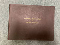
191048451Boston: Tudor Press n. d. ca 1910. 1910. RAILROAD WYOMING COLORADO UTAH. First and only edition. A special deluxe limited edition for presentation this being copy no. 479. Original oblong maroon boards with titles stamped in gilt on the front cover decorated front and rear endpapers n. p. 210 pp. 115 full-page photographs 85 pages of text one in-text map showing the route of the railroad and an elephant folio map coded in color showing the route from Laramie to Coalmont laid-in the front of the volume. The large folding map measures 65.4 x 90 cm 25 3/4" x 35 1/2" with a scale of about 14 miles for 1 inch. This large and handsomely produced volume was likely published for the purpose of luring potential investors into view the Company's operations. Having also the recipient's name in autograph and presented with the compliments of the railroad. This unusual and most remarkable album amounts to what can honestly be described as an extensive visual history of the development of the Laramie Hahns Peak and Pacific Railway System with much material on the region through which it passed including photographs of the people the industries the immense natural resources available to them the construction of dams and canals farming mining ranching lumbering etc. The text and captions emphasize the prospects for further development with much important information both textual and visual on Laramie Steamboat Springs Hayden Vernal Meeker etc. We find no note of this edition nor even the title of this edition in Howes or Graff. The Eberstadts had a so-called trade edition with no mention of the splendid map nor the presentation leaf. Overall an album of immense importance beauty and rarity especially having the large folding map. Minor wear to the corners else a near fine tight copy housed in a cloth slipcase with leather spine label and titles stamped in gilt. Map fine. Tudor Press, n. d. (ca 1910). hardcover
19392091502135500430Geumgangsan Electric Railway Co. Cheolwon-gun Gangwon-do Korea 1939. Soft Cover. Fine. Number of pages: Many photographs 181 text pages Size: 19 x 26 cm Geumgangsan Electric Railway Co., Cheolwon-gun, Gangwon-do, Korea paperback
19112092902138301906Not Available 1911. Soft Cover. Fine. Number of pages: 8242p Size: 23cm Not Available paperback
19352091502135500494Not Available 1935. Soft Cover. Fine. Number of pages: Photographic version 40p 19.5x27.5 cm Complete box Size: Uncollected materials of the National Diet Library Not Available paperback
1901166570Istanbul: 1901-07. An astounding feat of engineering Eight issues of this popular Ottoman magazine documenting the construction of the Hejaz Railway accompanied by a blank export declaration designed for the transportation of goods. The images focus on Tall al-Shahab on the Haifa branch Muzayrib near Dar'a' and the town of Ma'an. A view over the valley at Tall al-Shahab is followed by additional images showing the line snaking between the hills and a bridge in the same location with particular care taken to emphasize the technological achievement of blasting a route through the rock. Pictures from Muzayrib show workmen and locomotives on the track including a larger picture of a carriage with the railway's logo emblazoned. The photographs taken near Ma'an show the town's station and bridges. There are also two pictures of tunnels near Haifa each of which is an engineering achievement. The ultimate vision for the railway was to link Istanbul with the holy cities of Mecca and Medina and thereby consolidate Ottoman military control over the Arabian Peninsula. However only the section of the main line from Damascus to Medina was ever constructed becoming fully operational in 1909. Eight issues quarto each issue 4 pp. Photographic illustrations in the text. Two instalments in original wrappers as issued. Four issues with postal stamps some only partial. Two issues uncut some wear and toning as expected loss to a few characters of text expert repairs with Japanese tissue paper and archival tape. A very good collection of a fragile publication. unknown
19972080502106907340Not Available 1997. Soft Cover. Fine. The book is in fine condition. Not Available paperback
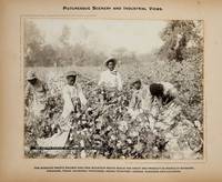
1900373823St. Louis 1900. 34 photographs mounted recto and verso on 17 cards with printed album title on each the images captioned in the negative on linen guards. Oblong small folio 10-1/8x12-1/2 inches. Contemporary half calf and cloth covered boards titled in gilt on the upper cover leather perished contents loose. The images generally dark printings in good condition. Provenance: Battery Park Hotel Asheville NC presentation in gilt on the upper cover from H. C. Townsend Gen'l Pass'r and Ticket Agent St. Louis. 34 photographs mounted recto and verso on 17 cards with printed album title on each the images captioned in the negative on linen guards. Oblong small folio 10-1/8x12-1/2 inches. The images by an unindentifed photographer comprise lovely compositions of buildings and scenes along the route in Missouri Kansas Nebraska and Arkansas. OCLC locates only a single example at University of Texas Austin. unknown
19902091202133206396Kuresushuppan 1990. Soft Cover. Fine. Number of books: 9 books in total Kuresushuppan paperback
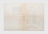
1914164836Istanbul: May 1330 Rumi / 1914 CE. North Arabia and the First World War First and only printing of this rare decree by the Ottoman Chamber of Deputies written in the opening months of the First World War which outlines the state's commitment to constructing a 23-kilometre railway connection between the towns of Jenin and Nablus in what is today the West Bank as an extension of the Jerusalem branch of the Hejaz railway. The decree states that the government will spend 1200000 Kuru from the budget for 1329/1913-14 and 4800000 Kuru from the budget for 1330/1914-15 and that it will complete the track within a period of two years. It also lays out the assembly's assent and an analysis of how the budget for the project will be balanced. A list of the committee members who had signed off on the project is appended. The railroad was a key piece of infrastructure in supplying Ottoman troops in the Sinai hence the decision of the Ottoman government to spend large amounts of money on its expansion as the war began. The ultimate vision for the railway was to link Istanbul with the holy cities of Mecca and Medina and thereby consolidate Ottoman military control over the Arabian Peninsula. However only the section of the main line from Damascus to Medina was ever constructed becoming fully operational in 1909. Single bifolium with text in Osmanl Turkish printed across three pages. Light folds old pale stain at left edge a few light pencil annotations otherwise in good condition. unknown
19478964Osaka: Liason Office Osaka Railway Division Japanese Government Railways 1947. First Edition . Hardcover. Fine. Quarto 66pp. illustrated with 89 mounted photographs. A fresh clean example sharp and bright with the only visible flaw being some waviness throughout due to the mounting glue. The prints themselves are universally in excellent condition; overall fine. An absolutely extraordinary visual collection of the rolling stock locomotives and all sorts of freight cars used by the Japanese Government Railways in the immediate post-war period. The prints are each about 4" x 6" and the developer cropped the exposiure to jst the immediate area around the trains leaving large white borders which give the trains themselves a real "pop."<br/> <br/> Int he mid-19th century Japan was an extremely isolated society both from the rest of the world and also to some extent internally with different regions of the main island quite distinct culturally. The railway system which began construction in 1872 facilitated movement throughout Japan and helped to create a more interconnected society. The railways were nationalized in 1906 and they remained under direct imperial control until 1949 when the Japanese National Railways corporation took over management of the system.<br/> <br/> This extremely well-illustrated album complete with details and specifications for all pictured models is undoubtedly the most extensive record of Japanese trains for the period of World War II and at the dawn of the post-war period. In the decades since Japan has become an undisputed world leader in train technology particularly in terms of human rather than freight transportation.<br/> <br/> OCLC records a single holding at the Army Logistics University library. Liason Office, Osaka Railway Division, Japanese Government Railways hardcover
19322091502135500223Not Available 1932. Soft Cover. Fine. Number of pages: 204p Size: 13x18.5㎠Not Available paperback