10 875 résultats
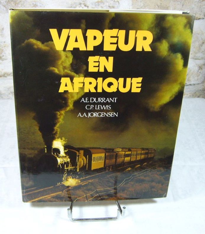
19791065181979 Editions La Vie du Rail / Picador - 1979 - In-Folio, cartonnage toilé bleu sous jaquette illustrée en couleurs - 248 p. - Nombreuses reproductions photographiques en couleurs et N&B
1979704521979 In-4 relié, toile grise en état d’occasion.
198254378Tardy-Lengellé, APRODEF 1982 In-4 broché, sous couverture rempliée 27 cm. 284 pages. Occasion comme neuf.
1 vol. in-4 br. sous jaquette illustrée, couv. ill. couleurs, nombr. photos, APRODEF, Tardy Lengellé, Paris, 1982, 284 pp. Bon état (cachet discret d'ex-libris , très bon état par ailleurs) Français
1990680571 vol. in-8 br., couv. ill. couleurs, photographies et dessins noir et blanc, Les éditions du Cabri, Breil-sur-Roya, 1990, 157 pp.
22538Cartonnage de l'éditeur sous jaquette, 30X24 cm, 208 pages, nombreuses photos en noir et en couleurs, éditions la vie du rail. Déchirures en bord de jaquette sans manque, bon exemplaire.
1979ca608Stenvalls Frank Broché 1979 In-4 broché à l'italienne (25,5 * 18,5 cm), couverture illustrée, 109 pages illustrées, texte quadrilingue, traduit du japonais ; bon état. Livraison a domicile (La Poste) ou en Mondial Relay sur simple demande.
1987109318Brussel-Bruxelles, G. Blanchart & Cie 1987 In-4 à l’italienne 21 x 25 cm. Cartonnage éditeur illusté en couleurs, 208 pp., 208 photographies en noir & blanc. Exemplaire en bon état.
200246551Harry N. Abrams, Inc. 2002 Livre en anglais. In-4 relié. Très bon état d’occasion.
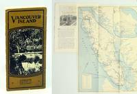
1925652j0955Canada: Canadian Pacific Railway C.P.R. Good. 1925. First Edition Thus. Pamphlet. Substantial text is graciously illustrated with black and white photos on alternating pages. Contents include: Victoria; Motoring & Golfing; East Coast; Hunting & Fishing; West Coast; Resources/Industries; Travel Routes. Two-colour 16.5" x 12" fold-out map of Vancouver Island affixed to back cover lists hotels and boarding houses on verso. 16 glossy pages folded vertically in half. Contents securely stapled. Black and white photo-illustrated covers loose but present with opening to upper portion of fold. Inside the covers are lists of Canadian Pacific Hotels and Canadian Pacific Agencies throughout the world. A remarkable and informative memento of Vancouver Island's early tourism industry.; Sm 4to . Canadian Pacific Railway (C.P.R.) unknown
304 pages. Index. Superbly illustrated in black and white. Map illustrated endpapers. "An Illustrated account of the construction and first years of operation of the Canadian Pacific transcontinental railway." - subtitle. Price-clipped dust jacket now preserved in archival-grade Brodart cover. Small bookseller's sticker upon first blank leaf. Unmarked. Average overall wear. A sound copy. Ex-Library
1396470816.Ghardcover. Good. Access codes and supplements are not guaranteed with used items. May be an ex-library book. hardcover
139109476X.Gpaperback. Good. Access codes and supplements are not guaranteed with used items. May be an ex-library book. paperback
0331602059.Ghardcover. Good. Access codes and supplements are not guaranteed with used items. May be an ex-library book. hardcover
0331602032.Gpaperback. Good. Access codes and supplements are not guaranteed with used items. May be an ex-library book. paperback
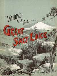
189046818Chicago: R. R. Donnelley and Sons Company 1890. 1890. UTAH. First Edition. 56 pp. Octavo 22 cm Gray illustrated wrappers. Illustrations. Offers a short history of the settlement and growth of Utah and includes profiles of Salt Lake Ogden and the Great Salt Lake. Illustrations include the tramway in Little Cottonwood "The vast improvements wrought by the industrious and frugal pioneers of Utah the great natural resources of the territory the balm of its health giving and invigorating climate the wonders of the majestic mountains the sylvan beauties of its unrivaled valleys the new relations of amity and progress that have sprung into life between all the religious sects of the territory and especially in Salt Lake City the enterprise of energetic railroads the building of great irrigating canals the establishment of manufactories the growth of mining in short all those great strides towards absolute preeminence which Utah has made have been to a great extant ignored in the past." - from the Preface. A small bump to the fore-edges along the upper portion of the front cover and diminishing in size inward very light foxing to the first few pages else a very good tight copy. Not in Flake/Draper. R. R. Donnelley and Sons Company, 1890. unknown
0260457876.Ghardcover. Good. Access codes and supplements are not guaranteed with used items. May be an ex-library book. hardcover
1354371232.Ghardcover. Good. Access codes and supplements are not guaranteed with used items. May be an ex-library book. hardcover
1894125669St. Paul Minn: Office of General Passenger and Ticket Agent 1894. Softcover. Good. 94 p. 20 cm. B&w photos and sepia line drawings. Grey paper covers with gold print. Lower spine chipped with pages separating. Some soiling to covers including white marks on rear. Stain on margin of p. 20. <br/><br/> Office of General Passenger and Ticket Agent paperback
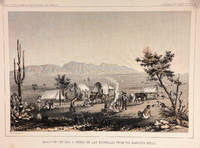
185714427Washington DC: Bevery Tucker Printer 1857. First Edition. Very Good. A.H Campbell. 8.25x11in One litho tinted illustrated plate Part I plate V; Light age-toning along edges with several light spots in margin. Samuels p. 81 Taft p. 265. This plate is from from Volume VII of the quarto edition of twelve volumes were published from 1855 to 1861 as exploration and survey reports became available. These volumes contained not only the survey maps and elevations but a monumental collection of scientific reports on geography geology zoology botany and ethnology of the Native American tribes. The surveys also included 11 artists to record the landscape and indigenous peoples of the west. <br /> <br /> <br /> <br /> Albert Henry Campbell 1826-1899 was a Railway survey artist-explorer civil engineer and surveyor. He was one of the more important artist of the surveys and participated in several survey expeditions across the west from 1853 to 1854. In the fall of 1854 he joined the Parke survey expedition for a coastal railroad route from San Francisco to San Diego and the survey along the 32nd parallel to Arizona. All eight of the full-page illustrations are credited to Campbell in the report three of California and five of Arizona scenes After the surveys he was assigned to Washington as Superintendent of Pacific wagon roads to 1860. During the Civil war he was a map maker for the Confederate Army and chief engineer of railroads based in West Virginia. from Samuels <br /> <br /> The twelve volumes were disorganized in publication with no overall all arrangement or indexing. Some of the plates and maps referred to in volumes were published in other volumes various reports were also published out of sequence relating to the four routes. Preliminary reports published were updated in latter volumes. From Wagner-Becker-Camp In 1853 Senator Gwin of California lead the inclusion of Congressional funding for 1853-54 of a series of surveys to determine the best and most economical railroad routes from the Mississippi River to the Pacific coast. The act directed the Secretary of War Jefferson Davis to plan and direct Army topographical engineers to conduct surveys of four routes. The first was between the 47th and 49th parallels generally along the Lewis and Clark route to the Pacific. The Second route between the 37th and 39th parallels was promoted by Senator Thomas Hart Benton of Missouri. The Third route was along the 35th parallel. The Fourth route was promoted by Secretary Davis along the 32nd parallel that followed Emory's 1846-47 reconnaissance. Bevery Tucker, Printer unknown
2016LFA-126726081Un ouvrage de 224 pages, format 240 x 320 mm, très illustré, relié cartonnage sous jaquette couleurs, publié en 2016, Presses & Editions Ferroviaires, bon état, peu courant
189588581Couverture rigide. Reliure toile rouge de l'éditeur. 108 pages. 10 x 14 cm. Couverture légèrement défraîchie.
A PRISTINE COPY OF THE FIRST AND ONLY EDITION OF THIS EXTREMELY EARLY MANUAL FOR RAILROAD CONDUCTORS AND ENGINEERS. 143 pp. Signed by author on verso of half-title (as with all copies). Printed on good wove paper. Name of former owner ("M. Picandet") stamped on front cover and half-title. 12mo. Original plain wraps. Uncut. Light wear to wraps. Internally fine and bright. Considering the tiny target audience of this book, surely very few copies were printed, and most of those were probably subject to heavy use. The survival of such a pristine copy is nothing short of remarkable.
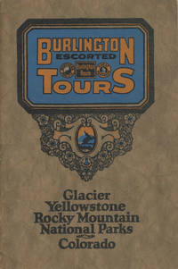
192548702N.P.: Privately printed n.d. ca 1925. ca 1925. 9" x 6" color pictorial wrappers. 47 pages tinted illustrations maps tour plans. Numerous tour itineraries and schedules with numerous beautifully colored photographs of various areas buildings and parks. Tours discussed include Glacier and Yellowstone; Colorado and Yellowstone; Inter-Mountain Route From Colorado to Yellowstone and Glacier; Colorado and Glacier. General information for the tourist including cost of tours discussion of climate apparel booklets of possible interest a list of ticket routing for various tours calendar schedules for various tours etc. Separate map depicting each tour. Very good plus. Privately printed, n.d. [ca 1925]. unknown
1912023031Maine Central Railroad 1912. No Binding. Near Fine. 104 pages routes and guide. Folding map in rear of same from Maine through the Whites and on into Quebec Portland Kineo etc. around Maine and NH. Scarce map dated 1912 measuring 13.75 t x 21.25" w. <br/> <br/> Maine Central Railroad unknown