[IMPERIAL JAPANESE NAVY TRAINING ALBUM].Biblio.com
19 421 résultats
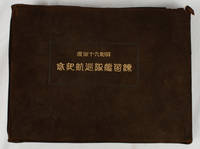
1935173467東京. Tokyo.: 昭和九・十年度練習艦隊司令部. Shōwa Kyū-Jūnendo Renshū Kantai Shireibu. Showa 10 1935. Colour map two large folding panoramas including a very striking one showing Sydney black and white photographic illustrations with captioned tissue guards in Japanese three full-page colour plates show: a Malay House an Australian rural scene featuring sheep and an Australian couple walking in Sydney's Hyde Park by Minakai. Three tipped-in portrait photographs of the Japanese Royal Princes profusely illustrated throughout with monochrome photographic plates showing the crew and ports of call with accompanying tissue guards titled in Japanese. 210 10pp all edges gilt. <br> <br>Handsome special brown suede binding with yap edges Japanese characters stamped in gilt on upper cover. Suede torn with minor loss at head of spine and upper corner lower hinge opening at lower edge. A particularly good copy in a superior binding suggesting it was issued to a high ranking officer on the occasion of this special Royal cruise. 22 x 30cm. This photographic album was issued to commemorate the Japanese Naval Training Squadron's tour which took place in 1934 and 1935. Two war ships the Yagumo and the Asama cruised around Japan before departing for Korea and China. There they visited Incheon Dalian Qingdao and Shanghai before returning to Japan. They also visited Hsin-King Shinkyo the newly established capital of Manchukuo to met the Manchukuo Emperor where a panorama photograph of the whole group of officers was taken. The ships then set off on their main cruise to Australia and New Zealand visiting Taiwan Hong Kong Manila Bangkok Singapore and Jakarta enroute to Fremantle. A colourful art illustration of a Malay house is a memento of their visit to the area. Hong Kong and Singapore sections have a whole page panorama photograph of the harbour each and two additional pages of photographs of the city. The crew visited a British naval ship in Hong Kong. In Singapore they enjoyed cosmopolitan atmosphere of the city where peoples from different racial backgrounds live together. <br> <br>During their tour of Australia the ships visited Adelaide Melbourne and Sydney and made a courtesy call to Canberra. Their cruise then continued to New Zealand after visiting Wellington and Auckland the ships continued to Fiji and Apia Western Samoa before reaching Honolulu. Finally they headed westward to the Marshal Islands Chuk Saipan and the Bonin Islands before returning to Yokosuka Japan. <br> <br>Australian ports of call were Fremantle Perth Adelaide Melbourne and Sydney where the crew participated in local activities and also held open ship exhibitions where the crew demonstrated Sumo wrestling and Kendo to the local public. In Sydney the ships participated in the silver jubilee celebration of King George V with a light display. A magnificent large panorama of Circular Quay and the newly opened Harbour Bridge through to a view across to the Eastern suburbs is fascinating. The region of Circular Quay is particularly striking for its emptiness! There are many other pages showing photographs of their visit to Sydney and the Blue Mountains. The Commandant with the royal Princes also made a courtesy visit to Canberra and a page of photographs marks this occasion. <br> <br>In New Zealand the Yagumo and the Asama visited Wellington and Auckland. Here the crew had an excursion to Rotorua. The cruise continued on to Hawaii where the Princes were welcomed enthusiastically by the Japanese migrants. On the return trip to Japan the ships called into Micronesia including Chuuk and Saipan. <br> <br>This cruise was of particular importance as three members of the Japanese Royal Family were among the crew. Prince Asa'akira of the Kuninomiya Household was in charge of the artillery on the Yagumo and two young Princes were among the newly graduated naval officers. Their presence probably explains why this album is more substantial than others previously issued - with more panoramic views and photographic illustrations; detailed captions are included on the tissue guards. Also the crew had access to royal members and other dignitaries during the cruise. <br> <br>This interesting album offers an extensive and detailed photographic record of all the places visited during the tour. Some pages are delicately illustrated with local motifs in monochrome. The album also includes photographs of the crew detailing names and positions as well as including information about lives on board. Photographs of local receptions and dignitaries at each port visited are featured. All indications are that the ships were warmly welcomed by the host countries and cities as well as the local Japanese residents. This edition was not circulated widely and is bound with suede leather cover special finish from other copies. It was probably offered to somebody important a memento of the Japanese Naval Training's Squadron's tour with three royal household members. . 昭和九・十年度練習艦隊司令部. [Shōwa K hardcover
1952MM365391952 16 p., 64 plates, 1 coloured frontispiece, cloth (dust jacket). Ex library Dr. H.P. Wagner (with his signature).
1960125614Montrouge, Imprimerie Draeger frères 1960 In-folio 36 x 27 cm.Cartonné sous couverture rempliée, dos muet, non paginé [20] pp., orné d'une illustration couleur en double page par A. Brenet. et de 15 photographies du chantier dont 2 contrecollées en couleurs. Exemplaire en bon état.
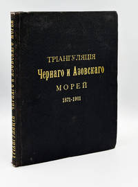
1907009702St. Petersburg: Imperial Academy of Sciences 1907 8vo 24.5 cm 2 146 pp 7 folding maps and plans. Publisher's cloth with gilt lettering to upper cover and spine binding slightly stained and rubbed ownership entry on the front free endpaper number in red pencil to title page. The volume presents the complete geodetic results of thirty years of systematic triangulation survey of the Russian and adjacent coastlines of the Black Sea and Sea of Azov conducted by the Hydrographic Expedition of the Black Sea from 1871 and continued by the Separate Survey of the Black Sea to 1901 covering seven component triangulation chains from the Nikolayev Bakal Yenikalsky Taganrog Mariupol Berdyansk and Feodosiya bases with all angles measured by theodolites to 10-arc-second precision coordinates calculated using Legendre's formulae on the Bessel ellipsoid to 0.001 arc-seconds and results presented in extensive numerical tables. Complete with all large folding plates comprising a schematic overview map of the principal triangulation network corrected to 1903 and five detailed triangulation chain diagrams showing all measured points triangle sides and base measurements with distances in versts. A work of fundamental importance to the geodetic and cartographic history of the Black Sea region representing the primary positional control data upon which subsequent Imperial Russian and later Soviet hydrographic charting of these waters was founded. Imperial Academy of Sciences hardcover
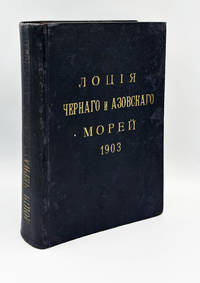
1903009701St. Petersburg: R. Golike & A. Vilborg 1903 8vo 24 cm LXIX 539 pp 2 folding maps 1 folding table 98 plates of photographs and diagrams. Publisher's cloth title gilt binding slightly rubbed and stained gilt partly faded. From the library of Paul v. Hintze stamps on endpapers. The fourth edition of the sailing directions for the Black and Azov Seas comprising an extensive physical-geographical survey covering coastlines currents temperatures salinity ice conditions weather prediction and storms followed by ten navigational chapters describing all shores from the Constantinople Strait proceeding westward northward and eastward around the entire Black Sea littoral to the Anatolian coast with a full chapter devoted to the Sea of Azov. With a prefatory history tracing the work through its four editions from 1851 the present edition prepared by Lieutenant A. M. Bukhtveyev in 1901-1902 and verified in the field by Colonel K. P. Andreyev. Supplemented by 118 autotype photographic views of Black Sea shores 31 wind-rose diagrams a general chart of the Black Sea and Sea of Azov and a composite sheet of charts and plans corrected to 1 January 1903. Provenance: Paul von Hintze German Admiral and diplomat who served as Naval Attaché in St. Petersburg 1903-1908 and later as Foreign Secretary of the German Empire in 1918. R. Golike & A. Vilborg hardcover
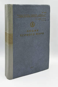
1987009700Leningrad: Main Directorate of Navigation and Oceanography Ministry of Defence of the USSR 1987 4to 26 cm 584 pp. Publisher's cloth with gilt lettering and Soviet naval anchor-and-star emblem to upper cover number stamped on the front board rebacked binding somewhat skewed with extensive manuscript corrections and annotations in red ink throughout including a densely completed "Лист для учёта корректуры" Correction Record Sheet correction slips inserted for crossed out parts. Publication No. 1244 copy No. 5536 stamped "Для служебного пользования" For Official Use Only. Comprising a general survey navigational-geographical and hydrometeorological overviews and nine chapters of detailed coastal navigation covering the entire Black Sea littoral from the Kiliya mouth of the Danube through the Crimea Caucasian coast Turkish coast and Bulgarian and Romanian shores to the Bosphorus; with a reference section distance tables and alphabetical index; illustrated throughout with coastal profile engravings and navigational diagrams; tracking amendments applied through 1991 the final entries postdating the dissolution of the USSR. A later and substantially expanded edition than the 1968 issue this copy is of exceptional documentary interest as a working navigational instrument actively corrected and used through the final years of the Soviet Black Sea Fleet with the correction record providing a remarkable archival trace of operational naval use up to and beyond the collapse of the Soviet state. Main Directorate of Navigation and Oceanography, Ministry of Defence of the USSR hardcover
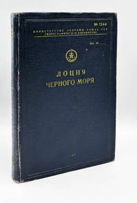
1968009699Leningrad: Hydrographic Directorate of the Ministry of Defence of the USSR 1968 4to 26 cm 440 pp with a loosely inserted pamphlet of corrections 14 pp. Publisher's cloth with gilt lettering and Soviet naval anchor-and-star emblem to upper cover binding slightly rubbed and dusted paper somewhat toned library stamps on the title. Publication No. 1244 copy No. 1433. Comprising a general survey navigational-geographical and hydrometeorological overviews and detailed coastal navigation in nine chapters covering the entire Black Sea littoral from the Kiliya mouth of the Danube to Cape Kaliakra; with a reference section including port and anchorage data distance tables and territorial waters information plus alphabetical index and correction notes. Stamped throughout “ДЛЯ СЛУЖЕБНОГО ПОЛЬЗОВАНИЯ” For Official Use Only with library stamp of the Technical Library of TsKB “Chernomorsudoproekt” Central Design Bureau for Black Sea Shipbuilding to the title page. Accompanied by the separately issued Сводная Корректура 1969 г. Consolidated Correction Supplement for 1969 copy No. 1535 a printed pamphlet with manuscript annotations in red ink updating the main volume in accordance with Notices to Mariners through September 1969. A complete and rare Soviet navigational publication for the Black Sea of considerable historical interest due to its restricted official-use classification and direct institutional provenance from a major Soviet shipbuilding design bureau. Hydrographic Directorate of the Ministry of Defence of the USSR hardcover
1931GR424Αθήνα, ΤΕΧΝΗ 1931, σχ. 4ο, 556, 83 σ. με πολλά σχέδια. Ι/2 βιβλ. εριφίου.
190818742St. Petersburg, Kügelgen, 1908. X, 127 SS., mit sehr zahlreichen Tabellen, statistischen Tafeln u. fotografischen Schiffs-Abbildungen, sowie 2 (von 3) mehrf. gef. farbigen Karten als Beilage. 8°, hellgrauer Orig.- HLwdbd. mit weißgepr. Deckeltitel. Kanten berieben.
1988107788München, Verlag C.H. Beck, 1988.
198815799München, Verlag C.H. Beck, 1988.
1988225892München, Verlag C.H. Beck, 1988.
190113578Berlin, Deutsches Verlagshaus Bong & Co., 1901. Mit zahlreichen Schwarzweiß-Abbildungen im Text und auf Tafeln, sowie einer farbigen Kunstbeilage. HLwd. d. Zt., 836S., 2° (=37 x 26 cm) [2 Warenabbildungen]
197796086Friedberg, Podzun-Pallas-Verlag, 1977.
197796087Friedberg, Podzun-Pallas-Verlag, 1977.
1977151491Friedberg, Podzun-Pallas-Verlag, 1977.
1977151490Friedberg, Podzun-Pallas-Verlag, 1977.
1915254344Bielefeld, Velhagen & Klasing Verlag, 1915.
191747227Kriegspresseamt, Bln. 1917. 29 S. OBrosch. Gebräunt.
1974181539Auf der Suche nach der Nordwestpassage. Ein Seefahrerschicksal des 17. Jahrunderts - dargestellt von Thorkild Hansen. Tübingen, Erdmann, 1974. Mit 32 zeitgenössischen Illustrationen u. Karten. 544 S. Or.-Lwd. mit Schutzumschlag. [4 Warenabbildungen]
2000249905Hamburg, E. S. Mittler & Sohn, 2000.
199483636Hamburg, E. S. Mittler & Sohn, 1994.
200059312Hamburg, E. S. Mittler & Sohn, 2000.
200044974Hamburg, E. S. Mittler & Sohn, 2000.
199426504E.S. Mittler & Sohn, 1994. gebundene Ausgabe