Brassey, AnnieAntiquariat.de

33 résultats
187916094Hirt, Leipzig 1879. VIII, 432 S. mit 9 Tontafeln, 104 Textillustrationen u. 1 farbigen Faltkarte, 4 Bl. Rotes illustr. Leinen. Gebrsp. Einband stark beschädigt. Rücken geplatzt, verblichen, oben u. unten eingerissen. Hinteres Gelenk geplatzt, hinterer Einbanddeckel vom Buchblock gelöst. Buchblock etwas gebräunt u. schief, sonst gut erhalten.
1802REIS0991Berlin und Hamburg 1802. 8°. Reihent., Titelbl., 435 S., mit zwei gestochenen Taf.; Karten fehlen. Halblederband d. Zeit, zwei Rückenschildchen u. Rückenzierlinien goldgeprägt, Vorsatz aus zweifärbig bedrucktem Buntpapier, Kanten bestoßen, Einbanddeckel berieben und abgeschabt, mit kleinem Wurmgang im vorderen Innengelenk, fliegende Vorsatzblätter fehlen. Seiten schwach gebräunt und wenig fleckig. Mit e. teilw. überklebten Bibliotheksschildchen mit alter handschriftlicher Zahl am vorderen Innendeckel. Vgl. Engelmann. Bibliotheca geographica 130 u. 132 - als zehnter Band der Reihe 'Bibliothek der neuesten und interessantesten Reisebeschreibungen' erschienene Übersetzungen des Berichts über eine Reise in diplomatischer Mission zum König von, im heutigen Sri Lanka gelegenen, Kandy 'A journal of an embassy from the Government of Madras, to the king of Candy, in Ceylon, in the year 1782' des irischen Autors Hugh Boyd (1746-1794), der 1781 eine Stelle als Sekretär des Gouverneuers von Madras, Lord Macartnay, angenommen hatte und eines Berichts des Ingenieurs der französischen Ostindiengesellschaft, J. F. Charpentier de Cossigny (1736-1809), von seiner Reise nach China und Bengalen. Unser Exemplar ohne gestochene Karten. [2 Warenabbildungen]
1900820ABBruxelles, Bulens 1900. 2e édition. [2] Bll., X, 330 S., [1] Bl. HLwd der Zt. mit Rückentitel. Etwas berieben. Leicht stockfleckig. Schulpreis-Etikett am Spiegel. 2
188015356Kandy, 1880er Jahre. Albuminabzug (Vintage). 222:282 mm. Aufgezogen auf Karton.
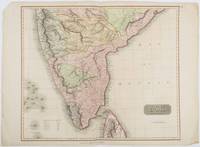
1816185242London.: Thomson. 1816. Engraved map with full handcolour 50.5 x 59.7 cms ; 53.9 x 73.8 cms sheet central fold a few minor edge tears one intruding into the top border the map unscathed marginal edgewear two corners with some loss but the map in very good crisp condition. An elegant map with great detail prepared for John Thomson's influential "New General Atlas" 1814-1821. Showing India from 20 degrees to 7 degrees north of the equator and includes the northern half of Ceylon with territorial interests attractively coloured. . Thomson. unknown
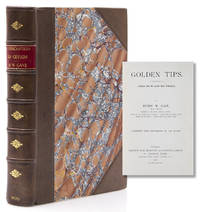
1900316899London: Sampson Low Marston and Company Limited St. Dunstan s House 1900. First Edition. Illustrated with photos by the Author and full-page partially colored map. xii 474 ii pp. 8vo. Bound in half brown polished calf marbled paper sides red leather title label a.e.g. Fine. First Edition. Illustrated with photos by the Author and full-page partially colored map. xii 474 ii pp. 8vo. Sampson Low, Marston and Company, Limited, St. Dunstan s House unknown
187816805Calw & Stuttgart, Vereinsbuchhandlung 1878. Illustr. OPp. 112 S. Mit zahlr. Illustrationen. 8°. Rückenbezug am Kopf mit Fehlstelle. Einbandkanten und -ecken etwas berieben und bestoßen. Stempel auf Vorsatz.
190076609[ca. 1900]. Bildgröße 19,5 x 12,5 cm. Unter Feinkartonpassepartout.