Biblio.com

75 résultats
18000356771800. Original Painting . No Binding. Very Good. Antique Painting On Paper Almost Certainly Nineteenth Century Or Earlier Depicting Blue Skinned Hindi God And His White Skinned Consort Shooting Each Other With Colored Water Using Water Guns Pichtari: Tubes With Plungers In The Hindu Indian Festival Of Holi. The Guns Were Made Of Brass And Most Date From The Mughal Period. Well Preserved Slight Edgewear 3/4" Faint Waterspot Near Center. Mounted On White Card Markedon The Verso With Signature And Stamps Of California Artist Pasquale Giovanni Napolitano 1901-2001 And From His Estate. <br/> <br/> unknown
1792910855CGLondon:, Dilly und Robinson, 1792. Kupferstich 19,5 x 23 cm, Blattgröße 22 x 26,5 cm.
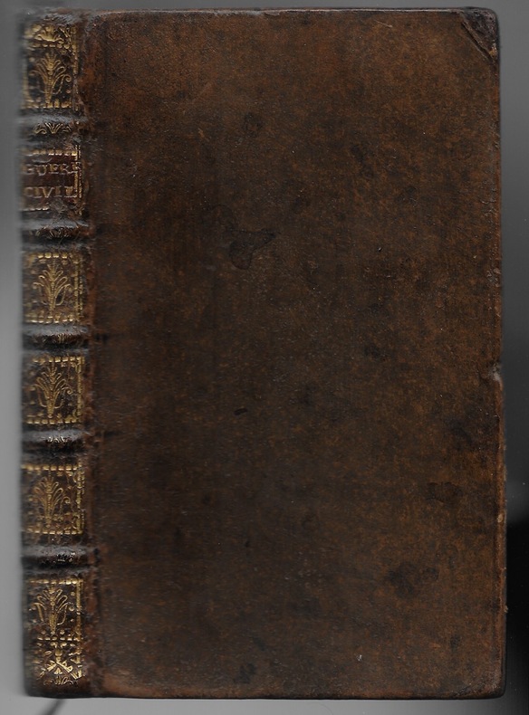
172212240… où l'on voit ce qui s'est passé de plus important dans cet empire pendant trente-huit ans qu'elles ont duré. Pleine basane brune, dos à nerfs orné, pièce de titre rouge. Très bon Amsterdam Jordan 1722 1 volume in-12
175630949ABBerlin, Voß, 1756. 4 Bll., 416 S. Marmorierter Lederband der Zeit mit 2 farbigen Rückenschildern und -vergoldung.
1766182986Vol. 6 (von 10). Paris, Lacombe, 1766. 393 S. Brauner Kalblederband der Zeit mit 5 erhabenen Bünden, reicher Rückenvergoldung u. rotem Rückenschild; Deckel etw. fleckig, Ecken, Kapitale u. vord. Gelenk etw. beschabt. [4 Warenabbildungen]
17952110502151105306Azusa Nagata 1795. Soft Cover. Fine. Number of books: 1 Azusa Nagata paperback
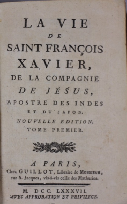
1787136288Guillot 1787 2 volumes in-12 plein veau marbré, dos lisse, caissons ornés, roulettes et dentelles, pièces de titre et de tomaisons, roulette sur les coupes, triple filet doré sur les plats, tranches dorées, 442- 418 pp. Frontispice gravé.
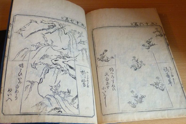
17691109s.l.[Japon], Kaïou Teï. Meïwa 5 (1769), "un jour de printemps". 18,5 x 26,5 cm. Broché cousu à la japonaise, couvertures souples en papier bleu de Prusse et indigo, pièces de titre collées sur les plats supérieurs. 62 p. Ouvrage comprenant 62 planches de motifs gravés sur bois.Tome 1 : motifs 1 à 31.Tome 2 : motifs 35 à 66.
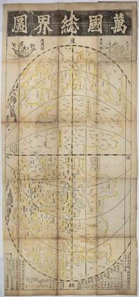
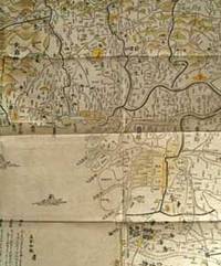
1708219243東京. Tokyo.: 須原屋茂兵衛. Suwaraya Mohei. Hoei 5 1708. Black and white woodblock map with yellow outlining in original hand colour 55.8 x 127cm map; 59.5 x 131cm sheet folding into the original Japanese wrappers chipped and rather worn 26.4 x 17.4cm the map with old repairs laid down on washi rather browned and wormed at the folds but with no serious loss the sheet age-toned and a little dusty but overall in remarkably good condition. Preserved in a modern blue linen Japanese case with toggle-closures. A famous woodblock-printed Japanese map of the world by renowned Edo Period map-maker Ishikawa Tomonobu who is also known as Ishikawa Ryūsen. This is a revised version of an earlier map produced by Ishikawa in 1688. <br> <br>The map appears to draw on Chinese and Portuguese geographical knowledge. The Chinese production of world maps had been transformed by the influence of the Italian Jesuit Matteo Ricci who collaborated with Chinese cartographers to produce a 1584 map of the world. In Japan the production of maps of "the myriad countries" or "the international countries" bankoku had been inspired by contact with Portuguese missionaries and with the Dutch in the 16th century. <br> <br>Ishikawa's map broadly resembles the Ricci map in being placed in an oval frame with the Pacific and thus also China and Japan at the centre. The content though is different. While Ricci's map is oriented to the north Ishikawa's is oriented to the east with America at the top of the page and the sketchy outlines of Europe including 'Ikiresu' England and a large and clearly marked Holland and Africa 'Kafuri' at the bottom. This orientation apparently influenced by the first world map in Japan "Bankoku Sōzu" 万国総図 which was published in 1645. Interestingly although Ishikawa had earlier produced a quite detailed and fairly accurate map of Japan the Japan shown on this world map is a rather loosely outlined collection of islands in which for example Ryūkyū the Ryukyu Kingdom now Okinawa and Hachijōjima appear much larger than they are in reality. Japan is also unusually oriented making it appear as though Ezo now Hokkaido is in the middle of the Pacific. It seems that the cartographer's interest here was less in outlining Japan in detail than in broadly setting out the country's place in relation to the land masses to the east and west. <br> <br>Like other Japanese world maps of the Edo period and like Ricci's map Ishikawa's image of the world includes imagined countries such as 'The Land of Giants". The continuing centrality of China in Japanese thought is indicated by the fact that Ishikawa's map contains a very clearly marked depiction of the Great Wall and that the map is decorated at the top with depictions of a Japanese and a Chinese sailing ship. The text at the bottom gives estimated distances between Hizen Province where the port of Nagasaki provided Japan's main official outlet to the world in this age of seclusion and various places in China and between Hizen and the Ryūkyū Kingdom. It also gives the estimated distance from Korea to Tsushima Island which served as Japan's gateway for diplomatic and trade relations with Korea. <br> <br>Engelbert Kaempfer a German physician and explorer brought back the 1688 edition of this map printing to Europe after his stay in Japan between 1690 and 1692. The map was introduced to European audiences in the 17th century and impacted on later European cartographic endeavours. <br> <br>Copies of this rare and historically significant map are held only in a handful of major collections: the British Library National Diet Library NDL of Japan the Staatsbibliothek of Berlin University of California Berkeley's Japanese Historic Maps Collection and the University of British Columbia. . 須原屋茂兵衛. [Suwaraya Mohei]. unknown
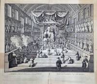
1740196135London.: William Jackson for Claude du Bosc. circa1740. Double-page copper-plate engraving image 30.5 x 41 cms; 39.3 x 44 cms sheet including plate-mark and captions edges chipped sheet age-toned with several patches noticeably darkened mainly outside the image area several repaired short tears to edges no loss to the image in sound condition. Bernard Picart's dynamic rendering of worshippers in a Japanese temple the Sanjūsangen-dō Buddhist temple in Kyoto first published in his landmark work "Ceremonies et Coutumes Religieuses de tous les Peuples du Monde" between 1723 and 1737 a history of religious ceremonies manners and dress from all countries of the world this from volume 4 of the first complete English edition 1733-1739. . (William Jackson, for Claude du Bosc) unknown
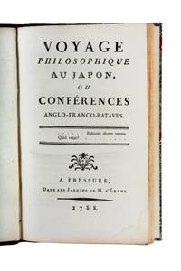
17883005361Pressure" Paris: Dans les Jardins de M. l'Ebahi 1788. A good copy. Octavo half-title woodcut vignette of a ship setting sail at start of text; neat modern quarter calf. <p><p>First edition scarce: a witty and urbane discussion of everything from the rules of Japanese society to the French Compagnie des Indes. The unknown author's reflections on religion and satirical comments on Europe meant that the work must have been skirting very close to being censored.</p> <p>Presumably published in Paris the imprint is meant to refer to l'Ebahi's stately home the Chateau de Pressure in a salon of which the three main characters the much-travelled Monsieur l'Ebahi "Mister Flabbergasted" the Englishman "Thincker" and the Dutchman "Wurtzheim" are comfortably seated as they swap tales of their marvellous adventures not only in Japan but throughout Asia. The whole story is told with such brio that it could almost pass for actual reportage if it were not for the knowing interjections of the author who says at the outset that the only philosophical lesson worth learning is to admire the teachings of Democritus and be amused by the foibles of mankind.</p> <p>The work does appear quite rare with copies recorded in the British Library and the Bibliothèque Nationale de France but with apparently few others.</p> </p> . Dans les Jardins de M. l'Ebahi unknown
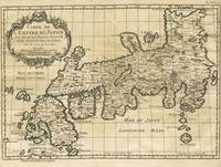
175216019Paris 1752. Striking map of the islands of Japan one of the best of Japan of the 1750's from L'Histoire Generale des Voyages. Titles in French and German. With a Baroque title cartouche at the upper left. Showing the Mer de Coree Meer von Corea in the west the Sea of Japan and the 'Golphe de Jedo' as well as the city Yedo or Edo; the seat of power & capital of Japan under the Tokugawa Shogunate . With Isle de Ximo and Isle de Xixoco. 12 3/4 x 8 3/4". Two short splits at top edge of folds repaired on verso; short tears at right margin with a library blind stamp in the left margin otherwise very good. Campbell 67; Walter 101. HK3250. unknown
1738018990Augsburg: Franz Antoni Alger 1738. First Edition. Hardcover. Nineteenth century signature to front fly leaf and early signature to title some very light staining in various places throughout mostly only visible in margins; expected soiling to binding. A clean and attractive Near Fine example. Quarto 8-1/2" x 12-1/2" with two parts bound together in contemporary blind-stamped pigskin over wooden boards clasps lacking but catches present title on spine label stamped in blind; 24 534 2 559 1 pages. Title in red and black engraved head- and tail-pieces and initials. Illustrated with 9 engraved plates. The First German Edition of this history of the Jesuit Mission in Japan. While Christianity in Japan flourished for a brief period in the mid 1500s the religion was banned in 1620 and existed only underground. The Catholic church took some exception to Crasset's work saying that he "attributed the origin of the persecution of 1597 to the imprudence of the friars in making their religious ceremonies too public" Catholic Encyclopedia IV 468. <br/><br/> Franz Antoni Alger hardcover
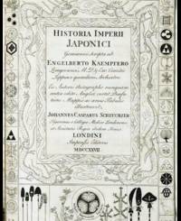
1728019215London: for the Publisher and Thomas Woodward and Charles Davis 1728. First Edition. Hardcover. Light dampstaining in second volume. Generally clean and bright Near Fine. Two folio 8-1/2" x 13-3/4 volumes in contemporary calf leather neatly rebacked preserving the original gilt spine labels. First edition in English second issue with the additional appendix in volume 2 translated from the German by J. G. Scheuchzer. Titles printed in red and black with additional engraved titles and 45 mostly double-page or folding plates and maps. Kaempfer's HISTORY OF JAPAN "was for more than a century the chief source of Western knowledge of the country. It contains the first biography of Kaempfer; an account of his journey; a history and description of Japan and its fauna; a description of Nagasaki and Deshima; a report on two embassies to Edo with a description of the cities which were visited on the way; and six appendices on tea Japanese paper acupuncture moxa ambergris and Japan's seclusion policy" DICTIONARY OF SCIENTIFIC BIOGRAPHY. Kaempfer was a physician for the Dutch East India Company's trading settlement at Nagasaki in the late 17th century. Sir Hans Sloane acquired the manuscript after Kaempfer's death and arranged for it to be translated into English for this edition. Of significance is the fine folding map of Japan "Imperium Japonicum in Sexaginta et Octo Provincias Divisum." <br/><br/>Cordier JAPONICA pages 414-15; Cox I: 332; Garrison-Morton 6374.11; See Nissen BBI 1019 note; Wellcome III: 376. for the Publisher, and Thomas Woodward and Charles Davis hardcover
178223766Nürnberg, Christoph Weigel und Schneider, 1782. Nach der 1773 in Lemgo im Nachlaß der Brudertochter gefundenen Handschrift. Vorliegende überarbeitete, gekürzte und ergänzte Ausgabe beruht auf der von Dohm herausgegebenen Ausgabe: Engelbert Kaempfers Geschichte und Beschreibung von Japan, Lemgo, 1777 und 1779. Die Ergänzungen beruhen auf den in Breslau herausgekommenen kritischen und philosophischen Bemerkungen über Japan und die Japaner. Mit 7 ausklappbaren Kupferkarten. 8°, ca. 19,2 x 11,4 cm, 7 Bl., 350 S., 1 Bl. Verlagsanzeige, roter Farbschnitt, Original-Halblederband. Inhalt: Vorrede / Anzeige und Erklärung der Kupfer / Erklärung der vorkommenden japanischen Münze / Reise von Batavia über Siam nach Japan / Geographie, Naturgeschichte und Einwohner von Japan / Politische Verfassung des japanischen Reichs / Von der Religionsverfassung und den verschiedenen Sekten in Japan / Beschreibung von Nangasacki / Vom Handel der Ausländer nach Japan, und besonders von der Verfassung der Holländer / Allgemeine Reisenachrichten von Japan / Erste Reise des Verfassers nach Jedo und wieder zurück / Zweite Hofreise. Tafel I: Schwimmende Dörfer, oder bewohnte Kähne der Siamer / Tafel II: die zwei Höfe des Berklams Tempel / Tafel III: eine Mia oder Sintos Tempel / Tafel IV: der Tempel des Tensjo Daisin zu Isje (nur zur Hälfte erhalten) / Tafel V: Aufzug der Holländischen Gesandschaft / Tafel VI: Prospect vom Schloß, Stadt und Hafen Muru / Tafel VII: der (kaiserliche) Audienzsaal. Die Vorrede dieser Ausgabe ist erweitert - gegenüber der Ausgabe in der Staats- und Stadtbibliothek, Augsburg. Name auf Titelblatt: F. Lichtewitz oder Lichtewick ?. Engelbert Kaempfer (geboren 16. September 1651 in Lemgo; gestorben 2. November 1716 in Lieme) deutscher Arzt und Forschungsreisender. Im Zuge einer fast zehnjährigen Forschungsreise (1683 bis 1693) die ihn schließlich 1690 - 1692 nach Japan führte, sammelte er zahlreiche Kenntnisse zur Geographie, Natur, Gesellschaft, Religion, Politik, Verwaltung sowie den Wissenschaften und Künsten der bereisten Regionen. 1. Auflage dieser Ausgabe. Rücken mit Einriß, Einband berieben und bestoßen, Tafel IV nur zur Hälfte vorhanden, Seiten vereinzelt fleckig, S. 293 mit Tintenfleck, sonst gut erhalten
1748826931748. MAP - JAPAN. SETTSU NO KUNI MEISHO. Kyoto Kimura Juyodo Kan'en Gannen 1748. A handcolored woodblock printed map of Settsu provice containing the area of Osaka castle etc. 117.3 X 129.1 cm folds into heavy paper covers of approximately 27.7 x 18.9 cm. The original title slip is gone replaced by a handbrushed label: "Osaka no Kuni" "Carte Baie d'Osacca". Lovely and interesting map found at Beans main volume p.22 1748.1. Condition is very good printed on very strong and supple paper. For a detaiuled illustration see the record at UBC's website for the Beans copy: http://angel.library.ubc.ca/cdm4/item_viewer.phpCISOROOT=%2Ftokugawa& CISOPTR=286&DMSCALE=50&DMWIDTH=600&DMHEIGHT=600&DMMODE=viewer&DMFULL=0 &DMX=75&DMY=44&DMTEXT=&DMTHUMB=1&REC=2&DMROTATE=0&x=266&y=296 Our copy has different hand-coloring. The Beans copy hand-colors the harbor ours hand-colors the land primarily. From the collection of Roger Keyes. unknown
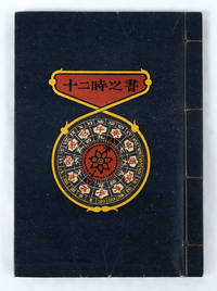
1719160736Tokyo.: 私刊豆本. Limited edition of 300 signed copies. Showa 17 1942. 15 folded leaves delightfully illustrated with colour lithographs showing Japanese clocks and other time pieces by well-known artist and author Takeo Takei. Japanese four hole stab string binding pictorial covers. A little very light wear. Very good. Influential Japanese artist Takeo Takei 1894 -1983 is probably best known for his children's book illustrations but his work was far from limited to this genre. His work is regarded as having three distinct areas: Douga or illustrations for children Hanga or woodblock prints and Kanpon books of various materials. This stunning petite book was his eighth book. . 私刊豆本. unknown
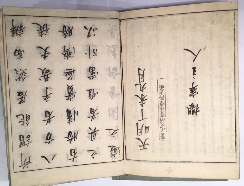
17804225Kyoto, 1780 (1786). 1780 5 vol. in-8° (260 x 184 mm.) de : [60] ff.; [51] ff.; [52] ff.; [58] ff.; [76] ff.; plus de 250 gravures sur bois dont une grande partie sur double-page; texte gravé sur bois. Brochage éditeur dépoque, cartonnage bleu, pièces de titre en japonais, titre manuscrit en français sur les couvertures.
1752102757Paris Didot 1752 1 vol. relié in-4, bradel cartonnage fauve avec pièce de titre soigneusement calligraphiée au dos, plats de papier à la colle, VI + 688 pp., 17 figures hors-texte à pleine page (mais sans les 10 cartes annoncées à la table des matières). Sympathique volume de cette série, avec une belle iconographie centrée principalement sur l'Inde et le Japon. Contient : Voyage de Thomas Rhoe dans l'Indoustan. Voyage de Jean-Albert de Mandeslo dans l'Indoustan. Voyage de Bernier au Royaume de Kachemire. Voyages de Tavernier dans l'Indoustan. Premier voyage des François dans l'Arabie heureuse. Relation du Carnate par quelques missionnaires jésuites. Voyage de Ferdinand Magalhanes, ou Magellan. Voyage d'Olivier de Noort, aux Indes orientales. Description des îles Marianne, des îles Philippines, de l'île de Luçon, nommé aussi Manille, etc. Navigation australe, ou voyage de Jacques Le Maire. Voyage d'Engelbert Kaempfer au Japon. Quelques rousseurs marginales, sinon bonne condition intérieure.
1752102757Paris Didot 1752 1 vol. relié in-4, bradel cartonnage fauve avec pièce de titre soigneusement calligraphiée au dos, plats de papier à la colle, VI + 688 pp., 17 figures hors-texte à pleine page (mais sans les 10 cartes annoncées à la table des matières). Sympathique volume de cette série, avec une belle iconographie centrée principalement sur l'Inde et le Japon. Contient : Voyage de Thomas Rhoe dans l'Indoustan. Voyage de Jean-Albert de Mandeslo dans l'Indoustan. Voyage de Bernier au Royaume de Kachemire. Voyages de Tavernier dans l'Indoustan. Premier voyage des François dans l'Arabie heureuse. Relation du Carnate par quelques missionnaires jésuites. Voyage de Ferdinand Magalhanes, ou Magellan. Voyage d'Olivier de Noort, aux Indes orientales. Description des îles Marianne, des îles Philippines, de l'île de Luçon, nommé aussi Manille, etc. Navigation australe, ou voyage de Jacques Le Maire. Voyage d'Engelbert Kaempfer au Japon. Quelques rousseurs marginales, sinon bonne condition intérieure.
17701606Augsburg, Lotter, 1770. Ritter, Lotter S. 126. - Mit figürlicher Kartusche, Schriftkasten und "Annotatio". - Die dekorative Karte umfasst ganz Asien, einschließlich Ostindien. Japan ist mit dem Festland durch ein Land verbunden, das als Terra Yeco bezeichnet wird (ungefähr die Lage des heutigen Hokkaido). Weiter im Nordwesten befindet sich die fiktive "Terra de la Compagnie", während Korea als Halbinsel dargestellt wird. Ostsibirien, noch unerforscht, fehlt völlig. In der Darstellung Südostasiens nehmen Indochina, Indonesien und die Philippinen allmählich ihre wahren Umrisse an. - Insgesamt wohlerhaltenes Exemplar.
1760LBW-2269vers 1760. 193 x 277 mm.
1760910976CGLeipzig:, Arkstee und Merkus, [um 1760]. Kupferstich, Blattgröße 27 x 29 cm, Bildgröße 25 x 24,5 cm.
1797STLB0015Hamburg, Benjamin Gottlob Hoffmann 1797. 8°. Tit., X S. (Vorrede), 2 Bll. (Inh., diese verbunden), 246 S.; Tit., 347(1) S. Mit 1 Porträt-Frontispiz u. 3 (dav. 1 gef.) Tafel in Kupferstich. Neuerer Pappband m. maschinengeschr. Rüschi. Einbd. angestaubt u. abgegriffen, Kopfschnitt m. Tintenfleck, im Text stockfl. u. z. Tl. etw. angeschmutzt, mehrere Seiten an der oberen Ecke m. Knickspur. Vgl. Henze 1, 243; Wurzbach 1, 272 f. u. Hadamitzky/Kocks 81. Neuausgabe einer von drei konkurrierenden Übersetzungen der Jahre 1790/91. »Vieler gehaltvoller Zusätze, Berichtigungen u. Anmerkungen wegen ist diese ? Uebersetzung am meisten geschätzt« (Wurzbach). B. verfasste seine Aufzeichnungen in französischer Sprache und die erste gedruckte Ausgabe seiner Geschichte war eine Übertragung ins Englische (»translated from the original manuscript«. London 1790). Die Tafeln zeigen Kleidung und Waffen der Einwohner Madagaskars und die gefaltete Karte mit 3 Abbildungen zeigt den Lauf des Flußes Tingballe, einen Plan der Stadt Louisbourg und einen Plan des Forts Augustus. ? Der Soldat, Abenteurer, Reiseschriftsteller und selbsternannte König auf Madagaskar Moritz August Benjowski (1746???1786) kämpfte 1786 auf der Seite Polens gegen Rußland. Er geriet 1769 in russische Gefangenschaft und wurde nach Kamtschatka verbannt. Mit anderen Verbannten plante er einen Aufstand, bei dem der Gouverneur ermordet und die Kronkasse geplündert wurde. Die Aufständischen fuhren über Japan und Formosa nach Macau und auf zwei französischen Schiffen über Mauritius und Madagaskar weiter nach Frankreich. Im Auftrag Frankreichs machte B. später Kolonisationsversuche auf Madagaskar.
17916424A Paris, Chez F. Buisson, Imprimeur-Libraire, rue Hautefeuille, n°20. (1791). 1791 2 vol. in-8° (200 x 125 mm.) de : I. [2] ff. (titre, f. t.), viii, 466 pp.; II. [2] ff. (titre, f. t.), 486 pp. Initiales manuscrites à l'encre "L R" surles faux titres. Demi-basane dépoque, dos lisses ornés et titrés à l'or, coins de parchemin, plats recouverts de papier à la colle bleu.