941 résultats
1952LFA-126730536Revue de 87 pages, format 145 x 195 mm, brochée, publiée en 1952, bon état
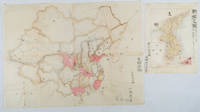
1902220266Japan. No date. Circa1902. Two very attractive colour folded manuscript maps one showing China and the other Korea. <br> <br>Map of China: Watercolour map 48 x 63.5cm. Closed tear now professionally repaired. <br> <br>Map of Korea: Finely detailed watercolour map a few tiny holes very neatly repaired on the verso with archival washi. 33 x 24.5cm Two delicate hand-painted maps one of China and one of Korea produced by a Japanese student cartographer named Koike Tokushige 小池徳重. <br> <br>The undated map of China appears to have been produced in the first five years of the twentieth century: a time when Japan had recently colonized Taiwan and when Japanese economic and political interest in the region was rapidly expanding. The inscription on the map suggests that it was a third year college project. But the high level of detail suggests that the artist had considerable experience of map making. The map of China shows the main provinces rivers major transport routes the Great Wall and the location of key cities although the names of the cities are not included. It also shows outlines of the Korean Peninsula Taiwan and the Japanese island of Kyushu but not the rest of Japan. <br> <br>The map of Korea is more detailed. It provides an accurate outline of the Korean Peninsula with careful hatching indicating changes in elevation. Rivers and major road routes are shown on the map and the locations of major towns are marked though only Busan and Incheon are named. Dotted lines show coastal sea routes and routes between Kyushu and Busan and between Incheon and China. The map shows the Gyeongin railway line between Seoul and Incheon which was completed in 1899 and route of the Gyeongbu railway line between Busan and Seoul whose construction started from both ends in 1901. But the map depicts only small sections of this line close to Seoul and Busan as being completed with the rest more lightly outlined to show the projected route implying that the map was drawn around 1901-1902 and certainly before the Gyongbu line was opened in 1904. <br> <br>Inserted text gives the land area and population of Korea. Rather strangely though the figure given for the Korean population is vastly underestimated. Ikeda gives this as 5.7 million when in fact at that time is was around 18 million. . unknown
191744452London: Thos. Cook & Son 1917. 8vo. 181 xxiii pp. 3 large folding maps numerous maps numerous photo illusts. Green cloth blk lettrng & insignia on frnt cvr blk lettrng on spine mnr rubbng edgewear still a VG copy. Third edition revised & expanded of this excellent Cook travel guide for travel through China Manchuria and Korea during World War I. There are detailed sightseeing instructions for Peking visiting the Great Wall Tientsin Tianjin Port Arthur in Manchuria and more. Of particular interest is the extensive section on Chosen Korea nice folding map of Seoul photo illustrations etc. Thos. Cook & Son, hardcover
19892091502135408964Not Available 1989. Soft Cover. Fine. Number of books: 1 Not Available paperback
19792111902156002142Ethnological Society of Japan 1979. Soft Cover. Fine. The book is in fine condition. Ethnological Society of Japan paperback
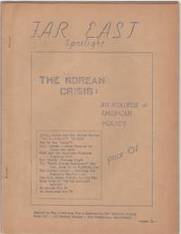
1950206875San Francisco: Committee for a Democratic Far Eastern Policy 1950. Evenly toned; rear cover leaf loose; very good. 22 mimeographed pages 8-1/2 x 11 in. with mimeographed cover stapled. In-depth eleven part essay. Though unsigned this was certainly the work of Maud Russell British-born American activist who devoted much of her life to China and the far east. At this time when the war in Korea was just underway Russell was executive director of the Committee for a Democratic Far Eastern Policy. Far East Spotlight was a precursor to her later self-published magazine Far East Reporter which she began in 1953 and continued for many years afterward. Committee for a Democratic Far Eastern Policy unknown
19932092902141205827Peking University 1993. Soft Cover. Fine. Volume: 1 Peking University paperback
19942092902141206323social studies literature 1994. Soft Cover. Fine. Volume: 1 social studies literature paperback
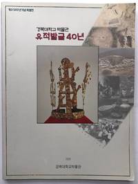
2000H8045Korea: Kyungpook National University Museum 2000. Paperback. Fine. 4to wraps 117 pp color photos throughout documenting findings from the site of Hwangseong-dong Kyongju in Korea. Very rare one copy on OCLC in the Korean National Library. Text entirely in Korean and the title we used is just an approximation not a literal translation. Kyungpook National University Museum paperback
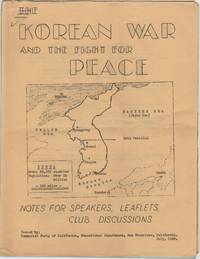
1950206874San Francisco: Communist Party of California Educational Department 1950. Folded; a touch of edge wear; some light doodles on front. 15 mimeographed leaves 8-1/2 x 11 in. on rectos only with mimeographed cover with a map of Korea stapled. Domestic communist perspective on the war which had begun the previous month. Communist Party of California, Educational Department unknown
193874971N.p.: South Manchuria Railroad. ca. 1938. This map has no date that we can see but history would likely place it at the end of the 30s. It is a full color and artistic panorama measuring 40 1/2 x 8 inches. The color map is on the recto and the verso is filled with text and illustrations of all the desirable and holy sites that the train's path goes through. The eight panels show the area of Kongosan or the Diamond Mountains. Some soiling to front panel and a recurring 1 inch tear to top border of each panel. Very bright and attractive.In 1910 Japan formally annexed Korea as a colony although in actuality Japan had been ruling Korea in some manner since 1876. The Japanese felt that their growing empire needed a buffer zone between the other two powers in the regions; China and Russia. Manchuria was also rich agricultural land with vast fields of soy. The laying out of a railway is a godd method of establishing borders so the Japanese were quick to lay down tracks. The Diamond Mountain or the Kumgang Mountains are a mountain/mountain range with a 1638-metre-high 5374 ft Birobong peak in Kangwon-do North Korea. It is about 50 kilometres 31 mi from the South Korean city of Sokcho in Gangwon-do. It is one of the best-known mountains in North Korea. The area often called "12000 Peaks" is one of the most revered sites for natural beauty on the Korean penisula. Koreans have perceived Kumgangsan as their muse since well before the Middle Ages. Practically every poet and artist who lived during the Joseon dynasty 1392-1910 made a pilgrimage to Kumgangsan. Among other well-known works are the Geumgang jeondo and the Pungaknaesan chongramdo painted in the 1740s by Jeong Seon. It was an area of religious interest as well and there were as many as 400 monasteries in the area. South Manchuria Railroad. unknown
1948LFA00856N° 159 - 30 octobre 1948 - Une revue de 32 pages, format 380 x 280 mm, nombreuses illustrations
197924275(San Francisco, Asian Art Museum (gedruckt in Korea), 1979). Ausstellungskatalog, verzeichnet 256 genau beschriebene Exponate. Mit sehr zahlreichen z.T. farbigen, z.T. ganzseitigen Abbildungen. 4°. 192 S. Farb. ill. OKarton.
1975100636Hamburg, Hauswedell & Nolte 1975. Mit zahlr. Abbildungen auf 16 Tafeln. 42 S. Gr.-8vo. OBrosch. mit mont. Abbildung auf dem VDeckel.
198281148Boston, Museum of Fine Arts, 1982. Mit zahlr. tlw. farb. Abbildungen. 216 S. 4to. OBrosch.
194111691Zürich, Kunstgewerbemuseum, 1941. XV, 1 Bl., 132 S. mit zahlr. großteils ganzseit. teils farb. Abb. im Text und auf teils doppelblgr. Tafeln. 4°. OPp. (kl. Gebrssprn., etw. gebräunt).
191328472Paris Au Siège De La société 1913 In-8 coiffe avec manque , 830 pp
191228406Lille Au siège De La société 1912 Fort In-8 Dos passé, basane usagé, pièces de titre, 2 semestres, 384 pp et 376 pp et une carte dépliante, quelques pages salies
191328407Lille Au siège De La société 1913 Fort In-8 Dos passé, basane usagé, pièces de titre, le second semestre de 1913 à été relié avec le premier semestre de 1914 qui n'est pas dans sin intégralité , 312 pp et 121-376 pp et une carte dépliante, quelques pages salies
198752668Köln 1987. 136 S., sehr zahlr. z.T. farb. Abb. Glossar. Lit.verz. 4° Br.
1998bf3391Ho-Am Art Museum Broché 1998 In-8 (24.5*24.5), couverture souple illustrée, dos broché, 163pp., abondante iconographie en couleurs hors texte, texte en coréen, légendes, bibliographie, présentation de l'ouvrage et listes des planches en anglais ; coins légèrement cornés, très bon état, very good condition. Livraison a domicile (La Poste) ou en Mondial Relay sur simple demande.
1972101155o. O., Verlag Neues Leben, 1972. 319 S. 4° Quart, Leinen
190418941Berlin, Mittler u. Sohn, 1904. Unterschiedl. Umfang (von 12 bis 35 Seiten, tls. mit Kartenbeilagen). 8°, Orig.- Broschuren. Etw. gebräunt u. stockfleckig.
190681646n.d., about 1906. 2 leaves of text (english and corean) and numerous illustrations on 48 (24 coloured) plates in original cloth-portfolio with mounted cover-title. Folio. OLwd.
197524352Seoul, Tongchun Moonhwa, (1975). Ausstellungskatalog des National Museum of Korea. Beschreibt 379 Exponate. Mit einigen Farbabbildungen und sehr zahlreichen Abbildungen. 4°. 4 S., 8 Farbtafeln, 139 S. Abbildungen, 41 S. OKarton mit etwas beschädigtem Schutzumschlag (kleine Fehlstelle im Rand, z.T. hinterlegt). Schmuckvorsatz. Minimal gebraucht.