Becker JérômeLivre Rare Book
1 955 résultats
100110169J. Lebègue et Cie 313 pages in8. Sans date. Relié. 313 pages.
1907283101Berlin : A. Schall, 1907. VIII,480 Seiten. Originalleinen. 25 cm
1913289105Berlin : A. Schall, 1913. XII,598 Seiten. Mit zahlreichen Abbildungen, Facsimiles und Karten. Originalleinen. 25 cm
1906287094Berlin : Alfred Schall, 1906. VI ,578 Seiten. Mit zahlreichen Abbildungen, Facsimiles und Karten.
18363642FBLeipzig, Weber Verlag, 1836. Klein-8°. 15 x 10,5 cm. XII, 320 Seiten. Leinenband der Zeit. [4 Warenabbildungen]
1980100074980Edit. Delroisse / Vilo 1980 in4. 1980. Cartonné. illustrations en couleurs
1928SEE1071Leipzig, Brockhaus, 1928. 331 Seiten, "mit 68 bunten und einfarbigen Abbildungen und 2 Karten", Gr.-8°, illustriertes, geprägtes OLeinen. - Name auf Titel; Rücken an Kopf und Fuss plus einer Ecke etwas bestoßen, ansonsten ordentlicher Erhalt. fest gebunden/ hardcover
8vo [24 x 17 cm]; xx, [ii], [23]-504 pp, frontis, 143 illustrations, including 4 color plates, maps, index. original pictorial gilt cloth, light cloth rippling, light shelf wear, very good clean copy, internally fine. A picture of this book is available upon request by email. Ferra V. This is marked volume I but there were never other volumes produced. Beebe became world famous for his record breaking descent into the depths of the sea in the bathysphere in the 1930's. He was an accomplished naturalist but was also an ornithologist, entomologist, ichthyologist, ecologist and taxonomist as this volume clearly illustrates. There is also a chapter on Indian Charms by James Rodway. Included wtih this book is Beebe's article, 'The High World of the Rain Forest; In the Trinidad Jungle, Naturalist and Artist Work Together to Portray a Teeming Animal Kingdom Men Seldom See'. in the National Geographic magazine, June 1958, an 18 page article with two photos of Beebe and many full-page paintings by Guy Neale of butterflies and other insects, and the author's 12 rules for observing wild birds and animals in the forest (very good condition).
1831E01322 volumes. xxi472 pages with three maps two folding and one double page figures and 13 plates; iv452 pages with 10 plates some folding tables and appendices. Octavo 9 1/2" x 5 1/2" Bound in contemporary half leather with marbled boards and gilt lettering to spine. Ferguson 1418; Hill I p. 19; Howes B309; Lada-Mocarski 95; Sabin 4347. Second edition published after quarto edition of the same year.<br /><br />Frederick William Beechey 17 February 1796 – 29 November 1856 was an English naval officer and geographer. He was the son of Sir William Beechey RA and was born in London. 1806 he entered the Royal Navy and saw active service during the wars with France and America. In 1818 he served under Lieutenant afterwards Sir John Franklin in David Buchan's Arctic expedition of which at a later period he published a narrative. In the following year he accompanied Lieutenant W. E. Parry in HMS Hecla. In 1821 he took part in the survey of the Mediterranean coast of Africa under the direction of Captain afterwards Admiral William Henry Smyth. He and his brother Henry William Beechey made an overland survey of this coast and published a full account of their work in 1828 under the title of Proceedings of the Expedition to Explore the Northern Coast of Africa from Tripoly Eastward in 1821-1822. In 1825 Beechey was appointed to command the HMS Blossom. His task was to explore the Bering Strait in concert with Franklin and Parry operating from the east. In the summer of 1826 he passed the strait and a barge from his ship reached 71°23'31" N. and 156°21'30" W. near Point Barrow which he named a point only 146 miles west of that reached by Franklin's expedition from the Mackenzie river. The whole voyage lasted more than three years and in the course of it Beechey discovered several islands in the Pacific and an excellent harbor near Cape Prince of Wales. In July 1826 he named the three islands in the Bering Strait. Two were the Diomede Islands that Vitus Bering had named in 1728: "Ratmanoff Island" Big Diomede and "Krusenstern Island" Little Diomede. Beechey called the uninhabited third islet "Fairway Rock" which is still its contemporary name. One of his crew Petty Officer John Bechervaise gave a detailed account of the voyage in his Thirty Six Years if a Seafaring Life by an Old Quartermaster published privately in 1839. In 1831 there appeared his Narrative of a Voyage to the Pacific and Beering's Strait to Co-operate with the Polar Expeditions 1825-1828. In 1835 and the following year Captain Beechey was employed on the coast survey of South America and from 1837 to 1847 carried on the same work along the Irish coasts. He was appointed in 1850 to preside over the Marine Department of the Board of Trade. In 1854 he was made rear-admiral and in the following year was elected president of the Royal Geographical Society. Beechey Island where Sir John Franklin wintered is named after him.<br /><br />Condition:<br /><br />Name neatly excised from head corner of titles small inconspicuous stamp to last pages. Inner hinges beginning marble to boards rubbed some stains to map. some toning to some plates some plates not bound in order to the printer but are all accounted for corners gently bumped else about a very good set. Henry Colburn and Richard Bentley hardcover books
1984100100962Unesco 1984 19x25x2cm. 1984. Relié. iconographie en couleurs
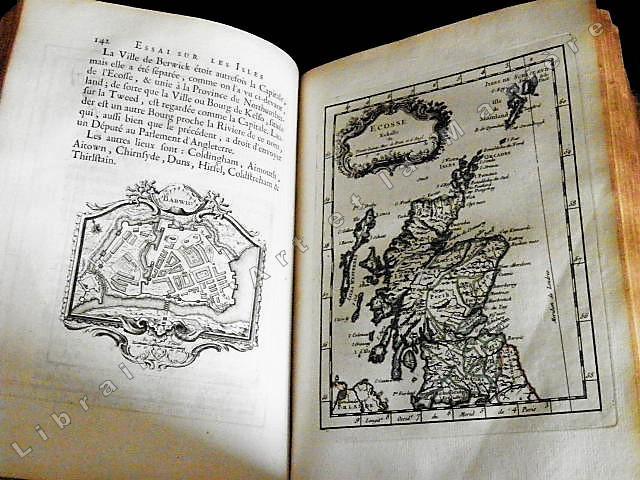
17571407Paris, de l'imprimerie de Didot, 1757. In-4 - 20x26cm. Reliure de l’époque en plein veau marbré, dos à 5 nerfs orné caissons et fleurons dorés, pièce de titre en maroquin rouge, tranches rouges. 4ff, 471pp. Exemplaire complet de son frontispice, 36 vignettes et de ses 5 cartes. Jacques Nicolas Bellin entra au Dépôt des cartes et plans de la Marine peu après la création de celui-ci, en 1721, et y passa toute sa vie. Nommé ingénieur hydrographe en août 1741, il incarne le type même du géographe en chambre car il ne voyagea jamais lui-même et se borna à travailler sur les documents qui lui étaient fournis par les navigateurs. Il a compilé en cinquante ans d’activité une masse énorme de connaissances géographiques de son temps en plagiant bien souvent les travaux des marins comme d’Après Mannevillette qui déposa à ce propos une plainte à l’Académie des Sciences. Il a publié 59 cartes de toutes les régions du monde, réunies en volumes sous le titre d’ « Hydrographie française » (1753) puis en 1764 le « Petit Atlas Maritime » en 5 volumes qui fut pendant plusieurs décennies le bréviaire des navigateurs. Auteur d’une « Nouvelle méthode pour apprendre la géographie » (1769), il fut membre de l’Académie de Marine et de la Société royale de Londres. (Taillemite)
1926191152Plon 1926 in8. 1926. Relié cartonné.
107519Paris, Librairie de L- Hachette & Cie. 1867, 180x115mm, XV - 324pages, reliure demi-parchemin avec avec titre manuscrits du dos. Plats papier marbré. Cachet de bibliothèque sur page de titre, autrement bon état.
181886Paris, Berquet et Pétion, 1842 3 vol. in-8, 4 fac-similés dépl., bradel demi-percaline brune (rel. de l'époque). Qqs rousseurs.
197738Paris, Berquet et Pétion, 1842 3 vol. in-8, 4 fac-similés dépl., demi-basane verte, dos à nerfs orné (reliure moderne). Mouillures.
236613Paris, Berquet et Pétion, 1842 3 vol. in-8, 6 fac-similés dépl., demi-veau prune, dos lisse, filets dorés (reliure de l'époque). Rousseurs.
1843E01482 volumes. xxxvii23878 ad pages with frontispiece woodcuts in text and 7 steel-engraved plates; vi2474 pages with frontispiece woodcuts in texts and 10 steel-engraved plates. Royal octavo 9¼x5½" in publisher's original green cloth spine lettered in gilt covers decorative blind stamped. First Edition.<br /><br />In 1825 Edward Belcher accompanied Frederick William Beechey's expedition to the Pacific and Bering Strait as a surveyor. In 1836. he commanded a surveying ship on the north and west coasts of Africa and in the British seas. Belcher took up the work which Beechey had left unfinished on the Pacific coast of South America. He was on board the bomb vessel HMS Sulphur which was ordered to return to England in 1839 by the Trans-Pacific route. Belcher made various observations at a number of islands which he visited having been delayed by being dispatched to take part in the war in China in 1840. On 26 January 1841 the then Commander Belcher landed on Possession Point at the north shore Hong Kong Island and made the first British survey of Hong Kong harbor. After the war's end in 1842 he reached home and for his services was made a Knight Bachelor in the following year. He was then engaged in HMS Samarang in surveying work in the East Indies the Philippines Geomun-do Port Hamilton and other places until 1847. In 1852 Belcher led the last and largest Admiralty expedition to rescue Sir John Franklin. He was also to look for his former surveying officer in Hong Kong Richard Collinson and Robert McClure whose ships had not been seen after entering the Bering Strait. He did a great deal of sledge exploration rescued McClure and abandoned four of his five ships in the ice. He had five ships: Assistance Belcher Resolute Henry Kellett second mate George Nares the steam tenders PioneerSherard Osborn and Intrepid Leopold McClintock and the depot ship North Star William Pullen. Belcher and one tender were to enter Wellington Channel where Franklin was thought to be while Kellett was to go west to Melville Island and look for Collinson and McClure. North Star was to stay at Beechey Island as a supply base. He left the Nore in April 1850. By early winter Assistanceand Pioneer were frozen in at Northumberland Sound to the north of Wellington Channel while Resolute and Intrepid were frozen in off Melville Island Arctic—the first ships this far west since William Edward Parry in 1819. A great deal of exploration was done by man-hauled sledges. In April 1853 Leopold McClintock and others left the Resolute on sledges and returned 105 days later having covered 1400 miles and discovered Prince Patrick Island. Another party went west and discovered Robert McClure whose ship was frozen in at Mercy Bay. Belcher went north by sledge and found a channel at the northern tip of Devon Island hinting that Franklin might have used it to escape to Baffin Bay. When the ice broke up that summer he pushed his ships up Wellington Channel and became trapped again. By February 1854 Belcher was becoming increasingly worried about the safety of his ships and men. In April he ordered Kellett to abandon his ships and return by sledge to North Star. Belcher abandoned his two ships in late July. Aided by two ships that showed up at Beechey Island Phoenix and Breadalbane the whole party returned to England. Belcher went through a court martial which was automatic for any captain who had lost a ship. He was exonerated but his sword was returned to him 'without observation'. He never again received an active command. Curiously Resolute broke free of the ice and drifted all the way to Davis Strait where it was picked up by an American whaler.<br /><br />Condition:<br /><br />Some staining and wear to covers spines a bit faded ends chipped and worn rear joint of Vol. I with chipping and loss; hinges repaired at endpapers some light foxing and occasional mostly marginal damp staining within the three folding maps which should be loose in a pocket not present; overall good uncommon in the original cloth. Henry Colburn hardcover books
1855E0558xx383 pages with hand colored frontispiece 3 maps in pockets plates many colored; vii41923 ad pages with color frontispiece and plates some colored. Small quarto 10 1/2" x 6 3/4" bound in original publisher's pictorial brown cloth with blind-stamped cover with gilt pictorial in gilt. Notes on the Natural History by John Richardson. Abbey Travel 645; Arctic Bibliography 1241; Books on Ice 5.8a; Hill 106; Sabin 4389; TPL 3409 First edition.<br /><br />Belcher's five-ship 1852-54 expedition in search of Franklin would be the last official British attempt. On the HMS Assistance Belcher successfully navigated through the Wellington Channel but beset by ice was unable to return to Lancaster Sound and was forced to abandon the ship. This account of the expedition also includes several essays on the natural history of the region by Richardson Owen Bell Salter and Reeve.<br /><br /><b>Condition:</b><br /><br />Minor wear re-backed with parts of original back-strips laid down; minor foxing short separations at folds to the largest map; inked stamps on title pages Edinger bookplates else a good set internally very good. Lovell Reeve hardcover books
1843E01482 volumes. xxxvii23878 ad pages with frontispiece woodcuts in text and 7 steel-engraved plates; vi2474 pages with frontispiece woodcuts in texts and 10 steel-engraved plates. Royal octavo 9¼x5½" in publisher's original green cloth spine lettered in gilt covers decorative blind stamped. First Edition.<br /><br />In 1825 Edward Belcher accompanied Frederick William Beechey's expedition to the Pacific and Bering Strait as a surveyor. In 1836. he commanded a surveying ship on the north and west coasts of Africa and in the British seas. Belcher took up the work which Beechey had left unfinished on the Pacific coast of South America. He was on board the bomb vessel HMS Sulphur which was ordered to return to England in 1839 by the Trans-Pacific route. Belcher made various observations at a number of islands which he visited having been delayed by being dispatched to take part in the war in China in 1840. On 26 January 1841 the then Commander Belcher landed on Possession Point at the north shore Hong Kong Island and made the first British survey of Hong Kong harbor. After the war's end in 1842 he reached home and for his services was made a Knight Bachelor in the following year. He was then engaged in HMS Samarang in surveying work in the East Indies the Philippines Geomun-do Port Hamilton and other places until 1847. In 1852 Belcher led the last and largest Admiralty expedition to rescue Sir John Franklin. He was also to look for his former surveying officer in Hong Kong Richard Collinson and Robert McClure whose ships had not been seen after entering the Bering Strait. He did a great deal of sledge exploration rescued McClure and abandoned four of his five ships in the ice. He had five ships: Assistance Belcher Resolute Henry Kellett second mate George Nares the steam tenders PioneerSherard Osborn and Intrepid Leopold McClintock and the depot ship North Star William Pullen. Belcher and one tender were to enter Wellington Channel where Franklin was thought to be while Kellett was to go west to Melville Island and look for Collinson and McClure. North Star was to stay at Beechey Island as a supply base. He left the Nore in April 1850. By early winter Assistanceand Pioneer were frozen in at Northumberland Sound to the north of Wellington Channel while Resolute and Intrepid were frozen in off Melville Island Arctic—the first ships this far west since William Edward Parry in 1819. A great deal of exploration was done by man-hauled sledges. In April 1853 Leopold McClintock and others left the Resolute on sledges and returned 105 days later having covered 1400 miles and discovered Prince Patrick Island. Another party went west and discovered Robert McClure whose ship was frozen in at Mercy Bay. Belcher went north by sledge and found a channel at the northern tip of Devon Island hinting that Franklin might have used it to escape to Baffin Bay. When the ice broke up that summer he pushed his ships up Wellington Channel and became trapped again. By February 1854 Belcher was becoming increasingly worried about the safety of his ships and men. In April he ordered Kellett to abandon his ships and return by sledge to North Star. Belcher abandoned his two ships in late July. Aided by two ships that showed up at Beechey Island Phoenix and Breadalbane the whole party returned to England. Belcher went through a court martial which was automatic for any captain who had lost a ship. He was exonerated but his sword was returned to him 'without observation'. He never again received an active command. Curiously Resolute broke free of the ice and drifted all the way to Davis Strait where it was picked up by an American whaler.<br /><br />Condition:<br /><br />Some staining and wear to covers spines a bit faded ends chipped and worn rear joint of Vol. I with chipping and loss; hinges repaired at endpapers some light foxing and occasional mostly marginal damp staining within the three folding maps which should be loose in a pocket not present; overall good uncommon in the original cloth. Henry Colburn hardcover
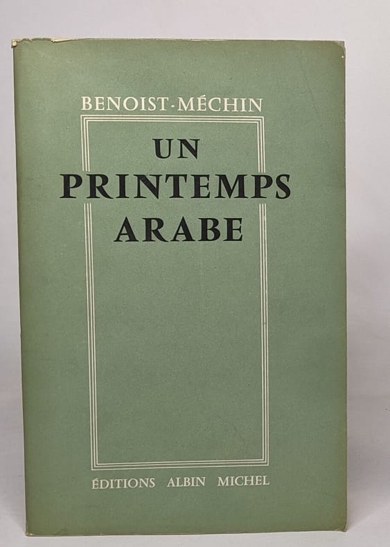
1959100116769Editions Albin Michel 1959 in8. 1959. Broché.
1953100114076Amiot - Dumont 1953 in8. 1953. Relié.
1675P1-4D-6Milan, Recaldini, 1675. 2 parties reliées en un in-12 (140x70 mm), plein vélin époque, 6ff.n.c.-336 pp. Première édition Italienne. Petit trou de vers dans la reliure. First edition in Italian, 2 parts in on volume 12mo (140x70mm), contemporary vellum, binding slightly stained and rubbed.
19061481Alger, Imprimerie algérienne, 1906. Grd In-8 - 16x24,5 cm. Broché sous couverture crème illustrée sur le premier plat d'un décor de motifs orientaux à entrelacs, fleurs et rinceaux en couleurs vives, en encadrement du titre, des noms des auteurs, date et lieu d'édition, etc. imprimés en noir sur fond jaune pâle. X-195 pp. Exemplaire bien complet de sa planche dépliante en couleurs in fine, représentant en 6 cartes les progrès de la pénétration saharienne des Français (1830, 1852, 1864, 1881, 1900, 1906). Ouvrage publié à l'occasion de l'Exposition coloniale de Marseille, sous la houlette du Gouvernement général de l'Algérie (Service des Affaires indigènes). Les auteurs sont respectivement professeur de géographie à l'Ecole des Lettres d'Alger, chargé de cours à la Sorbonne (A. Bernard) et Chef de bataillon d'Infanterie hors cadre, Chef du Service des Affaires indigènes au Gouvernement général de l'Algérie (N. Lacroix). Ils avaient déjà publié ensemble un "Historique de la pénétration saharienne" en 1900.
1961234877Édition ouvrières 1961 351 pages in8. 1961. Relié. 351 pages.
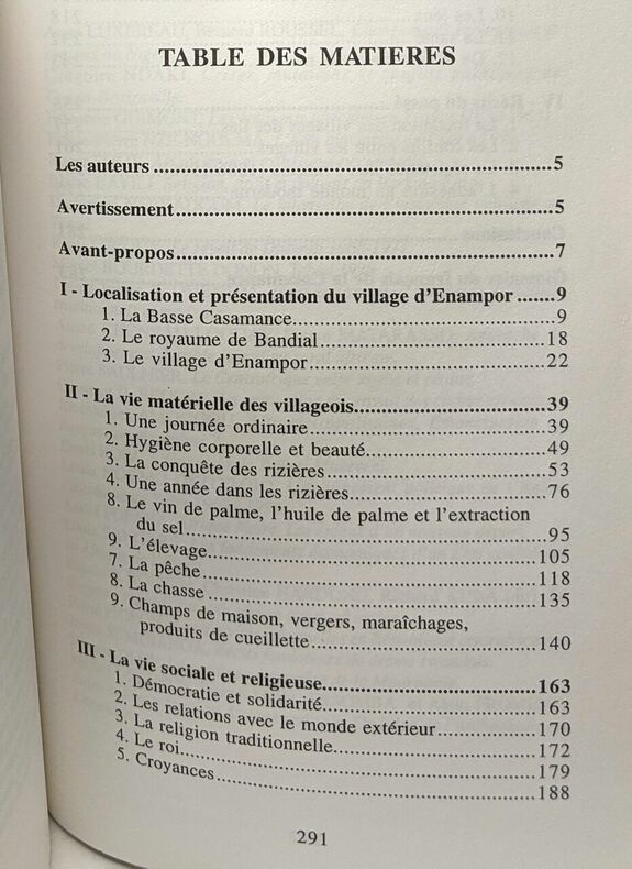
2000100089333Editions L'Harmattan 2000 296 pages 14x21x2cm. 2000. Broché. 296 pages. illustrations en noir et blanc