Antiquariat.de

236 résultats
1873184026Einsiedeln, New York und Cinncinnati, 1873. 423 Seiten. Mit zahlreichen Schwarz-Weiß- Illustrationen. Originalhalbleinen
182414481Bourg, Bottier ; in-8, broché ; 168 pp. ; Thomas Riboud : Essai sur l'étude de l'histoire des Pays composant le département de l'Ain, par la recherche et l'observation des Monuments militaires, expédition, travaux et ouvrages de défense ou d'attaque, dont il reste les vestiges ou des notices, 60 pp. (Le Duc, 105) ; (4) pp., couverture rouge-brique décorée.
1857000151London: J.B. Nichols and Sons 1857. Hardcover. See Description. Tall 4to. pp. viii 2 508. Volume XXVII. 12 plates including several in color and 2 folding maps one map is folded in six sections and backed with thin gauze or mull. B&W illustrations with the text. Pages are generally clean with a couple small marginal tears. Light brown cloth; re-backed preserving part of the original spine minus 25mm at the tail and 15mm at the top. Inner hinges neatly strengthened. Some rubbing and wear; corners bumped. Contents include: An accound of the discovery of Anglo-Saxon remains at Kemble in North Wilts; On choirs and chancels particularly as to their use in the South of Europe; Remarks on some early churches in France and Switzerland partly in the time of Charlemagne; The City of Cumae and the recent excavations there; An account of the investigation of some remarkable circular trenches and the discovery of an ancient British cemetery at Stanlake Oxon.; The Burning and burial of the dead.and many other articles. <br/> <br/> J.B. Nichols and Sons hardcover
186979541Braunschweig, Vieweg, 1869. VIII, 384 S. Mit zahlr., xylograph. Illustr. 3to (30 x 23). HLwd d. Zeit m. Rückenverg.
188488663Hamburg, Aug. Meyer & Dieckmann, ( 1884). 61, [3] S. Mit Kalendarium u. 2 Abb. auf Tafeln. 18 cm. OBrosch.
185546629Gotha, Julius Perthes, 1855-1874. 4to. Bound in 18 contemp. hcalf, some wear to the first 10 vols., some a bit rubbed. Some scattered brownspots to the first volumes. Gilt spines. Wear to top of spines. With a huge amount of original maps, plates, profiles etc., lithographed and engraved, large and folded and mainly in colour. This set does not include the ""Ergänzungsbände"".
182146092(London, W.Bulmer and W. Nicol, 1821). 4to. No wrappers as extracted from ""Philosophical Transactions"" 1821 - Part I. Pp. 164-190 a. 5 folded tables.
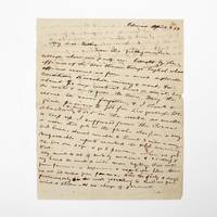
1854369733Palmas Panama 1854. 2pp. single 4to sheet. With: Carte-de-visite photograph of Mayo signed and inscribed to his sister on verso. Folds minor separations. 2pp. single 4to sheet. With: Carte-de-visite photograph of Mayo signed and inscribed to his sister on verso. Seeking a low-level train or canal route to bridge the Atlantic and Pacific Oceans in late 1853 President Franklin Pierce ordered a U.S. Naval exploring expedition to participate in an international attempt affiliated with a venture by the Atlantic and Pacific Junction Company. Although ships from Great Britain New Grenada and the United States were involved the principle overland portion of the expedition through 40 miles of dense jungle would be led by Lieutenant Isaac G. Strain who had previously led exploring expeditions in Brazil Baja California and Chile. With a party of 27 officers and men and including the author of the present letter they entered the jungle on January 20 1854.<br /> <br /> Problems began almost immediately. While puting ashore a boat was swamped and a portion of the party's provisions lost. Next the route Strain had been tasked with following contained no gap in the cordillera as had been previously believed. Led through the jungle by several groups of indigenous people the promise of a few days hike turned into months of wandering in the jungle before being abandoned by the guides. Subsisting on plantains and bananas and drinking river water Stain divided his men with an advance party striking out to seek rescue. On March 9 forty-nine days after starting from Caledonia Bay Strain and his advance party reached Yavisa; it would be another nearly three weeks before the main body was rescued but not before at least five had died of starvation or disease. Sometimes compared with the trials of the crew of the Essex or the members of the Donner Party the men on the Darien expedition endured extreme harship and resorted to unspeakable things. <br /> <br /> This remarkable letter was written by one of the expedition's survivors shortly after his rescue and return to civilization. George Upshur Mayo 1834-1896 was born into a prominent family in Norfolk VA. He attended the Virginia Military Institute served as an assistant engineer on the Strain Expedition was involved in the United States Geodetic Survey and was later a major in the Confederate Army. Here he writes:<br /> <br /> "My dear father From this filthy native village where our party are brought by the officers of the war steamer Virago English whose officers rescued us from a most deplorable condition starvation misery & want for about 70 days without bread or meat living on roots & nuts from the trees. May the rescue be never forgotten & I thank & give praises to God for his goodness. We abandoned & buried 4 or 5 in the woods as unable to keep up. I suffered from the cusano a worm that gets in the flesh also from a very bad knee. Almost unable to travel 3 miles a day. Unfavorable reports reached the U.S. concerning us. We are safe & go to Panama when we get well. My mind is out of sorts by medicine & sickness & my hand too weak to write more legibly. Will write from Panama or Aspinwall a respectable letter there. We are 100 miles from Panama. Had the party 8 days provisions only in the woods yet nothing to shield us from wind & storm & no change of garments. The suffering was intense & the rescue came at the most dreadful & important for our safety. I with 3 others on the river bank washing at sundown when the canoes came in sight. Captain Strain had no pants or underdraws to protect him from the briars & vermin. God be praised for rescue. Love to Annie. . . . In all probability will meet the Cyane at Aspinwall."<br /> <br /> A remarkable first-hand account of a desperate struggle for survival. unknown
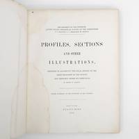
1872373132New York: Jules Bien 1872. First edition. Limited to 100 copies. 65 lithographed plates many folding preceded by 4pp. text. 4to. Original green cloth boards upper cover lettered in gilt rebacked endpapers renewed. Dampstaining. First edition. Limited to 100 copies. 65 lithographed plates many folding preceded by 4pp. text. 4to. This book was prepared to illustrate the work of the Hayden survey. It contains numerous panoramic illustrations many on folding sheets depicting sites in Wyoming Utah Colorado and Montana. This report contains the bulk of Henry Wood Elliott's art work for the Hayden Survey see preceding entry most of which was published nowhere else. These images are important because of their scientific contribution to several fields historical significance documentation of the Hayden expedition and their beauty and attention to detail. Elliott's illustrations were among the early images of many locations in the new territories of the West.<br /> <br /> From an edition of 100 copies issued in advance of the text. The Prefatory Note states p. 3: "A small edition of one hundred copies of the Profiles and Sections are issued in advance of the text for the purpose of placing them in the hands of the principal geologists in this country and in Europe. The first issue of two thousand copies in colors will be published with descriptions in about one year." We find no evidence that a subsequent edition in color was ever printed and it is stated of the present work in the Checklist of United States Public Documents 1789-1909 Washington: Government Printing Office 1909: "Originally intended to illustrate v. 4 of quarto series of reports but never thus used." <br /> <br /> The Hayden Survey was the most important of the four major government surveys of the American West undertaken after the Civil War the others being Powell King and Wheeler. Collectively these surveys filled in the map of the United States using accurate scientific methods to chart the land and investigate not only its geology but natural resources wildlife and plants as well. Schmeckebier Catalogue and Index of the Publications of the Hayden King Powell and Wheeler Surveys p. 32 #3 Jules Bien unknown
188473300Washington: Government Printing Office 1884. First edition. Octavo. 75 1 pp. plus folding map of the Lena Delta in Russia and four full page heliotypes. Original blue printed wrappers. Small piece missing from outer edge of front wrapper three small and excellent paper repairs to wrappers. A very good and very clean copy in the original wrappers.The heliotypes in this publication are particularly interesting as they show Russian soldiers guarding the graves of the Jeannette crew. The final photograph shows all the coffins loaded into a Russian train."In February 1882 Secretary Thompson had despatched naval lieutenants Giles Harber and William Schuetze to the delta to search for any traces of the lost explorers particularly of Chipp's party. They were unsuccessful but in November received orders from the secretary to supervise the return of the bodies of De Long and his comrades to the United States. Weather and bureaucracy delayed them for a year; finally in November 1883 the bodies were taken from Yakutsk by train to Moscow Berlin and finally Hamburg. Here they were placed on board the U.S. steamer Frisia which arrived in New York in February 1884. The funeral cortège was escorted by naval and military detachments to the Church of the Holy Trinity on Madison Avenue for a memorial service. Afterwards the bodies of Ambler Collins and Boyd were claimed for private burial; those of De Long and six others were taken to Woodlawn Cemetery in the Bronx and buried together there. In October 1890 a large monument to the expedition's dead was unveiled at the United States Naval Academy in Annapolis. Its design is based on the original cairn and cross raised at the burial site on the Lena Delta." Wiki [Government Printing Office] unknown
180272327London: A. Arrowsmith 1802. A fine and high quality facsimile of this seminal map commissioned in 2001 by renown Lewis & Clark collector Roger Wendlick. Backed on canvas and measuring 150 x 58 inches in color Wendlick commissioned the firm of Ford Graphics of Portland to make this map. Only 21 copies were made and this is the last one with a letter from Wendlick attesting to this fact. Fine. "The 1802 revision of the map of North America on display delineates the complete length of the Missouri River as well as Mackenzie's journey to the Pacific in 1793. The depiction of the Missouri headwaters which Arrowsmith studied from Peter Fidler's drawing of a map by the Blackfoot Indian Ac Ko Mo Ki shows several streams joining into two branches of the Missouri which flow almost due east. The southern branch of the Missouri appears to be the main branch of the river and connects to the Knife River; the northern branch is a good representation of the actual course of the Missouri.Although the revised map still shows a single ridge of mountains in the west a note near the southern sources of the Missouri states: "Hereabout the Mountains divide into several low Ridges." This note which was based on the reports of Fidler Mackenzie and Thompson was more encouraging to Jefferson and Lewis than the note about the Stony Mountains on the 1795 map which unfortunately turned out to be more accurate. Arrowsmith's map situates the Great Lake River on the western slopes of the mountain range and connects this river to the Columbia River with a dotted line. Since another note claims that this river can be descended to the sea in eight days the Arrowsmith map supported the erroneous belief in a convenient route to the Pacific Ocean.Both the 1795 and 1802 versions of Arrowsmith's map served as resources that Nicholas King consulted as he prepared his map for the Lewis and Clark Expedition. Lewis and Clark in fact carried the 1802 Arrowsmith map along on the expedition. Thomas Jefferson owned the 1802 map as well as an 1802 edition of Arrowsmith's map of the United States. Arrowsmith's 1802 map of North America was the most comprehensive map of the West available to Jefferson and Lewis and it was probably the most important map used in the planning of the expedition." University of VirginiaAaron Arrowsmith's 1802 map was the most current and accurate cartographic representation of the American West available to Lewis on the eve of the journey. Lewis studied this edition closely during the summer of 1803 and even carried a copy on the first leg of the expedition. Among Arrowsmith's sources were Indian maps reports and manuscript maps from the British fur trade and British Navy exploration reports and charts of the Pacific Coast. But various elements in the map reinforced Jefferson's misconceptions of western geography among these were depictions of the Rocky Mountains as a single long chain and the headwaters of the upper Missouri River at the eastern edge of the Rockies suggesting those mountains were readily portaged. A. Arrowsmith unknown
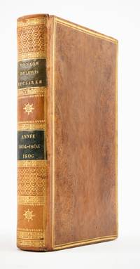
1810ST20849Paris: Chez Arthus-Bertrand 1810. First Edition in French. 205 x 128 mm. 8 x 5". xviii 443 1 pp.Translated into French by A. J. N. Lallemant. <br/> Contemporary flamed sheep covers with thick and thin gilt rule border smooth spine divided into panels by metope and pentaglyph roll panels either with rows of interlocking gilt circles or a gilt compass ornament two black morocco labels marbled endpapers. Folding engraved map by J. B. Tardieu. Wagner-Camp-Becker 6:3; Howes G-77; Sabin 26742; Graff Collection 1519; Wheat Trans-Mississippi 300. Very small loss to head of rear joint boards faintly abraded but the binding entirely solid and pleasing; a handful of leaves with small marginal tears or paper flaws one slightly larger but not affecting text approximately one-third of volume very mildly browned other trivial imperfections but still an excellent copy extremely clean and fresh internally.<br/> <br/> Issued three years after the original English text this is the initial printing in French—and the first in any foreign language—of an important firsthand account of the Lewis and Clark voyage of discovery written by a key figure both during and after the company’s undertaking; it is also and crucially the first edition to include a map of the expedition. Tardieu's map the first to mention the names Lewis and Clark noted important landmarks on the journey including the formidable Rocky Mountains the Columbia River and Fort Clatsop on the Pacific Coast where the expedition spent the winter of 1805-06. Our French edition also adds two letters of Clark not appearing in other editions of Gass—one to William Henry Harrison 2 April 1805 from Fort Mandan and one to Clark’s brother 23 September 1806 on the day the six-month return journey came to an end. Wheat observes that this work held special interest for the French as it provided much information about lands that had until the Louisiana Purchase been part of their domain. A carpenter by training Patrick Gass 1771-1870 was in charge of constructing winter accommodations for the party and his knowledge of building informs his observations here about forts and native architecture. This account was based on journals he kept during the explorations and it was an immediate success upon its first publication in Pittsburgh in 1807. The American public was hungry for information about the Western frontier and their curiosity was shared by Europeans particularly those considering emigration to the New World. Wagner-Camp observes that Gass "became one of the best-known members of the expedition for several reasons: his key role as sergeant brought his name up frequently in the journals of Lewis and Clark; his account was the first to be published; he was the first to have a biography written about him; and finally he outlived the other members of the Corps of Discovery by decades" dying at the age of 98. . Chez Arthus-Bertrand unknown
186454080Berlin Decker 1864-73. Lex8vo. 3 contemp. hcalf. Gilt spines and with gilt lettering. Spines slightly rubbed. XXII4352;VI4375;XI4426 pp. 24 engraved plates and 3 folded maps. Faint brownspots to margins in volume 1. <br/><br/><em>First edition. The offered volumes contains the general description of the expedition which relates to Japan and China. They do not comprise the scientific parts zoology botany of the expedition and not the landscape plates published as "Ansichten aus Japan China und Siam". </em> unknown
186454080Berlin, Decker, 1864-73. Lex8vo. 3 contemp. hcalf. Gilt spines and with gilt lettering. Spines slightly rubbed. XXII,(4),352VI,(4),375"XI,(4),426 pp., 24 engraved plates and 3 folded maps. Faint brownspots to margins in volume 1.
1857324349New Haven 1857. Separately-issued offprint from the American Journal of Science and Arts 2nd series Vol. xxiv July 1857. 21-38 pp. plus folding map. 8vo. Period plain green wrappers stitched. Separately-issued offprint from the American Journal of Science and Arts 2nd series Vol. xxiv July 1857. 21-38 pp. plus folding map. 8vo. "Redfield's last contribution to meteorological science was a memoir upon the cyclones or typhoons of the north Pacific Ocean prepared at the request of Commodore Perry to accompany his Narrative of the United States Expedition to Japan; and was printed in the second volume of that work . He showed that the hurricanes of the Pacific followed the same general laws as those of the Atlantic and traced the paths of several remarkable storms among which was one of great force encountered by the steamer 'Mississippi' one of the vessels of Commodore Perry's squadron on route from Simoda to the Sandwich Islands in October 1854" Recollections of John Howard Redfield p. 302. Page 37 includes a description of the Kona or southerly winds of Hawaii as well as the effects of cyclones on the Hawaiian islands.<br /> <br /> Following its publication within Perry's Narrative in 1856 the work was issued in a slightly more condensed form within the July 1857 issue of the American Journal of Science and Arts. The present separately-issued offprint from the AJSA is the only separately-issued edition of the work. Scarce. Sabin 68512. Not in Forbes unknown
186257939Melbourne: Government Printer 1862. First Edition. Paperback. Melbourne Government Printer 1862 and 1862. Foolscap folio two papers 51 and 31 pages. Title-wrappers stab-sewn as issued; a few uncut edges a little foxed; an excellent pair. Victorian Parliamentary Papers Number 108 and 109 of 1861-2. The expedition was 'for the purpose of rendering relief if possible to the missing explorers under the command of Mr Burke; and directing the movements of the two land parties organized and despatched on the same mission of humanity from Brisbane and Rockhampton' under Landsborough and Walker respectively. Paper 109 gives Norman's account of the activities of his own party; Paper 108 in spite of its prosaic title is almost exclusively devoted to detailed accounts by Landsborough 33 pages and Walker 16 pages. Landsborough's reports include an account of the voyage and wreck of the hired transport 'Firefly'; two on the Albert River and the surrounding country and the journal of his south-western expedition 20 pages. Walker's reports include the journal of his expedition from Rockhampton to the Albert River 12 pages; its first and only publication. Three maps are referred to in the list of contents of Paper 108; these maps are rarely seen and were apparently issued only in copies made available to Victorian Members of Parliament. 2 items. Government Printer paperback
189820487Adelaide: RSSA 1898. First Edition. Paperback. Fine. Adelaide RSSA 1898. Octavo pages 125-192 plus a tipped-in errata slip with several minor references to this article. Wrappers slightly and uniformly tanned acidic paper; a fine copy uncirculated. Keartland's field notes make this far more interesting than the 'List of Birds' title suggests. For example he concludes his account of the Nankeen kestrel thus: 'I took four eggs from a tree near our camp and was surprised to find the nest lined with pellets of camel dung. This is probably the first time this material has been used for nest-lining'. Indeed. <p>Other articles of more-or-less general interest include KOCH Max: A List of Plants collected on Mount Lyndhurst Run 18 pages; BROWNE J. Harris: Use of the Wedge by the Natives of the Great Barrier Plain 1 page; and the address by the president W.L. Cleland 7 pages essentially on the anthropology of Australia. RSSA paperback
18932712376Adelaide: C.E. Bristow 1893. Wrappers torn at edges but well repaired as are the boards of the map section. Octavo complete with maps; original wrappers and boards preserved in a brown morocco bookform box. <p><p>First edition: one of 500 copies printed of the narrative of one of the last great Australian exploring expeditions written by the leader of the expedition and complete with its maps.</p> <p>Lindsay led this extensive expedition - it ran to eight men forty-four camels and five Afghan camel drivers - organised by the South Australian Branch of the Royal Geographical Society and equipped by Sir Thomas Elder to explore the unknown interior between South Australia and the west coast and to look for Leichhardt. Lindsay's exhaustive report includes the surveyor L.A. Wells's journal of the expedition. Also included is an extensive Aboriginal vocabulary collected by Wells from the Pidong tribe at the head of the Murchison River the Minninng tribe at Fraser Range from the Everard Ranges at Mount Illbillee and from the "Wallawe" tribe at Yarragabie Station Western Australia. He states "Appended is a list of native names which I have collected from four tribes met with during the expedition.".</p> <p>The separate large folding maps are original lithographs coloured to illustrate geological changes. Compiled and drawn by both Lindsay and Wells these maps show in great detail the earlier discoveries of Giles Gosse Forrest and Hunt as well as the route taken by the Elder explorers.</p> </p> . C.E. Bristow unknown
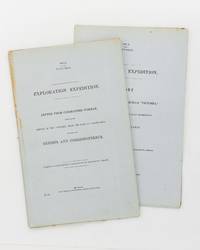
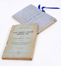
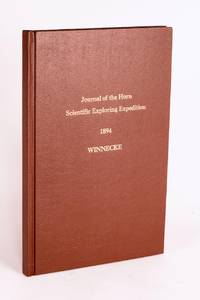
189658059Adelaide: C.E. Bristow Government Printer 1896. First Edition. Hardcover. Fine. Adelaide C.E. Bristow Government Printer 1896. Foolscap folio 32 pages including Appendix B: Report of the Physical Geography of Central Australia by Professor R. Tate and J.A. Watt plus 24 plates on 13 leaves printed rectos only and a folding meteorological chart 2 folding maps a topographical map of Mount Watt and a Survey of Hermannsburg Mission Station and a very large folding colour map 1210 × 1210 mm. Modern cloth lettered in gilt on the front cover; blank bottom margin of the main map slightly creased with one tiny tear expertly sealed; a fine copy. South Australian Parliamentary Paper 19 of 1896: only 650 copies printed. Winnecke was the leader of the expedition and in 'the natural order of things these journals and maps should have been published in connection with the scientific and other records of the Horn Expedition as both supplementary and complementary to them'. After a financial disagreement with W.A. Horn the organiser and backer of the venture this did not occur and this first edition was published under the auspices of the South Australian branch of the Royal Geographical Society of Australasia in conjunction with the Department of the Minister for the Northern Territory and the Survey Department. McLaren 16973; an octavo edition was published the following year see McLaren 16969 - not noting the very large map. C.E. Bristow, Government Printer hardcover
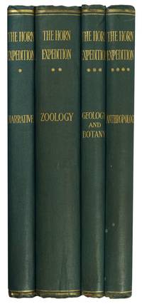
189695477London: Dulau 1896. First Edition. Hardcover. Very Good. London Dulau 1896. Quarto four volumes ii xviii 220 pages with illustrations and a map plus 11 pages of plates and a large folding map 650 × 615 mm; ii iv 432 pages with illustrations plus 28 pages of plates 1 folding 11 in colour and a corrigenda slip at page 1; vi 204 pages with illustrations plus 9 pages of plates 2 folding; and vi 200 pages with illustrations plus 20 pages of plates 6 folding 4 of them in colour. Original blue cloth lightly scuffed and bumped with the spines a little sunned; front board of Volume 2 partially cracked creasing the cloth a little; edges untrimmed and a trifle foxed in places; an excellent set uncut and with the last three volumes completely unopened. The purpose of this scientific expedition sponsored by mining magnate and philanthropist William Austin Horn and with Charles Winnecke as commander and surveyor was to examine the MacDonnell Ranges on the not unreasonable premise that 'when the rest of the Continent was submerged the elevated portions of the McDonnell sic Range existed as an island and that consequently older forms of life might be found in the more inaccessible parts'. This in fact proved not to be the case but the expedition of some fourteen weeks and 2000 camel miles was an outstanding success. 'It was not the intention . to explore a new region . But in the pursuit of natural history the expedition split into independent groups and explored undiscovered areas thus filling in more of the blank spaces in this vast region' Feeken Feeken and Spate. 'These volumes constitute one of the most substantial contributions in nineteenth-century Australian exploration but perhaps more importantly the expedition is a landmark in anthropological history because it resulted in Baldwin Spencer meeting Frank Gillen' Mulvaney. 4 items. Dulau hardcover
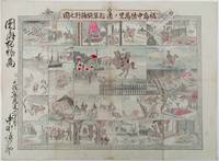
1893214562大阪. Osaka.: 福井榮之助. Fukui Einosuke. Meiji 26 1893. Handcoloured folding engraving 37.5 x 51cm. A prior owner's name is recorded in brush strokes down the left margin. Few small washi repaired tears two old repaired tears on the reverse some occasional browning particularly at centre fold light staining upper margin intruding a little into the printed image. Overall an attractive copy. Scarce. Lieutenant Colonel Fukushima Yasumasa 1852 – 1919 undertook a remarkable solo horseback expedition across Eurasia in 1892. Starting in Poland he traversed Russia and Siberia on his journey. Stationed in Berlin as a military attaché in 1887 he was tasked with researching the Trans-Siberian Railway under construction by Russia. His successful expedition was followed by further explorations in India and the Balkan Peninsula.<br><br>This sheet divided into 24 illustrated panels narrates Fukushima's story from his youth to his triumphant return after the expedition. Filled with adventure the story depicts his encounters with both danger and excitement. The narrative unfolds in a clockwise direction starting from the bottom right corner similar to a sugoroku game which this may be but it is uncertain. The central panel featuring a newly erected statue represents the final goal of his journey. Each panel is accompanied by a caption that furthers the story. . 福井榮之助. [Fukui Einosuke]. unknown
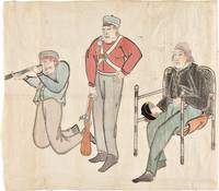
185334749Edo 1853. Watercolour and ink drawing on Japanese paper. A contemporary Japanese watercolour of Commodore Perry and members of his expedition produced at the moment of the American squadron’s arrival in Japan and the opening of sustained diplomatic contact between Japan and the United States.<br/> <br/> This lively drawing belongs to the immediate visual culture generated by Commodore Matthew C. Perry's arrival in Japan in 1853. Perry entered Edo Bay in July 1853 to deliver President Fillmore's request for a treaty and returned the following year leading to the Treaty of Kanagawa on 31 March 1854. The event prompted wide Japanese interest in the appearance dress equipment and conduct of the visiting Americans and images of the "Black Ships" and their crews circulated in manuscript painted and printed form. The composition presents three American figures isolated against the paper ground arranged almost as a study of types. At right Commodore Perry is shown seated in a chair wearing a dark naval coat and holding his hat. At center stands an armed crewman or marine in a red jacket holding a musket upright; at left another crewman kneels while looking through a telescope or spyglass. The emphasis falls on uniform posture weaponry and optical instrument details that would have marked the Americans as visually and technologically unfamiliar to Japanese observers. The drawing is especially interesting as a Japanese interpretation of the expedition distinct from the official American pictorial record produced by artists such as Wilhelm Heine. The Japanese manuscript images such as the present work preserve a different perspective shaped by local observation report and curiosity. unknown
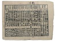
1853347481853. Three woodblock-printed sheets on mulberry paper. Mild edge wear old folds. A detailed revealing group of late Tokugawa samurai reference sheets recording the names ranks stipends heraldry standards and service obligations through which the shogunate and Edo public understood military readiness at the moment of Perry's arrival.<br/> <br/> Commodore Matthew C. Perry anchored off Uraga at the entrance to Edo Bay in July 1853. His arrival made visible the vulnerability of the Tokugawa capital and produced an immediate demand for information about coastal defence domain strength and the lords responsible for guarding the approaches to Edo. Kawaraban and related broadsides answered that demand in compressed visual form combining names crests military symbols income figures and geographical or administrative data. The first printed sheet appears to be an earlier roster of Edo office-holders or guard personnel. Its tabular format with names offices crests and standards records the recognitional system already in place within Tokugawa administration before the Perry crisis sharpened the public appetite for such information. The manuscript sheet is ruled into a large grid with headings formed from the twelve zodiac signs and the four seasons including Rat Ox Tiger Hare and the seasonal headings. The entries appear to record named houses Lords or retainers against recurring seasonal and cyclical categories probably for service attendance or ceremonial obligation. The third sheet is headed "Rekko yushinroku" here translated as "Register of Valiant Retainers of the Lords." It lists major daimyo houses and their principal retainers with domain or house headings names titles stipend figures in koku family crests standards and related insignia. Visible regional or house designations include "Kaga" "Owari" "Kii" "Satsuma" "Higo" and "Tosa." The sheet gives a graphic register of the daimyo world mobilised or imagined as mobilised around the defence of Edo Bay. Together the sheets preserve the administrative and visual language of Tokugawa defence at a moment of acute pressure. They are not formal shogunal orders and the first sheet may predate Perrys arrival but they show how late Edo Japan translated rank obligation military identity and coastal defence into portable tabular form. Their compression the names of Lords and retainers the scale of domains the crests and standards by which armed households could be recognised and the bureaucratic habits of a regime suddenly forced to account for its capacity to defend the country reveals these documents' immediacy and importance. unknown
1853347471853. 31; 31; 61pp. plus a loose sheet. Original paper wrappers stitched. Contemporary manuscript annotations in red ink in one volume Scattered worming heavy in places. Some dampstaining and dust soiling. About very good.<br/> <br/> Separate Accounts of the Arrival of Commodore Perry<br/> <br/> Three fascinating Japanese manuscript accounts of the arrival of Commodore Perry to Japan in 1853. Then first Uraga Kurotone Ni Kansaru or "The Black Ship Arriving in Uraga" comprises the official government report of events when Perry steamed into Uraga Bay. This volume contains contemporary edits to the text in red ink. The second account of Perry's arrival Edo Urgga Bikoku Fune Torai Ikken or "Arrival of the Ships at Uraga" contains a double-page manuscript sketch of the coastline of Uraga Bay together with the disposition of Perry's ships. The final volume consists of a third manuscript entitled GASSHUKKO SHOKAN WAGE UTSUSHI a copy of the report on the Perry arrival prepared by Abe Masahiro Chief Senior Councillor in the Toguwara Shogunate which includes translations of the letters from Fillmore and Perry delivered by Perry on July 8 1853. Also with a single manuscript sheet that provides a description of Perry's ship. Vital contemporary manuscript accounts of this monumental transformation in Japanese foreign relations from significant Japanese participants in events. unknown
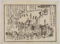
1854218512Japan. Circa1854. Black and white wood block print kawaraban 17.8 x 14cm This kawaraban is dated February 1854 and shows the retreat of the defending lords after the departure of American ships. The caption states that about 1000 people took part in the parade which was led by commanding samurai on horseback with a large cannon drawn at the rear. As it was a peaceful retreat the atmosphere appears relaxed and cheerful. . unknown