harry venckenLivre Rare Book
1 956 résultats
100124877Nijmegen Antwerpen in8. Sans date. Cartonné.
1935064976New York: Dodd Mead & Company 1935. 5th printing New and Enlarged Edition which has a new final chapter. Square and unmarked with residue on front flyleaf from a bookplate removal. We've laid in another bookplate that can mostly cover this. Full blue cloth binding. 406pp. Photos. Dust jacket is moderately worn along edges with small chips toned spine. Now in a new mylar cover. Hardcover. Very Good/Very Good. 4to - over 9" - 12" Tall. Dodd, Mead & Company Hardcover
19301948289Harvard University Press 1930. Hardcover. Used-Very Good. Two volumes. Tall 8vo. Cloth dj. 1064 pp. in all. A very sound set with clean internals. First Edition. Harvard University Press hardcover
19345134London: Kegan Paul Trench & Co. Very Good. 1934. Reprint. Hard Cover. With 64 plates map quarter leather spine dec in gilt blue cloth sides with school Geelong Grammar gilt crest to front top edge gilt marbled endpapers prize plate to front endpaper internally clean & tight. A very good copy. ; 215 x 140mm; xvi 366 pages . Kegan Paul, Trench, & Co. hardcover
193333950Insel-Verlag, Leipzig, (1933). EA, 306 Seiten, zahlreiche Abbildungen+ 1 Faltkarte; Gr.-8°, 23 x 15 cm, Leinen
19412113Goldmann Verlag Leipzig, Wilhelm, 1941. 248(4) S., OLn, farbiger Kopfschnitt, mit Karte auf dem Vorsatz und Porträts im Text. Register und ausführliche Sekundärliteratur. Gutes Exemplar. Good copy.
188929662Stuttgart : Cotta, o. J. (1889). XII, 298 S., 304 S., 294 S., 304 8°, Org.-Halbleinen [2 Warenabbildungen]
1976100118418Arthaud 1976 in8. 1976. Broché.
1876100140572Plon et Cie 1876 in4. 1876. Broché.
H909Washington Beverley Tucker 1856. Three volumes quarto Volume 1 with 88 lithographed plates most tinted three colour facsimiles of Japanese woodblock prints two folding six maps two folding numerous wood-engraved illustrations in text the suppressed nude bathers plate is present !; Volume 2 with 27 illustration plates 18 hand-coloured 16 plates of wind & current diagrams 16 folding maps 14 linen-backed; Volume 3 with 352 wood-engraved star charts. Original cloth rubbed joints with small tears minor wear Text and plates in good condition. First edition the Senate Issue of Perry's account of his historic voyage to Japan in command of a naval expedition which was to lobby the Japanese government to establish diplomatic relations with the United States. The resulting treaty in 1853 ensured better treatment by the Japanese authorities of shipwrecked seamen and permitted American ships to dock at two Japanese ports to refuel and to seek supplies. "The most important result. was that the visit contributed to the collapse of the feudal regime and to the modernization of Japan" Hill. "As one of the chief diplomatic achievements of the 19th century the opening of Japan by the treaty negotiated by Perry will long make the name of Perry memorable. His expedition marked a departure in Occidental policy restricting Japan in American policy respecting the Orient and in Japanese policy respecting the Western world. In June 1855 Perry was ordered to Washington where his chief duty for more than a year was the preparation of a report of his expedition which was published by the government in 1856" DAB. hardcover
1887307461Paris, Hachette, 1887. 316 pages et illustré de 58 gravures sur Bois. 24,5 x 16 cm Originalhalblederband mit vergoldetem Rückentitel und Lederecken. [3 Warenabbildungen]
195278298Darmstadt, Neue Darmstädter Verlagsanstalt, 1952. 75 S. 4° Quart, Softcover/Paperback
100090435Van Ditmar / De lAge Landen in4. Sans date. Cartonné. illustrations en noir et blanc
1899P1-2iHEDIN SVEN. Trois ans de lutte aux déserts d’Asie. Traduit du Suédois et résumé par Ch. Rabot. Paris, Hachette, 1899. Grand in-8, 280 pp., nombreuses photos in-texte, 3 cartes sur 1 f. dépliant, relié demi-chagrin brun à coins, dos à 5 nerfs, titre et tête dorés, plats marbrés. Bel exemplaire.
19321666Leipzig, Brockhaus, 1932. 335 S., geprägter OLn (dieser verschmutzt und mit kleinen Läsuren an den Kanten und Ecken), innen mit wenigen Stockflecken, eingeklebter Zeitungsartikel auf Vorsatz, Klammerheftung (dieses angerostet, dadurch eine Lage lose), mit 74 Abbildungen nach Aufnahmen und Zeichnungen des Verfassers und seiner Mitarbeiter, sowie zwei vierfarbigen Karten. 2.Auflage. Trotz der beschriebenen Mängel ein ordentliches Exemplar. Good copy.
101743Paris, Félix Juven 1904, 270x190mm, VIII - 404pages, reliure chagrin bleue avec titre et auteur dorés au dos. Bon état. Intérieur propre.
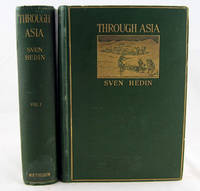
1898901London: Methuen. Very Good with no dust jacket. 1898. First English Edition; First Printing. Hardcover pictorial boards. Two volumes. Profusely illustrated with 83 photos 49 drawings 4 colour drawings and coloured fold out map to first volume; 81 drawings 28 photos 2 colour drawings and coloured fold out map to the second volume. Both volumes in original dark green pictorial cloth bindings. From the library of Christ's Hospital school. Both volumes have new endpapers some unobtrusive library stamps and have some shelf wear otherwise very good sound presentable copies. ; Colour Illustrations; 8vo 8" - 9" tall; Vol I 663 Vol II 614 pages . Methuen hardcover
1942201860Leipzig, F.A. Brockhaus, 1942. Halbleinen
192253Leipzig, F.A.Brockhaus, 1922. 7. Auflage, Band 1 (von 2). Gr.8°, 236 S., hellbrauner Org.-Lwd. mit deckelvignette und rotem Kopfschnitt
192110846Braunschweig,Hamburg und Berlin, Westermann Verlag, 1921.
1903312130Leipzig Brockhaus, 1903. 559, 570 Seiten. Originalhalbleinenbände 24cm
1940103192Leipzig, F. A. Brockhaus, 1940. IX + 335 S. Gr.-8° Groß-Oktav, Leinen
190915119Leipzig, F. A. Brockhaus, 1909. Gr.-8°. Mit 397 Abbildungen nach photographischen Aufnahmen, Aquarellen und Zeichnungen des Verfassers (davon je Band 1 Fototafel als Frontispiz) und geografischen 10 Karten. XVIII, 405, X, 406 S. Orig.-Ganzleinenbände mit je 1 aufkaschierten farbigen Deckelillustration. Deutsche Erstausgabe. - Sven Anders Hedin (1865 - 1952), schwedischer Geograph und Entdeckungsreisender. In vier Expeditionen nach Zentralasien entdeckte er den Transhimalaya, die Quellen mehrerer Flüsse, den See Lop Nor sowie Überreste von Städten, Grabanlagen und der Chinesischen Mauer in den Wüsten des Tarimbeckens. 2 Karten lose beiliegend, diese stärker rissig bzw. mit Klebebandrestauraturen. 1 eingebundene Karte randbestoßen. Vorderdeckel von Bd. 1 etwas angeschmutzt.
1942115383Leipzig . F. A. Brockhaus, 1942. 319 S., mit Abb. auf Tafeln Halbleinen, Farbkopfschnitt, ohne Schutzumschlag, Vorsätze. Abb. karte Nord-, Südpol
22617o.J. XIV, 559 SS.; X, 570 SS. Mit 76 (8 farb.) Tafeln, 5 (4 farbigen, gefalteten) Karten und 326 Textabbildungen. Gr.-8°, illustr. orig.-Leinwand. Verlagseinbände.