Park, MungoAntiquariat.de

53 résultats
179974583Berlin, Haude und Spener, 1799. VII, (1), 325, (1) S., 1 Bl. Mit gestoch. Frontispiz (Porträt) u. 5 teilw. gefalt. Kupfertafeln. HLdr. d. Zt. mit Rückenschild u. linearen Fileten.
1748BOOKS00585324548 pages with three folding engraved maps present southern part of South America; part of the Pacific Ocean and the track of the Centurion round the world. Octavo 8 1/4" x 5 1/2" bound in full leather with five raised spine bands with red label to spine in gilt lettering with decorative blind-stamped ruled edges. Compiled from papers and other materials of the Right Honourable George Lord Anson and published under his direction by Richard Walter M.A. Chaplain of his Majesty's Ship the Centurion in that expedition. Hill I pp 317-138. Third edition.<br /><br />"This is the official account of Anson's voyage. England at war with Spain in 1739 equipped eight ships under the command of George Anson to harass the Spaniards on the western coast of South America for the purpose of cutting off Spanish supplies of wealth from the Pacific area. Lord Anson who was a friend and patron of Benjamin Robins after returning from the voyage around the world in the Centurion appears to have entrusted to Robins for revision the account of the voyage which had been compiled from the journals by his chaplain Richard Walter. It is probable that Robins revised and edited the work wrote an introduction and added dissertations." Hill. Perhaps the most popular account of maritime adventure of the eighteenth century. Anson's account of harrying the Spanish of South America and the taking of the Manilla galleon with treasure with a contemporary value of $800000 and his circumnavigation has long enjoyed a distinguished place as a masterpiece in descriptive travel.<br /><br /><b>Condition:</b><br /><br />Some small closed tears at the edges of the maps. Rebound in tooled leather with raised bands. Over all a very good to fine copy. John and Paul Knapton hardcover books
1799biblio153<p>a1-42 binders direction8 subscribers4c-4204 additional subscribers pages with 7 maps 5 folding and 6 plates. Quarto 11 3/4" x 9 1/2" with new spine in six compartment with red label in gilt over original decorative blind stamped calf boards. Ferguson 329; Sabin 104.633 First edition first printing.<br /><br />Captain James Wilson brought the first British missionaries to Tahiti on ship <em>Duff </em>in 1797. Wilson was a deeply religious man. The missionaries he brought were from the London Missionary Society. There were thirty men six women and three children. Wilson on the <em>Duff </em>also explored and visited many islands in the Pacific some of which had never had any recorded visit by a European. Among these the most important are Mangareva in the Gambier Islands and Pukarua in the Tuamotus. <em>Duff</em> paid a visit as a missionary ship to Tahiti during 1796 as a result Missionary Society has first been established in Tahiti. Three years after the establishment the directors of the Society appointed a committee to consider a suitable memorial for presentation to Wilson for his services in helping to establish the first mission in the South Seas.<br /><br />Wilson fought with the British army during the American War of independence and then served nine years with the East India company. While in India he was captured by Hyder Ali and after a daring bid for escape was imprisoned in the black hole of Seringapatam. After his release he continued service as a captain and despite illness and further dangerous missions accumulated sufficient sources to retire. throughout it all Wilson remained fast in his irreligious opinions. While living in England with his niece however he was converted to an evangelical faith. he felt called to volunteer for missionary service after reading the <em>Evangelical Magazine</em>. Haweis did not know Wilson before receiving a letter volunteering his services in the Pacific. his skills and newfound devotion seemed perfectly suited to the situation and Haweis saw him as "God's man." the <em>Duff </em>arrived at Tahiti on march 5 1797. the settlement at Tahiti of twenty of the missionaries five of them with wives and two children gives further examples of the role of the missionary captain. A pattern of intercourse had already been established by other voyagers according to which the captain of a vessel would take the leading role in meetings. It is therefore not surprising that the focus of the chapter describing the arrival is on meetings between significant island figures and Captain Wilson. For example Manemane a "high priest" Frommo'orea sought Wilson as a tayo or friend not Jefferson the president of the missionaries.<br /><br />The official account of the first mission appeared in 1799 under the lengthy title <em>A missionary voyage to the southern Pacific Ocean performed in the years 1796 1797 1798 in the ship Duff commanded by Captain James Wilson compiled from the journals of the officers and the missionaries; and illustrated with maps charts and views drawn by Mr William Wilson.</em>.it was placed firmly within the tradition of the voyages of discovery by an introduction compiled by Samuel Great heed that described previous European contacts with the islands and an appendix "including details never before published of the natural and civil state of Otaheite." the main narrative was taken from Wilson's journal with additions from his son and a journal kept by the missionaries during the period when the <em>Duff </em>was away from Tahiti at Tonga. Wilson dominated the events recorded in the narrative.<br /><br /><strong>Condition:</strong><br /><br />Some offset toning from maps occasional foxing water mark to upper margin on some leaves two leaves miss-bound at back re-backed with contemporary blind stamped calf boards.</p> S Gosnell for T Chapman hardcover
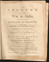
1761E6754xxxiii270215148xix1 pages 14 of 18 engraved plates maps many folding and index. Quarto 10 1/4" x 8 1/4" in original leather binding. First edition.<br /><br />Richard Owen Cambridge was a British poet. He was educated at Eton and at St John's College Oxford. Leaving the university without taking a degree he took up residence at Lincolns Inn in 1737. Four years later he married and went to live at his country seat of Whitminster Gloucestershire. In 1751 he removed to Twickenham where he enjoyed the society of many notable persons. Horace Walpole in his letters makes many jesting allusions to Cambridge in the character of news-monger. His chief work is the <i>Scribleriad</i> 1751 a mock epic poem the hero of which is the Martinus Scriblerus of Alexander Pope John Arbuthnot and Jonathan Swift. The poem is preceded by a dissertation on the mock heroic in which he avows Cervantes as his master. The satire shows considerable learning and was eagerly read by literary people; but it never became popular and the allusions always obscure have little interest for the present-day reader. He made a valuable contribution to history in his <i>Account of the War in India on the Coast of Coromandel from the year 1750 to 1760</i> 1761. He had intended to write a history of the rise and progress of British power in India but this enterprise went no further than this one work as he found that Robert Orme who had promised him the use of his papers contemplated the execution of a similar plan. The Works of Richard Owen Cambridge includes several pieces never before published. It contains an <i>Account of his Life and Character</i>by his Son George Owen Cambridge 1803 the Scribleriad some narrative and satirical poems and about twenty papers originally published in Edward Moore's paper The <i>World</i>. His poems are included in Alexander Chalmers' English Poets 1816.<br /><br /><b>Condition:</b><br /><br />Previous owner's name in neatly written dated 1806 on front end paper with his book plate on front past down with his library stamp. Lacks rear free end paper. Front hinge separated back hinge cracked. Lacks the Mongol on horse back plate map of Maratta County view of the attack on Geriah and view of Surat. Front worn spine ends and corners reinforced and repaired new spine label else about very good. Printed for T Jefferys hardcover
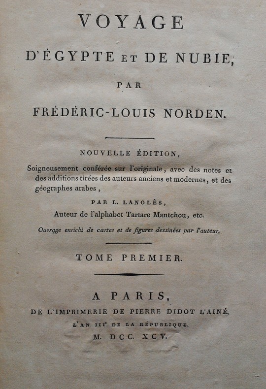
1795P1-2M-2Paris, Pierre Didot l’Ainé, 1795. Un volume in-4 (320x240mm), pleine percaline rouge, un portrait et deux gravures en frontispice, LV-176pp, 59 planches. Non rogné, imprimé sur papier vergé à la cuve. TOME 1 SEUL SUR 3. Bel état. Etude sur l’Egypte la plus complète avant la « Description de l’Egypte » ordonnée par Bonaparte. Second edition of the famous work of the Danish explorer, illustrated with a frontispiece, a portrait of Norden and 59 full page engraving. Modern red cloth. First volume only.
1725P1-3K-2Amsterdam, Etienne Roger, 1725-1726. 2 volumes in-12 (15.5x9.5cm) reliés maroquin du levant, cerise époque, dos lisse orné, pièce de titre et de tomaison, filets d’or sur les plats, dentelles or sur les plats intérieurs, tranches dorées. Relié par ANGUERRAND de la Bibliothèque de LAMOIGNON avec le numéro de référence, cachet à la première page. 663pp.-17ff, illustré de 6 planches dépliantes. TOME 5 en 2 parties comprenant Voyage à Formose. TRÈS BEL EXEMPLAIRE, PROVENANCE PRESTIGIEUSE. Chrétien-François de Lamoignon (1735-1789), président à mortier du Parlement de Paris, fut le dernier gardien d’une collection familiale de près de 5000 ouvrages commencée au milieu du XVIIe siècle. Ces livres sont caractérisés par un numéro d’inventaire au dos, un ex-libris imprimé Bibliotheca Lamoniana au contre plat supérieur, avec une côte manuscrite, et un timbre humide L couronné dans la marge de la page 3 du texte. Etienne II Anguerrand, reçu maître en 1747, nommé relieur du Roi en 1767, habilla nombre de ses volumes en maroquin.
1707BB0368Amsterdam: Chez Thomas Lombrail marchand libraire dans le Beurs-Straat 1707. Full Calf. Near Fine. First French-language Edition another French language edition was printed in Orleans but bearing a Paris imprint the same year with no priority definitively established translated from the English of the first history of the Virginia colony "and the best contemporary account of its aboriginal tribes and the life of its early settlers." Howes 12mo 159 x 92mm: 643316pp with engraved title page featuring coat of arms of Virginia14 finely executed numbered plates based on engravings from De Bry's Grand Voyages and folding table p. 433. Contemporary calf spine richly gilt in six compartments between raised bands red morocco lettering piece gilt. A handsome well-preserved copy tightly bound and clean throughout. This edition was in Thomas Jefferson's library at Monticello. Sabin 5116. Howe B-410. Church 821. JCB I 93. Goldsmiths'-Kress 4396. Geology Emerging 212. European Americana V p. 436. While in London in 1705 Robert Beverley wrote and published The History and Present State of Virginia one of the earliest printed English-language histories about North America by an author born there. Beverley was a scion of Virginia's planter elite at odds with royal governors in the colony. As a native-born American—most famously claiming "I am an Indian"—he provided English readers with the first thoroughgoing account of the province's past natural history Indians and current politics and society. Sabin calls Beverley the "best authority" affording the "most vivid comprehensive instructive and entertaining picture of Virginia at the date of his writing." N. B. With few exceptions always identified we only stock books in exceptional condition carefully preserved in archival removable mylar sleeves. All orders are packaged with care and posted promptly. Satisfaction guaranteed. Fine Editions Ltd is a member of the Independent Online Booksellers Association and we subscribe to its codes of ethics. Chez Thomas Lombrail, marchand libraire, dans le Beurs-Straat unknown
1749E0529<p>2 volumes. 182 pages with fold out frontispiece map and three additional folding engravings; 319 pages with seven folding engravings. half-titles in each title pages improperly marked first volume as second and vice versa. Duodecimo 6 1/2" x 3 1/2" bound in original publisher's full uniform contemporary French sponged calf with gilt-tooled spines. First French edition after the 1748 English edition.<br /><br />Henry Ellis was a traveler hydrographer and colonial governor returned from Italy in 1746 just in time to find an expedition to search for a north-west passage on the point of sailing. He appears to have been in easy circumstances; his name stands in the list of subscribers to the north-west expedition and he had sufficient interest to get attached to it nominally as agent for the committee and really as hydrographer surveyor and mineralogist the expedition consisting of two vessels the <i>Dobbs</i> galley of 180 and <i>California</i> of 150 tons left Gravesend on 20 May 1746 joined the Hudson's Bay convoy in Hollesley Bay and finally sailed from Yarmouth on the 31st. They parted from the convoy on 18 June made Resolution Island on 8 July and after a tedious passage through Hudson's Straits rounded Cape Digges on 8 August and on the 11th 'made the land on the west side the Welcome in latitude 64° N.' Bad weather drove them to the southward and prevented their doing anything more that season. They wintered in Hayes River in a creek about three miles above Fort York where a quarrel with the agent of the Hudson's Bay Company gave an unwonted piquancy to the dark and weary days. They suffered much from scurvy the prevalence of which Ellis attributes to their having got two kegs of brandy from Fort York for their Christmas merrymaking and in a minor degree to the 'governor' not permitting the Indians to supply them with fresh provisions. On 29 May 1747 the ice broke up and they were able to warp to the mouth of their creek; on 9 June they got down to Fort York. There they were allowed to get some provisions and stores and on the 24th cleared the river and 'stood to the northward on the discovery'. On 1 July each of the two ships sent away her long-boat but owing apparently to some ill-feeling between the two captains without any prearranged plan for working in concert. The consequence was that they separately went over the same ground discovering naming and examining the several creeks and inlets on the west side of Hudson's Bay the double examination perhaps compensating for the confusion arising from the double naming. Before the season closed in they had satisfied themselves that the only possible exit from Hudson's Bay on the west must be through the Welcome and that very probably there was no way out except that on the east by which they had come in. The result may not seem much; but as it served to put an end to the idea that the passage must lie through Hudson's Bay it was at least so much gain to accurate knowledge. After 21 August the weather broke and they decided in council 'to bear away for England without further delay.' On the 29th they entered Hudson's Straits passed Resolution Island on 9 September and arrived at Yarmouth on 14 Octivwe. Ellis's share in the work of the expedition had really been very slender but the reputation of it has been commonly assigned to him by reason of the narrative which he published the following year under the title <i>A Voyage to Hudson's Bay by the DobbsGalley and California in the years 1746 and 1747 for Discovering a North-West Passage</i> 1748; a work which with many valuable observations on tides on the vagaries of the compass and on the customs of the Eskimos a people then practically unknown mingles a great deal of speculation on the certain existence of the passage on magnetism on fogs on rust and other matters all more or less ingenious but now known to be wildly erroneous. Such as it was the book commended its author to the scientific workers of the day and on 8 February 1748-9 he was elected a fellow of the Royal Society. Possibly in acknowledgment of his scientific labors but more probably by some family interest he was afterwards appointed successively governor of Georgia and of Nova Scotia from which employment he retired about 1770. He seems to have spent his later years as a wanderer on the continent was at Marseilles in 1775 and died at Naples on 21 January 1806.<br /><br /><b>Condition:</b><br /><br />Some dark spot to spine else a very good copy.</p> Ballard Fils hardcover books
1790E00534 of 6 volumes. Volume 1: i-ix-372 pages with 23 plates including frontispiece plate of Cook and 4 folding maps; Volume II lacking; Volume III: 793-1184 pages with 11 plates including frontispiece of Possession Bay and 5 fold out maps; Volume IV: 1185-1546 pages with 26 plates including frontispiece of Woman Child and Man of Van Diemen's Land and 6 folding maps; Volume V: 1547-1938 pages with 30 plates including frontispiece of A View of Huaheine and 8 folding maps; Volume VI lacking. Octavo 8 1/2" x 5 1/2" bound in original full leather with red labels to spine with gilt lettering. Abridged by George William Anderson. An earlier Large folio edition by Anderson was published earlier. This edition originally issued in 80 weekly parts and also called the Large octavo edition. M K Beddie: 39 First edition of the bound edition.<br /><br />Captain James Cook RN was a British explorer navigator and cartographer ultimately rising to the rank of Captain in the Royal Navy. Cook made detailed maps of Newfoundland prior to making three voyages to the Pacific Ocean during which he achieved the first European contact with the eastern coastline of Australia and the Hawaiian Islands as well as the first recorded circumnavigation of New Zealand. Cook joined the British merchant navy as a teenager and joined the Royal Navy in 1755. He saw action in the Seven Years' War and subsequently surveyed and mapped much of the entrance to the Saint Lawrence River during the siege of Quebec. This helped bring Cook to the attention of the Admiralty and Royal Society. This notice came at a crucial moment both in his personal career and in the direction of British overseas exploration and led to his commission in 1766 as commander of HM Bark Endeavour for the first of three Pacific voyages. Cook charted many areas and recorded several islands and coastlines on European maps for the first time. His achievements can be attributed to a combination of seamanship superior surveying and cartographic skills courage in exploring dangerous locations to confirm the facts for example dipping into the Antarctic Circle repeatedly and exploring around the Great Barrier Reef an ability to lead men in adverse conditions and boldness both with regard to the extent of his explorations and his willingness to exceed the instructions given to him by the Admiralty. Cook was killed in Hawaii in a fight with Hawaiians during his third exploratory voyage in the Pacific in 1779.<br /><br />Condition:<br /><br />Lacks volume II and VI. First signature of volume one loose inner hinges cracked some interior soiling spine ends and corners of leather rubbed some scuffing to leather else a good set. Printed for A Millar, W Law, and R Cater hardcover
1749E0529<p>2 volumes. 182 pages with fold out frontispiece map and three additional folding engravings; 319 pages with seven folding engravings. half-titles in each title pages improperly marked first volume as second and vice versa. Duodecimo 6 1/2" x 3 1/2" bound in original publisher's full uniform contemporary French sponged calf with gilt-tooled spines. First French edition after the 1748 English edition.<br /><br />Henry Ellis was a traveler hydrographer and colonial governor returned from Italy in 1746 just in time to find an expedition to search for a north-west passage on the point of sailing. He appears to have been in easy circumstances; his name stands in the list of subscribers to the north-west expedition and he had sufficient interest to get attached to it nominally as agent for the committee and really as hydrographer surveyor and mineralogist the expedition consisting of two vessels the <em>Dobbs</em> galley of 180 and <em>California</em> of 150 tons left Gravesend on 20 May 1746 joined the Hudson's Bay convoy in Hollesley Bay and finally sailed from Yarmouth on the 31st. They parted from the convoy on 18 June made Resolution Island on 8 July and after a tedious passage through Hudson's Straits rounded Cape Digges on 8 August and on the 11th 'made the land on the west side the Welcome in latitude 64° N.' Bad weather drove them to the southward and prevented their doing anything more that season. They wintered in Hayes River in a creek about three miles above Fort York where a quarrel with the agent of the Hudson's Bay Company gave an unwonted piquancy to the dark and weary days. They suffered much from scurvy the prevalence of which Ellis attributes to their having got two kegs of brandy from Fort York for their Christmas merrymaking and in a minor degree to the 'governor' not permitting the Indians to supply them with fresh provisions. On 29 May 1747 the ice broke up and they were able to warp to the mouth of their creek; on 9 June they got down to Fort York. There they were allowed to get some provisions and stores and on the 24th cleared the river and 'stood to the northward on the discovery'. On 1 July each of the two ships sent away her long-boat but owing apparently to some ill-feeling between the two captains without any prearranged plan for working in concert. The consequence was that they separately went over the same ground discovering naming and examining the several creeks and inlets on the west side of Hudson's Bay the double examination perhaps compensating for the confusion arising from the double naming. Before the season closed in they had satisfied themselves that the only possible exit from Hudson's Bay on the west must be through the Welcome and that very probably there was no way out except that on the east by which they had come in. The result may not seem much; but as it served to put an end to the idea that the passage must lie through Hudson's Bay it was at least so much gain to accurate knowledge. After 21 August the weather broke and they decided in council 'to bear away for England without further delay.' On the 29th they entered Hudson's Straits passed Resolution Island on 9 September and arrived at Yarmouth on 14 Octivwe. Ellis's share in the work of the expedition had really been very slender but the reputation of it has been commonly assigned to him by reason of the narrative which he published the following year under the title <em>A Voyage to Hudson's Bay by the DobbsGalley and California in the years 1746 and 1747 for Discovering a North-West Passage</em> 1748; a work which with many valuable observations on tides on the vagaries of the compass and on the customs of the Eskimos a people then practically unknown mingles a great deal of speculation on the certain existence of the passage on magnetism on fogs on rust and other matters all more or less ingenious but now known to be wildly erroneous. Such as it was the book commended its author to the scientific workers of the day and on 8 February 1748-9 he was elected a fellow of the Royal Society. Possibly in acknowledgment of his scientific labors but more probably by some family interest he was afterwards appointed successively governor of Georgia and of Nova Scotia from which employment he retired about 1770. He seems to have spent his later years as a wanderer on the continent was at Marseilles in 1775 and died at Naples on 21 January 1806.<br /><br /><strong>Condition:</strong><br /><br />Some dark spots to spine else a very good copy.</p> Ballard Fils hardcover
1799biblio153a1-42 binders direction8 subscribers4c-4204 additional subscribers pages with 7 maps 5 folding and 6 plates. Quarto 11 3/4" x 9 1/2" with new spine in six compartment with red label in gilt over original decorative blind stamped calf boards. Ferguson 329; Sabin 104.633 First edition first printing.<br /><br />Captain James Wilson 1760–1814 brought the first British missionaries to Tahiti on ship Duff in 1797. Wilson was a deeply religious man. The missionaries he brought were from the London Missionary Society. There were thirty men six women and three children. Wilson on the Duff also explored and visited many islands in the Pacific some of which had never had any recorded visit by a European. Among these the most important are Mangareva in the Gambier Islands and Pukarua in the Tuamotus. Duff Paid a visit as a missionary ship to Tahiti during 1796 as a result Missionary Society has first been established in Tahiti. Three years after the establishment the directors of the Society appointed a committee to consider a suitable memorial for presentation to Wilson for his services in helping to establish the first mission in the South Seas.<br /><br />Wilson fought with the British army during the American War of independence and then served nine years with the East India company. While in India he was captured by Hyder Ali and after a daring bid for escape was imprisoned in the black hole of Seringapatam. After his release he continued service as a captain and despite illness and further dangerous missions accumulated sufficientr esources to retire. throughout it all Wilson remained fast in his irreligious opinions. While living in England with his niece however he was converted to an evangelical faith. he felt called to volunteer for missionary service after reading the Evangelical Magazine. Haweis did not know Wilson before receiving a letter volunteering his services in the Pacific. his skills and newfound devotion seemed perfectly suited to the situation and Haweis saw him as "God's man." the Duff arrived at Tahiti on march 5 1797. the settlement at Tahiti of twenty of the missionaries five of them with wives and two children gives further examples of the role of the missionary captain. A pattern of intercourse had already been established by other voyagers according to which the captain of a vessel would take the leading role in meetings. It is therefore not surprising that the focus of the chapter describing the arrival is on meetings between significant island figures and Captain Wilson. For example Manemane a "high priest" Frommo'orea sought Wilson as a tayo or friend not Jefferson the president of the missionaries.<br /><br />The official account of the first mission appeared in 1799 under the lengthy title A missionary voyage to the southern Pacific Ocean performed in the years 1796 1797 1798 in the ship Duff commanded by Captain James Wilson compiled from thejournals of the officers and the missionaries; and illustrated with maps charts and views drawn by Mr William Wilson.it was placed firmly within the tradition of the voyages ofdiscovery by an introduction compiledby samuel Greatheed that described previous european contacts with the islands and anappendix "including details never before published of the natural and civil state of otaheite." the main narrative was taken from Wilson's journal with additions from his son and a journal kept by the missionaries during the period when the Duff was away from Tahiti at Tonga. Wilson dominated the events recorded in the narrative.<br /><br />Condition:<br /><br />Some offset toning from maps occasional foxing water mark to upper margin on some leaves two leaves miss-bound at back re-backed with contemporary blind stamped calf boards. S Gosnell for T Chapman hardcover books
17526264BB1. und 2. Teil in 1 Band (von 2). Halle, Johann Justinus Gebauer, 1752 4°. (48) 688 S. Mit 1 gest. Frontispiz von Schleuen, 1 gest. Vignette, mehreren Holzschnitt-Vignetten, 1 gest. Karte u. 41 gest. Tafeln. Pergamentband der Zeit mit goldgepr. Rückenschild.
17526264BBHalle, Johann Justinus Gebauer, 1752. 4°. (48) 688 S. Mit 1 gest. Frontispiz von Schleuen, 1 gest. Vignette, mehreren Holzschnitt-Vignetten, 1 gest. Karte u. 41 gest. Tafeln. Pergamentband der Zeit mit goldgepr. Rückenschild. + Wichtig: Für unsere Kunden in der EU erfolgt der Versand alle 14 Tage verzollt ab Deutschland / Postbank-Konto in Deutschland vorhanden +, A|B|C|D 1. und 2. Teil in 1 Band (von 2).
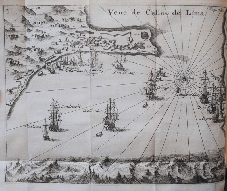
1716BB0841Paris: chez Jean-Geoffroy Nyon quay de Conti au coin de la rue Guenegaud au Nom de Jesus Etienne Ganeau rue Saint Jacques aux Armes de Dombes vis-à-vis la Fontaine de S. Severin Jacque Quillau imprimeur-juré-libraire rue Galande aux Armes de l'Université 1716. First Edition. A defective first edition missing one map and one plate of this classic in the literature of Pacific voyages of exploration. 4to: xiv2982pp with 35 of 37 maps plans and plates 18 of which are folding; ornamental engraved vignettes and woodcut musical notation in the text never bound in were the map of Détroit de le Maire no. v and the plate of Indiens en habits simples no. ix; plate xvi was bound in twice. Contemporary calf spine richly gilt in six compartments brown leather lettering piece gilt "Caissotti" in gilt script on upper board all edges stained red marbled end papers red silk page marker. An exceptional wide-margined copy text maps and plates fresh and clean marred only by a stain in the gutter of first three leaves. Provenance: copper-engraved bookplate "Il Cittadino / Carlo Giac. Caissotti." Sabin 25924. Borba de Moraes 328. Hill p. 115. Leclerc 1736. Palau 94964. Gibson's Library p. 128. Item #BB0841. Frézier set sail in 1712 with a French commission to assess the strength of Spanish settlements on the Pacific coast and to revise existing charts. According to Hill he "brought back information of considerable geographical and scientific value" to later navigators and his account is today appreciated for its keen observations of the customs commerce and natural history—including the cotton and strawberry plants—of Chile Peru and Tierra del Fuego. It's interesting to note that Frezier's surname was itself derived from fraise the French for strawberry. The chapters on Indian and Creole life include descriptions of costume and architecture as well as musical instruments. The folding plans of cities visited are often enhanced by panoramic views as in the case of Callao Concepción Valparaíso La Serena Salvador de Bahía and Angra Azores. Amongst the most important plates are the general map of the expedition the Strait of Lemaire Valdivia Bahía de an Vicente Santiago de Chile Lima and Bahía de Todos los Santos. An immediate success the work was soon translated into English and German and republished several times in the eighteenth century. N. B. With few exceptions always identified we only stock books in exceptional condition with dust jackets carefully preserved in archival removable mylar sleeves. All orders are packaged with care and posted promptly. Satisfaction guaranteed. Fine Editions Ltd is a member of the Independent Online Booksellers Association and we subscribe to its codes of ethics. chez Jean-Geoffroy Nyon, quay de Conti, au coin de la rue Guenegaud, au Nom de Jesus, Etienne Ganeau, rue Saint Jacques, aux Arm unknown
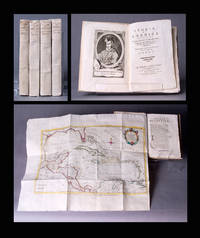
1783BB0692In Venezia Venice: Nella stamperia Gatti a spese di Leonardo e Giammaria Fratelli Bassaglia 1783. Original Wraps. Fine. Second Venice Edition of Antonio Pillori's translation of Robertson's standard work on the discovery of America and the conquest of Mexico and Peru. Demy 8vo 202 x 136mm: xxiv240pp with frontispiece portrait of Columbus and large folding map of Gulf of Mexico showing Florida Cuba Jamaica and farther Caribbean islands; 25-328pp with frontispiece portrait of Bartolomé de las Casas and folding map of South America; 23-359 p. 181 misnumbered "281"; p. 304 "204"1pp with frontispiece portrait of Cortés and folding map of Mexico; 42951pp with frontispiece portrait of Pizarro and large folding map of Middle America. Original paper-case bindings with yapped edges manuscript titles and volume numbers to spines text block sewn on tawed tongs vol. iv with modern replacements. Worming to upper cover portrait title page and map margins of vol. iv now expertly restored by a paper conservationist. A remarkably fresh wide-margined set in original paper-case bindings complete in four volumes eight books as issued with all four folding maps colored in outline by a contemporary hand as the John Carter Brown Library copy. Borba de Moraes p. 740-41 first edition. Sabin 71997 noting the Venice editions of 1778 and 1802 only. Originally published in two volumes in 1777 by Strahan and Cadell in London and Balfour in Edinburgh "to a very positive reception" ODNB; first Venice edition published in 1778. "Its success" according to the ODNB "was even more marked on the continent where it was considered Robertson's masterpiece . . . With its dramatic sweep of narrative combined with a provocative confrontation of two very different stages of civilization Spanish and Native American and a prose that was more flexible and evocative than that of his earlier books the History of America is often regarded as Robertson's most interesting original and even Romantic work. However it also shows the Eurocentric limits of his stadial thinking because it presents an unsympathetic account of Native Americans and glosses over Spanish atrocities." Borba de Moraes credits Roberston with writing the "first history of the discovery and Spanish conquest of America based on ample bibliographical information and documents in the Simancas archives. . . . The bibliography at the end of the second volume is remarkable for the time." Franklin D. Roosevelt owned the first Venice edition. N. B. With few exceptions always identified we only stock books in exceptional condition carefully preserved in archival removable mylar sleeves. All orders are packaged with care and posted promptly. Satisfaction guaranteed. Fine Editions Ltd is a member of the Independent Online Booksellers Association and we subscribe to its codes of ethics. Nella stamperia Gatti a spese di Leonardo e Giammaria Fratelli Bassaglia unknown
177432872NY: James Rivington. Good with no dust jacket. 1774. Hardcover. 18th Century; Maritime; 12mo 7" - 7½" tall; 2 17 1 4 2 260p pages; A New Voyage Round The World In The Years 1768 1769 1770 And 1771; Undertaken by Order of his present Majesty performed by Captain James Cooke In the Ship Endeavour Drawn up from his own Journal and form the Papers of Joseph Banks Vol I of 2. Contemp leather. Covers scuffed edgeworn lacking eps and both plates though small part of folding map is present. Foxed some stains. Upper blank margin of 2nd leaf roughly removed list of subscribers losses to printed area of pp67-68 amounting to a dozen words the normal tears to printed area of a few dozen leaves pencil sketches to rear flyleaf and inside of rear cover. Various old ink markings to title page. JCB Annuel Report for 1931 pp. 12-15; Sabin 30936; Evans 13324 Mitchell Library Cook 656; Holmes 9. 2 . Withal a rare and important American edition of Cook's first voyage. Rivington pirated this American edition to undercut the price of the London First Edition in the American market. . James Rivington hardcover
1787E0052<p>Two volumes: xv462 pages with two folding maps; xv430 pages with three folding plates. Octavo 8 1/4" x 5 1/4" bound in original full leather with black and red labels to spine lettered in gilt. translated from the French by an English gentleman who resided in America at that period ; with notes by the translator. Translated by G. Grieve Watt and Sabin ascribe the translation to J. Kent. Sabin 12229 First Irish edition.<br /><br />Chastellux was a military officer who served during the War of American Independence as a major general in the French expeditionary forces led by general Comte de Rochambeau. Being on general Rochambeau's staff for the duration of the war Chastellux acted as the principal liaison officer between the French commander in chief and George Washington. However the Chevalier de Chastellux was also widely recognized at the time of his campaigns in America as a highly talented man of letters and a member of the French Academy. After arriving in America in July 1780 Chastellux participated to the American Revolutionary War as Major General in the French expeditionary force led by general Rochambeau. During the following year he was third in command of the French forces engaged at the decisive Siege of Yorktown in 1781 where the British were ultimately defeated. Major General de Chastellux was fluent in English and with his strong ideological support of the American cause he served the alliance well. During the latter part of the campaign he was the principal liaison officer between George Washington and French general Rochambeau. Thereafter Chastellux remained a personal friend of George Washington for life. Furthermore the College of William and Mary and the University of Pennsylvania also awarded Chastellux with honorary degrees. After his return to France Chastellux also remained in contact with Thomas Jefferson now the American representative in Paris whom he had previously visited on his Virginia estate at Monticello.<br /><br /><strong>Condition:</strong><br /><br />Title page clipped at top corner first fold out map repaired map edges repaired hinges repaired previous owner's names on front paste downs and content pages else a good set.</p> Printed for Messrs. Colles, Moncrieffe, White, H. Whitestone, Byrne, Cash, Marchbank, Heery, and Moore hardcover
1717E01353559index pages 36 of 37 maps and copper cuts of the coasts harbor cities plants and other curiosities comprising: 14 plates 3 folding 22 maps charts or plans 14 folding. title page printed in red and black. Printed from the author's original plates inserted in the Paris edition. Lacks the frontispiece map. Royal octavo 9 3/4" x 7 3/4" bound in leather with raised spine bands and red label with gilt lettering. Postscript by Dr Edmund Halley and an account of the settlement commerce and riches of the Jesuits in Paraguay. Palau 94965 Sabin 25926 Nissen ZBI 1433 Hill p117 First English edition.<br /><br />Frézier was educated in Paris and served as lieutenant of infantry from 1702 til 1707 when he entered the engineer corps. In 1712 the government sent him to examine the condition of the Spanish colonies in America. After visiting the principal points in Peru Chili and Brazil he returned to Marseilles. He pointed out several mistakes in the "Relation" of Father Feuille and this led to a bitter controversy between the two travelers. Frézier introduced the large Chili strawberry into France. First published in France in 1714. The first edition into English is preferable to the French original "because it contains Halley's. postscript which corrects certain geographical errors made by Frézier" Hill. "The first part of this book gives an interesting account of the voyage from France around Cape Horn. The second part relates to the voyage along the coasts of Chile and Peru describing the chief towns and cities. Frézier a man of observation brought back information of considerable geographical and scientific value. Much data is included about the native inhabitants.<br /><br />Condition:<br /><br /> Rebacked with original spine label laid down; lacking frontispiece map and binder's leaf free endpapers renewed intermittent foxing else a very nice copy. Jonah Bowyer hardcover
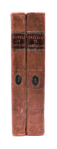
1790029884<p>London: J. Johnson 1790. Volume I: folding map xvi 283 pages; volume 2: viii 408 pages. De Lesseps accompanied La Perouse on the first part of his attempted circumnavigation of the globe. After investigation of the west coast of North America La Perouse sent de Lesseps overland to take the journals and maps of the expedition to Paris. La Perouse and his ships subsequently were lost after they left Australia and the journals carried by de Lesseps assumed great historical significance when published. Even more scarce than those records today are de Lesseps' report of his own overland travels through the Kamtschatka peninsula. The report also includes 25 pages of vocabulary translating common English words into Russian Kamtschadale Koriac Tchouktchi and Lamont languages. Internally clean with only minor foxing the two volumes in 3/4 leather over marbled paper covered boards have recently been sympathetically rebacked original title and volume patches retained. Very attractive example of a quite scarce title. Howes L269 Howes & Hartley rate this item dd "superlatively rare". First English Language Edition. Hardcover. Collectible-Very Good . 8vo - over 7¾" - 9¾" tall. Book.</p> J. Johnson hardcover
1733E0553<p>2 volumes. 8xxiv616471 pages with 4 maps ad view one folding and 3 plates one folding; 2693892 pages with 1 map and 6 plates. Quarto 10 1/4" x 10 1/4" bound in half leather with raised spine bands and gilt lettering to spine over marbled boards. Borba de Moraes page I:453; European Americana 733/146; Sabin 38591 First edition.<br /><br />Joseph-François Lafitau was a French Jesuit missionary ethnologist and naturalist. He is best known for his use of the comparative method in the field of scientific anthropology the discovery of ginseng and his writings on the Iroquois. Lafitau was the first of the Jesuit missionaries in Canada to have a scientific point of view. Lafitau is considered the first of the modern ethnographers and a precursor of scientific ethnology for his work on the Iroquois. He developed a model of studying peoples that involved describing existing cultures on their own terms—not in comparison to European society. He distinguished generic and specific traits transforming the "generic savage" into specific tribal groups. He explained that "only from specific identities can genetic relations be inferred." Furthermore he was the first to declare "contemporary primitive cultures throw light upon the culture of ancient people and vice versa. Lafitau is remembered for applying the comparative method with a greater level of competency than any of his contemporaries. Through original field observations he was able to critique the works of earlier writers on Primitive peoples. By using the Comparative Method Lafitau rejected all theories of social and cultural change and instead used his study to demonstrate the similarities in customs practices and usages of the Native North Americans with diverse peoples from different continents and centuries. He consistently relied on the doctrine of degeneration: all men originally shared one religion with one God but over time as people migrated to separate margins of the earth where they then lost touch with the values and traditions of this one true religion and culture. Therefore Lafitau believed in the "psychic unity of mankind" and the doctrine of primitive monotheism. His major work written in French was first published in 1724 in Paris. It is entitled <em>Customs of the American Indians Compared with the Customs of Primitive Times</em> <em>Moeurs des Sauvages Amériquains Comparées aux Moeurs des Premiers Temps</em> and is 1100 pages in total. In 1974 William Fenton and Elizabeth Moore made the first translation into English available.</p><p>Lafitau published two other works. One <em>Histoire de Jean de Brienne Roy de Jérusalem et Empereur de Constantinople</em> Paris 1727 was released before he returned to Canada; it is little known and seldom seen. A two-volume <em>Histoire des découvertes et conquestes des Portugais dons le Nouveau Monde . . .</em> 1733 appeared after he came home to France. Frequently found in libraries it is not just a compilation of original sources but an attempt to make available to French readers a story of exploration and adventure otherwise denied to them; in the chronicles he sees a long development of customs hitherto unnoticed such as he had reported in the <em>Mœurs</em>; from them understood only he says in the original languages of the people who practice them he builds his "system" or philosophy of history and once more he is concerned too with the relation between custom and natural history or ecology.<br /><br /><strong>Condition:</strong><br /><br />Beautifully rebound in half leather. Faint dampening to second volume; early owner's signatures on title pages inked stamps of St Charles Borromeo Seminary on front paste-downs and first title page lacks frontispiece else a very good to fine set.</p> Chez Saugrain pere, quai des Augustins, au coin de la rue Chez Saugrain pere, quai des Augustins, au coin de la rue Pavee, a la hardcover
1799biblio160<p><strong>First French edition of Bartram's</strong><strong> Travels which chronicled his explorations of the southern British colonies in North America from 1773–1777</strong><br /><br />2 volumes. 457 pages with frontispiece engraved portrait by Bovinet Mico Chlucco Grana King of the Seminoles and one folding plate; 436 pages without title with large folding map by J.B. Poirson engraved by Alexandre Blondeau and folding plate. Octavo 8 1/4" x 5 1/4" bound in half leather with six spine compartments with red and black labels in gilt over original marbled boards. Translated by Pierre Vincent Benoist. Sabin 3871; Palau 251346; Howes B223; Field 94 First French edition.<br /><br />William Bartram was an American naturalist. The son of the naturalist John Bartram. As a boy he accompanied his father on many of his travels to the Catskill Mountains the New Jersey Pine Barrens New England and Florida. In 1773 he embarked upon a four-year journey through eight southern colonies. Bartram made many drawings and took notes on the native flora and fauna and the native American Indians. In 1774 he explored the St. Johns River where he had memorable encounters with aggressive alligators and also visited a principal Seminole village at Cuscowilla where his arrival was celebrated with a great feast. He met Ahaya the Cowkeeper chief of the Alachua band of the Seminole tribe. When Bartram explained to the Cowkeeper that he was interested in studying the local plants and animals the chief was amused and began calling him Puc Puggy the flower hunter. Bartram continued his explorations of the Alachua Savannah or what is today Paynes Prairie. William Bartram wrote of his experiences exploring the Southeast in his book Travels through North & South Carolina East & West Florida the Cherokee Country the Extensive Territories of the Muscogulges or Creek Confederacy and the Country of the Chactaws Containing an Account of the Soil and Natural Productions of Those Regions Together with Observations on the Manners of the Indians published in 1791 and which is today simply known as Bartram's Travels. It was considered at the time one of the foremost books on American natural history. Many of Bartram's accounts of historical sites were the earliest records including the Georgia mound site of Ocmulgee. In addition to its contributions to scientific knowledge Travels is noted for its original descriptions of the American countryside. Bartram's writing influenced many of the Romantic writers of the day. William Wordsworth Samuel Taylor Coleridge and François René de Chateaubriand are known to have read the book and its influence can be seen in many of their works. Ephraim George Squier and Edwin Hamilton Davis in their book <em>Ancient Monuments of the Mississippi Valley</em> name Bartram as "the first naturalist who penetrated the dense tropical forests of Florida."<br /><br /><strong>Condition:</strong><br /><br />Some rubbing to original boards page 143 of volume one has small burn mark affecting text half title bound upside down in back old water stain to plate of volume two. Fold-out map has repair to first fold internally pages are clean and free of toning and foxing else a very good copy.</p> Chez Carteret et Brosson and Dogour Duran hardcover
1799biblio160<b>First French edition of Bartram's</b><b> Travels which chronicled his explorations of the southern British colonies in North America from 1773–1777</b><br /><br />2 volumes. 457 pages with frontispiece engraved portrait by Bovinet Mico Chlucco Grana King of the Seminoles and one folding plate; 436 pages without title with large folding map by J.B. Poirson engraved by Alexandre Blondeau and folding plate. Octavo 8 1/4" x 5 1/4" bound in half leather with six spine compartments with red and black labels in gilt over original marbled boards. Translated by Pierre Vincent Benoist. Sabin 3871; Palau 251346; Howes B223; Field 94 First French edition.<br /><br />William Bartram was an American naturalist. The son of the naturalist John Bartram. As a boy he accompanied his father on many of his travels to the Catskill Mountains the New Jersey Pine Barrens New England and Florida. In 1773 he embarked upon a four-year journey through eight southern colonies. Bartram made many drawings and took notes on the native flora and fauna and the native American Indians. In 1774 he explored the St. Johns River where he had memorable encounters with aggressive alligators and also visited a principal Seminole village at Cuscowilla where his arrival was celebrated with a great feast. He met Ahaya the Cowkeeper chief of the Alachua band of the Seminole tribe. When Bartram explained to the Cowkeeper that he was interested in studying the local plants and animals the chief was amused and began calling him Puc Puggy the flower hunter.2 Bartram continued his explorations of the Alachua Savannah or what is today Paynes Prairie. William Bartram wrote of his experiences exploring the Southeast in his book Travels through North & South Carolina East & West Florida the Cherokee Country the Extensive Territories of the Muscogulges or Creek Confederacy and the Country of the Chactaws Containing an Account of the Soil and Natural Productions of Those Regions Together with Observations on the Manners of the Indians published in 1791 and which is today simply known as Bartram's Travels. It was considered at the time one of the foremost books on American natural history. Many of Bartram's accounts of historical sites were the earliest records including the Georgia mound site of Ocmulgee. In addition to its contributions to scientific knowledge Travels is noted for its original descriptions of the American countryside. Bartram's writing influenced many of the Romantic writers of the day. William Wordsworth Samuel Taylor Coleridge and François René de Chateaubriand are known to have read the book and its influence can be seen in many of their works. Ephraim George Squier and Edwin Hamilton Davis in their book Ancient Monuments of the Mississippi Valley name Bartram as "the first naturalist who penetrated the dense tropical forests of Florida."<br /><br />Condition:<br /><br />Some rubbing to original boards page 143 of volume one has small burn mark affecting text half title bound upside down in back old water stain to plate of volume two. Fold-out map has repair to first fold internally pages are clean and free of toning and foxing else a very good copy. Chez Carteret et Brosson and Dogour Duran hardcover books
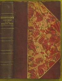
1711E0013iixxixvii1911blank 223 pages with 1 of 3 large fold out maps and 15 of 19 engraved fold out plates. Octavo 8" x 5" bound three quarter leather with raised spine bands and gilt lettering to spine over marbled boards. Edited by Sir Tancred Robinson. Second edition preferred over the first edition "because it has the chart of the western and southern oceans." Hill In 1699.<br /><br />First published in 1694 which contained only two maps The book is important because it contains one of the earliest English accounts of Abel Janszoon Tasman's famous voyage of 1642 from Batavia during which he discovered Tasmania and New Zealand and visited Tonga and Fiji Hill 1475.<br /><br />Rear Admiral Sir John Narborough RN was an English naval commander of the 17th century who served with distinction during the Anglo-Dutch Wars and against the Barbary Coast pirates. He was descended from an old Norfolk family. He received his commission in 1664 and in 1666 was promoted lieutenant for gallantry in the action with the Dutch fleet off the Downs in June of that year. After the peace he was chosen to conduct a voyage of exploration in the South Seas. He set sail from Deptford on November 26 1669 and entered the Straits of Magellan in October of the following year. In 1670 he visited Port Desire in Argentina and claimed the territory for the Kingdom of Great Britain but returned home in June 1671 without accomplishing his original purpose. A narrative of the expedition was published at London in 1694 under the title <i>An Account of several late Voyages and Discoveries to the South and North</i>. During the Third Anglo-Dutch War Narborough was second captain of the Lord High Admiral's ship the Prince and conducted himself with such conspicuous valor at the battle of Solebay Southwold Bay in May 1672 that he won special approbation and shortly afterwards was made rear-admiral and knighted. In 1675 he was sent to suppress the Tripoline piracies and by the bold expedient of dispatching gun-boats into the harbor of Tripoli at midnight and burning the ships he induced the them to agree to a treaty. Shortly after his return he undertook a similar expedition against the Algerians. In 1680 he was appointed commissioner of the Navy an office he held till his death. He was buried at Knowlton church Kent where a monument has been erected to his memory. The island of Fernadina the youngest and westernmost island of the Galapagos Archipelago was originally named 'Narborough Island' in his honor by the 17th century buccaneer William Ambrosia Cowley.<br /><br /><b>Condition:</b><br /><br />Marginal foxing soiling and damp staining through out paper fault across second C2 affecting one letter some rubbing hinges and corners else a better than good copy. Printed for D Brown hardcover books
1733E05532 volumes. 8xxiv616471 pages with 4 maps ad view one folding and 3 plates one folding; 2693892 pages with 1 map and 6 plates. Quarto 10 1/4" x 10 1/4" bound in half leather with raised spine bands and gilt lettering to spine over marbled boards. Borba de Moraes page I:453; European Americana 733/146; Sabin 38591 First edition.<br /><br />Joseph-François Lafitau was a French Jesuit missionary ethnologist and naturalist. He is best known for his use of the comparative method in the field of scientific anthropology the discovery of ginseng and his writings on the Iroquois. Lafitau was the first of the Jesuit missionaries in Canada to have a scientific point of view. Lafitau is considered the first of the modern ethnographers and a precursor of scientific ethnology for his work on the Iroquois. He developed a model of studying peoples that involved describing existing cultures on their own terms—not in comparison to European society. He distinguished generic and specific traits transforming the "generic savage" into specific tribal groups. He explained that "only from specific identities can genetic relations be inferred."5 Furthermore he was the first to declare "contemporary primitive cultures throw light upon the culture of ancient people and vice versa. Lafitau is remembered for applying the comparative method with a greater level of competency than any of his contemporaries. Through original field observations he was able to critique the works of earlier writers on Primitive peoples. By using the Comparative Method Lafitau rejected all theories of social and cultural change and instead used his study to demonstrate the similarities in customs practices and usages of the Native North Americans with diverse peoples from different continents and centuries. He consistently relied on the doctrine of degeneration: all men originally shared one religion with one God but over time as people migrated to separate margins of the earth where they then lost touch with the values and traditions of this one true religion and culture. Therefore Lafitau believed in the "psychic unity of mankind" and the doctrine of primitive monotheism. His major work written in French was first published in 1724 in Paris. It is entitled <i>Customs of the American Indians Compared with the Customs of Primitive Times</i> <i>Moeurs des Sauvages Amériquains Comparées aux Moeurs des Premiers Temps</i> and is 1100 pages in total. In 1974 William Fenton and Elizabeth Moore made the first translation into English available. Lafitau published two other works. One <i>Histoire de Jean de Brienne Roy de Jérusalem et Empereur de Constantinople</i> Paris 1727 was released before he returned to Canada; it is little known and seldom seen. A two-volume <i>Histoire des découvertes et conquestes des Portugais dons le Nouveau Monde . . .</i> 1733 appeared after he came home to France. Frequently found in libraries it is not just a compilation of original sources but an attempt to make available to French readers a story of exploration and adventure otherwise denied to them; in the chronicles he sees a long development of customs hitherto unnoticed such as he had reported in the <i>Mœurs</i>; from them understood only he says in the original languages of the people who practice them he builds his "system" or philosophy of history and once more he is concerned too with the relation between custom and natural history or ecology.<br /><br /><b>Condition:</b><br /><br />Beautifully rebound in half leather. Faint dampening to second volume; early owner's signatures on title pages inked stamps of St Charles Borromeo Seminary on front paste-downs and first title page lacks frontispiece else a very good to fine set.<br /> Chez Saugrain pere, quai des Augustins, au coin de la rue Chez Saugrain pere, quai des Augustins, au coin de la rue Pavee, a la hardcover books
1790E00534 of 6 volumes. Volume 1: i-ix-372 pages with 23 plates including frontispiece plate of Cook and 4 folding maps; Volume II lacking; Volume 3: 793-1184 pages with 11 plates including frontispiece of Possession Bay and 5 fold out maps; Volume IV: 1185-1546 pages with 26 plates including frontispiece of Woman Child and Man of Van Diemen's Land and 6 folding maps; Volume V: 1547-1938 pages with 30 plates including frontispiece of A View of Huaheine and 8 folding maps; Volume VI lacking. Octavo 8 1/2" x 5 1/2" bound in original full leather with red labels to spine with gilt lettering. Abridged by George William Anderson. An earlier Large folio edition by Anderson was published earlier. This edition originally issued in 80 weekly parts and also called the Large octavo edition. M K Beddie: 39 First edition of the bound edition.<br /><br />Captain James Cook RN was a British explorer navigator and cartographer ultimately rising to the rank of Captain in the Royal Navy. Cook made detailed maps of Newfoundland prior to making three voyages to the Pacific Ocean during which he achieved the first European contact with the eastern coastline of Australia and the Hawaiian Islands as well as the first recorded circumnavigation of New Zealand. Cook joined the British merchant navy as a teenager and joined the Royal Navy in 1755. He saw action in the Seven Years' War and subsequently surveyed and mapped much of the entrance to the Saint Lawrence River during the siege of Quebec. This helped bring Cook to the attention of the Admiralty and Royal Society. This notice came at a crucial moment both in his personal career and in the direction of British overseas exploration and led to his commission in 1766 as commander of HM Bark Endeavour for the first of three Pacific voyages. Cook charted many areas and recorded several islands and coastlines on European maps for the first time. His achievements can be attributed to a combination of seamanship superior surveying and cartographic skills courage in exploring dangerous locations to confirm the facts for example dipping into the Antarctic Circle repeatedly and exploring around the Great Barrier Reef an ability to lead men in adverse conditions and boldness both with regard to the extent of his explorations and his willingness to exceed the instructions given to him by the Admiralty. Cook was killed in Hawaii in a fight with Hawaiians during his third exploratory voyage in the Pacific in 1779.<br /><br />Condition:<br /><br />Lacks volume II and VI. First signature of volume one loose inner hinges cracked some interior soiling spine ends and corners of leather rubbed some scuffing to leather else a good set. Printed for A Millar, W Law, and R Cater hardcover books