Biblio.com

502 résultats
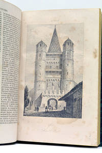
1857000151London: J.B. Nichols and Sons 1857. Hardcover. See Description. Tall 4to. pp. viii 2 508. Volume XXVII. 12 plates including several in color and 2 folding maps one map is folded in six sections and backed with thin gauze or mull. B&W illustrations with the text. Pages are generally clean with a couple small marginal tears. Light brown cloth; re-backed preserving part of the original spine minus 25mm at the tail and 15mm at the top. Inner hinges neatly strengthened. Some rubbing and wear; corners bumped. Contents include: An accound of the discovery of Anglo-Saxon remains at Kemble in North Wilts; On choirs and chancels particularly as to their use in the South of Europe; Remarks on some early churches in France and Switzerland partly in the time of Charlemagne; The City of Cumae and the recent excavations there; An account of the investigation of some remarkable circular trenches and the discovery of an ancient British cemetery at Stanlake Oxon.; The Burning and burial of the dead.and many other articles. <br/> <br/> J.B. Nichols and Sons hardcover
H921Wien Tempsky/ Gerold/ Hˆlder 1892-1931. Reihe 1-5: ÷stliches Mittelmeer; ab Reihe 6: Rotes Meer und weiterf¸hrend ˆstliches Mittelmeer endet mit Reihe 11; in Reihe 9 gab es nur Berichte ¸ber das Rote Meer. Alle Reihen in den Jahresb‰nden der Denkschriften der k.k. Akademie der Wissenschaften. Meist in Original-Leinenb‰nden bzw. in Original-Broschur sehr guter Zustand. Genaue Auflistung der Forschungsergebnisse und Publikation in Kainbacher S.358-362. - Eine der groflen Tiefsee-Expeditionen gegen Ende des 19. Jahrhunderts waren die ÷sterreichischen Expeditionen des S.M. Schiffes "Pola" in das ˆstliche Mittelmeer bis 1894 und nachfolgend in 2 Reisen in das nˆrdliche und s¸dliche Rote Meer 1895/98. Die Publikation der wissenschaftlichen Ergebnisse dieser Expeditionen liegen hier vollst‰ndig vor. Der Schwerpunkt lag auf der zoologischen Erforschung daneben gab es aber auch umfangreiche meteorologische geod‰tische geologische botanische chemische und physikalische Untersuchungen Wasserproben etc. Neben der Tiefsee wurden auch die K¸sten von S¸darabien Jemen Sokotra Sudan ƒgypten Arabien Levante Kleinasien und Libyen besucht und erforscht. Die Publikation ist mit groflem wissenschaftlichem und verlegerischem Aufwand hervorragendes Karten- und Abbildungsmaterial ¸ber einen Zeitraum von fast 40 Jahren in kleiner Auflage f¸r wissenschaftliche Kreise und Bibliotheken herausgegeben worden. unknown
1922314367Ottawa: F. A. Acland 1922. 5 of 12 parts comprised of the Introduction Preface and errata and parts A B and G. With a duplicate of the Preface part. 5 vols. 8vo. Three in original wrappers. 5 of 12 parts comprised of the Introduction Preface and errata and parts A B and G. With a duplicate of the Preface part. 5 vols. 8vo. Five individual parts from Volume III of the official reports of the Expedition organized and led by Vilhjalmur Stefansson. <br/><br/> F. A. Acland unknown
1923321730Ottawa: F. A. Acland 1923. Vol XII Part B: Physical Characteristics 12 photographic plates. Vol. XII Part C: Osteology: 9 plates. 2 vols. 8vo. Publisher's lettered wrappers. Vol XII Part B: Physical Characteristics 12 photographic plates. Vol. XII Part C: Osteology: 9 plates. 2 vols. 8vo. Two individual wrappered parts from the official reports of the Expedition organized and led by Vilhjalmur Stefansson. Vol. XII part B on the physical characteristics of the Copper River Eskimos by D. Jenness is particularly noteworthy due to its portraits of the aboriginal peoples encountered. <br/><br/> F. A. Acland unknown
1928321731Ottawa: F. A. Acland 1928. Vol XII Part B: Physical Characteristics 12 photographic plates. Vol. XII Part C: Osteology: 9 plates. 3 vols. 8vo. Publisher's lettered wrappers. One part lacking upper wrapper. Vol XII Part B: Physical Characteristics 12 photographic plates. Vol. XII Part C: Osteology: 9 plates. 3 vols. 8vo. Three individual wrappered parts from the official reports of the Expedition organized and led by Vilhjalmur Stefansson. Vol. XII part B on the physical characteristics of the Copper River Eskimos by D. Jenness is particularly noteworthy due to its portraits of the aboriginal peoples encountered. <br/><br/> F. A. Acland unknown
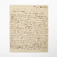
1854369733Palmas Panama 1854. 2pp. single 4to sheet. With: Carte-de-visite photograph of Mayo signed and inscribed to his sister on verso. Folds minor separations. 2pp. single 4to sheet. With: Carte-de-visite photograph of Mayo signed and inscribed to his sister on verso. Seeking a low-level train or canal route to bridge the Atlantic and Pacific Oceans in late 1853 President Franklin Pierce ordered a U.S. Naval exploring expedition to participate in an international attempt affiliated with a venture by the Atlantic and Pacific Junction Company. Although ships from Great Britain New Grenada and the United States were involved the principle overland portion of the expedition through 40 miles of dense jungle would be led by Lieutenant Isaac G. Strain who had previously led exploring expeditions in Brazil Baja California and Chile. With a party of 27 officers and men and including the author of the present letter they entered the jungle on January 20 1854.<br /> <br /> Problems began almost immediately. While puting ashore a boat was swamped and a portion of the party's provisions lost. Next the route Strain had been tasked with following contained no gap in the cordillera as had been previously believed. Led through the jungle by several groups of indigenous people the promise of a few days hike turned into months of wandering in the jungle before being abandoned by the guides. Subsisting on plantains and bananas and drinking river water Stain divided his men with an advance party striking out to seek rescue. On March 9 forty-nine days after starting from Caledonia Bay Strain and his advance party reached Yavisa; it would be another nearly three weeks before the main body was rescued but not before at least five had died of starvation or disease. Sometimes compared with the trials of the crew of the Essex or the members of the Donner Party the men on the Darien expedition endured extreme harship and resorted to unspeakable things. <br /> <br /> This remarkable letter was written by one of the expedition's survivors shortly after his rescue and return to civilization. George Upshur Mayo 1834-1896 was born into a prominent family in Norfolk VA. He attended the Virginia Military Institute served as an assistant engineer on the Strain Expedition was involved in the United States Geodetic Survey and was later a major in the Confederate Army. Here he writes:<br /> <br /> "My dear father From this filthy native village where our party are brought by the officers of the war steamer Virago English whose officers rescued us from a most deplorable condition starvation misery & want for about 70 days without bread or meat living on roots & nuts from the trees. May the rescue be never forgotten & I thank & give praises to God for his goodness. We abandoned & buried 4 or 5 in the woods as unable to keep up. I suffered from the cusano a worm that gets in the flesh also from a very bad knee. Almost unable to travel 3 miles a day. Unfavorable reports reached the U.S. concerning us. We are safe & go to Panama when we get well. My mind is out of sorts by medicine & sickness & my hand too weak to write more legibly. Will write from Panama or Aspinwall a respectable letter there. We are 100 miles from Panama. Had the party 8 days provisions only in the woods yet nothing to shield us from wind & storm & no change of garments. The suffering was intense & the rescue came at the most dreadful & important for our safety. I with 3 others on the river bank washing at sundown when the canoes came in sight. Captain Strain had no pants or underdraws to protect him from the briars & vermin. God be praised for rescue. Love to Annie. . . . In all probability will meet the Cyane at Aspinwall."<br /> <br /> A remarkable first-hand account of a desperate struggle for survival. unknown
a26142Cambridge 1935.Volume 1 General Ethnography. Hardcover. 4to. 421pp. 11 full page photo plates on glossy stock brown buckram cloth. FINE. clean bright; no owner marks no DJ. no ownership marks. Volume 1 only. . hardcover
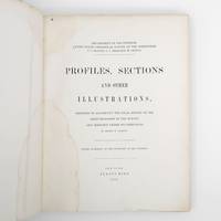
1872373132New York: Jules Bien 1872. First edition. Limited to 100 copies. 65 lithographed plates many folding preceded by 4pp. text. 4to. Original green cloth boards upper cover lettered in gilt rebacked endpapers renewed. Dampstaining. First edition. Limited to 100 copies. 65 lithographed plates many folding preceded by 4pp. text. 4to. This book was prepared to illustrate the work of the Hayden survey. It contains numerous panoramic illustrations many on folding sheets depicting sites in Wyoming Utah Colorado and Montana. This report contains the bulk of Henry Wood Elliott's art work for the Hayden Survey see preceding entry most of which was published nowhere else. These images are important because of their scientific contribution to several fields historical significance documentation of the Hayden expedition and their beauty and attention to detail. Elliott's illustrations were among the early images of many locations in the new territories of the West.<br /> <br /> From an edition of 100 copies issued in advance of the text. The Prefatory Note states p. 3: "A small edition of one hundred copies of the Profiles and Sections are issued in advance of the text for the purpose of placing them in the hands of the principal geologists in this country and in Europe. The first issue of two thousand copies in colors will be published with descriptions in about one year." We find no evidence that a subsequent edition in color was ever printed and it is stated of the present work in the Checklist of United States Public Documents 1789-1909 Washington: Government Printing Office 1909: "Originally intended to illustrate v. 4 of quarto series of reports but never thus used." <br /> <br /> The Hayden Survey was the most important of the four major government surveys of the American West undertaken after the Civil War the others being Powell King and Wheeler. Collectively these surveys filled in the map of the United States using accurate scientific methods to chart the land and investigate not only its geology but natural resources wildlife and plants as well. Schmeckebier Catalogue and Index of the Publications of the Hayden King Powell and Wheeler Surveys p. 32 #3 Jules Bien unknown
188473300Washington: Government Printing Office 1884. First edition. Octavo. 75 1 pp. plus folding map of the Lena Delta in Russia and four full page heliotypes. Original blue printed wrappers. Small piece missing from outer edge of front wrapper three small and excellent paper repairs to wrappers. A very good and very clean copy in the original wrappers.The heliotypes in this publication are particularly interesting as they show Russian soldiers guarding the graves of the Jeannette crew. The final photograph shows all the coffins loaded into a Russian train."In February 1882 Secretary Thompson had despatched naval lieutenants Giles Harber and William Schuetze to the delta to search for any traces of the lost explorers particularly of Chipp's party. They were unsuccessful but in November received orders from the secretary to supervise the return of the bodies of De Long and his comrades to the United States. Weather and bureaucracy delayed them for a year; finally in November 1883 the bodies were taken from Yakutsk by train to Moscow Berlin and finally Hamburg. Here they were placed on board the U.S. steamer Frisia which arrived in New York in February 1884. The funeral cortège was escorted by naval and military detachments to the Church of the Holy Trinity on Madison Avenue for a memorial service. Afterwards the bodies of Ambler Collins and Boyd were claimed for private burial; those of De Long and six others were taken to Woodlawn Cemetery in the Bronx and buried together there. In October 1890 a large monument to the expedition's dead was unveiled at the United States Naval Academy in Annapolis. Its design is based on the original cairn and cross raised at the burial site on the Lena Delta." Wiki [Government Printing Office] unknown
180272327London: A. Arrowsmith 1802. A fine and high quality facsimile of this seminal map commissioned in 2001 by renown Lewis & Clark collector Roger Wendlick. Backed on canvas and measuring 150 x 58 inches in color Wendlick commissioned the firm of Ford Graphics of Portland to make this map. Only 21 copies were made and this is the last one with a letter from Wendlick attesting to this fact. Fine. "The 1802 revision of the map of North America on display delineates the complete length of the Missouri River as well as Mackenzie's journey to the Pacific in 1793. The depiction of the Missouri headwaters which Arrowsmith studied from Peter Fidler's drawing of a map by the Blackfoot Indian Ac Ko Mo Ki shows several streams joining into two branches of the Missouri which flow almost due east. The southern branch of the Missouri appears to be the main branch of the river and connects to the Knife River; the northern branch is a good representation of the actual course of the Missouri.Although the revised map still shows a single ridge of mountains in the west a note near the southern sources of the Missouri states: "Hereabout the Mountains divide into several low Ridges." This note which was based on the reports of Fidler Mackenzie and Thompson was more encouraging to Jefferson and Lewis than the note about the Stony Mountains on the 1795 map which unfortunately turned out to be more accurate. Arrowsmith's map situates the Great Lake River on the western slopes of the mountain range and connects this river to the Columbia River with a dotted line. Since another note claims that this river can be descended to the sea in eight days the Arrowsmith map supported the erroneous belief in a convenient route to the Pacific Ocean.Both the 1795 and 1802 versions of Arrowsmith's map served as resources that Nicholas King consulted as he prepared his map for the Lewis and Clark Expedition. Lewis and Clark in fact carried the 1802 Arrowsmith map along on the expedition. Thomas Jefferson owned the 1802 map as well as an 1802 edition of Arrowsmith's map of the United States. Arrowsmith's 1802 map of North America was the most comprehensive map of the West available to Jefferson and Lewis and it was probably the most important map used in the planning of the expedition." University of VirginiaAaron Arrowsmith's 1802 map was the most current and accurate cartographic representation of the American West available to Lewis on the eve of the journey. Lewis studied this edition closely during the summer of 1803 and even carried a copy on the first leg of the expedition. Among Arrowsmith's sources were Indian maps reports and manuscript maps from the British fur trade and British Navy exploration reports and charts of the Pacific Coast. But various elements in the map reinforced Jefferson's misconceptions of western geography among these were depictions of the Rocky Mountains as a single long chain and the headwaters of the upper Missouri River at the eastern edge of the Rockies suggesting those mountains were readily portaged. A. Arrowsmith unknown
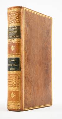
1810ST20849Paris: Chez Arthus-Bertrand 1810. First Edition in French. 205 x 128 mm. 8 x 5". xviii 443 1 pp.Translated into French by A. J. N. Lallemant. <br/> Contemporary flamed sheep covers with thick and thin gilt rule border smooth spine divided into panels by metope and pentaglyph roll panels either with rows of interlocking gilt circles or a gilt compass ornament two black morocco labels marbled endpapers. Folding engraved map by J. B. Tardieu. Wagner-Camp-Becker 6:3; Howes G-77; Sabin 26742; Graff Collection 1519; Wheat Trans-Mississippi 300. Very small loss to head of rear joint boards faintly abraded but the binding entirely solid and pleasing; a handful of leaves with small marginal tears or paper flaws one slightly larger but not affecting text approximately one-third of volume very mildly browned other trivial imperfections but still an excellent copy extremely clean and fresh internally.<br/> <br/> Issued three years after the original English text this is the initial printing in French—and the first in any foreign language—of an important firsthand account of the Lewis and Clark voyage of discovery written by a key figure both during and after the company’s undertaking; it is also and crucially the first edition to include a map of the expedition. Tardieu's map the first to mention the names Lewis and Clark noted important landmarks on the journey including the formidable Rocky Mountains the Columbia River and Fort Clatsop on the Pacific Coast where the expedition spent the winter of 1805-06. Our French edition also adds two letters of Clark not appearing in other editions of Gass—one to William Henry Harrison 2 April 1805 from Fort Mandan and one to Clark’s brother 23 September 1806 on the day the six-month return journey came to an end. Wheat observes that this work held special interest for the French as it provided much information about lands that had until the Louisiana Purchase been part of their domain. A carpenter by training Patrick Gass 1771-1870 was in charge of constructing winter accommodations for the party and his knowledge of building informs his observations here about forts and native architecture. This account was based on journals he kept during the explorations and it was an immediate success upon its first publication in Pittsburgh in 1807. The American public was hungry for information about the Western frontier and their curiosity was shared by Europeans particularly those considering emigration to the New World. Wagner-Camp observes that Gass "became one of the best-known members of the expedition for several reasons: his key role as sergeant brought his name up frequently in the journals of Lewis and Clark; his account was the first to be published; he was the first to have a biography written about him; and finally he outlived the other members of the Corps of Discovery by decades" dying at the age of 98. . Chez Arthus-Bertrand unknown
186454080Berlin Decker 1864-73. Lex8vo. 3 contemp. hcalf. Gilt spines and with gilt lettering. Spines slightly rubbed. XXII4352;VI4375;XI4426 pp. 24 engraved plates and 3 folded maps. Faint brownspots to margins in volume 1. <br/><br/><em>First edition. The offered volumes contains the general description of the expedition which relates to Japan and China. They do not comprise the scientific parts zoology botany of the expedition and not the landscape plates published as "Ansichten aus Japan China und Siam". </em> unknown
1857324349New Haven 1857. Separately-issued offprint from the American Journal of Science and Arts 2nd series Vol. xxiv July 1857. 21-38 pp. plus folding map. 8vo. Period plain green wrappers stitched. Separately-issued offprint from the American Journal of Science and Arts 2nd series Vol. xxiv July 1857. 21-38 pp. plus folding map. 8vo. "Redfield's last contribution to meteorological science was a memoir upon the cyclones or typhoons of the north Pacific Ocean prepared at the request of Commodore Perry to accompany his Narrative of the United States Expedition to Japan; and was printed in the second volume of that work . He showed that the hurricanes of the Pacific followed the same general laws as those of the Atlantic and traced the paths of several remarkable storms among which was one of great force encountered by the steamer 'Mississippi' one of the vessels of Commodore Perry's squadron on route from Simoda to the Sandwich Islands in October 1854" Recollections of John Howard Redfield p. 302. Page 37 includes a description of the Kona or southerly winds of Hawaii as well as the effects of cyclones on the Hawaiian islands.<br /> <br /> Following its publication within Perry's Narrative in 1856 the work was issued in a slightly more condensed form within the July 1857 issue of the American Journal of Science and Arts. The present separately-issued offprint from the AJSA is the only separately-issued edition of the work. Scarce. Sabin 68512. Not in Forbes unknown
56216Paris Didot 1846. 4 feuillets. 460 pages. 1 carte dépliante. 91 planches hors-texte. 215x18 Cm. Cartonnage vert de lépoque. Dos lisse. Titre doré. Coins émoussés. Plats un peu frottés. Ouvrage illustré de nombreuses vues costumes portraits etc. Histoire de la Suisse des temps anciens jusqu'au début du 19e siècle suivie de la statistique et la description de chacun des cantons suisses. Il suit une 2e partie beaucoup plus brève sur le Tyrol. Rousseurs. Paris, Didot, 1846. unknown
ria9781016132305_inpHardcover. New. New Book; Fast Shipping from UK; Not signed; Not First Edition; N/A hardcover
45190289like new. unknown
1018634444.Ghardcover. Good. Access codes and supplements are not guaranteed with used items. May be an ex-library book. hardcover
0353693677.Ghardcover. Good. Access codes and supplements are not guaranteed with used items. May be an ex-library book. hardcover
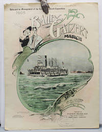
190517219Portland Oregon: Published by Fisher Music Co. Lithographed by Anderson & Duniway Co. 1905 First edition of this sheet music as printed for the Lewis and Clark Exposition second edition overall. The sheet music was originally printed in 1902 but is here printed to promote the Lewis and Clark Exposition. The song honors the Bailey Gatzert the most famous Columbia River steamship. Benjamin A. Gifford 1859 – 1936 is considered perhaps Oregon's most famous photographer and his images include the cover photo of the steamship and Multnomah Falls. Original color-printed paper wrappers illustrated with an elaborate border around a color-tinted photo reproduction of the Bailey Gatzert steamship heading up the Columbia River by Benjamin A. Gifford. 10 x 14 in. . . With six text photo reproductions. Some chipping to edges. With the ink ownership stamp of the Portland area piano teacher Lillian R. Bickner 1884 – 1962. A very good copy. "Portland staged its first and only world's fair from June 1 through October 15 1905. During those four and a half months 1588000 paying visitors passed through the gates to the 400-acre fairgrounds on the northwest edge of town…The Lewis and Clark Exposition was conceived so Portland could demonstrate that it could mount a major civic enterprise. The city had had a solid record of economic growth since its founding in 1845 but at the turn of the twentieth century it was competing for investment and immigration with dozens of other cities throughout the American West" Carl Abbott on the Oregon Encyclopedia website. Published by Fisher Music Co., Lithographed by Anderson & Duniway Co.,
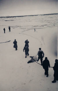
1948new11<p><strong> POLAR EXPEDITIONS COMMANDANT CHARCOT 19481950 </strong><br /><strong> ANTARCTICA ADÉLIE LAND PAUL-ÉMILE VICTOR </strong><br /><strong> EXCEPTIONAL ARCHIVE OF 415 PHOTOGRAPHIC NEGATIVES </strong></p><p><strong> Albums of Negatives <em>Commandant Charcot</em> </strong><br />France Atlantic Oceania Antarctica 19481950.</p><p>Five albums and one binder containing <strong>415 photographic negatives</strong>.</p><p>Comprising:</p><ul><li><p>3 albums 15 x 8.5 cm faux-leather covers with snap closures index pages negatives 6.5 x 11 cm; 5 x 9 cm stored in glassine sleeves.</p></li><li><p>2 albums 15.5 x 10.5 cm cardboard covers negatives 6.5 x 11 cm in tied glassine envelopes with annotations in black pencil.</p></li><li><p>1 binder 27 x 15.5 cm oblong format cardboard covers index sheets pasted inside rear board negative strips 18.8 x 3.5 cm some cut stored in three rows of stapled oblong glassine envelopes.</p></li></ul><p>The albums and binder show signs of wear. With the exception of a very few fogged images the negatives are in excellent condition.</p><p>An <strong>exceptional ensemble</strong> of five albums and one binder comprising 415 photographic negatives including 32 strips documenting the <strong>first two expeditions of the vessel <em>Commandant Charcot</em> to Adélie Land in Antarctica 19481950.</strong></p><p>These unofficial photographs come from the private collection of one of the expedition members clearly taken as personal keepsakessome are even intermingled with unrelated family or holiday shots.</p><p>Adélie Land is a coastal region of Antarctica discovered in 1840 by naval officer Jules Dumont d'Urville who named it after his wife. Claimed by France but neglected for over a century this 432000 km² territory only regained strategic interest in the aftermath of WWII and renewed geopolitical rivalries.</p><p>In 1946 three young mountaineersJ.A. Martin Robert Pommier and Yves Valletteconcerned by Norway's claims to Adélie Land sought to land there to reaffirm French sovereignty. They turned to their illustrious elder explorer and scientist <strong>Paul-Émile Victor 19071995</strong> already famed for his Greenland expeditions. To this end the <em>Expéditions Polaires Françaises Missions Paul-Émile Victor EPF</em> was founded in 1947 to organize new scientific ventures in Greenland and Adélie Land.</p><p>Although Paul-Émile Victor did not personally participate he coordinated the mission which combined territorial reassertion with scientific research including the establishment of a permanent base. In 1948 the French Navy acquired an American warship refitted at Saint-Malo and renamed it <strong>Commandant Charcot</strong> in honor of polar explorer Jean-Baptiste Charcot 18671936.</p><p>The ship sailed on <strong>26 November 1948</strong> carrying 62 crew members including expedition leader André-Franck Liotard Commander Max Douguet and twelve scientists among them Martin Pommier and Vallette. After stops in Casablanca Durban and Hobart the <em>Commandant Charcot</em> attempted to reach Adélie Land but heavy pack ice in February 1949 forced it to turn back only 35 miles from the coast. The ship returned to Brest in June.</p><p>A <strong>second expedition</strong> departed in September 1949 with nearly the same crew and an onboard seaplane. During the voyage J.A. Martin died suddenly of an aneurysm; his body was laid to rest in Cape Town. The ship reached Adélie Land on <strong>20 January 1950</strong> where a basenamed <strong>Port-Martin</strong> in his memorywas established. The <em>Commandant Charcot</em> departed on 8 February leaving the scientific team to winter over and returned to Brest on 10 June 1950.</p><p>This remarkable photographic archive documents both expeditions in detail from the ship's refitting at Saint-Malo in 1948 to the historic landing at Adélie Land nearly two years later. The photographs were likely taken by one of the expedition members for personal remembrance. They may be compared with those by <strong>Luc-Marie Bayle 19142000</strong> naval painter and future director of the Musée de la Marine who took part in both voyages. Bayle's prints from these expeditions are preserved today in the collections of the Musée National de la Marine and were featured in the 2008 exhibition <em>De Brest en Terre Adélie</em>.</p><p>Bayle also published a humorous illustrated account of these expeditions: <em>Le Voyage de la Nouvelle Incomprise</em> Paris Ozanne 1953 and produced two documentary films on his journeys to Adélie Land.</p><p><strong>Selected Bibliography:</strong></p><ul><li><p>Bayle L.-M. <em>Le Voyage de la Nouvelle Incomprise</em> Paris Ozanne 1953.</p></li><li><p>Bayle L.-M. Dubard P. <em>Le Charcot et la terre Adélie</em> Paris France-Empire 1951.</p></li><li><p>Douguet G. <em>Cap sur la terre Adélie. Premières expéditions polaires françaises 19481951</em> Brest Le Télégramme 2007.</p></li><li><p>Liotard A.-F. Pommier R. <em>Terre Adélie</em> Paris Arthaud 1952.</p></li><li><p>Tabuteau M. "La 'Saga' antarctique et la terre Adélie. II Expéditions françaises actuelles" <em>L'Information géographique</em> vol. 15 no. 3 1951 pp. 104109.</p></li></ul><p><strong>Inventory</strong></p><p><strong>Album titled "Charcot A. Nos. 1133. From St. Malo. First Campaign":</strong><br />126 negatives format 6 ½ x 11 cm.</p><ul><li><p><strong>Negs. 110 11 negatives two housed in the same sleeve:</strong> Reinforcement work on the hull of the <em>Commandant Charcot</em>then named <em>L'Atiette</em> see no. 1in the port of Saint-Malo JuneAugust 1948.</p></li><li><p><strong>Nos. 1128:</strong> Taken in the port of Brest in the Pontaniou dry docks where equipment and thirty sled dogs were loaded see nos. 2627.</p></li><li><p><strong>Nos. 2934:</strong> Probably at Casablanca where the vessel stopped Dec. 13 as suggested by faint pencil annotations on some sleeves. Includes a fine photograph of crew members at rest no. 33.</p></li><li><p><strong>Nos. 3537:</strong> Construction of a structure on deck around Dec. 4.</p></li><li><p><strong>Nos. 3842:</strong> Sled dogs on board at sea around Dec. 8.</p></li><li><p><strong>Nos. 4347:</strong> Portraits of crewmen. The ship's captain Max Douguet seems recognizable nos. 4647.</p></li><li><p><strong>Nos. 4853:</strong> Ashore likely Durban South Africa where the ship stopped Dec. 2831 1948. Mainly photographs of the dogs.</p></li><li><p><strong>Nos. 55120 sleeve 54 empty:</strong> At sea from Durban to Hobart Tasmania. Daily life onboard: a man napping no. 55 a sailor cutting another's hair no. 79 others building what seems to be a shelter for the dogs nos. 8083 possibly André Paget construction officer no. 83. Many images devoted to the dogs. No. 59 captures dolphins swimming alongside the ship. Also views of the sea small boats and a sail hoisted no. 119.</p></li><li><p><strong>Nos. 121125:</strong> Portraits of crew members.</p></li><li><p><strong>Nos. 126127:</strong> Ashore likely Hobart. Group portraits of sailors posing with a <em>bachi</em> hat inscribed "Commandant Charcot."</p></li><li><p><strong>No. 128:</strong> Monument to world expeditions.</p></li><li><p><strong>Nos. 129133:</strong> In polar seas. First photographs of pack ice.</p></li></ul><p><strong>Album titled "Charcot B. 134250":</strong><br />101 negatives format 6 ½ x 11 cm.</p><ul><li><p><strong>Nos. 134167:</strong> Series documenting the failed attempt to cross the pack ice toward Adélie Land before returning to Franceor possibly from the second voyage. Photographs include Adélie penguins 134135; 137 seals no. 144 pack ice and icebergs frost on the ship 149155.</p></li><li><p><strong>Nos. 168174:</strong> Seal hunt. Images close to those in Luc-Marie Bayle's documentary <em>Le Commandant Charcot dans l'Antarctique</em> 1950. Seals shot and hoisted aboard by pulley to feed both dogs and men. Negatives show sailors reaching the ice by boat and hauling carcasses.</p></li><li><p><strong>Nos. 175189:</strong> Views of pack ice icebergs and a group of penguins no. 176.</p></li><li><p><strong>From sleeve 190 onward:</strong> Negatives taken during the second expedition leaving Brest Sept. 1949.</p><ul><li><p><strong>Nos. 190193:</strong> Coasts of Madeira and Tenerife.</p></li><li><p><strong>Nos. 194195:</strong> Views of the seaplane carried on the second voyage.</p></li><li><p><strong>Nos. 196204:</strong> Views of the ship's bow and distant coast likely St. Helena.</p></li><li><p><strong>Nos. 205216:</strong> Ashore at Cape Town from Oct. 22. No. 210 shows the Waverley Hotel built 1897 Sea Point and a Forsdick Motors building. Cape Town is where J.A. Martin who died onboard Oct. 20 was buried. Expedition leader André-Franck Liotard appears in nos. 207208. Other photographs from the port where the ship was docked.</p></li><li><p><strong>Nos. 217241:</strong> At sea. Sailors working on deck 221222 or observing rough seas 227229; multiple images of the <em>Commandant Charcot</em> from port and starboard 237241 and from the crow's nest 218; 236.</p></li></ul></li></ul><p><strong>Album titled "K1100 Charcot. 19491950":</strong><br />96 negatives format 6 ½ x 11 cm.</p><ul><li><p><strong>Nos. 138:</strong> At sea. Numerous views of icebergs 4; 612; 1516; 3338 and pack ice 18; 2530; photographs of the ice from the crow's nest 2023; 31; seals 19 and penguins 23; sailors at work on deck 3.</p></li><li><p><strong>Nos. 3940:</strong> Portraits of expedition members including Robert Pommier no. 39 in charge of sled transport atmospheric optics and photography during the wintering. The second negative may include hydrographer François Tabuteau.</p></li><li><p><strong>Nos. 4143:</strong> Crewman stepping onto the ice roped for safety.</p></li><li><p><strong>Nos. 4448:</strong> Penguins.</p></li><li><p><strong>Nos. 49100:</strong> Photographs of icebergs 5051 and pack ice 6276 sometimes with seals 57; 60; 7778 and side views of the ship 49; 5556; 58; 61; 83; 9596. From no. 96 onward the pack is less dense.</p></li></ul><p><strong>Album titled "L101L200 Charcot. Airplane. 19491950":</strong><br />82 negatives format 6 ½ x 11 cm and 7 negatives format 5 x 9 cm.</p><p>An important album containing photographs taken in Adélie Land and a series shot from the seaplane in flight.</p><ul><li><p><strong>Nos. 17 5 x 9 cm:</strong> Pack ice views from the seaplane.</p></li><li><p><strong>Nos. 101118:</strong> Views of the sea and distant pack ice. No. 113 shows crewmen on the bow watching an explosion on the ice in the distance.</p></li><li><p><strong>From no. 119 onward:</strong> Photographs in Adélie Land during construction of the wintering base. Many negatives show unloading cargo building the camp and erecting the base 119120; 124; 126; 134; 145146; 147; 166168. Nos. 135 and 137 depict a manpossibly meteorologist Henri Boujonposing by the camp; further portraits in 172174. Dogs unloaded onto barges 165. A mast being raised 176. Views of the <em>Commandant Charcot</em> from Adélie Land 121; 143; 164 Adélie coastlines 127129; 138141; 150151 and Adélie penguins 144; 148149; 151; 170; 177. Two men pose with a seal 173.</p></li><li><p><strong>Nos. 152160:</strong> Views of an islet archipelago numbered 112. May not correspond to the Adélie landing.</p></li><li><p><strong>Nos. 178192:</strong> Coastlines or glacial islets possibly marking the ship's departure from Adélie Land.</p></li></ul><p><strong>Oblong binder:</strong><br />32 negative strips.</p><p>The annotated index on the inside back cover indicates by dates and place names that these negatives were taken during the first expedition 19481949. Some entries match visible images in strips 2122 and 2934.</p><ul><li><p><strong>Nos. 16:</strong> Crew portraits. Captain Max Douguet clearly identifiable strip 2.</p></li><li><p><strong>Nos. 911:</strong> Expedition dogs.</p></li><li><p><strong>Nos. 1213:</strong> Albatrosses.</p></li><li><p><strong>Nos. 1528:</strong> Ashore. Likely Hobart Tasmania where the ship stopped Jan. 25Feb. 5 1949 and again March 20 on the return. Includes a plaque honoring French explorer Antoine Bruny d'Entrecasteaux strip 20 unveiled at Gordon in 1938. Strips 2122 show reproductions of Dumont d'Urville and his ship <em>L'Astrolabe</em> matching the index entry "Hobart reproductions of engravings relating to Dumont d'Urville." Other negatives: country outing with women and children 1719; 2426 a car beach bystanders 15 rocky plain and coast 16 and the <em>Commandant Charcot</em> moored in port 21; 23; 27.</p></li><li><p><strong>Nos. 2931:</strong> At sea. Albatrosses and heavy seas ship rolling. Likely taken between Fremantle Australia and Aden Yemen late Aprilmid-May 1949.</p></li><li><p><strong>Nos. 3234:</strong> At sea same route. Mainly group or individual crew portraits including possibly André Breton strip 32 third negative and Paul Tchernia scientific officer in charge of oceanographic research. Strip 34 may show him sampling.</p></li><li><p><strong>No. 35:</strong> Portraits of a crewman perhaps Lieutenant-Commander Jacques-Gilbert Guillon Douguet's second-in-command.</p></li></ul><p><strong>A major photographic record of one of the last great French polar maritime adventures.</strong></p>
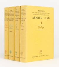
1956144270Carlton: Melbourne University Press 1956. First Edition. Hardcover. Very Good/Very Good. Carlton Melbourne University Press 1956 1960 1958 and 1964 all first - and only - editions. Quarto four volumes xxx 513 pages with 68 figures and 157 plates plus 2 colour plates; xiv 515 pages with 7 graphs 281 maps and illustrations and 47 plates plus a colour plate; xvi 522 pages with 81 maps and illustrations and 17 plates; and xviii 533 pages with a map and 100 plates plus 5 colour plates. Cloth; minimal signs of age and use; an excellent set with the lightly used dustwrappers. Charles Mountford was the leader of the expedition; he was also the author of the first volume the editor of the second and co-editor of the third with R.L. Specht who edited the fourth volume. 4 items. Melbourne University Press hardcover
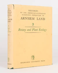
1958120448Carlton: Melbourne University Press 1958. First Edition. Hardcover. Very Good/Dust Jacket Included. Carlton Melbourne University Press 1958. Quarto xvi 522 pages with 81 maps and illustrations and 17 plates plus a double-page colour map. Cloth slightly rubbed at the extremities; rear cover very slightly marked; endpapers a little offset; an excellent copy with the dustwrapper a little foxed sunned flecked chipped and torn. One of four volumes in the series published between 1956 and 1964. Melbourne University Press hardcover