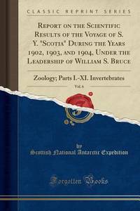
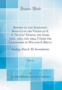
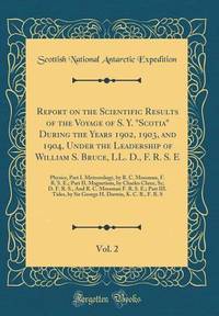
Scottish National Antarctic ExpeditionBiblio.com
1 955 résultats
133348643X.Gpaperback. Good. Access codes and supplements are not guaranteed with used items. May be an ex-library book. paperback
1333471300.Gpaperback. Good. Access codes and supplements are not guaranteed with used items. May be an ex-library book. paperback
0265919568.Ghardcover. Good. Access codes and supplements are not guaranteed with used items. May be an ex-library book. hardcover
0267485026.Ghardcover. Good. Access codes and supplements are not guaranteed with used items. May be an ex-library book. hardcover
048434191X.Ghardcover. Good. Access codes and supplements are not guaranteed with used items. May be an ex-library book. hardcover
1875WRCAM50727London 1875. 349-356pp. Modern blue wrappers printed paper label. Fine. The report extracted from a larger volume was compiled by George Richards Francis M'Clintock and Sherard Osborn to provide guidance to the impending proposed British expedition to the North Pole to be led by Sir George Strong Nares. In late May of the same year Nares would command two ships north around Greenland failing to reach the North Pole but becoming the first explorer to successfully pilot ships through the channel between Greenland and Ellesmere Islands; the channel was later named for him. In this report Richards M'Clintock and Osborn recommend two ships the Alert and the Bloodhound for Nares though the Bloodhound would be renamed the Discovery before the expedition began. The scope of the expedition is defined: "to attain the highest northern latitude and if possible to reach the North Pole." Also includes information on the route of the expedition the orders to be given various kinds of stores and provisions to be taken whether or not dogs should be used and much more. No listing in OCLC. unknown books
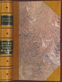
1853E0014198 pages with 23 plates. Royal octavo 9 1/2" x 6" rebound in 3/4 leather with marbled boards and black label with gilt lettering to spine. 79 plates with one Buffalo Dance folding and some with a single tint in this first issue there are errors in the list of illustrations corrected in later issues viz. Landscapes etc. 23 plates numbered as 1-13 15-23 plus one unnumbered at end; Mammals 6 plates; Birds 5 plates numbered 1 3-6 plate 2 Struthus Canicops Woodhouse male is called for but not present and most likely not to be found in this issue; Reptiles 21 plates with 10a miss-numbered as 10 12 as 13 and 13 as 16; Fishes 3 plates; Plants 21 plates plate 21 Aploppus Nuttalii present but not called for. Includes <i>Reconnaissance of the Zuni Little Colorado and Colorado Rivers Made in 1851</i> map as called for but includes Lithographed map <i>Boundary of the Creek Country</i> 24" x 36" laid in not called for. Senate Executive Document 59 Howes: 528 First edition.<br /><br />Survey of the watershed of the Canadian River and Red Fork of the Arkansas River in Indian Territory extending from Fort Smith to the border with Texas. The lands of the Cherokee Creek Seminole and Choctaw Indians are located. The map locates numerous forts including Smith Coffee Gibson and Old Fort Holmes and their connecting wagon roads. Talasee is shown at the site of Tulsa. This map was issued with the "Northern and Western Boundary Line of the Creek Country" report by Sitgreaves and Lt. J.C. Woodruff. The surveys were made in 1848 and 1850 but the report in which the map was issued wasn't published until 1858.<br /><br />After the conquest of New Mexico and California it was apparent that transportation and communications needed to be improved between these new territories and the rest of the United States east of the Mississippi. Geographical knowledge of most of this area particularly northwestern New Mexico now northern Arizona was very limited and inaccurate. Some maps of the day showed a river system that might provide a possible navigable water corridor between New Mexico and the Gulf of California via the Zuni Little Colorado and Colorado Rivers. In September of 1851 Captain Lorenzo Sitgreaves along with a small crew of topographers naturalists artists and support personnel and an escort of 30 infantrymen left the Zuni Pueblo in western New Mexico by pack train with instructions to explore and map the Zuni and Colorado Rivers and evaluate their navigability in light of a possible impending war with the Mormons in Utah. They traveled southwest along the Zuni River to its mouth and then headed northwest along the Little Colorado intending to follow it to the Colorado. When they reached Grand Falls northwest of present-day Winslow Arizona their guide Antoine Leroux advised them that it was unwise to follow the river any further because it flowed in a deep canyon for the rest of its course and emptied into the great canyon of the Colorado River. They left the river and struck off due west around the north side of the San Francisco Mountains discovering the Wupatki Indian Ruins along the way and looped southwestward around the south side of Bill Williams Mountain. The rest of their westward march followed near the future alignment of Route 66 to the Colorado River near the modern town of Bullhead City Arizona. After a difficult march south along the Colorado River they reached Camp Yuma on November 30. Of course Sitgreaves discovered that the Zuni and Little Colorado Rivers were not at all navigable and would be useless to transport troops and supplies. The Colorado River however was found to be navigable along the entire distance that he explored. Sitgreaves' official report "Report of an Expedition Down the Zuni and Colorado Rivers in 1851" was published in 1853.<br /><br /><b>Condition:</b><br /><br />Foxing left margin trimmed as issued for folding all other plates present as called for in Howes as well as Lithographed map <i>Boundary of the Creek Country</i> laid in and not called for some folding. Rebound in attractive three quarter leather else a about very good. Robert Armstrong hardcover books
1922314367Ottawa: F. A. Acland 1922. 5 of 12 parts comprised of the Introduction Preface and errata and parts A B and G. With a duplicate of the Preface part. 5 vols. 8vo. Three in original wrappers. 5 of 12 parts comprised of the Introduction Preface and errata and parts A B and G. With a duplicate of the Preface part. 5 vols. 8vo. Five individual parts from Volume III of the official reports of the Expedition organized and led by Vilhjalmur Stefansson. <br/><br/> F. A. Acland unknown
1923321730Ottawa: F. A. Acland 1923. Vol XII Part B: Physical Characteristics 12 photographic plates. Vol. XII Part C: Osteology: 9 plates. 2 vols. 8vo. Publisher's lettered wrappers. Vol XII Part B: Physical Characteristics 12 photographic plates. Vol. XII Part C: Osteology: 9 plates. 2 vols. 8vo. Two individual wrappered parts from the official reports of the Expedition organized and led by Vilhjalmur Stefansson. Vol. XII part B on the physical characteristics of the Copper River Eskimos by D. Jenness is particularly noteworthy due to its portraits of the aboriginal peoples encountered. <br/><br/> F. A. Acland unknown
1928321731Ottawa: F. A. Acland 1928. Vol XII Part B: Physical Characteristics 12 photographic plates. Vol. XII Part C: Osteology: 9 plates. 3 vols. 8vo. Publisher's lettered wrappers. One part lacking upper wrapper. Vol XII Part B: Physical Characteristics 12 photographic plates. Vol. XII Part C: Osteology: 9 plates. 3 vols. 8vo. Three individual wrappered parts from the official reports of the Expedition organized and led by Vilhjalmur Stefansson. Vol. XII part B on the physical characteristics of the Copper River Eskimos by D. Jenness is particularly noteworthy due to its portraits of the aboriginal peoples encountered. <br/><br/> F. A. Acland unknown
1331918332.Gpaperback. Good. Access codes and supplements are not guaranteed with used items. May be an ex-library book. paperback
0656013095.Ghardcover. Good. Access codes and supplements are not guaranteed with used items. May be an ex-library book. hardcover
0365218367.Ghardcover. Good. Access codes and supplements are not guaranteed with used items. May be an ex-library book. hardcover
1391453921.Ghardcover. Good. Access codes and supplements are not guaranteed with used items. May be an ex-library book. hardcover
192850893København Reitzel 1928. Royal8vo. With orig. printed frontwrapper. Spine gone. Sewing a bit loose. 6464 pp. 3 maps 2 large and folded 6 plates many photographic illustrations in the text. Small stamp on foot of wrapper and halftitle. Uncut and internally fine and clean. <br/><br/><em>First edition of the report of the famous Second Thule Expedition which brought back importent geographical and geological informations of the fjords especially Independence Fjord. - Meddelelser om Grønland Bd.65. </em> unknown
1020977434.Ghardcover. Good. Access codes and supplements are not guaranteed with used items. May be an ex-library book. hardcover
0259175005.Gpaperback. Good. Access codes and supplements are not guaranteed with used items. May be an ex-library book. paperback
0666346135.Ghardcover. Good. Access codes and supplements are not guaranteed with used items. May be an ex-library book. hardcover
0656491183.Ghardcover. Good. Access codes and supplements are not guaranteed with used items. May be an ex-library book. hardcover
0266173373.Ghardcover. Good. Access codes and supplements are not guaranteed with used items. May be an ex-library book. hardcover
0666425922.Ghardcover. Good. Access codes and supplements are not guaranteed with used items. May be an ex-library book. hardcover
1332448097.Gpaperback. Good. Access codes and supplements are not guaranteed with used items. May be an ex-library book. paperback
1332447988.Gpaperback. Good. Access codes and supplements are not guaranteed with used items. May be an ex-library book. paperback
1334033110.Gpaperback. Good. Access codes and supplements are not guaranteed with used items. May be an ex-library book. paperback