[PERRY EXPEDITION - JAPANESE DEFENCES].Biblio.com
237 résultats
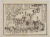
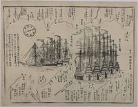
1854215028Japan. Circa1854. Black and white woodblock map with illustrations 32.2 x 41.5cm. Laid down on thick paper. Printed black border line at lower corner and occasionally in other areas along the border not printed otherwise good. This woodblock print map shows the defence layout around Tokyo Bay against the arrival of the American fleet. Names of lords who are responsible for defending particular areas are written with their rankings in terms of wealth sizes. In the centre the American ships are illustrated in detail. There are five sailing ships painted in red and three steam ships. These eight ships entered the bay on 6 February 1854. Thus this map most likely depicts the scene around that time. A caption on the left reads: 'The United States of America founded by Washington 77 years ago sent Matthew Perry with the President's letter in 1853; Perry revisited Edo in 1854.' . unknown
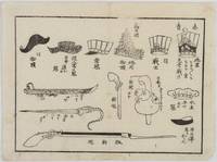
1854218389Japan. Circa1854. Black and white woodblock kawaraban 18 x 24cm. Small break in the border line along upper edge as issued. Small stain lower margin not affecting the imageotherwise good. This kawaraban features eight types of headgear worn by American crew members when they arrived in Japan including both ceremonial items and an interpreter's hat. It also illustrates a sword with its sheath alongside a bayonet and a hand-gun. Each item is depicted in meticulous detail reflecting a high level of curiosity about the foreign visitors. . unknown
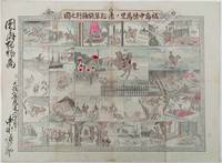
1893214562大阪. Osaka.: 福井榮之助. Fukui Einosuke. Meiji 26 1893. Handcoloured folding engraving 37.5 x 51cm. A prior owner's name is recorded in brush strokes down the left margin. Few small washi repaired tears two old repaired tears on the reverse some occasional browning particularly at centre fold light staining upper margin intruding a little into the printed image. Overall an attractive copy. Scarce. Lieutenant Colonel Fukushima Yasumasa 1852 – 1919 undertook a remarkable solo horseback expedition across Eurasia in 1892. Starting in Poland he traversed Russia and Siberia on his journey. Stationed in Berlin as a military attaché in 1887 he was tasked with researching the Trans-Siberian Railway under construction by Russia. His successful expedition was followed by further explorations in India and the Balkan Peninsula.<br><br>This sheet divided into 24 illustrated panels narrates Fukushima's story from his youth to his triumphant return after the expedition. Filled with adventure the story depicts his encounters with both danger and excitement. The narrative unfolds in a clockwise direction starting from the bottom right corner similar to a sugoroku game which this may be but it is uncertain. The central panel featuring a newly erected statue represents the final goal of his journey. Each panel is accompanied by a caption that furthers the story. . 福井榮之助. [Fukui Einosuke]. unknown
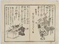
1854218390Japan. Circa1854. Black and white woodblock print 18 x 24cm a little light soiling very good. In this kawaraban two humorous and satirical poems concerning foreign arrivals are featured accompanied by illustrations. Both poems relate to foreigners and foreign ships clearly demonstrating that ordinary people were deeply interested in the arrival of foreign vessels and expressed their curiosity in various ways . unknown
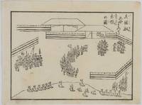
1853218506Japan. Circa1853. Black and white woodblock kawaraban 17.7 x 24cm In this kawaraban the American crew are assembled ready to board their rowing boats in anticipation of being transferred to their sailing ships. A group of American crew with pointed hats are in the middle while Japanese guards with black hats in an area surrounded by screens guard them at fore and rear. Numerous boats are ready on the beach with flags fluttering. . unknown
1854218512Japan. Circa1854. Black and white wood block print kawaraban 17.8 x 14cm This kawaraban is dated February 1854 and shows the retreat of the defending lords after the departure of American ships. The caption states that about 1000 people took part in the parade which was led by commanding samurai on horseback with a large cannon drawn at the rear. As it was a peaceful retreat the atmosphere appears relaxed and cheerful. . unknown
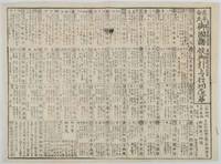
1854218513Japan. Circa1854. Black and white woodblock kawaraban 35.6 x 48.7cm ink mark upper section but text still legible otherwise a very good copy. This kawaraban dated 20 February 1854 elaborates a list of the defending lords following Commodore Perry's second visit to Edo Bay. The chart lists approximately 40 feudal lords mobilised to defend Edo each accompanied by detailed information including their house crests defensive positions and troop numbers. The total mobilisation is noted as around 375600 troops. . unknown
18763933DBStuttgart, E. Schweizerbart'sche Verlagshandlung (E. Koch), 1876 und 1877. Groß-8°. 23 cm. XIV, 231, VIII, 176 Seiten. Neuerer Halbleinenband mit goldgeprägtem Rückentitel. (= Ch. Darwin's gesammelte Werke. Autorisirte deutsche Ausgabe. Band 11. Erste und zweite Hälfte).
1824113477Jena: in der Bran 'schen Buchhandlung, 1824. 18,5 cm ; Pp.
189623118Berlin, Paetel, (1896). Porträt als Frontispiz, 4 Bll., 303 SS., 1 Bl., 18 SS. Anhang, 1 mehrfach gefaltete farbige Karte in der Deckellasche. Mit 70 Text-Illustrationen und 16 (fälschlich angegeben 6) Lichtdruckbildern nach Photographien und Skizzen (inkl. das Frontispiz). Gr.-8°. - 23,5:16 cm. Farbig illustr. orig. Leinenband.
1887A60472Leiden, Brill 1887 vii + 186pp.with 22 plates (14 lithographs and 8 photographs) + 1 large folding map, original 1887-edition, 28cm., original softcover (spine bit repaired & small piece of paper detached from front wappers) well protected by a removable cover of cristal paper, text in german, pages still uncut, [off-print from the 1st part of K.Martins "Bericht ueber eine Reise nach Niederlandisch West-Indien und darauf gegrundete Studien"], good condition, A60472
184932058Stuttgart : Cotta, ca. 1849 - 1859. XII, 362; XII, 349, 366; 466, 575; XII, 298, 304; 294, 304 S. 8°. OLwd mit Goldpräg. u. marmorierten Schnitten.
187513774DBTours, Alfred Mame et Fils, Editeurs, 1875. 4°. 27 x 18 cm. 345 Seiten, 4 Blatt. Dunkelbrauner Halblederband der Zeit mit goldgeprägtem Rückentitel. Jules Joseph Leclercq, geboren 1848, gestorben 1928. Belgischer Geograph.
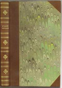
1818E0061323 pages with a portrait frontispiece and five colored aquatints. Octavo 8 3/4" x 5 1/2" bound in attractive half leather with marbled boards and gilt lettering to spine. Hill 1168 Second and best edition<br /><br />The Alceste brought Lord Amherst to China to serve as ambassador and specifically to negotiate the China trade at the time a matter of dispute between China and Great Britain.M'Leod who was surgeon on the ship describes the voyage out the various calls in the East Indies including touching at Batavia surveying off Korea the visit to Okinawa another to Manila and the shipwreck off the coast of Sumatra and subsequent rescue from Malay pirates. A brief but interesting interview with Napoleon at St. Helena is also included in the narrative. This was one of the most popular travel books of its time portraying the Far East to a much wider audience than had been reached by earlier accounts. The idyllic descriptions of Lewchew undoubtedly appealed to the romantic sensibilities of the era. Indeed buoyed by its success M'Leod published another work recounting his time as a slaver <i>A Voyage to Africa with some Account of the Manners and Customs of the Dahomian People</i>.<br /><br /><b>Condition:</b><br /><br />Attractive half rebind some foxing through out with no spotting to plates else a very good copy. John Murray hardcover books
1818E0061323 pages with a portrait frontispiece and five colored aquatints. Octavo 8 3/4" x 5 1/2" bound in attractive half leather with marbled boards and gilt lettering to spine. Hill 1168 Second and best edition<br /><br />The <i>Alceste</i> brought Lord Amherst to China to serve as ambassador and specifically to negotiate the China trade at the time a matter of dispute between China and Great Britain. M'Leod who was surgeon on the ship describes the voyage out the various calls in the East Indies including touching at Batavia surveying off Korea the visit to Okinawa another to Manila and the shipwreck off the coast of Sumatra and subsequent rescue from Malay pirates. A brief but interesting interview with Napoleon at St. Helena is also included in the narrative. This was one of the most popular travel books of its time portraying the Far East to a much wider audience than had been reached by earlier accounts. The idyllic descriptions of Lewchew undoubtedly appealed to the romantic sensibilities of the era. Indeed buoyed by its success M'Leod published another work recounting his time as a slaver <i>A Voyage to Africa with some Account of the Manners and Customs of the Dahomian People</i>.<br /><br /><b>Condition:</b><br /><br />Attractive half rebind some foxing through out with no spotting to plates else a very good copy. John Murray hardcover
1802E01512 volumes with Atlas. 4xxiv385 pages with xxii-xxiv lists books of voyages available from the publisher; 4418 pages with appendix containing vocabularies of the languages of Yukagir Yakut Tungoose Kamchatka the Aleutian Islands and Kadiak and inex. Atlas with title list of plates 14 engraved plates & large folding engraved map. Text volumes are small octavo 7¾" x 4½" 19th century quarter calf & boards spines tooled in gilt morocco lettering pieces; atlas is quarto 11" x 7½" in period tree calf spine tooled in gilt. Translated by J Castéra. Howes S-117 First French Edition.<br /><br />Martin Sauer was an English civil servant who knew Russian French and German. He became acquainted with Joseph Billings in St Petersburg in the 1780s. He agreed to join Billings expedition as his secretary and interpreter. It was agreed that he would write the official account but there is some controversy about his actives when he returned to St Petersburg in 1794. It has been suggested that he left hurriedly for England with much of the important archival material from the voyage including diaries and secret reports so that he could publish a record of the expedition before Russian authorities and scholars in the Academy of Sciences could review its details. Sauer's <i>An account of the Geographical and Astronomical Expedition to the Northern Parts of Russia</i> was published in London in 1802. It contains an abundance of detail about eastern Siberia and the Aleutian Islands and records the expeditions visits to Kodiak Island Prince William Sound and the coast south as far as Yakutat Bay. <br /><br />The chart was made by Aaron Arrowsmith from Sauer's notes and Billings observations and the whole complements well the other contemporary accounts of the expedition by the cartographer Gavriil Sarychev and the naturalist Carl Heinrich Merck. Aaron Arrowsmith 1750–1823 was an English cartographer engraver and publisher and founding member of the Arrowsmith family of geographers. He moved to Soho Square London from Winston County Durham when about twenty years of age and was employed by John Cary the engraver and William Faden. He became Hydrographer to the Prince of Wales ca. 1810 and subsequently to the King in 1820. In January 1790 he made himself famous by his large chart of the world on Mercator projection. Four years later he published another large map of the world on the globular projection with a companion volume of explanation.<br /><br /><b>Condition:</b><br /><br />Some rubbing and wear to coves of both atlas and text volumes some chipping to spine ends small gouge at back of atlas and stamp to front end paper else in very good condition. Chez F Buisson hardcover books
1802E0151<p>2 volumes with Atlas. 4xxiv385 pages with xxii-xxiv lists books of voyages available from the publisher; 4418 pages with appendix containing vocabularies of the languages of Yukagir Yakut Tungoose Kamchatka the Aleutian Islands and Kadiak and inex. Atlas with title list of plates 14 engraved plates & large folding engraved map. Text volumes are small octavo 7¾" x 4½" 19th century quarter calf & boards spines tooled in gilt morocco lettering pieces; atlas is quarto 11" x 7½" in period tree calf spine tooled in gilt. Translated by J Castéra. Howes S-117 First French Edition.<br /><br />Martin Sauer was an English civil servant who knew Russian French and German. He became acquainted with Joseph Billings in St Petersburg in the 1780s. He agreed to join Billings expedition as his secretary and interpreter. It was agreed that he would write the official account but there is some controversy about his actives when he returned to St Petersburg in 1794. It has been suggested that he left hurriedly for England with much of the important archival material from the voyage including diaries and secret reports so that he could publish a record of the expedition before Russian authorities and scholars in the Academy of Sciences could review its details. Sauer's <em>An account of the Geographical and Astronomical Expedition to the Northern Parts of Russia</em> was published in London in 1802. It contains an abundance of detail about eastern Siberia and the Aleutian Islands and records the expeditions visits to Kodiak Island Prince William Sound and the coast south as far as Yakutat Bay. <br /><br />The chart was made by Aaron Arrowsmith from Sauer's notes and Billings observations and the whole complements well the other contemporary accounts of the expedition by the cartographer Gavriil Sarychev and the naturalist Carl Heinrich Merck. Aaron Arrowsmith 1750–1823 was an English cartographer engraver and publisher and founding member of the Arrowsmith family of geographers. He moved to Soho Square London from Winston County Durham when about twenty years of age and was employed by John Cary the engraver and William Faden. He became Hydrographer to the Prince of Wales ca. 1810 and subsequently to the King in 1820. In January 1790 he made himself famous by his large chart of the world on Mercator projection. Four years later he published another large map of the world on the globular projection with a companion volume of explanation.<br /><br /><strong>Condition:</strong><br /><br />Some rubbing and wear to coves of both atlas and text volumes some chipping to spine ends small gouge at back of atlas and stamp to front end paper else in very good condition.</p> Chez F Buisson hardcover
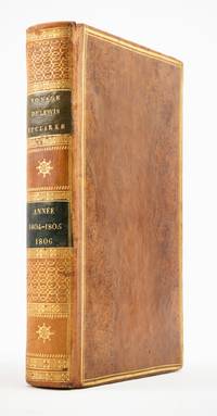
1810ST20849Paris: Chez Arthus-Bertrand 1810. First Edition in French. 205 x 128 mm. 8 x 5". xviii 443 1 pp.Translated into French by A. J. N. Lallemant. <br/> Contemporary flamed sheep covers with thick and thin gilt rule border smooth spine divided into panels by metope and pentaglyph roll panels either with rows of interlocking gilt circles or a gilt compass ornament two black morocco labels marbled endpapers. Folding engraved map by J. B. Tardieu. Wagner-Camp-Becker 6:3; Howes G-77; Sabin 26742; Graff Collection 1519; Wheat Trans-Mississippi 300. Very small loss to head of rear joint boards faintly abraded but the binding entirely solid and pleasing; a handful of leaves with small marginal tears or paper flaws one slightly larger but not affecting text approximately one-third of volume very mildly browned other trivial imperfections but still an excellent copy extremely clean and fresh internally.<br/> <br/> Issued three years after the original English text this is the initial printing in French—and the first in any foreign language—of an important firsthand account of the Lewis and Clark voyage of discovery written by a key figure both during and after the company’s undertaking; it is also and crucially the first edition to include a map of the expedition. Tardieu's map the first to mention the names Lewis and Clark noted important landmarks on the journey including the formidable Rocky Mountains the Columbia River and Fort Clatsop on the Pacific Coast where the expedition spent the winter of 1805-06. Our French edition also adds two letters of Clark not appearing in other editions of Gass—one to William Henry Harrison 2 April 1805 from Fort Mandan and one to Clark’s brother 23 September 1806 on the day the six-month return journey came to an end. Wheat observes that this work held special interest for the French as it provided much information about lands that had until the Louisiana Purchase been part of their domain. A carpenter by training Patrick Gass 1771-1870 was in charge of constructing winter accommodations for the party and his knowledge of building informs his observations here about forts and native architecture. This account was based on journals he kept during the explorations and it was an immediate success upon its first publication in Pittsburgh in 1807. The American public was hungry for information about the Western frontier and their curiosity was shared by Europeans particularly those considering emigration to the New World. Wagner-Camp observes that Gass "became one of the best-known members of the expedition for several reasons: his key role as sergeant brought his name up frequently in the journals of Lewis and Clark; his account was the first to be published; he was the first to have a biography written about him; and finally he outlived the other members of the Corps of Discovery by decades" dying at the age of 98. . Chez Arthus-Bertrand unknown
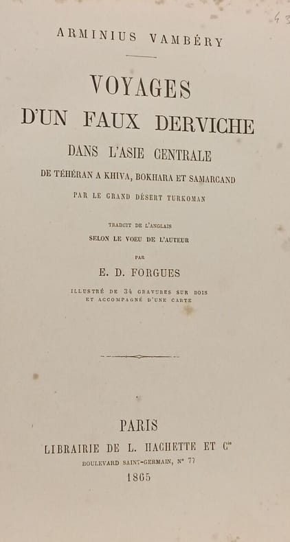
1865100144398Librairie de L. Hachette et Cie 1865 in8. 1865. Cartonné. Récit du voyageur et orientaliste hongrois Arminius Vambéry qui déguisé en derviche sunnite sous le nom de Rachid Effendi traverse l'Asie centrale entre 1862 et 1864. Parti de Téhéran il parcourt à pied ou à dos d'âne le désert turkoman pour atteindre Khiva Boukhara et Samarcand dans le but d'étudier les dialectes et de rechercher les origines des Magyars
1859100132292Megard et cie 1859 in8. 1859. Cartonné.
186210232Paris Hachette 1862 Un volume in-8 demi chagrin vert, dos à nerfs, caissons décorés, titre doré, tranches dorées, 719 pages, illustrations in-texte, complet de ses deux cartes. Légères rousseurs, bel exemplaire.
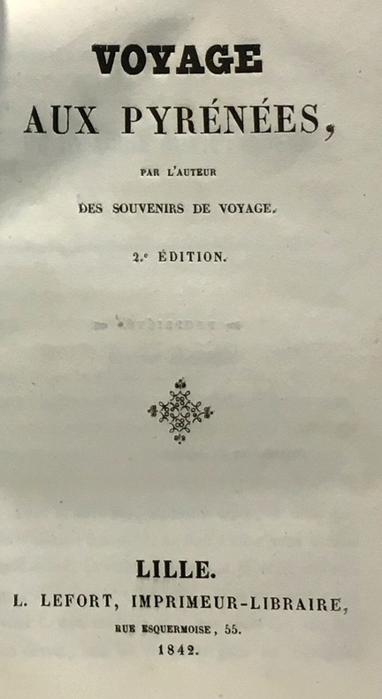
1842100045939Lefort 1842 in12. 1842. Cartonné.
1898100122577Plon 1898 in12. 1898. Broché.
1886271618Hachette et cie 1886 300 pages in12. 1886. Relié. 300 pages.
1826P2-6A-5Paris, Delaforest, Arthhus Bertrand, 1826. In-8 (215x130mm), relié demi-basane, tranches rouge, cachet de bibliothèque. IXV-432pp, illustré d’une carte reliée et 8 lithographies. Bon état. Edition originale. LAING fut le premier Européen à atteindre Tombouctou.