1 956 résultats
1818E0061323 pages with a portrait frontispiece and five colored aquatints. Octavo 8 3/4" x 5 1/2" bound in attractive half leather with marbled boards and gilt lettering to spine. Hill 1168 Second and best edition<br /><br />The Alceste brought Lord Amherst to China to serve as ambassador and specifically to negotiate the China trade at the time a matter of dispute between China and Great Britain.M'Leod who was surgeon on the ship describes the voyage out the various calls in the East Indies including touching at Batavia surveying off Korea the visit to Okinawa another to Manila and the shipwreck off the coast of Sumatra and subsequent rescue from Malay pirates. A brief but interesting interview with Napoleon at St. Helena is also included in the narrative. This was one of the most popular travel books of its time portraying the Far East to a much wider audience than had been reached by earlier accounts. The idyllic descriptions of Lewchew undoubtedly appealed to the romantic sensibilities of the era. Indeed buoyed by its success M'Leod published another work recounting his time as a slaver <i>A Voyage to Africa with some Account of the Manners and Customs of the Dahomian People</i>.<br /><br /><b>Condition:</b><br /><br />Attractive half rebind some foxing through out with no spotting to plates else a very good copy. John Murray hardcover books
200323857Adelaide: The Friends of the State Library of South Australia. Fine. 2003. First thus. Hardcover. 1876154381 . Limited to 400 copies with 99 copies bound in leather and the remaining 301 copies bound in cloth this is a cloth bound copy. An as new copy. Foreword by John Ling and an introduction by Anthony J. Brown. With illustrations / plates foldout chart and a map in pocket at the rear of book. The first published translation into English from the French by Christine Cornell of chapters XXII to XXXIV of Peron's journey as part of the Baudin expedition as zoologist aboard the Geographe. ; 245 x 160mm; xxxviii 278 pages . The Friends of the State Library of South Australia hardcover
1818E0061323 pages with a portrait frontispiece and five colored aquatints. Octavo 8 3/4" x 5 1/2" bound in attractive half leather with marbled boards and gilt lettering to spine. Hill 1168 Second and best edition<br /><br />The <i>Alceste</i> brought Lord Amherst to China to serve as ambassador and specifically to negotiate the China trade at the time a matter of dispute between China and Great Britain. M'Leod who was surgeon on the ship describes the voyage out the various calls in the East Indies including touching at Batavia surveying off Korea the visit to Okinawa another to Manila and the shipwreck off the coast of Sumatra and subsequent rescue from Malay pirates. A brief but interesting interview with Napoleon at St. Helena is also included in the narrative. This was one of the most popular travel books of its time portraying the Far East to a much wider audience than had been reached by earlier accounts. The idyllic descriptions of Lewchew undoubtedly appealed to the romantic sensibilities of the era. Indeed buoyed by its success M'Leod published another work recounting his time as a slaver <i>A Voyage to Africa with some Account of the Manners and Customs of the Dahomian People</i>.<br /><br /><b>Condition:</b><br /><br />Attractive half rebind some foxing through out with no spotting to plates else a very good copy. John Murray hardcover
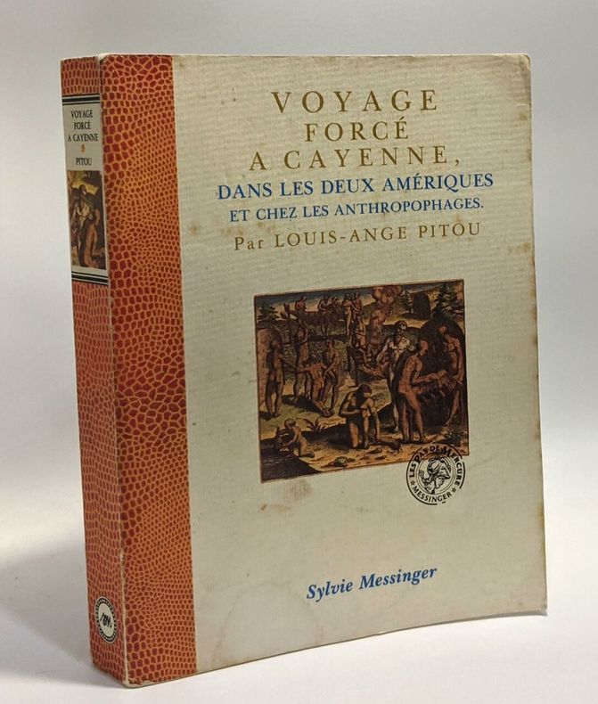
1989100059327Messinger 1989 304 pages in8. 1989. Broché. 304 pages.
1802E01512 volumes with Atlas. 4xxiv385 pages with xxii-xxiv lists books of voyages available from the publisher; 4418 pages with appendix containing vocabularies of the languages of Yukagir Yakut Tungoose Kamchatka the Aleutian Islands and Kadiak and inex. Atlas with title list of plates 14 engraved plates & large folding engraved map. Text volumes are small octavo 7¾" x 4½" 19th century quarter calf & boards spines tooled in gilt morocco lettering pieces; atlas is quarto 11" x 7½" in period tree calf spine tooled in gilt. Translated by J Castéra. Howes S-117 First French Edition.<br /><br />Martin Sauer was an English civil servant who knew Russian French and German. He became acquainted with Joseph Billings in St Petersburg in the 1780s. He agreed to join Billings expedition as his secretary and interpreter. It was agreed that he would write the official account but there is some controversy about his actives when he returned to St Petersburg in 1794. It has been suggested that he left hurriedly for England with much of the important archival material from the voyage including diaries and secret reports so that he could publish a record of the expedition before Russian authorities and scholars in the Academy of Sciences could review its details. Sauer's <i>An account of the Geographical and Astronomical Expedition to the Northern Parts of Russia</i> was published in London in 1802. It contains an abundance of detail about eastern Siberia and the Aleutian Islands and records the expeditions visits to Kodiak Island Prince William Sound and the coast south as far as Yakutat Bay. <br /><br />The chart was made by Aaron Arrowsmith from Sauer's notes and Billings observations and the whole complements well the other contemporary accounts of the expedition by the cartographer Gavriil Sarychev and the naturalist Carl Heinrich Merck. Aaron Arrowsmith 1750–1823 was an English cartographer engraver and publisher and founding member of the Arrowsmith family of geographers. He moved to Soho Square London from Winston County Durham when about twenty years of age and was employed by John Cary the engraver and William Faden. He became Hydrographer to the Prince of Wales ca. 1810 and subsequently to the King in 1820. In January 1790 he made himself famous by his large chart of the world on Mercator projection. Four years later he published another large map of the world on the globular projection with a companion volume of explanation.<br /><br /><b>Condition:</b><br /><br />Some rubbing and wear to coves of both atlas and text volumes some chipping to spine ends small gouge at back of atlas and stamp to front end paper else in very good condition. Chez F Buisson hardcover books
1802E0151<p>2 volumes with Atlas. 4xxiv385 pages with xxii-xxiv lists books of voyages available from the publisher; 4418 pages with appendix containing vocabularies of the languages of Yukagir Yakut Tungoose Kamchatka the Aleutian Islands and Kadiak and inex. Atlas with title list of plates 14 engraved plates & large folding engraved map. Text volumes are small octavo 7¾" x 4½" 19th century quarter calf & boards spines tooled in gilt morocco lettering pieces; atlas is quarto 11" x 7½" in period tree calf spine tooled in gilt. Translated by J Castéra. Howes S-117 First French Edition.<br /><br />Martin Sauer was an English civil servant who knew Russian French and German. He became acquainted with Joseph Billings in St Petersburg in the 1780s. He agreed to join Billings expedition as his secretary and interpreter. It was agreed that he would write the official account but there is some controversy about his actives when he returned to St Petersburg in 1794. It has been suggested that he left hurriedly for England with much of the important archival material from the voyage including diaries and secret reports so that he could publish a record of the expedition before Russian authorities and scholars in the Academy of Sciences could review its details. Sauer's <em>An account of the Geographical and Astronomical Expedition to the Northern Parts of Russia</em> was published in London in 1802. It contains an abundance of detail about eastern Siberia and the Aleutian Islands and records the expeditions visits to Kodiak Island Prince William Sound and the coast south as far as Yakutat Bay. <br /><br />The chart was made by Aaron Arrowsmith from Sauer's notes and Billings observations and the whole complements well the other contemporary accounts of the expedition by the cartographer Gavriil Sarychev and the naturalist Carl Heinrich Merck. Aaron Arrowsmith 1750–1823 was an English cartographer engraver and publisher and founding member of the Arrowsmith family of geographers. He moved to Soho Square London from Winston County Durham when about twenty years of age and was employed by John Cary the engraver and William Faden. He became Hydrographer to the Prince of Wales ca. 1810 and subsequently to the King in 1820. In January 1790 he made himself famous by his large chart of the world on Mercator projection. Four years later he published another large map of the world on the globular projection with a companion volume of explanation.<br /><br /><strong>Condition:</strong><br /><br />Some rubbing and wear to coves of both atlas and text volumes some chipping to spine ends small gouge at back of atlas and stamp to front end paper else in very good condition.</p> Chez F Buisson hardcover
1957100116807Le club français du livre 1957 in8. 1957. Relié.
217730Bibliothèque charpentier 390 pages in12. Sans date. Relié. 390 pages.
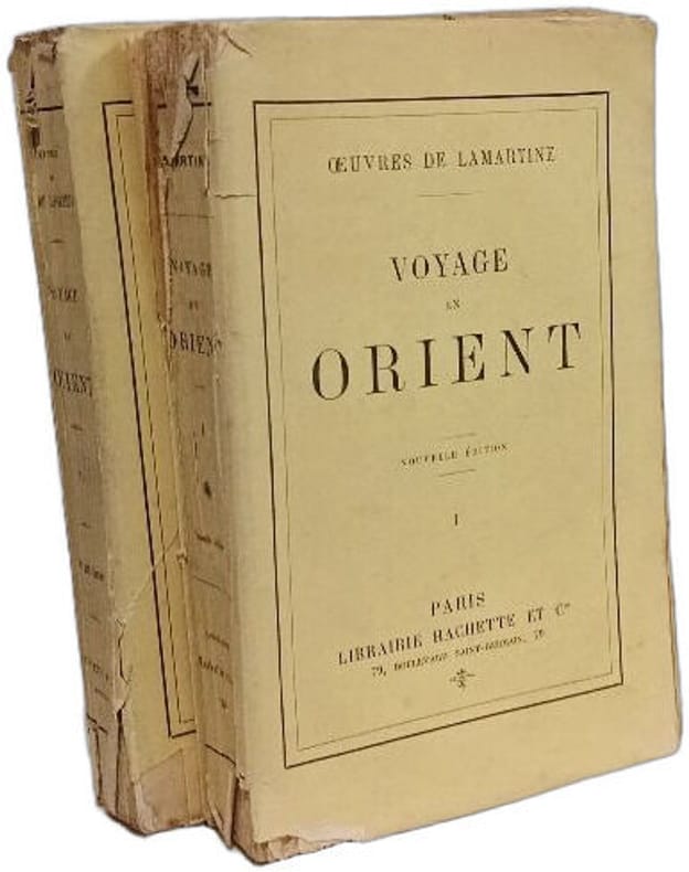
1896100152899Librarie Hachette et Cie 1896 in12. 1896. Broché. 2 volume(s).
1963168926Union générale d'éditions 1963 in12. 1963. Broché.
1958100125515Flammarion 1958 in8. 1958. Broché.
1809P2-1B-3Paris, Arthus-Bertrand, 1809. 2 volumes in-8° (21x13cm), reliés demi-maroquin, dos ornés, plats et tranches marbrés, 415 et 464pp. 2 frontispices par Lafitte et Adam et un portrait de l’auteur. Édition originale contenant es détails extrêmement curieux sur les mœurs et coutumes des Espagnols à la fin du XVIIIe siècle. First edition, nice copy.
1935100094552Montaigne 1935 in12. 1935. Broché. iconographie en noir et blanc
2004100116413Pimientos 2004 380 pages 14 6x2 2x21 8cm. 2004. Broché. 380 pages.
in-8 broche, 140 pages + 8 planches, couv. illustree. Ethnologue et naturaliste, d'Orbigny s'embarque en 1826 pour l'Amerique latine, de cette expedition qui dura huit ans il rapporta des documents sur les tribus autochtones, sur la flore et la faune, sur l'archeologie. Bel exemplaire [DV-2] Bel exemplaire
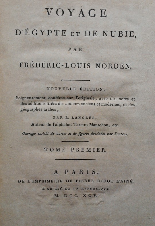
1795P1-2M-2Paris, Pierre Didot l’Ainé, 1795. Un volume in-4 (320x240mm), pleine percaline rouge, un portrait et deux gravures en frontispice, LV-176pp, 59 planches. Non rogné, imprimé sur papier vergé à la cuve. TOME 1 SEUL SUR 3. Bel état. Etude sur l’Egypte la plus complète avant la « Description de l’Egypte » ordonnée par Bonaparte. Second edition of the famous work of the Danish explorer, illustrated with a frontispiece, a portrait of Norden and 59 full page engraving. Modern red cloth. First volume only.
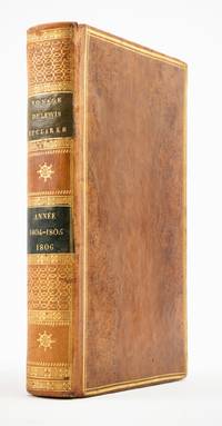
1810ST20849Paris: Chez Arthus-Bertrand 1810. First Edition in French. 205 x 128 mm. 8 x 5". xviii 443 1 pp.Translated into French by A. J. N. Lallemant. <br/> Contemporary flamed sheep covers with thick and thin gilt rule border smooth spine divided into panels by metope and pentaglyph roll panels either with rows of interlocking gilt circles or a gilt compass ornament two black morocco labels marbled endpapers. Folding engraved map by J. B. Tardieu. Wagner-Camp-Becker 6:3; Howes G-77; Sabin 26742; Graff Collection 1519; Wheat Trans-Mississippi 300. Very small loss to head of rear joint boards faintly abraded but the binding entirely solid and pleasing; a handful of leaves with small marginal tears or paper flaws one slightly larger but not affecting text approximately one-third of volume very mildly browned other trivial imperfections but still an excellent copy extremely clean and fresh internally.<br/> <br/> Issued three years after the original English text this is the initial printing in French—and the first in any foreign language—of an important firsthand account of the Lewis and Clark voyage of discovery written by a key figure both during and after the company’s undertaking; it is also and crucially the first edition to include a map of the expedition. Tardieu's map the first to mention the names Lewis and Clark noted important landmarks on the journey including the formidable Rocky Mountains the Columbia River and Fort Clatsop on the Pacific Coast where the expedition spent the winter of 1805-06. Our French edition also adds two letters of Clark not appearing in other editions of Gass—one to William Henry Harrison 2 April 1805 from Fort Mandan and one to Clark’s brother 23 September 1806 on the day the six-month return journey came to an end. Wheat observes that this work held special interest for the French as it provided much information about lands that had until the Louisiana Purchase been part of their domain. A carpenter by training Patrick Gass 1771-1870 was in charge of constructing winter accommodations for the party and his knowledge of building informs his observations here about forts and native architecture. This account was based on journals he kept during the explorations and it was an immediate success upon its first publication in Pittsburgh in 1807. The American public was hungry for information about the Western frontier and their curiosity was shared by Europeans particularly those considering emigration to the New World. Wagner-Camp observes that Gass "became one of the best-known members of the expedition for several reasons: his key role as sergeant brought his name up frequently in the journals of Lewis and Clark; his account was the first to be published; he was the first to have a biography written about him; and finally he outlived the other members of the Corps of Discovery by decades" dying at the age of 98. . Chez Arthus-Bertrand unknown
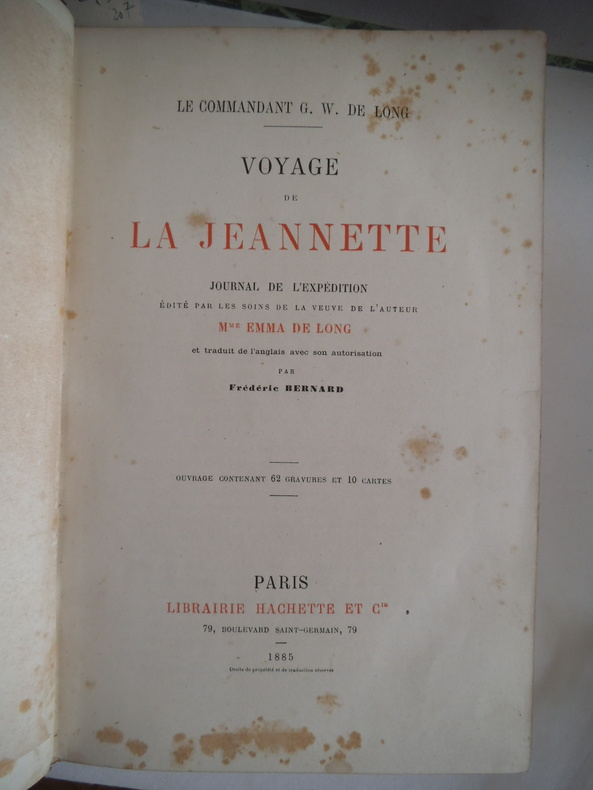
2324journal de l’expédition édité par les soins de la veuve de l’auteur Madame Emma DE LONG, traduction de l’anglais par Frédéric BERNARD. In 8 demi chagrin rouge à nerfs titre et caissons dorés plats percaline.Faux-titre, frontispice,titre,IV 686 pages, tranches dorées,gravures dans et hors-texte 9 cartes dont une grande dépliante(déchirures de manipulation réparées)Hachette 1885.rousseurs éparses habituelles
1749E0529<p>2 volumes. 182 pages with fold out frontispiece map and three additional folding engravings; 319 pages with seven folding engravings. half-titles in each title pages improperly marked first volume as second and vice versa. Duodecimo 6 1/2" x 3 1/2" bound in original publisher's full uniform contemporary French sponged calf with gilt-tooled spines. First French edition after the 1748 English edition.<br /><br />Henry Ellis was a traveler hydrographer and colonial governor returned from Italy in 1746 just in time to find an expedition to search for a north-west passage on the point of sailing. He appears to have been in easy circumstances; his name stands in the list of subscribers to the north-west expedition and he had sufficient interest to get attached to it nominally as agent for the committee and really as hydrographer surveyor and mineralogist the expedition consisting of two vessels the <i>Dobbs</i> galley of 180 and <i>California</i> of 150 tons left Gravesend on 20 May 1746 joined the Hudson's Bay convoy in Hollesley Bay and finally sailed from Yarmouth on the 31st. They parted from the convoy on 18 June made Resolution Island on 8 July and after a tedious passage through Hudson's Straits rounded Cape Digges on 8 August and on the 11th 'made the land on the west side the Welcome in latitude 64° N.' Bad weather drove them to the southward and prevented their doing anything more that season. They wintered in Hayes River in a creek about three miles above Fort York where a quarrel with the agent of the Hudson's Bay Company gave an unwonted piquancy to the dark and weary days. They suffered much from scurvy the prevalence of which Ellis attributes to their having got two kegs of brandy from Fort York for their Christmas merrymaking and in a minor degree to the 'governor' not permitting the Indians to supply them with fresh provisions. On 29 May 1747 the ice broke up and they were able to warp to the mouth of their creek; on 9 June they got down to Fort York. There they were allowed to get some provisions and stores and on the 24th cleared the river and 'stood to the northward on the discovery'. On 1 July each of the two ships sent away her long-boat but owing apparently to some ill-feeling between the two captains without any prearranged plan for working in concert. The consequence was that they separately went over the same ground discovering naming and examining the several creeks and inlets on the west side of Hudson's Bay the double examination perhaps compensating for the confusion arising from the double naming. Before the season closed in they had satisfied themselves that the only possible exit from Hudson's Bay on the west must be through the Welcome and that very probably there was no way out except that on the east by which they had come in. The result may not seem much; but as it served to put an end to the idea that the passage must lie through Hudson's Bay it was at least so much gain to accurate knowledge. After 21 August the weather broke and they decided in council 'to bear away for England without further delay.' On the 29th they entered Hudson's Straits passed Resolution Island on 9 September and arrived at Yarmouth on 14 Octivwe. Ellis's share in the work of the expedition had really been very slender but the reputation of it has been commonly assigned to him by reason of the narrative which he published the following year under the title <i>A Voyage to Hudson's Bay by the DobbsGalley and California in the years 1746 and 1747 for Discovering a North-West Passage</i> 1748; a work which with many valuable observations on tides on the vagaries of the compass and on the customs of the Eskimos a people then practically unknown mingles a great deal of speculation on the certain existence of the passage on magnetism on fogs on rust and other matters all more or less ingenious but now known to be wildly erroneous. Such as it was the book commended its author to the scientific workers of the day and on 8 February 1748-9 he was elected a fellow of the Royal Society. Possibly in acknowledgment of his scientific labors but more probably by some family interest he was afterwards appointed successively governor of Georgia and of Nova Scotia from which employment he retired about 1770. He seems to have spent his later years as a wanderer on the continent was at Marseilles in 1775 and died at Naples on 21 January 1806.<br /><br /><b>Condition:</b><br /><br />Some dark spot to spine else a very good copy.</p> Ballard Fils hardcover books
1749E0529<p>2 volumes. 182 pages with fold out frontispiece map and three additional folding engravings; 319 pages with seven folding engravings. half-titles in each title pages improperly marked first volume as second and vice versa. Duodecimo 6 1/2" x 3 1/2" bound in original publisher's full uniform contemporary French sponged calf with gilt-tooled spines. First French edition after the 1748 English edition.<br /><br />Henry Ellis was a traveler hydrographer and colonial governor returned from Italy in 1746 just in time to find an expedition to search for a north-west passage on the point of sailing. He appears to have been in easy circumstances; his name stands in the list of subscribers to the north-west expedition and he had sufficient interest to get attached to it nominally as agent for the committee and really as hydrographer surveyor and mineralogist the expedition consisting of two vessels the <em>Dobbs</em> galley of 180 and <em>California</em> of 150 tons left Gravesend on 20 May 1746 joined the Hudson's Bay convoy in Hollesley Bay and finally sailed from Yarmouth on the 31st. They parted from the convoy on 18 June made Resolution Island on 8 July and after a tedious passage through Hudson's Straits rounded Cape Digges on 8 August and on the 11th 'made the land on the west side the Welcome in latitude 64° N.' Bad weather drove them to the southward and prevented their doing anything more that season. They wintered in Hayes River in a creek about three miles above Fort York where a quarrel with the agent of the Hudson's Bay Company gave an unwonted piquancy to the dark and weary days. They suffered much from scurvy the prevalence of which Ellis attributes to their having got two kegs of brandy from Fort York for their Christmas merrymaking and in a minor degree to the 'governor' not permitting the Indians to supply them with fresh provisions. On 29 May 1747 the ice broke up and they were able to warp to the mouth of their creek; on 9 June they got down to Fort York. There they were allowed to get some provisions and stores and on the 24th cleared the river and 'stood to the northward on the discovery'. On 1 July each of the two ships sent away her long-boat but owing apparently to some ill-feeling between the two captains without any prearranged plan for working in concert. The consequence was that they separately went over the same ground discovering naming and examining the several creeks and inlets on the west side of Hudson's Bay the double examination perhaps compensating for the confusion arising from the double naming. Before the season closed in they had satisfied themselves that the only possible exit from Hudson's Bay on the west must be through the Welcome and that very probably there was no way out except that on the east by which they had come in. The result may not seem much; but as it served to put an end to the idea that the passage must lie through Hudson's Bay it was at least so much gain to accurate knowledge. After 21 August the weather broke and they decided in council 'to bear away for England without further delay.' On the 29th they entered Hudson's Straits passed Resolution Island on 9 September and arrived at Yarmouth on 14 Octivwe. Ellis's share in the work of the expedition had really been very slender but the reputation of it has been commonly assigned to him by reason of the narrative which he published the following year under the title <em>A Voyage to Hudson's Bay by the DobbsGalley and California in the years 1746 and 1747 for Discovering a North-West Passage</em> 1748; a work which with many valuable observations on tides on the vagaries of the compass and on the customs of the Eskimos a people then practically unknown mingles a great deal of speculation on the certain existence of the passage on magnetism on fogs on rust and other matters all more or less ingenious but now known to be wildly erroneous. Such as it was the book commended its author to the scientific workers of the day and on 8 February 1748-9 he was elected a fellow of the Royal Society. Possibly in acknowledgment of his scientific labors but more probably by some family interest he was afterwards appointed successively governor of Georgia and of Nova Scotia from which employment he retired about 1770. He seems to have spent his later years as a wanderer on the continent was at Marseilles in 1775 and died at Naples on 21 January 1806.<br /><br /><strong>Condition:</strong><br /><br />Some dark spots to spine else a very good copy.</p> Ballard Fils hardcover
12693In 8 percaline éditeur rouge à décor passe partout. Titre dans cartouche. Plats biseautés. Faux-titre, titre avec vignette, 510 pages, 1 page de table des chapitres, 17 planches hors-texte et nombreuses vignettes dans le texte, de D. SEMEGHINI, tranches dorées. Paris Garnier frères libraires éditeurs, sans date. Bon exemplaire.
1799biblio160<b>First French edition of Bartram's</b><b> Travels which chronicled his explorations of the southern British colonies in North America from 1773–1777</b><br /><br />2 volumes. 457 pages with frontispiece engraved portrait by Bovinet Mico Chlucco Grana King of the Seminoles and one folding plate; 436 pages without title with large folding map by J.B. Poirson engraved by Alexandre Blondeau and folding plate. Octavo 8 1/4" x 5 1/4" bound in half leather with six spine compartments with red and black labels in gilt over original marbled boards. Translated by Pierre Vincent Benoist. Sabin 3871; Palau 251346; Howes B223; Field 94 First French edition.<br /><br />William Bartram was an American naturalist. The son of the naturalist John Bartram. As a boy he accompanied his father on many of his travels to the Catskill Mountains the New Jersey Pine Barrens New England and Florida. In 1773 he embarked upon a four-year journey through eight southern colonies. Bartram made many drawings and took notes on the native flora and fauna and the native American Indians. In 1774 he explored the St. Johns River where he had memorable encounters with aggressive alligators and also visited a principal Seminole village at Cuscowilla where his arrival was celebrated with a great feast. He met Ahaya the Cowkeeper chief of the Alachua band of the Seminole tribe. When Bartram explained to the Cowkeeper that he was interested in studying the local plants and animals the chief was amused and began calling him Puc Puggy the flower hunter.2 Bartram continued his explorations of the Alachua Savannah or what is today Paynes Prairie. William Bartram wrote of his experiences exploring the Southeast in his book Travels through North & South Carolina East & West Florida the Cherokee Country the Extensive Territories of the Muscogulges or Creek Confederacy and the Country of the Chactaws Containing an Account of the Soil and Natural Productions of Those Regions Together with Observations on the Manners of the Indians published in 1791 and which is today simply known as Bartram's Travels. It was considered at the time one of the foremost books on American natural history. Many of Bartram's accounts of historical sites were the earliest records including the Georgia mound site of Ocmulgee. In addition to its contributions to scientific knowledge Travels is noted for its original descriptions of the American countryside. Bartram's writing influenced many of the Romantic writers of the day. William Wordsworth Samuel Taylor Coleridge and François René de Chateaubriand are known to have read the book and its influence can be seen in many of their works. Ephraim George Squier and Edwin Hamilton Davis in their book Ancient Monuments of the Mississippi Valley name Bartram as "the first naturalist who penetrated the dense tropical forests of Florida."<br /><br />Condition:<br /><br />Some rubbing to original boards page 143 of volume one has small burn mark affecting text half title bound upside down in back old water stain to plate of volume two. Fold-out map has repair to first fold internally pages are clean and free of toning and foxing else a very good copy. Chez Carteret et Brosson and Dogour Duran hardcover books
1826P2-6A-5Paris, Delaforest, Arthhus Bertrand, 1826. In-8 (215x130mm), relié demi-basane, tranches rouge, cachet de bibliothèque. IXV-432pp, illustré d’une carte reliée et 8 lithographies. Bon état. Edition originale. LAING fut le premier Européen à atteindre Tombouctou.
1790P1-3J-0PARIS (LEROY) 1790. 2 volumes In 8° (200 x 130) relié plein veau époque. Faux titres, titre frontispice XXIV - 381 pp. Faux titres, titre 399 pp. illustré de 12 planches dont le Hottentote à tablier. Bon état, peu de rousseurs.
1859100132292Megard et cie 1859 in8. 1859. Cartonné.