426 résultats
19112883BBLeipzig, Insel-Verlag, 1911. 8°. Orig.-Halbleinenband mit Rückenvergoldung. + Wichtig: Für unsere Kunden in der EU erfolgt der Versand alle 14 Tage verzollt ab Deutschland / Postbank-Konto in Deutschland vorhanden + 4 Bände.
191026365Beirut (Syria), Sarrafian Bros., ca. 1910. Carte postale, Lichtdruck, s/w, ungelaufen, ca. 1910. Kartennummer 11200. Gut erhalten.
191026368Meissen (Saxe), Hermann Seibt, ca. 1910. Carte postale, Lichtdruck, s/w, ungelaufen, ca. 1910. Bildnummer 1792. Gut erhalten.
191026367Meissen (Saxe), Hermann Seibt, ca. 1910. Ansichtskarte, s/w, ungelaufen, ca. 1910. Bildnummer des Photographen: 40. Gut erhalten
191026203Beyrouth u.a., Dimitri Tarazi & Fils, ca. 1910. Farbige Ansichtskarte, ungelaufen, ca. 1910. Kartennummer 12324. Gut erhalten.
191026204Beyrouth u.a., Dimitri Tarazi & Fils, ca. 1910. Farbige Postkarte, ungelaufen, ca. 1910. Kartennummer 12325. Gut erhalten.
191026209Beyrouth u.a., Dimitri Tarazi & Fils, ca. 1910. Karte, s/w, ungelaufen, ca. 1910. Albumspuren, Kanten berieben, etwas fleckig.
191026205Beirut (Syria), Sarrafian Bros., ca. 1910. Farbige Postkarte, ungelaufen, ca. 1910. Album und Einsteckspuren, berieben, sonst gut erhalten.
191026360Beirut (Syria), Sarrafian Bros., ca. 1910. Lichtdruckkarte, s/w, ungelaufen, ca. 1910. Gut erhalten.
191026356Beirut (Syria), Sarrafian Bros., ca. 1910. Correspondance, Karte, s/w, ungelaufen, ca. 1910. Gut erhalten.
191026362Beirut (Syria), Sarrafian Bros., ca. 1910. Carte postale 115a. Lichtdruck, s/w, ungelaufen. Kartennummer 9239. Look at the Fouad Debbas Collection. Gut erhalten.
19229805J. Carbonel | Alger 1922 | 16 x 24.50 cm | broché
190826359Beirut, Syria, Sarrafian Bros., 1908. Carte postale, s/w, gelaufen, ohne Briefmarke, mit Stempel von Port-Said. Kanten berieben, sonst gut erhalten.
19768676Hayward Gallery, London 1976. 396 S. mit 16 Farbtafeln, zahlr. Abbildungen u. 1 Karte. Gr.-8°. Kart. Gering berieben u. bestoßen. Gutes Exemplar.
19272299Jerusalem Keren Kajemeth Lejisrael 1927. Soft cover. . ~ ~ NOTE: THE PRICE OF THIS BOOK IS CURRENTLY REDUCED! ~ ~ . Small octavo. Pp. 48. Plus 2 extra pages with 3 photo-plates and 6 other such illustrations. With a folding line-drawn map tipped-in onto inside of back wrap. Appendices. Original decorated wrappers lettered in red with a woodcut illustration of a Holy Land landscape spine very lightly rubbed. In about fine condition. Excellent copy. ~ Second edition. A fascinating publication published by the Zionist Information Office of the Jewish National Fund and printed in Tel Aviv. Not a traditional traveller's guide to the Holy Places it is an invitation to visit the Zionist community in Palestine. It includes background information for visits in Jerusalem Tel Aviv and its region Haifa Valley of Yisrael Nazareth Afula Beth Shean as well as some newly established villages. Further there are detailed programmes for a three-day a five-day a week and two-weeks visits with advise what to do and where to go on each day. There is also a train timetable and a currency conversion table. The second part is the history of the Zionist Movement in Palestine and the book concludes with a financial report of the Fund's activities. This copy includes the road map "Erez-Israel" with indication of railways main roads paths and tracks marshes and rivers as well as Jewish National Fund land and national frontier. Y-3 OUT <br/> <br/> Jerusalem, Keren Kajemeth Lejisrael paperback
1960LFA-126741349Revue de 64 pages, format 135 x 210 mm, illustrée, brochée, bon état
1962LFA-126741362Revue de 96 pages, format 135 x 210 mm, illustrée d'une carte dépliable, brochée, bon état
1990LFA016f6Revue trimestrielle de l'Institut international de géopolitique : environ 100 pages, format 210 x 280 mm, illustrée, brochée couverture couleurs
1993LFA01700Revue trimestrielle de l'Institut international de géopolitique : environ 100 pages, format 210 x 280 mm, illustrée, brochée couverture couleurs
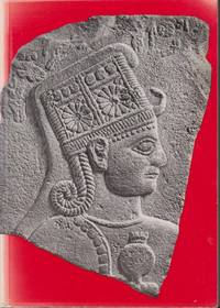
196120239Zürich: Kunsthaus Zürich. 1961. Seventh Edition. Softcover. Very Good. The art of the Hittites in German. Exhibition catalogue from a show at the Kunsthaus Zürich from 1961. Extensive rear section with plates of artifacts. ; 8vo 8" - 9" tall; 110 pages . Kunsthaus Zürich paperback
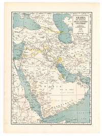
1936L6CG5IA5ETO8Chicago: Geographical publishing company 1936. Colour printed map 54 x 40 cm. Map of the Arabian Peninsula and parts of the USSR Turkey Iran and the British French and Italian colonies in Africa possibly coming from an edition of the Commercial atlas of the world. Printed in yellow are oil fields and pipelines including the legendary Kirkuk-Haifa/Tripoli oil pipeline. Detailed maps of Iran and of British controlled Palestine are printed on the other side.With a few small holes near the inner margin. Geographical publishing company, unknown
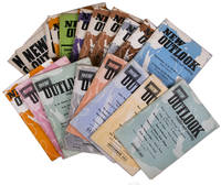
1957L94EK3173IPOTel Aviv: Tazpioth 1957. Original wrappers. 8vo. 18 instalments plus 1 duplicate. A selection of instalments of the magazine: New outlook an Tel Aviv-based monthly devoted to Israeli and Middle Eastern affairs and the promotion of Israeli-Palestinian dialogue and peace. It includes articles on politics poetry agriculture meteorology the Cold War education music education economy etc. covering all countries in the Middle East and from both Jewish and Arab perspectives.A very good set. Tazpioth, unknown
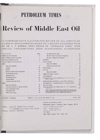
1948L2EG76GNBQ6GLondon: Brettenhem house 1948. Later cardboard binder. 30 x 23.5 cm. With many reproductions of photographs ground plans maps and cross-sections. Extract from the periodical The Petroleum Times containing an extensive article on oil in the Middle East. It opens with a list of Middle East oil companies and their concessions accompanied by a map showing their oil fields followed by a section on the future of Middle East oil. Individual chapters are devoted to the oil industry in Iran Iraq Bahrein Saudi Arabia Haifa Israel and Kuwait describing the area's geology oil fields reservoirs and more illustrated with photographs and cross-sections of the soil. The first 25 and last 16 pages consist of advertisements. Lacking the first 4 leaves of the preliminaries probably advertisements but the article itself complete some leaves slightly creased otherwise in very good condition. Brettenhem house, unknown
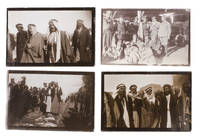
1920ABC_48727Iraq 1920. Kept in a clear plastic sleeve. With 11 snapshots all ca. 6 x 9 cm. Collection of 11 snapshots from the early 1920s likely taken by a British soldier stationed in the Middle East. It is difficult to pinpoint exactly where these photographs were taken but presumably in Mesopotamia present day Iraq. Great Britain was actively involved in Mesopotamia from 1914-1932. Prior to the First World War a large portion of the Middle East was in the hands of the Ottoman Empire. However when the Ottomans sided with Germany in 1914 Great Britain sent forces to Mesopotamia to protect the Anglo-Persian oil fields. The British army initially suffered a major defeat but eventually gained the upper hand and captured Baghdad in 1917. In 1920 after the Ottoman Empire was partitioned the United Kingdom formally established control in the region under a mandate of the League of Nations. However the Iraqi people resented this idea and revolted. In 1922 Great Britain and Iraq then signed the Anglo-Iraqi Treaty in which Iraq was given the right for self-government while Great Britain stayed in control of the country's foreign policy. This would last until Iraq's independence in 1932.The present snapshots were taken in the early days of British control in the region and depict the atmosphere at the time. They show the daily life of locals including women collecting water from the river men standing guard and the hustle and bustle in the streets. Also included are various group photos of British soldiers and locals.The photographs show some traces of wear around the corners and edges but are overall in good condition. unknown
1971848641971 Grenoble, Roissart, 1971, in 8° broché, XXX-124 pages ; couverture rempliée, sous double emboîtage de toile marron de l'éditeur.