Biblio.com

255 résultats
1469London Religious Tract Society Ca. 1840. 1st Edition . Hardcover. . ~ ~ NOTE: THE PRICE OF THIS BOOK IS CURRENTLY REDUCED! ~ ~ . Crown quarto. Unpaginated. Ca. 100 pages of text. Plus 25 hand-coloured engraved plates each with facing tissue guard including frontispiece. Engraved vignette on title-page. Engraved tail-pieces. HARDCOVER bound in the original publisher's blue full cloth gilt illustration on cover gilt spine sides with ornaments embossed in blind all edges gilt; extremities worn inner hinges cracked lacks last free endpaper; sporadic small stains and finger smudges one plate repaired on verso. In good condition. ~ FIRST EDITION. This is the rare edition with hand-coloured plates marked with the words "Coloured Plates" in gilt at foot of spine. The quality of the colouration is very high with dense and rich dyes and most plates are clean and well preserved. E-4 OUT <br/> <br/> London, Religious Tract Society, Ca. 1840. hardcover
1470London Religious Tract Society Ca. 1840. 1st Edition . Hardcover. . ~ ~ NOTE: THE PRICE OF THIS BOOK IS CURRENTLY REDUCED! ~ ~ . Crown quarto. Unpaginated. Ca. 100 pages of text. Plus 25 hand-coloured engraved plates each with facing tissue guard including frontispiece. Engraved vignette on title-page. Engraved tail-pieces. HARDCOVER bound in the original publisher's brown cloth neatly re-spined with plain cloth gilt illustration on cover sides with ornaments embossed in blind all edges gilt; extremities bit rubbed inner hinges cracked; few small spots. In good condition. ~ FIRST EDITION. This is the rare edition with hand-coloured plates. The quality of the colouration is very high with dense and rich dyes and most plates are clean and well preserved. E-4 OUT <br/> <br/> London, Religious Tract Society, Ca. 1840. hardcover
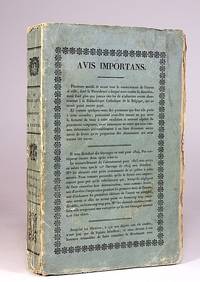
18240830Louvain Vanlinthout et Vandenzande 1824. Hardcover. . ~ ~ NOTE: THE PRICE OF THIS BOOK IS CURRENTLY REDUCED! ~ ~ . Royal octavo. Two parts in one volume paginated continuously. Pp. ii 90; 91-356. Letterpress device to title-page Imprimatur dated 1824 on verso; half-title with Approbation dated 1818 on verso. List of subscribers. Footnotes. Printed on laid paper. HARDCOVER contemporary half cloth and marbled boards spine gilt with small shelf label all edges speckled old institutional stamps and label. In about fine condition. ~ Travel account to the Holy Land. Not in Tobler who lists the 1819 edition and the 1860 edition only. F-5 IN <br/> <br/> Louvain, Vanlinthout et Vandenzande hardcover
18242118Louvain Vanlinthout et Vandenzande 1824. Soft cover. . ~ ~ NOTE: THE PRICE OF THIS BOOK IS CURRENTLY REDUCED! ~ ~ . Royal octavo. Two parts in one volume paginated continuously. Pp. ii 90; 91-356. Letterpress device to title-page Imprimatur dated 1824 on verso; half-title with Approbation dated 1818 on verso list of subscribers footnotes. Original printed wrappers slightly edge frayed. In a very good condition with contemporary Prize label in manuscript. ~ Travel account to the Holy land. This edition not in Tobler who lists the 1819 edition and the 1860 edition only. Z-3 IN <br/> <br/> Louvain, Vanlinthout et Vandenzande paperback
19272299Jerusalem Keren Kajemeth Lejisrael 1927. Soft cover. . ~ ~ NOTE: THE PRICE OF THIS BOOK IS CURRENTLY REDUCED! ~ ~ . Small octavo. Pp. 48. Plus 2 extra pages with 3 photo-plates and 6 other such illustrations. With a folding line-drawn map tipped-in onto inside of back wrap. Appendices. Original decorated wrappers lettered in red with a woodcut illustration of a Holy Land landscape spine very lightly rubbed. In about fine condition. Excellent copy. ~ Second edition. A fascinating publication published by the Zionist Information Office of the Jewish National Fund and printed in Tel Aviv. Not a traditional traveller's guide to the Holy Places it is an invitation to visit the Zionist community in Palestine. It includes background information for visits in Jerusalem Tel Aviv and its region Haifa Valley of Yisrael Nazareth Afula Beth Shean as well as some newly established villages. Further there are detailed programmes for a three-day a five-day a week and two-weeks visits with advise what to do and where to go on each day. There is also a train timetable and a currency conversion table. The second part is the history of the Zionist Movement in Palestine and the book concludes with a financial report of the Fund's activities. This copy includes the road map "Erez-Israel" with indication of railways main roads paths and tracks marshes and rivers as well as Jewish National Fund land and national frontier. Y-3 OUT <br/> <br/> Jerusalem, Keren Kajemeth Lejisrael paperback
a67416Boston 1993 G. K. Hall. ISSN 1058-644X. ISBN 0-8161-1678-4. 4to. 644pp. black cloth hardcover. Fine no DJ. hardcover
a595971993. ISBN 92-1-128139-3. United Nations Bulletin No 13. Text in English and in Arabic. Statistics--gross national product private final consumption expenditure government expenditures national savings and so on-- for Bahrain Egypt Iraq Jordan Kuwait Lebanon Oman Palestine Qatar Saudi Arabia Syria United Arab Emirates Yemen. 4to. about 75pp. original printed wraps. VG. paperback
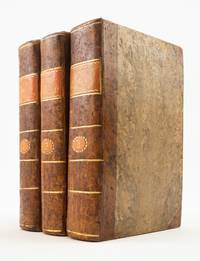
1717ST20754Lyon: Chez Anisson et Posuel 1717. Second Edition. 197 x 125 mm. 7 3/4 x 5". Three volumes. <br/> Pleasing contemporary half calf over paper boards painted to resemble tree calf smooth spines with gilt rules and two citron morocco labels. Attractive woodcut head- and tailpieces throughout WITH 153 ENGRAVED PLATES depicting the scenery flora fauna dress and architecture of locations described. Contemporary ink ownership inscription of De St. George on title page. Brunet V 903; Graesse VII 180. Corners slightly bumped and rubbed joints with just a hint of flaking but the period bindings solid and still extremely attractive survivals. Internally with a handful of quires faintly browned other trivial defects BUT AN UNUSUALLY WELL-PRESERVED SET inside and out.<br/> <br/> This lively narrative of travel at the turn of the 18th century includes a wealth of illustrations and a pleasing period bindings. A professor at the Jardin des Plantes in Paris Joseph Pitton de Tournefort 1656-1708 developed a system of botanical classification that became the standard method until it was superseded by Linnaeus in 1753. He made numerous collecting trips throughout his career; the present work is the record of his most significant voyage through Greece Turkey and along the Black Sea to Armenia and Georgia. The expedition which took place between 1700-02 had been proposed by the Comte du Pontchartrain then Secretary of State in 1699 as both a botanical and commercial endeavor. Tournefort's observations include a wealth of botanical detail but are also a rich source of information about the landscapes and peoples he encountered. He was accompanied on this voyage by German botanist Andreas Gundelsheimer and by the painter Claude Aubriet ca. 1665-1742 who had collaborated with Tournefort on his previous work "Eléments de Botanique." The work of Aubriet a botanical illustrator at the Jardin des Plantes was long appreciated by botanists and laypeople alike for its beauty and accuracy. The detailed depictions of plants here are accompanied by illustrated maps and engravings depicting zoological specimens archaeological sites and the costumes and cultures of the areas visited. The account was published posthumously in 1717 first in Paris and then shortly afterward in the present Lyon edition. The bindings here were never meant to be showy but they have come down to us in a remarkable state of preservation given their pedestrian construction and expected use. Chez Anisson et Posuel unknown
a538971949-50. Issued as a section of the preliminary version of the world Economic Report 1949-50. 4to. 235pp. large color foldout map of region's Principle Transport Route showing roads railroads and airports stapled printed wraps. VG light wear. paperback
a53345London 1953 Europa. A survey and directory of Arabia Cyprus Egypt Iraq Israel Jordan the Lebanon Libya Persia the Sudan Syria and Turkey with geographical historical economic and education surveys concise information about political industrial financial and cultural organisations and Who's Who in the Middle East. 4to. 430pp. hardcover. Institute name stamps ontop and bottom fore-edges bookplate. Spine numbers removed. VG no DJ. . hardcover
a53417Beirut 1973 1974. The Americans for Justice in the Middle East an anti-Israel anti-Zionist group. Volume VII Nos 1 2 3 4. Volume VIII Nos. 1 2. Covers the Yom-Kippur war and various terrorist attacks and the Israeli response. Threats of suicide bombing using commercial airliners. 4to. original covers bound in buckram. Institution stamp on fore-edges and on covers. VG. hardcover
152556635Strasbourg. 1525. Originalt tresnitt. Arkets størrelse : 535 cm X 395 cm. Latin. <br/><br/><em>Latinsk tekst. Bretten noe gulnet et par brunpletter.Med Kypros.Map of Palestine Mesopotamia and Babylonia in present day Middle East.Relief shown pictorially.Includes names of places and natural features.Descriptive text within ornamental borders on verso.Appears in the author's Geographia translated by Willibald Pirckheimer with annotations by Joannes Regiomontanus. Argentoragi i.e. Strasbourg : Iohannes Grieningerus communibus Iohannis Koberger impensis excudebat anno a Christi Natiuitate 1525 tertio Kalendas Apriles. Boston Public Library. </em> unknown
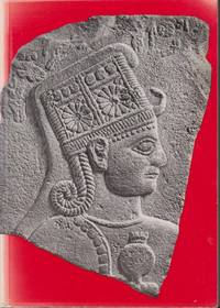
196120239Zürich: Kunsthaus Zürich. 1961. Seventh Edition. Softcover. Very Good. The art of the Hittites in German. Exhibition catalogue from a show at the Kunsthaus Zürich from 1961. Extensive rear section with plates of artifacts. ; 8vo 8" - 9" tall; 110 pages . Kunsthaus Zürich paperback
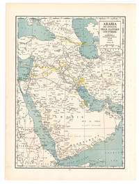
1936L6CG5IA5ETO8Chicago: Geographical publishing company 1936. Colour printed map 54 x 40 cm. Map of the Arabian Peninsula and parts of the USSR Turkey Iran and the British French and Italian colonies in Africa possibly coming from an edition of the Commercial atlas of the world. Printed in yellow are oil fields and pipelines including the legendary Kirkuk-Haifa/Tripoli oil pipeline. Detailed maps of Iran and of British controlled Palestine are printed on the other side.With a few small holes near the inner margin. Geographical publishing company, unknown
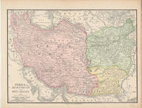
1893174920New York.: Hunt & Eaton. Circa1893. Printed map in colour elevation shown with hachures 29 x 23.5 cm text on the verso relating to entries for Afghanistan Beluchistan and Turkey prepared for Hunt & Eaton's "New York Recorder's Atlas" small tears to the top edge but in very good condition. . Hunt & Eaton. unknown
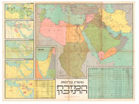
ABC_47243Jerusalem 1973. 121 x 92 cm. Carta Colour-printed map folded. Scale 1:20000000. A large wall map of the Middle East shortly before the Yom Kippur War showing the Arabian Peninsula north-eastern Africa with Libya Egypt and Sudan as well as Turkey and Iraq pictured in their entirety. A separate inset shows Israel others show statistics such as population and trade oil production etc.A few large tears to folds some adhesive tape reinforcements to reverse but well preserved. unknown
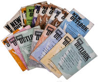
1957L94EK3173IPOTel Aviv: Tazpioth 1957. Original wrappers. 8vo. 18 instalments plus 1 duplicate. A selection of instalments of the magazine: New outlook an Tel Aviv-based monthly devoted to Israeli and Middle Eastern affairs and the promotion of Israeli-Palestinian dialogue and peace. It includes articles on politics poetry agriculture meteorology the Cold War education music education economy etc. covering all countries in the Middle East and from both Jewish and Arab perspectives.A very good set. Tazpioth, unknown
1890174941Chicago.: Rand McNally & Co. 1890. Map with original colour 18.6 x 25.9 cm central fold inner margin darkened and outer margin a bit worn but in very good condition. An appealing map showing Iran/Persia Afghanistan and Beluchistan finely shaded and the borders with Turkey India Turkestan and the Russian Empire. Also noting that "Names referring to Ancient Geography are in Light Characters" and recording submarine telegraph cables. . Rand McNally & Co. unknown
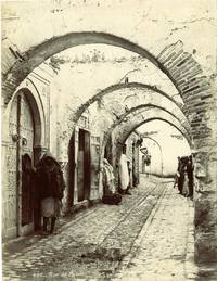
64259c.1880. . Albumen print. Good tonal range and in good condition pasted on original mount photographers title and number in negative. Dimensions: 260 x 200mm. 10.25 x 8 inches.<br /> <br /> [c.1880]. unknown
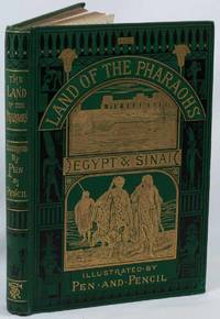
1875223701London.: The Religious Tract Society. 1875. First edition. 32 full page illustrations one double-page including frontispiece map and numerous text illustrations 224pp 8pp "Illustrated Books of Travel" publisher's advertisement original green pictorial cloth elaborately embossed in gilt black and blind spine gilt lettered 28 x 19.5 cms binding bright and unmarked small bump to the lower corner affecting the inner leaves discolouration to the verso of the frontispiece early owner's inked signature a most attractive copy in very good condition. Richly illustrated in a fine pictorial binding from the "Pen & Pencil" series of travel books by the editor of the Religious Tract Society Rev. Samuel Manning 1821–1881. . The Religious Tract Society. hardcover
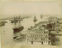
60273c.1890s. . Albumen print 21 x 27 cm; fair tonal range. <br /> <br /> [c.1890s]. unknown
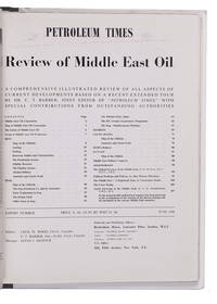
1948L2EG76GNBQ6GLondon: Brettenhem house 1948. Later cardboard binder. 30 x 23.5 cm. With many reproductions of photographs ground plans maps and cross-sections. Extract from the periodical The Petroleum Times containing an extensive article on oil in the Middle East. It opens with a list of Middle East oil companies and their concessions accompanied by a map showing their oil fields followed by a section on the future of Middle East oil. Individual chapters are devoted to the oil industry in Iran Iraq Bahrein Saudi Arabia Haifa Israel and Kuwait describing the area's geology oil fields reservoirs and more illustrated with photographs and cross-sections of the soil. The first 25 and last 16 pages consist of advertisements. Lacking the first 4 leaves of the preliminaries probably advertisements but the article itself complete some leaves slightly creased otherwise in very good condition. Brettenhem house, unknown
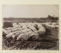
1880ABC_487231880. Tipped onto a stiff paper mount ca. 40 x 30 cm. Kept in a clear plastic sleeve. One albumen print ca. 22.5 x 27.5 cm. Striking image of a large group of Arabic men dressed in white engaged in prayer on a field. The large image was likely taken by a photographer who was active in the Middle East in the late 19th-century but is unfortunately unsigned.The edges are somewhat discoloured and the corners are creased from a past mounting method. Otherwise in good condition. unknown
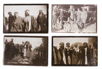
1920ABC_48727Iraq 1920. Kept in a clear plastic sleeve. With 11 snapshots all ca. 6 x 9 cm. Collection of 11 snapshots from the early 1920s likely taken by a British soldier stationed in the Middle East. It is difficult to pinpoint exactly where these photographs were taken but presumably in Mesopotamia present day Iraq. Great Britain was actively involved in Mesopotamia from 1914-1932. Prior to the First World War a large portion of the Middle East was in the hands of the Ottoman Empire. However when the Ottomans sided with Germany in 1914 Great Britain sent forces to Mesopotamia to protect the Anglo-Persian oil fields. The British army initially suffered a major defeat but eventually gained the upper hand and captured Baghdad in 1917. In 1920 after the Ottoman Empire was partitioned the United Kingdom formally established control in the region under a mandate of the League of Nations. However the Iraqi people resented this idea and revolted. In 1922 Great Britain and Iraq then signed the Anglo-Iraqi Treaty in which Iraq was given the right for self-government while Great Britain stayed in control of the country's foreign policy. This would last until Iraq's independence in 1932.The present snapshots were taken in the early days of British control in the region and depict the atmosphere at the time. They show the daily life of locals including women collecting water from the river men standing guard and the hustle and bustle in the streets. Also included are various group photos of British soldiers and locals.The photographs show some traces of wear around the corners and edges but are overall in good condition. unknown
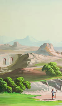
1910J68AIMO7W1D1Palestine 1910. Rolled up and kept in a cardboard tube. An enormous panoramic view drawn in coloured gouaches on a single continuous roll of unwatermarked wove paper 70 x 583 cm the drawing running to the edges of the paper. A panoramic view of what appears to be a fantasy Middle Eastern landscape with spectacular mountains in the background a body of water near each end and a wide variety of buildings and ruins some clearly classical Roman and others Middle Eastern. The combination of classical Roman architecture with dromedaries and other Middle Eastern features places it very likely in Palestine but we have not been able to identify specific buildings. The most distinctive ruin a round Roman temple with five columns on the viewer's side an entablature above them and a vertical base below them looks more like the Temple of the Vesta at Tivoli than like any known in the Middle East the columns are not rendered in sufficient detail to determine their order but they are almost certainly not Ionic and are probably Corinthian. There are also classical Roman aqueducts. The six shepherds with their flocks all wear broad-brimmed hats and have staffs and two are blowing long slightly curved horns. Several more figures with broad-brimmed hats and staffs might be pilgrims one together with what is presumably his wife. With a 33 cm tear into the left end a few insignificant and much smaller tears and with pin holes about 1 cm from the edges from mounting on a wall but otherwise in very good condition and with the colours fresh and bright. A spectacular panoramic view of the Middle East including many classical Roman ruins. unknown