Schachnowitz, S (Selig).Biblio.com

255 résultats
19324609Frankfurt am Main Palästina-Zentrale der Agudas-Jisroel 1932. Soft cover. . ~ ~ NOTE: THE PRICE OF THIS BOOK IS CURRENTLY REDUCED! ~ ~ . Small octavo. Pp. 77 3. Set in Gothic type; thumb-soiled in places. Bound in the original printed stiff wrappers incorporating publisher's and other announcements one of which is illustrated. In a very good condition. ~ First and only edition. Selig Schachnowitz 1874-1952 noted neo-Orthodox journalist and writer. In 1908 at the invitation of Agudat Israel in Germany he became editor of Der Israelit a post he held for 30 years until the journal was closed down by the Nazis in 1938. He escaped to Switzerland taking up residence in Zurich where he continued his public and literary work until his death. Following a visit to Israel in 1931 he wrote "Zwischen Ruinen und Aufbau in Erez-Israel" which praised agricultural settlement and expressed strong reservations about the lack of religious observance in the new Israel. He was a prolific writer and although his various publicistic works were of a religious propagandist nature many were of a high literary standard and attracted numerous readers. For a review of Schachnowitz's travelogue in Palestine see Wolf Kaise: "Palästina Erez Israel" Doctoral Thesis Berlin 1988. I-2 IN <br/> <br/> Frankfurt am Main, Palästina-Zentrale der Agudas-Jisroel paperback
18530869Berlin Reimer 1853. 1st Edition . Hardcover. . ~ ~ NOTE: THE PRICE OF THIS BOOK IS CURRENTLY REDUCED! ~ ~ . Small octavo. Pp. cvi 677. Plus 4 lithographic plates bound in two of which are folding. Some text illustrations; tables footnotes index corrections. HARDCOVER bound in contemporary half cloth and marbled boards bit rubbed at extremities spine gilt with shelf label; old institutional label and stamp to first endpapers scattered spotting throughout paper repairs to gutter margin in few places. In good condition all plates are fine. ~ FIRST EDITION. The first book of this work complete in itself. Tobler 158. Y-3 OUT <br/> <br/> Berlin, Reimer hardcover
51624Chapel Hill: University of North Carolna Press 2009. Goldman ofers a fresh perspective on the history of Zionism deftly weaving together the stories of poets and diplomats Christian scholars and Jewish leaders the Vatican and the State of Israel and modern literary masters." Pp.xiv/367 inscribed by the author to title page 15 illustrations. Blue boards dustwrapper has minor wear to top of spine. VG/VG. Chapel Hill: University of North Carolna Press, 2009. hardcover
1932004247Garden City New York: Crime Club Dble 1932. 1st ed. very light wear at edges else near fine copy in home-made clear acetate dust jacket. The book is tight and square in black cloth covered boards with yellow stamped decoration and printing to the spine and front board. Oriental adventure novel set against background of Middle East slave traffic and other nefarious activities of international gang of criminals lead by evil Chinese mastermind. Considered by some to be among Rohmer's best novels. Bleiler Hubin . First Edition. Hard Cover. Near Fine. Book. Crime Club Dble Hardcover
19694225z1969. Soft Cover. Good. PB/pub.1969/Gd. condition/302 pages - This Text is in French only. AH24225z paperback
2018146462Kurdistan Academics / Kurdistan Institution for Strategic Studies 2018. Trade Paperback. Near Fine. Book is in excellent condition with very light shelf wear only. Binding is solid and square covers have sharp corners exterior shows no blemishes text/interior is clean and free of marking of any kind. 310 pages. Keywords: Kidnaping Human Trafficking Women Girls Middle East Kurds Kurdish Islam Arab Armies Sultans Caliphs Iraq Syria Turkey Iran Fatwa Sex Trade Anfal Children Kurdistan Academics / Kurdistan Institution for Strategic Studies paperback
1985002212Cambridge England: Cambridge Univ Pr. First edition first printing. Hard cover in dust jacket. Published Cambridge England: Cambridge Univ Pr. 1985. 8vo. xii251 pages. Pages somewhat darkened else very good in very good dust jacket. . Very Good. Hard. 1st. 1985. Cambridge Univ Pr unknown
19191206T060London: Andrew Melrose Ltd 1919. 1st Edition . Hardback. Printed pages: xi 288. Very Good Plus. 5.5 x 7.75 inches 13.5 x 20 cm. Blue cloth binding. Light foxing to page edges tanning to free endpapers. Patches of foxing to pages facing plates otherwise clean throughout. Complete with all 9 photographic plates. Overall condition is Very Good Plus. Size: 5.5 x 7.75 inches 13.5 x 20 cm. Andrew Melrose Ltd hardcover
1940153817E. P. Dutton 1940. Hard Cover. Fine/Fair. Book is in excellent condition. Binding is solid and square covers have sharp corners exterior shows no blemishes text/interior is clean and free of marking of any kind. Beige buckram cloth covers with deep red lettering on cover and spine. Book contains over 90 black and white photo illustrations usually full page by the female author who also authored a volume of photos Seen in the Hadhramaut and wrote Baghdad sketches The Vallys of the assassins The southern gates of Arabia and travelled extensively in the region. Three maps. 329 pages with index. Publisher's page reads ""First Edition."" Contents include: Mukalla Kathiri Wadi Amd High Jol Azzan Naqb al Hajr Jebel Kadur Sultan's Caravan Cana etc. wtih an appendix of Arabic plants. Dust jacket is now wrapped in clear protective cover. Keywords: History Arabia Middle East Woman Author Mukalla Kathiri Wadi Amd High Jol Azzan Naqb al Hajr Jebel Kadur Sultan's Caravan Cana Arabic plants E. P. Dutton hardcover
200335807New York New York U.S.A.: BBS Public Affairs 2003. 2d . Hardcover. As New/As New. 2d Large book black spine black boards very bright gilt lettering on spine 218 lightly browned pages. DJ glossy black beneath mylar map of Iraq with unit insignias at center front color photo of General Clark on back. Signed by General Clark. DJ and book both As New. <br/> <br/> BBS Public Affairs hardcover
200338854New York New York U.S.A.: Public Affairs 2003. First Edition . Hardcover. Fine/Near Very Fine. 1st 1st Larger book smooth black spine army green boards bright gilt lettering on spine 218 pages Signed by General Clark on title page. DJ glossy dark green beneath mylar with color-illustration of map with unit patches silver and gold lettering color photo of Clark on back. DJ has two tiny light dents at front spine indentation. Near Very Fine DJ/Very Fine book. <br/> <br/> Public Affairs hardcover
40206London: Simpkin Marshall Hamilton Kent and Co Ltd 1890. 1st edition. "Throws light on the Geography of the Holy Land and brings out in vivid relief the towns and hills and valleys and streams of which the names are so familiar to Bible readers." All edges gilt. Pp.viii/252 engraved frontispiece 8 further engraved plates some scattered foxing mainly affecting the first thirty pages owner's names and ink monogram to front endpapers. Dark green bevelled cloth gilt title and image of a man in arab dress to front gilt title to spine wear to edges. Good. London: Simpkin, Marshall, Hamilton, Kent and Co Ltd, 1890. hardcover
1979MS-15Cambridge England: Middle East & North Africa Studies Press 1979. Comprehensive reference text presents a detailed ten-year study which assesses the scale of renewable and fossil water resources and the achievements and problems of managing water in the arid and semi-arid Middle East and North Africa. Topics covered include: water resource management; surface water; occurrence of natural water resources; groundwater in primary and secondary permeable material; hydrology; technological modifications of the hydrological cycle; integrated technology and its impact in arid areas; etc. 132 pgs. Illustrated. Publisher's stamp on front and rear endpapers. Dustjacket in mylar. First Menas Edition. Hard Cover. As New/As New. 8vo - over 7¾" - 9¾" tall. . Middle East & North Africa Studies Press Hardcover
19010009096New York: Dodd Mead 1901. First edition. Hardcover. Fine. 8vo 313 pages untrimmed blue cloth <br/><br/>This is the American issue of the British sheets. "Though Burton wrote and published many bulky volumes of travel . none of them assumed a popular form . The essays that follow were all prepared by Burton himself . Burton here gives an epitome of his principal travels in three continents - Preface." The "three" continents are Africa South America. North America Asia. Dodd, Mead hardcover
1997MS-44Boulder CO.: Westview Press 1997. When Iraq invaded Kuwait in 1990 the sight of tens of thousands of non-Kuwaiti Arabs Indians East Asians and Westerners fleeing or trapped under occupation made the outside world suddenly aware of a singular fact of Kuwaiti societythat Kuwaitis are an absolute minority in their own country. Basing her analysis on extensive fieldwork and archival research the author examines the social dimension of labor migration to Kuwait since independence in 1961 exploring how the presence of over one million foreign workers has influenced the way Kuwaitis organize their lives and perceive themselves. In particular Longva looks at the relations between two sharply differentiated social categories and the politics of exclusion that have allowed Kuwaitis to protect their rights and privileges as citizens against infringement by the huge influx of expatriates. Longva examines the little-studied system of kafala or sponsorship under which all foreign workers enter and reside in the country showing how it has become the most critical source of power for native Kuwaitis vis-à-vis immigrants. She also addresses aspects of ethnicity and class describes the life of expatriates and looks at developments in gender relations and the role of women in building the national identity in the context of migration and modernization. 266 pgs. Illustrated. Dustjacket in mylar. First Edition. Hard Cover. As New/As New. 8vo - over 7¾" - 9¾" tall. Westview Press Hardcover
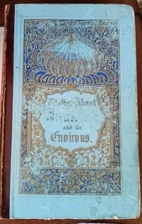
61537<p>London: George Virtue. Good with no dust jacket; Boards worn split along right side of backstrip scattered foxing to preliminary leaves and edges of some of the plates. no date. Second Edition. Hardcover. First edition was published in 1845 and this second edition appears to be circa 1850s. Brown leather gilt stamped spine with blue illustrated paper-covered boards. Many engravings folding maps and views of Jerusalem scenes. viii 252pp 8pp publisher ads. ; 8vo 8" - 9" tall .</p> George Virtue hardcover
2004K8022004. Hardcover. Good. Hardcover/Gd. condition/365 pages - From revival and reform to global Jihad. K802HT9 hardcover
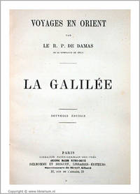
0862Paris Delhomme et Briguet ca. 1870. Hardcover. . ~ ~ NOTE: THE PRICE OF THIS BOOK IS CURRENTLY REDUCED! ~ ~ . Octavo. Pp. 378. HARDCOVER contemporary cloth-backed marbled boards manuscript labels to spine; old institutional stamps to prelims and verso of title small label on half-title. In fine condition. Excellent copy practically unused fresh and bright. ~ New edition with an extended appendix of notes and related information. Tobler 190 earlier editions. F-5 IN <br/> <br/> Paris, Delhomme et Briguet, ca. 1870. hardcover
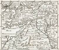
1700402AG1700. Paris c. 1700. Original copper engraved maps. 15.5 cm wide x 13 cm high. Mounted on paper. Very good condition. From a wonderful collection of Maps from an old english library South Shields - with a tiny library stamp to the mounting paper The stamp is NOT on the Map. Nicolas de Fer 164625 October 1720 was a French cartographer and geographer. De Fer was the youngest of three sons of Antoine de Fer who was also a cartographer. When he was 12 he became the apprentice of Parisian engraver Louis Spirinx and made his first map of the Canal du Midi at the age of 23. After the death of his father in June 1673 his mother Geneviève initially took over the map making company which had begun to decline. She passed it and the atelier called Quai de L'Horloge on to Nicolas in 1687 because of her old age. De Fer was so successful at improving the firm that in 1690 he became the official geographer to Louis Dauphin of France. With support from the Spanish and French Royal Families de Fer also became official geographer for Philip V and Louis XIV the kings of Spain and France respectively. Because of this his maps became Bourbon propaganda endorsing French King Louis XIV. His business flourished producing town plans atlases wall maps and more than 600 sheet maps. He made maps of places in Europe and North America including New Spain places fortified by Vauban the Low Countries and the War of the Spanish Succession. In 1698 de Fer published a map of North America which included a depiction of beavers building dams near Niagara Falls. Seventeen years later Herman Moll published a map which plagiarized elements of de Fer's work particularly the beaver scene. It became known as the "Beaver map". De Fer became the official geographer for His Catholic Majesty in 1720. Two of his sons-in-law Guillaume Danet and Jaques-François Bénard continued the company after de Fer's death on 25 October of that year until around 1760. Wikipedia unknown
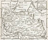
1700403AG1700. Paris c. 1700. Original copper engraved maps. 15.5 cm wide x 13 cm high. Mounted on paper. Very good condition. From a wonderful collection of Maps from an old english library South Shields - with a tiny library stamp to the mounting paper The stamp is NOT on the Map. Nicolas de Fer 164625 October 1720 was a French cartographer and geographer. De Fer was the youngest of three sons of Antoine de Fer who was also a cartographer. When he was 12 he became the apprentice of Parisian engraver Louis Spirinx and made his first map of the Canal du Midi at the age of 23. After the death of his father in June 1673 his mother Geneviève initially took over the map making company which had begun to decline. She passed it and the atelier called Quai de L'Horloge on to Nicolas in 1687 because of her old age. De Fer was so successful at improving the firm that in 1690 he became the official geographer to Louis Dauphin of France. With support from the Spanish and French Royal Families de Fer also became official geographer for Philip V and Louis XIV the kings of Spain and France respectively. Because of this his maps became Bourbon propaganda endorsing French King Louis XIV. His business flourished producing town plans atlases wall maps and more than 600 sheet maps. He made maps of places in Europe and North America including New Spain places fortified by Vauban the Low Countries and the War of the Spanish Succession. In 1698 de Fer published a map of North America which included a depiction of beavers building dams near Niagara Falls. Seventeen years later Herman Moll published a map which plagiarized elements of de Fer's work particularly the beaver scene. It became known as the "Beaver map". De Fer became the official geographer for His Catholic Majesty in 1720. Two of his sons-in-law Guillaume Danet and Jaques-François Bénard continued the company after de Fer's death on 25 October of that year until around 1760. Wikipedia unknown
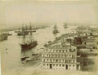
60273c.1890s. . Albumen print 21 x 27 cm; fair tonal range. <br /> <br /> [c.1890s]. unknown
1999032798Berlin: Gerbruder Borntraeger 1999. Second Edition. Cloth. Like New/No d/j as Published. 4to - over 9¾" - 12" tall. Type: Book 205pp. Gerbruder Borntraeger hardcover
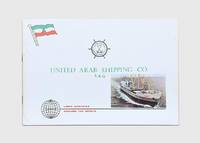
1977178846Kuwait: United Arab Shipping Company c.1977. First edition first printing of this pamphlet explaining the history structure capacity and services of this newly formed shipping company. It contains many full-page illustrations of ships docks the management board and officers in training. "It is the aim of the company to provide complete reliable and economic shipping freight forwarding and cargo handling services for the vast amount of cargo moving into the area for the development of the Gulf countries and to further their national shipping interests" p. 9. This pamphlet was likely produced in 1977 as it lists ten ships that were "due to be delivered" in 1978. These ships took the total fleet size to 58 ships at time of publication. Oblong folio pp. 32. Full-page illustrations throughout many in colour. Original colour printed wrappers wire-stitched as issued. Wrappers lightly scuffed small tidemarks contents bright: a very good copy. unknown
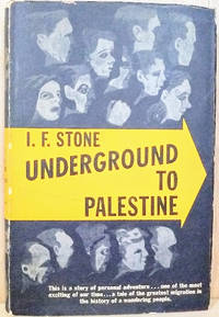
194653020NY: Boni & Gaer. Very Good in Good dust jacket; Pages and jacket toned jacket chipped and . worn. 1946. First Edition. Hardcover. Reddish brown illustrated cloth. The Jewish-American journalist traveled on a ship that evaded British blockades of Palestine in bringing Jewish refugees in. He writes a sympathetic account of the movement to establish a Jewish state in Palestine in the several years before Israel was founded. Illustrations. Author bio and photo on rear jacket flap. ; 8vo 8" - 9" tall; 240 pages . Boni & Gaer hardcover
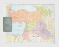
1941179626London: Geore Philip & Son. 1941. A cartographic representation of the Middle East in wartime centred on the Levant and showing oil pipelines seasonal streams and wadis and transportation routes. Colour lithographed map 540 x 660 mm folding away into green card covers lettered in black. Couple of nicks and creases else fine. unknown