PERTHUIS Comtesse (de)Livre Rare Book

4 751 résultats
68137Manuscrit inédit découvert par Fouad debbas, éditions Daran-Nahar, 2007, 246 pp., illustrations, relié, 34,6 x 24,2 cm, jaquette partiellement insolée, bon état.
1377043Paris: Presses de la Renaissance, 2007 in-8, broché, bon état.
c4427Paris, Baudry, 1853 ; 2 tomes en 1 volume fort in-8°, demi-chagrin rouge de l' éditeur, dos à nerfs palts caissons de double fuilet doré tès ornés de petits fers dorés , auteur et titre dorés, plats de toile chagrinée rouge, tranches dorées; 2ff.,399pp.; 2ff.,655pp.;frontispice au tome 1;
174310890Jean Neaulme La Haye 1743 1 vol. 2 tomes en un vol. in 4 de 1 f.n.ch. (page de titre) XLIV 414 pp. et IV 192 pp. 172 pp., pleine basane brune de l'époque, dos lisse orné, pièce de titre en maroquin, dentelle intérieure dorée, tranches marbrées (restaurations soignées aux coiffes et coins).
Colour-printed map, ca. 124 x 97 cm. Constant ratio linear horizontal scale 1:5,000,000. Conic projection. Rare German military wall map of the Near and Middle East, produced during the Second World War for the German General Staff. Marked as "First special edition, for service use only!". Shows international and administrative boundaries, as well as railways, roads, tracks, telegraph lines, and oil pipelines. - Traces of folds; a few minor edge chips. Formerly in the collections of the Geographical Institute of the University of Berlin with the Institute's stamp and pencil shelfmark. OCLC 49986920.
8vo. 66 SS. Halbleinenband der Zeit (Bibliotheksbindung). Ausführlicher Bericht über den mehrtägigen Orientalisten-Kongress an der Universität Wien. Lincke gibt die wissenschaftlichen Verhandlungen der einzelnen Sektionen wieder und beschreibt auch das gesellige Beisammensein im Anschluss. - Rundstempel des Orientalischen Instituts der Universität Leipzig (Arabisch-Islamische Abteilung) am Titel; alte Bibliothekssignaturen.
Large 8vo. 2 vols. XV, (1), 334 pp. XIII, (3), 434 pp. With 2 (instead of 3) folding maps in rear-cover pockets and numerous illustrations in the text and on photo plates. Original illustrated green cloth. First edition of this rare travel account by the diplomat, archaeologist and orientalist Max Oppenheim (1860-1946), a work that made his name as an expert on the orient. With numerous, mainly photographic illustrations. - Bindings professionally restored; wants the large general map. Some slight browning; one map in vol. 2 loose with frayed edges. Henze III, 650ff. OCLC 13166400.
Oblong 8vo. LVI, 236 pp. Full brown calf, richly giltstamped on both covers. All edges gilt. White moirée endpapers. Splendidly bound dictionary of French and Italian words with their counterparts in Arabic, Turkish, and Modern Greek, all in Roman transliteration. Contains brief introductions to the grammar of the various languages. Written for the use of the French army in Northern Africa and the Levant as well as for travellers and tradesmen throughout the eastern Mediterranean. - Pencil note "Relie au Caire" to flyleaf. Some browning throughout, title page and preface as well as final leaves show more pronounced foxing. Bookplate of Gaetano Querci on pastedown; old collection stamps on half-title and title page. Not in Zaunmüller or Vater/Jülg.
8vo. 280 pp. Contemporary cloth with giltstamped spine title. Rare French-Arabic dictionary for use at Lebanese primary schools. - Evenly browned throughout due to paper. Copies known only at the Library of the American University in Cairo, the BnF and at the British Library. OCLC 63514556.
8vo. (32), "290" (but: 288; omitting 257f.), 38 pp. With engraved frontispiece (portrait of Cosimo Medici III) and woodcut Medici coat of arms on title page. Contemporary limp vellum with handwritten spine title. Only edition of this uncommon Italian-Turkish dictionary by the Neapolitan linguist Mascis, interpreter to the Grand Duke of Tuscany (to whom his effort is dedicated). In Roman type throughout, even the table of Arabic letters consists only of the letters' transliterated names. The alphabetical word list is followed by quick-reference sections on the parts of the human body as well as on numbers and the names of the Islamic months, and lists of the languagues spoken throughout the Ottoman Empire (no fewer than 33), of the kingdoms and principalities ruled by the Ottomans, and of the names of all the Ottoman sultans to Mehmed IV, reigning at the date of publication. A final part with separate page numbering contains a basic grammar of Turkish to facilitate translation from Italian into the Turkish language. - Occasional brownstaining. Wants endpapers; contemporary ownership on front pastedown. A little loosened, but complete. A rare little vocabulary. The Macclesfield copy, which wanted the portrait frontispiece, commanded £1060. Zaunmüller 389. Vater/Jülg 414. BM-STC Italian XVII, 554.
Allo stato di nuovo
Benny Morris Vittime. Storia del conflitto arabo-sionista 1881-2001. , Rizzoli 2001, Copertina: rigida, cartonata, leggermente sporca con margini leggermente stanchi. Sovraccoperta: con alette informative, ingiallita e sporca anche in quarta di copertina con margini leggermente stanchi. Dorso: ingiallito e leggermente sporco con margini stanchi in modo lieve alla sovraccoperta. Taglio: molto ingiallito e leggermente sporco. Sguardi: ingialliti. Frontespizio: ingiallito e brunito ai margini della pagina. Pagine testo: ingiallite e brunite ai margini. Margini delle pagine: molto ingialliti. Legatura: a colla. Buono (Good) . <br> <br> <br> 939<br> 9788817867603
8vo. 144 (but: 150) pp. With a full-page woodcut (crucifixion) after the preface. Contemporary limp paper boards. Only edition of this life of the Saints Leontius and Carpophorus, Christians martyred under the Diocletianic Persecution early in the 4th century. Their relics where brought from Rome to Vicenza, where both are still revered. According to tradition, they were physicians of Arab extraction, their father having hailed from Syria. This account of their martyrdom and miracles also includes a life of their sisters Euphemia and Innocentia. - Some browning and waterstaining throughout. First quire loosened and reinforced in the gutter; several erroneous page numbers corrected by a contemporary hand. A hole in the upper board cover. Very rare: only two copies known in libraries (Montecassino and Bertoliana Vicenza). ICCU VIAE\002487.
4to. (40), 24, (4), 25-234 pp., final blank leaf. With 3 engraved plates. Contemporary vellum with ms. title to spine. Very scarce first and only edition of the life and death of San Alipio, who was captured by Ottoman pirates on 1 July 1643 and brought to Tripoli. He converted to Islam, but repented and was martyred on 17 February 1645 when he told to the Pasha that he wished to return to his Christian faith. The plates show the martyrdom (a supersized image after the prelims, folded in at the bottom) and the holy relics of the Saint. - Some defects to spine, otherwise fine. Old ownership of the "Convento dell' Angelo Custode" on the flyleaf. Streit XVI, p. 525, no. 4001. ICCU UM1E\007052.
556850Watertown, Armenian Studies, 1965. In-8 broché, 82 pp., 2 cartes dans le texte.
Pagine: 726 . Illustrazioni: Foto fuori testo in bianco e nero . Formato: 16° . Rilegatura: Cartonato con dorso in tela . Stato: Buono .
4to. XII, 23, (5) pp. Arabic letterpress text within red ornamental borders. Contemporary papered spine. Only edition; exceedingly rare. - At first glance, the editio princeps of an ancient Arabic encomium based on two manuscript sources, accompanied by copious notes on the text as well as by German and Latin versions, and published on the occasion of the 50th teaching anniversary of Christian Woltersdorf, the director of the Salzwedel grammar school, by Friedrich Wilhelm Gliemann (1792-1864), teacher at the school. The few holding libraries unanimously cite the author as "Abu-’l Harr al-Mumallih", a poet entirely unknown to oriental literary history. Contemporary reviewers were quick to point out that the publication is, in fact, an elaborate hoax as scholarly as it is witty: "Indeed, the poem constitutes a cento assembled by Mr. Gliemann, in the main based on several poems of the Hamasah genre and on the encomium of Safieddin, edited by Bernstein [in 1816]. Yet the feat of properly conjoining these various pieces to form a whole, in a single, pure and correct metre, reveals no mean knowledge of Arabic. Several of the verses are of Mr. Gliemann's own invention. And so it is evident that the purported editor is none other than Abu’l Charr himself (the 'father of the embers', a pun on the name, 'Glühmann'), and that the variant readings of the second MS are nothing but different readings of the various passages of the original" (cf. Ergänzungsblätter zur A.L.Z. [1829], col. 263f.). - Printed on fine, crisp writing paper with tree watermark. Slight corner flaws to Latin and Arabic title-pages, otherwise a clean and wide-margined copy. Only four copies known in institutional possession (Halle, Leipzig, Göttingen, Greifswald). A rare and highly original piece of Arabic scholarship. OCLC 257626548.
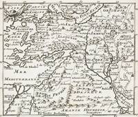
1700402AG1700. Paris c. 1700. Original copper engraved maps. 15.5 cm wide x 13 cm high. Mounted on paper. Very good condition. From a wonderful collection of Maps from an old english library South Shields - with a tiny library stamp to the mounting paper The stamp is NOT on the Map. Nicolas de Fer 164625 October 1720 was a French cartographer and geographer. De Fer was the youngest of three sons of Antoine de Fer who was also a cartographer. When he was 12 he became the apprentice of Parisian engraver Louis Spirinx and made his first map of the Canal du Midi at the age of 23. After the death of his father in June 1673 his mother Geneviève initially took over the map making company which had begun to decline. She passed it and the atelier called Quai de L'Horloge on to Nicolas in 1687 because of her old age. De Fer was so successful at improving the firm that in 1690 he became the official geographer to Louis Dauphin of France. With support from the Spanish and French Royal Families de Fer also became official geographer for Philip V and Louis XIV the kings of Spain and France respectively. Because of this his maps became Bourbon propaganda endorsing French King Louis XIV. His business flourished producing town plans atlases wall maps and more than 600 sheet maps. He made maps of places in Europe and North America including New Spain places fortified by Vauban the Low Countries and the War of the Spanish Succession. In 1698 de Fer published a map of North America which included a depiction of beavers building dams near Niagara Falls. Seventeen years later Herman Moll published a map which plagiarized elements of de Fer's work particularly the beaver scene. It became known as the "Beaver map". De Fer became the official geographer for His Catholic Majesty in 1720. Two of his sons-in-law Guillaume Danet and Jaques-François Bénard continued the company after de Fer's death on 25 October of that year until around 1760. Wikipedia unknown
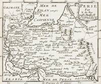
1700403AG1700. Paris c. 1700. Original copper engraved maps. 15.5 cm wide x 13 cm high. Mounted on paper. Very good condition. From a wonderful collection of Maps from an old english library South Shields - with a tiny library stamp to the mounting paper The stamp is NOT on the Map. Nicolas de Fer 164625 October 1720 was a French cartographer and geographer. De Fer was the youngest of three sons of Antoine de Fer who was also a cartographer. When he was 12 he became the apprentice of Parisian engraver Louis Spirinx and made his first map of the Canal du Midi at the age of 23. After the death of his father in June 1673 his mother Geneviève initially took over the map making company which had begun to decline. She passed it and the atelier called Quai de L'Horloge on to Nicolas in 1687 because of her old age. De Fer was so successful at improving the firm that in 1690 he became the official geographer to Louis Dauphin of France. With support from the Spanish and French Royal Families de Fer also became official geographer for Philip V and Louis XIV the kings of Spain and France respectively. Because of this his maps became Bourbon propaganda endorsing French King Louis XIV. His business flourished producing town plans atlases wall maps and more than 600 sheet maps. He made maps of places in Europe and North America including New Spain places fortified by Vauban the Low Countries and the War of the Spanish Succession. In 1698 de Fer published a map of North America which included a depiction of beavers building dams near Niagara Falls. Seventeen years later Herman Moll published a map which plagiarized elements of de Fer's work particularly the beaver scene. It became known as the "Beaver map". De Fer became the official geographer for His Catholic Majesty in 1720. Two of his sons-in-law Guillaume Danet and Jaques-François Bénard continued the company after de Fer's death on 25 October of that year until around 1760. Wikipedia unknown
In-8, 220p. Avec 27 illustrations hors-texte. A l'état de neuf, non coupé.
197999057Paris Chêne/Hachette 1979 1 vol. relié in-4 oblong, cartonnage éditeur, jaquette illustrée, non paginé. Premier tirage des 81 photographies en couleurs de l'auteur. Bonne condition.
197999057Paris Chêne/Hachette 1979 1 vol. relié in-4 oblong, cartonnage éditeur, jaquette illustrée, non paginé. Premier tirage des 81 photographies en couleurs de l'auteur. Bonne condition.
Collection of 4 press photos, c. 130 x 180 mm each. The Government building, palace, two minarets, and a downtown street scene. Hungarian press captions on reverse.
Oblong 8vo. 53 printed photographs on 27 ff. printed in sepia to rectos only, contained in original printed card covers with oval window. A remarkable series of photographs of the peoples and places of South Persia (modern Iran and Iraq). The first leaf - which contains the title with a small portrait of a street seller - is followed by four leaves showing views of the Abadan Refinery. The remaining leaves show scenes in Mohammerah (now Khorramshahr), Shatt-el-Arab, Dizful (Dezful), Ahwaz (Ahvaz), as well as artistic views of the coast ("Moonlight on the Shatt-el-Arab", "Sunset in the Gulf"). There are also further portraits of street sellers and other local people (dervish, snake charmer, barber). The booklet closes with a view of the "Pumping Station, Tembi" which served the Abadan refinery, "The road up to the oil fields", and a view of the Ctesiphon Arch. An uncommon and nicely produced view-book of the area. - Minor spotting to first leaf, creasing to upper wrapper but contents generally in good, clean condition.
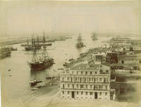
60273c.1890s. . Albumen print 21 x 27 cm; fair tonal range. <br /> <br /> [c.1890s]. unknown