Modiano, ColetteMareMagnum

4 751 résultats
No marks or inscriptions. A very clean very tight copy with bright unmarked boards and no bumping to corners. Dust jacket not price clipped or marked or torn with very minor creasing to spine ends. 189pp. Travel and history from the author - wanderings through the Lebanon, Mesopotamia, Israel, Jordan and Syria.
Fine English Paperback. Pbo. Roy. 8vo. (24 x 17 cm). Articles in English, German, French and Turkish. [vii], 305, [1] p., b/w plts. Turkish and Islamic Science and tecnology in the 16th century. II. International Congress on the History of Turkish and ISlamic Science and Technology.= 16. yüzyilda Türk ve Islam bilim ve teknolojisi. II. Uluslararasi Türk ve Islam Bilim ve Teknoloji Tarihi Kongresi. Proceedings.= Bildiriler. 28 April - 2 May, 1986. Vol. 1. ISLAM Islamic world History of science Ottoman Empire Middle East Mamluks Iran Arabic world Engineering Numismatics Archeology Architecture Astronomy.
Very Good English Paperback. Pbo. Roy. 8vo. (24 x 17 cm). In English. [4], 98, [1] p. Turkey's place in the Middle East. Economic, political and cultural dimensions. International Girne Conferences. Edited by Erol Manisali.
As New English Paperback. Pbo. Mint. Roy. 8vo. (23 x 16 cm). In English. 224 p. "The International Girne Conferences were held in Girne between 1984 and 1994. Regional and international issues and problems have been discussed by International and Turkish figures in economics and politics. Most of the papers and discussions were published in a book from after the conferences. In 1988 and 1989 Turkey's place in Europe and in the Middle East were under discussion. The book contains well known Turkish and regional experts of the international community".
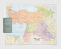
1941179626London: Geore Philip & Son. 1941. A cartographic representation of the Middle East in wartime centred on the Levant and showing oil pipelines seasonal streams and wadis and transportation routes. Colour lithographed map 540 x 660 mm folding away into green card covers lettered in black. Couple of nicks and creases else fine. unknown
Heliozincograph in colour, 590 x 465 cm. Scale: 1 inch to 4 miles (1:253,440). Exceedingly rare and classified at the time of release: one of the first maps to depict clearly the Abadan Petroleum Refinery, the first oil refinery in the Middle East. The map of the Khorramshahr-Abadan area of Iran and the lower Shatt al-Arab waterway at the head of the Arabian Gulf was published in the early days of World War I, when protecting the refinery was Britain’s primary objective in the region. Published in Calcutta by the Survey of India, predicated on the best and most recent surveys. Labelled "For Official use only". - Some creasing; some stains to upper margin. An abrasion to upper neatline with old repair on verso; an old tear with minor loss to upper left blank margin with old repair from verso.
Fine English Paperback. Pbo. Roy. 8vo. (24 x 17 cm). In English. 172 p. This book aims to analyze Turkish policy in the Greater Middle East area. The events and discussions that view the region as having a discrete political as well as geographic identity have gained prominence in political circles and in academic analysis. The U.S. administration's stated goals are to create order and stability in the Greater Middle East area that consists of the countries from North Africa to Indian subcontinent and from Saudi Arabia to Central Asian steppes. Since the September 11 attacks to the U.S., the only country that promoted both security and freedom at home in the Greater Middle East region has been Turkey. Thanks to its dual European and Middle Eastern identities, its political and social modernization and its democratic standards, Turkey is strategically important to both U.S. and European interests in many respects and is therefore a natural key to any plan or concept that aims to promote democracy and raise living standards in this region. With its ability to reconcile democracy and Islam and as well as democracy and security, Turkey is the best candidate to suggest and help initiate internal mechanisms for positive change in the Greater Middle East.
8vo. First edition. XV, (1), 328 pp. With lithographic map bound as frontispiece. First edition; flyleaf inscribed by the author to "Mr A. Regnaudin". Important overview of Turkish trade, resources, infrastructure and municipal organisation by the diplomat David Urquhart (1805-77). After two and a half years fighting in the Greek war of independence, Urquhart was invited to accompany Sir Stratford Canning to Constantinople in November 1831 as an advisor during negotiations to settle the Greek boundary. In 1832 Urquhart was sent to Albania to cultivate the support of Rechid Pasha, leading advisor to the Turkish sultan. Urquhart became a great supporter of Turkey, spending most of 1834 in the country, and encouraged the British government to ally itself with Turkey against Egypt. This substantial book was written to inform the British political class of the possible commercial benefits of an Anglo-Turkish alliance. - Some negligible toning to first few leaves. Very good, uncut in original grey paper-covered boards, spine with original printed label, light wear to extremities. Scarce, particularly in original condition as here. Goldsmiths’ 27883. OCLC 65261681.
Engraved map, outline colour (560 x 450 mm). Decorative map of the Turkish Empire, showing the Ottoman territories in the Balkans, Anatolia, Levant, Arabia and North Africa, published by Henricus Hondius in Atlas sive Cosmographicae Meditationes de Fabrica Mundi et Fabricati figura. The map has a decorative cartouche with the portrait of Ottoman Sultan Mahomet Turcorum Imperat 2. The English translation of the text (1636 edition) includes observations such as "The Countrie is for the most part fruitfull in graine, as wheate, barlie, oats, winter wheate, beanes, pease, and all manner of pulse. It aboundeth in rice, flaxe and cottons. They have vines, whose fruit they make use of after divers manners. The Christians make wine of them, & the Turcks prepare a kind of sweete meate, by mingling honey and grapes together, which seemeth allwayes fresh, both to the sight & tast, this they call Vsum Turssi (sic)." Tibbetts 63. Al Ankary 178. Al-Qasimi 50.
Engraved map (49 x 37 cm). Contemporary hand-coloured. Matted. Map of the Arabian Peninsula, Turkey, North Africa, Syria, Israel, the Balkans, etc. From the "Theatrum Orbis Terrarum" by Abraham Ortelius. - Slightly age-toned and brownstained. Green faded to brown; repaired tear with tiny holes in the middle. Generally in a good condition. Van den Broecke, 169. Al Ankary 15. Tibetts 42.
Milano, 1935, stralcio con copertina posticcia muta, pp. 35/63 con numerose fotografie e tavole fotografiche. - !! ATTENZIONE !!: Con il termine estratto (o stralcio) intendiamo riferirci ad un fascicolo contenente un articolo di rivista, sia che esso sia stato stampato a parte utilizzando la stessa composizione sia che provenga direttamente da una rivista. Le pagine sono indicate come "da/a", ad esempio: 229/231 significa che il testo è composto da tre pagine. Quando la rivista di provenienza non viene indicata é perchè ci è sconosciuta. - !! ATTENTION !!: : NOT A BOOK : “estratto” or “stralcio” means simply a few pages, original nonetheless, printed in a magazine. Pages are indicated as in "from” “to", for example: 229/231 means the text comprises three pages (229, 230 and 231). If the magazine that contained the pages is not mentioned, it is because it is unknown to us.
Ottima copia gr 500
4to. (16), 458, (2) pp. With the title in a woodcut architectural frame. Contemporary vellum. "First printing of the Pentateuch in Arabic characters" (Smitskamp). Edited by Thomas Erpenius and printed with his influential nashk Arabic types, cut under his direction by Arent Corsz. Hogenacker in Leiden. It gives the text of a 13th-century translation of the Pentateuch in the Maghreb dialect (spoken in Mauritania). Erpenius was one of the most distinguished orientalists and by far the best Arabist of his day. He published an influential Arabic grammar and several excellent critical editions. His own private printing office, equipped with Hebrew, Arabic, Syriac, Ethiopic and Turkish type, produced its first works as early as 1615. - With bookplate, owner's inscription and library stamp of Verplanck Colvin (1847-1920). Occasional spots, some leaves with a minor waterstain in the upper or lower margin, nor affecting the text. A good copy, with generous margins. Binding slightly soiled and with a restoration to the front inner hinge, but otherwise good. Breugelmans 1622-2. Darlow/Moule 1645. Smitskamp, PO 86.
555636Oxford, Currey, 2000. In-8 broché, XII-244 pp., ill. phot. en noir, chronol., bibliogr., index. (World Anthropology).
555573S.l., Edgewood. Publ. Co., [vers 1896]. In-8 reliure éditeur pleine toile vert amande, titre illustré au dos et au plat sup., XV-574 pp., ill. photogr. en noir h.-t., index.
557028Fresno (Californie), Meshag Publications, 1982. In-8, broché, couv. ill., 574 pp., ill. en noir h.-t., une carte dépliante. Index.
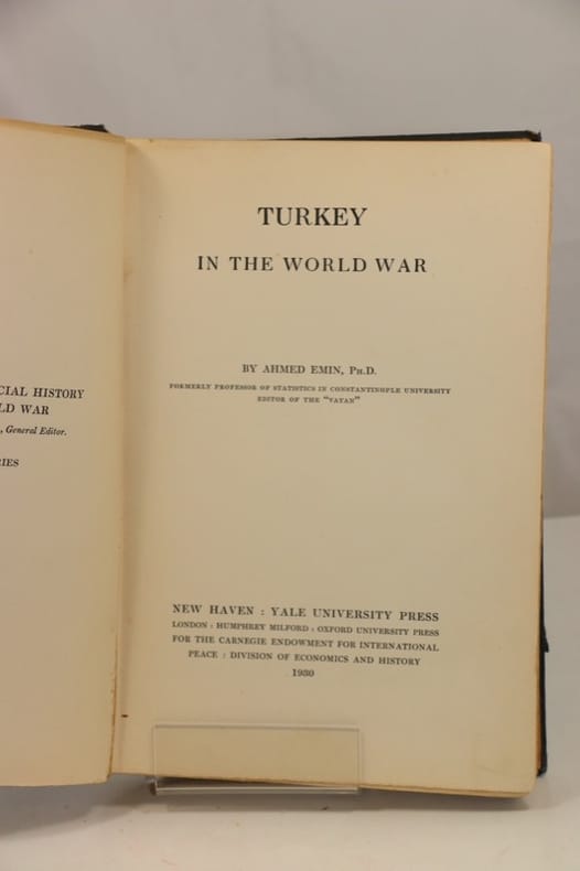
556834New Haven, Yale University Press, 1930. Grand in-8 reliure éditeur pleine toile noire, XVIII-310 pp., index.
556205London, Allen, 1957. In-8 reliure éditeur pleine toile sous jaquette, XIV-244 pp., 3 cartes dans le texte, biblio., index.
555639London, Darf, 1985. In-8 cartonnage éditeur sous jaquette, XVI-340 pp., ill. en noir h.-t., index.
515162Cairo, Ministry of Education Press, 1953. In-8 broché, 78 pp., ill. photogr. en noir et fig. dans le texte, bibliogr., index. (Collections of the Museum of Islamic Art, 1).
555926London, The Traval Book Club, 1951. In-8, rel. d’éditeur percaline brune, 258 pp., cartes in-t. Index.
189069382Maison Quantin | Paris 1890 | 24.50 x 31.50 cm | relié
Small folio (185 x 246 mm). (7), 75, (2) ff. With 2 (instead of 4) double-page-sized engraved maps and a double-page-sized compass rose plate, all in contemporary hand colour. Early 20th century half calf over marbled covers with title gilt to spine. The first illustrated printed Turkish book and the second work from the press of Ibrahim Müteferrika. Composed in 1656, this is a compilation containing in its main section a history of the Ottoman navy and naval wars, from the conquest of Constantinople down to the author's own lifetime. It includes an introductory geographical summary of the conditions around the Balkans and the Black Sea, a chronological list of all Ottoman admirals, a description of the administrative organisation of the navy and dockyards, regulations on sea battles, ships in the Ottoman navy, their equipment and maintenance, together with suggestions for improvement. - The maps show the Mediterranean and the Adriatic Sea (some edge flaws; rebacked; lacks the map of the Black Sea and the world map). Some browning and waterstaining throughout; ff. 17-18 transposed between ff. 4 and 5, ff. 25-28 between ff. 22 and 23. Watson 2. Atabey 898. Özege 21273. Babinger 12. Blackmer 1176. De Sacy III, 5017. Toderini III, p. 25, no. II.
8vo. (8), 384 pp. Cloth-backed red boards with title inked on spine, likely privately bound. Very rare privately published botanical text on the famous expedition of the Jewish agronomist Aaron Aaronsohn (1876-1919) through the Anti-Lebanon mountain range and his subsequent discovery of what was claimed to be the oldest wild wheat, ancestor of all farmed wheat today. - While the exact line of descent of modern wheat is contested and complex, Aaronsohn's wheat - wild emmer - was indeed ancient, and its discovery remains a landmark moment in historical botany and the study of the history of human civilization. Like much of Aaronsohn's work, his detailed notes on the wild wheat distribution and other botanical notes on the landscapes he surveyed were published posthumously by Aaronsohn's family. The text includes numerous scientific names and an index, plus 13 botanical designs and 38 photoplates documenting the expedition. A folding map at the rear is titled "Aaronsohn's travels in Jordan and the distribution of wild wheat in the land of Israel". Largely in Hebrew, supplemented with scientific Latin, this Hebrew version is very uncommon, as Aaronsohn's work was originally published in French as "Florula transiordanica: révision critique des plantes récoltées et partiellement determinées", also by his family, in 1931. - Binding bumped at extremeties; a few library stamps to title-page, along with some minor paper repairs. Altogether in good condition. OCLC 42945306.
189513689F. Juven Paris 1895 1 vol. In-8 de VI 454 pp. 1 f.n.ch., pleine percaline éditeur, premier plat et dos décoré, tranches dorées.