4 750 résultats
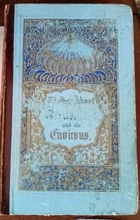
40206London: Simpkin Marshall Hamilton Kent and Co Ltd 1890. 1st edition. "Throws light on the Geography of the Holy Land and brings out in vivid relief the towns and hills and valleys and streams of which the names are so familiar to Bible readers." All edges gilt. Pp.viii/252 engraved frontispiece 8 further engraved plates some scattered foxing mainly affecting the first thirty pages owner's names and ink monogram to front endpapers. Dark green bevelled cloth gilt title and image of a man in arab dress to front gilt title to spine wear to edges. Good. London: Simpkin, Marshall, Hamilton, Kent and Co Ltd, 1890. hardcover
Large 4to (260 x 328 mm). 26 bi-chrome lithographed double-page maps (each 485 x 315 mm), with 48 sheets of interleaved text, all contents unnumbered and entirely in Ottoman Turkish. Original half black cloth over red boards with cover bearing the title and the Tughra of Sultan Mehmed V Reshad in gilt. This is one of the rarest and most extraordinary works of late Ottoman cartography, produced by the Interior Ministry at the behest of the "Young Turks" regime on the eve of World War I. Published with text entirely in Ottoman Turkish, the atlas consists of 26 double-page maps, all of an extraordinary proto-modernist design, accompanied by detailed text explaining all of the road itineraries depicted. All of the maps are original productions, predicated upon the latest official sources supplied by both state engineers and private contractors. Of the maps, eight focus exclusively upon subjects from the Arab world, including a dedicated map of the Hejaz (with the Hejaz Railway and pilgrimage routes), as well as a map focussing upon Mecca and Jeddah. The atlas provides by far and away the most comprehensive and accurate record of the road system throughout the Ottoman Empire, taken in the wake of an unprecedented wave of infrastructure development. Additionally, while not part of the technical remit of the work, the maps also provide a stellar overview of the Ottoman railway system, including the Hejaz Railway and the in-progress Anatolian-Baghdad Railway. The atlas therefore gives the most authoritative historical accounts of the technical nature of the empire’s key corridors of military and commercial movement, as well as the most important routes of the Hajj Pilgrimage, during a critical historical juncture. - Internally remarkably clean and crisp, just some light natural oxidization of the original glue along the gutters of some leaves and light even toning to text pages, plus a few negligible stains, but overall in a very good condition. Özege 22737. Türkiye Diyanet Vakfý - Ýslâm Araþtýrmalarý Merkezi (ÝSAM) [Turkey Diyanet Foundation - Centre for Islamic Studies, Istanbul] 912.95607 VÝL.Y. Dâhiliye Nezareti Umur-i Mahalliye ve Vilayat Müdürlügü Evraki [Archives of the Turkish Interior Ministry, Ankara] DH UMVM 74/31. Istanbul Büyüksehir Belediyesi Atatürk Kitapligi [Istanbul Metropolitan Municipality Atatürk Library] 23589. OCLC 51297423 (listing the work, but not citing the locations of any examples). - Citations in recent academic publications: E. Erol, The Ottoman Crisis in Western Anatolia: Turkey’s Belle Epoque and the and the Transition to a Modern Nation State (London, 2016), pp. 73 & 301. A. Kisa, "II. Mesrutiyet Dönemi’nde Bitlis Vilayeti’nde Karayollari" [Highways in Bitlis Province During the Second Constitutional Era], Tarih ve Gelecek Dergisi, Aralik 2019, Cilt 5, Sayi 3 [Journal of History and the Future, December 2019, Vol. 5, Issue 3], pp. 702-711, esp. pp. 707-708.
570 x 420 mm. Colour lithograph, signed "Ibrahim K.". Mounted on styrofoam board. Bilingual safety poster in Arabic and English. - Traces of folds.
760 x 750 mm. Scale 1:1,000,000. Relief shown by hachures, spot heights, submarine contours, airports and airstrips, mining activity, and land routes. Key in English. Printed on cloth. Blueprint map of Saudi Arabia covering 20-26° N and 38-45° E, extending from the Nejd to the Red Sea coast including Jeddah and Yanbu al-Nakhal. It pays particular attention to geological features, showing the lava fields of Harrat Rahat, Harrat Kishb, Harrat Khaybar, Harrat Nawasif, Harrat Buqum and Harrat Hadan, as well as the Uruq Subay dunes and the tribal areas of Bilad Zahran and Bilad Ghamid. Among the most prominent labelled cities are Mecca with its environs (Muna, Shumaysi), Medina, Jeddah and Taif; the Darb al-Hijaz (Riyad-Jeddah Road) is named. - The sheet was prepared as a working document by Aramco and the US Geological Survey to help them in the early stages of comprehensive nationwide mapping and exploration work for the Saudi Government. - Slightly toned along folding lines and right margin.
8vo. (24), 216 (misnumbered as 226), (8) pp. (pagination skips from pp. 80 to pp. 91 due to a printers' error, with no missing text). 18th century full leather ruled in blind and gilt, titled in gilt on red morocco spine label. Early English account of Muslim North Africa. An early example of notoriously difficult Arabic typesetting appears in the index of 'Moorish Words' at the rear, where Arabic terms are listed in both romanized and Arabic alphabets. - The Reverend Lancelot Addison (1632-1703), father of the essayist Joseph Addison, lived and worked as a chaplain in Tangier in northwest Morocco for seven years, which provided the basis for his historical accounts and gave him some knowledge of Arabic. Here he discusses, with some editorialising, the marital dramas of Moroccan dynastic struggles as well as the local traditions of cattle farming, and explains the camel to his European audience. - Leather rubbed and scuffed; spine, binding, and corners repaired; some offsetting to endpapers and half-title; light toning and foxing. Contemporary handwritten ownerships "Tho. Willughby" to front free endpaper and "T. Willughby" to title-page, probably belonging to the influential Tory politician Thomas Willoughby, 1st Baron Middleton (1672-1729), second son of the Warwickshire naturalist Francis Willughby (1635-72).
8vo. (2), 307, (1) pp. Contemporary marbled half calf with giltstamped red label to prettily gilt spine. All edges red. First German translation of the "Layiha" of Ahmet Resmî bin Ibrahim Giridî (1700-83), a Greek-Ottoman statesman and diplomat and Turkey's first ambassador to Berlin. A political memoir on the Ottoman-Russian war of 1768-74, one of the few existing accounts from the Turkish perspective. Between 1772 and 1773 the Ottomans undertook ultimately abortive negotiations with the Russians during which Ahmed Resmi pressed for peace, arguing that the Russians were badly overextended and that both sides should recognize their military and territorial limitations. Such thinking was still novel in Ottoman administration and represents the good understanding of the balance of power diplomacy which the author had gained at the courts of Vienna and Berlin. - The oriental scholar H. F. Diez (1751-1817) had trained as a jurist but, bored by his administrative occupation, soon left the Prussian civil service and in 1784 went to Constantinople as Frederick the Great's chargé d'affaires at the Sublime Porte. He was ennobled after only two years of successful diplomatic service. Recalled in 1790 on the eve of the Russo-Turkish War, the self-confessed Turkophile soon retired to the life of an independent scholar and book collector in Berlin. His orientalist publications captured the attention of the learned world, and he moved in the circles of Goethe, Gleim, and Alexander von Humboldt, though largely outside the contemporary tradition of academic oriental studies. "Even if many aspects of his scholarly life are almost forgotten, his merits, especially for the development of Turkish studies, are noteworthy [...] His works, almost completely printed at his own expense, reflect his interest in the origins of Asian cultures, literatures, and politics, as well as everyday issues and ethics" (J. Gonnella et al. [ed.], The Diez Albums [Leiden, 2017], p. 58, 76). - Corners slightly bumped, otherwise very good. Bookplate of the "Brigade-Schule zu Potsdam"; several 19th century stamps of Prussian military academies on title-page; old shelfmark label to spine. Katalog der k. k. Kriegs-Bibliothek (1853), p. 266.
Folio (210 x 345 mm). 22 issues. Together (58), 388 pp. With 2 photographs, 1 plate of graphs showing incidents in Egypt, June-July 1946, 1 folding plan of Persian Azerbaijan, 1 folding plan of Greece and Western Turkey, and 1 folding map of Middle East Intelligence. Original printed stapled wrappers. An intriguing specimen of British post-war intelligence documentation rarely seen in the trade, focussing on but not limited to the Middle East. Based on the Middle Eastern Intelligence services' zones of major responsibility and their spheres of interest (see the map in vol. 100), their reviews cover a vast range of topics. They not only outline the Anglo-Egyptian treaty negotiations and the political situation in Libya, Palestine, and Syria, but also discuss the Arab League (photograph of a meeting of the League in vol. 90), terrorist attacks carried out by Jewish illegal forces in Palestine, the struggle with illegal immigration (a photograph showing a boat of immigrants in vol. 74), and political Zionism. However, the reviews also cover the political and economic situation in Germany, the problem of former Nazi sympathisers regaining positions of power and security (sketched out in the case of "Dr. Drecksacker"), and include an eye-witness report by an SS man employed at the Auschwitz concentration camp, translated into English. British views on Russia make up another significant part, including the reprint of an article by the American journalist Brooks Atkinson, published in the U.S. magazine "Life", accusing Soviet leaders of "group paranoia", as well as analyses of Russian broadcasts with respect to Middle Eastern countries. Moreover, the reviews outline British relations with Greece and the Balkans, France, Yugoslavia, Bulgaria, Italy, Turkey and Kurdistan, Romania, and India, while also discussing the organisation and functions of the U.N. - Despite the imprint indicating a print run of 400 copies, none can be traced on WorldCat. A 12-volume set was sold at Christie's in 2018. - Wrappers have stamps of the "Assistant Director of Medical Service 3rd Divisions". Traces of rust near the staples. The first two pages of vol. 100 loose; a small tear on pp. 9f. of vol. 90, as well as a small flaw to the title-page of vol. 98, neither touching the text. - A rare window into the issues that concerned the British military intelligence following WWII.
4to. 63 pp., final blank page. With map frontispiece and several illustrations and tables in the text. Contemporary printed wrappers. Stapled. First edition. Rare climatological study originating from a series of meteorological handbooks of the Indian Ocean issued by the British government between 1940 and 1944. The three-volume series, comprising a total of 12 parts, was prepared by the Meteorologial Office, Air Ministry, in cooperation with the Naval Meteorological Branch, Admiralty, London; it was reprinted for the U.S. Navy as late as 1980. The ESSA Technical Memorandum of 1969 mentions another reprint in 1945. - The present volume is the last of nine parts of volume II, covering the climate of the East African coast from the equator to Cape Delgado, discussing tropical cyclones and depressions, winds, visibility, clouds, rain and hail, temperature, humidity and other meteorological events. The frontispiece shows a map of the relevant area; additional diagrams illustrate surface winds and higher winds, as well as the amount of clouds and rainfall. The tables show the general climate in Mombasa, Tanga, Zanzibar, Dar es Salaam, Kilwa, and Lindi, as well as the monthly frequency of wind direction and force at sea and in the upper air, and the visibility at coastal stations. - Library shelfmark in pencil, as well as a mounted blank loaning sheet to final blank page. 7 combinations of letters and digits in black felt pen to lower cover. Traces of a shelfmark label and a cancelled inscription to front cover. Not a single copy in auction records. U.S. Department of Commerce, ESSA Technical Memorandum EDSTM10, A Note on Climatology of Thailand and Southeast Asia, 164, 19. OCLC 1181290135.
2 vols., 8vo., First Edition, with numerous plates, maps in the text, and front and rear endpaper maps; grey cloth, gilt backs, blue tops (faded), a very good, bright, clean set in dustwrapper, the latter chafed at extremities. The acclaimed and definitive life of the great commander-in-chief in the Middle East and India ('the only British general who showed a touch of genius' said Rommel). The first volume covers his career to June 1941; the second (completed and edited by Brigadier Michael Roberts following Connell's untimely death) deals with 1941-1943. Enser, p.471.
Small 4to. (8), 253, (1) pp., final blank leaf. Contemporary full cloth with giltstamped spine title. Top edge red. First edition. - In his fourth travel book the British writer Waugh (1903-66), who was commissioned by the Daily Mail to cover events in Ethiopia in August 1935, makes a case for the Italian intervention in the country, presenting "a lucid and interesting narrative of personal experience, and useful as a minority defense of Italian occupation and attack on British policy" (Morris/Dooley). Interestingly enough, a printed sheet of paper denying the oil magnate Francis William Rickett access to travel facilities to Persia and the states on the Persian Gulf is loosely enclosed. On the journey from Port Said, Waugh met Rickett, who was dispatched by the African Exploration & Development Company to conduct secret negotiations with the Ethiopian emperor Haile Selassie in pursuit of a concession. While Waugh was up country, sidetracked by another story, Rickett was conferring with government officials in Addis Ababa at the dead of night. After a week of to-ing and fro-ing, papers were signed by which about half the nation's subsoil rights - an area of nearly 400,000 square km - was made over to Rickett for a period of 75 years. By the time he sailed into Suez, the story had made world headlines. Waugh, for his part, missed the scoop and was sacked. - A few marginal notes in pencil, some of them highlighting passages that also appear in Waugh's 1938 novel "Scoop", a satire of sensationalist journalism and foreign correspondents. Newspaper clipping with excerpts of a review of "Waugh in Abyssinia" from the Times Literary Supplement of 7 November 1936 is loosely enclosed. - Spine and lower inner hinges slightly worn. Still a good copy. Morris/Dooley, Evelyn Waugh: a reference guide 15. OCLC 807259442.
Oblong 4to (287 x 195 mm). 23 leaves with 17 watercolours and 4 pencil drawings (1 watercolour having been removed); a few blanks. Contemporary marbled half calf. A fine watercolour album composed by a member of the British Army stationed in Pakistan, shortly after the Battle of Hyderabad in March 1843. The unknown artist (whose name may be indicated by the initials "WME" on the flyleaf) followed the Indus river from Karachi to the northern parts of the Sindh province. Most drawings have pencilled place names; only a few are untitled. The album begins with a watercolour of the tomb of the British officer Bowen, of the 86th regiment, who drowned in an attempt to swim his horse across the river, followed by a watercolour of the spot where the accident occurred. Furthermore, the album contains views of Karachi (3, including a "captured pirate vessel"), Hyderabad (4), Jerruk (Jhirk), Bhaker Fort (3), Sukkur, Soonda (between Makli and Jerruck), and eight unidentified cities and landscapes. A sketch of the "Mess Verandah" at Fort Hyderabad has been removed. - A rare and very interesting manuscript album with fresh and unfaded colours, dating from the early years of the British presence of Pakistan: the British East India Company began its invasion of Sindh in 1839; Karachi was the first area in the province to be occupied. By 1843 most of the province (excepting the State of Khairpur) was added to the Company's territory after victories at Miani, Dubba and Hyderabad.
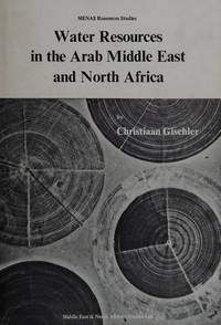
1979MS-15Cambridge England: Middle East & North Africa Studies Press 1979. Comprehensive reference text presents a detailed ten-year study which assesses the scale of renewable and fossil water resources and the achievements and problems of managing water in the arid and semi-arid Middle East and North Africa. Topics covered include: water resource management; surface water; occurrence of natural water resources; groundwater in primary and secondary permeable material; hydrology; technological modifications of the hydrological cycle; integrated technology and its impact in arid areas; etc. 132 pgs. Illustrated. Publisher's stamp on front and rear endpapers. Dustjacket in mylar. First Menas Edition. Hard Cover. As New/As New. 8vo - over 7¾" - 9¾" tall. . Middle East & North Africa Studies Press Hardcover
Fine English Paperback. Roy. 8vo. (24 x 16 cm). In English. 72 p. Water conflict in the Middle East. MIDDLE EAST Eastern question Water International relations Politics Imperialism.
Fine English Paperback. Roy. 8vo. (24 x 16 cm). In English. [iv], 446 p. Water as an element of cooperation and development in the Middle East.
565 x 425 mm. Colour lithograph, signed "A. Jawa". Mounted on styrofoam board. Bilingual safety poster in Arabic and English. - Traces of folds. Numbered "B61-2" in blue pen below the horizonat fold on the right.
570 x 430 mm. Colour lithograph. Mounted on styrofoam board. Bilingual safety poster in Arabic and English. - Traces of folds.
4to. (48) pp. All edges sprinkled in red. Disbound. Exceedingly rare separate "offprint" issue, with Heyinger's imprint and date on title page, of this account usually only encountered bound after a half-title as part of Francisco Caccia's "Monumentum Gloriae Seraphicae" (bibliographically unrecorded thus). Contains the German translation of the Sultan's mandate by which suzerainity over several holy sites in Jerusalem (particularly, two vaults in the Church of the Holy Sepulchre, part of Golgotha, the Seven Arches of the Virgin, and the Stone of the Anointing) was restored to the Franciscans. Includes relevant correspondence and indulgences (all in German). - Some browning and staining. Removed from a collection; old number "23" on t. p. An early work from the press of Andreas Heyinger, active in Vienna from 1692 to 1732. Cf. VD 17, 12:113676Z.
No marks or inscriptions. A lovely clean very tight copy with bright unmarked boards and no bumping to corners. Dust jacket not price clipped or marked with small tear/crease to lower front corner. 212pp. A study of the most fought-over region in the world, whose capital is Jerusalem, a city sacred to the three great religions, Judaism, Christianity and Islam. Armies have fought to take this land over millennia. With a series of specially commission maps and many archive photographs.
In-8° pp. 8, bross. edit.
19010009096New York: Dodd Mead 1901. First edition. Hardcover. Fine. 8vo 313 pages untrimmed blue cloth <br/><br/>This is the American issue of the British sheets. "Though Burton wrote and published many bulky volumes of travel . none of them assumed a popular form . The essays that follow were all prepared by Burton himself . Burton here gives an epitome of his principal travels in three continents - Preface." The "three" continents are Africa South America. North America Asia. Dodd, Mead hardcover
8vo. 40 pp. With woodcut vignette at the end. Boards. First edition of Hammer's German translation of this Persian verse epic. A good copy showing very little browning. Graesse III, 206. Goedeke VII, 766, 84. OCLC 29890924.
1997MS-44Boulder CO.: Westview Press 1997. When Iraq invaded Kuwait in 1990 the sight of tens of thousands of non-Kuwaiti Arabs Indians East Asians and Westerners fleeing or trapped under occupation made the outside world suddenly aware of a singular fact of Kuwaiti societythat Kuwaitis are an absolute minority in their own country. Basing her analysis on extensive fieldwork and archival research the author examines the social dimension of labor migration to Kuwait since independence in 1961 exploring how the presence of over one million foreign workers has influenced the way Kuwaitis organize their lives and perceive themselves. In particular Longva looks at the relations between two sharply differentiated social categories and the politics of exclusion that have allowed Kuwaitis to protect their rights and privileges as citizens against infringement by the huge influx of expatriates. Longva examines the little-studied system of kafala or sponsorship under which all foreign workers enter and reside in the country showing how it has become the most critical source of power for native Kuwaitis vis-à-vis immigrants. She also addresses aspects of ethnicity and class describes the life of expatriates and looks at developments in gender relations and the role of women in building the national identity in the context of migration and modernization. 266 pgs. Illustrated. Dustjacket in mylar. First Edition. Hard Cover. As New/As New. 8vo - over 7¾" - 9¾" tall. Westview Press Hardcover
61537<p>London: George Virtue. Good with no dust jacket; Boards worn split along right side of backstrip scattered foxing to preliminary leaves and edges of some of the plates. no date. Second Edition. Hardcover. First edition was published in 1845 and this second edition appears to be circa 1850s. Brown leather gilt stamped spine with blue illustrated paper-covered boards. Many engravings folding maps and views of Jerusalem scenes. viii 252pp 8pp publisher ads. ; 8vo 8" - 9" tall .</p> George Virtue hardcover
Octavo in red and orange illus wraps; 235 p. ; 21 cm. In Arabic Short stories.
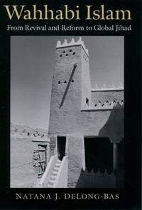
2004K8022004. Hardcover. Good. Hardcover/Gd. condition/365 pages - From revival and reform to global Jihad. K802HT9 hardcover