138 résultats
Olivier Orban 1991, In-8 broché, 304 pages. Trés bon état.
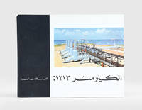
1960187923Beirut: Matba'at al-sharq al-'awsat li-l-tasdir c.1960. First edition of this well-illustrated pamphlet unrecorded institutionally on the 1213-km Trans-Arabian Pipeline Tapline which operated between Qaisumah Saudi Arabia and Sidon Lebanon especially in the years 1950-76. It provides an overview of its operations managed by four US oil companies with an initial output of 350000 barrels which increased to 450000 after a structural upgrade in 1958. Landscape octavo. With half-tone and colour photographic illustrations. Text in Arabic. Original pictorial wrappers wire-stitched as issued. Extremities a trifle rubbed rear wrapper a bit soiled contents clean: a very good copy. unknown
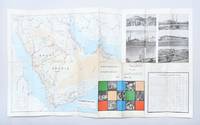
1969179167Dammam: Ministry of Information c.1969. An early map of Saudi Arabia's developing road network printed on one side in English and the other in Arabic. It shows surfaced roads those under construction and proposed highways. It also promotes the nation's medical and communications infrastructure agriculture and education. After the discovery of oil in the 1960s the Saudi government began to invest heavily in the road network. The Ministry of Planning created a series of five-year road programmes to execute these initiatives building 3221 kilometres of new roads from 1970 to 1975 and a further 21452 kilometres from 1975 to 1980. This example doubles as a promotional pamphlet featuring photographic illustrations of landmarks such as the Holy Mosque at Mecca Jeddah International Airport and the ruins of Mada'in Salih Hegra. It was likely printed in 1969 as the section introducing communications infrastructure references the future expansion of Dammam port in 1970. Single sheet 479 x 840 mm folding to 242 x 110 mm maps printed recto and verso. Six half-tone photographic illustrations small colour vignettes; text in Arabic and English. Inscribed by one Muhammad Jukhdar on front panel. Maps bright outer panels a little scuffed and toned small hole at fold intersection: a very good copy. unknown
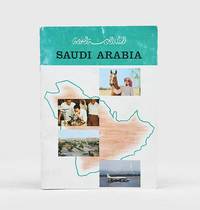
1963182391Saudi Arabia: 1963. First edition of this pamphlet detailing Saudi Arabia's history and development. It features portraits of Ibn Sa'ud King Sa'ud and King Faisal along with illustrations of hospitals schools agriculture oil refineries and the Ka'aba. The pamphlet also includes data on the country's economic resources including both its revenue from oil and its annual budget. Quarto. Half-tone photographic illustrations and maps throughout some in colour. Original colour wrappers front wrapper lettered in black rear wrapper decorated with emblem of Saudi Arabia in black and white. Wrappers rubbed and a little creased contents clean: a very good copy. unknown
1982182093Riyadh: King Abdulaziz Foundation Publications 1982. First edition of this rare comparative study of the natural and human geography of the Western Saudi coast published by Darah and illustrated with numerous colour maps. We have traced only two copies in OCLC. The work sought to establish unified institutional research and scientific independence in the field of environmental studies as well as to provide reference works in Arabic on ports and harbours in Saudi Arabia. It discusses the development and uses of natural harbours in pre-Islamic and Islamic times; geographical historical and economic factors in their development; their subdivision into historic strategic and economic harbours; as well as their uses past and present the types of professional employment they have traditionally fostered and the morphology of port cities. The illustrations include maps of ancient and modern harbours and of the historical phases of urban development in Rabigh Duba al-Wajh and al-Lith. Octavo. With 13 colour maps and plans errata leaf tipped-in. Original pale blue printed wrappers. Minor wear to wrappers contents slightly yellowed: a very good copy. unknown
1998188302Riyadh: Maktabat al-malek 'abd al-'aziz al-'amma 1998. Second edition of this well-illustrated history of communications and telecommunications in Saudi Arabia during the first half of the 20th century. The study begins with the most traditional modes of communication and transport - the use of camels and horses across the desert - with a map of the main routes from Damascus to Mecca and Basra. The second part examines the modernization of roads and the introduction of motor and rail transport under King Abdulaziz with particular emphasis on the Hijaz Railway and considers Aramco's central role in developing Saudi road and rail infrastructure. The third section is devoted to maritime communications with old photos of the Jeddah and Dammam ports and the earliest travel from the airports of Jeddah and Hofuf. The last section offers an overview of wired and wireless communications including the telegraph the postal service and the telephone. Octavo 240 x 160 mm. With half-tone photographic illustrations and maps. Text in Arabic. Original pictorial wrappers wire-stitched as issued. Extremities a little rubbed: a very good copy. unknown
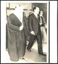
1960144431960. Wirephoto Showing the King of Saudi Arabia and other Arab leadesr. From the Historic Archives of the Baltimore titled Sun Arab Summit Conference Size: 8.3" x 9.1" This WIREPHOTO is straight from The Baltimore Sun's historical photo archive. Wirephotos are different than traditional photographic prints! This print is the result of what used to be breakthrough technology now completely obsolete that allowed a photographic image to be scanned transmitted over "the wire" telegraph phone satellite networks and then printed at the receiving location. They are often on thinner slick paper. Long removed from commercial use these artifacts represent an important era in the history of news media. Circa 1960-1970's. unknown
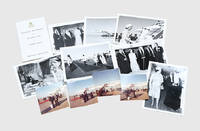
190830Saudi Arabia and Bahrain: 1979. The first trip to the Gulf by a British sovereign An interesting archive with the original confidential printed programme issued by the Master of the Household of Queen Elizabeth II and Prince Philip's two-week visit to Saudi Arabia in 1979. It was the first-ever visit to the Gulf by a female head of state. The official printed programme for internal circulation only given to each participants includes detailed information on the composition of the party. It also features arrangements for the Concorde flight cabin and room arrangement on H.M.Y. Britannia and the Nasiriya Palace in Riyadh and the full logistics of the royal tour with a schedule of the commitments and visits in Kuwait Bahrain Saudi Arabia Qatar Abu Dhabi Dubai and Oman travel protocols and mail delivery to the royals on tour. The photographic images include the landing of the British Airways Concorde in Bahrain the welcome delegation led by Sheikh Isa bin Salman Al Khalifa of Bahrain and the Saudi royal welcome by King Khalid Prince Fahd and Prince Abdullah. Together 11 items: with 7 monochrome photographs 167 x 122 mm H.M.Y. Britannia's red ink stamp "Royal Navy Official Photograph Crown Copyright Reserved" on verso of all but one; booklet 161 x 98 mm original printed wrappers gilt monograph "ER II" embossed on upper wrapper; and 3 colour photographs 89 x 85 mm. Traces of adhesive on versos of photographs two small light water stains on rear wrapper colour photographs a trifle faded: very good exemplars. unknown
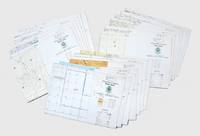
156758Saudi Arabia: Royal Saudi Armed Forces 1983. Destroy when no longer needed First editions of this extensive and institutionally rare set of large aerial charts produced for the Royal Saudi Air Force covering northeastern Saudi Arabia the Arabian Gulf region Iraq and Iran. Strictly confidential they bear the legend: "For distribution to Royal Saudi Defence Forces only. Destroy when no longer needed". The year of their publication saw the first joint military exercises of the Gulf Cooperation Council headquartered in Riyadh. Saudi Arabia relied on significant foreign assistance to augment its military during the 20th century as it sought to increase its influence in the Middle East. US involvement within the country was formalized through the establishment of a Military Training Mission in 1951. By the mid-1980s when these charts were produced a "45000-strong Saudi army received training and logistical support from some 38000 advisors of US British and French origin" Cronin. Based on extensive maps produced by the British Geographical Services General Staff GSGS the charts contain updated indices of elevations populated places roads railroads boundaries terrain elevations hydrography and vegetation and an Arabic-English glossary. The collection comprises: 1. NG38-2445 Saudi Arabia. 2. NG38-2645 Saudi Arabia. 3. NG39-2448 Saudi Arabia & Qatar. 4. NG39-2648 Saudi Arabia. 5.NG40-2454 Oman United Arab Emirates. 6.NG40-2657 Iran. 7. NH38-2845 Saudi. 8. Arabia Kuwait Iraq. 9. NH38-3045 Iran Iraq Kuwait. 10. NH39-2848 Saudi Arabia Iran Kuwait Iraq. 11. NH39-2851 Iran. 12. NH39-3048 Iran Iraq Kuwait. 13. NH39-3051 Iran. 14. NH40-2854 Iran. 15. NI38-3242 Iraq. 16. NI38-3245 Iraq Iran. 17. NI39-3248 Iran. 18. NI39-3251 Iran. 19 colour charts each 890 x 1230 mm. Some pencillings to the margins. A few small creases occasional finger soiling large section excised from centre of NH39-3048. Overall in excellent condition. Stephanie Cronin "Tribes Coups and Princes: Building a Modern Army in Saudi Arabia" Middle Eastern Studies vol. 49 no. 1 2013. unknown
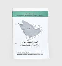
1961178445Bonn: Delegation der Liga der Arabischen Staaten November 1961. First edition first printing of this introduction to Saudi Arabia. It contains biographies and photographic illustrations of Ibn Sa'ud and other members of the royal family. We have traced no institutional copies outside of Germany Austria and Denmark. This pamphlet was produced by the Arab League's delegation in Switzerland as part of a series introducing its members their economies political systems and histories. The introduction opens by emphasizing Saudi Arabia's importance among the Arab states both for its oil resources and religious significance. The chapters then go on to cover geography infrastructure education oil and industry. Octavo. Half-tone photographic illustrations throughout; text in German. Original white printed wrappers wire-stitched and hole-punched as issued front wrapper lettered and decorated in black and green Wrappers lightly toned at edges a few scuff marks minor offsetting internally contents bright: a very good copy. Philipp 796. unknown
1976171424Dhahran: Arabian American Oil Co. Exploration Department 1976. A scarce map showing the locations of oil wells pipelines and refineries in the region surrounding Aramco's headquarters. We have traced only one copy US Library of Congress. The discovery of commercial quantities of oil in Dhahran at the Dammam Number 7 well in 1938 kick-started the industry in Saudi Arabia. The city is now one of the major centres of oil production in the region and has been the centre of Aramco's now Saudi Aramco's activities since the early 1950s. This map shows the Abqaiq-Dhahran Dhahran-Ras Tanura and Saudi Arabia-Bahrain pipelines. It also maps the road network airport powerlines and drainage systems. Six different types of wells are marked from observational to structural suspended and abandoned examples. It was drawn by Aramco employee Kei Inouye and first released in December 1975 with revisions published on 20 September 1976. The 1:1000000 scale key shows the connections between Dhahran and other major cities such as Dammam Safwa and al-Khobar. Large map 1366 x 845 mm key on recto. Folds toned edges a little nicked one small hole neatly repaired: a very good copy. unknown
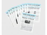
1966187021Jeddah: Dar Al Asfahani & Co. 1966. The Kingdom of Saudi Arabia in 1966 A substantial run of this scarce weekly newsletter on the Kingdom of Saudi Arabia issued by the Ministry of Information. WorldCat lists other similar collections at Exeter the UN Library Geneva and NLI. The newsletter ran from 1964 to 1976 based on surviving copies. The news focuses on internal and foreign politics with accounts of King Faisal's and Prince Salman's policies and diplomatic activities at home and abroad. These include King Faisal's visit to Pakistan and Turkey where he advocated for "Islamic solidarity" the visit of the Somali president the acquisition of modern jet fighters for the army KSA's stand at the United Nations concerning South Africa's white supremacists and education especially the opening of girls' schools. Several articles report news in the oil world including the creation of refineries in Jeddah and Riyadh the role of Petromin and Aramco in the Saudi economy the drilling of water wells the expansion of Jeddah's seaport Saudi-Kuwaiti boundaries urban town planning and the full texts of Royal Decrees on the Railways Organisation Ordnance and banking control. 11 non-consecutive issues each a printed bifolium approx. 690 x 500 mm folding into 350 x 250 mm dating April to August 1966. With half-tone photographic images. Edges occasionally chipped occasional tiny holes to text and along central folds: very good copies. unknown
1958187023Madrid and Buenos Aires: 1958-79. First and only editions of these bulletins produced by the Saudi Arabian embassies in Madrid and Buenos Aires between the 1950s and the 1970s. WorldCat lists no institutional copies outside Spain. Issued in Madrid until c.1973 Noticias de Arabia Saudita features here in two exemplars. The first July 1958 is devoted to the latest modernization of the Saudi railways connecting Dammam al-Hofuf Riyadh and the arms factory of al-Jary to agricultural innovation Saudi-Israeli and Saudi-Palestinian relations and the project of a new Arabic Language academy. The second May 1967 focuses on diplomatic visits by King Faisal and Price Jalid Ibn Abdul Aziz irrigation projects and the telecommunications sector. Realidades here present in three exemplars was issued in Buenos Aires. The first January 1978 opens with a long interview to Prince Fahd on the Middle East question the Israel-Palestine conflict and Saudi-Egyptian relations and continues with the planned construction of the Jeddah-Mecca motorway. The second January 1979 includes features on the Saudi-French bank telecommunications precious metals in the Red Sea and the International Palestine Day. The third February 1979 discusses UN assemblies attended by Saudi representatives and new laws on foreign capital. 5 issues 310 x 220 mm or 330 x 220 mm. Half-tone photographic illustrations. Text in Spanish occasional Arabic. Original pictorial wrappers wire-stitched. Administrative note in red ink to one rear wrapper concerning photos to be kept in the photo file occasional annotations in ink. Wrappers slightly soiled foxed or frayed at margins occasional traces of horizontal folds contents toned to three pamphlets small light water stain at foot of one issue lower half of one leaf torn away: very good copies. unknown
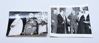
1953172560London: Associated Press 1953. Ibn Sa'ud's anticommunist alliance Rare prints of Associated Press photographs documenting the changing face of Saudi foreign policy in 1953 during the final months of Ibn Sa'ud's reign and a few short years before the Suez crisis. The first image captures a meeting between Prince - later King - Faisal and President Eisenhower in Washington while the second shows Ibn Sa'ud meeting Emperor Haile Selassie d. 1975 of Ethiopia. After Eisenhower assumed office in 1953 he and his Secretary of State John Foster Dulles also seen here were keen to continue the flourishing relationship between their country and Saudi Arabia which had been cemented during the presidency of Franklin Roosevelt. On 2 March of that year Prince Faisal at this point Saudi minister for foreign affairs was accompanied to the White House by the chief of his cabinet Ibrahim Suleiman and his country's ambassador extraordinary to the United States Asad al-Faqih who had signed the UN constitution on Saudi's behalf when it was drafted in 1945. Ibn Sa'ud's brief trip to Ethiopia was made in July 1953. Haile Selassie met him in a special marquee which had been erected at Addis Ababa airport and the two monarchs sat on lavish thrones. The state visit aimed to strengthen Saudi-Ethiopian relations as both nations faced the common adversary of Nasserism. The visit laid the ground for improved bilateral relations throughout the 1950s: King Sa'ud visited Addis in 1957 and Haile Selassie travelled to Riyadh in 1960. Two silver gelatin prints 200 x 150 mm; 215 x 205 mm. Stamps of the Associated Press to rear of both prints press clipping to rear of 1 print slug to rear of 1 print manuscript to rear of 1 print: "Faisal king of Saudi Arabia". Edges a little worn surface abrasions damp staining to rear of one print. A very good set. unknown
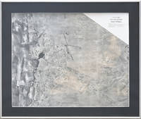
1956185255Philadelphia: Aero Service Corp. 1956. Exceptional photo map An impressive aerial view of Jeddah and its environs which shows Jeddah's urban development less than ten years from the demolition of the old walls in 1947 and the start of the oil boom in 1950. It illustrates the expansion of residential areas northward and eastward of the airport runways and the dock area as well as what appears to be oil well infrastructure. It was produced for the surveying work of Glen F. Brown a US specialist in surface geology and natural resources. Hired by Ibn Saud in 1945 Brown carried out geological investigations in Saudi Arabia until well into the 1950s to identify sites with water oil and minerals. The ground-breaking cartographic and photographic surveys prepared by Brown were the basis for the most detailed maps of Saudi Arabia ever produced up to that time. Established in Philadelphia in 1919 Aero Services Corporation - "the oldest flying corporation in the world" Storms p. 1279 - specialized in large-scale aerial photography photogrammetry and photographic surveying through the creation of photo-mosaics. "High-altitude photography on a scale of 1:60000 of the Kingdom of Saudi Arabia was initiated during 1949 by the Aero Service Corp. and completed in 1959. Both third-order vertical and horizontal control and Shoran were utilized in compiling the photography. This controlled photography resulted in highly accurate geographic maps at the publication scale which then served as a base for the geologic overlay. The topography of the sedimentary areas was depicted by hachuring and that of the shield region by shaded relief utilizing the airbrush technique" Powers p. iii. In this view airbrushing covers the lands east of Jeddah towards Mecca where the Arabian-Nubian Shield stretches out. Half-tone photograph 402 x 499 mm. Right-hand half airbrushed. English caption date and scale. Mounted framed and glazed. Couple of minor marginal creases: a very good example. R. W. Powers et al. "Geology of the Arabian Peninsula: Sedimentary Geology in Saudi Arabia" U. S. Geological Survey Professional Paper 560-D 1966 with foreword by O.A. Seager et al.; C. Eric Storms et al. "Aero Service Corporation: The Early Years-1919-1940" Photogrammetric Engineering & Remote Sensing vol. 50 1984. unknown
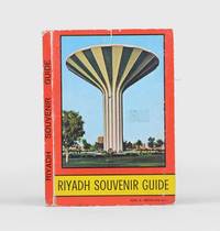
1976179946Jeddah: Jeddah Modern Service c.197677. First edition unrecorded on WorldCat. This photograph collection features both old and new sites from the Masmak Fortress through to the University of Riyadh. This guide is undated but was most likely released in the mid-1970s judging from both the population statistics and the many photos of the Riyadh Water Tower completed in 1971. The introduction recounts the history of the city from its founding in the 17th century through to the first Saudi state the Ottoman Empire the restoration of the House of Saud and modern times. "In 1902 Adbul Aziz Ibn Abdul Rahman who was only 20 years old accompanied by only 40 men with his brother Mohammed and his cousin Abdullah Ibn Jilwai set out to recover Riyadh. With a daring surprise attack they killed the Rashidi governor Ajlan. On hearing the news the people of Riyadh welcomed Abdul Aziz back" p. 3. Small octavo concertina-style 162 x 111 mm. With 25 colour photographic illustrations 3 double-page colour map colour diagram of regional flight routes. Original pictorial card wrappers colour map on inner covers. Rubbed spine cocked old adhesive to front wrapper some small abrasions internally plates bright: a very good copy. unknown
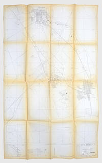
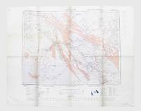
1945165179London: Geographical Section General Staff 1945. A detailed early map of central Arabia Second edition of this pilot's map of Riyadh and the surrounding region reissued by Britain's general staff for the use of the Royal Air Force at the end of the Second World War and annotated by a member of 53 Squadron. Revised from its first publication in 1922 the map was photolithographed in 1942 and then updated in 1945 to include new information on roads airfields landing grounds and seaplane stations. The topographical features that are referenced include all the salient information a pilot might expect such as rivers marshes areas liable to flooding mountains ruins lava flow and sandy desert. A glossary explains the English meanings of the Arabic terms included in the map such as darb road jabal mountain and qasr fort. The owner's inscriptions to the lower corners read "Riyadh" and "E. Skemp" most likely Eric Skemp who "flew Liberators on 53" Squadron Mulder p. 298. Although the squadron spent the war years stationed in Britain and the eastern United States it was assigned to carry troops home to India in 1945. Photolithographed map 630 x 790 mm. General light creasing more marked at head and foot of central fold scuff at top left corner: a very good example. Rob J. M. Mulder The Fokker Fours 2019. unknown
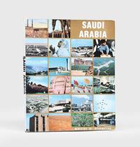
1978175074Riyadh: General Directorate of Press c.1978. A colourful photobook gifted to a delegate to an international geological conference held in Jeddah. Published midway through the second Five-Year Development Plan it documents "the concrete achievements of recent years which have witnessed the rapid transition from a traditional society towards a technological one" rear cover. Tipped onto the title page verso is a sheet in English and Arabic stating that this copy was "presented on occasion of the international symposium on evolution and mineralization of the Arabian-Nubian Shield" which was convened in February 1978 at the Institute of Applied Geology King Abdulaziz University. Some of the photographs celebrate recent achievements in Saudi science and technology. No publication date is given and we have traced a number of editions with unknown priority including one spiral-bound and one in three languages. Large quarto. Colour illustrations throughout. Original pictorial wrappers spine lettered in black front cover lettered in white map on inner front cover. Spine ends bumped covers creased some leaves proud where volume somewhat crudely bound photographs bright: a very good copy. unknown
1958151710Geneva: Printed in Switzerland 1958. Scarce document relating to the 1958 Saudi-Aramco arbitration talks First edition preceding the English and Arabic translations presentation copy from Professor Georges Sauser-Hall with his compliments slip laid in. Production may have been restricted to principal participants for review before preparation of the official versions. We have traced only six institutional copies. The document records the Geneva tribunal established under the Aramco Concession Agreement to resolve a major dispute between the Saudi government and Aramco early in the reign of King Saud. Significant both for Saudi-Aramco relations and as an early modern test of sovereignty and concessionary rights the case arose from the concession granting Aramco 60 years exclusive rights to explore extract transport and export petroleum together with an arbitration clause. Amid surging post-war demand Aramco concluded offtake agreements for future exports which Saudi Arabia challenged in 1954 by granting Aristotle Onassis priority tanker-transport rights through the Saudi Arabian Maritime Tankers Company a Saudi-flag fleet with tax exemptions royalties and preferential access to Aramco exports. Aramco refused compliance as impractical and contrary to the concession and arbitration commenced on 23 February 1955. Saudi Arabia first appointed Dr Helmy Badawi succeeded after his death by Judge Mahmoud Hassan; Aramco appointed Dr Saba Habachi. The arbitrators selected the Swiss jurist Georges Sauser-Hall as referee and Pierre Lalive as secretary general after which both parties assembled leading international counsel. Empowered to state the law but not reconcile the competing agreements the tribunal considered separate submissions addressing maritime transport rights assignment of concessionary privileges preferential treatment for Saudi-flag shipping and the compatibility of the Onassis agreement with the concession. Proceedings comprised three rounds of written exchange and forty-two sittings over eight weeks in Geneva during summer 1956 drawing on Hanbali and international law. On 23 August 1958 the tribunal ruled overwhelmingly for Aramco holding that Satco's priority rights contravened the concession that Aramco had not assigned its rights and that Saudi Arabia could neither compel use of Satco tankers nor disregard Aramco's export and offtake arrangements; the Onassis agreement was therefore ineffective against Aramco. Despite dissent the Saudi government complied with the award abandoned enforcement of the Onassis arrangement and avoided international arbitration for decades. This document presents the proceedings in full. Quarto. Original pale grey printed wrappers. Spine lightly toned and palely stained a few other minor marks. An excellent copy. An online search of institutional libraries cites UN Geneva University of Basel Bibliotheque cantonale et universitaire Lausanne Peace Palace Library University of Chicago University of California. unknown
1977184718Jeddah: Banawi Printers 1977. Rare annual report by the Saudi Arabian Monetary Agency SAMA - today's Saudi Central Bank - on economic development in the KSA for the year 1977. We have traced no other copies in OCLC. SAMA was established in 1952 under King Abdul Aziz. In 1977-78 it was relocated from Jeddah to Riyadh. Regular statistical summaries were issued from the 1960s covering the trends of the Saudi economy. For 1977 the most important was "the elimination of congestion at the Jeddah and Dammam ports which had been plaguing the country's economy for close to two years" p. 1 followed by a decline in the cost of living index and housing rents. Chapters are devoted to money supply imports and exports investments and oil production with specific mention of major projects such as the expansion of the Riyadh refinery. The appended tables provide data in riyals on project expenditure oil production and export including data on Aramco and revenue sources as well as imports and internal consumption. Quarto. Original white wrappers wire-stitched. Front wrapper slightly foxed at margins a few light marks or small water stains to back cover contents clean: a very good copy. unknown
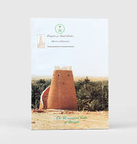
2000167658Saudi Arabia: Ministry of Education Assistant Deputy Ministry for Antiquities and Museums c.2000. First edition first printing of this illustrated bilingual guide to the archaeology of the capital of the Emirate of Diriyah widely considered the first Saudi state. The work celebrates the recent government-backed restoration of fortification walls and watchtowers. Diriyah's At-Turaif district served as the home of the Saudi royal family. The town was "founded in the 15th century and bears witness to the Najdi architectural style which is specific to the centre of the Arabian Peninsula. In the 18th and the early 19th century its regional political and religious role increased and the citadel of at-Turaif became the centre of the temporal power of the House of Saud and the spread of the Islamic reform movement in Arabia Salafiyya. The property includes the remains of many palaces and an urban ensemble built on the edge of the ad-Dir'iyah oasis" UNESCO. The At-Turaif district was included on the list of World Heritage Sites in 2010. Large octavo. With folding map duplicated in Arabic and English photographs and diagrams in text. Text in Arabic and English. Original illustrated card wrappers lettered in black and green in Arabic and English. Wrappers lightly rubbed bright internally. A near-fine copy. unknown
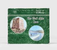
1975167654Al Khobar: Printed by the East Press for the Ministry of Information 1975. First edition first printing of this report covering agriculture town planning municipality projects of Asir and particularly Abha the capital of the region. The handsome illustrations include one of H.R.H. Fahd ibn 'Abdul-'Aziz Al Saud inaugurating the Wadi Abha Dam. Oblong octavo. With illustrations throughout some in colour. Original green pictorial wrappers front wrapper lettered in white and black. Minor loss to spine wrappers creased and rubbed. A good copy. unknown
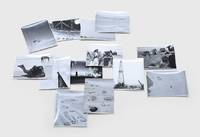
1950171429Saudi Arabia: c.1950. A record of Aramco's formative era A collection of ground and aerial shapshots apparently taken by a Saudi Aramco manager stationed at the Mahasin camp just outside al-Hofuf showing the site's early years several scenes of local life and the drilling rig. Collectively the images provide a window onto the early years of Saudi Arabia's development. Seven images depict the camp itself including one picture taken from atop the radio tower overlooking the barracks mess halls powerhouse water trucks and wells. The structures are all surrounded by black lines which the annotations to the verso of the image inform us are "oil to keep the scorpions and snakes out - we hope". Other snapshots show the view up to the top of the radio mast the view down to ground and a panorama across to the nearest town presumably al-Mubarraz. One picture shows the drilling rig with cars in front and a crane to the right. The remaining six images were taken at leisure and show a rocky outcrop several camels locusts on the fender of a jeep local camel drivers and a view from a water tank in an oasis. Accompanying the photographs is a handwritten note from two Aramco employees to a "Mr Canady" perhaps the photographer. The employees complain of a colleague who is proposing to charge the company rent for the use of a dysfunctional bulldozer leased by the Bin Laden company. Muhammad Bin Laden was Saudi Arabia's most successful construction magnate of the mid-20th century and was famously the world's largest importer of Caterpillar bulldozers. 13 gelatin silver photographs c.120 x 92 mm 1 slightly trimmed and numbered on the print in ink manuscript captions relating to numbering on verso. Housed in developer's buff paper sleeve. Numbered image creased and slightly trimmed several others with slight striations: a very good collection. unknown
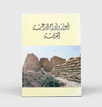
1985163227Riyadh: General Department of Antiquities and Museums 1985. The capital of the first Saudi state First edition first impression of this richly illustrated bilingual guide for visitors to the historic earthen city of Diriyah recording its history and restoration to date. This work is institutionally uncommon with WorldCat tracing only four locations Library of Congress Smithsonian Bilkent University Library and Bibliotheque Geneve. The Emirate of Diriyah often referred to as the First Saudi state had the town of Diriyah as its capital. Located on the northwestern outskirts of Riyadh its At-Turaif district served as the original home of the Saudi royal family. The town was "founded in the 15th century and bears witness to the Najdi architectural style which is specific to the centre of the Arabian Peninsula. In the 18th and the early 19th century its regional political and religious role increased and the citadel of at-Turaif became the centre of the temporal power of the House of Saud and the spread of the Islamic reform movement in Arabia Salafiyya. The property includes the remains of many palaces and an urban ensemble built on the edge of the ad-Dir'iyah oasis" UNESCO. The At-Turaif District in Diriyah was included on the list of World Heritage Sites in 2010. Quarto. With 2 folding maps numerous illustrations in the text. Original light yellow wrappers illustrations from photographs; text in Arabic and English. Some marks to covers neat repair at foot of spine. A very good copy. "At-Turaif District in ad-Dir'iyah" UNESCO available online. unknown
198020596Riyadh 1980. Paperback. Very Good. maps and charts xxxiii 503p. Original wrapper. 28cm. <br/><br/> paperback books