Burton, Richard FrancisMareMagnum

138 résultats
Two volumes. No marks or inscriptions. Two very clean very tight copies with bright unmarked red cloth boards, very slight bumping to spine feet and no bumping to corners. Dust jackets not price clipped or marked or torn with slight creasing to spine extremities from being constrained in protective sleeves. Both jackets now protected in fully-removable transparent sleeves. Large folded detailed map at end of Vol 2 in perfect condition. Total of 657pp. Burton's purported reason for visiting North West Arabia in 1877 to 1878 was gold prospecting but his real purpose was to study and survey the region scientifically. Facsimile edition of the 1879 edition.
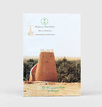
2000167658Saudi Arabia: Ministry of Education Assistant Deputy Ministry for Antiquities and Museums c.2000. First edition first printing of this illustrated bilingual guide to the archaeology of the capital of the Emirate of Diriyah widely considered the first Saudi state. The work celebrates the recent government-backed restoration of fortification walls and watchtowers. Diriyah's At-Turaif district served as the home of the Saudi royal family. The town was "founded in the 15th century and bears witness to the Najdi architectural style which is specific to the centre of the Arabian Peninsula. In the 18th and the early 19th century its regional political and religious role increased and the citadel of at-Turaif became the centre of the temporal power of the House of Saud and the spread of the Islamic reform movement in Arabia Salafiyya. The property includes the remains of many palaces and an urban ensemble built on the edge of the ad-Dir'iyah oasis" UNESCO. The At-Turaif district was included on the list of World Heritage Sites in 2010. Large octavo. With folding map duplicated in Arabic and English photographs and diagrams in text. Text in Arabic and English. Original illustrated card wrappers lettered in black and green in Arabic and English. Wrappers lightly rubbed bright internally. A near-fine copy. unknown
19874558Boston : Houghton Mifflin, 1987. XII, 433 pp. Map Gr. 8°. OCloth
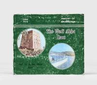
1975167654Al Khobar: Printed by the East Press for the Ministry of Information 1975. First edition first printing of this report covering agriculture town planning municipality projects of Asir and particularly Abha the capital of the region. The handsome illustrations include one of H.R.H. Fahd ibn 'Abdul-'Aziz Al Saud inaugurating the Wadi Abha Dam. Oblong octavo. With illustrations throughout some in colour. Original green pictorial wrappers front wrapper lettered in white and black. Minor loss to spine wrappers creased and rubbed. A good copy. unknown
198020596Riyadh 1980. Paperback. Very Good. maps and charts xxxiii 503p. Original wrapper. 28cm. <br/><br/> paperback books
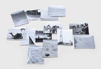
1950171429Saudi Arabia: c.1950. A record of Aramco's formative era A collection of ground and aerial shapshots apparently taken by a Saudi Aramco manager stationed at the Mahasin camp just outside al-Hofuf showing the site's early years several scenes of local life and the drilling rig. Collectively the images provide a window onto the early years of Saudi Arabia's development. Seven images depict the camp itself including one picture taken from atop the radio tower overlooking the barracks mess halls powerhouse water trucks and wells. The structures are all surrounded by black lines which the annotations to the verso of the image inform us are "oil to keep the scorpions and snakes out - we hope". Other snapshots show the view up to the top of the radio mast the view down to ground and a panorama across to the nearest town presumably al-Mubarraz. One picture shows the drilling rig with cars in front and a crane to the right. The remaining six images were taken at leisure and show a rocky outcrop several camels locusts on the fender of a jeep local camel drivers and a view from a water tank in an oasis. Accompanying the photographs is a handwritten note from two Aramco employees to a "Mr Canady" perhaps the photographer. The employees complain of a colleague who is proposing to charge the company rent for the use of a dysfunctional bulldozer leased by the Bin Laden company. Muhammad Bin Laden was Saudi Arabia's most successful construction magnate of the mid-20th century and was famously the world's largest importer of Caterpillar bulldozers. 13 gelatin silver photographs c.120 x 92 mm 1 slightly trimmed and numbered on the print in ink manuscript captions relating to numbering on verso. Housed in developer's buff paper sleeve. Numbered image creased and slightly trimmed several others with slight striations: a very good collection. unknown
1936VOY512MNew York: Random House, 1936. New Definitive Edition [2 Volumes in 1]. Hardcover on light gray cloth, This edition has a black and white map in the mappocke, Large 8vo 9"-10" tall; [1370] pages.
In-16 (cm. 19.10), brossura originale, pp. 308, (4), con illustrazioni in bianco e nero fuori testo. COPIA DA STUDIO. Scritte d’appartenenza. Segnatura al verso dell’antiporta. Tracce d’uso al dorso. Distacco parziale delle prime carte. Scollamento tra le pagine 112 e seguente; peraltro testo in buono stato (text in good condition).
Milano, C.T.I., 1937, in-8, br., pp. XII, (125). Copertina e 4 tavv. a col., numerose ill. fotografiche in b.n., cartine e pubblicità.
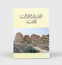
1985163227Riyadh: General Department of Antiquities and Museums 1985. The capital of the first Saudi state First edition first impression of this richly illustrated bilingual guide for visitors to the historic earthen city of Diriyah recording its history and restoration to date. This work is institutionally uncommon with WorldCat tracing only four locations Library of Congress Smithsonian Bilkent University Library and Bibliotheque Geneve. The Emirate of Diriyah often referred to as the First Saudi state had the town of Diriyah as its capital. Located on the northwestern outskirts of Riyadh its At-Turaif district served as the original home of the Saudi royal family. The town was "founded in the 15th century and bears witness to the Najdi architectural style which is specific to the centre of the Arabian Peninsula. In the 18th and the early 19th century its regional political and religious role increased and the citadel of at-Turaif became the centre of the temporal power of the House of Saud and the spread of the Islamic reform movement in Arabia Salafiyya. The property includes the remains of many palaces and an urban ensemble built on the edge of the ad-Dir'iyah oasis" UNESCO. The At-Turaif District in Diriyah was included on the list of World Heritage Sites in 2010. Quarto. With 2 folding maps numerous illustrations in the text. Original light yellow wrappers illustrations from photographs; text in Arabic and English. Some marks to covers neat repair at foot of spine. A very good copy. "At-Turaif District in ad-Dir'iyah" UNESCO available online. unknown
8vo., Second Impression thus, with a frontispiece and folding map, small neat signature on half-title; original green cloth, gilt back, a very good, clean copy. Nice copy of the second impression of the first single-volume edition. Garnett's abridgement of Doughty's nineteenth century classic, first published in two volumes in 1908, brought the work to a new and appreciative audience (including T E Lawrence). Professor Bonney, Doughty's geological tutor, attributed to this publication the award by the RGS of the Founder's Gold Medal in 1912. The first single-volume edition appeared in 1926. Scarce.
8vo. First Edition with plates and maps neat contemporary inscription on front free endpaper; blue cloth upper board and backstrip lettered in gilt a very good bright clean copy in unclipped dustwrapper the latter lightly rubbed at extremities. SCARCE.
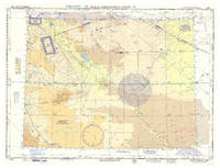
1958L6DAZGHLUF3GWashington DC: USAF aeronautical chart and information service 1958. Colour printed map 56 x 73.5 cm with a legend printed on the back. Scale 1:1000000. Pilot's map of Wadi Sirhan in the border region of Iraq Saudi Arabia and Jordan. The map shows the concave and zigzagging border between Saudi Arabia and Jordan before it revision in 1965. The indefinite nature of the borders is clearly visible on the map in the changed and crossed-out borderlines and the notations "boundary approximate" and "boundary approximate". Several areas are marked as "danger area" or "prohibited area". Stamped "obsolete for use in aviation" otherwise in excellent condition. USAF aeronautical chart and information service, unknown