Yemen ChenBiblio.com
33 résultats
B9781732845954Paperback / softback. New. paperback
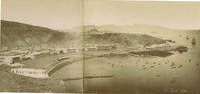
71236c.1880. . Albumen print. Four-part panorama very good tonal range and in good condition.<br /> <br /> [c.1880]. unknown
0333353250.Ghardcover. Good. Access codes and supplements are not guaranteed with used items. May be an ex-library book. hardcover
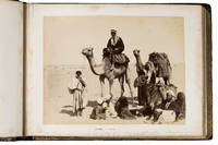
1889ABC_49512Yemen Egypt and other places 1889. Contemporary burgundy/auburn gold- and blindstamped calf lozenge-patterned blindstamping. Re-backed with the original back strip laid down. Gold-stamped turn-ins white watered silk endpapers gilt edges. Oblong folio 37.8 x 28 cm. An album containing 25 albumen prints ca. 20 x 27 cm including 1 double page mounted on thick card leaves many captioned in English. Photographic record of a journey begun in Australia and taken via Aden through the Suez canal and to the Mediterranean and then on to England. While the first image shows the steamship R.M.S. Ormuz in the port of Sydney three images including a double-page spread show the port of Aden in Yemen the famous water tanks and a native of the Southern Arabian region in a studio portrait. The majority of the album is dedicated to Egypt showing Arabs on their camels the Khedive's Ismailia Palace the Suez Canal Port Said and members the local population as well as the famous pyramids. The last few photographs show the final leg of the journey Naples and ultimately Gibraltar. Among the studios identified in the photographs are those of Hippolyte Arnoux and the Zangaki brothers based at Port Said.With a near-contemporary manuscript inscription in blue ink on the verso of the first flyleaf: "Edith Elkington or Elrington Aunt Ediths voyage home - to England about 1889". Foxed throughout slightly water stained but the prints are largely clean and clear some paper repairs in the margins the last flyleaf is lacking the final leaf is nearly detached. unknown
1951364074.Gpaperback. Good. Access codes and supplements are not guaranteed with used items. May be an ex-library book. paperback
43437629like new. unknown
B9781951364076Paperback / softback. New. paperback
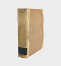
1772376213Copenhagen: Nicolaus Moeller 1772. First edition. Engraved vignettes to title page and dedication. With 24 engraved plates some folding including two Kufic facsimiles with hand-colored diacritical marks and initials; and a large folding map of Yemen colored in outline. Genealogical table folding at p. 194. xlvii 3 431 1 errata pp. 1 vols. 4to. Contemporary quarter vellum spine titled in manuscript. Early owner signature of Andreas Narr struck out by Henricus Walther 1829. Spine soiled with old library label blind stamps to bottom of first and last leaves a clean and fresh copy. Very good plus. First edition. Engraved vignettes to title page and dedication. With 24 engraved plates some folding including two Kufic facsimiles with hand-colored diacritical marks and initials; and a large folding map of Yemen colored in outline. Genealogical table folding at p. 194. xlvii 3 431 1 errata pp. 1 vols. 4to. Attractive copy of the first publication of Niebuhr's six-year travels in Arabia Felix modern Yemen and vicinity a key work of the European exploration of Arabia. Engelmann I 127; Embacher 217; Cox I237; Henze III 611; Graesse IV 674; Gay 3589; Ibrahim-Hilmy II 66; Howgego I N24. Provenance: General Theological Seminary Nicolaus Moeller unknown
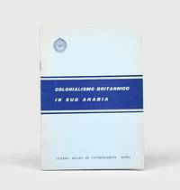
1962164052Rome: Centro arabo di informazioni 1962. First edition first printing scarce of this booklet published by the League of Arab States's communications body in Italy. The three maps show de facto and indefinite boundaries on the Arabian Peninsula in Aden and in Muscat and Oman. We have traced four institutional copies all of which are in Italy. The text surveys British activity in the region from the early 19th century through to the present day with sections on the Ottoman empire the First World War the 1934 peace treaty and the structure of the Aden Colony and Protectorates. Octavo. With 3 folding maps. Original card wrappers wire-stitched as issued front cover lettered in blue. Wrappers lightly toned and foxed contents clean with just couple of spots. A near-fine copy. unknown
2006BN7978Kasparek 2006. 2006. Softcover. Jemen Das HarazgebirgeNatur - Kultur - Trekking. Wandern in einer wunderschönen Terrassenlandschaft zwischen Wehrdörfern im Bergjemen <br/><br/>Jemen Das HarazgebirgeNatur - Kultur - Trekking. Wandern in einer wunderschönen Terrassenlandschaft zwischen Wehrdörfern im Bergjemen Kasparek paperback
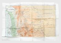
1962171426Sana'a: c.1962. Mining the border between north and south Yemen First and sole edition of this map of North Yemen with unique additions marked "top secret" in Arabic and annotated Kharitah tanbih mawaqi' al-algham "mashru' rif'at" "A map of briefing of the locations of mines of the Rifaat Plan". Although the map itself is undated and information about the "Rifaat Plan" is not publicly available it is possible that the strategy was connected to the Egyptian military officer Kamal Rifaat who visited the Yemen Arab Republic along with Anwar Sadat just after its establishment in 1962. Subsequently the Egyptians provided the YAR with a great deal of military support and advice as Abd Allah al-Sallal the country's first president fought the Federation of South Arabia later South Yemen. The long period of confrontation between North and South Yemen extended throughout the 1970s from the First Yemenite War of 1972 to the Second Yemenite War of 1979. Mines were also laid on the border before the two countries were unified in 1990 and have continued to be planted in subsequent conflicts until the present day. The map shows schematic clusters of minefields beginning due east of Sana'a around Meghdal extending in a line northwards to Wa'ir and then northwest to Jabal Mara' on the border with Saudi Arabia. The consequence of laying these minefields would have been to entrench the border between North and South Yemen the course of which they mirror almost exactly. It is annotated in pencil and colour pencil. Colour map 1000 x 690 mm. Text in Arabic. Creased where folded short closed tears and holes along fold lines and extremities a little soiled in places: a very good copy. unknown
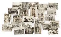
65883Yemen 1950s-1960s. 84 large-format gelatin silver prints 17.5 x 23.5cm or the reverse all with typescript caption slips in Arabic mounted to versos several captions also including series-titles e.g. 'Judges of Yemen' 'The king crown prince and Yemeni personalities' many with additional manuscript captions in Spanish. Excellent condition. An extensive visual record of the people and places of Yemen during the final years of the short-lived Mutawakkilite kingdom the majority apparently the work of a single studio based in the Arabic-speaking world and perhaps intended as an official record of Yemeni life. The Mutawakkilite regime was established after the end of Ottoman power in 1918 and lasted until 1962 when Muhammad al-Badr was deposed in a republican coup a week after succeeding his father Ahmad bin Yahya as king and imam leading to an eight-year civil war which ended in victory for the republican side. Subjects comprise: 1 Muhammad al-Badr 1926-1996 last king and imam of Yemen r.1962 5 portraits as crown prince of Yemen including one as foreign minister seated at his desk one with his uncle Sayf al-Islam 'Ali minister of science 2 during a horseback procession into Sana'a 2 photographs and one with his father Imam Ahmad this an enlarged photograph of an earlier photograph. 2 Yemeni notables 9 in total: Judge 'Abd al-Rahman al-Siyaghi minister of finance; Judge Ahmad al-Hafrani 'a man of letters of great insight and one of the greatest reciters of poetry and history'; Muhammad al-Shami minister of state and commander of the Sana'a brigade of the Yemeni army; Hasan Ibrahim minister of state and deputy foreign minister; Muhammad bin Ahmad al-Shami director of broadcasting and publications; Judge 'Abdullah al-Shawkani vice-president of the sharia council; Muhyi bin Muhammad al-Mutawakkil president of the court of appeal with assistants; Muhammad Abdullah al-Ghimizah commander of the Yemeni defence force; commander of the royal guard. 3 Daily life professions and dress 25 in total including: soldiers posed portraits and soldiers on the march; children in Ta'iz and Sana'a; teachers; tribal costume; a Yemeni 'mafraj' club or lounge; a Yemeni qaylula siesta; tennis in Sana'a; roadworks; agriculture including a coffee plantation; a student protest in support of Egypt; etc. 4 Buildings and places 21 in total including: hospitals Sana'a and Ta'iz; government ministries; mosques Janad Sana'a; palaces Ta'iz 'Dar al-Wusul'; Ta'iz airstrip; Sana'a general library; Sana'a cityscape 2 views; etc. Together with 23 further photographs: 6 of Muhammad al-Badr 9 x 14cm to 18 x 36cm depicting al-Badr addressing an open-air press conference on his arrival in Moscow 2 versions including an original large-format version on two conjoined sheets and a reduced version with typescript caption in Russian on verso attending 2 diplomatic meetings possibly in the USSR one attendee resembling Nikita Khrushchev and meeting Gamal Abdel Nasser with an informal portrait Associated Press ink-stamp and caption verso; 5 of Ahmad bin Yahya 1891-1962 King and Imam of Yemen 4 of which approx. 10 x 14.5cm 3 of these with manuscript Arabic captions on verso one depicting Ahmad and Gamal Abdel Nasser with ink-stamp and caption of Oscar Kersenbaum Argentina verso and a larger photograph 20.5 x 15cm showing Ahmad seated with Muhammad al-Badr at a victory parade Associated Press ink-stamp and caption; and 12 similar including other Yemeni notables various dimensions. Yemen, 1950s-1960s. unknown
1994BN100253Mainz am Rhein : von Zabern 1994. 1994. Les fortifications d'Arabie méridionale du 7e au 1er siècle avant notre ère. par. Deutsches Archäologisches Institut Sana / Archäologische Berichte aus dem Yemen ; BD 8 1.80 <br/><br/>Les fortifications d'Arabie méridionale du 7e au 1er siècle avant notre ère. par. Deutsches Archäologisches Institut Sana / Archäologische Berichte aus dem Yemen ; BD 8 1.80 Mainz am Rhein : von Zabern unknown
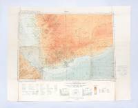
1930182334London: Geographical Section General Staff War Office 1930. Later impression overprinted with a Cassini grid in 1930 following the first edition of 1926. This map of the Aden Protectorate and its neighbours was produced for the International Map of the World a project that aimed to create a complete world map at a 1:1000000 scale. It covers South Yemen and the Hadhramaut as well as the tip of French Somaliland. The International Map of the World or the Millionth Map of the World was first proposed by German geographer Albrecht Penck in 1891. The project was adopted by ten countries in 1909 who agreed to follow consistent rules and standards for mapping their own territories. While countries like the US and UK made strides at first "production was slow in the earlier years since it was first necessary to complete basic surveys for the required data and during and after World War II there was little interest in pursuing the project" Ency. Brit. Colour lithograph map 648 x 856 mm linen-backed perhaps not as issued key printed on recto; text in English and French. A little foxed dust-soiling slight wear and a few small holes along fold lines: a very good copy. unknown
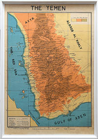
1976168409San a: Yemen Arab Republic Government 5 January 1976. Second edition labelled here as "The Yemen". It is drawn by the elusive cartographer usayn Abd All h Dham r here appearing as H. Althamary who also produced a map of San a . We have identified only six institutional copies on WorldCat at Exeter Leiden NLS Cornell LoC US Geological Survey. The first edition was published in Egypt in 1972 while an Arabic edition appeared in 1976. The map is in idiosyncratic English and marks the strategically important governorates of Taiz al-Bayda and Ma rib. Several words are misspelled including "drawen" "boundries" and "vally." The eastern border is left blank excluding the independent People's Democratic Republic of Yemen. A brief border war took place in October 1972 ending with the Cairo Agreement which proposed unification of the two Yemeni states. Each was backed by opposing Cold War powers: Saudi Arabia supported the Yemen Arab Republic while the Soviet Union backed the other. The two states ultimately united in 1990 as the Republic of Yemen. Colour lithographed map 655 x 450 mm scale 1:1000000; later laid down on board; white wooden frame overall 690 x 490 mm; text in English. Slightly toned some creasing one small hole: a very good copy. Warren P. Aston "The Origins of the Nihm Tribe of Yemen: A Window into Arabia's Past" in Journal of Arabian Studies: Arabia the Gulf and the Red Sea 4:1 2014 pp. 134-148. unknown
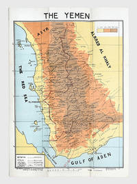
178175Egypt: M. Louts 5 January 1972. With manuscript route annotations First edition here labelled "The Yemen". It is drawn by the elusive cartographer usayn Abd All h Dham r appearing as H. Althamary who also produced a map of San a . Only three institutional copies are recorded in WorldCat at Leiden the Library of Congress and Michigan. An Arabic edition and a second English edition were published in 1976. The map is in idiosyncratic English and marks the strategically important governorates of Taiz al-Bayda and Ma rib. Several words are misspelled including "drawen" "boundries" and "vally." The eastern border is left blank excluding the independent People's Democratic Republic of Yemen. A brief border war took place in October 1972 ending with the Cairo Agreement which proposed unification of the two Yemeni states. Each was backed by opposing Cold War powers: Saudi Arabia supported the Yemen Arab Republic while the Soviet Union backed the other. The two states ultimately united in 1990 as the Republic of Yemen. The route annotations in red pen stretch from Najran in the north to the Bab al-Mandab Strait in the south. Colour map 660 x 463 mm scale 1:1000000 text in English. Old fold marks a few small holes at folds small chip to head not affecting text a little offsetting at lower margin: a very good copy. Warren P. Aston "The Origins of the Nihm Tribe of Yemen: A Window into Arabia's Past" in Journal of Arabian Studies: Arabia the Gulf and the Red Sea 4:1 2014 pp. 134-148. unknown
0071586873.Gpaperback. Good. Access codes and supplements are not guaranteed with used items. May be an ex-library book. paperback
a76526Washington 1976 Defense Mapping Agency. Oblong 4to. 204pp. original printed wraps. Light non-circulating library marks no spine numbers no pocket no bookplate. VG. . paperback
60392c. 1880s. . Panorama two albumen prints pasted on original card 20 x 50 cm title in negative. Good tonal range and in good condition.<br /> <br /> [c. 1880s]. unknown
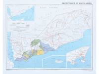
1964182178Surrey: Directorate of Overseas Surveys 1964. Later edition printed in the second year of the protectorate. In addition to showing the states of Kathiri Mahra and Qu'aiti it also highlights the members of the Federation of South Arabia in colour and features three inset maps which show the entire region the island of Socotra and the State of Aden. The Directorate of Overseas Surveys was established in 1946 with responsibility for surveying parts of the British Empire that did not have the resources to otherwise map themselves. "The Directorate was charged with two key tasks. It was to provide national geodetic frameworks throughout the British Empire that would contribute to understanding the size and shape of the earth and constitute the basis for accurate mapping. It would also produce mapping using modern methods based on aerial photography. This would in turn help to inform the development and administration of each country" Natural Collection of Aerial Photography. This copy is the fourth edition. Colour map 324 x 406 mm printed on recto only key on recto. Map bright a little bowed sometime folded with a vertical crease at centre slightly creased at edges: a very good copy. National Collection of Aerial Photography "Directorate of Overseas Surveys". unknown
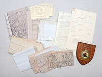
1950141716Aden & Yemen: 1950s. Into the remote places" - policing tribal disturbances in the Arabian Peninsula from the air A compelling archive of rare documents and maps. RAF operations in Aden and Yemen represented a late phase of the imperial air-policing strategy advanced by Churchill in the 1920s in response to post-Great War demobilization and Britain's expanding responsibilities in the Middle East and Africa. Claimed as a naval base on the East India route in 1839 and strengthened after the opening of the Suez Canal Aden relied on tribal treaties but as the Protectorate expanded over-stretched ground forces prompted RAF deployment from 1928 as an economical means of control. Airstrips centred on RAF Khormaksar - motto "Into the Remote Places" - supported reconnaissance leaflet-dropping and punitive strikes that helped secure the Anglo-Yemen Treaty of Friendship 1934 and later frontier policing. Reversal followed in 1954-55 with the loss of Robat while the Suez Crisis intensified unrest and Yemeni pressure leading to air attacks covert tribal agitation intervention in Oman and escalation of the frontier war into Yemen during 1958-59. The present material belongs to this volatile final phase preceding federation in 1963. Central to these operations were maps produced by the Joint Air Reconnaissance Intelligence Centre a discreet intelligence organization rooted in pre-war MI6 work. It was formalized during the Second World War and renamed in 1953 following the adoption of radar-scope photography. Headquartered at RAF Brampton and having Middle East offices in Cyprus and a detachment at Aden JARIC processed high-altitude imagery from Canberra PR9 and Victor aircraft. The archive comprises secret air-liaison instructions annotated operational maps a frontier-war-marked sketch map of Ahwar a Middle East Air Force memorandum on oxygen-mask trials RAF pilot log cards and a Khormaksar wall shield - rare survivals of evident operational use and a tangible record of Britain's final armed presence in southern Arabia. Small archive of maps memos and other documentation as detailed above. General signs of handling commensurate with active service use but overall very good. Major Michael A. Longoria "A Historical View of Air Policing Doctrine: Lessons from the British Experience Between the Wars 1919-1939" School of Advanced Airpower Studies May 1992. unknown
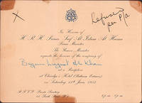
51-6973London: June 1953. 13.4 x 18.4 cm. Card stock with gilt embossing.Annotated in ink: Refused per P/a. This image could have imperfections as it’s either historical or reportage."May 07 1953 - Here for the Coronation: Prince and Princess Himalaya have arrived in London to attend the coronation from their home in the Everest country of Nepal.This is the Prince's first trip to Europe. Photo shows Prince and Princes Himalaya ".The personal copy of Begum Ra’ana Liaquat Ali Khan 1905–1990 who was a Pakistani diplomat and the country’s first female governor.She was born Sheila Irene Pant on 13 February 1905 in Almora British India today’s India to a Brahmin family who had converted to Christianity two generations prior.Academically brilliant she graduated from the University of Lucknow in 1927 with bachelor’s degrees in economics and theology. She obtained a double master’s degree in economics and sociology in 1929. In 1931 she became professor of economics at Indraprastha College in Delhi where she met her future husband lawyer Liaquat Ali Khan when he visited to deliver a lecture on law.The couple married in 1932 despite her family’s objection. The bride converted to Islam and took the name Begum Ra’ana. She became involved with the Muslim League devoting herself to creating political consciousness among the Muslim women in British India.After the Partition in 1947 Liaquat Ali Khan became Pakistan’s first prime minister. As the first First Lady of Pakistan Begum Ra’ana founded or helped establish organisations that uplifted women’s rights and women’s public role such as the Pakistan Women’s National Guard PWNG the Women’s Naval Reserves and All Pakistan Women’s Association APWA. London: June 1953 unknown
40728514like new. unknown
1951364058.Gpaperback. Good. Access codes and supplements are not guaranteed with used items. May be an ex-library book. paperback
B9781951364052Paperback / softback. New. paperback