GADSBY JohnMareMagnum

3 525 résultats
8vo., First Edition, with 4 engraved illustrations (2 full-page) and a full-page engraved map in the text; neat contemporary signature on front free endpaper; original brown cloth, boards elaborately framed and blocked in blind, upper board lettered in gilt, yellow endpapers, upper joint very lightly rubbed else a remarkably well-preserved, bright, clean copy. With 2pp publisher's catalogue bound in at end. Vividly-written personal account of the author's journey from Marseilles through Palestine and Egypt in 1864. A MOST DESIRABLE COPY, IN THE PUBLISHER'S ORIGINAL AND FRAGILE BINDING, OF A WORK FAR SCARCER THAN ITS PREDECESSOR 'MY WANDERINGS'. RARE.
In-8 p. (mm. 202x124), 3 volumi, cartoncino coevo, tit. su etichetta al dorso, pp. CIX,277; (4),413; (4),370,8; con una bella e grande carta geografica del Mar Mediterraneo “dressée pour le voyage de Mr. de Chateaubriand” e un facsimile del contratto in arabo fatto tra Chateaubriand e il proprietario della barca che lo portò da Jaffa a Saint-Jean-d’Acre. "Prima edizione". Cfr. Gay “Bibl. des ouvrages relatifs a l’Afrique et a l’Arabie”,336: “Ouvrage réimprimé souvent depuis”. “François-Auguste-René de Chateaubriand (1768-1848), scrittore francese. Di nobile famiglia, iniziò giovanissimo la carriera militare, interrotta dalla Rivoluzione; compì un viaggio in America; combatté nell’esercito degli emigrati, poi andò esule, sino al 1800, in Inghilterra, dove pubblicò l’Essai historique sur les révolutions.. Mirando a un’arte cristiana che reggesse il confronto con la bellezza classica, scrisse poi un ampio poema in prosa, "Les Martyrs" (1809), servendosi di elementi raccolti durante un viaggio in Oriente ("itineraire de Paris a Jerusalem", 1811).. Il suo esempio non fu estraneo alla formazione artistica di Flaubert”, così Diz. Treccani,III, pp. 131-132. Rare e lievi fioriture, altrimenti esemplare ben conservato.
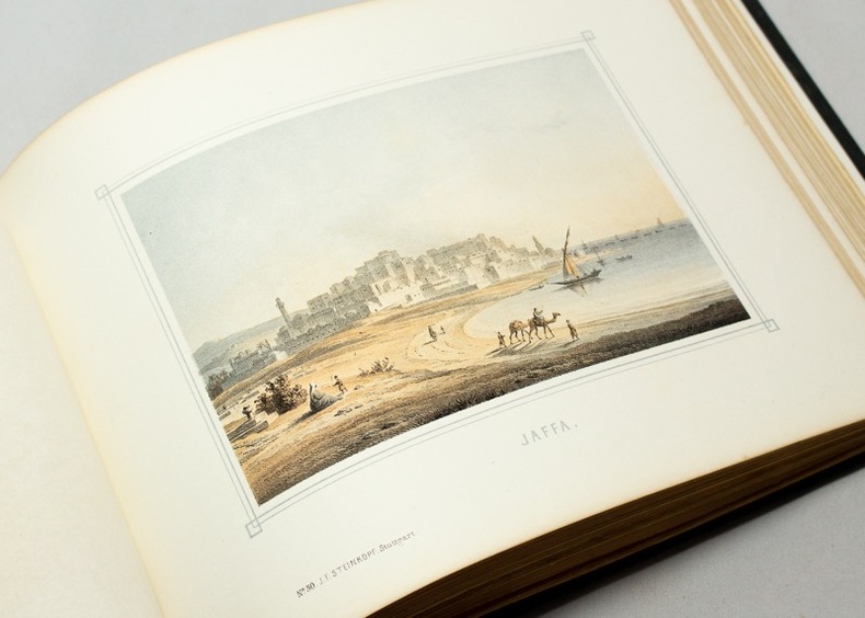
Three books in one volume. Octavo. Pp. vii, 343; (2), 310, (1) verso blank; (1) verso blank, 302, (1) verso blank. Three title-pages and three chromolithograph frontispieces with tissue guards, a pair to each book. Plus 10 other chromolithograph plates with facing tissue guards, and two hand-coloured, folding lithograph maps, bound-in. Index. Hardcover, contemporary tan half calf, corners forest-green, and marbled boards. Spine gilt-stamped, richly decorated. In about fine condition (paper on boards rubbed and dull, endpapers dusty, small stain or two). Overall an excellent copy. ~ First edition. Tobler, p. 226 (wrongfully dating the edition as 1862). Very rare. Eduard Gerdes (1821-1898). With charming views of Hebron, Bethlehem, Jaffa, Jericho, Mount of Olives, Sinai, Suez, Damascus, and other locations in the region.
18360045371836 Paris, Adrien Leclère et Cie, [et] Laval, Genesley-Portier, 1836. Trois volumes in-8 (138 X 212 mm) maroquin aubergine foncé à grain long, plats décorés d'un double encadrement de jeu de quadruple filet doré, grand fleuron doré latéral et dans les angles, grand médaillon central à froid, dos lisse orné en long de filets et fleurons dorés, titre et tomaison dorés, coupes, coiffes et angles filetés, bordure intérieure, tranches dorées (Devers). Tome I : (1) f. blanc, frontispice, (2) ff., 400 pages - Tome II : (1) f. blanc, frontispice, 410 pages, (1) f. blanc - Tome III : (1) f. blanc, frontispice dépliant, (2) ff., 357 pages, 2 cartes dépliantes. Étiquette papier du relieur collée sur le premier contreplat de chaque volume : «Relié par Devers, rue Mercière, n°44, à Lyon ». Rousseurs, souvent fortes.
Small octavo. Pp. 54. Plus 34 halftone photographic plates, printed on different paper, bound in. Original pictorial grey card wrappers, bit rubbed, corner creased, upper wrapper with tape repair for short tear. Else, a fine copy. ~ A fascinating small book, written and photographed by the Senior Chaplain to the Forces, Egyptian Expeditionary Force, with the intention to provide His Majesty's soldiers with a handy book of reference to Palestine and the Holy Land. The book contains a relatively large number of plates, depicting ancient and new towns and villages, holy shrines, landscapes, historical monuments and sites, and some inhabitants. Most fascinating are the images of pure military interest: a derelict tank; a cannon named "Jericho Jane"; and a mobile gun, nicknamed the "Finish Turk". Reverend Payne's text is a wonderful combination of historical background, actual information, traveller's notations, and Biblical contemplations. He previously wrote "Jerusalem, the City of the Great King" which was meant to serve as a guide book to Jerusalem. Both these books were sold in army canteen huts. In his Foreword, Philip W. Chetwode, Late Commanding 20th Army Corps, Palestine, writes: "I feel sure that all soldiers who find themselves, now or in the future, serving in Palestine, will be grateful to him for having provided them with such a useful book which cannot fail to add to the interest of the time they spend in the Holy Land." [Descriptive text Copyright Librarium, The Hague]
1910053731The Ottoman Empire: Ottoman Directorate of Mapping. c. 1910 1910. No Binding. Very Good. Original lithograph map with brown white and blue tons. 81x57 cm. In Ottoman script Old Turkish with Arabic letters. All toponyms are in Ottoman Turkish and Arabic. Scale: 1:500000. Shows Mediterranean shores on the north Bahr-i Lût i.e. the Dead Sea Aqaba Bay areas of Arabic tribes in very detail in addition special huge lands like 'Al-Hism Land'. Also it shows holy places antiquities fortresses rivers; and Turkish Sanjaks Qazas Nahiyes Qariyes based on the Ottoman administrative system. Cartographer is not indicated but it's composed for military purposes in the last period of the Imperial Ottoman especially for showing Arabian tribes spreading over vast areas in its period just before World War 1 date of the printing of this map such as 'Houtat Tribe'. A very detailed and attractive map of Palestine and Quds area and their topography. Following the Muslim conquest of Palestine in 636-640 several Muslim ruling dynasties succeeded each other as they wrestled control of Palestine: the Rashiduns; the Umayyads who built the Dome of the Rock and the al-Aqsa Mosque in Jerusalem; the Abbasids; the semi-independent Tulunids and the Ikhshidids; the Fatimids; and the Seljuks. In 1099 the Crusaders established the Kingdom of Jerusalem in Palestine which the Ayyubid Sultanate conquered in 1187. The Crusaders failed to retake Palestine despite further attempts. The Egyptian Mamluks took Palestine from the Mongols who had conquered the Ayyubid Sultanate in 1260. The Ottomans captured Palestine in 1516 and ruled it until Egypt took it in 1832. Eight years later the United Kingdom intervened and returned the region to the Ottomans. Considerable demographic changes happened during the 19th century and with the regional migrations of Druze Circassians and Bedouin tribes. The emergence of Zionism also brought many Jewish immigrants from Europe and the revival of the Hebrew language. Arabs in Palestine both Christian and Muslim settled and Bedouin were historically split between the Qays and Yaman factions. These divisions had their origins in pre-Islamic tribal feuds between Northern Arabians Qaysis and Southern Arabians Yamanis. The strife between the two tribal confederacies spread throughout the Arab world with their conquests subsuming even uninvolved families so that the population of Palestine identified with one or the other. Their conflicts continued after the 8th-century Civil war in Palestine until the early 20th century and gave rise to differences in customs tradition and dialect which remain to this day. Beit Sahour was first settled in the 14th century by a handful of Christian and Muslim clans hamula from Wadi Musa in Jordan the Christian Jaraisa and the Muslim Shaybat and Jubran who came to work as shepherds for Bethlehem's Christian landowners and they were subsequently joined by other Greek Orthodox immigrants from Egypt in the 17th-18th centuries. Due to the legacy of the Ottoman period the ethnic origins of some rural and urban Palestinians are either Albanian Circassian or from other non-Arab populations. <br/> <br/> [Ottoman Directorate of Mapping]., [c. 1910] unknown
Very Good Arabic Original pamphlet. Large roy. 8vo. (25 x 17,5 cm). Texts in completely Arabic. [4] pp., ills. An extremely rare propaganda and political proclamation in Arabian related to Jerusalem and Palestine question. It has a "call to arms" for the struggle. A unique brochure. Not in OCLC.; Not in IISG.
185818513London. Stuttgart & Leipzig, Paris, Williams & Norgate, J.F. Steinkopf, Fr. Kliksieck, [1858]. In-8 oblong de [116] pages, pleine percaline verte empire, dos lisse, quadruple encadrement des plats estampé à froid, décors de scènes de nativité au plat supérieur dans un encadrement végétal aux symboles bibliques le tout doré, tranches dorées.
Three books in one volume. Crown Octavo. Pp. 51; 78; 207. Plus three folding lithographed maps, one of which is coloured, each as frontispiece to each book; two lithographed plans bound in Book III. With numerous engraved illustrations, some full-page, throughout. Indices of names with transliteration, Arabic script, and translation. Hardcover, bound in the original publisher's ochre cloth, lettered in black, illustration stamped in gilt on cover. In a very fine condition. Excellent copy of a lovely book. ~ First edition. Three books in one volume, published 1889, 1895, 1890 respectively. Provenance: Noted classicist Dr. Henriëtte Boas' copy, with her bookplate. Schumacher was the first explorer to survey the regions described here, and his minute and thorough scientific observations, notes, maps, drawings, and sketches were prepared for publication at the request of the Palestine Exploration Fund by his friend, the explorer Guy le Strange. They were published here for the first time. Gottlieb Schumacher (1857) settled at a very young age with his family in Haifa, where his father, a member of the "Temple Association" designed most of the buildings of the German Colony. Following the completion of his engineering studies in Stuttgart, he returned to Haifa and was appointed Chief Engineer for the Province of Akko. He designed many buildings and was a leading figure in civil engineering. One of his most important projects was the survey of the Golan, Hauran, and the Ajlun districts in preparation for the construction of the Damascus-Haifa railway. In the course of this survey he produced the first accurate maps of these regions, along with detailed descriptions of the archaeological remains and the present villages. He published many other reports and books on his discoveries, supported by the Palestine Exploration Fund. With the outbreak of World War I the Templar community left for Germany. Schumacher returned in 1924 to his home on the Carmel, where he died a year later. Although he was born in Ohio, U.S.A., Gottlieb was brought-up and educated as a German. "I beg to through myself on the indulgence of my readers for the defects of style," he once wrote, "for my work has been perforce written in a language which, though familiar to me, is not my own." Scarce. [Descriptive text Copyright Librarium, The Hague]
Three volume set. Complete. Royal quarto (32 x 27 cm). Pp. x, 240 plus 10 steel-engraved plates; vi, 240 plus 12 steel-engraved plates; vi, 240 plus 11 steel-engraved plates and a double-page engraved map of Palestine, printed in orange and blue, with inset plan of Jerusalem. The total number of 33 plates includes four different steel-engraved frontispieces and four different, large steel-engraved title vignette, all printed on heavy paper bound-in, with tissue-guards. The three volumes are illustrated with a total of 429 wood-engraved illustrations, many of which are full-page, all with explanatory captions. Index to each volume. Titles printed in red and black. Hardcover, uniformly bound in the original publisher's richly decorated green cloth, gilt panelled and lettered, spine gilt, bevelled boards, all edges gilt, yellow endpapers. In about fine condition (occasionally some spotting; slight wear to spine ends.) A very handsome set, very well preserved. ~ Second edition, published in 3 volumes. It does not differ from the first edition, in four volumes, which was published in 1881. The publisher, James Virtue, seeking new marketing opportunities, substitute the line "In Four Volumes" with "In Three Volumes" and did not reissue the fourth volume, devoted to Sinai and Egypt. Other editions followed suit. Appleton of New York has published a two-volume version, rather crowded in comparison with the original, and indeed one that could not match the exceptionally fine, two large folios of the German edition that was published in 1833 under the direction of Georg Ebers and Hermann Guthe. Although it is Wilson who receives all the credit for this monumental work, it is the contribution of the authors whose work he edited that makes this 3-volume an opus of value. Distinguished Palestine explorers such as Canon Tristram, Charles Warren, M. Rogers, and notably Major Claude Reignier Conder, R.E. (1848-1910), as well as several others created the necessary balance between image and word. The superb steel engraved plates are printed here with fine, crisp detail, subtlety and elegance. Noteworthy are the artists who produced them. Most of the original paintings were made by J. D. Woodward and Harry Fenn. Born in England in 1838, Fenn came at the age of 18 to the United States where he has achieved great success as an illustrator of books, was one of the founders of the American Watercolor Society, and has been one of its exhibitors nearly every year since its organization. Some of his best work is contained in "Picturesque America," "Picturesque Europe," and "Picturesque Palestine". A keen traveller, Fenn has travelled extensively through the United States, Canada, Europe, Egypt, Palestine, and the Sinai Peninsula. Other artists include C. Werner and H. A. Harper. The engravings were executed by numerous outstanding craftsmen, noteworthy among them are C. Bertrand and E. Brandard. The numerous lovely and lively wood-engraved illustrations complete this celebration of word and image. A fine set. [Total weight: 10 kg]. [Descriptive text Copyright Librarium, The Hague]
Very Good Arabic Original chromo-lithograph map in brown tones. On a special paper with an ongoing blindstamped "Regestre Robur" during the borders. Folded. 70x100 cm. In Arabic. Scale: 1 /1.000.000. Chipped on margins, split on folded traces. Slight discoloration and one stain on lower margin. Otherwise a good copy. An attractive and detailed map of Syria shows the capital (as Aleppo n that map), other cities like Damascus, Raqqa, Homs, Latakia, Ayn al-Arab, Idlib, Hama, Deir Ez-Zor, Jarabulus, et alli. And it shows Turkey on the north (as Turkey containing Hatay and Alexandrette), The Mediterranean shores of the land as well as Lebanon and Palestine (and Jerusalem) on the west, Sharq al-Urdun (Jordan) and Iraq on the south and east. It's very detailed on showing the roads spread throughout the land like railways and ancient roads from the Roman period. Additionally this roads can be followed to the other Arabic countries and regions on the map. This map was calligraphed by Kamel Al-Baba, (1905-1991), who was a Lebanese contemporary / modern calligrapher. He is the son of famous calligrapher Mokhtar Al-Baba. Cannot be found in WorldCat.; Not in Library of Congress Map Collection. Very scarce.
19803755DBMünchen, Idion-Verlag, 1980. Schmall-Folio (18() Blatt mit zahlreichen Illustrationen. Pergamentband mit drei Schliessen. + Wichtig: Für unsere Kunden in der EU erfolgt der Versand alle 14 Tage verzollt ab Deutschland / Postbank-Konto in Deutschland vorhanden +, A|B [2 Warenabbildungen]
1843PHO-2303Paris, Challamel, sans date (1843). In-8° de 328 pp. 16 pl. en coul. h.-t. Cartonnage illustrée d'éditeur à la Bradel. Des rousseurs, cartonnage usagé, fentes certaines planches brunies.
188416153Paris, Plon, Nourrit et Cie, 1884 ; 2 tomes in-folio ; demi-chagrin à coins vert foncé, dos à nerf, titre doré ; (4), 468 ; (4), 512 pp. et en tout 44 planches hors-texte gravées sur acier dont 2 frontispices et 3 cartes en couleurs (dont 2 à doubles pages) et le plan de Jérusalem et plusieurs centaines d'illustrations gravées sur bois.
184414501Paris, Comptoir des Imprimeurs Unis, 1844 ; in-8 ; plein maroquin bleu-marine, dos à nerfs, titre doré, double filet doré sur les coupes, dentelle intérieure, toutes tranches dorées sur marbrure (Andrieux) ; (8), 526 pp.
119104Paris, Librairie Hachette et Cie, 1884, 1 volume in-folio de 260x345 mm environ, 675 pages, complet de la carte dépliante de la Palestine in-fine et des 8 autres cartes. Reliure éditeur signée Ch. Magnier, cartonnage décoré par A. Souze. Demi chagrin rouge, dos à nerfs richement orné, plats décorés en rouge, noir et or, toutes tranches dorées, gardes marbrées. Coins émoussés, discrets frottements sur le cuir, des rousseurs (fortes par endroits), déchirures sur la carte de la Palestine, sinon très bel exemplaire. PRÉVOIR DES FRAIS D'EXPÉDITION POUR COLIS DE PLUS DE 5kg.
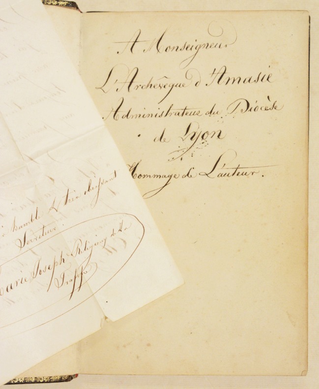
184726103Paris Librairie Ethnographique 1847 -in-4 demi-chagrin à coins un volume, reliure demi-chagrin bleu-marine in-quarto à coins (binding half shagreen in-4 with corners) (28 x 19,2 cm), RELIURE D'ÉPOQUE, dos 5 nerfs (spine with raised bands), décoration "or" et à froid, titre frappé "or" avec un filet "or" de part et d'autre, filet fin "or" en place des nerfs avec un filet large à froid de part et d'autre des nerfs, entre-nerfs à caissons formés d'un filet large et d'un filet fin à froid en encadrement, double filets "or" en tête et en pied, plats décorés à froid d'un filet à froid aux mors et aux coins, papier marbré vert aux plats, tête lisses dorée, gouttière et tranche de queue non-rognées, gardes blanches moirées tachées en marge, cachet Ex-Libris ovale à l'encre noire en bas de la gravure titre et en bas de la page de titre : collège des Jésuites de Lyon [ sodalitas juvenum Dae Nae a Bono consilio - J. H. S Lugduni], ÉDITION ORIGINALE ornée d'un titre frontispice lithographié en couleurs + une vignette lithographiée en noir en bas de la page de titre + 58 Gravures hors-texte lithographiées en deux Tons (teintées à pleine page) d'après DAVID ROBERTS + une grande carte dépliante de la Palestine pour servir à La TERRE SAINTE ILLUSTRÉE par Soulavie Le Jeune, gravée en noir par B. Wohlmuth in-fine + de trés nombreuses lettrines et vignettes en cul-de-lampes historiées gravées in-texte en noir, 232 pages, sans date (1847) Paris, Librairie Ethnographique Editeur,
174298103Paris Chez Guillaume Cavelier père 1742 6 vol. relié 6 vol. in-12, veau marbré fauve, dos à nerfs avec caissons dorés et pièces de titre de cuir brun, filet doré sur les coupes, tranches marbrées (quelques infimes déchirures et rousseurs marginales, coiffes un peu frottées). Bonne édition illustrée de 6 frontispices, un portrait de l'auteur et 14 gravures hors-texte dont 2 plans dépliants (Babylone et Temple de Jérusalem avec sa notice explicative) et 5 cartes dépliantes (Syrie, Grèce ancienne, carte générale des anciennes monarchies qui ont eu relation avec les Juifs pour servir à l'histoire de ce peuple, Asie Mineure et Palestine). Ex-libris manuscrit au dernier tome : "Carlo Nicosia, violoniste italien, année 1877". Agréable exemplaire en reliure de l'époque.
174298103Paris Chez Guillaume Cavelier père 1742 6 vol. relié 6 vol. in-12, veau marbré fauve, dos à nerfs avec caissons dorés et pièces de titre de cuir brun, filet doré sur les coupes, tranches marbrées (quelques infimes déchirures et rousseurs marginales, coiffes un peu frottées). Bonne édition illustrée de 6 frontispices, un portrait de l'auteur et 14 gravures hors-texte dont 2 plans dépliants (Babylone et Temple de Jérusalem avec sa notice explicative) et 5 cartes dépliantes (Syrie, Grèce ancienne, carte générale des anciennes monarchies qui ont eu relation avec les Juifs pour servir à l'histoire de ce peuple, Asie Mineure et Palestine). Ex-libris manuscrit au dernier tome : "Carlo Nicosia, violoniste italien, année 1877". Agréable exemplaire en reliure de l'époque.
243173Paris, Furne [Imprimerie de H. Fournier], 1846 in-12, [2] ff. n. ch., 290 pp., un f. n. ch. de table, veau violine, dos lisse orné en long, encadrement de triple filet doré avec volutes d'angle sur les plats, hachuré doré sur les coupes, tranches dorées (reliure de l'époque). Abondantes rousseurs.
175909Paris, A l'Imprimerie Nationale, 1849 in-4, VIII-331 pp., demi-basane rouge, dos à nerfs orné de fleurons à froid et de roulettes dorées sur les nerfs (reliure de l'époque). Rousseurs. Bon exemplaire.
Lot of 3 works on the subject. The first item is octavo, Pp. 24. Original printed wrappers, faded, bit soiled, vertical fold mark, small old ticket at top corner, small rubbed patch at back. In good condition, very good and clean interior. ~ First edition. Interesting and very rare document relating to the Jewish "Planters Association of Palestine". The first part, approved by the High Commissioner Herbert Samuel, is the Memorandum of Association. Its articles specify the objects for which the company is established as "the purchase of any lands, forests (.) and other immovable property in Palestine, Transjordania, Syria, and the Peninsula of Sinai, for the purpose of constructing, maintaining, and managing any roads, ways, railways, bridges, viaducts, harbours, telegraphs, electrical works, factories, etc. In doing so, the company will take over all the assets and liabilities of 'The Ottoman Company for Commerce and Agriculture and Industries Limited' incorporated under Turkish Law the 26th April, 1910". On the curious case of "Agendath (sic.) Netaim", which the half-Jewish Leopold Bloom spends a whole day considering, one should read with pleasure in James Joyce's "Ulysses". [TO THIS IS ADDED:] "Statuts de la Societé Ottomane de Commerce, d'Agriculture et d'Industrie." Constantinople, Ferd. Walla, 1910. 12mo. Pp. 12. Plain wrappers. In fine condition. [AND:] "Prospekt. Ottomanische anonyme Gesellschaft für Agricultur, Handel und Industrie. Genehmigt mit Kaiserlicher Irade vom 26 April/9 Mai 1910. Jaffa, [Agudath Netaim],1911." 12mo. Pp. 8. Self-wrappers. Original document with manuscript entries specifying names of the Committee members and its Auditors, financial situation, scope and scale of the plantation (Oranges 235 dunam; Olives 385 dunam, etc.). Extremely rare set of documents relating to one of the earliest Zionist enterprises.
1861AMO-4437d'après les documents officiels, les travaux des publicistes et les monuments de l'art, par A. Morel. Paris, E. Dentu, Bruxelles et Liège, 1861 (Liège, typographie de N. Redouté) 1 volume petit in-12 (143 x 105 mm) de 193 pages. Reliure de l'époque demi-maroquin rouge poli, plats de papier marbré, non rogné (relié sur brochure). Légères traces à la reliure restée fraîche. Intérieur frais. Papier vélin teinté. Édition originale. Cet ouvrage, dont le premier volume (paru séparément) est aussi intitulé Histoire du Diable et sert d'introduction en CIV pages à un ensemble qui devait compter six tomes, n'a jamais été achevé par son auteur. Ce second et dernier volume publié semble fort rare si l'on en croit les dénombrements effectués dans les dépôts publics. Très intéressante étude sur l'histoire du Diable et les différents démons au travers du prisme des différents textes officiels de l'histoire sainte. Aucun exemplaire répertorié sur les différents sites de vente de livres rares en ligne (consultés le 3 octobre 2018). Bel exemplaire de ce livre rare.
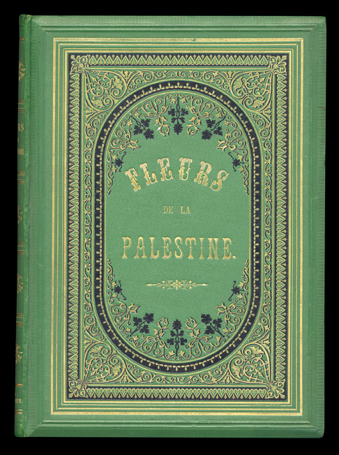
187014678Bâle, C.F. Spittler, s.d. (1870) ; in-8 ; cartonnage d'éditeur vert-or-noir à décor orientaliste sur plats biseautés, titre doré dans un grand cartouche, toutes tranches dorées ; (3) ff. de titre, préface par Félix Bovet et table des matières (liste des plantes en latin, français, anglais et allemand), 54 planches chromolithographiées protégées par des serpentes blanches de papier fin.
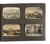
1927208311927. Photo album documenting a multi country group यातà¥à¤°à¤¾ in 1927 records interwar travel across southern Europe and the eastern Mediterranean including regions under colonial administration and recent political transition. The album follows a group of travelers moving from France through Italy Greece Turkey British administered Palestine and Egypt capturing urban landmarks archaeological sites and local populations encountered along the route. The sequence provides visual evidence of tourism infrastructure mobility and cross cultural observation during a period when former imperial territories such as Constantinople were undergoing redefinition following the dissolution of the Ottoman Empire and the establishment of modern nation states.<br /> <br /> Album contains 93 black and white silver gelatin photographs and four real photo postcards with images ranging approximately from 2.5 x 4 inches to 3.5 x 5.5 inches and one larger group photograph measuring about 9 x 7 inches. Photographs are mounted on black paper boards with handwritten captions in white pencil and interleaved tissue guards; string bound in patterned cloth boards. The album opens in Avignon with views of St. Pierre's Church and the Palais des Papes then continues through Italy with scenes of Naples and Pompeii as well as shipboard images captioned S.S. Adriatic. Subsequent sections include Athens with views of the Parthenon followed by Constantinople where four postcards depict the harbor the Sultan Ahmed Mosque and the Hagia Sophia shortly after the end of the Ottoman Empire. In British Mandate Palestine images show street scenes in Nazareth and Jerusalem including sites along the River Jordan the Western Wall and the Garden of Gethsemane alongside a captioned portrait labeled "A Jewish Maiden." The album concludes in Egypt with extensive views of archaeological and urban sites at Thebes Memphis Cairo and Luxor including the Obelisk of Hatshepsut Edfu Temple the tomb of Amenhotep II the Colossi of Memnon and the pyramids and Great Sphinx at Giza where the final group portrait shows the travelers posed on camels.<br /> <br /> Produced during the interwar period the album reflects expanding international tourism networks alongside ongoing European influence in the eastern Mediterranean and Middle East. The juxtaposition of ancient sites modern transport and local populations situates the material within broader histories of archaeology empire and travel culture in the early twentieth century. Light general wear to album and mounts; images well preserved with clear captions; overall very good condition. unknown