3 524 résultats
0282241914.Gpaperback. Good. Access codes and supplements are not guaranteed with used items. May be an ex-library book. paperback
Estratto da La riforma sociale. Lavoro realizzato dal Bachi, noto economista del tempo.
Original single-sheet map in copperplate engraving of fine quality. Overall size ca. 400 x 510 mm. Plate mark ca. 350 x 445 mm. Image size ca. 325 x 410 mm. Incorporates a detailed Plan of the City of Jerusalem within a general, delicately illustrated topographical view of its environs. Plain cartouche encloses title and colophon. Fine, strong impression on heavy handmade paper with ample margins all round. First, original state, unaltered by later colouration. Preserved flat in acid-free, pH-balanced, buffered archival paper. In fine condition. (Single outer corner finger-soiled, well away from image and plate mark.) - - First edition. Willem Albert Bachiene (1712-1783), Dutch clergyman, later a professor of geography and astronomy at the Illustere School, Maastricht. Well known cartographer. The 3-volume "Heilige geographie of aardrijkskundige beschryving van het Joodsche land, alsmede andere landen in de H. Schrift voorkomende," is considered among his most important works. It was published in Utrecht between 1763-1768, and included a suite of 12 fine geographical maps of the Holy Land and its neighbouring lands which Bachiene made during a period of ten years, the first in as early as 1758. The map offered herewith is taken from this suite. Other important cartographic works of the Holy Land by Bachiene were included in the so-called "Jehovah Bible" i.e. "De Gansche H. Schrift, Vervattende alle de regelmatige Boeken des Ouden en Nieuwen Testaments (.) Gods Gedenk-Naam Jehovah onvertaald gehouden" published in 1762 by N. Goetzee of Gorinchem, shortly before the present map first appeared in book form. Whereas other single-sheet maps by Bachiene are in relative abundance, the works from "Heilige geographie of aardrijkskundige beschryving van het Joodsche land" are very scarce, seldom found in any state, practically unavailable in their original, uncoloured state.
Original single-sheet map in copperplate engraving of fine quality. Overall size ca. 400 x 510 mm. Plate mark ca. 360 x 445 mm. Image size ca. 345 x 425 mm. With Inset Map, "Der Verdeelinge van Israels Land", measuring ca. 150 x 110 mm, presented by two, finely engraved cherubs. Engraved illustration, depicting Joshua's men about to embark on the entry into the Promised Land. Illustrated cartouche encloses engraved title and colophon. Fine, strong impression on heavy handmade paper with ample margins all round. First, original state, unaltered by later colouration. Preserved flat in acid-free, pH-balanced, buffered archival paper. In a very fine condition. - - First edition. Willem Albert Bachiene (1712-1783), Dutch clergyman, later a professor of geography and astronomy at the Illustere School, Maastricht. Well known cartographer. The 3-volume "Heilige geographie of aardrijkskundige beschryving van het Joodsche land, alsmede andere landen in de H. Schrift voorkomende," is considered among his most important works. It was published in Utrecht between 1763-1768, and included a suite of 12 fine geographical maps of the Holy Land and its neighbouring lands which Bachiene made during a period of ten years, the first in as early as 1758. The map offered herewith is taken from this suite. Other important cartographic works of the Holy Land by Bachiene were included in the so-called "Jehovah Bible" i.e. "De Gansche H. Schrift, Vervattende alle de regelmatige Boeken des Ouden en Nieuwen Testaments (.) Gods Gedenk-Naam Jehovah onvertaald gehouden" published in 1762 by N. Goetzee of Gorinchem, shortly before the present map first appeared in book form. Whereas other single-sheet maps by Bachiene are in relative abundance, the works from "Heilige geographie of aardrijkskundige beschryving van het Joodsche land" are very scarce, seldom found in any state, practically unavailable in their original, uncoloured state.
Original single-sheet map in copperplate engraving of fine quality. Overall size ca. 400 x 510 mm. Plate mark ca. 365 x 445 mm. Image size ca. 340 x 420 mm. Engraved illustration at lower right corner. Handsome illustrated cartouche encloses engraved title and colophon. Scale within illustrated frame. Fine, strong impression on heavy handmade paper with ample margins all round. First, original state, unaltered by later colouration. Preserved flat in acid-free, pH-balanced, buffered archival paper. In fine condition. (A touch of browning to centrefold.) ~ First edition. Willem Albert Bachiene (1712-1783), Dutch clergyman, later a professor of geography and astronomy at the Illustere School, Maastricht. Well known cartographer. The 3-volume "Heilige geographie of aardrijkskundige beschryving van het Joodsche land, alsmede andere landen in de H. Schrift voorkomende," is considered among his most important works. It was published in Utrecht between 1763-1768, and included a suite of 12 fine geographical maps of the Holy Land and its neighbouring lands which Bachiene made during a period of ten years, the first in as early as 1758. The map offered herewith is taken from this suite. Other important cartographic works of the Holy Land by Bachiene were included in the so-called "Jehovah Bible" i.e. "De Gansche H. Schrift, Vervattende alle de regelmatige Boeken des Ouden en Nieuwen Testaments (.) Gods Gedenk-Naam Jehovah onvertaald gehouden" published in 1762 by N. Goetzee of Gorinchem, shortly before the present map first appeared in book form. Whereas other single-sheet maps by Bachiene are in relative abundance, the works from "Heilige geographie of aardrijkskundige beschryving van het Joodsche land" are very scarce, seldom found in any state, practically unavailable in their original, uncoloured state.
Original single-sheet map in copperplate engraving of fine quality. Overall size ca. 400 x 800 mm, with 2 flapped wings. Image size, within plate mark, ca. 340 x 740 mm. Handsome ornate cartouche encloses engraved title and colophon. Fine, strong impression on heavy handmade paper with ample margins all round. First, original state, unaltered by later colouration. Preserved flat in acid-free, pH-balanced, buffered archival paper. In fine condition. - - First edition. Willem Albert Bachiene (1712-1783), Dutch clergyman, later a professor of geography and astronomy at the Illustere School, Maastricht. Well known cartographer. The 3-volume "Heilige geographie of aardrijkskundige beschryving van het Joodsche land, alsmede andere landen in de H. Schrift voorkomende," is considered among his most important works. It was published in Utrecht between 1763-1768, and included a suite of 12 fine geographical maps of the Holy Land and its neighbouring lands which Bachiene made during a period of ten years, the first in as early as 1758. The map offered herewith is taken from this suite. Other important cartographic works of the Holy Land by Bachiene were included in the so-called "Jehovah Bible" i.e. "De Gansche H. Schrift, Vervattende alle de regelmatige Boeken des Ouden en Nieuwen Testaments (.) Gods Gedenk-Naam Jehovah onvertaald gehouden" published in 1762 by N. Goetzee of Gorinchem, shortly before the present map first appeared in book form. Whereas other single-sheet maps by Bachiene are in relative abundance, mostly with added colouration for purely decorative purpose, the works from "Heilige geographie of aardrijkskundige beschryving van het Joodsche land" are very scarce, seldom found in any state. They are practically unavailable in their original, unaltered, uncoloured state.
Lot of 5 original single-sheet maps in copperplate engraving of fine quality. Fine, strong impressions on heavy handmade paper with ample margins all round. First, original state, unaltered by later colouration. Preserved flat in acid-free, pH-balanced, buffered archival paper. In fine condition. - - Full individual descriptions are available on request. - - First edition. Willem Albert Bachiene (1712-1783), Dutch clergyman, later a professor of geography and astronomy at the Illustere School, Maastricht. Well known cartographer. The 3-volume "Heilige geographie of aardrijkskundige beschryving van het Joodsche land, alsmede andere landen in de H. Schrift voorkomende," is considered among his most important works. It was published in Utrecht between 1763-1768, and included a suite of 12 fine geographical maps of the Holy Land and its neighbouring lands which Bachiene made during a period of ten years, the first in as early as 1758. The map offered herewith is taken from this suite. Other important cartographic works of the Holy Land by Bachiene were included in the so-called "Jehovah Bible" i.e. "De Gansche H. Schrift, Vervattende alle de regelmatige Boeken des Ouden en Nieuwen Testaments (.) Gods Gedenk-Naam Jehovah onvertaald gehouden" published in 1762 by N. Goetzee of Gorinchem, shortly before the present map first appeared in book form. Whereas other single-sheet maps by Bachiene are in relative abundance, the works from "Heilige geographie of aardrijkskundige beschryving van het Joodsche land" are very scarce, seldom found in any state, practically unavailable in their original, uncoloured state. - - Note regarding this lot: Each of the 5 maps in this lot is offered also separately. [Descriptive text Copyright Librarium, The Hague]
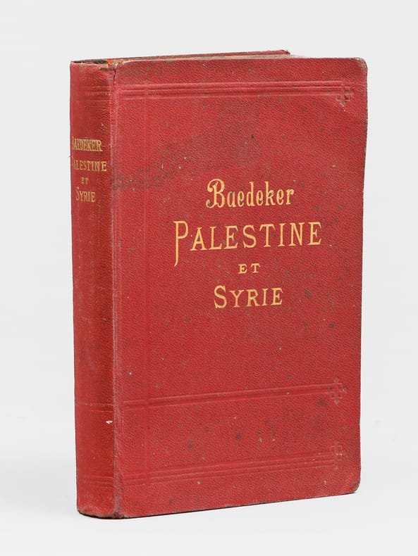
50107Baedeker.1912.In-12.Couv.rouge éditeur.Cartes rempliées.BE.
1912yam1211BEL EXEMPLAIRE in-12 458 pages + cartes dépliantes
1906116419Baedeker 1906 Leipzig, Karl Baedeker Editeur, 1906, XCVI-429 p., cartonnage éditeur, environ 16x11cm, un plan dépliant contrecollé au second contreplat. Début de fente sur un mors, premier plat un peu incurvé. Bon état pour le reste.
190671516Par Karl Baedeker, Avec 20 cartes, 52 plans et un panorama de Jérusalem, Troisième édition, 1 vol. in-12 reliure éditeur pleine percaline souple rouge, Karl Baedeker Éditeur, Leipzig, Paul Ollendorff, Paris, 1906, XCVI-429 pp.
in-12°, XCVI-429 pages, cartes, plans et panoramas, relie pleine toile rouge decor d"editeur, tranches jaspees.- Nom du proprietaire en page de garde sinon tres bel exemplaire TRES frais, bien complet de tous ses plans et cartes. [BU-1] All maps present and in fine condition. Fine. Nice tight binding. Rare to find a Baedeker in such excellent condition.
8vo; 1st seperate edition. Original Paper Wrappers, 8vo, 12 pages. Light wear, Very Good Condition. (KH-2-38)
1952R119358Gerusalemme [Jerusalem], Tipografia dei PP. Francescane 1952 x + 279pp., + 65 illustrations in text & 56 bl/w plates out of text & 4 folding plans, 29cm., in the series "Pubblicazioni dello Studium Biblicum Franciscanum" volume 9, original softcover, few foxing on edges, ex-libris stamp on title page, text is clean and bright, good condition, weight: 1kg., R119358
1947R119359Gerusalemme [Jerusalem], Tipografia dei PP. Francescane 1947 245pp., + 48 illustrations in text & 42 bl/w plates out of text (of which 2 folding plans), 29cm., in the series "Pubblicazioni dello Studium Biblicum Franciscanum" volume 4, original softcover, ex-libris stamp on title page, pages still uncut, text is clean and bright, good condition, R119359
1948R118524Gerusalemme [Jerusalem], Tip. Dei PP. Francescani 1948 135pp. + frontispiece and 40 figures in text + 40 figures out of text, in the series "Pubblicazioni dello Studium Biblicum Franciscanum (Publications of the Studium Biblicum Franciscanum)" vol.5, original softcover (few loss of paper at lower end of spine), pages are still uncut, 2 ex-libris stamps, text is clean and bright, good condition, R118524
1968R119350Jérusalem, Imprimerie des PP. Franciscains 1968 vii + 357pp., avec 223 illustrations en n/bl, 25cm., brochure originale, dans la série "Publications du Studium Biblicum Franciscanum. Collection minor" volume 4, cachet au verso de la page de titre, texte et intérieur sont frais, bon état, R119350
200170207Marval 2001 In-4 relié 32,8 cm sur 25. 150 pages. Jaquette fendillée en tête et en pieds ; bords un peu frottés, sinon intérieur en bon état d’occasion. Bon état d’occasion.
New York, Crescent Books, (1988), in-folio, tela edit., sovraccoperta, pp. 159. Con illustrazioni fotografiche a colori.
THIS VOLUME ONLY: Volume 7, 1940 - February. 245x170mm. 74 pages (pagination: 47-120). Softcover. Cover yellowing and dirty. Front cover upper corner tattered/creased. Front cover corners missing. Spine missing. Spine hinges tattered. Title-page and page 47/48 upper corner creased. Front cover, title-page and page 47/48 almost detached from binding. Stamp on title-page and page 47. Binding coming loose between pages 88-89, 72-73, 104-105. Pages yellowing. Else in good condition. PLEASE NOTE: This book's cover is very worn, loose or missing. If you'd like, we can send this book to be rebound for an extra charge.
In 8°, bross. edit., pp 88 ed ill. fot. n.t. a piena pagina . Macchie al piatto posteriore, peraltro ottimo es. Interessante, di grande attualità.
Volume in 4°, brossura editoriale figurata, titolo al piatto ed al dorso, sguardie, occhiello, frontespizio, prefazione, LIII (3) 430 pp., 1 carta ripiegata f.t. raffigurante la Palestina, numerose illustrazioni n.t.. Molto più di una guida, questo interessante lavoro pubblicato a cura dell'Associazione Nazionale per soccorrere.i Missionari italiani, è preceduto da un ampio saggio sulle relazioni fra l'Italia e la Terra Santa e procede poi con una descrizione accurata sul territorio dal punto di vista fisico e storico, rivelando una miniera di informazioni e notizie sui moltissimi luoghi significativi. Il tutto arricchito dalle molte illustrazioni fotografiche. Importante e rara pubblicazione in ottimo stato di conservazione.
XII, 335 p. con ill. nel testo e cartine ripiegate fuori testo; 16,5 cm. Tutta tela editoriale. Lievi tracce d'uso alla copertina, buona copia
"Whatever place its author may ultimately occupy in future histories of England, one thing is certain, that in the history of the Jewish people the name of Balfour will enjoy unchallenged immortality, evoking comparison with that of Cyrus, for the issue of the Balfour Declaration marked the opening of a new epoch in the annals of Jewry which will be recognised as such even in the remotest centuries to come. In this little book have been gathered together all the utterances of Lord Balfour on the interpretation and implications of his Declaration, on its political aspects and its practical realisation, made during the last ten years." - Preface. [4], 5-128 pp. 7" x 4.75". Original spine label present and intact. Front free endpaper professionaly replaced. Tanning to central portion of half-title. Prior owner's ink stamp upon title page. Duplicate spine label bound at p.128. Average external wear. Binding intact with moderate forward lean. No dust jacket, presumably as issued. Quarter inch notch from top of backstrip. A sound copy of this jewel of Zionist history. EMANUEL p.48. [ASIN B000852UV4] Book
Madrid, Nerea, 1996. 4to.; 316 pp. Ilustraciones. Cubiertas originales. Inédito hasta su publicación el Diario de Ballobar es un extraordinario documento sobre la situación en Palestina durante el periodo de la Primera Guerra Mundial, ya que al retirar los países europeos y Estados Unidos sus legaciones en Jerusalem el cónsul español acabó velando por los intereses en la zona de todos los enemigos de Alemania hasta la toma de Jerusalem por los británicos en 1917.