Miller, Konrad / Husslein, Gertrud (Hrsg/Einf)Antiquariat.de

277 résultats
198852178ABBregenz, Eigenverlag Gertrud Husslein, 1988. 4° (35x25), LXXV, (1) S., 960 Sp, [961] - 992 S. (Register), mit 317 Kartenskizzen und Textbildern, grüner Oln mit goldPrägung, [2 Warenabbildungen] ungenutzt, schönes gepflegtes Exemplar, im Pappschuber,
190818951St. Petersbourg, Kügelgen, 1908. (2) 180 p., 79 illustrations, 1 carte dépliante. In-8°, demi-toile originale. Le dos taché.
192723896New Haven: Yale University Press 1927. Hardcover. Small 4to. Black cloth. xx 215pp. Frontispiece numerous illustrations. Very good. Slightest bit of edgewear and bit of "flecking" to the cloth but overall tight clean and attractive. First edition limited to 1000 copies. Interesting association copy for this belonged to the noted writer HAROLD BELL WRIGHT 1872-1944 one of the most popular novelists of the early 20th century author of such bestsellers as "The Shepherd of the Hills" 1907 "The Calling of Dan Matthews" 1909 and "The Winning of Barbara Worth" 1911 -- whose descendants parted with much of HBW's personal library in December 2005. Wright was a serious long-time boating enthusiast a fanatical follower of all things nautical whose hobby was designing and building from scratch his own sailboats. A rather uncommon title with an interesting provenance. Yale University Press hardcover
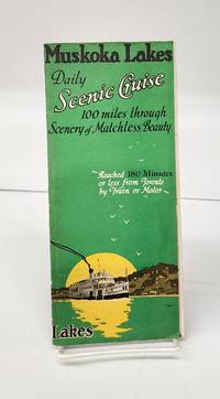
1941160265Gravenhurst Ont.: Press of Hugh C. MacLean Productions 1941. Very good. 24 cm flyer has b&w photos route charts boat info general info partial-colour map of area. Tear in horizontal fold and small holes in crease intersections. <br/><br/>"A Day of Interest of ever Changing Scenes of Enjoyment. Reached 180 Minutes or less from Toronto by Train or Motor." Press of Hugh C. MacLean Productions unknown
194539135Chatham: Shepherd Printing n. d. ca 1945. 1945. CANADA. 18" x 24" sheet one side opens to a half-sheet color map and numerous advertisements for lodging including the Joe Gawa Hotel one of Ontario's newest and finest hotels. The other side has 12 panels of promotional text regarding the various cruise packages of the beautiful Muskoka Lakes time tables and schedules and views of the inland waterways steamships R. M. S. Sagamo and the R. M. S. Cherokee. Some minor to light wear to the folds else a very good copy. Shepherd Printing, n. d. (ca 1945). unknown
1994G030904829XI5N01Natl Academy Pr 1994. Hardcover. Acceptable. Missing dust jacket; Readable copy. Pages may have considerable notes/highlighting. ~ ThriftBooks: Read More Spend Less.Dust jacket quality is not guaranteed. Natl Academy Pr hardcover
1994SONG030904829XNatl Academy Pr 1994-01-01. hardcover. Used: Good. 6.50x1.50x9.25. Buy with confidence. Excellent Customer Service & Return policy. Natl Academy Pr hardcover
19822111902154600035Kaibundo shuppan 1982. Soft Cover. Fine. The book is in fine condition. Kaibundo shuppan paperback
195514915AB1955. Sevilla 1955-1958. differentes damaños Con muchas ilustraciones en parte en color. Interesante conjunto de folletos de las lineas de navegacion Ybarra. Contiene: 'Plano de acomodaciones de los nuevos transatlanticos Cabo San Roque y Cabo San Vicente' 'Un billete de pasaje Tenerife - Barcelona en 1958 que costaba entonces Pts. 2.420-' 2 menus Coleccion Ybarra 3 minutas Cuidad de Sevilla de 1957; 2 ediciones de la revista 'Maripez' de Ybarra de 1958 contiene una reportaje de una visita de Brigitte Bardot a Picasso con foto; mapas de Lisboa y Barcelona. unknown
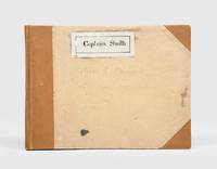
1928174745Likely Shanghai: 1928-34. Mariners are warned to exercise due caution when approaching and when in the waterways A collection of otherwise untraced notices to mariners compiled by a civilian captain who plied the lower Yangtse during the late 1920s and early 1930s. Yangtse shipping was regulated by the Maritime Customs Service which issued around 100 navigational advisories per year. During the late 1920s shipping traffic on the Yangtse rebounded after several years of decline during the Warlord Era. Low water however continued to pose problems for navigators and increased the need for effective river management. The 39 notices are technical directions concerning specific parts of the channel. They specify when vessels may and may not enter stretches of water warning of the persistent presence of Chinese craft not subject to the same notices offer guidance for navigating buoyed channels provide optimum bearings and relay a change to the position of the Bend and Gravener Island beacons due to the erosion of the channel. The majority date from 1929. The identify of the "Captain Smith" referenced on the front cover has proved elusive but he may be the individual pictured in photograph Sw13-045 G. Warren Swire collection SOAS. Landscape octavo. Contemporary brown half cloth binder with metal clasp spine lettered in gilt buff paper sides front board with manuscript label "Captain Smith" boards lined with pink paper typescript list of charts on inner front cover 39 sheets each typed one side only in black or blue most duplicate typescript a few top copy. Boards lightly soiled clasp rusted sheets generally well preserved a few creased or with holes near clasp legibility unaffected typescript list with a few losses to text: a very good example. hardcover
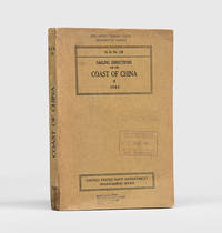
1943172166Washington DC: United States Navy Department Hydrographic Office 1943. First edition first printing pleasingly with all the printed supplement tickets still present and the detailed maps well preserved. Updated chapters offer information on general subjects such as pilotage storm and weather signals quarantine regulations and ocean currents as well as detailed discussion of stretches of river and ocean along China's east coast down to Hong Kong and up the Yangtze. While common institutionally as expected copies are now seldom encountered in commerce. Octavo. With 2 folding maps 2 diagrammatic plates illustrations in text. With all 8 leaves 4 blank of printed supplement tickets bound in at front as issued. Original brown card wrappers spine and front cover printed in black. Ex-Civil Affairs Training School University of Chicago with its ink stamps on front cover and "discard" noted in pencil. Wrappers well preserved first map with stub tear just touching neatline second map split along one fold neatly repaired on verso with archival tape couple of small nicks and chips internally not affecting text: a very good copy. unknown
193731172Imray Laurie Norie & Wilson 1937. 4to. First Edition with frontispiece and plates; blue cloth gilt back a very good bright clean copy. This copy was formerly in the library of The Cruising Association and bears its bookplate on front paste-down and neat blind stamp on title. Traces the history of the firm of Imray and irs successors from 1670 to 1937. VERY SCARCE. Imray Laurie Norie & Wilson, hardcover
1939136776Bremen. 1939. 24 Seiten. Mit 4 großformatigen Abbildungen, einer Linien-Neztkarte u. einer Illustration sowie einem Widmungsblatt als Beilage. Dekorativ farbig illustrierte Originalbroschur mit Fadenheftung. (Einband teils fleckig u. mit einem Eingangsstempel versehen). 25x22 cm
191119610Toronto: Niagara Navigation Company. Very Good. 1911. First Edition. Softcover. Water damage in the gutter at the bottom which does not show on the wraps. This brochure is both advertising and a timetable. As-is. ; 8vo 8" - 9" tall; 32 pages . Niagara Navigation Company paperback
194310655Berlin, E. S. Mittler & Sohn, 1943. (abgeschlossen am 31. Dezember 1942) - Einundsiebzigste Auflage. . ill OKt., 589 / 104 S., Gr.8°
197568022Wiesbaden : Brockhaus, 1975. 188 S. mit 30 Fotos und 8 Karten; 23 cm, gebunden, Orig.-Leinen mit Orig.-Schutzumschlag,
198231646ABStuttgart, W. Kohlhammer Verlag, 1982. gr8° (23x17), XIII, 120 S., farb Frontispiz, 3 Titelblatt-Faksmilies im Text, 1 mehrfach gefaltete farb Kartenbeilage in Deckeltasche (Liebenzeller Forst), OKart (Brosch), ohne Gebrauchsspuren, offensichtlich ungelesen, [= Veröffentlichungen der Kommission für Geschichtliche Landeskunde in Baden-Württemberg: Reihe B (Forschungen); 103],
1923165732Paris, Société d'Editions Géographiques, Maritimes et Coloniales, 1923. 236, VII, 120, 44, 24, 29, 24S., mit Illustrationen und Karten, 4° OHalbleinen, mit handgeschriebenen Rückentitel
19068656Portland Oregon: The Oregon Railroad & Navigation Co. Fine with no dust jacket. 1906. First Edition. Original Wraps. Map unfolds to about 1 1/2'x5'. Colored semi-topographical map of the Columbia River with towns etc. Really cool!; Map; 4 1/2x9 1/2" . The Oregon Railroad & Navigation Co. paperback
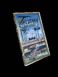
19118633Tacoma: Tacoma Commercial Club and Chamber of Commerce 1911. First edition. 14x8cm 32pp. Full color and sepia photographic illustrations throughout. Single map. Detachable post card/order form present at rear. Staple bound in color lithographed card covers. Some edge rubbing and light wear else near fine. <br /> <br /> Beautiful and scarce promotional booklet a joint effort of the Oregon-Washington Railroad and Navigation Company Bureau of Community Publicity and the Tacoma Commercial Club and Chamber of Commerce. Photos of prominent buildings factories the port Mount Rainier and Stadium High School among others. Includes information on industry and culture of the fast-growing city. <br /> <br /> <br /> OCLC cites 4 holdings only including just 1 in the state of Washington. . Tacoma Commercial Club and Chamber of Commerce unknown
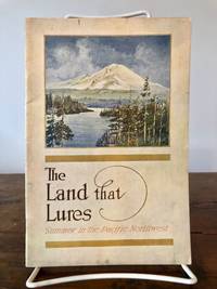
19137087Portland Oregon: Oregon-Washington Railroad & Navigation Co 1913. Fourth Edition. Stiff Illustrated Wrappers. Good. 8vo. Pp. 45 3. Frontis. scenic photograph. Illustrated with black & white halftone photo reproductions and one route map. Color illustrated wraps saddle-stapled. Light soiling and stains mellowed crease to back cover staples a tad oxidized trace of oxidized paperclip to head of the frontis. In sum a bright copy. Revised edition of the enticing 1911 tourism booklet lauding sites natural and man-made from Oregon to Alaska. Includes motoring tours and hiking in Mount Rainier National Park plus lakes and streams to cast the lure. The uncredited color illustrations are dreamy; the photography including a few shots by Asahel Curtis presents keen insight into early 1900s life in the Puget Sound Country. SMITH 7721.<p>Preserved in a removable clear archival pouch with acid-free backing. Oregon-Washington Railroad & Navigation Co unknown
1905100722Montreal: Desbarats & Co. 1905. Book. Good. Original Wraps. 8vo - over 7¾" - 9¾" tall. Title continued: With many illustrations of interesting places and scenes also a short description of the Ottawa River and points of interest to the tourist who may make the trip via the Grand River and Rideau Lakes through the most charming scenery in America between Montreal Ottawa and Kingston. 56 p. Folding map - Route of the Ottawa River Navigation Co. 35 illustrations. Covers worn with chips in spine. Top corner stained. A scarce guide book. Desbarats & Co. Paperback
190421834London, Methuen & Co., 1904. 8vo. With 3 illustrations. 179, 40 p. Cloth binding, gilt lettering on the spine. - The fotographs show: 1. Bermuda Floating Dock; Lock Gates at the New Dock, Leith; Sectional Diagram of Bucket Dredger. Crowns slightly bumped. 1 stamp and 1 handwritten note on the endpapers. 1 stamp on the title page. Eges foxy.
193469120Privately printed. 1934/1935. Collection of ephemera from P&O cruises. comprising 6 slim pamphlets: 4 x P&O Menus 2 x P&O list of Passengers with coloured covers. Occasional dirty mark to covers and contents with dates written in biro to upper margin of list of passngers o/w an attractive set. VG. unknown
193793014London: Riddle Smith & Duffus Ltd. 1937. 1st ed. octavo. pp.47 some light foxing to orig. wraps otherwise near fine condition. 1st edition. Riddle, Smith & Duffus Ltd paperback