341 résultats
248791882. Printed. One page 33 x 25cm small chip off one corner fold marks discreet repair to edges and fold just noticeable shadow caused by exposure to sun good condition. See Image. On otherwise blank version there is the small stamp of the Webster Collection no. '1569'. Note: In "Orient Line Guide: Chapters for Travellers by Sea and by Land" W.J. Loftie pubd 1890 i.e. a later edition the relevant plate only shows the outward journey not the homeward. I have found no other copy of the White/Hull edition 1882 on viaLibri. 1882. unknown
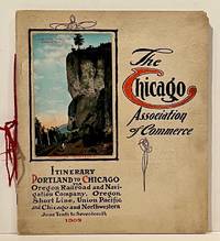
190922859Chicago: Chicago Association of Commerce 1909. First Edition. Quarto; 8pp. Four string-tied and stapled leaves with ten 3 1/2" x 5 1/2" mounted colored illustrations each titled in red along with a map of the route. Near Fine copy in grey cardstock titled and color photograph tipped to front cover. Rare promotional piece; we fine only 1 copy at University of Michigan. This booklet was prepared by the Oregon Railroad & Navigation Company the Oregon Short Line Railroad the Union Pacific Railroad and the Chicago & Northwestern Railway as an itinerary for the approximately 40 Chicago merchants' return trip ". calling your attention to a few of the points of interest in a country of marvellous scenes wonderful accomplishments and a still more wonderful future." Lists 38 members of the Chicago Association of Commerce making the return trip. Uncommon attractive & elaborate promotional piece. Chicago Association of Commerce unknown
19397103Np: Matson Navigation Company 1939. 1st. Paperback. First Edition. Folio. Vol. 1 No. 1 - 4 Jan. 1941-June 1941 Complete. Each issue 14pp. Numerous photo-illustrations; ads. Original photo-illustrated wrappers. Minor soiling and wear to extremities; front cover of No. 2 partially separated; otherwise near fine. Four numbers issued during the 4 day voyage on the Matson Line cruise ship from California to Hawaii California-Hawaii-Samoa-Fiji-New Zealand-Australia. Each number features a special theme-the first Hawaii's History; the second Scenic Attractions; the third Island Sports and Recreation; and fourth Native Life and Folklore. Matson Navigation Company paperback
2020x-9811370885Springer Nature 2020. Paperback. New. 300 pages. 9.25x6.10x0.71 inches. Springer Nature paperback
187838742Brazil 1878. A few small holes affecting a few letters some folds reinforced on verso additions in manuscript. Broadside. 20 3/4x29 inches. The Companhia Nacional de Navegação a Vapor replaced the Companhia Brasileira de Navegação a Vapor as the government sponsored line along the southern route in 1872. Montevidio was the furthest stop of this important Brazilian shipping company from which it also provided river service to upper Brazil. The broadside contains a listing of the rates of passage from Rio de Janeiro to Montevideo as well as the limitations and restrictions for passengers which included a prohibition on weapons and flammable materials. unknown
188217482New York: Leve & Alden's Publication Department 1882. Very good condition. Folding brochure with map of the St. Lawrence and Saguenay River and timetable with cover illustration of the river and with advertisement for Leve & Alden General Agents for the United States and list of ticket office locations. Yellow stock with black text. Descriptive text on points of interest along the route including Ha! Ha! Bay; with a Time Table commencing June 27 1882 "Until about September 10 1882" and listing departure times for the steamer "Saguenay" and "Union". With full page b&w map on the verso with the map of the Saguenay River at the top and below the map of the St. Lawrence "traversed by the Saguenay boats". The St. Lawrence route originates in Quebec and shows stops in Murray Bay Riviere du Loup and Tadousac. <br /> Lists Hon. Thomas McGreevy President Julien Chabot Manager and A. Gaboury Secretary of the Company. Folded 3 1/2 x 7 1/2". Unfolded 17 1/2 x 15". Very small area of loss at fold on lower map of St. Lawrence; short split at horizontal fold left edge o/w very good. Leve & Alden's Publication Department unknown
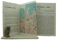
1962161834London: P&O Orient Lines 1962. Ten long single sheets folded into four five or six panels with text on one side and coloured maps on reverse the headings printed in blue & black; small cr. 8vo folded size; all numbered by hand near the top fore-corner of the upper panel with the number whited-out on number 2 Melbourne occasional slight soiling heavier on the Miami folder edges a trifle rubbed; P&O Orient Lines London 1962-1963. The folders were 'produced to assist passengers' and contain a brief history and description of each city including places of interest hotels shopping theatres currency information etc. P&O Orient Lines unknown
BN168889Audio Navigation und Telematik für Kraftfahrzeuge <br/><br/>Audio Navigation und Telematik für Kraftfahrzeuge Audio Navigation und Telematik für Kraftfahrzeuge unknown
BN324090Segeln Schnelle Hilfe an Bord: Manöver · Navigation · Technik · Sicherheit Schwarzmeier Thomas <br/><br/>Segeln Schnelle Hilfe an Bord: Manöver · Navigation · Technik · Sicherheit Schwarzmeier Thomas Segeln Schnelle Hilfe an Bord: Manöver · Navigation · Technik · Sicherheit Schwarzmeier Thomas unknown
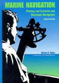
1990BN151395U S Naval Inst Pr 1990. 1990. Marine Navigation: Piloting and Celestial and Electronic Nagivation <br/><br/>Marine Navigation: Piloting and Celestial and Electronic Nagivation Marine Navigation - Hobbs Richard R. U S Naval Inst Pr unknown
DADAX4431544747Springer 2014-03-27. 2014. hardcover. New. 6.14x0.88x9.21. Buy with confidence. Excellent Customer Service & Return policy. Springer hardcover
192759226Washington D.C.: Government Printing Office Hydrographic Office U.S. Navy 1927-1928. Two vols. 8vo. 8 viii 424; 6 v 1 446 pp. With 4 large folding colour maps 1 double-sided elevation maps showing harbor entrances numerous photo plates. Beige publisher’s cloth black lettering front cover & spine darkening to spine fore-edges minor shelfwear dustsoiling still VG set. Third & Seventh editions revised & updated of these coast pilot guides to Central America and Mexico in the 1920’s. Prior to modern GPS systems and satellite navigation these regularly updated and revised navigation handbooks provided key sailing instructions often drawing not only from Mexican and West Indies sources but also governmental publications in the Panama Canal sailing reports from U.S. Navy vessels and those from merchant ships. The first large map delineates not only the requisite coast pilots for sailing in American waters but also the charts to be ordered from the Hydrographic Office. Government Printing Office, Hydrographic Office, U.S. Navy, hardcover
18880009730New York 1888. First edition. Map. Fine. 15 x 11 inches / 36 x 26 cm 3 folds matted glazed and framed. Very Scarcce <br/><br/>This map was removed from an Annual Report. The black-and-white map shows the boundaries of Illinois in outline presenting the Illinois River improved passage from Chicago to Grafton where it pours into the Mississippi River. It also shows the Rock River traversing to the Quad Cities. Toward the east is the Illinois & Michigan Canal the DesPlaines River the Little Calumet River and the Little Kankakee River and Calumet Harbor. The map is attributed to Thomas H. Handburg. The University of Illinois-Urbana has a photocopy of it from the photocopy in the National Archives. I have not identified to which Annual Report this belonged Nor can I find another map attribued to Thomas H. Handburg. unknown
180755849Philadelphia: Published by B.B. Hopkins and Co. and sold by W.P. Farrand No. 170 Printed by T. & G. Palmer 1807. 8vo. xxiii 1 270; 271-275 1 40 16 15-16 17-220 4 pp. including binders instructions and publisher’s advertisement. With 7 copper-engraved plates & maps 6 engraved by Benjamin Tanner. Contemporary polished brown calf red & gilt morocco spine label chipping to head of spine minor edgewear occasional interior foxing & toning still a VG- copy from the library of John L. Gow 1797-1866 noted Pennsylvania attorney w/ ownership label and markings on front pastedown. First American edition of this classic navigation handbook which was first published in 1804 and here contained substantial corrections to the tables of the latitudes and longitudes of places on the American coast and in the West Indies as well as an improved system of finding the longitude by P. Delamar of Philadelphia. Mackay 1760-1809 was noted Scottish mathematician and astronomer taught navigation and instructed in methods of how to find longitude. Shoemaker 12965. Published by B.B. Hopkins and Co., and sold by W.P. Farrand, No. 170, Printed by T. & G. Palmer, unknown
194539135Chatham: Shepherd Printing n. d. ca 1945. 1945. CANADA. 18" x 24" sheet one side opens to a half-sheet color map and numerous advertisements for lodging including the Joe Gawa Hotel one of Ontario's newest and finest hotels. The other side has 12 panels of promotional text regarding the various cruise packages of the beautiful Muskoka Lakes time tables and schedules and views of the inland waterways steamships R. M. S. Sagamo and the R. M. S. Cherokee. Some minor to light wear to the folds else a very good copy. Shepherd Printing, n. d. (ca 1945). unknown
195540503City Not Stated: Peninsular & Oriental Steam Navigation Company P & O 1955. Each card: Folded small octavo 14 x 21 cm very good condition colour drawing front cover corner tips some cards little scuffed card 1 is slightly shorter at the top presumed as issued no text missing minor edgewear. Each card: 4 pp. A set of 11 of 12 in set menu cards designed by the artist Strom Gould. Card No. 1 Red-Crowned Pigeon & Purple-Crowned Pigeon. Card No 2 Fairy Wrens. Card No. 3 Gouldian Finch. Card No. 4 Pink Cockatoo. Card No. 5 Count Raggi's Bird Of Paradise. Card No. 6 Rainbow Bird. Card No. 7 Regent Bower-Bird. Card No. 8 Scarlet Honey-Eater. Card No. 9 Red-Capped Robin. Card No. 10 Laughing Kookaburra. Card No. 11 Rainbow Lorikeet Red-Winged Parrakeet & Green Leek Parrakeet. MISSING: Card No. 12 Kingfisher. The artist also known as Charles Sidebotham Gould was born in Letchworth England on 2/8/1910 and came to Australia in 1937. He was employed as the Sydney Morning Herald's first art director and he also drew its first comic strip in 1944. He died in 1992. No date but about 1955. Peninsular & Oriental Steam Navigation Company (P & O) unknown
20182-4431567801Springer 2018. Paperback. New. reprint edition. 260 pages. 9.25x6.10x0.59 inches. Springer paperback
187355613Washington Government Printing Office 1873. Royal8vo. Orig. full calf. Gilt boders and gilt lettering on covers. Gilt spine. Lithographed frontispiece in colour. XVI107203268 pp. 3 lithographed colourplates one large folded. unknown
192059238Washington D.C.: Government Printing Office Hydrographic Office U.S. Navy 1920; 1930. Two vols. 8vo. viii 4 577 1 pp.; 1 38 1 leaves. With 1 large folding colour map. 1st vol. in green publisher’s buckram gilt lettering stamped on front cover & spine darkening to spine shelfwear deep embossed circular indentation at gutter margin where brass weight held book open; 2nd vol. Supplement in self-printed softcovers toning chipping & tears to spine still G set. Second edition stated of vol. I 1st edition of Supplement vol. of these surprisingly scarce coast pilot guides detailing the sailing directions for the treacherous coasts of Norway & Sweden notoriously treacherous for sailing and powered vessels. Prior to modern GPS systems and satellite navigation these regularly updated and revised navigation handbooks provided key sailing instructions drawing upon British Norwegian Swedish & Danish coast pilots. Worldcat locates only 1 copy of the Supplement U of W. Government Printing Office, Hydrographic Office, U.S. Navy, paperback
191236542North Yakima: Yakima Commercial Club 1912. 1912. WASHINGTON. 10 1/2" x 7" in color pictorial wrappers. 64 pp. introduction illustrations. Very brief history followed by extensive information on the Yakima Valley to include geography topography climate the Indian Reservation irrigation products produced methods of orchard development live stock dairying transportation communities industries etc. Numerous black and white photographs many full page photos of scenery residential homes buildings agriculture industries public buildings etc. Wrappers disbound from text. Light bleeding to first and last page wrappers lightly soiled and with chipping to top of front wrapper and with tiny fold to tops of page corners. Yakima Commercial Club, 1912. unknown
1905100722Montreal: Desbarats & Co. 1905. Book. Good. Original Wraps. 8vo - over 7¾" - 9¾" tall. Title continued: With many illustrations of interesting places and scenes also a short description of the Ottawa River and points of interest to the tourist who may make the trip via the Grand River and Rideau Lakes through the most charming scenery in America between Montreal Ottawa and Kingston. 56 p. Folding map - Route of the Ottawa River Navigation Co. 35 illustrations. Covers worn with chips in spine. Top corner stained. A scarce guide book. Desbarats & Co. Paperback
185854442n.p. n.d. 1858. 8vo pp. 20; self-wrappers; fine. UC-Riverside and AAS only in OCLC. In 1855 while charting the Rio de Plata Basin the United States ship U.S.S. Water Witch was fired upon by a Paraguayan fort killing the helmsman Samuel Chaney. This outraged the U.S. government who along with the U.S. & Paraguay Navigation Company decided to bring the incident to the Supreme Court. In 1858 began the Paraguay Expedition the purpose of which was to demand an apology from the Paraguyan government and to address alleged insults against the Navigation Company. The result of the expedition was that Paraguay apologized the Chaney's family was indemnified and a new advantageous commercial treaty between Paraguay and the United States was forged. unknown
1995281400PN. New. 1995. Soft Cover. Date is original print. This is a reprint edition . PN paperback
200333333336969Brussels Belgium.: PIANC General Secretariat. 2003. Includes a CD ROM. This book is part of a large purchase from a Public Sector Library and except where mentioned are for the most part LIKE NEW! MOSTLY the ONLY flaws are the blacked out they insisted Library stamps which show many of them to be UNUSED! This copy is Near Fine NEAR NEW. FEEL FREE TO E-MAIL FOR PHOTOGRAPHS AND FURTHER DETAILS. FROM A DEALER WHO TELLS YOU WHO THEY ARE AND WHAT THEIR TELEPHONE AND ADDRESS CONTACT DETAILS ARE!. EX PUBLIC SECTOR LIBRARY BLACKED OUT STAMPS. This is the First Edition. Glossy Pictorial Card. Near Fine NEAR NEW/No Jacket. 4to - over 9¾" - 12" tall. CARD COVERED PAPERBACK. PIANC General Secretariat. Paperback
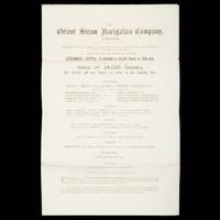
26003London : The Orient Steam Navigation Co. Ltd. 13 Fenchurch Avenue E.C. 1880. Folio 420 x 265 mm bifolium 3 pp folding to 265 x 105 mm with printed title to outer side; original share application form still loosely enclosed; outer side a little dusty but a near fine example. 'The Orient Steam Navigation Company was established in 1878 and jointly managed by the London shipowning firms of Anderson Anderson and Company and F. Green and Company until 1919 when the Peninsular and Oriental Steam Navigation Company acquired a controlling interest in its shareholding capital; at approximately the same time the dual management of the undertaking by the Anderson and Green companies came to an end and the two businesses were merged into a private limited company formed for the purpose Anderson Green and Company Limited. The Orient company was a small enterprise operating a handful of very large ships in virtually one trade the mail and passenger service to Australia and New Zealand. In due course it provided a co-ordinated service in this region with ships of the P&O fleet; in later years similarly in collaboration with P&O a passenger service between North American ports and Australia and New Zealand was instituted and in attempts to promote passenger traffic in the Pacific a series of voyages between North America the Far East and Australia were inaugurated. The company's ships were also extensively employed in ocean cruising.' Royal Museums Greenwich Internal references date this very early Company prospectus to 1880. Trove locates no copies. unknown