263 résultats
1893G83619Montevideo, "El Siglo Ilustrado" de Turenne, Varzi y c.a 1893 xvi + 242pp.+ 4 plates out-of-text, 23cm., hardcover (spine in green leather wih gilt lettering and decorations, marbled boards with some use at ends and corners), marbled endpapers, text in Spanish, few foxing, good condition, G83619
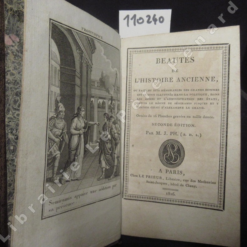
18161102401816 A Paris, Chez Le Prieur, Libraire - 1816, seconde édition - In-12, reliure pleine peau brune, tranches mouchetées - Filets et décor dorés encadrant les plats - Pièce de titre, fleurons et filets dorés au dos - 360 p. - Orné de 12 planches gravées en tailles douce dont une en frontispice
18971148581897 A Paris, Librairie Hachette, collection "Bibliothèque des écoles et des familles" - 1897 - In-4, cartonnage toilé décoré, premier plat estampé du sceau des Ecoles Communales de la Ville de Lyon, titre et fleurons dorés au dos - 347 pages - Ouvrage illustré de 52 gravures en N&B par A. Paris
1824WOC-2294Genève, Chez P.-G. Le Double, 1824. In-8 (20,5x13cm) relié demi veau blond d'époque, dos lisse avec titre doré sur maroquin rouge et nom de l'auteur doré sur maroquin vert, faux-nerfs dorés et noms dorés vers la queue du livre, tranches jaunes. 246pp.
18880009730New York 1888. First edition. Map. Fine. 15 x 11 inches / 36 x 26 cm 3 folds matted glazed and framed. Very Scarcce <br/><br/>This map was removed from an Annual Report. The black-and-white map shows the boundaries of Illinois in outline presenting the Illinois River improved passage from Chicago to Grafton where it pours into the Mississippi River. It also shows the Rock River traversing to the Quad Cities. Toward the east is the Illinois & Michigan Canal the DesPlaines River the Little Calumet River and the Little Kankakee River and Calumet Harbor. The map is attributed to Thomas H. Handburg. The University of Illinois-Urbana has a photocopy of it from the photocopy in the National Archives. I have not identified to which Annual Report this belonged Nor can I find another map attribued to Thomas H. Handburg. unknown
186894558Paris, E. Maillet, Libraire-éditeur 1868 In-8 24,5 x 16,5 cm. Reliure demi-chagrin vert, XVII-340 pp., 17 gravures sur bois h.-t. Vues de Montréal, Cayenne, Manille etc... nombreuses illustrations dans le texte. Reliure légèrement frottée, gouttière irrégulière, rousseurs marginales.
1880PHO-2359Paris, Hachette et Cie, 1880 - In-12, ix-335pp., demi-basane prune, dos à nerfs, tr. mouchetées (petits défauts dont frottis). Illustré de nombreuses gravures et cartes
181539889Lisbon: Simao Thaddeo 1815. hardcover. very good. 144pp. 8vo. Lisbon 1813. Second Edition. BOUND WITH: Taboa da Declinacao do Sol ao Meio Dia no Meridiano da Cidade de Lisboa . IV 64pp. 8vo full leather. Lisbon 1815. Scarce. Very good.<br/><br/> Tables of latitude and longitude for marine navigation.<br/><br/> Simao Thaddeo unknown books
1866003178Hachette et Cie (Imprimerie Générale de Ch. Lahure), 1866
1842GITe929Paris Imprimerie Royale 1842. In-16 broché couverture muette de l'époque 2 feuillets non chiffrés 6-23pp. Quelques pâles rousseurs. exemplaire bien complet et en bon état, portant la mention "pour Augustin Normand".
18350034381835 Paris, Imprimerie Royale, 1835. In-8 (141 X 217) demi-veau brun, dos lisse orné de deux chainettes et d'un triple filet dorés en place des nerfs, petit fleuron doré dans les compartiments, auteur et titre dorés sur le premier plat (reliure de l'époque) ; 51 pages (dont titre), carte dépliante, 16 pages, (1) f. de table, (1) f. blanc, un tableau dépliant. Déchirure sans manque aux cartes.
1846WOC-1209Description des Villes, Bourgs, Villages, Châteaux et Maisons de campagne situés sur les deux rives du fleuve. Orné de 4 gravures lithographies par Floury: Château de Fontainebleau – Corbeil – Montereau - Melin. Paris, 1846. In-8 (19x11,5cm broché de couverture romantique d'époque (petit manque à la couverture inférieure). 288pp.
1844054743Glasgow: Printed for the author and sold by Blackie and Son 1844. First Edition . Hardcover. Good. Small Octavo. Frontispiece; engraved title-page . FIRST EDITION. GLASGOW : 1844. Hardback. Frontispiece and engraved secondary title-page. Original brown cloth; gilt lettered cover. Later cream end-papers. Owner names. Frontispiece repaired to bottom margin and slightly foxed and stained to one corner as is the engraved title-page. Main title-page clean. Binding has moderate wear. Internally tight and clean. Overall a GOOD copy of a scarce book. vi 175 viii pages. "List of subscribers' names": p. 1-8 to the rear. Referenced by: OCLC 18332799. Sm.8vo. Will be well-packed for posting/shipping. Rosley Books for Antiquarian books CHS Cumberland Everyman GKC Inklings Keswick Literature MacDonald Rarities Theology and History. . <br/> <br/> Printed for the author, and sold by Blackie and Son hardcover
18970005133New York: Harper & Brothers 1897. First American edition. Hardcover. Good. 16 color plates 120 photogravures 4 folding maps in pockets. Quartos green cloth Vol. 1 torn at head of spine inked 1897 inscriptions on blank pages. <br/><br/>In the space of 280 years previous to 1893 the combined efforts of all the Arctic expeditions succeeded only in travelling 150 miles nearer the Pole. Dr. Nansen in three years penetrated 200 miles beyond the farthest point then reached. Originally published at $10. Publisher's advance prospectus in front pocket. 16 color plates 120 photogravures 4 folding maps in pockets. Bennett PRACTICAL GUIDE TO AMERICAN NINETEENTH CENTURY COLOR PLATE BOOKS p.82 - "The 16 colored plates are on a par with all the rest of this fine and honest and permanent work.". One of his aims was to explore arctic ocean currents. Nansen was awarded the Nobel Peace Prize in 1922. PRINTING AND THE MIND OF MAN 384; Arctic Bibliography 11983. Preceded by the Danish edition in 1897. 120 photogravures 4 folding maps in pockets. Harper & Brothers hardcover
1900176895Shanghai: Brewer & Co. c.1900. From the Chefoo Bluff to Lamtong Head Sole edition untraced institutionally the copy of Vice-Admiral Seymour's chief of staff in Tianjin during the Boxer Uprising. This photographic guide is designed for "the navigator of this changeable and frequently foggy locality" preface. We have traced only one other copy which appeared in commerce in 2017. Navigators in the late Qing period could rely on only a small network of lighthouses and fixed navigational aids when sailing the Chinese coast. "In thick weather even a person familiar with the coast is at a loss to identify a well-known Islands with its summit" preface. The thirty views include the Chefoo Bluff in the Pechili Gulf the waters near the Hieshans Light House Zhejiang and Hong Kong's Lamtong Head. A concerted period of lighthouse-building in the 1910s and 1920s obviated the need for further publications of this kind. Provenance: though unmarked as such this copy was owned by Captain Edward Henry Bayly C.B. 1849-1904 Commander of the International Forces at Tianjin in June 1900. Bayly had a lifelong career in the Royal Navy. He was promoted to the rank of lieutenant in September 1873 commander in June 1887 and captain in January 1894 having served overseas in numerous ships. Bayly captained HMS Pelorus during the fleet review for Queen Victoria's diamond jubilee in 1897 and in 1899 became captain of the armoured cruiser HMS Aurora on the China station. During the Boxer Uprising he replaced the wounded John Jellicoe as chief of staff to Seymour was mentioned by Seymour in dispatches and remained at Tianjin until the withdrawal of naval forces. He retired at his own request in February 1904. Landscape octavo. With 30 mounted collotypes within red frames. Original red cloth front cover lettered in gilt white coated endpapers leaves hinged with white linen as issued. A little shaken binding sunned and stained contents well preserved a little toning at fore edges: a very good copy. hardcover
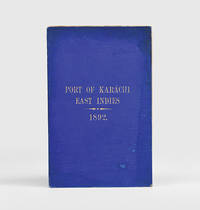
1892184592Karachi: Published by the Chairman Karachi Port Trust 1892. Traced in only one institutional library First edition of this scarce guide for pilots and mariners with the tipped-in compliments slip of the secretary of the Karachi Port Trust addressed in manuscript to the Swedish shipping firm K. O. F. Dalman. The guide details the specifications of the harbour mooring charges pilotage and towage charges and the size of recent trade. The four appendices include a July 1892 notice to mariners a list of steamers to leave port in the preceding year a name list for the Karachi's chamber of commerce and foreign consuls and the text of a Sind Gazette article on a recent survey by the port engineer. WorldCat records a copy at the University of Western Australia. Octavo pp. 34. Tissue-guarded frontispiece 3 colour folding maps regional map extending from Tibet to Arabia; plan of Karachi harbour plan of suggested additional wharfage. Original blue cloth front cover lettered in gilt. Text block now loose in covers but in itself sturdy cloth with some staining and marking wharfage plan with small closed tear just crossing neatline: very good. hardcover
183349821New York: G & C & H Carvill 1833. First Edition. Octavo. Original pebble-grained boards; paper spine title; 1-78-1582pp. Backstrip partially detached ; spine label faded barely legible; text fresh and unmarked - Good or better. Ex-U.S. Naval Lyceum with ink pressure stamp to endpapers and title page with de-accession dated 1927 on verso of title page. Pencil ownership inscription of a "Thos. J. Manning U.S. Navy" at head of title page. Verso of final text leaf prints a brief list of errata. G & C & H Carvill unknown books
18471008098vo slate blue cloth stamped in gilt and blind illustrated with frontispiece and folding charts viii 21 429 3 24 pp.Wear to spine ends spine faded small splits to joints hinges cracked copious nautical notes to endpapers slight aging but text and charts are generally clean and unworn; about very good. This is rare first edition of what is known as "The Atlantic Navigator" which includes detailed sailing instructions for the North and South Atlantic. Includes ten folding charts and much of the text is from various captains and navigators familiar the routes contained in this work. The first numbered section of 21 pages is an 1847 supplement and the catalogue at the rear is dated 1851. Sabin noting 2300 only an 1854 fourth edition. James Imray, books
1877z015748London: Netherlands India Steam Navigation Company 1877. Very Good. Two page letter of transmittal from a Netherlands India Steam Navigation Company agent to James M. Lincoln of the Pacific Mail Steamship Co. New York. Measures 8.5 by 11 inches recto only. Very good. Pages toned and lightly creased else clean and unmarked. 2p. Netherlands India Steam Navigation Company unknown
1879z015731Batavia: Netherlands India Steam Navigation Company 1879. Very Good. Measures 8.5 by 10 inches printed recto only with corrections in contemporary hand. Very good. Edge wear and creasing else complete and clean. Netherlands India Steam Navigation Company unknown
1885B90082Bruxelles, E. Guyot 1885 318pp. richment illustré avec des gravures dans le texte & planches hors texte (dont des plans et cartes dépliantes), 23cm., reliure cart. (plats marbrés, dos en toile avec titre doré), très bon état, B90082
1894GITe908Bulletin de l'Association Technique Maritime sans date (1894). In-8 broché couverture muette 12pp. Pâles rousseurs sur 1 feuillet. Exemplaire en bon état et complet.
1895GITe911London Institution of Naval Architects 1895. In-4 broché 2-10pp. Avec 2 planches en fin d'ouvrage regroupant 4 figures. Quelques rousseurs en bordure de la couverture et 1 feuillet. exemplaire en bon état et bien complet.
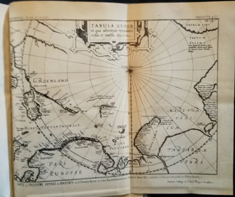
1883WOC-2661Accompagné d'un résumé des voyages précédemment effectués le Long des Côtes Septentrionales de l'Ancien Continent. Ouvrage traduit du Suédois avec l'autorisation de l'auteur par MM. Charles Rabot (Membre de la Société de Géographie de Paris) et Charles Lallemand (Ingénieur au Corps des Mines). Contenant 293 gravures sur bois, 3 gravures sur acier et 18 cartes. Paris, Librairie Hachettes et Cie, 1883-1885. 2 volumes in-4 (28,5x3,5x20cm) reliés demi chagrin brun à coins, dos petits nerfs ornés de caissons dorés, double filets sur les plats, têtes dorées (reliure d'époques). [2]ff. n. ch., IV,481pp. + [2]ff. n.ch., 278pp.