263 résultats
1857ABC_46672HMS Cyclops:: Oman Khuriya Muriya Islands Yemen Egypt Red Sea Arabian Sea Pakistan Sri Lanka and other places 1857. Contemporary brown cloth over boards rebacked in period-style black calf with the spine lettered in gold: "Log H.M.S. Cyclops". Folio 20 x 31.5 cm. Over 360 pp. of manuscript entries written with brown ink in a legible hand on watermarked laid paper with a blue cast. With 8 pen and ink nautical charts and 5 sketches of coastal sites including the city of Muscat 8 on the logbook pages and 5 on separate thick album leaves. Historically significant manuscript logbook containing a detailed record of the first attempt to lay a submarine telegraph cable to connect London with British India. The expedition took place from May 1859 the Red Sea leg from Suez to Aden to February 1860 from Aden to the Khuriya-Muriya Islands Muscat and Karachi. The two specially designed cable ships the Imperador and Imperatrix were supported by HMS Cyclops which surveyed the coastlines and reported on the depth and structure of the ocean floor.The entries from February 1859 to May 1860 documenting the ship's Red Sea and Arabian Sea mission span over 200 pages. We first find the Cyclops near Cape Ras al Hadd on the eastern coast of Oman at the entrance to the Gulf of Oman: "Cape Ras al Hadd . terminates in a low sandy spit at the head of which is a village and mud fort. There is an inlet about 4 miles to the northward of the cape but inaccessible to large vessels. There is a heavy surf on the beach during northerly winds" 9 February 1859. The ship then plied in the Red and Arabian Seas between Egypt Yemen and Oman eventually finishing in Bombay.During its expedition the Cyclops visited and moored in Quseer and Zabardag Island Egypt Suakin Sudan Perim Island Strait Bab-el-Mandeb Yemen the Hanish Islands Yemen Palinurus Shoal and Cape Fartak Yemen al-Hallaniyah and al-Qibliyah Khuriya Muriya Islands Oman Ras Madrakah and Ras al Hadd Oman Charna Island and Karachi Pakistan. The logbook entries record the soundings and the laying of cable along with quotidian ship activity. Brief entries touch on the death of crew members; discharging coal; punishing men for wrongdoing; maintenance of the ship; other ships in company; visits on board by local notables etc. Six larger entries occupying up to two pages of text describe the topography landmarks soundings and economy of Karachi Zabargad Island and Muscat Cove this last harbour said to be "formed by Muscat Island on the east and Ras Muscat on the West it is one mile deep by half a mile wide with 12 fathoms at entrance decreasing to 3 fathoms ahead of the town. It is defended by two . batteries on the island one on the height to the seat of town and two on Ras Muscat. They are all in a stay ! - or: state of decay. The entrance to the cove is difficult to make out when coming from the eastward . The exports of Muscat are wheat dried fish dates and cattle the imports being European and Indian manufactured goods sugar etc. The revenue is about £100000. The Imaum's Palace faces the water his army generally consists of from 10 to 12000 men and the fleet of 2 frigates 2 corvettes a transport and brig the greater part of the Navy having been removed to Zanzibar the Captains of these vessels being educated at Bombay or Calcutta. Supplies of all kind are cheap and plentiful. Boats may be hired thro' the medium of the Agent of the Indian Government for the shipment of coals" 26 November 1859.Illustrated with eight well-executed pen and ink nautical charts showing the routes of the Cyclops in the Red and Arabian Seas as well as the harbours of Muscat Cove and other places. Five beautiful ink sketches show the city of Muscat "Hallani Bluff from Addington Cove" al-Hallaniyah the largest of the Khuriya Muriya Islands Oman Ras Fartak Yemen Karachi harbour and Colombo.The cable too lightly armoured and laid with too little slack soon failed: indeed the 1859 section had already broken down by the time the route was completed in 1860. Messages were passed over individual sections but the entire cable never worked as a unit. Communication to India would not be established until the 1864 Persian Gulf cable was laid. The captain of the Cyclops the noted British navigator and Arctic explorer William Pullen 1813-87 took part in the unsuccessful 1849 attempt to rescue Sir John Franklin's disastrous expedition in search of a northwest passage then in the same year became the first European to sail along the north coast of Alaska in his voyage from the Bering Strait to the Mackenzie River in Canada.A final part of the log comprising some additional 150 pp. May 1860-May 1861 covers the Cyclops's survey of the southeast coast of Ceylon and her return voyage to England. Overall an important content-rich source on the early history of the submarine telegraph cable around the Arabian Peninsula to British India.In good condition. Oman, Khuriya Muriya Islands, Yemen, Egypt, Red Sea, Arabian Sea, Pakistan, Sri Lanka and other places, hardcover
1900176895Shanghai: Brewer & Co. c.1900. From the Chefoo Bluff to Lamtong Head Sole edition untraced institutionally the copy of Vice-Admiral Seymour's chief of staff in Tianjin during the Boxer Uprising. This photographic guide is designed for "the navigator of this changeable and frequently foggy locality" preface. We have traced only one other copy which appeared in commerce in 2017. Navigators in the late Qing period could rely on only a small network of lighthouses and fixed navigational aids when sailing the Chinese coast. "In thick weather even a person familiar with the coast is at a loss to identify a well-known Islands with its summit" preface. The thirty views include the Chefoo Bluff in the Pechili Gulf the waters near the Hieshans Light House Zhejiang and Hong Kong's Lamtong Head. A concerted period of lighthouse-building in the 1910s and 1920s obviated the need for further publications of this kind. Provenance: though unmarked as such this copy was owned by Captain Edward Henry Bayly C.B. 1849-1904 Commander of the International Forces at Tianjin in June 1900. Bayly had a lifelong career in the Royal Navy. He was promoted to the rank of lieutenant in September 1873 commander in June 1887 and captain in January 1894 having served overseas in numerous ships. Bayly captained HMS Pelorus during the fleet review for Queen Victoria's diamond jubilee in 1897 and in 1899 became captain of the armoured cruiser HMS Aurora on the China station. During the Boxer Uprising he replaced the wounded John Jellicoe as chief of staff to Seymour was mentioned by Seymour in dispatches and remained at Tianjin until the withdrawal of naval forces. He retired at his own request in February 1904. Landscape octavo. With 30 mounted collotypes within red frames. Original red cloth front cover lettered in gilt white coated endpapers leaves hinged with white linen as issued. A little shaken binding sunned and stained contents well preserved a little toning at fore edges: a very good copy. hardcover
1892184592Karachi: Published by the Chairman Karachi Port Trust 1892. Traced in only one institutional library First edition of this scarce guide for pilots and mariners with the tipped-in compliments slip of the secretary of the Karachi Port Trust addressed in manuscript to the Swedish shipping firm K. O. F. Dalman. The guide details the specifications of the harbour mooring charges pilotage and towage charges and the size of recent trade. The four appendices include a July 1892 notice to mariners a list of steamers to leave port in the preceding year a name list for the Karachi's chamber of commerce and foreign consuls and the text of a Sind Gazette article on a recent survey by the port engineer. WorldCat records a copy at the University of Western Australia. Octavo pp. 34. Tissue-guarded frontispiece 3 colour folding maps regional map extending from Tibet to Arabia; plan of Karachi harbour plan of suggested additional wharfage. Original blue cloth front cover lettered in gilt. Text block now loose in covers but in itself sturdy cloth with some staining and marking wharfage plan with small closed tear just crossing neatline: very good. hardcover
1822PHO-2146Paris, Au Dépôt général de la Marine, 1822 et 1829. 2 volumes grands in-4 (34,5 × 27 cm), demi-maroquin à coins, dos lisses avec titres et tomaisons, guirlandes aux plats. Deux volumes de vues uniquement, toutes gravées et montées sur onglets. Premier volume : faux-titre, titre gravé illustré d’une Vue du Goulet de Brest, gravée par Schroeder, table des planches, et 91 vues à double page. Second volume : faux-titre, table des planches, 91 vues à double page, numérotées 79 à 169, et 20 planches de marées.
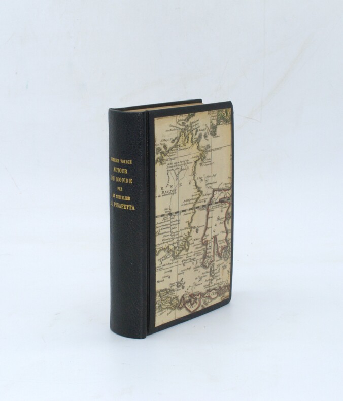
1837PHO-2280Paris, Arthus Bertrand, 1837, 2 volumes (3) grand in-4° (30x24,5cm), VIII pp., 742 pp., demi chagrin et coins époque, dos lisse avec auteur, titre et tomaison, frottements au dos, quelques rousseurs, défaut à la coiffe supérieure. Édition originale du texte du voyage du Bougainville autour du monde, manque l’atlas.
1801PHO-2435A Paris, Chez H. J. Jansen, Imprimeur-Libraire, L’An IX [1801]. In-8° (20,5x14cm), 1f.-LXIV + [IV] + 415pp., chagrin moderne, dos lisse avec titre doré, cartes anciennes aux plats, tête dorée, ex-libris en page de garde. Manque le dernier feuillet, réparation professionnelle à une dizaine de feuillets avec perte de qlqs lettres sur 1 feuillet Neuf planches gravées dont 4 aquarellées et deux cartes dépliantes
1801PHO-2394A Paris, Chez H. J. Jansen, Imprimeur-Libraire, L’An IX [1801]. In-8° (20,5x13cm), LXIV + [IV] + 415 + [I (errata)] pp., basane blonde, dos lisse orné (reliure de l’époque). Reliure accidentée avec petits manque de matière, charnières fendues, coiffes arasées, coins usés, petite mouillure en coin en début d’ouvrage. Ex-praemio manuscrit en page de garde. Neuf planches gravées dont deux cartes repliées et QUATRE AQUARELLÉES.
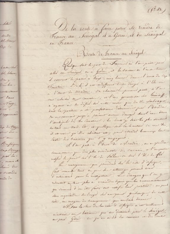
1819204461819 (1819),manuscrit autographe de 47 pages (paginé),carton relié in fine,annonçant le depart de l’auteur, le 11 fervier 1819,et interrompant le memoire.
18195237Zum Gebrauch für Navigationsschulen auch zum Selbstunterricht angehender Steuerleute. Mit einer vollständigen Sammlung der unentbehrlichsten Seemannstafeln nebst 15 Kupfern und zwey Seecharten. Verfaßt von der Hamburgischen Gesellschaft zur Verbreitung der mathematischen Kenntnisse. 2 Teile in 1 Bd. Mit 15 gefalt. gest. Tafeln (2 von J. L. Semmelrahn nach E. W. Schuback) u. 2 gefalt. gest. Karten von J. T. Hagemann nach E. W. Schuback. Hamburg, Perthes und Besser. Gedruckt bey J. G. Langhoff, 1819. 8vo. (21,1 x 12,7 cm). 1: XIV S., 1 Bl., 397 S. 2: Zwischentitel, XVI, 227 S. Marmorierter Halblederband d. Zt. mit goldgeprägtem Rückenschild.
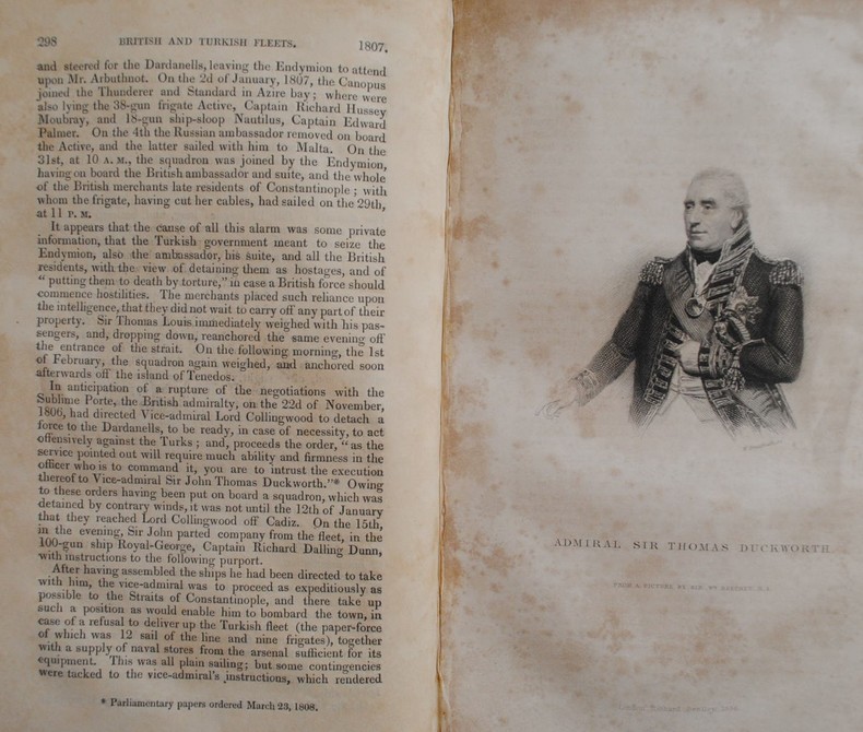
1837P2-2BLondon, Richard Bentley, 1837. 6 Volumes in-8° (213x133), percaline bleue éditeur, 404, 396, 376, 375 et 567 pp. Illustré de 24 portraits H.T et 27 plans dépliants, 38 plans de batailles dans le texte, dos un peu passés. Meilleure histoire navale de la fin du 18ème à la bataille de Navarin. 6 volumes, octavo (213x133mm), full contemporary cloth. 24 portraits, 38 battle-plans in the text, 28 folding tables. Spines a little sunned, mild shelf-wear, light toning, else a sound and handsome set. A “monument of accuracy – it has stood the test of time and remains the best account of the naval side of the Revolutionary and Napoleonic Wars. First conceived of when he was held prisoner in America during the War of 1812 the Naval History is a remarkable work. Working under the motto “Vérité sans peur” James set himself standards of inclusiveness and accuracy extraordinary for the 19th century. His aim was to compile “…an exact account of every operation of naval war during the period named.”
1852317692Washington, Jno. T. Towers, 4th edition with additions, 1852. 4°. Dark violet original cloth, somewhat faded and rubbed, with blind embossings gilt title on the front cover: 'Memoir and Maps of California.' 48 pages with 8 lithographed plates including frontispiece ( altogether 12 coast views ), but lacking the 6 maps. Contemporary stamp 'From National Observatory Washington' on the title page, slightly pushed through on the reverse and with a slight offset on the opposite panel. Front fly leaf with a little dirt, after the fly leaf the binding is slightly cracked. The rear attachment and inner cover are slightly browned in places by an insert. Slightly browned throughout the marginsin and slightly yellow stained in places. Overall good condition. Please note the photos ! --- Dunkelviolettes Originalleinen, etwas ausgeblichen und berieben, mit Blindprägungen und vergoldetem Titel auf dem Vorderdeckel: ' Memoir and Maps of California. ' 48 Seiten mit 8 lithographierten Tafeln inkl. Frontispiz ( zusammen 12 Küstenansichten ), jedoch ohne die 6 Karten. Zeitgenössischer Stempel ' From National Observatory Washington ' auf dem Titelblatt, etwas auf die Rückseite durchgedrückt und mit leichtem Abklatsch auf die gegenüberliegende Tafel. Vorderer Vorsatz mit kleiner Anschmutzung, nach dem Vorsatzblatt ist die Bindung leicht angeplatzt. Hinterer Vorsatz und Innendeckel sind durch einen Einleger stellenweise leicht gebräunt. Durchgehend im Ranbereich leicht gebräunt und stellenweise schwach gelbfleckig. Insgesamt gutes Exemplar. - Bitte beachten Sie die Fotos ! [11 Warenabbildungen]
1891001528Paris Hennuyer 1891
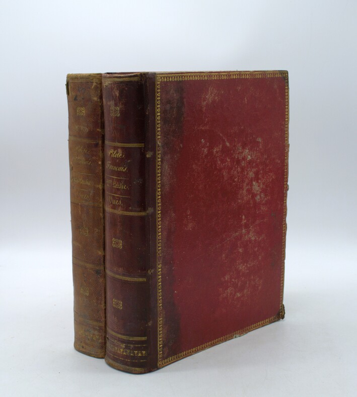
1851bf4542Dépot général de la marine, Paris, Imprimerie Nationale Relié 1851 "Fort volume in-4 relié pleine toile bleue (reliure moderne), VIII et 543 pages, bien complet des XVI planches hors-texte contenant les vues de profil des côtes, Polak 3941. Ouvrage publié sous le ministère de M. Chasseloup -Laubat. ""Il s'agit des premières instructions officielles et complètes pour naviguer au large des côtes françaises, elles sont très détaillées, 40 pages sont consacrés à Saint-Malo et à ses environs"" source le livre maritime français au siècle des lumières, édition et diffusion des connaissances maritimes aux presses de l'université Paris Sorbonne ; très bon état. Livraison a domicile (La Poste) ou en Mondial Relay sur simple demande."
182031213A Paris, chez Etienne Ledoux / de l'Imprimerie de Crapelet, 1820. 24 vol. vol. au format in-8 (213 x 135 mm) de xxviii - 463 pp. ; 2 ff. n.fol. et 496 pp. ; 2 ff. n.fol., 496 pp., 1 f. n.fol. et 1 f. bl. ; 2 ff. n.fol., 480 pp. et 1 f. n.fol. ; 2 ff. n.fol., 474 pp. et 1 f. n.fol. ; 2 ff. n.fol. et 435 pp. ; 2 ff. n.fol. et 473 pp. ; 2 ff. n.fol. et 475 pp. ; 2 ff. n.fol., 586 pp. et 1 f. n.fol. ; 2 ff. n.fol., 496 pp., 1 f. n.fol. et 1 f. bl. ; 2 ff n.fol., 508 pp. et 1 f. n.fol. ; 2 ff. n.fol. et 383 pp. ; 2 ff. n.fol. et 520 pp. ; 2 ff. n.fol. et 523 pp. ; 2 ff. n.fol. et 415 pp. ; 2 ff. n.fol. et 473 pp. ; 2 ff. n.fol. et 471 pp. ; 2 ff. n.fol., 488 pp. et 1 f. n.fol. ; 2 ff. n.fol., 378 pp. et 1 f. n.fol. ; 2 ff. n.fol, 429 pp. et 1 f. bl. ; 2 ff. n.fol. et 399 pp. ; 2 ff. n.fol. et 363 pp. ; 2 ff. n.fol. et 379 pp. ; 2 ff. n.fol., 346 pp. et 1 f. n.fol. Reliures uniformes de l'époque de pleine basane glacée et granitée fauve, filet, filet en pointillés et dentelle dorée encadrant les plats, dos lisses ornés de filets gras à froid, jeu de petits filets obliques dorés formant filets, roulettes dorées, larges fleurons romantiques dorés, pièces de titre et de tomaison de maroquin émeraude, titre doré, tomaison dorée, palette dorée en queue, filet doré sur les coupes, tranches jaspées.
1837PHO-2143Paris, Arthus Bertrand, 1837, 1 volume (3) grand in-4° (30x24,5cm), VIII pp., 742 pp., demi basane époque, dos lisse avec auteur, titre et tomaison, frottements au dos, quelques rousseurs, défaut à la coiffe sup., de la bibliothèque de Cayrol avec son cachet et signature manuscrite.
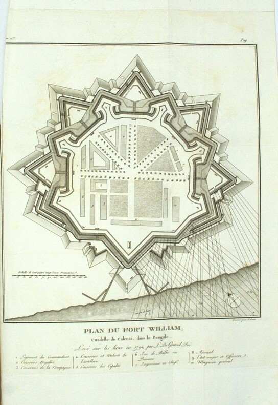
1801PHO-1972Paris, Dentu, an IX (1801); Atlas seul, in-4 (33x24,5cm),composé de 7 planches gravées dépliantes dont une grande vue de la citadelle de Calcutta et un plan du Fort William.. Bel exemplaire, relié basane époque, roulette aux plats et à l’intérieur, tranches dorées, manque au dos, coins usés, intérieur frais.
18471008098vo slate blue cloth stamped in gilt and blind illustrated with frontispiece and folding charts viii 21 429 3 24 pp.Wear to spine ends spine faded small splits to joints hinges cracked copious nautical notes to endpapers slight aging but text and charts are generally clean and unworn; about very good. This is rare first edition of what is known as "The Atlantic Navigator" which includes detailed sailing instructions for the North and South Atlantic. Includes ten folding charts and much of the text is from various captains and navigators familiar the routes contained in this work. The first numbered section of 21 pages is an 1847 supplement and the catalogue at the rear is dated 1851. Sabin noting 2300 only an 1854 fourth edition. James Imray,
18471008098vo slate blue cloth stamped in gilt and blind illustrated with frontispiece and folding charts viii 21 429 3 24 pp.Wear to spine ends spine faded small splits to joints hinges cracked copious nautical notes to endpapers slight aging but text and charts are generally clean and unworn; about very good. This is rare first edition of what is known as "The Atlantic Navigator" which includes detailed sailing instructions for the North and South Atlantic. Includes ten folding charts and much of the text is from various captains and navigators familiar the routes contained in this work. The first numbered section of 21 pages is an 1847 supplement and the catalogue at the rear is dated 1851. Sabin noting 2300 only an 1854 fourth edition. James Imray, books
1833PHO-2138Paris : Ministère de la marine, 1833-34. In-4, cartonnage papier marbré, dos lisse, tranches mouchetées (reliure de l'époque). Usures au cartonnage (coins, coiffes, frottements, etc…) Rousseurs, cachet au titre.
189322201893 Librairie Ch. Delagrave, Paris, sans date (1893). In-folio, pleine percaline. 3 feuillets, 8 cartes rempliées montées sur onglet. Cartes générales des Services Français, et des Services Etrangers; carte Méditerranée et Mer Noiire; carte Asie, Océanie et Côtes d'Afrique; carte Europe Occidentale; carte Antilles et Mexique. En annexe Câbles sous-marins (lignes télégraphiques), et Lignes téléphoniques Internationales
18261171Paris, Imprimerie royale, 1826 ; in-8 broché de 418 pp., couverture d’attente bleu gris, monogramme LL calligraphié à l’encre sur le premier plat.
1842PHO-1056Paris, Imprimerie royale, 1842. In-4 de viii p., 493 p., [1] f. d’errata et 12 pl. dépl. de vues de profils des côtes. Cartonnage éditeur. Première édition sur un beau papier de l’imprimerie royale (Papier déchiré sur les mors, cart. frotté et taché , qlqes rousseurs sur les plans). (Polak, 3941.)
184041654Paris ca. 1840. Folio. 36x25 cm. Contemp. hcalf. Spine gilt but somewhat rubbed. 264 pp. numerous illustrations in margins and in the text. 2 folded maps. The text is handwritten and reproduced with an etching technique probably zinkography. Internally clean and fine. unknown
184041654(Paris ca. 1840). Folio. (36x25 cm.). Contemp. hcalf. Spine gilt, but somewhat rubbed. 264 pp., numerous illustrations in margins and in the text., 2 folded maps. The text is handwritten and reproduced with an etching technique, probably zinkography. Internally clean and fine.