3 550 résultats
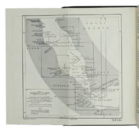
192659231Washington D.C.: Government Printing Office Hydrographic Office U.S. Navy 1926-1928. Two vols. 8vo. xxxii 4 788; ix 1 619 pp. With 5 large folding colour maps 2 double-sided. Uniformly bound in light-green publisher’s buckram gilt lettering stamped on front covers & spines slight uniform toning darkening to spines shelfwear still VG set w/ maps in bright condition. Third editions revised & expanded of these coast pilot guides to waters of the South Pacific Southeast Asia and Australasia encompassing New Zealand New Guinea the Gilbert Caroline Marshall Fiji Samoan Hawaiian New Hebrides and Indonesian Islands drawing upon British Royal Navy coast pilots Australian Southeast Asian Polynesian and U.S. Navy reports. Prior to modern GPS systems and satellite navigation these regularly updated and revised navigation handbooks provided key sailing instructions. The map outlines the available charts for the entire Pacific. Government Printing Office, Hydrographic Office, U.S. Navy, hardcover
1955ABC_47446London 1955. 8vo. Published for the Hydrographic Department Admiralty Original blue cloth with yellow lettering on the spine and the front board the supplement is loosely inserted at the end of the volume: original printed paper wrappers stapled. With a folding map printed on both sides 2 coloured plates with diagrams printed on both sides 28 plates showing coastlines and occasionally a map many printed on both sides and many some illustrations in text. 2 LI = LIII: II plus 1 1 blank 1 blank 518 1 1 blank pp; Supplement: 20 pp. The essential standard sailing directions for the Red Sea and Gulf of Aden corresponding with zone NP64 on the official Admiralty charts. These nautical works - pilot guides and charts - were published by the United Kingdom Hydrographic Office which provides the necessary hydrographic and marine geospatial data to all kinds of maritime organisations across the world. The publications are not only used by the British Royal Navy but can also be found on board the majority of international merchant ships. The data provided in the pilot guides and other publications are compliant with SOLAS the Safety of Life at Sea treaty guidelines and are updated constantly in weekly "Notices to mariners" and supplements to and new editions of the pilot guides whenever necessary.The present copy is the 10th edition 1955 of the pilot guide with sailing directions and other information on the weather currents radar ranges etc. relating to the Red Sea and Gulf of Aden including the supplement issued in 1957. It includes an erroneous "advertisement to the eight edition" by the Hydrographer of the Navy Rear-Admiral Kenneth St Barbe Collins 1904-1982. The advertisement states that with the publication of "the ninth edition" presumably this volume the previous edition and its supplements are cancelled since the most up-to-date information has been compiled in the new edition and the weekly "Notices to mariners" that appeared after the publication of the 11th edition. The 10th edition of 1955 and its 1957 supplement were made redundant with the publication of the 11th edition in 1967. Each subsequent edition of the pilot supersedes the last which have appeared infrequently depending on newly available information from the mid-19th century until the present day.The front paste-down and recto of the first free endpaper contain a "caution" notice and room for the notation of "supplements and annual summaries of notices to mariners relating to this book" the first two pages are printed on red-pink paper. The binding shows minor signs of wear around the spine and corners of the boards the gutter after page II is somewhat weakened the head edge of the wrappers of the supplement are very slightly browned. Otherwise in very good condition. hardcover
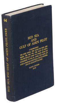
1967ABC_46470London: United Kingdom Hydrographic Office 1967. Grey-blue back wrapper; the two quires map and back wrapper held together by two metal staples. Blue cloth with title information in yellow on front cover and spine the supplement loosely inserted at the end of the volume. Large 8vo. The main work with 3 maps including 2 folding and 82 views of coastal profiles on 52 plates. The supplement with 2 folding maps on the two sides of a single folding leaf and 4 views of coastal profiles on 3 pages. With: NAVIGATION - RED SEA - PILOT GUIDE. Supplement No. 7 - 1977 to Red Sea and Gulf of Aden pilot eleventh edition 1967 corrected to 4th March 1977 Whenever reference is made to the pilot this supplement must be consulted.London United Kingdom Hydrographic Office 1977. The essential standard sailing directions for the Red Sea and Gulf of Aden corresponding with zone NP64 on the official Admiralty charts. These nautical works - pilot guides and charts - were published by the United Kingdom Hydrographic Office which provides the necessary hydrographic and marine geospatial data to all kinds of maritime organisations across the world. The publications are not only used by the British Royal Navy but can also be found on board the majority of international merchant ships. The data provided in the pilot guides and other publications are compliant with SOLAS the Safety of Life at Sea treaty guidelines and are updated constantly in weekly "Notices to mariners" and supplements to and new editions of the pilot guides whenever necessary.The present copy is the 11th edition 1967 of the pilot guide with sailing directions and other information on the weather currents radar ranges etc. relating to the Red Sea and Gulf of Aden including the supplement issued in 1977. The first two pages are printed on red-pink paper. Binding slightly rubbed and faded board edges very slightly soiled fore-edge of the supplement slightly frayed. Overall in good condition. United Kingdom Hydrographic Office, hardcover
1955K3CC18ANEAK3London: published by the Hydrographic Department Admiralty 1955. Original blue cloth with title on spine and front board; supplement with original printed paper wrappers. 8vo. With a folding map printed on both sides 2 coloured plates with diagrams printed on both sides 28 plates showing coastlines and occasionally a map many printed on both sides and many some illustrations in text. Including: Supplement no. 1-1957 relating to the Red Sea and Gulf of Aden pilot tenth edition . Tenth edition of a work "comprising sailing directions for the Suez canal the Gulf of Suez and the central track for power vessels through the Red sea Straits of Bab-al-Mandab and Gulf of Aden ." p. III and more areas. Besides navigation it deals with the climate weather and ocean streams of the area. The first chapter also gives and "general description of countries bordering the Red sea and Gulf of Aden" p. V. Including two copies of the supplement. Spine slightly discoloured otherwise in very good condition. published by the Hydrographic Department, Admiralty, hardcover
192059238Washington D.C.: Government Printing Office Hydrographic Office U.S. Navy 1920; 1930. Two vols. 8vo. viii 4 577 1 pp.; 1 38 1 leaves. With 1 large folding colour map. 1st vol. in green publisher’s buckram gilt lettering stamped on front cover & spine darkening to spine shelfwear deep embossed circular indentation at gutter margin where brass weight held book open; 2nd vol. Supplement in self-printed softcovers toning chipping & tears to spine still G set. Second edition stated of vol. I 1st edition of Supplement vol. of these surprisingly scarce coast pilot guides detailing the sailing directions for the treacherous coasts of Norway & Sweden notoriously treacherous for sailing and powered vessels. Prior to modern GPS systems and satellite navigation these regularly updated and revised navigation handbooks provided key sailing instructions drawing upon British Norwegian Swedish & Danish coast pilots. Worldcat locates only 1 copy of the Supplement U of W. Government Printing Office, Hydrographic Office, U.S. Navy, paperback
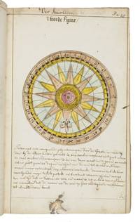
1735LC4E9Q4RAGZBHolland 1735. Green paper wrappers made from a discarded prospectus or the wrapper of an instalment of a book ca. 1865 sewn at 6 stations some perhaps without supports later green cloth spine with the title in manuscript on the front wrapper. Folio 31.5 x 20.5 cm. A manuscript course in navigation written in brown ink on laid paper in a largely upright cursive hand with 6 colour figures including 2 volvelles about 100 black and white diagrams and numerous tables of data highlighted with a yellow wash. A detailed manuscript course in the art of navigation in folio format with figures in colour including two volvelles partly based on the very rare first edition in 8vo format of Klaas de Vries 1662-1730 Schat-kamer ofte konst der stier-lieden 1702; Crone 374 probably in the first issue not known to survive before the insertion of an additional quire between B and C. But the manuscript doesn't merely copy the printed book: at least much of the text differs and also at least some of the tabular data and some of the figures also have no direct equivalents in the printed book also not in later editions as far as we have seen. The colour illustrations include a compass rose 13.8 cm diameter with a ship in the centre directly copied from the folding engraved plate in De Vries and virtually the same size but the ship in the centre is copied in mirror image and De Vries's abstract floral decorations in the corners outside the circle are replaced by colour drawings of four different flowers one in each corner. The manuscript also directly copies De Vries's woodcut illustration of a human hand marked with the numbers "29" "9" and "19" on the thumb and the letters A B and C next to them presented as an aid to calculating the epact the number of days past the new moon on 1 January but the hand is rotated 180 degrees. Most of the examples of calculations use years in the period 1700-1711 though there are a few later ones one example uses the year 1809! which also largely agrees with the 1702 edition of De Vries though the examples are not identical. The clearest indication that the present manuscript follows the 1702 edition rather than a later one is that the tables giving differences between the positions of the sun and moon cover the years 1701-1704 as in the first edition before the insertion of an extra quire extending the tables to 1710 B8 was replaced at the same time not noted by Crone. All later editions we have seen give these tables and the examples of calculations for later years. Yet even in these tables the data in the present manuscript doesn't exactly agree with De Vries's. With a bookseller's ticket ca. 1901/1919. Very slightly browned with occasional minor spots or ink stains but still in good condition. The one leaf that appears to be lacking may have been deliberately cancelled by the compiler. The wrapper has a later cloth spine as noted and is somewhat worn. A fascinating manuscript course in navigation with volvelles and other figures in colour partly based on the very rare first 1702 edition of De Vries's handbook but not merely copying it.l For De Vries's 1702 handbook: Crone 374 collation not entirely correct. hardcover
192759236Washington D.C.: Government Printing Office Hydrographic Office U.S. Navy 1927-1930. Three vols. 8vo. x 4 550; viii 4 560 pp.; 1 17 2 leaves. With 4 large folding colour maps 1 w/ toning at fore-edge from being improperly folded some edgewear numerous plates showing lighthouses. Two volumes uniformly bound in red publisher’s cloth gilt lettering front cover & spine darkening to spine fore-edges minor shelfwear dustsoiling minor paint drip at fore-edge 1 vol. Supplement in self-printed softcovers edgewear toning to fore-edges minor predation still VG- set. Third editions revised & updated of vols. I & II first edition of scarce Supplement of these coast pilot guides to South America and Antarctica in the 1920’s. Prior to modern GPS systems and satellite navigation these regularly updated and revised navigation handbooks provided key sailing instructions often drawing not only from Brazilian Argentine and British coast pilots as well as sailing reports from U.S. Navy vessels and those from merchant ships. The first large map delineates the requisite coast pilots for sailing in American waters and charts to be ordered from the Hydrographic Office while the second maps depict the sailing routes. The expanded 3rd edition is quite scarce with 1 copy located of both vols. in Worldcat NYPL. Government Printing Office, Hydrographic Office, U.S. Navy, paperback
321<p><strong>NAVIGATION BEZOUT Etienne</strong> <em>Suite du cours de mathématiques à l'usage des gardes du pavillon et de la marine contenant le traité de navigation</em> Paris P. H. Pierres 1793.</p><p>8° xii 296 pages 10 folding plates 44 leaves of tables ; contemporary green morocco flat spine gilt.</p><p><strong>Last part of Bezout's mathematical course dedicated to navigation. </strong></p><p>The plates were not bound in at the time but pasted to blank leaves so they could be fully unfolded while reading the text.</p><p>The original edition was published between 1764 and 1769. Bezout was appointed examiner for the Marine Guard schools in 1764. His career was then mainly devoted to writing and teaching mathematics courses which were used for many years by candidates for military schools. This classic mathematics textbook was one of the main reference books for aspiring officers in the French royal armies in the second half of the 18th century. The last voume contains a treatise on navigation.</p><p>A beautiful copy in contemporary green morocco.</p>
181555781New York: Printed for Edmund M. Blunt Oct. 1815. 8vo. xvi 297 86 pp. plus 2 pp. publisher’s ads. Woodcut-engraved front of the Blunt New York Shop 9 of 15 maps & charts 1 w/ partial loss several w/ additional sailing instructions and printed notices pasted-in manuscript sailing instructions and notes on versos of some. Original calf spine & calf on rear cover perished shaken dampstaining & toning still fair reference copy from the library of Captain Thomas Hall II 1804-1829 son of Captain Thomas Hall 1778-1816 who was lost at sea while sailing from Charleston to Boston in Feb. 1829 which his brother Charles Hall 1810-1829 ownership markings on endpapers of both w/ manuscript note on verso of ffep. that this is “good for a pint of ale†facing clippings about new lighthouses ca. 1821 listing the Ten Pound Island stone tower light house first built on the site in 1821. Preserved in brick-coloured linen cloth clamshell slipcase w/ printed label on spine. Eighth edition of this early vital tool for American sea captains and navigators first published in a much shorter version of only 122 pp. in 1796 and the first edition to bear only Edmund Blunt’s name as author. The original commissioned from Captain Lawrence Furlong proved so crude and unusable that Blunt arranged for it to be edited and rewritten. Blunt’s Coast Pilots were the earliest works of their type published in North America to cover the Atlantic Coast of the U.S. with sailing directions tide tables tables of latitudes and longitudes and as this copy shows were often working evolving documents with additional manuscript annotations and printed additions including in this case the Charleston Harbour map which is not included in the binding instructions and supposedly left out of the 8th edition. Printed for Edmund M. Blunt, hardcover
180755849Philadelphia: Published by B.B. Hopkins and Co. and sold by W.P. Farrand No. 170 Printed by T. & G. Palmer 1807. 8vo. xxiii 1 270; 271-275 1 40 16 15-16 17-220 4 pp. including binders instructions and publisher’s advertisement. With 7 copper-engraved plates & maps 6 engraved by Benjamin Tanner. Contemporary polished brown calf red & gilt morocco spine label chipping to head of spine minor edgewear occasional interior foxing & toning still a VG- copy from the library of John L. Gow 1797-1866 noted Pennsylvania attorney w/ ownership label and markings on front pastedown. First American edition of this classic navigation handbook which was first published in 1804 and here contained substantial corrections to the tables of the latitudes and longitudes of places on the American coast and in the West Indies as well as an improved system of finding the longitude by P. Delamar of Philadelphia. Mackay 1760-1809 was noted Scottish mathematician and astronomer taught navigation and instructed in methods of how to find longitude. Shoemaker 12965. Published by B.B. Hopkins and Co., and sold by W.P. Farrand, No. 170, Printed by T. & G. Palmer, unknown
192059229Washington D.C.: Government Printing Office Hydrographic Office U.S. Navy 1920;1929. Two vols. 8vo. vii 1 4 500 pp.; 2 32 2 leaves. With 1 large folding colour map. First in dark blue publisher’s buckram lettering stamped on front cover & spine minor soiling edgewear slight uniform interior toning 2nd vol. in self-printed softcovers oxidized toning & predation to outer fore-edges front chipped corner still VG- set. First editions of these very scarce coast pilot guides to waters off the West coast of India just after World War I drawing upon British Royal Navy coast pilots and U.S. Navy reports. Prior to modern GPS systems and satellite navigation these regularly updated and revised navigation handbooks provided key sailing instructions often drawing not only from British & Indian sources but also sailing reports from U.S. Navy vessels and those from merchant ships. The map outlines the available charts for the coastline off of Bombay down to Cape Comorin the Maldives and Sri Lanka. Worldcat locates only 2 copies of the scarce supplement. Government Printing Office, Hydrographic Office, U.S. Navy, paperback
94960Caen, Poisson, 1822 in-4, 8 pp.
32630Lille, Lefort, 1861, in 12 relié d'une modeste demi-toile verte, dos lisse, 177pp. ; frontispice ; des rousseurs, cachets ; reliure un peu fanée.
1958121103Saint-Brieuc, Presses bretonnes 1958 In-8 24 x 15 cm. Broché, couverture beige illustrée, 191 pp., figures dans le texte, table des matières. Couverture poussiéreuse.
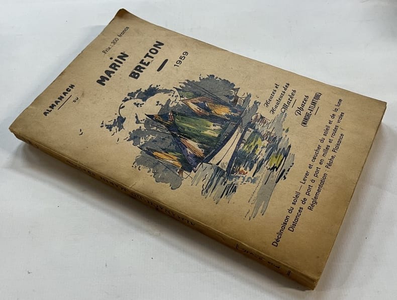
1959131425Saint-Brieuc, Presses bretonnes 1959 In-8 24 x 15 cm. Broché, couverture beige illustrée, 192 pp., figures dans le texte, table des matières. Couverture poussiéreuse.
1857ABC_46672HMS Cyclops:: Oman Khuriya Muriya Islands Yemen Egypt Red Sea Arabian Sea Pakistan Sri Lanka and other places 1857. Contemporary brown cloth over boards rebacked in period-style black calf with the spine lettered in gold: "Log H.M.S. Cyclops". Folio 20 x 31.5 cm. Over 360 pp. of manuscript entries written with brown ink in a legible hand on watermarked laid paper with a blue cast. With 8 pen and ink nautical charts and 5 sketches of coastal sites including the city of Muscat 8 on the logbook pages and 5 on separate thick album leaves. Historically significant manuscript logbook containing a detailed record of the first attempt to lay a submarine telegraph cable to connect London with British India. The expedition took place from May 1859 the Red Sea leg from Suez to Aden to February 1860 from Aden to the Khuriya-Muriya Islands Muscat and Karachi. The two specially designed cable ships the Imperador and Imperatrix were supported by HMS Cyclops which surveyed the coastlines and reported on the depth and structure of the ocean floor.The entries from February 1859 to May 1860 documenting the ship's Red Sea and Arabian Sea mission span over 200 pages. We first find the Cyclops near Cape Ras al Hadd on the eastern coast of Oman at the entrance to the Gulf of Oman: "Cape Ras al Hadd . terminates in a low sandy spit at the head of which is a village and mud fort. There is an inlet about 4 miles to the northward of the cape but inaccessible to large vessels. There is a heavy surf on the beach during northerly winds" 9 February 1859. The ship then plied in the Red and Arabian Seas between Egypt Yemen and Oman eventually finishing in Bombay.During its expedition the Cyclops visited and moored in Quseer and Zabardag Island Egypt Suakin Sudan Perim Island Strait Bab-el-Mandeb Yemen the Hanish Islands Yemen Palinurus Shoal and Cape Fartak Yemen al-Hallaniyah and al-Qibliyah Khuriya Muriya Islands Oman Ras Madrakah and Ras al Hadd Oman Charna Island and Karachi Pakistan. The logbook entries record the soundings and the laying of cable along with quotidian ship activity. Brief entries touch on the death of crew members; discharging coal; punishing men for wrongdoing; maintenance of the ship; other ships in company; visits on board by local notables etc. Six larger entries occupying up to two pages of text describe the topography landmarks soundings and economy of Karachi Zabargad Island and Muscat Cove this last harbour said to be "formed by Muscat Island on the east and Ras Muscat on the West it is one mile deep by half a mile wide with 12 fathoms at entrance decreasing to 3 fathoms ahead of the town. It is defended by two . batteries on the island one on the height to the seat of town and two on Ras Muscat. They are all in a stay ! - or: state of decay. The entrance to the cove is difficult to make out when coming from the eastward . The exports of Muscat are wheat dried fish dates and cattle the imports being European and Indian manufactured goods sugar etc. The revenue is about £100000. The Imaum's Palace faces the water his army generally consists of from 10 to 12000 men and the fleet of 2 frigates 2 corvettes a transport and brig the greater part of the Navy having been removed to Zanzibar the Captains of these vessels being educated at Bombay or Calcutta. Supplies of all kind are cheap and plentiful. Boats may be hired thro' the medium of the Agent of the Indian Government for the shipment of coals" 26 November 1859.Illustrated with eight well-executed pen and ink nautical charts showing the routes of the Cyclops in the Red and Arabian Seas as well as the harbours of Muscat Cove and other places. Five beautiful ink sketches show the city of Muscat "Hallani Bluff from Addington Cove" al-Hallaniyah the largest of the Khuriya Muriya Islands Oman Ras Fartak Yemen Karachi harbour and Colombo.The cable too lightly armoured and laid with too little slack soon failed: indeed the 1859 section had already broken down by the time the route was completed in 1860. Messages were passed over individual sections but the entire cable never worked as a unit. Communication to India would not be established until the 1864 Persian Gulf cable was laid. The captain of the Cyclops the noted British navigator and Arctic explorer William Pullen 1813-87 took part in the unsuccessful 1849 attempt to rescue Sir John Franklin's disastrous expedition in search of a northwest passage then in the same year became the first European to sail along the north coast of Alaska in his voyage from the Bering Strait to the Mackenzie River in Canada.A final part of the log comprising some additional 150 pp. May 1860-May 1861 covers the Cyclops's survey of the southeast coast of Ceylon and her return voyage to England. Overall an important content-rich source on the early history of the submarine telegraph cable around the Arabian Peninsula to British India.In good condition. Oman, Khuriya Muriya Islands, Yemen, Egypt, Red Sea, Arabian Sea, Pakistan, Sri Lanka and other places, hardcover
195219424Paris Société d'éditions géographiques, maritimes et coloniales 1952 in-4 broché un volume, broché crème in-quarto Editeur (paperback in-4 Editor) (28,5 x 23 cm), à couverture rempliée imprimée en bleu marine et illustrée en couleurs d'un blason gauffré aux Armes des d'Orbigny (or, argent, rouge et noir), dos muet (spine without title), orné de 2 Tableaux Généalogiques + Fac-similé dépliant du brevet d'admission au commandement des bâtiments de Commerce en date du 15/02/1839 + 2 illustrations couleurs in- texte + illustrations NB des personnages & bâtiments propriété de la compagnie + les armoiries de la ville de la rochelle hors-texte en couleurs, 170 pages + Table, 1952 PARIS, Société d'éditions géographiques, maritimes et coloniales Editeurs,
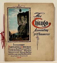
190922859Chicago: Chicago Association of Commerce 1909. First Edition. Quarto; 8pp. Four string-tied and stapled leaves with ten 3 1/2" x 5 1/2" mounted colored illustrations each titled in red along with a map of the route. Near Fine copy in grey cardstock titled and color photograph tipped to front cover. Rare promotional piece; we fine only 1 copy at University of Michigan. This booklet was prepared by the Oregon Railroad & Navigation Company the Oregon Short Line Railroad the Union Pacific Railroad and the Chicago & Northwestern Railway as an itinerary for the approximately 40 Chicago merchants' return trip ". calling your attention to a few of the points of interest in a country of marvellous scenes wonderful accomplishments and a still more wonderful future." Lists 38 members of the Chicago Association of Commerce making the return trip. Uncommon attractive & elaborate promotional piece. Chicago Association of Commerce unknown
191236542North Yakima: Yakima Commercial Club 1912. 1912. WASHINGTON. 10 1/2" x 7" in color pictorial wrappers. 64 pp. introduction illustrations. Very brief history followed by extensive information on the Yakima Valley to include geography topography climate the Indian Reservation irrigation products produced methods of orchard development live stock dairying transportation communities industries etc. Numerous black and white photographs many full page photos of scenery residential homes buildings agriculture industries public buildings etc. Wrappers disbound from text. Light bleeding to first and last page wrappers lightly soiled and with chipping to top of front wrapper and with tiny fold to tops of page corners. Yakima Commercial Club, 1912. unknown
201002598Paris, Robert Laffont - les énigmes de l'univers, 1975 ; in-8, 263 pp., broché, couverture illustr.
182080441820 Caen, F. Poisson, 1820. Une plaquette in-4 sous couverture d'attente bleue, 20 et 4 pages. Bon état.
226885Paris, A. Cadart, s.d. (vers 1875) in-4, titre et 40 planches gravées à l'eau-forte, signées, en partie numérotées et généralement légendées, demi-chagrin olive, dos lisse orné de filets dorés, tranches mouchetées de rouge (reliure moderne).
183349821New York: G & C & H Carvill 1833. First Edition. Octavo. Original pebble-grained boards; paper spine title; 1-78-1582pp. Backstrip partially detached ; spine label faded barely legible; text fresh and unmarked - Good or better. Ex-U.S. Naval Lyceum with ink pressure stamp to endpapers and title page with de-accession dated 1927 on verso of title page. Pencil ownership inscription of a "Thos. J. Manning U.S. Navy" at head of title page. Verso of final text leaf prints a brief list of errata. G & C & H Carvill unknown
201211759A Paris, ChezMérigot jeune libraire quai des augustins, 1781 ; in-8, xiv-175 pp., cartonnage de l'éditeur. Bon état plein veau marbré, dos bien orné tête de coiffe un petit manque coiffe sup et inf manquante très bon état.