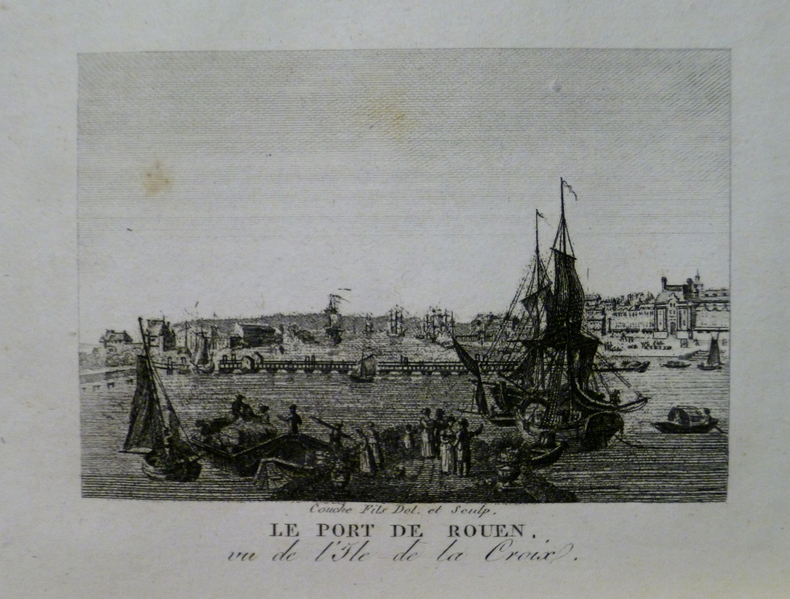
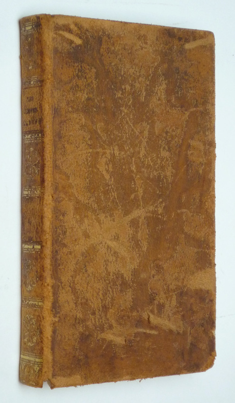
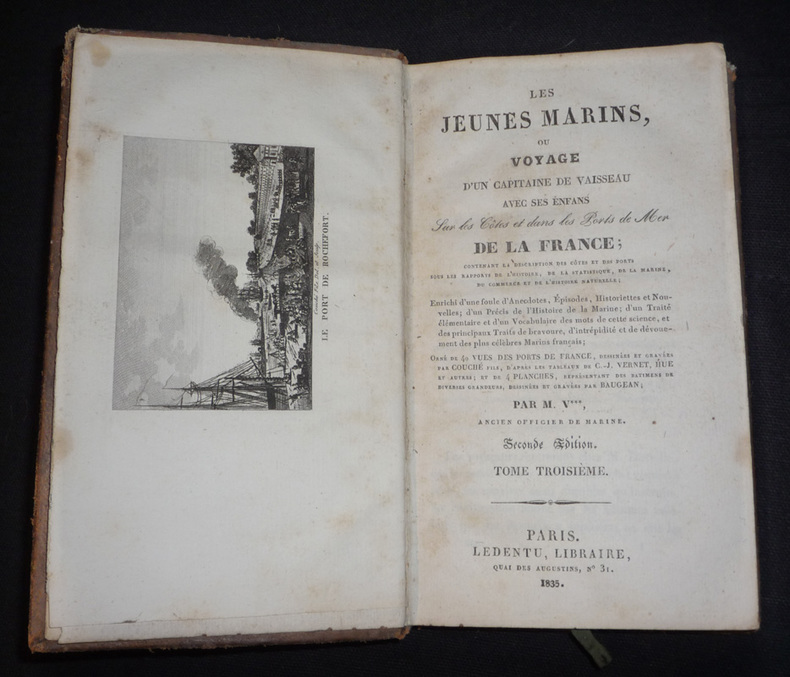
3 550 résultats
104017aafMilano, Valentino Bompiani, u.a. ca. 1966 in-8vo, cartonnage original, bon état,
La Coruña, Imprenta Moret, 1962. 4to. mayor; 709 pp. Con 335 gráficos. Encuadernación original en cartoné.
243375Lille, René Giard, Paris, Arthur Rousseau, 1919 in-12, 238 pp., un f. n. ch. de table, L pp. [Réponse à quelques remarques, réserves, objections et critiques adressées à la méthode employée], [2] ff. n. ch. (table des matières répétée, errata), broché, non coupé.
1999500182138Plaisancier-Vagnon éditions 1999 13 4x1x20 8cm. 1999. Broché.
1997500059005Plaisancier-Vagnon éditions 1997 13 6x1x20 2cm. 1997. Broché.
9754les éditions du plaisancier 126 pages in8. Sans date. broché. 126 pages.
1827yd987Paris, Guillaume et compagnie, rue Hautefeuille, n°14 Relié 1827 "Quatre volumes in-12 (10,8 x 17,4 cm), reliure demi-peau, dos lisses ornés de dorures, XXXII-239, 260, 283 et 251 pages, complet des 40 gravures de ports + 4 planches dépliantes, 2e tirage de ""Les Jeunes Marins ou Voyage d'un capitaine de vaisseau avec ses enfants sur les côtes et dans les ports de mer de la France ; contenant la description des côtes et des ports sous les rapports de l'histoire, de la statistique, de la marine, du commerce et de l'histoire naturelle ; enrichi d'une foule d'épisodes, anecdotes, historiettes et nouvelles ; d'un Précis de l'histoire de la marine ; d'un Traité élémentaire et d'un Vocabulaire des mots de cette science, et des principaux traits de bravoure, d'intrépidité et de dévouement des plus célèbres Marins français"" ; coiffes, mors et coins frottés, quelques marques d'usage sur les plats, assez bon état. Livraison a domicile (La Poste) ou en Mondial Relay sur simple demande."
1835ys2842Paris, Ledentu, libraire, quai des Augustins, n°31 Relié 1835 In-12 (10,5 x 17,7 cm), reliure pleine peau, dos lisse, 251 pages, tome 4 isolé, ouvrage orné de vues des ports de France dessinées et gravées par Couché fils, d'après les tableaux de C.-J. Vernet, Hue et autres, et de 4 planches dépliantes représentant des bâtiments de diverses grandeurs, dessinées et gravées par Baugean ; dorures passées sur le dos, épidermures sur les plats et le dos, par ailleurs intérieur frais, assez bon état. Livraison a domicile (La Poste) ou en Mondial Relay sur simple demande.
1835ys2875Paris, Ledentu, libraire, quai des Augustins, n°31 Relié 1835 In-12 (10,5 x 17,7 cm), reliure pleine peau, dos lisse, 251 pages, tome 3 isolé, ouvrage orné de vues des ports de France dessinées et gravées par Couché fils, d'après les tableaux de C.-J. Vernet, Hue et autres ; coins frottés, dorures passées sur le dos, épidermures sur les plats et le dos, par ailleurs intérieur frais, assez bon état. Livraison a domicile (La Poste) ou en Mondial Relay sur simple demande.
1898106031Washington: Government Printing Office 1898. Hardcover. very good. 1st Edition. 740pp. tipped-in erratapp. Octavo in original gilt lettered blue cloth with plates from photos and drawings some folding - including ship plans and elevations and folding maps including colour. Faint dampstain to edges of text block top corner else very good. very good Spine Title: "Naval Operations of the War with Spain.". An appendix to the official report by the United States Navy Department Bureau of Navigation "relating to the operations of the war with Spain and covering as well important operations of the Department before during and after the war." pp.3 grouped according to general subject. 1898 Government Printing Office hardcover
19275373Washington DC: GPO 1927. Revised Edition. fair. 703 illus. figs foxing to fore-edge & ins bds stamps & ink name ins fr flylf bds scuffed edges of spine worn. This revised manual contains new material on the latest combat principles developed for infantry and machine-gun units. There is also much new material on medical tactics ashore field hygiene sanitation and first aid. The enlarged chapter on machine guns includes the Marine Corps Cole cart drill extended order drill gun emplacements classes of fire range cards and the Browning automatic rifle. GPO unknown
18844002Washington DC: GPO 1884. fair ex-lib. 219 fold-out illus. tables fr bd weak pencil name ins fr bd lib stamps bds scuffed & edges worn sm tears at sp & lib sticker. GPO unknown
18834004Washington DC: GPO 1883. fair ex-lib. 119 plates fold-out illus. tables bds weak & sm tears bds scuffed & edges worn sm pcs missing at spine & lib sticker. GPO unknown
18834003Washington DC: GPO 1883. fair ex-lib. 176 plates fold-out illus. sm tears & soiling tables pencil notes ins fr bd bds scuffed & edges worn sm tears at spine & lib sticker. GPO unknown
189677014Washington DC: U.S. Department of the Navy Bureau of Navigation Hydrographic Office 1896. Presumed First Edition First printing thus. Map. Good. This was published at the Hydrographic Office in Washington D.C. in February 1896. No. 1530. Charles D. Sigabee Commander U.S. N. Hydrographer. Format is approximately 26 inches by 17 inches folded. This map is disbound from Volume I of the Commercial Directory of the American Republics compiled by the Bureau of American Republics International Union of American Republics Joseph P. Smith Director 1897 Title page from Directory is present. Taped to top right of map in margin is the statement "This chart is intended solely to show tracks of steam vessels on the ocean and no authority is assumed for the boundary lines as drawn between the countries." Map has some color differentiation and several inserts presenting distance information between major ports of call. Map has been folded with approximately the top third folded down. It is also folded into four sections of different lengths to fit as the frontis to the Directory. Map has some wear and soiling/staining. This is similar to the large-scale and detailed World chart on Mercator's projection produced by the British Admiralty under the "Superintendence of Captain Wharton R.N. F.R.S Hydrographer" engraved by Edward Weller and sold by J. D. Potter chart agent. The map has no internal landmass detail unless relevant to steam ship routes thus the Suez and Panama canals are marked as is the Canadian Pacific Railway. Panels along the lower edge list major ports and give distances dependent on routes taken and average knots-per-hour speeds with daily distances covered in miles. The world's major ports are linked by ship-routes each track with its relevant distance and so on. An interesting chart at the time steam took over from sail. Charles Dwight Sigsbee 1845 - 1923 was a Rear Admiral in the United States Navy. In his earlier career he was a pioneering oceanographer and hydrographer. He is best remembered as the captain of the USS Maine which exploded in Havana harbor Cuba in 1898. U.S. Department of the Navy, Bureau of Navigation, Hydrographic Office unknown
187355613Washington, Government Printing Office, 1873. Royal8vo. Orig. full calf. Gilt boders and gilt lettering on covers. Gilt spine. Lithographed frontispiece in colour. XVI,107,203,26,8 pp., 3 lithographed colourplates (one large folded).
1396836926.Gpaperback. Good. Access codes and supplements are not guaranteed with used items. May be an ex-library book. paperback
1396837647.Ghardcover. Good. Access codes and supplements are not guaranteed with used items. May be an ex-library book. hardcover
187355613Washington Government Printing Office 1873. Royal8vo. Orig. full calf. Gilt boders and gilt lettering on covers. Gilt spine. Lithographed frontispiece in colour. XVI107203268 pp. 3 lithographed colourplates one large folded. unknown
63 p. diagrs. (part fold.) 2 fold. charts. 24 cm. Hardcover Very good condition
131p. XLib stamp on title page. 8vo. Original full leather binding, gold lettered. Edges of boards ruled in gold. Front board detached. Spine worn. Hardbound. Scarce. **PRICE JUST REDUCED! NAVAL/2
1882130Washington D.C.: 1882. 32 plates in full color. Very good with light wear. hardcover books
pp. xii, 1145 + Plus Index, frontis and color plates of flags. Numerous illustrations. Inked ownership of Ralph C. Gemmill A.S., Co. 366 E-11, U.S.N.T.S., Sampson, NY. Paper beginning to brown but not brittle. 8vo. Original full cloth binding, faded. WWII 3
38p. Double column. 4to. Original printed wraps. Very good copy. SCIENCE BOX 3
185854442n.p. n.d. 1858. 8vo pp. 20; self-wrappers; fine. UC-Riverside and AAS only in OCLC. In 1855 while charting the Rio de Plata Basin the United States ship U.S.S. Water Witch was fired upon by a Paraguayan fort killing the helmsman Samuel Chaney. This outraged the U.S. government who along with the U.S. & Paraguay Navigation Company decided to bring the incident to the Supreme Court. In 1858 began the Paraguay Expedition the purpose of which was to demand an apology from the Paraguyan government and to address alleged insults against the Navigation Company. The result of the expedition was that Paraguay apologized the Chaney's family was indemnified and a new advantageous commercial treaty between Paraguay and the United States was forged. <br/><br/> unknown books