341 résultats
1931ZB1037295Washington: GPO 1931. first edition 111 pp. softcover slightly toned or faded overall good-very good. - If you are reading this this item is actually physically in our stock and ready for shipment once ordered. We are not bookjackers. Buyer is responsible for any additional duties taxes or fees required by recipient's country. Washington: GPO paperback
184041654Paris ca. 1840. Folio. 36x25 cm. Contemp. hcalf. Spine gilt but somewhat rubbed. 264 pp. numerous illustrations in margins and in the text. 2 folded maps. The text is handwritten and reproduced with an etching technique probably zinkography. Internally clean and fine. unknown
1878z015739Paris: Chargeurs Reunis Compagnie Francaise de Navigation a Vapeur 1878. Good. Letter of transmittal from a Compagnie Francaise de Navigation a Vapeur agent to James M. Lincoln of the Pacific Mail Steamship Co. New York. French language measures 8.5 by 10.5 inches recto only. Good. Chipping and paper repair to extremities edges toned else clean and unmarked. Chargeurs Reunis Compagnie Francaise de Navigation a Vapeur unknown
1878z015742Marseille: Compagnie De Navigation Mixte 1878. Good. Letter of transmittal from a Compagnie De Navigation Mixte agent to James M. Lincoln of the Pacific Mail Steamship Co. New York. French language measures 8.5 by 7 inches recto only. Good. Paper repair to verso. Lightly creased stain to upper right corner else clean and unmarked. Compagnie De Navigation Mixte unknown
1877z015748London: Netherlands India Steam Navigation Company 1877. Very Good. Two page letter of transmittal from a Netherlands India Steam Navigation Company agent to James M. Lincoln of the Pacific Mail Steamship Co. New York. Measures 8.5 by 11 inches recto only. Very good. Pages toned and lightly creased else clean and unmarked. 2p. Netherlands India Steam Navigation Company unknown
18966694Washington. Government Printing Office. 1896. Bound in gilt titled royal blue cloth. Square 8vo. First Edition. Mild scuffing to covers corners gently rubbed mild foxing to prelims. A Very Good copy. Government Printing Office. hardcover
0365666378.Ghardcover. Good. Access codes and supplements are not guaranteed with used items. May be an ex-library book. hardcover
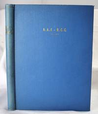
19442005200040Houston : Gulf Publishing Co 1944. First Edition. Hardcover. Very Good. The Army Air Corps: A Rare and fine collection of the Army Air Forces in World War II. Log of Navigation. 7 issues bound as one. Bound in full blue cloth. Good binding and cover. Original pictorial wraps bound in. Clean unmarked pages. Numerous photographs maps comics. Heavily illustrated an interesting periodical. "The approved publication of the AAF Training Command." Includes: "A Camera Trip Through Army Air Forces School Hondo Texas" - a smaller photo-pamphlet; AND Log of Navigation issues: April 1944. Vol. 2 no. 4; May 1944. Vol. 2 no. 5; June 1944. Vol. 2 no. 6; July 1944. Vol. 2 no. 7; September 1944 Vol. 2 no. 9; March 1945. Vol. 3. No. 3. <br> From the former head of the U.S. Air Forces History Division. Houston : Gulf Publishing Co hardcover
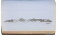
1857ABC_46672HMS Cyclops:: Oman Khuriya Muriya Islands Yemen Egypt Red Sea Arabian Sea Pakistan Sri Lanka and other places 1857. Contemporary brown cloth over boards rebacked in period-style black calf with the spine lettered in gold: "Log H.M.S. Cyclops". Folio 20 x 31.5 cm. Over 360 pp. of manuscript entries written with brown ink in a legible hand on watermarked laid paper with a blue cast. With 8 pen and ink nautical charts and 5 sketches of coastal sites including the city of Muscat 8 on the logbook pages and 5 on separate thick album leaves. Historically significant manuscript logbook containing a detailed record of the first attempt to lay a submarine telegraph cable to connect London with British India. The expedition took place from May 1859 the Red Sea leg from Suez to Aden to February 1860 from Aden to the Khuriya-Muriya Islands Muscat and Karachi. The two specially designed cable ships the Imperador and Imperatrix were supported by HMS Cyclops which surveyed the coastlines and reported on the depth and structure of the ocean floor.The entries from February 1859 to May 1860 documenting the ship's Red Sea and Arabian Sea mission span over 200 pages. We first find the Cyclops near Cape Ras al Hadd on the eastern coast of Oman at the entrance to the Gulf of Oman: "Cape Ras al Hadd . terminates in a low sandy spit at the head of which is a village and mud fort. There is an inlet about 4 miles to the northward of the cape but inaccessible to large vessels. There is a heavy surf on the beach during northerly winds" 9 February 1859. The ship then plied in the Red and Arabian Seas between Egypt Yemen and Oman eventually finishing in Bombay.During its expedition the Cyclops visited and moored in Quseer and Zabardag Island Egypt Suakin Sudan Perim Island Strait Bab-el-Mandeb Yemen the Hanish Islands Yemen Palinurus Shoal and Cape Fartak Yemen al-Hallaniyah and al-Qibliyah Khuriya Muriya Islands Oman Ras Madrakah and Ras al Hadd Oman Charna Island and Karachi Pakistan. The logbook entries record the soundings and the laying of cable along with quotidian ship activity. Brief entries touch on the death of crew members; discharging coal; punishing men for wrongdoing; maintenance of the ship; other ships in company; visits on board by local notables etc. Six larger entries occupying up to two pages of text describe the topography landmarks soundings and economy of Karachi Zabargad Island and Muscat Cove this last harbour said to be "formed by Muscat Island on the east and Ras Muscat on the West it is one mile deep by half a mile wide with 12 fathoms at entrance decreasing to 3 fathoms ahead of the town. It is defended by two . batteries on the island one on the height to the seat of town and two on Ras Muscat. They are all in a stay ! - or: state of decay. The entrance to the cove is difficult to make out when coming from the eastward . The exports of Muscat are wheat dried fish dates and cattle the imports being European and Indian manufactured goods sugar etc. The revenue is about £100000. The Imaum's Palace faces the water his army generally consists of from 10 to 12000 men and the fleet of 2 frigates 2 corvettes a transport and brig the greater part of the Navy having been removed to Zanzibar the Captains of these vessels being educated at Bombay or Calcutta. Supplies of all kind are cheap and plentiful. Boats may be hired thro' the medium of the Agent of the Indian Government for the shipment of coals" 26 November 1859.Illustrated with eight well-executed pen and ink nautical charts showing the routes of the Cyclops in the Red and Arabian Seas as well as the harbours of Muscat Cove and other places. Five beautiful ink sketches show the city of Muscat "Hallani Bluff from Addington Cove" al-Hallaniyah the largest of the Khuriya Muriya Islands Oman Ras Fartak Yemen Karachi harbour and Colombo.The cable too lightly armoured and laid with too little slack soon failed: indeed the 1859 section had already broken down by the time the route was completed in 1860. Messages were passed over individual sections but the entire cable never worked as a unit. Communication to India would not be established until the 1864 Persian Gulf cable was laid. The captain of the Cyclops the noted British navigator and Arctic explorer William Pullen 1813-87 took part in the unsuccessful 1849 attempt to rescue Sir John Franklin's disastrous expedition in search of a northwest passage then in the same year became the first European to sail along the north coast of Alaska in his voyage from the Bering Strait to the Mackenzie River in Canada.A final part of the log comprising some additional 150 pp. May 1860-May 1861 covers the Cyclops's survey of the southeast coast of Ceylon and her return voyage to England. Overall an important content-rich source on the early history of the submarine telegraph cable around the Arabian Peninsula to British India.In good condition. Oman, Khuriya Muriya Islands, Yemen, Egypt, Red Sea, Arabian Sea, Pakistan, Sri Lanka and other places, hardcover
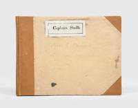
1928174745Likely Shanghai: 1928-34. Mariners are warned to exercise due caution when approaching and when in the waterways A collection of otherwise untraced notices to mariners compiled by a civilian captain who plied the lower Yangtse during the late 1920s and early 1930s. Yangtse shipping was regulated by the Maritime Customs Service which issued around 100 navigational advisories per year. During the late 1920s shipping traffic on the Yangtse rebounded after several years of decline during the Warlord Era. Low water however continued to pose problems for navigators and increased the need for effective river management. The 39 notices are technical directions concerning specific parts of the channel. They specify when vessels may and may not enter stretches of water warning of the persistent presence of Chinese craft not subject to the same notices offer guidance for navigating buoyed channels provide optimum bearings and relay a change to the position of the Bend and Gravener Island beacons due to the erosion of the channel. The majority date from 1929. The identify of the "Captain Smith" referenced on the front cover has proved elusive but he may be the individual pictured in photograph Sw13-045 G. Warren Swire collection SOAS. Landscape octavo. Contemporary brown half cloth binder with metal clasp spine lettered in gilt buff paper sides front board with manuscript label "Captain Smith" boards lined with pink paper typescript list of charts on inner front cover 39 sheets each typed one side only in black or blue most duplicate typescript a few top copy. Boards lightly soiled clasp rusted sheets generally well preserved a few creased or with holes near clasp legibility unaffected typescript list with a few losses to text: a very good example. hardcover
19752090202120403487Kaibundo shuppan 1975. Soft Cover. Fine. Number of books: 1 Kaibundo shuppan paperback
18880009730New York 1888. First edition. Map. Fine. 15 x 11 inches / 36 x 26 cm 3 folds matted glazed and framed. Very Scarcce <br/><br/>This map was removed from an Annual Report. The black-and-white map shows the boundaries of Illinois in outline presenting the Illinois River improved passage from Chicago to Grafton where it pours into the Mississippi River. It also shows the Rock River traversing to the Quad Cities. Toward the east is the Illinois & Michigan Canal the DesPlaines River the Little Calumet River and the Little Kankakee River and Calumet Harbor. The map is attributed to Thomas H. Handburg. The University of Illinois-Urbana has a photocopy of it from the photocopy in the National Archives. I have not identified to which Annual Report this belonged Nor can I find another map attribued to Thomas H. Handburg. unknown
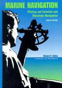
1990BN151395U S Naval Inst Pr 1990. 1990. Marine Navigation: Piloting and Celestial and Electronic Nagivation <br/><br/>Marine Navigation: Piloting and Celestial and Electronic Nagivation Marine Navigation - Hobbs Richard R. U S Naval Inst Pr unknown
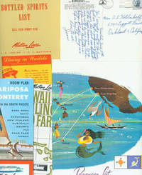
63-6134Honolulu Hawaii: Matson Lines 1964. 18 Pieces of Travel Ephemera Brochures Post Cards Booklet and Wine Lists from a May 1964 Cruise from Honolulu Hawaii to San Francisco. 11" x 8.5" and smaller. Color photos. Very Good. Honolulu, Hawaii: Matson Lines, 1964. unknown
15-9500San Francisco: S. S. Matsonia 1957. 4to. 8 pp. Two stapled folded sheets Covers with slight crease lightly browned and dust soiled else Fine. Illustrated. San Francisco: S. S. Matsonia, 1957. unknown
171959235Washington D.C.: Government Printing Office Hydrographic Office U.S. Navy 1917-1930. Nine vols. 8vo. x 4 470; 4 687 1; ix 1 586; ix 1 750 pp. plus publisher’s ads; ii 38; 5; 1 47; 1 60 3; 1 35 7 leaves. With 4 large folding colour maps. Four uniformly bound in tan publisher’s buckram black lettering front covers & spines minor soiling spotting fore-edges of covers darkening to spines very slight uniform interior toning; remaining Supplement vols. w/ self-printed softcovers toning to fore-edges minor chipping minor soiling chipping still VG set. First edition stated of vol. III and Supplements 2nd editions of other three vols. of these surprisingly scarce coast pilot guides to the Mediterranean Sea encompassing the coasts of Spain Morocco Algeria Tunisia Libya Egypt Palestine Turkey the Balearics and more draw upon British Royal Navy Ottoman Empire & Turkish coast pilots North African Russian & U.S. Navy reports. Prior to modern GPS systems and satellite navigation these regularly updated and revised navigation handbooks provided key sailing instructions. The maps outlines the available charts for the designated areas surrounding the Mediterranean Sea as well as detailing those for the Black Sea volume. Very uncommon to find complete set with all supplements to 1930. Government Printing Office, Hydrographic Office, U.S. Navy, paperback
18471008098vo slate blue cloth stamped in gilt and blind illustrated with frontispiece and folding charts viii 21 429 3 24 pp.Wear to spine ends spine faded small splits to joints hinges cracked copious nautical notes to endpapers slight aging but text and charts are generally clean and unworn; about very good. This is rare first edition of what is known as "The Atlantic Navigator" which includes detailed sailing instructions for the North and South Atlantic. Includes ten folding charts and much of the text is from various captains and navigators familiar the routes contained in this work. The first numbered section of 21 pages is an 1847 supplement and the catalogue at the rear is dated 1851. Sabin noting 2300 only an 1854 fourth edition. James Imray,
185854442n.p. n.d. 1858. 8vo pp. 20; self-wrappers; fine. UC-Riverside and AAS only in OCLC. In 1855 while charting the Rio de Plata Basin the United States ship U.S.S. Water Witch was fired upon by a Paraguayan fort killing the helmsman Samuel Chaney. This outraged the U.S. government who along with the U.S. & Paraguay Navigation Company decided to bring the incident to the Supreme Court. In 1858 began the Paraguay Expedition the purpose of which was to demand an apology from the Paraguyan government and to address alleged insults against the Navigation Company. The result of the expedition was that Paraguay apologized the Chaney's family was indemnified and a new advantageous commercial treaty between Paraguay and the United States was forged. unknown
195540503City Not Stated: Peninsular & Oriental Steam Navigation Company P & O 1955. Each card: Folded small octavo 14 x 21 cm very good condition colour drawing front cover corner tips some cards little scuffed card 1 is slightly shorter at the top presumed as issued no text missing minor edgewear. Each card: 4 pp. A set of 11 of 12 in set menu cards designed by the artist Strom Gould. Card No. 1 Red-Crowned Pigeon & Purple-Crowned Pigeon. Card No 2 Fairy Wrens. Card No. 3 Gouldian Finch. Card No. 4 Pink Cockatoo. Card No. 5 Count Raggi's Bird Of Paradise. Card No. 6 Rainbow Bird. Card No. 7 Regent Bower-Bird. Card No. 8 Scarlet Honey-Eater. Card No. 9 Red-Capped Robin. Card No. 10 Laughing Kookaburra. Card No. 11 Rainbow Lorikeet Red-Winged Parrakeet & Green Leek Parrakeet. MISSING: Card No. 12 Kingfisher. The artist also known as Charles Sidebotham Gould was born in Letchworth England on 2/8/1910 and came to Australia in 1937. He was employed as the Sydney Morning Herald's first art director and he also drew its first comic strip in 1944. He died in 1992. No date but about 1955. Peninsular & Oriental Steam Navigation Company (P & O) unknown
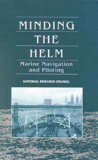
ANAIS-030904829XNatl Academy Pr. hardcover. Good. 0x0x0. Buy with confidence. Excellent Customer Service & Return policy. Natl Academy Pr hardcover
1994G030904829XI5N01Natl Academy Pr 1994. Hardcover. Acceptable. Missing dust jacket; Readable copy. Pages may have considerable notes/highlighting. ~ ThriftBooks: Read More Spend Less.Dust jacket quality is not guaranteed. Natl Academy Pr hardcover
1994SONG030904829XNatl Academy Pr 1994-01-01. hardcover. Used: Good. 6.50x1.50x9.25. Buy with confidence. Excellent Customer Service & Return policy. Natl Academy Pr hardcover
19477378Milwaukee: Kalmbach Publishing Co 1947. Paperback. Oblong small 4to. Stiff pictorial wrappers plastic spiral binding. Ca. 22pp rectos only. Very good. Ownership name/city inkstamped inside front wrapper. First edition tight and clean and with plastic spiral binding intact. Number 1 in the "Ships and Sailing Albums" series. Housed in a modern heavy-duty clear mylar sleeve for protection. Kalmbach Publishing Co paperback
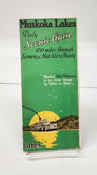
1941160265Gravenhurst Ont.: Press of Hugh C. MacLean Productions 1941. Very good. 24 cm flyer has b&w photos route charts boat info general info partial-colour map of area. Tear in horizontal fold and small holes in crease intersections. <br/><br/>"A Day of Interest of ever Changing Scenes of Enjoyment. Reached 180 Minutes or less from Toronto by Train or Motor." Press of Hugh C. MacLean Productions unknown
194539135Chatham: Shepherd Printing n. d. ca 1945. 1945. CANADA. 18" x 24" sheet one side opens to a half-sheet color map and numerous advertisements for lodging including the Joe Gawa Hotel one of Ontario's newest and finest hotels. The other side has 12 panels of promotional text regarding the various cruise packages of the beautiful Muskoka Lakes time tables and schedules and views of the inland waterways steamships R. M. S. Sagamo and the R. M. S. Cherokee. Some minor to light wear to the folds else a very good copy. Shepherd Printing, n. d. (ca 1945). unknown