341 résultats
026085431X.Ghardcover. Good. Access codes and supplements are not guaranteed with used items. May be an ex-library book. hardcover
0282878858.Gpaperback. Good. Access codes and supplements are not guaranteed with used items. May be an ex-library book. paperback
0483160172.Ghardcover. Good. Access codes and supplements are not guaranteed with used items. May be an ex-library book. hardcover
048345740X.Ghardcover. Good. Access codes and supplements are not guaranteed with used items. May be an ex-library book. hardcover
0259113565.Gpaperback. Good. Access codes and supplements are not guaranteed with used items. May be an ex-library book. paperback
195514915AB1955. Sevilla 1955-1958. differentes damaños Con muchas ilustraciones en parte en color. Interesante conjunto de folletos de las lineas de navegacion Ybarra. Contiene: 'Plano de acomodaciones de los nuevos transatlanticos Cabo San Roque y Cabo San Vicente' 'Un billete de pasaje Tenerife - Barcelona en 1958 que costaba entonces Pts. 2.420-' 2 menus Coleccion Ybarra 3 minutas Cuidad de Sevilla de 1957; 2 ediciones de la revista 'Maripez' de Ybarra de 1958 contiene una reportaje de una visita de Brigitte Bardot a Picasso con foto; mapas de Lisboa y Barcelona. unknown
1946ZB1115421Paris: Alepee et Cie. 1946. folio i 65 pp. paperback minor ownership marks text tanned & binding tight. - If you are reading this this item is actually physically in our stock and ready for shipment once ordered. We are not bookjackers. Buyer is responsible for any additional duties taxes or fees required by recipient's country. Paris: Alepee et Cie. paperback
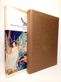
19873114La Coruña: Ed. Cámara Oficial de Comercio Industria y Navegación de La Coruña 1987.- 440 p. 4 h.: Ilustraciones fotográficas en negro y color; Folio 305 x 218 cm; Buena impresión en offset sobre papel satinado tipo cuché; Tela Ed. con camisa. La camisa reparada de unos pequeños desgarros en la cabeza. Por lo demás en excelente estado. GEOGRAFÃA ECONÓMICA HUMANA Y ECONOMÃAS REGIONALES Libro en español Cámara Oficial de Comercio, Industria y Navegación de La Coruña hardcover
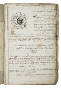
1710ABC_46964The Netherlands 1710. Contemporary flexible paperboards. Folio 33.5 x 21.5 cm. With more than 300 mathematical figures and illustrations mainly full- half- and quarter-circle diagrams. The Dutch text is written in a clearly legible 18th-century cursive hand in brown ink. Early 18th-century Dutch manuscript on the art of navigation based on Klaas de Vries Schat-kamer ofte konst der stuurlieden . 1702. De Vries taught mathematics in Amsterdam his work proved very popular and appeared in numerous editions between 1702 and 1818. The author of the present manuscript unknown but was most likely a student of mathematics possibly even a student of De Vries himself at the beginning of the 18th century.The manuscript deals with several subjects regarding navigation including many different calculations for calendars for example the golden number the tides and determining the time at night. Furthermore theories and examples of correcting compass declination and determining the time of sunrise and sunset from the declination of the sun in combination with the pole star map reading and course calculation. It ends with approximately 50 sample problems in trigonometry and geometry showing the student author's mathematical work.Binding soiled edges frayed lacking the first 7 leaves quires 3 and 5 detached. With several ink stains the ink has bled through some leaves. Otherwise in good condition. An interesting manuscript on navigation probably from a Dutch student ca. 1702/13.l For De Vries's work: The Crone library 374 1st ed 1702. hardcover
a95921San Marcos Texas. no date c. 1943. San Marcos Army Air Field. 4to hardcover. Maroon textured leatherette cover. Fully illustrated with bw photos and portraits. About 50 pages. Some cartoons by Lt. Albandh and Cpl. John Lee. VG plus. no owner marks. Clean. . hardcover
9788497001526New. unknown
192459232Washington D.C.: Government Printing Office Hydrographic Office U.S. Navy 1924; 1930. Two vols. 8vo. 608 pp.; 1 32 1 leaves. With1 large folding colour map. 1st vol. in light-green publisher’s buckram black lettering stamped on front cover & spines slight uniform toning darkening to spines shelfwear 2nd vol. w/ self-printed softcovers toning & minor predation minor chipping to fore-edges still VG- set w/ map in bright condition. Second edition of vol. 1 substantially revised & expanded 1st of 2nd of these very scarce coast pilot guides to waters of Indonesia drawing upon British Royal Navy coast pilots Australian Southeast Asian Polynesian and U.S. Navy reports. Prior to modern GPS systems and satellite navigation these regularly updated and revised navigation handbooks provided key sailing instructions. The map outlines the available charts for those covering the difficult sailing conditions through Java the Celebes Borneo Sumatra the Gulf of Siam the Celebes Timor and more. Worldcat locates only 4 copies of the first vol. Yale NYPL BN Mexico Stattsbibliotheck Berlin & 1 copy of the 2nd U of W. Government Printing Office, Hydrographic Office, U.S. Navy, paperback
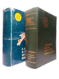
197148464Bilbao: La Editorial Vizcaina 1971.- XXIV 911 p. 1 h.; 4º 25 x 188 cm: Estados mapas y planos plegados; Pleno Guaflex Ed. imitando piel camisa. Excelente estado. Tan solo la camisa tiene algunas faltas y rozaduras. GEOGRAFÃA ECONÓMICA HUMANA Y ECONOMÃAS REGIONALES Libro en español La Editorial Vizcaina hardcover
18970005133New York: Harper & Brothers 1897. First American edition. Hardcover. Good. 16 color plates 120 photogravures 4 folding maps in pockets. Quartos green cloth Vol. 1 torn at head of spine inked 1897 inscriptions on blank pages. <br/><br/>In the space of 280 years previous to 1893 the combined efforts of all the Arctic expeditions succeeded only in travelling 150 miles nearer the Pole. Dr. Nansen in three years penetrated 200 miles beyond the farthest point then reached. Originally published at $10. Publisher's advance prospectus in front pocket. 16 color plates 120 photogravures 4 folding maps in pockets. Bennett PRACTICAL GUIDE TO AMERICAN NINETEENTH CENTURY COLOR PLATE BOOKS p.82 - "The 16 colored plates are on a par with all the rest of this fine and honest and permanent work.". One of his aims was to explore arctic ocean currents. Nansen was awarded the Nobel Peace Prize in 1922. PRINTING AND THE MIND OF MAN 384; Arctic Bibliography 11983. Preceded by the Danish edition in 1897. 120 photogravures 4 folding maps in pockets. Harper & Brothers hardcover
0484402072.Ghardcover. Good. Access codes and supplements are not guaranteed with used items. May be an ex-library book. hardcover
192119891Washington D. C.: Gpo. Very Good. 1921. First Edition. Hardcover. Covers are very lightly soiled. ; Small 4to 9" - 11" tall; 576 pages . Gpo hardcover
0332231011.Ghardcover. Good. Access codes and supplements are not guaranteed with used items. May be an ex-library book. hardcover
0656066180.Ghardcover. Good. Access codes and supplements are not guaranteed with used items. May be an ex-library book. hardcover
1333511027.Gpaperback. Good. Access codes and supplements are not guaranteed with used items. May be an ex-library book. paperback
0484042661.Ghardcover. Good. Access codes and supplements are not guaranteed with used items. May be an ex-library book. hardcover
0366759663.Ghardcover. Good. Access codes and supplements are not guaranteed with used items. May be an ex-library book. hardcover
188740498N.p.: N.p. 1887. Paperback. 8vo. Self-cover. 7pp. Very good. Outer wrappers faintly soiled and mildly edgeworn. Probable sole edition of this bibliographically-cryptic pamphlet presenting the case of Lefferts W. Lloyd Catherine W. Mitchell and Samuel F. Engs each the administrator of the estate of a deceased versus the United States in this "French Spoliation Claim" -- claims made by U.S. citizens against France Holland and Spain for ships and goods seized by privateers prior to September 30 1800 at ports controlled by those countries -- a rather sizeable and definitely bizarre category of strange maritime documents with claims made by descendants into the 20th century. This particular claim involves John and Abraham Franklin and their ship "Hunter" commanded by William Whitlock. In 1798 she sailed from New York headed for France and then China but was captured by a Spanish and then a French privateer -- it all gets hairy and convoluted but in the end the ship and goods were damaged and the descendants seek $75000 in damages. N.p. paperback
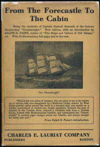
192442805Boston: Charles E. Lauriat Co 1924. Hardcover. 8vo. Black cloth with gilt spine lettering and decoration pictorial dust jacket. xxvii 308pp. Top edge gilt. Frontispiece numerous full-page illustrations. Near fine/good plus. Jacket a bit edgeworn and lightly soiled with several small edge chips -- but complete and fairly attractive nonetheless. A tight attractive first of this edition following the 1887 true first edition described by Harold F. Smith: "One of the great packet commanders writes his autobiography giving a lively series of maritime adventures around the world." Very uncommon especially in a decent jacket. AMERICAN TRAVELLERS ABROAD S3. Charles E. Lauriat Co hardcover
1868285943Washington: Government Printing Office 1868. Soft Cover. Very Good binding. The Bureau of Navigation Navy Department's booklet General Instructions for Hydrographic Surveyors. Dampstaining to the bottom edge of the second half of the textblock. Writing in ink on the front wrapper. Engraved plate of "Brooke's Deep Sea Sounding Apparatus" at the rear. Blue printed paper wrappers. Very Good. 62 pp. Very Good binding. Government Printing Office unknown
1939RiverPilot<p>HUDSON RIVER NAVIGATION <strong>Godfrey's river and canal pilot</strong>: <strong>useful information for masters pilots mates and yachtmen navigating the Hudson River New York State Barge Canals and Long Island Sound. Compiled by Daisy M and Frank H Godfrey. Rome NY: Republican Printing Company 1939. 8vo 33pp; blue textured paper covers lettered in silver a fine copy overall.</strong></p><p><strong>First and apparently only printing OCLC locating only two copies. Extensive listing of magnetic compass courseCayuga Ls including the Hudson River both North and South bound Oneida Lake Cayuga Lake Seneca Lake Erie Canal Oswego Canal Buffalo Harbor Long Island Sound and New Haven maint entrance to Stratford Point. </strong></p> Republican Printing Company paperback