Companhia Nacional de Navegacao a VaporBiblio.com

260 résultats
187838742Brazil 1878. A few small holes affecting a few letters some folds reinforced on verso additions in manuscript. Broadside. 20 3/4x29 inches. The Companhia Nacional de Navegação a Vapor replaced the Companhia Brasileira de Navegação a Vapor as the government sponsored line along the southern route in 1872. Montevidio was the furthest stop of this important Brazilian shipping company from which it also provided river service to upper Brazil. The broadside contains a listing of the rates of passage from Rio de Janeiro to Montevideo as well as the limitations and restrictions for passengers which included a prohibition on weapons and flammable materials. unknown
187838742Brazil 1878. Broadside. A few small holes affecting a few letters some folds reinforced on verso additions in manuscript. 20 3/4x29 inches. The Companhia Nacional de Navegação a Vapor replaced the Companhia Brasileira de Navegação a Vapor as the government sponsored line along the southern route in 1872. Montevidio was the furthest stop of this important Brazilian shipping company from which it also provided river service to upper Brazil. The broadside contains a listing of the rates of passage from Rio de Janeiro to Montevideo as well as the limitations and restrictions for passengers which included a prohibition on weapons and flammable materials. unknown books
1898xf2Augustin Challamel Relié 1898 "In-4 (17,7 x 27,2 cm), reliue demi-parchemin, dos lisse, pièce de titre, 266 pages, titre complet : ""Tables des azimuts du soleil, de la lune et de tous les astres (planètes, étoiles) dont la déclinaison est comprise entre 30° sud et 30° nord pour les latitudes du navire variant de 61° sud à 61° nord, suivies de tables de déclinaisons et d'ascensions droites des principales étoiles"" ; reliure abîmée (salissures sur le parchemin, manques de papier reliure aux plats, coupes usées), par ailleurs intérieur bien conservé, état moyen. Livraison a domicile (La Poste) ou en Mondial Relay sur simple demande."
181539889Lisbon: Simao Thaddeo 1815. hardcover. very good. 144pp. 8vo. Lisbon 1813. Second Edition. BOUND WITH: Taboa da Declinacao do Sol ao Meio Dia no Meridiano da Cidade de Lisboa . IV 64pp. 8vo full leather. Lisbon 1815. Scarce. Very good.<br/> <br/> Tables of latitude and longitude for marine navigation.<br/> <br/> Simao Thaddeo unknown
181539889Lisbon: Simao Thaddeo 1815. hardcover. very good. 144pp. 8vo. Lisbon 1813. Second Edition. BOUND WITH: Taboa da Declinacao do Sol ao Meio Dia no Meridiano da Cidade de Lisboa . IV 64pp. 8vo full leather. Lisbon 1815. Scarce. Very good.<br/><br/> Tables of latitude and longitude for marine navigation.<br/><br/> Simao Thaddeo unknown books
18261171Paris, Imprimerie royale, 1826 ; in-8 broché de 418 pp., couverture d’attente bleu gris, monogramme LL calligraphié à l’encre sur le premier plat.
181555781New York: Printed for Edmund M. Blunt Oct. 1815. 8vo. xvi 297 86 pp. plus 2 pp. publisher’s ads. Woodcut-engraved front of the Blunt New York Shop 9 of 15 maps & charts 1 w/ partial loss several w/ additional sailing instructions and printed notices pasted-in manuscript sailing instructions and notes on versos of some. Original calf spine & calf on rear cover perished shaken dampstaining & toning still fair reference copy from the library of Captain Thomas Hall II 1804-1829 son of Captain Thomas Hall 1778-1816 who was lost at sea while sailing from Charleston to Boston in Feb. 1829 which his brother Charles Hall 1810-1829 ownership markings on endpapers of both w/ manuscript note on verso of ffep. that this is “good for a pint of ale†facing clippings about new lighthouses ca. 1821 listing the Ten Pound Island stone tower light house first built on the site in 1821. Preserved in brick-coloured linen cloth clamshell slipcase w/ printed label on spine. Eighth edition of this early vital tool for American sea captains and navigators first published in a much shorter version of only 122 pp. in 1796 and the first edition to bear only Edmund Blunt’s name as author. The original commissioned from Captain Lawrence Furlong proved so crude and unusable that Blunt arranged for it to be edited and rewritten. Blunt’s Coast Pilots were the earliest works of their type published in North America to cover the Atlantic Coast of the U.S. with sailing directions tide tables tables of latitudes and longitudes and as this copy shows were often working evolving documents with additional manuscript annotations and printed additions including in this case the Charleston Harbour map which is not included in the binding instructions and supposedly left out of the 8th edition. Printed for Edmund M. Blunt, hardcover
180755849Philadelphia: Published by B.B. Hopkins and Co. and sold by W.P. Farrand No. 170 Printed by T. & G. Palmer 1807. 8vo. xxiii 1 270; 271-275 1 40 16 15-16 17-220 4 pp. including binders instructions and publisher’s advertisement. With 7 copper-engraved plates & maps 6 engraved by Benjamin Tanner. Contemporary polished brown calf red & gilt morocco spine label chipping to head of spine minor edgewear occasional interior foxing & toning still a VG- copy from the library of John L. Gow 1797-1866 noted Pennsylvania attorney w/ ownership label and markings on front pastedown. First American edition of this classic navigation handbook which was first published in 1804 and here contained substantial corrections to the tables of the latitudes and longitudes of places on the American coast and in the West Indies as well as an improved system of finding the longitude by P. Delamar of Philadelphia. Mackay 1760-1809 was noted Scottish mathematician and astronomer taught navigation and instructed in methods of how to find longitude. Shoemaker 12965. Published by B.B. Hopkins and Co., and sold by W.P. Farrand, No. 170, Printed by T. & G. Palmer, unknown
187355613Washington Government Printing Office 1873. Royal8vo. Orig. full calf. Gilt boders and gilt lettering on covers. Gilt spine. Lithographed frontispiece in colour. XVI107203268 pp. 3 lithographed colourplates one large folded. unknown
187355613Washington, Government Printing Office, 1873. Royal8vo. Orig. full calf. Gilt boders and gilt lettering on covers. Gilt spine. Lithographed frontispiece in colour. XVI,107,203,26,8 pp., 3 lithographed colourplates (one large folded).
1844054743Glasgow: Printed for the author and sold by Blackie and Son 1844. First Edition . Hardcover. Good. Small Octavo. Frontispiece; engraved title-page . FIRST EDITION. GLASGOW : 1844. Hardback. Frontispiece and engraved secondary title-page. Original brown cloth; gilt lettered cover. Later cream end-papers. Owner names. Frontispiece repaired to bottom margin and slightly foxed and stained to one corner as is the engraved title-page. Main title-page clean. Binding has moderate wear. Internally tight and clean. Overall a GOOD copy of a scarce book. vi 175 viii pages. "List of subscribers' names": p. 1-8 to the rear. Referenced by: OCLC 18332799. Sm.8vo. Will be well-packed for posting/shipping. Rosley Books for Antiquarian books CHS Cumberland Everyman GKC Inklings Keswick Literature MacDonald Rarities Theology and History. . <br/> <br/> Printed for the author, and sold by Blackie and Son hardcover
18956590Portsmouth Griffin & Co 1895 GRAND In-8 X+418 pp, ninth year of publication. Frontispice ; I : Lord Brassey, K.C.B, II : F.K. Barnes, Esq., M.I.N.A., III : Major Orde Browne, late R.A., IV : statistics, official statements and papers. Nombreuses planches N&B et couleur hors-texte, nombreux tableaux. Percaline passée sur le 1er plat, dos passé ; coiffes frottées, épidermures sur coupes. Intérieur très frais
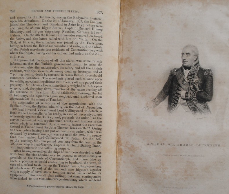
1837P2-2BLondon, Richard Bentley, 1837. 6 Volumes in-8° (213x133), percaline bleue éditeur, 404, 396, 376, 375 et 567 pp. Illustré de 24 portraits H.T et 27 plans dépliants, 38 plans de batailles dans le texte, dos un peu passés. Meilleure histoire navale de la fin du 18ème à la bataille de Navarin. 6 volumes, octavo (213x133mm), full contemporary cloth. 24 portraits, 38 battle-plans in the text, 28 folding tables. Spines a little sunned, mild shelf-wear, light toning, else a sound and handsome set. A “monument of accuracy – it has stood the test of time and remains the best account of the naval side of the Revolutionary and Napoleonic Wars. First conceived of when he was held prisoner in America during the War of 1812 the Naval History is a remarkable work. Working under the motto “Vérité sans peur” James set himself standards of inclusiveness and accuracy extraordinary for the 19th century. His aim was to compile “…an exact account of every operation of naval war during the period named.”
1898111111113294Government Printing Office 1898. Hardcover. Good. Government Printing Office; Washington 1898. Hardcover. A Good blue cloth binding with gilt lettering on front board and spine binding intact starting hinges handling/scuffing and some discoloration to boards bit frayed spine edges age toning to pages small abrasions to board corners rubbing along board edges sunned spine bit of scattered foxing to front and back matters mild musty odor without Dust wrapper. A good copy. 8vooctavo or approx. 6 x 9 inches 405pp. We pack securely and ship daily with delivery confirmation on every book. The picture on the listing page is of the actual book for sale. Additional Scans are available for any item please inquire. Government Printing Office hardcover
188217482New York: Leve & Alden's Publication Department 1882. Very good condition. Folding brochure with map of the St. Lawrence and Saguenay River and timetable with cover illustration of the river and with advertisement for Leve & Alden General Agents for the United States and list of ticket office locations. Yellow stock with black text. Descriptive text on points of interest along the route including Ha! Ha! Bay; with a Time Table commencing June 27 1882 "Until about September 10 1882" and listing departure times for the steamer "Saguenay" and "Union". With full page b&w map on the verso with the map of the Saguenay River at the top and below the map of the St. Lawrence "traversed by the Saguenay boats". The St. Lawrence route originates in Quebec and shows stops in Murray Bay Riviere du Loup and Tadousac. <br /> Lists Hon. Thomas McGreevy President Julien Chabot Manager and A. Gaboury Secretary of the Company. Folded 3 1/2 x 7 1/2". Unfolded 17 1/2 x 15". Very small area of loss at fold on lower map of St. Lawrence; short split at horizontal fold left edge o/w very good. Leve & Alden's Publication Department unknown
189677014Washington DC: U.S. Department of the Navy Bureau of Navigation Hydrographic Office 1896. Presumed First Edition First printing thus. Map. Good. This was published at the Hydrographic Office in Washington D.C. in February 1896. No. 1530. Charles D. Sigabee Commander U.S. N. Hydrographer. Format is approximately 26 inches by 17 inches folded. This map is disbound from Volume I of the Commercial Directory of the American Republics compiled by the Bureau of American Republics International Union of American Republics Joseph P. Smith Director 1897 Title page from Directory is present. Taped to top right of map in margin is the statement "This chart is intended solely to show tracks of steam vessels on the ocean and no authority is assumed for the boundary lines as drawn between the countries." Map has some color differentiation and several inserts presenting distance information between major ports of call. Map has been folded with approximately the top third folded down. It is also folded into four sections of different lengths to fit as the frontis to the Directory. Map has some wear and soiling/staining. This is similar to the large-scale and detailed World chart on Mercator's projection produced by the British Admiralty under the "Superintendence of Captain Wharton R.N. F.R.S Hydrographer" engraved by Edward Weller and sold by J. D. Potter chart agent. The map has no internal landmass detail unless relevant to steam ship routes thus the Suez and Panama canals are marked as is the Canadian Pacific Railway. Panels along the lower edge list major ports and give distances dependent on routes taken and average knots-per-hour speeds with daily distances covered in miles. The world's major ports are linked by ship-routes each track with its relevant distance and so on. An interesting chart at the time steam took over from sail. Charles Dwight Sigsbee 1845 - 1923 was a Rear Admiral in the United States Navy. In his earlier career he was a pioneering oceanographer and hydrographer. He is best remembered as the captain of the USS Maine which exploded in Havana harbor Cuba in 1898. U.S. Department of the Navy, Bureau of Navigation, Hydrographic Office unknown
1874TECH0652Bln., Ernst & Korn 1873 u. 1874. VI, 399 S.; VI, 415 S.; die beiden (Folio) Atlasbände enthalten die Tafeln XII - XXVII und IL - LVIII; HLdr. d. Zt. m. Buntpapierbezug u. vgldt. Rückentitelpräg., alle Bände berieben, leicht bestoß. mit Inst.-Stemp., hs. Einträge auf Vors. u. Tit., ein kl. Einriß am Innentit. v. Bd. 2. Handbuch der Wasserbaukunst. Zweiter Theil: Die Ströme. - Der Inhalt: Anordnung u. Ausführung der Strombauten. Stau-Anlagen. Vertiefung des Fahrwassers. Schiffsschleusen (Fortsetzung) u. eigentümliche Schiffsschleusen. Kanäle u. Eindeichungen.
1880103331880 PARIS, Ed. Hetzel et Cie - Sans date (1880 ?) - Bibliothèque d'Education et de Récréation - Grand in-8 - Reliure éditeur percaline rouge ornée - 1er plat illustré - 4ème plat orné - Toutes tranches dorées - Frontispice, illustrations NB HT de H. Meyer - 264 pages + catalogue éditeur in fine - Rousseurs sinon bon exemplaire
18971148581897 A Paris, Librairie Hachette, collection "Bibliothèque des écoles et des familles" - 1897 - In-4, cartonnage toilé décoré, premier plat estampé du sceau des Ecoles Communales de la Ville de Lyon, titre et fleurons dorés au dos - 347 pages - Ouvrage illustré de 52 gravures en N&B par A. Paris
1821235681821 Paris Vve Courcier 1821. In-8 XV 528pp. pleine basane fauve, dos lisse orné de filets et fleurons finement dorés,charnieres en partie fendues rel époque. Orné de 11 planches hors texte dépliantes dont 5 cartes des constellations. Bel exp complet de toutes ses planches. Polak 3605 pour l'édition de 1821.
1900149010Couverture souple. Broché. 240 pages. Couverture défraîchie.
1837A106726Lyon, J.F. Rolland 1837 364pp., à noter: les deux planches gravées manquent, Nouvelle édition corrigée et augmentée, 18cm., reliure cart. moderne, quelques rousseurs, dans l'état, A106726
18535771Paris Furne et Cie 1853 GRAND In-8 XI+550+542 pp, dos à 4 nerfs ornés de 3 fers dorés ; tome 1 : frontispice, 22 planches de gravures hors-texte, 1 carte couleur dépliante en fin de volume ; tome 2 : frontispice, 22 planches de gravures hors-texte dont une carte dépliante. épidermures avec très légers manques sur dos, coiffes et mors frottés sur les deux volumes, rousseurs éparses. Indes, Chine, Japon, Australie, Afrique, Amériques.
1870GITj073Paris Plon sans date ver 1870. Fort in-4 880pp imprimées sur 2 colonnes. Demi percaline chagrinée rouge, dos lisse orné de chaînettes et fleurons dorés, plats de papier chagriné rouge, reliure de l'époque. Orné d'un beau titre-frontispice, de nombreuses illustrations dans le texte et hors texte (comprises dans la pagination), 7 cartes (3 sur double page) et 1 plan. Quelques rousseurs. Exemplaire complet de son texte, des illustrations, cartes et du plan, reliure en bon état et solide.
190092265Couverture rigide. Reliure toile légèrement défraîchie. 320 pages. Papier bruni. 15 x 29 cm.