College, Atlantic ChristianBiblio.com
2 455 résultats
133492841X.Gpaperback. Good. Access codes and supplements are not guaranteed with used items. May be an ex-library book. paperback
1334950504.Gpaperback. Good. Access codes and supplements are not guaranteed with used items. May be an ex-library book. paperback
0428838421.Ghardcover. Good. Access codes and supplements are not guaranteed with used items. May be an ex-library book. hardcover
0483978345.Ghardcover. Good. Access codes and supplements are not guaranteed with used items. May be an ex-library book. hardcover
1334502803.Gpaperback. Good. Access codes and supplements are not guaranteed with used items. May be an ex-library book. paperback
1980029703Chambersburg PA: Kittochtinny Historical Society Library 1980. Book. Very Good. Original Wraps. First Thus. 4to - over 9¾" - 12" tall. Partial run of Franklin County Footnotes consisting of Vol. 1 No. 1 Jan.-Mar. 1980 through Vol. 4 No. 3 1983 complete excepting Vol. 1 No. 3 14 issues total. 144 103 113 64 pp. Issues show light to moderate handling wear with several showing vol/issue numbers in ink on front cover 4 issues signed by former owner on front cover. A bit of scattered internal soiling one or two issues with a few notations. Condition thus ranges Good to Near Fine averaging VG. Scarce. Kittochtinny Historical Society Library Paperback
1908015755Princeton NJ: Princeton University Library 1908. Book. Near Fine. Buckram. First Edition. 8vo - over 7¾" - 9¾" tall. Original text block newly recased in olive buckram gold foil title stamp on spine new endsheets text block edges slightly trimmed. xii295 pp. lacks frontis. engraving of Washington all other plates present. A few minor internal repairs to closed edge tears interior otherwise clean and bright. Durable reference copy. Scarce. Princeton University Library Hardcover
1926071075Lancaster and Philadelphia PA: Printed by Wickersham Printing Co. for Pennsylvania Society of Colonial Dames of America 1926. Book. Good. Hardcover. 1st Edition. 8vo - over 7¾" - 9¾" tall. Complete in four 4 volumes uniformly bound in light blue buckam lettered and with front-cover device in gilt untrimmed text block edges. Ex-library copy typically marked/stamped but did not circulate and thus showing fairly minimal actual wear. Spine panels tanned typical of issue most covers tanning toward edges a few with mild flecking or foxing. Firm bindings clean interiors beyond library marks. Vol. III issued in two parts thus 3 volumes in 4. xiii261 xii291 xiii218 xiv219-576 pp. Printed by Wickersham Printing Co. for Pennsylvania Society of Colonial Dames of America Hardcover
1927031435Philadelphia PA: Pennsylvania Society of the Colonial Dames of America 1927. Book. VG. Buckram. First Edition. 8vo - over 7¾" - 9¾" tall. Publications of the Pennsylvania Society of the Colonial Dames of America IV. Light blue buckram lettered and with front cover publisher's device in gilt deckled text block edges. Three volumes comprised by Vol. II Vol. III Parts I and II lacking Vol. I for completion. Vol. II spine panel slightly sunned Vol. III.I spine panel mildly tanned. Light surface rubbing/flecking to cloth. Firm bindings clean interiors beyond light foxing to a few blank prelims. and/or latter leaves. xii291 xiii218 xiv220-576 pp. illus. w/ b&w plates. Extremely scarce. Pennsylvania Society of the Colonial Dames of America Hardcover
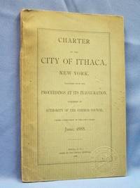
18888885Ithaca NY: Authority of the Common Council. Good. 1888. First Edition. Softcover. Scarce original Ithaca City Charter published in June 1888 when Ithaca was incorated as a city. CHAPTER 212 was approved by the Governor on May 2 1888 & became law 30 days later. 63pp 6pp index 16 pp "Inauguration Of A City Form Of Government In Ithaca New York". Seal of the City of Ithaca embossed on front cover. Green paper covers with black lettering. Text tight clean & intact. Cover wear at spine ends & top third of rear cover missing. Boundries officers Common Council streets highways & bridges fire department & miscellaneous provisions. New York ; 8vo 8" - 9" tall; 85 pages . Authority of the Common Council paperback
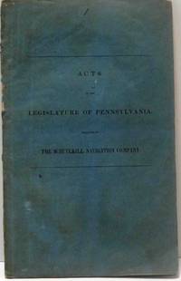
183816460Philadelphia: Joseph & William Kite. Good. 1838. First Edition. Hardcover. Blue paper covers with black title on front cover. Interior of booklet is tight clean & intact. Laws relative to the Schuylkill Navigation Company. Rubbed spine. Canal Pennsylvania ; 8vo 8" - 9" tall; 44 pages . Joseph & William Kite hardcover
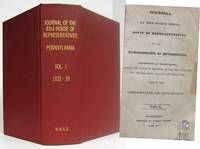
183216592Harrisburg PA: Printed By Henry Welsh. Very Good. 1832-33. First Edition. Hardcover. Rebound in clean red cloth with bright gilt title on spine. Volume 1. Interior of text is tight clean & intact. Interior of text is tight & intact. A few pages have a small damp stains. Title page and page three have small mended edge tears. Contents: Boroughs Bridges Canals Railroads and Turnpikes ; 8vo 8" - 9" tall; 1023 pages . Printed By Henry Welsh hardcover
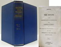
183316649Harrisburg:: Printed By Henry Welsh 1833-1834. Very Good. 1833-34. First Edition. Hardcover. Rebound in blue buckram cloth with gilt title on spine. Pages slightly age toned. First page has a few tiny edge chips. Text block is reinforced with green cloth tape. ; 8vo 8" - 9" tall; 657 pages . Printed By Henry Welsh (1833-1834) hardcover
1894022327Harrisburg PA: Clarence M. Busch State Printer 1894. Book. VG. Unbound. First Edition. Complete set of 23 maps complete as issued Nos. 1-16 19-25 2 additional as given housed in original marbled paper portfolio worn with repair. All maps issued in conjunction with Pennsylvania Archives 3rd Series Appendix I-X except as noted with numbers given as issued and as listed in MG 11 Map Collection of PA State Archives PHMC. All printed in color sizes ranging considerably several measuring 3' x 2' or larger. Most maps show clean fronts mildly soiled backs some showing minor separations at fold junctures typical of issue. 1-608 Die Gros-Britannische Colonie-Laender In Nord-America in accuraten Special-Mappen nach den Londone Originalien 608. 2-609 The London Land Company Survey by Thomas Fairman 1709. Copy 1764 of an Island in the river Delaware in Philadelphia County above the mouth of the Schuylkill. 3-610 John McCulloch's Land Survey situated on the East side of Monongahela River between Great Redstone and Dunlap's Creek by John Lukens 1769. Shows: Fort Bird Burd. 4-611 A Map of the State of Pennsylvania by Reading Howell 1792. Shows: county and township lines roads furnaces forges grist and saw mills Indian paths and towns minerals dwelling houses. 5-612 The London Land Company Resurvey in Chester County February 21 1736. Survey of lands said to be in New Castle County but found to be in Chester County. 6-613 "Coxburg" Survey "Notingham" Township Washington County January 25 1780. John Lukens Surveyor General. 7-614 Pennsylvania Land Company in London Survey September 12-15 1760. Survey for land lying on Conestoga Creek Lancaster County by John Lukens Surveyor General. 8-615 Peters Creek Mount Pleasant Washington County Survey May 7 1785. Survey to adjust title to unpatented lands in Monongahela Youghiogheny and Ohio Counties. 9-616 Manallin Township Fayette County Survey March 22 1785. Bazil Brown's survey on the waters of the Redstone and Dunlaps Creeks for adjusting the claims to unpatented lands in Monongahela Youghiogheny and Ohio Counties. 10-617 John Estaughand Company's Land situate on Conostogoe and the Mill Creek Chester County 1717. 11-618 7500 Acres on the Delaware River Bucks County Survey August 17 1699. Copy of original by Thomas Fairman Surveyor. Shows: Delaware River 20 miles above the Falls. 12-619 Tracts of Land called New Munster and Society December 13 1763. Shows: mill dwelling house Rankin's field. 13-620 Map of the British Colonies in the Year 1765 from a Map of the Period. Shows: Indian villages forts Philadelphia New Castle Delaware rivers falls mines. 14-621 London Land Company Survey August 19 1709 of 5000 Acres Chester County by Thomas Fairman Surveyor. 15-622 London Land Company Survey of 5000 Acres bounded by the "Scholkil and Perqueaming" Creek. Thomas Fairman Surveyor. 16-623 London Land Company Survey of 5000 Acres Chester County. Surveyed by Thomas Fairman August 19 1709. 17-18: Not issued. 19-624 Map of the Province of Pennsylvania.Servt W. Scull. Philadelphia Printed by James Nevil for the author April 4 1770. 20-625 A Map of Pennsylvania Exhibiting not only The Improved Parts of that Province but also Its Extensive Frontiers: Laid down from Actual Surveys and Chiefly from the Late Map of W. Scull Published in 1770. Shows: roads ferrys churches forts houses miles coal falls Indian villages. 21-626 A Map of the Provinces of New-York and New-Jersey with a part of Pennsylvania and the Province of Quebec from the Topographical Observations of C. J. Sauthier Augsburg 1777. 22-627 Regni Mexicani seu Novae Hispaniae Ludovicianae N. Angliae Carolinae Virginiae et Pensylvaniae nec mon Insviarvm Archipelagi Mexicani in America Septentrionali accurata Tabula exhibita a Joh. Baptista Homanno n.d. 23-628 A Map of the Improved Part of the Province of Pennsylvania in America. Begun by William Penn Proprie. Clarence M. Busch, State Printer unknown
1894022328Harrisburg PA: Clarence M. Busch State Printer 1894. Book. Very Good. Unbound. First Edition. Complete set of 23 maps complete as issued Nos. 1-16 19-25 2 additional as given housed in original marbled paper portfolio worn covers separated. All maps issued in conjunction with Pennsylvania Archives 3rd Series Appendix I-X except as noted with numbers given as issued and as listed in MG 11 Map Collection of PA State Archives PHMC. All printed in color sizes ranging considerably several measuring 3' x 2' or larger. Most maps show clean fronts mildly soiled backs some showing minor separations at fold junctures typical of issue. 1-608 Die Gros-Britannische Colonie-Laender In Nord-America in accuraten Special-Mappen nach den Londone Originalien 608. 2-609 The London Land Company Survey by Thomas Fairman 1709. Copy 1764 of an Island in the river Delaware in Philadelphia County above the mouth of the Schuylkill. 3-610 John McCulloch's Land Survey situated on the East side of Monongahela River between Great Redstone and Dunlap's Creek by John Lukens 1769. Shows: Fort Bird Burd. 4-611 A Map of the State of Pennsylvania by Reading Howell 1792. Shows: county and township lines roads furnaces forges grist and saw mills Indian paths and towns minerals dwelling houses. 5-612 The London Land Company Resurvey in Chester County February 21 1736. Survey of lands said to be in New Castle County but found to be in Chester County. 6-613 "Coxburg" Survey "Notingham" Township Washington County January 25 1780. John Lukens Surveyor General. 7-614 Pennsylvania Land Company in London Survey September 12-15 1760. Survey for land lying on Conestoga Creek Lancaster County by John Lukens Surveyor General. 8-615 Peters Creek Mount Pleasant Washington County Survey May 7 1785. Survey to adjust title to unpatented lands in Monongahela Youghiogheny and Ohio Counties. 9-616 Manallin Township Fayette County Survey March 22 1785. Bazil Brown's survey on the waters of the Redstone and Dunlaps Creeks for adjusting the claims to unpatented lands in Monongahela Youghiogheny and Ohio Counties. 10-617 John Estaughand Company's Land situate on Conostogoe and the Mill Creek Chester County 1717. 11-618 7500 Acres on the Delaware River Bucks County Survey August 17 1699. Copy of original by Thomas Fairman Surveyor. Shows: Delaware River 20 miles above the Falls. 12-619 Tracts of Land called New Munster and Society December 13 1763. Shows: mill dwelling house Rankin's field. 13-620 Map of the British Colonies in the Year 1765 from a Map of the Period. Shows: Indian villages forts Philadelphia New Castle Delaware rivers falls mines. 14-621 London Land Company Survey August 19 1709 of 5000 Acres Chester County by Thomas Fairman Surveyor. 15-622 London Land Company Survey of 5000 Acres bounded by the "Scholkil and Perqueaming" Creek. Thomas Fairman Surveyor. 16-623 London Land Company Survey of 5000 Acres Chester County. Surveyed by Thomas Fairman August 19 1709. 17-18: Not issued. 19-624 Map of the Province of Pennsylvania.Servt W. Scull. Philadelphia Printed by James Nevil for the author April 4 1770. 20-625 A Map of Pennsylvania Exhibiting not only The Improved Parts of that Province but also Its Extensive Frontiers: Laid down from Actual Surveys and Chiefly from the Late Map of W. Scull Published in 1770. Shows: roads ferrys churches forts houses miles coal falls Indian villages. 21-626 A Map of the Provinces of New-York and New-Jersey with a part of Pennsylvania and the Province of Quebec from the Topographical Observations of C. J. Sauthier Augsburg 1777. 22-627 Regni Mexicani seu Novae Hispaniae Ludovicianae N. Angliae Carolinae Virginiae et Pensylvaniae nec mon Insviarvm Archipelagi Mexicani in America Septentrionali accurata Tabula exhibita a Joh. Baptista Homanno n.d. 23-628 A Map of the Improved Part of the Province of Pennsylvania in America. Begun by William Penn Pr. Clarence M. Busch, State Printer unknown
0365709891.Ghardcover. Good. Access codes and supplements are not guaranteed with used items. May be an ex-library book. hardcover
0364458771.Ghardcover. Good. Access codes and supplements are not guaranteed with used items. May be an ex-library book. hardcover
188917253Chester Pennsylvania: Board of Trade. Very Good. 1889. First Edition. Hardcover. Clean blue cloth with gilt title on spine. Pictorial frontispiece. Engraved illustrations of locations and portraits. Two small mended bottom edge tears that do not interfere with text. Text Is tight clean and intact. Located on the west bank of the Delaware River. 99 pages including 31pages of advertisements. Pennsylvania ; 8vo 8" - 9" ; 99 pages . Board of Trade hardcover
0331931583.Ghardcover. Good. Access codes and supplements are not guaranteed with used items. May be an ex-library book. hardcover
0331931575.Gpaperback. Good. Access codes and supplements are not guaranteed with used items. May be an ex-library book. paperback
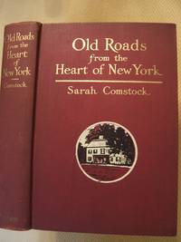
1915014968New York and London: G. P. Putnam's Sons 1915. Very Good condition. A bright clean square tight copy see photos. Sharp corners. Inner hinges are perfectly sound. NO owner's name or bookplate. Pages are fresh and crisp. NO underlining. NO highlighting. NO margin notes. Top edge gilt. Bound in the original maroon cloth. NO fading. Gilt stamping on the spine and front cover is still bright and shiny. With 100 illustrations by the Author and others. First printing with 1915 printed on both the title and copyright pages and NO indication of any other printing. Frontispiece is a tissue-guarded photo of The Kitchen in Washington's Headquarters at Morristown New Jersey. Bound-in at the back are two folding maps. The first is a Map of the Country Thirty Miles Around New York Showing Railroads and Trolley Lines Leading to Places of Historical Interest unfolds to 15.5" wide by 15.5" tall. The second is a facsimile of a similar map from 1828 Map of the Country Thirty Miles Around unfolds to 15" wide by 10" tall. Bibliography. Index. First Edition. Hardcover. Very Good condition/No jacket. 8vo. 401pp. G. P. Putnam's Sons Hardcover
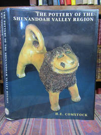
1994055054<p>Winston-Salem North Carolina: Museum of Early Southern 1994. 1st Edition . Hardcover. Very Good/Very Good. 4to - over 9¾ - 12" tall. Quarto. xiv 538 pages indexed. INSCRIBED AND SIGNED BY THE AUTHOR on the title page. Hardcover with a black and brown pictorial dust jacket. Light to moderate wear to the jacket which is a little bumped about the edges. The fore edge of the text block is smudged or thumbed. The text of the book appears generally clean. Signed and inscribed by the author to a North Carolina antiques dealer and dated 12/08/94. Illustrated with both black and white photos and with color photos. Laid in loosely are a few photocopied pages pertaining to Marie Rogers pottery. <br /><br /></p> Museum of Early Southern hardcover
1974x-0837170508Praeger Pub Text 1974. Hardcover. New. 145 pages. 8.70x5.80x0.60 inches. Praeger Pub Text hardcover
1920215883Harrisburg PA: Department of Labor 1920. Book. Good Minus. Hardcover. Probable First Edition. 8vo - over 7¾ - 9¾" tall. This directory is divided into four main parts: Part I - Industrial establishments classified by product and alphabetically arranged; Part II - Industrial establishments classified by counties and alphabetically arranged by cities and towns with brief resume of the industrial resources of each county; Part III - Boards of Trade Chambers of commerce Business men's manufacturers; and miscellaneous associations with location and names of officers; Part IV - Labor organizations officers and unions. Complete Index covering each subject or item of interest. Hardback - green cloth with gilt lettering on spine only no dust jacket. 1212 pages. Book Condition : Good-; pages are very lightly aged and clean for the most part with just a few small spots / stains. No markings a bit of light creasing no tears but there are a few small edge nicks. Text block is lightly soiled. Cover has rubbing and chipping. Wear and chipping to edges especially the spine tearing to spine ends dent to top front edge. Hinges are intact and binding is tight. Department of Labor Hardcover
197116142Greencastle Pa.: Robson & Kaye Inc. Near Fine. 1971. First Edition. Hardcover. Clean brown cloth has black titles on spine & front cover. Inscribed copy. Text's interior is tight clean & intact. B/W photograph illustrations. History of this part of the Cumberland Valley. The cronology of a community that has come a long way since the frontier days. Pennsylvania; B/W Photograph Illustrations; 8vo 8" - 9" tall; 233 pages . Robson & Kaye Inc. hardcover