443 résultats
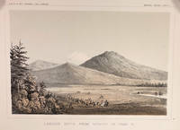
185714424Washington DC: A. O. P. Nicholson Printer 1857. First Edition. Very Good. 8.25x11in Four litho tinted illustrated plates I II VIII and XII; Some age-toning along edges one with large stain along right edge not affecting neatline of illustration. These plates are from from Volume VI of the quarto edition of twelve volumes were published from 1855 to 1861 as exploration and survey reports became available. These volumes contained not only the survey maps and elevations but a monumental collection of scientific reports on geography geology zoology botany and ethnology of the Native American tribes. The surveys also included 11 artists to record the landscape and indigenous peoples of the west. <br /> <br /> The plates were drawn in 1855 by John J. Young 1830-1879 a staff artist for the War Department. He was assigned in 1855 as a draftsman for the Lt. Williamson railway survey to connect California's Sacramento Valley with Oregon's Columbia River.Young's views of the Cascade Range included 14 landscape scenes one geologic scene and 10 drawings of trees in there habitat from Samuels p 545 <br /> <br /> The Illustrations are: Plate 1 - Lassens Butte From Vicinity of Camp 18 Plate II Mouth of Fall River near Camp 20 Plate VIII Canon of Psuc-See-Que Creek near Camp 41A Plate XII Shasta Butte and Shasta Valley from a point near Camp 70A.<br /> <br /> The twelve volumes were disorganized in publication with no overall all arrangement or indexing. Some of the plates and maps referred to in volumes were published in other volumes various reports were also published out of sequence relating to the four routes. Preliminary reports published were updated in latter volumes. From Wagner-Becker-Camp In 1853 Senator Gwin of California lead the inclusion of Congressional funding for 1853-54 of a series of surveys to determine the best and most economical railroad routes from the Mississippi River to the Pacific coast. The act directed the Secretary of War Jefferson Davis to plan and direct Army topographical engineers to conduct surveys of four routes. The first was between the 47th and 49th parallels generally along the Lewis and Clark route to the Pacific. The Second route between the 37th and 39th parallels was promoted by Senator Thomas Hart Benton of Missouri. The Third route was along the 35th parallel. The Fourth route was promoted by Secretary Davis along the 32nd parallel that followed Emory's 1846-47 reconnaissance. A. O. P. Nicholson, Printer unknown
1850DEMO014460IPhiladelphia: Printed by C. Sherman 1850. Popular Edition. Hardcover. Good. 64 excellent steel-plate engravings with 12 of 13 maps Samoa map apparently never inserted many vignettes and woodcuts. Octavos half brown calf blue marbled boards edges and endpapers; vol. 1 rebacked retaining original back and leather labels scuffing and wear to other spines corners worn. <br/><br/>Wilkes' expedition was the first American scientific exploring expedition by sea voyage. His six ships sailed south around South America along Antarctica causing Wilkes to decide that Antarctica was indeed a separate continent. Other stops were at the Pacific islands of Tahiti the Samoas Australia and New Zealand. Maps of Tahiti & Australia and New South Wales Along the way they charted the coasts of California Washington and Oregon. Howes W414; Palau 375505; Sabin 103994 note; see Cowan p.683; Taylor PACIFIC BIBLIOGRAPHY p.13. "Wilkes' spectacular Antarctic and South Sea explorations - Goetzmann ARMY EXPLORATION IN THE . WEST p.61" 64 excellent steel-plate engravings many vignettes and woodcuts. Unlike the 1844 edition the following Sherman editions did not have a 6th volume - the Atlas but have 3 Tables and 11 maps Printed by C. Sherman hardcover
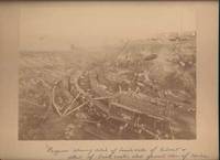
190042650Miles City Montana: Wiley Bros. Photographers Successors to L. A. Huffman 1900. Photograph. Very Good. Large format photograph 18.5 x 24 cm on a tan mount 25 x 30 cm. Wiley Bros. backstamp "Wiley Bros. Photographers Successors to L. A. Huffman. Miles City - Montana.". Mount edges are lightly bumped and chipped. Photograph is gently rubbed and lightly faded but still showing good detail and contrast. Shows many workers constructing the bridge with Northern Pacific Railroad cars visible in the background. Photograph taken from above looking down. In ink by hand on the front of the mount "Progress showing detail of bench walls of Culvert detail of brick arch; also general view of Coulee Bridge 148. Yellowstone Riv. River. Wiley Bros., Photographers, Successors to L. A. Huffman unknown
190051798Chicago: Curt Teich & Co. for the Van Noy Inter-State Co 1900. Oblong 4to unpaginated; 25 full-pg illustrations in color and mounted two pages of text containing illustration descriptions; tan pictorial wrappers lettered in black & gilt color illustration mounted on upper cover ribbon-bound; covers a bit toned at edges corners creased illustrations clean & bright overall very good. A picturesque view-book of "the most interesting views seen along the route" of Utah Nevada and California. <br/><br/> Curt Teich & Co. for the Van Noy Inter-State Co unknown books
18451309560London, J. Murray, 1845. 10, 482 S., 32 S. Anzeigen, 1 lithograph. Faltkarte (69 x 49 cm) in Kartentasche im Hinterdeckel). OLwd m. goldgeprägtem Rückentitel (Rücken verblichen, Vorderdeckel bleichfleckig, innen gering gebräunt).
1900VF231971900 26, 6 p., 3, 1 pls, disbound (no covers). Published in: Rec. Australian Museum.We added from the same journal: Waits, 1899. Stegostoma tigrinum. An addition to the Fauna of NSW (2 p.) / Ogilby, 1893. New Pelagic Fish New Zealand & Revieuw Genus Scheophilus (10 p.) & McCulloch, 1926. Studies in Australian Fishes. No. 8 (11 p., 1 plate).
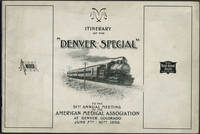
189824652American Medical Association 1898. Wraps. Very good condition. Unrecorded guide to the railway trip and preliminary program for the 1898 American Medical Association meeting in Denver by way of the Wabash Railroad St. Louis to Kansas City and the Chicago Rock Island & Pacific Railway Kansas City to Denver.<br /> <br /> The guide includes description of the train accommodations round trip fare St. Louis to Denver $26.50 special cars the train schedule with illustration of the new Union Station in St. Louis a preliminary program of meeting events and points of interest including the trans Mississippi and International Exposition in Omaha.<br /> <br /> Oblong 8vo 10 x 7" 26pp. Printed pictorial paper wrappers with route of Denver Special at rear wrapper. Front wrapper faintly dusty; bright and clean copy. American Medical Association unknown
1879PHO-2277Paris, Hetzel et Cie, s.d. [1879]. In-4° de VI, [2], 464 pp. 51 dessins par P. Philippoteaux. 66 fac-similé‚ et cartes par Matthis et Morieu. Demi-chagrin bleu, dos à 4 faux-nerfs orné, titre doré, tranches mouchetées rouges. (Reliure de l'époque). Quelques rousseurs. Bel ex. Ouvrage historique et géographique, réalisé en collaboration
1882139451882 P., Hachette et Cie, 1888, 1 vol. in-18 (184 x 112 mm) reliure à la Bradel du temps pleine toile verte, pièce de titre en maroquin marron, fleuron, date et double filet en pied doré au dos, de (2) ff. (faux-titre et titre) - 386 pp.Petite tache à la pièce de titre, petite déchirure sans manque à la carte dépliante, bel exemplaire.
1840LBW-3642[1840]. 220 x 291 mm.
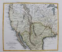
1861M9549New York: Thomas Ford c.1861. Very Good. Notes: Detailed map of the western United States and Mexico. Size : 180x208 mm 7.09x8.19 Inches Coloring: Hand Colored Category: Maps Central America Mexico; Maps United States; Thomas Ford unknown
1861M9550New York: Thomas Ford c.1861. Very Good. Notes: Map of the Western United States. Size : 178x205 mm 7.01x8.07 Inches Coloring: Hand Colored Category: Maps United States West; Thomas Ford unknown
1859013021San Francisco: Towne & Bacon 1859. Small faded ink stamp on front wrapper and an old ink accession number. Contained in a cloth clamshell box with a printed paper label. First Edition. Original Printed Wrappers. Very Good. Towne & Bacon Paperback
1856120572Washington D. C. A. O. P. : Nicholson Printer 1854-1856 1856. First Edition. Hardback. Very good copy in the original gilt-blocked cloth. Professionally recased with the original spine laid back; very impressively finished. Remains particularly well-preserved overall; tight bright clean and strong. Scans and additional detail on request. ; 1 pages; Physical desc. : 1 vol. various pagings : ill ; 30 cm. Subjects; Natural history - West U. S. . Indians of North America - West U. S. . Geology - California. Washington, D. C. , A. O. P. : Nicholson, Printer [1854-1856] hardcover
1869ZB386909Washington 1869. 40th Cong. 3rd Sess. Senate Rep Committee No. 219 3 pp. ex library good. - If you are reading this this item is actually physically in our stock and ready for shipment once ordered. We are not bookjackers. Buyer is responsible for any additional duties taxes or fees required by recipient's country. Washington unknown
1884WRCAM23845New York 1884. 27pp. plus large folding map. Original printed wrappers. Some minor edge nicks and chips to front wrapper else just about very good. Annual stockholder's report for the famous western railway. With detailed financial statement and other statistics relative to western lands etc. Total surplus earnings for 1883 topped $12700000. The handsome and quite large folding map of the United States west of the Mississippi shows the Union Pacific Route and its connections. unknown books
1885403740Washington D. C.: Government Printing Office 1885. 8vo. 21 pp. Disbound. FIRST EDITION. <br/><br/> [Government Printing Office] unknown books
18831423347TH Cong. 2d Sess. HED94. 1883. 19pp. Disbound. Light wear Good. unknown books
18671393540TH Cong. 2d Sess.: HED31. 1867. 9pp Disbound Very Good. HED31. unknown books
18681392740TH Cong. 3d Sess. SED4. 1868. 12 4 pp. Disbound. Very Good. unknown books
18661665939th Cong. 1st Sess.: SED14. 1866. 17 1 blank pp disbound. Very Good. SED14. unknown books
1868403801New York: Union Pacific Railroad 1868. 8vo. 40 pp. Frontispiece map additional engraved title. Original gilt-lettered cloth backed with linen. Lightly worn text slightly soiled. Provenance: S. P. Windmuller New York inkstamp on title; Arthur Elton bookplate. FIRST EDITION stated "Pamphlet Edition". Warren Heckrotte notes that "This report is celebratory - they're not finished building but there's no doubt they will be finished in a years time" and briefly discusses the " Map of the Union Pacific Railroad and its Connection" 10.5x19 cm: "The solid line from Omaha stops about at the border of Wyoming and Utah and from there to Sacramento the black line is shown with white dots. It runs north of Great Salt Lake. The point where the Union Pacific and the Central Pacific will meet is left undetermined. A branch represented by a dotted line runs to Puget Sound. This is briefly discussed and there is a separate report by Gen. Dodge on this possible branch." <br/><br/> Union Pacific Railroad hardcover books
1885403742Omaha: The Republican Printers 1885. 8vo. 64 pp. Wood-engravings in text. Original blue printed wrappers the rear wrapper with full-panel map by Matthews Northrup & Co. Buffalo. Niagara Falls ticket seller's ink advertisement stamp on front wrapper light toning at edges. FIRST EDITION. Jones Checklist 1637; Streeter sale VI:3395. <br/><br/> The Republican Printers unknown books
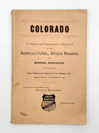
1889403718Chicago: Rand McNally & Co 1889. 8vo. 91 pp. Original salmon printed wrappers. Light wear. Second edition. The wrapper title is: 'Colorado. A Complete and Comprehensive Description of the Agricultural Stock Raising and Mineral Resources of Colorado; Also Statistics in Regard to its Climate Etc. Compiled from the Latest Reports of 1868.' Printed on the inner front wrapper is a map of the Union Pacific Overland Route from the Pacific Ocean in the West to Omaha in the East. <br/><br/> Rand, McNally & Co unknown books
1878WRCAM26334Washington 1878. 235pp. Modern half morocco and marbled boards by Sangorski & Sutcliffe. Very good. Detailed correspondence relating to a controversy stemming from the rates charged by the Union Pacific for transporting the Second Infantry to the west coast. The troops were destined to suppress an Indian outbreak in Oregon. hardcover books