Canadian Pacific RailwayBiblio.com
133 résultats
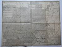
1874M7548Montreal: Canadian Pacific Railway 1874. Very Good; laid down on acid-free tissue paper for long-term preservation. Notes: A very important and early working map of Alberta and British Columbia depicting existing and suggested railways.<br>There is a note written in period ink in the lower margin in reference to a contemporary marking of newly suggested routes in black ink:<br><br>"Note -- The Surveys made since the publication of the Report & Maps of 1874 shew the routes colored full black line and thus broken black line to be the best lines for railway construction that have been found to this date Oct 1875. Mr. Smith".<br><br>"Mr. Smith" is believed to be Donald A. Smith a major partner in the yet-to-be incorporated Canadian Pacific Railway Company in 1881. <br><br>The routes marked out in red as printed depict potential lines crossing the Rockies to the west of Edmonton at Yellowhead Pass. Almost none of the suggested routes depicted on this map were eventually used--CPR dismissed the use of Yellowhead Pass for a pass farther south in order to discourage competition from railway lines south of the border. They chose instead Kicking Horse Pass which is depicted on this map. Size : 608x779 mm 23.94x30.67 Inches Coloring: Hand Colored Category: Maps Railroad; Maps Canada West British Columbia;Maps Canada West Alberta; Canadian Pacific Railway unknown
185275869Oregon City: Surveyor General's Office 1852. First edition. 15 3/4 x 26 inches. Printed in various shades of green blue red and black. Some light toning long fold-lines else a very good map of a vastly underpopulated Territory.The map above shows the surveyed portion of the Oregon Territory as of October 21 1852. It was prepared by John B. Preston first surveyor general of Oregon."With the establishment of the Oregon Territory on August 14 1848 all grants of claims of land in the territory were nullified. It was not until the passage of the Donation Land Act on September 27 1850 that new provisions were made for acquiring unclaimed land to be based upon government surveys. John B. Preston was appointed first surveyor general of Oregon where he arrived on April 20 1851. On June 7 1851 Preston drove the “starting stake†for the base surveys of the territory at what is today known as the Willamette Stone. The east-west Willamette Base Line and the north-south Willamette Meridian still define surveying and legal land descriptions in Oregon and Washington state.Preston and his crew were able to carry out their surveying and mapping to the extent depicted on this map in just over one year. Each square of the grid termed a section is one mile on each side and includes 640 acres of land—the maximum acreage allowed for a married couple making a claim under the Donation Land Act; a single man could claim up to 320 acres. Thirty-six sections make up a township.The surveyors took careful note of waterways hills prairies and roads. Some recognizable places are already viable communities such as Salem and Lafayette; other communities of the period—Champoeg Fairfield Cincinnati for example—have vanished as meaningful places. All three of those were river landings that were affected by floods channel changes and the eventual disappearance of river transportation. Notably absent from the map is Mission Bottom or Mission Landing the by-then-abandoned site of the Methodist mission of the 1830s and St. Paul on French Prairie. The roads that are mapped include ancient routes such as the California-Oregon Trail which had sections that paralleled both sides of the valley as well as newer roads established in recent years. The roads converging on Salem from the outlying farming districts for instance reflect its recent importance as a mill town powered by the waters of Mill Creek Surveyor General's Office unknown
1887009783Chicago: Rand McNally & Co./ Matthews Northrup & Company Engravers & Printers Buffalo NY 1887. Book. Very Good. Single Sheet Folded. 33 3/4" x 27 1/2". Corrected up to Apr. 1 1887 inset at upper left. Single Sheet Folded 33 3/4" x 27 1/2" entire verso contains - "Map showing land grant of the Northern Pacific Railroad Co. in eastern Washington and northern Idaho" with inset map showing "Northern Pacific Railroad System" . Sheet folded to 17 3/8" x 13 3/4" with additional folds making it 8 7/8" x 4 3/4" to fit in a pocket. Recto titled - "Sectional Map Showing the Lands of Northern Pacific Railroad Co. In Eastern Washington and Northern Idaho with Condensed Information Relating to the Northern Pacific Country" - contains printed information on the Pacific Northwest company advertising and a smaller map 10 3/4" x 8 1/2" of "Washington Oregon & Northern Idaho" by Rand McNally. Very Good small tears and a few small holes at creases. RARE OCLC locates three libraries with holdings of this 1887 map - U. of Calif Berkeley U. of Missouri St. Louis and Washington State Library. There was one earlier version corrected up to January 1 1886 one of which most recently seen at an auction in 2007. Rand McNally & Co./ Matthews, Northrup & Company Engravers & Printers , Buffalo, NY unknown
1848DEMO015918IGand / Ghent: Chez Ve Vander Schelden 1848. First Belgian edition. Hardcover. Very Good. Small octavo 589 pages contemporary full green sheep extra gilt aeg scuffed. Inked presentation in 1912 from Rev. Francis J. Harbe: Harbe died in 1913 at age 37 in San Antonio Texas. He may have acquired this when a seminarian at Belgium in 1900. <br/><br/>Howes D286; Graff 3826; Field 1425; Sabin 82266; Smith 9549; Strathern 511:iii. "This edition seems to have been prepared by the author himself. It contains more material than the edition in English "Oregon Missions" the illustrations are different and the three maps are entirely new - Sabin 82265." It has several additional letters and an Appendix pp. 360 - 378. "Origine des Americains." Contains Fr. De Smet's description of his travels through and about the central Columbia River Plateau . he continued . to the Fort Vancouver by way of Fort Colville -- Wagner-Cam-Becker 141.2." Contains 16 plates including the pictorial title-age and 3 folding maps. Chez Ve Vander Schelden hardcover
1848DEMO015778IParis & Lyon: Librairie de Poussielgue-Rusand 1848. First French edition. Hardcover. Very Good. lithographs. 12mo 408 pages quarter red calf marbled boards lacks half-title. Ex libris Francis Reynolds Dickinson. <br/><br/>Howes D286; Graff 3826; Field 1425; Sabin 82266; Smith 9549; Strathern 511:iii "Contains Father Smet's description of his travels through and about the central Columbia River plateau . he continued . to the country of the Assiniboines and arrived at Fort Augusta . He returned to Fort Vancouver by way of Fort Colville -- Wagner- Camp - Becker 141:3." Contains only 8 trimmed of its 13 chromolithographed plates lacking also its illustrated half-title. Librairie de Poussielgue-Rusand hardcover
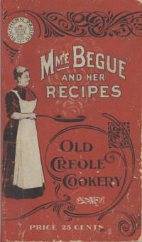
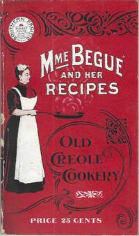
19006878San Francisco; Chicago: Southern Pacific Railroad; Printed by Poole Bros 1900. Duodecimo-size booklet 14.75 x 8.5 cm. 80 pages. Blue and brown ink on pink paper. Two photographic portraits Monsieur and Madame Bégué. Illustrations. List of railway agents. Title from cover. In logo at head of title: Southern Pacific Sunset Route. ~ Evident FIRST EDITION. A souvenir anthology of writings including sixty recipes from two landmark New Orleans restaurants offered for sale to customers traveling the Sunset Route San Francisco–New Orleans by the Southern Pacific Railroad Company. A sampling: Mutton Feet à la Créole Liver à la Bégué Jambalaya of Chicken Codish with White Beans Bisque of Crayfish Creamed Cauliflower Onion Salad Eggplant with Rice and Ham Mayonaise of Celery and Shrimps Pineapple with White Wine. ~ The title displayed on the wrappers is misleading: the atmospheric essays and testimonials – arranged by a literary journalist who contributed to Southern Pacific's promotional magazine Sunset Henry Monroe Mayo 1868-1950 – reveal little regarding the eponymous originator of the recipes or the history of the cuisine that brought her fame. Only pages 47-68 contain recipes by Elizabeth née Elisabetha Kettenring Dutreuil Bégué 1831-1906 the proprietary chef of the beloved restaurant in the Vieux Carré – the second oldest such establishment in New Orleans – located on the Rue de la Levée Decatur Street after 1870 downriver from Jackson Square and across from the French Market. An immigrant from southern Germany she had opened a coffee shop with her husband Louis Dutreuil in 1863. After his death in 1875 she married again and with her second husband Hippolyte Bégué 1842-1917 reopened in the same location with the aim of serving one meal per day – a “second breakfast†beginning at 11:00 a.m. – to accommodate laborers in the meat markets and on the docks who started work at dawn. A fuller history by David Shields is available in his The Culinarians Chicago: University or Chicago Press 2017 pages 270-273. By the mid-1880s trade fairs held in the city were bringing tourists as well and Bégué’s became a destination on its own. Madame Bégué died in 1906. The restaurant continued under management of her daughter but was sold in 1914 to relatives of the family Tujague competitors since 1856 on Decatur Street a few doors away. ~ A shorter tribute with recipes pages 69-74 is accorded another restaurateur presumably Victor Béro d. 1904 an immigrant from Belgium who had presided over Victor's Restaurant since 1873. Mayo appears to confuse the "Monsieur Victor" of his time with the founder and namesake of the establishment Victor Martin 1812-1865; cf. Shields page 136 445. ~ The Sunset Route of the Southern Pacific Company was the southernmost of the transport lines to the West Coast originally contemplated by the series of Pacific Railroad Acts between 1862 and 1866. Of the resulting publicly subsidized corporate consortia that would transform western North America – known collectively as the transcontinental railroads – Southern Pacific was already a mammoth system in 1900 including smaller subsidiaries such as the Texas and New Orleans Railroad and extending across territories that would later become New Mexico and Arizona as well as northwards through Nevada Utah and much of California. The in-house Sunset magazine appears to have been printed close to headquarters in San Francisco but like many publications issued by the transportation industry Mme. Bégué and Her Recipes was printed by Poole Brothers of Chicago who advertised as "railway printers" and also produced tickets brochures and mileage tables. ~ A few pages dog-eared. Very good in publisher's red wrappers decorated in black and white with an image of Madame Chef in kitchen apron. Rare. OCLC locates thirteen copies; Uhler 28; New Orleans Culinary History Group page 13; not in Bitting Brown or Cagle. Southern Pacific Railroad]; [Printed by] Poole Bros unknown
190010228San Francisco; Chicago: Southern Pacific Railroad; Printed by Poole Bros 1900. Duodecimo-size booklet 14.75 x 8.5 cm. 80 pages. Blue and brown ink on pink paper. Two photographic portraits Monsieur and Madame Bégué. Illustrations. List of railway agents. Title from cover. In logo at head of title: Southern Pacific Sunset Route. ~ Evident FIRST EDITION. A souvenir anthology of writings including sixty recipes from two landmark New Orleans restaurants offered for sale to customers traveling the Sunset Route San Francisco–New Orleans by the Southern Pacific Railroad Company. A sampling: Mutton Feet à la Créole Liver à la Bégué Jambalaya of Chicken Codish with White Beans Bisque of Crayfish Creamed Cauliflower Onion Salad Eggplant with Rice and Ham Mayonaise of Celery and Shrimps Pineapple with White Wine. ~ The title displayed on the wrappers is misleading: the atmospheric essays and testimonials – arranged by a literary journalist who contributed to Southern Pacific's promotional magazine Sunset Henry Monroe Mayo 1868-1950 – reveal little regarding the eponymous originator of the recipes or the history of the cuisine that brought her fame. Only pages 47-68 contain recipes by Elizabeth née Elisabetha Kettenring Dutreuil Bégué 1831-1906 the proprietary chef of the beloved restaurant in the Vieux Carré – the second oldest such establishment in New Orleans – located on the Rue de la Levée Decatur Street after 1870 downriver from Jackson Square and across from the French Market. An immigrant from southern Germany she had opened a coffee shop with her husband Louis Dutreuil in 1863. After his death in 1875 she married again and with her second husband Hippolyte Bégué 1842-1917 reopened in the same location with the aim of serving one meal per day – a “second breakfast†beginning at 11:00 a.m. – to accommodate laborers in the meat markets and on the docks who started work at dawn. A fuller history by David Shields is available in his The Culinarians Chicago: University or Chicago Press 2017 pages 270-273. By the mid-1880s trade fairs held in the city were bringing tourists as well and Bégué’s became a destination on its own. Madame Bégué died in 1906. The restaurant continued under management of her daughter but was sold in 1914 to relatives of the family Tujague competitors since 1856 on Decatur Street a few doors away. ~ A shorter tribute with recipes pages 69-74 is accorded another restaurateur presumably Victor Béro d. 1904 an immigrant from Belgium who had presided over Victor's Restaurant since 1873. Mayo appears to confuse the "Monsieur Victor" of his time with the founder and namesake of the establishment Victor Martin 1812-1865; cf. Shields page 136 445. ~ The Sunset Route of the Southern Pacific Company was the southernmost of the transport lines to the West Coast originally contemplated by the series of Pacific Railroad Acts between 1862 and 1866. Of the resulting publicly subsidized corporate consortia that would transform western North America – known collectively as the transcontinental railroads – Southern Pacific was already a mammoth system in 1900 including smaller subsidiaries such as the Texas and New Orleans Railroad and extending across territories that would later become New Mexico and Arizona as well as northwards through Nevada Utah and much of California. The in-house Sunset magazine appears to have been printed close to headquarters in San Francisco but like many publications issued by the transportation industry Mme. Bégué and Her Recipes was printed by Poole Brothers of Chicago who advertised as "railway printers" and also produced tickets brochures and mileage tables. ~ Internally clean and sound; in publisher's red wrappers decorated in black and white with an image of Madame Chef in kitchen apron. Wrappers with some rubbing and two small chips to the spine Near very good. Rare. OCLC locates thirteen copies; Uhler 28; New Orleans Culinary History Group page 13; not in Bitting Brown or Cagle. Southern Pacific Railroad]; [Printed by] Poole Bros unknown
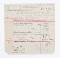
1883108441Montreal 1883. receipt. Invoice to the Canadian Pacific Railway dated 9th May 1883 for hose couplings and oil cups. approximately 21 X 21 CM folded twice. Several tears along folds. Several stamps with signature or initials on front and note in ink on verso signed and dated by F. G. Shaughnessey. Thomas George Shaughnessy 1853-1923 1st Baron Shaughnessy was president of the Canadin Pacific railway from 1899-1918. 1883 unknown
1850DEMO014460IPhiladelphia: Printed by C. Sherman 1850. Popular Edition. Hardcover. Good. 64 excellent steel-plate engravings with 12 of 13 maps Samoa map apparently never inserted many vignettes and woodcuts. Octavos half brown calf blue marbled boards edges and endpapers; vol. 1 rebacked retaining original back and leather labels scuffing and wear to other spines corners worn. <br/><br/>Wilkes' expedition was the first American scientific exploring expedition by sea voyage. His six ships sailed south around South America along Antarctica causing Wilkes to decide that Antarctica was indeed a separate continent. Other stops were at the Pacific islands of Tahiti the Samoas Australia and New Zealand. Maps of Tahiti & Australia and New South Wales Along the way they charted the coasts of California Washington and Oregon. Howes W414; Palau 375505; Sabin 103994 note; see Cowan p.683; Taylor PACIFIC BIBLIOGRAPHY p.13. "Wilkes' spectacular Antarctic and South Sea explorations - Goetzmann ARMY EXPLORATION IN THE . WEST p.61" 64 excellent steel-plate engravings many vignettes and woodcuts. Unlike the 1844 edition the following Sherman editions did not have a 6th volume - the Atlas but have 3 Tables and 11 maps Printed by C. Sherman hardcover
18851099Chicago: Geo. F. Cram 1885. Good plus. Large folding pamphlet approximately 20 x 41.5 inches. A few small chips and short closed tears at edges; several short separations and very minor losses along folds. Contemporary agent's ink stamp on cover panel. Tape repair across portion of horizontal fold; one panel with patches of light staining. A scarce colorful promotional for the Rock Island Route as well as its national and international connections with a fascinating stamp of an Australian sales agent. One side of the sheet prints an extensive promotional text and timetables for the various routes and services of the Chicago Rock Island & Pacific Railway. The main side of the sheet prints a map of the United States with state borders shaded in four colors highlighting the principal routes of the Rock Island from Chicago to Minnesota Iowa and Kansas and its connections to points on both the East and West Coasts. An inset map at lower right promotes the Rock Island as part of a transcontinental route between the United Kingdom Ireland and Australia. Most interestingly this copy is stamped on the cover panel with the information of a George. H. Hibbard "Australian Passenger Agent America's Cons'd Trans-continental Railways 6 Bridge Street Sydney N.S.W." Hibbard was evidently the agent in charge of distributing information about the trans-America route in Sydney one of its end points.<br /> <br /> Several issues of this map were published during the 1880s all scarce. We locate copies of the present 1885 issue at Stanford SMU and the Library of Congress. Geo. F. Cram unknown
19002716ml1900. Soft Cover. Good. Gd. condition : Gay Literature . A mag to match the movie . . L6a paperback
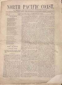
188035140New Tacoma W.T.: North Pacific Coast Publishing Company 1880. Newspaper. Fair. Newspaper. Pages 33-48. Pages are separated and detached. Front page has a corner chip with slight loss of print both sides. Edge wear and small tears to the fragile paper. <br /> <br /> Contents include North Pacific Exploration; The Chehalis and the Willapa; Opportunities for Settlers; The Ascent of Takhoma and more. Fair condition. Territorial imprint. North Pacific Coast Publishing Company unknown
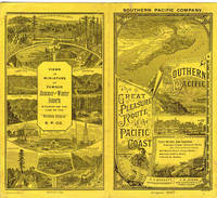
188741282N. P.: Crocker & Co. 1887. 1887. RAILROAD CALIFORNIA. First edition. 6 1/4" x 13 3/4" goldenrod colored paper folds to 6 1/4" x 3 3/8" two-sided eight panel timetable with exquisite scenes a map and train schedules for the Northern California lines of the railroad. The timetable has engraved vignettes and ornate lettering by E. Schultze. This is an attractive museum quality timetable and one of the rarest and finest early Southern Pacific railroad pieces that we have handled. It's in near fine condition and 130 years old. Crocker & Co., 1887. unknown
187031135Springfield Mo. 1870. Stitched in original printed wrappers. 41 1 blank pp. Very Good.<br /> <br /> The opening is "a great event in the history of St. Louis and of the State of Missouri.The South Pacific Railroad has burst through upon the prairies of Southwest Missouri and has welded its western terminus upon the rails of the Atlantic and Pacific Railroad. This latter road is going to the Pacific coast as rapidly as it is possible to construct a road in this day of rapid railroad building." The pamphlet describes "the celebration" including speeches and festivities; the route; and the many exciting possibilities the Road will create for the State and Nation.<br /> BRE 175 4 locations. Sabin 57393. unknown
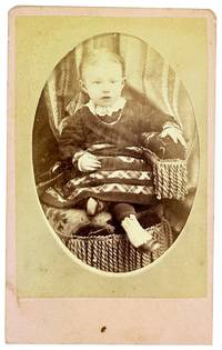
188032410N.p.: U.P.R.R. Photograph 1880. Very Good. N.p.: U.P.R.R. Photograph ca. 1880s. Small format albumen carte de visite 8.5x6cm mounted to card measuring 10x6.5cm. Brief smudging else Very Good to Near Fine. Portrait of a seated child about 18 months old. <br /> <br /> Verso printed in red with an engraved reproduction of the photographer's studio which was housed in a railway car that the photographer S.B. Silvis traveled around on the Union Pacific Railroad line. "Stereoscope & Landscape Views of Notable Points on Line of Pacific R.R. / Always on Hand." We can't find much about Silvis though a notice in Hailey Idaho in late June of 1888 announced that he was in town for a few days to take pictures through the holiday. . U.P.R.R. Photograph unknown
190074021Port Townsend WA and others: N.p. ca. 1900. Original quarto album of full morocco measuring 9 1/2 x 6 1/2 inches. There are 24 think leaves mounted on stubs with each leaf bearing four windows for photographs measuring 3 7/8 x 2 7/8 inches. Most of the leaves in the rear bear no photographs but in the front there are 64 inserted silver gelatin photographs. Of these 36 bear images of people places and activities in the Puget Sound/Port Townsend area The remainder are quotidian shots of England. A chief concern in this album is mining and likely they brought in some British miners which would explain the shots of England. No surnames are given so it is all a bit of a mystery but the pictures speak for themselves. Finding a mining album of the Northwest is a rather rare occasion.The photographs of interest are; Log Cabin; Ranch House with two women and an infant in front; the nanny appears to be a Native American; Ore Coming out of a Tunnel; Harry Smith Cabin with two gents relaxing on the front porch; Cook House a mess tent with many miners taking their meal; Bunk homes for the workers; Blacksmith shop and Ore Dump with two men pushing a cart of trailings down the hill; Swamp grass three foot high; Dumping ore from car; Road Gang at Dinner; Railroad Station near mountains; Road Makers to the Mine a posed group shot of 20 men; Sunset near Port Townsend; Mates at the Boiler Makers; A river near our mine faded. The rest are uncaptioned but we can see the same camp and people in the winter snow; 2 shots of a sailing vessel trying to come up the Columbia ; and seven photographs of Native Americans unposed. One of them seems to be wearing a mask or bag over his head. A fascinating album of a rough and tumble time in the Pacific Northwest. N.p. unknown
1895BOOKS009456INew York: Charles Scribner's Sons. Good/No Dj. 1895. 1st Edition. Hardback. 8vo Rubs to cover/spotting. Text is clean and complete . Charles Scribner's Sons hardcover
1900ZB377716Washington: GPO 1900. 22 pp issued as 56th Congress 1st Session SD 192; light extraction roughness at spine now disbound in self wrappers. - If you are reading this this item is actually physically in our stock and ready for shipment once ordered. We are not bookjackers. Buyer is responsible for any additional duties taxes or fees required by recipient's country. Washington: GPO, unknown
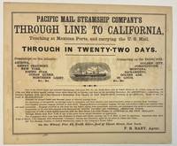
186740392New York 1867. Oblong broadsheet 9-1/2" x 11-1/2." Attractively printed within a ruled border with several type styles and sizes and engraved vignette of a steamship. The number '110' printed in lower margin beneath the border. Signed in type at the end "F. R. Baby Agent." Advertisement on verso for "Simons Brothers & Co. Manufacturers of the Metropolitan Shirt. . . Boston." Light foxing Very Good.<br /> <br /> "One of the above large and splendid Steamships will leave Pier No. 42 North River foot of Canal street at 12 o'clock noon on the 1st 11th and 21st of every month. . . for APSINWALL connecting via Panama Railway with one of the Company's Steamships from Panama for SAN FRANCISCO touching at ACAPULCO. Those of the 1st touch at MANZANILLO.<br /> "Families in Second Cabin and Steerage taken at reduced passage rates.<br /> "An allowance of one-quarter on through rates to clergymen and their families and school-teachers going to practice their vocations."<br /> According to Wikipedia "The Pacific Mail Steamship Company was founded April 18 1848 as a joint stock company under the laws of the State of New York by a group of New York City merchants. Incorporators included William H. Aspinwall Edwin Bartlett American consul at Lima Peru and also involved with the Panama Railroad Company Henry Chauncey Mr. Alsop G.G. Howland and S.S. Howland. The Pacific Mail Steamship Company was established to carry US mail on the Pacific leg of a transcontinental route via Panama."<br /> OCLC does not record this as of August 2024 nor does AAS; but the Huntington owns a copy "Date is determined by the vessels listed in the print". unknown
1890ZB333618Washington: GPO 1890. 11 pp. 2 pp issued as 51st Congress 1st Session HR 2329 Parts 1 and 2; extraction roughness at spine text browned with one tip chipped now disbound in self wrappers; concerns refunding the Pacific Railroad debt to the government. - If you are reading this this item is actually physically in our stock and ready for shipment once ordered. We are not bookjackers. Buyer is responsible for any additional duties taxes or fees required by recipient's country. Photos available upon request. Washington: GPO, unknown
1900373823St. Louis 1900. 34 photographs mounted recto and verso on 17 cards with printed album title on each the images captioned in the negative on linen guards. Oblong small folio 10-1/8x12-1/2 inches. Contemporary half calf and cloth covered boards titled in gilt on the upper cover leather perished contents loose. The images generally dark printings in good condition. Provenance: Battery Park Hotel Asheville NC presentation in gilt on the upper cover from H. C. Townsend Gen'l Pass'r and Ticket Agent St. Louis. 34 photographs mounted recto and verso on 17 cards with printed album title on each the images captioned in the negative on linen guards. Oblong small folio 10-1/8x12-1/2 inches. The images by an unindentifed photographer comprise lovely compositions of buildings and scenes along the route in Missouri Kansas Nebraska and Arkansas. OCLC locates only a single example at University of Texas Austin. unknown
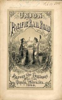
186854323New York: Published by the Company 1868. 1868. TRANSCONTINENTAL RAILROAD. First edition. Pamphlet edition. 8vo. Pictorial wrappers 40 pp. frontispiece Map of the Union Pacific Rail Road and its Connections introduction illustrated frontispiece map advertisement on rear cover for "First Mortgage Bonds at 102 principal and interest payable in gold with an annual income of "between eight and nine percent." This is an investment and advertising booklet for the first transcontinental railroad in the United States which was built by the Union Pacific Railroad and the Central Pacific Railroad in order to connect the Atlantic and Pacific coasts by rail for the first time. Begun in July of 1865 and built primarily by Civil War veterans the construction and completion of the Union Pacific line was one of the most significant technological and economic accomplishments of the 19th century creating the vital connection for commerce trade and travel and literally joining the eastern and western halves of the United States. Contents include the formation of the Union Pacific Railroad Company progress natural resources construction branch and connecting roads construction resources anticipated business & profits actual earnings and sale of first mortgage bonds. A list of officers of the company is provided. Top of front cover displays that this copy is mildly ex-library with stamp and number appearing at the upper right side a faint vertical fold to the center of the booklet tiny chips to bottom corner of front cover and a few preliminary pages. Overall a very good copy of an important railroad report. Published by the Company, 1868. unknown
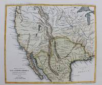
1861M9549New York: Thomas Ford c.1861. Very Good. Notes: Detailed map of the western United States and Mexico. Size : 180x208 mm 7.09x8.19 Inches Coloring: Hand Colored Category: Maps Central America Mexico; Maps United States; Thomas Ford unknown
1861M9550New York: Thomas Ford c.1861. Very Good. Notes: Map of the Western United States. Size : 178x205 mm 7.01x8.07 Inches Coloring: Hand Colored Category: Maps United States West; Thomas Ford unknown
1889354257San Francisco: H.S. Crocker & Co 1889. 70pp. Original printed wrappers. Spine chipped. Small old stamp on titlepage. Very good. 70pp. Introductory material by Leland Stanford. A positive report on the Central Pacific's dealings with the government. <br/><br/> H.S. Crocker & Co unknown