[MAP OF ASIA IN THE PACIFIC WAR].Biblio.com
5 960 résultats
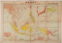
1719176771東京. Tokyo.: 日本放送出版会社. Nihon Hōsō Shuppan Kaisha. Showa 17 1942. Colour folding map scale 1:14500000 55cm x 80cm naval warship photographic illustrations on reverse. The wartime paper is browned and friable but small closed tears along fold lines and edges have been neatly repaired with archival washi on the verso. 79 x 53cm This colour map of Asia and the Pacific was published as a supplement to a magazine Hoso 放送 on January 1942 less than one month after the Pearl Harbor attack by the Japanese Forces. The war had just started but amazingly the map accurately predicted where the fighting would take place throughout the war. An inset map on upper right shows Singapore Borneo Sumatra and Java where battles took place in the area in early 1942. An inset chart on lower left shows various resources and their location including coal tin and iron ore clearly showing that the war was fought over securing resources. On reverse eleven photographic illustrations of war ships from Germany Britain the US and Japan are shown including the Prince of Wales and Enterprise. . 日本放送出版会社. [Nihon Hōsō Shuppan Kaisha]. unknown
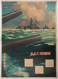
1619176888東京. Tokyo.: 東京日日新聞社. Tōkyō Nichinichi Shinbunsha. Showa 16 1941. Colour poster from a 1941 calendar. 53.5 x 38.5cm small holes at corners central horizontal fold. Some light even browning but overall a striking WWII image from a Japanese calendar. This colour illustrated calendar shows the months of March April and May 1941. The illustration features four Japanese war ships at sea with two naval guns in the foreground. The calendar is titled "Rough Sea on the Pacific Ocean". The implication being military threats are coming from across the Pacific. . 東京日日新聞社. [Tōkyō Nichinichi Shinbunsha]. unknown
1719219230東京. Tokyo.: 日本放送協会. Nihon Hōsō Shuppan Kyōkai. Showa 17 1942. Colour folding map scale 1: 10000000 54.7cm x 79.5cm chronology of building the Greater East Asia Co-Prosperity Sphere on reverse. Some light browning a little darker at folds and reverse washi repairs to folds on reverse. This colour map of Asia and the Pacific published on 30 January 1942—just one month after Japan's attack on Pearl Harbor—offers a striking glimpse into wartime strategy and propaganda. Remarkably despite being produced at the war's outset it accurately anticipated key battlegrounds that would define the conflict. The main map is supplemented by two inset maps: one in the upper right highlighting Japan the Hawaiian Islands and Honolulu and another in the lower left focusing on Singapore with Darwin marked along the lower edge. <br> <br>The reverse side features a revealing chronological chart titled "Building Great East Asia" documenting Japan's military expansion from the 1931 Manchurian Incident through January 1942 as troops advanced across Southeast Asia. Notably two blank rows were intentionally left at the chart's end anticipating future victories to be recorded as the war progressed—a telling detail that underscores the map's dual role as both strategic document and propaganda tool. An interesting map which combines geographical precision with ideological messaging. . 日本放送協会. [Nihon Hōsō Shuppan Kyōkai]. unknown
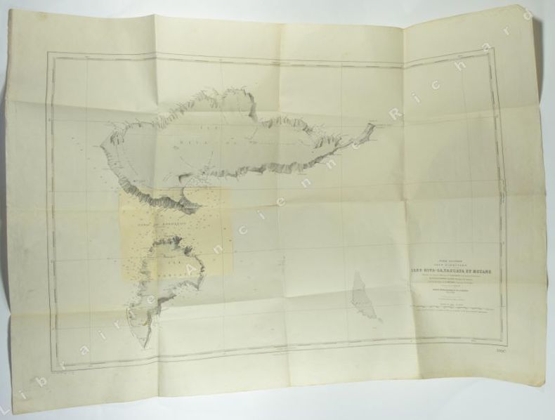
1869PE107911869 16 p., 1 folded lithographed plate, disbound (no covers). Unopened copy. Published in: Sitzungsberichte der Kaiserlichen Akademie der Wissenschaften. Scarce.
1892PE107901892 41 p., 4 lithographed pls, disbound (no back cover, original front cover of journal added loose). Unopened copy. Published in: Sitzungsberichte der Kaiserlichen Akademie der Wissenschaften. Scarce.
5468s. l.(Paris), 1943 - 1950. 1 carte géographique 1050 x 740 mm, imprimé en noir et blanc, 1 correction (également imprimé) au format 179 x 220 mm collée, 1 tache de rousseurs sur la partie imprimée, plusieurs claires piqûres de rousseurs par ailleurs, traces de pli. Bon exemplaire.
1966RO80036010SOCIETE CONTINENTALE D'EDITIONS MODERNES ILLUSTREES. 1966. In-8. Cartonnage d'éditeurs. Très bon état, Couv. fraîche, Dos satisfaisant, Intérieur frais. 367 pages. Nombreuses photos, illustrations et cartes en noir et blanc et en héliogravures, dans le texte et hors-texte.. . . . Classification Dewey : 996-Autres régions du pacifique
19338151Paris Imprimerie Nationale 1933 In-8 Large XXIII+594 pp, Service hydrographique de la marine, n°363, Instructions nautiques. 4 cartes dépliantes hors-texte en début de volume. Dos passé et frotté, légers manques aux coiffes, un mors fendu en tête et queue ; une partie des plats passés. N° et date au tampon. On y joint un fascicule des corrections
1998R240002172EDITIONS ATLAS. 1998. In-4. Cartonnage d'éditeurs. Bon état, Couv. convenable, Dos satisfaisant, Intérieur frais. 291 pages. Nombreuses photos en couleur et en noir et blanc, dans le texte et hors texte.. . . . Classification Dewey : 996-Autres régions du pacifique
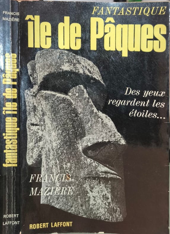
1965PACIFIQUE1111116Paris, Robert Laffont, 1965, 13,5 x 21,5, 242-XX pages cousues, sous couverture rempliée illustrée. Avec XX pages de photographies noir & blanc (et couleurs).
10423Avignon, Editions A. Barthélemy, 1992 21 x 30, 81 pp., illustrations en couleurs, cartonnage éditeur illustré, état neuf
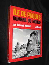
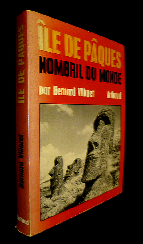
1970100149161Arthaud 1970 in8. 1970. Broché.
1970na802Arthaud Broché 1970 In-8, (20x15 cm), broché, couverture à rabats illustrée, 237 pages, quelques illustrations en noir et blanc, bibliographie, 1 carte postale insérée avec l'ouvrage ; pliures sur le dos, mors frottés, bon état. Livraison a domicile (La Poste) ou en Mondial Relay sur simple demande.
1970nn929Arthaud Broché 1970 In-8, (20x15 cm), broché, couverture à rabats illustrée, 237 pages, quelques illustrations en noir et blanc, bibliographie, 1 carte postale insérée avec l'ouvrage ; dos insolé et bord du 1er plat insolés, coiffes et bords frottés, des marques d'usage aux plats, assez bel état. Livraison a domicile (La Poste) ou en Mondial Relay sur simple demande.
19659304Robert Laffont 1965 231 pages in8. 1965. Broché couverture rempliée. 231 pages. L'ouvrage relate l'expédition archéologique et ethnologique menée par Francis Mazière en 1963 vers l'île de Pâques à bord d'une goélette en compagnie de sa femme polynésienne Tila. Il s'agit du récit d'une aventure visant à percer les secrets de cette île mystérieuse du Pacifique et à témoigner de la vie de ses derniers habitants
500184935CHERCHE MIDI 416 pages 13 9x22x3 1cm. Sans date. Broché. 416 pages.
20192-6139516528Éditions universitaires européennes 2019. Paperback. New. 60 pages. French language. 8.66x5.91x0.14 inches. Éditions universitaires européennes paperback
19391811241178xbvkParis, Vigot Frères, 1939. 46 (1) pages, photographically illustrated throughout. - Publisher's illustrated (drawing) softcover; 8vo.(ca. 21 x 16 cm).
6138394003.Gpaperback. Good. Access codes and supplements are not guaranteed with used items. May be an ex-library book. paperback
2004EL376292004 vii, 248 p., 448 figures, 64 coloured plates (of which 57 are beautiful drawings by F. Gregor), blue publisher’s cloth (dust jacket). Monographs on Australian Lepidoptera Vol. 9. Library stamps, else good copy.
ria9786208561635_inpPaperback. New. New Book; Fast Shipping from UK; Not signed; Not First Edition; N/A paperback
6208561639.Gpaperback. Good. Access codes and supplements are not guaranteed with used items. May be an ex-library book. paperback
1909EL137001909 304 p., 232 figs, 10 pls, roy. 4to (25 x 31 cm), disbound (no covers). Unopened copy. Published in: Kungl. Svenska Vetenskapsakademiens Handlingar.
19501200531Wien, Herold, 1950. 4to. 3 Bl., 75 S. (in Blattzählung) (Acta Ethnologica et Linguistica 1). OKart. (Stempel verso Titel).
1988EO370581988 xi, 316 p., cloth. Library stamps, else good copy.