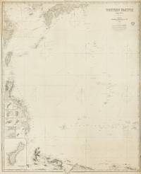
[Western Pacific]. IMRAY, James and SonBiblio.com
133 résultats
1884143681London: James Imray and Son 1884. Very Good. London James Imray and Son 1884. A very large engraved chart printed on two sheets combined printed surface 1268 × 1015 mm overall total size 1280 × 1048 mm mounted on the original blue backing paper with the publisher's title-label on the verso. Chips and short tears to the margins in a few places clear of the printed surface; a few small light stains and other minor signs of age and handling; in very good condition with faint pencil annotations tracking a voyage to Hangzhou in September 1888. A very large and detailed blueback chart of the western rim of the Pacific Ocean including the East China Sea Philippine Sea and parts of the coastlines of Japan Korea China Taiwan the Philippines and New Guinea. It features eight inset charts: Guajan Island; Borodino Island; Umata Bay; Farralon de Medinilla; Rota; Alamagan; Guguan; and Rosario Island. Both sheets incorporate corrections to June 1884. <p>The title-label on the verso reads 'Chart No 193. Western Pacific in Seven Charts. Chart No. 4. Price 8s.'. James Imray and Son unknown
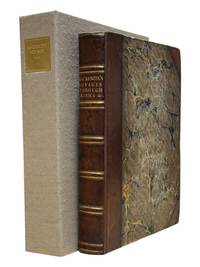
18019122London: Printed for T. Cadell Jun. & W. Davies; Cobbett & Morgan; and W. Creech by R. Noble 1801. First edition. 4to 4 viii 412 2 errata cxxii pp with "General History of the Fur Trade" following the Voyages section and errata leaf. Complete with half title often lacking frontis portrait three large folding engraved maps. Fine 1/2 polished calf tooled in blind and lettered in gilt on spine marbled boards endpapers and page edges. Few stains and foxing to prelims most notably at the inner margin of the frontis and title pages. Otherwise scattered light foxing mainly marginal and more pronounced on the final dozen leaves or so. Maps quite nice with typical offsetting from folds some foxing and toning. A very good copy in attractive binding housed in a custom oatmeal cloth Solander box lined with green felt gilt spine label. <br /> <br /> A cornerstone work on early Pacific Northwest exploration being the first account of crossing the continent from ocean to ocean by a white man some dozen years before Lewis and Clark. This text also represents the first published account of the fur trade which was attributed to Roderick Mackenzie. A nice copy in attractive binding. <br /> <br /> Howes M 133. Sabin 43414. Streeter 3653. <br /> <br /> <br /> . Printed for T. Cadell, Jun. & W. Davies; Cobbett & Morgan; and W. Creech, by R. Noble unknown
1850DEMO015143ILille France: L. Lefort 1850. Stated Second edition. Hardcover. Very Good. steel-engraved frontispiece. 8vo 258 pages 20th century half sprinkled calf marbled boards original wrappers bound in place. <br/><br/>Needs to be read with de Smet's LETTERS AND SKETCHES . AMONG THE INDIAN TRIBES OF THE ROCKY MOUNTAINS 1843 which contains several letters not included in this French text; but this French text "contains material not found in the English - Wagner-Camp-Becker 113a:5." Howes M288; Graff 3831; Monaghan 1332. Binding by "Reliure Francais". Issued in the Bibliotheque Historique et Morale this is actually the Third French Edition. Steel-engraved frontispiece. L. Lefort hardcover
1869ZB386909Washington 1869. 40th Cong. 3rd Sess. Senate Rep Committee No. 219 3 pp. ex library good. - If you are reading this this item is actually physically in our stock and ready for shipment once ordered. We are not bookjackers. Buyer is responsible for any additional duties taxes or fees required by recipient's country. Washington unknown
1870354323New York: E. & H.T. Anthony & Co 1870. Single stereocard 3½ x 7 inches. Stereo image mounted onto printed orange cardstock. Slight wear at edges. Very good. Single stereocard 3½ x 7 inches. An appealing stereocard image showing several long stretches of railroad track heading into the small town of Ogden Utah. It is a view of an important point crossing point in American railroad history as Ogden is the point at which the Union Pacific Railroad ends and the Central Pacific begins. A train can be seen on the tracks in the far distance as well as a few clapboard buildings. The New York photographic firm of E. & H.T. Anthony & Co. produced several stereoscopic views for the Central Pacific Railroad though few are known today. A nice image of an important railroad intersection. E. & H.T. Anthony & Co unknown
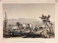
185714427Washington DC: Bevery Tucker Printer 1857. First Edition. Very Good. A.H Campbell. 8.25x11in One litho tinted illustrated plate Part I plate V; Light age-toning along edges with several light spots in margin. Samuels p. 81 Taft p. 265. This plate is from from Volume VII of the quarto edition of twelve volumes were published from 1855 to 1861 as exploration and survey reports became available. These volumes contained not only the survey maps and elevations but a monumental collection of scientific reports on geography geology zoology botany and ethnology of the Native American tribes. The surveys also included 11 artists to record the landscape and indigenous peoples of the west. <br /> <br /> <br /> <br /> Albert Henry Campbell 1826-1899 was a Railway survey artist-explorer civil engineer and surveyor. He was one of the more important artist of the surveys and participated in several survey expeditions across the west from 1853 to 1854. In the fall of 1854 he joined the Parke survey expedition for a coastal railroad route from San Francisco to San Diego and the survey along the 32nd parallel to Arizona. All eight of the full-page illustrations are credited to Campbell in the report three of California and five of Arizona scenes After the surveys he was assigned to Washington as Superintendent of Pacific wagon roads to 1860. During the Civil war he was a map maker for the Confederate Army and chief engineer of railroads based in West Virginia. from Samuels <br /> <br /> The twelve volumes were disorganized in publication with no overall all arrangement or indexing. Some of the plates and maps referred to in volumes were published in other volumes various reports were also published out of sequence relating to the four routes. Preliminary reports published were updated in latter volumes. From Wagner-Becker-Camp In 1853 Senator Gwin of California lead the inclusion of Congressional funding for 1853-54 of a series of surveys to determine the best and most economical railroad routes from the Mississippi River to the Pacific coast. The act directed the Secretary of War Jefferson Davis to plan and direct Army topographical engineers to conduct surveys of four routes. The first was between the 47th and 49th parallels generally along the Lewis and Clark route to the Pacific. The Second route between the 37th and 39th parallels was promoted by Senator Thomas Hart Benton of Missouri. The Third route was along the 35th parallel. The Fourth route was promoted by Secretary Davis along the 32nd parallel that followed Emory's 1846-47 reconnaissance. Bevery Tucker, Printer unknown
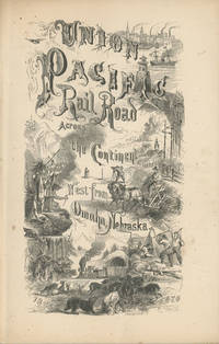
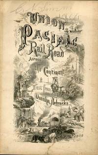
186849559New York: Published by the Union Pacific Railroad Company 1868. 1868. RAILROAD. First edition. 8vo. Original pictorial printed wrappers 32 pp. frontispiece Map of the Union Pacific Rail Road and its Connections introduction. Details the formation of the company and the progress of the work including the topography character of the country and distances along the line. Much information is provided regarding agricultural resources timber minerals etc. Branches and connecting roads along with the needed resources for construction are discussed as is information on actual earnings anticipated earnings and the issuance of the company's first mortgage bonds. A wonderful advertisement on the rear cover panel offers First Mortgage Bonds at par principal and interest Payable In Gold. A faint vertical crease and very lightly toned at the cover edges else a near fine bright copy. Published by the Union Pacific Railroad Company, 1868. unknown
189071195San Francisco: Southern Pacific Co. ca. 1890. Two original albumen photographs taken by a staff photographer for the Southern Pacific Railroad Company. Each photograph is 8 1/8 x 5 7/8 inches. Both are captioned and mounted on original boards with gilt edges. The first entitled 'Rotary Snow Plow in Action' and the second 'Snow Shovelling at Cascade'. Each photo shows a large group of men working on removing snow from the tracks. The Cascade mentioned is probably Cascade Trestle near Truckee although it is conceivable that it is Cascade Summit Oregon. Southern Pacific Co. hardcover
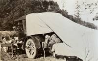
188059310Portland OR & Seattle WA: Walter Angus MacKay Julia Rose Eder MacKay Cross & Dimmitt ca. 1880-1958. Two vols. 1st - Thick oblong 4to. 11.5 x 8.75 x 2.25 in. 128 pp unpaginated. on thick black paper. With 461 photographs sized 1.75 x 2.75 in. up to 4.5 x 5.5 in. including 2 CDV’s 1 cyanotype several albumen and range of silver gelatin snapshots on matted and glossy paper stock many w/ annotations either on verso below images or w/in the margins at lower fore-edge or in pencil some w/ white ink alongside the images. Contemporary flexible polished calf post-binder punch-sewn at gutter margin in gold silk braid RPPC of Tillamook Bay OR by Gregg mounted on front cover chipping & wear to front cover wear to corners wear & rubbing to some fore-edges occasional chipping minor closed tears still VG exemplar; 2nd vol. -- Oblong 8vo. 8 x 5.75 in. 78 pp unpaginated. on thick tan paper stock. With 101 silver gelatin photographs mounted sized from 1.75 x 2.75 in. up to 4 x 6 in. some w/ sepia effect either mounted directly on the pages or many affixed with small strips of black paper or old paper corners affixing the images to the leaves a few w/ annotations on verso or below. Contemporary flexible diced calf “Housh†photo album chipping & wear to spine wear & bumping to corners some pages reworked by compilers at some point still a G exemplar both albums’ photos with bright strong contrast. These photo albums faithfully follow the sporting and leisure activities of two gearheads from Chicago -- Walter MacKay and his brother Carrol MacKay who together with their extended families and friends drive and auto-camp across the West. The large first album opens with many photos following a trip to Yosemite National Park as well as scenes along the route and upon the return of Walter & Julia. Their follow-up automobile trip in 1928 takes them to Yellowstone National Park via Spokane Idaho and Montana with photos included of Old Faithful a photo by Haynes of the Grand Geyser as well as auto camping at “Mammoth Hot Springs.†Subsequent photos trace their travels through the Columbia River Gorge the Snake River Mount Rainier National Park Ariel Dam near Ariel WA Hoods Canal WA and Newport OR. Their speed boat launch the Carmen is featured in some photos along with several views of pumps hoisting engines giant diesel and gas engines under repair. Other trips include those to Snoqualmie Falls Trout Lake WA near Mt. Adams working a hoist at logging camp partying with friends in Renton WA and even views of Walter MacKay advertising his Automobile Repair Shop with a cover on his rear tire. Other outings include auto camping and picnicking along the Mt. Hood Loop Grant’s Park on the Clackamas River Mt. Hood the Rogue River Table Mountain and views of Grants Pass. Walter and his gearhead friends were known for their stripped-down roadster racing cars and were also early participants in the Seattle Motorcycle Club and Motorcycle races. A couple photos within the two albums show early motorcycles and even gallivanting on some stripped down chassis without engines or tires. The second album includes a series of photos featuring Walter and his car beneath a towering Cedar Stump with arch cut into the base and him holding gun as well as standing on the fenders of the car. The second also includes automobile camping photos with tent and cots folded out of the rear of the automobile driving into Vancouver B.C. as well as driving to Mount Rainier and more along the Columbia River Highway and Mount Hood. Also featured are hunting shots in Eastern Oregon construction of a summer log cabin and much more. Mackay 1883-1959 was a mechanical engineer machinist gearhead racecar builder who came West working for the railroad as a machinist before working for Paragon Co. in Seattle as parts manager. He owned and operated the MacKay Automotive Repair at 165 E. 39th in Portland OR on the SW corner of 39th Cesar Chavez and Belmont for years before working at Albina Engine & Machine Works at the end of the Great Depression. One of the photos in the 2nd album shows MacKay with his camera shooting a photo and several show Julia MacKay’s 1880-1958 sisters and family. Should be noted we unknowingly catalogued an album on Seattle Auto Racing and Motorcycle Clubs from before World War I without having had access to these unknown albums. See: The Origins and Growth of the Club Scene in Western Washington 1910-1941 Jolly Rogers Motorcycle Club Feb. 7 2009; Seattle Motorcycle Races Pantages Theater Program Early Advertising in the West 1867-1918 Univ. of Washington Spec. Collections. Walter Angus MacKay, Julia Rose Eder MacKay, Cross & Dimmitt, unknown
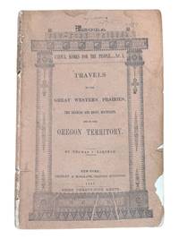
18439124New York: Greeley & McElrath 1843. Third edition. 23.5x15.5cm 112pp. Printed in two columns with tables ads on inner wrappers. Stitched in original printed brown wraps. Damp staining to upper corner of first 35 or so pages more pronounced at title and near the front. Spine cocked and with ends chipped chipping along edges of wraps. Pencil annotation to front cover. A very good copy. <br /> <br /> Third edition following the 1841 and 1843 Poughkeepsie printings of this popular text issued as an "Extra" of the New York Tribune. The book is essentially an account of the first overland to Oregon migration of emigrants bound for the territory led by Farnham and known as the "Peoria Party." They left Independence Missouri on May 20th 1839 and as a substantially smaller group arrived in Oregon on September 23 1839 with Marcus Whitman. Scarce in the original wrappers.<br /> <br /> Howes F50. Wagner-Camp 85:3. Washington 89 20. Greeley & McElrath unknown
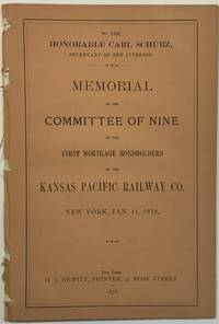
187840161New York: H.J. Hewitt Printer 1878. 2 34 pp with two folded leaves of freight rates. Original printed front title wrapper lacking rear wrapper. Disbound with slight loosening. Clean text. Good.<br /> <br /> The Argument demonstrates that the Union Pacific Company discriminates against the Kansas Pacific Company in its imposition of freight rates.<br /> OCLC locates twelve copies under several accession numbers as of June 2024. H.J. Hewitt, Printer unknown
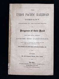
1868004824New York: Union Pacific Railroad Company 1868. Soft cover. Good. 8vo - over 7¾ - 9¾" tall. 32pp. Pamphlet 8 1/2 x 5 1/2 inches in size describes the company's progress during the construction of their cross continental railroad in 1867. Cover and map are not present. The 32 page booklet is in very good condition unworn condition. <br/> <br/> Union Pacific Railroad Company paperback
186754322New York: Brown & Hewitt Printers 1867. 1867. TRANSCONTINENTAL RAILROAD. First edition. Pamphlet edition. 8vo. Pictorial wrappers 24 pp. frontispiece Map of the Union Pacific Rail Road and its Connections introduction illustrated frontispiece map advertisement on rear cover for "First Mortgage Bonds at six per cent. In gold at Ninety Cents on the Dollar. Light evidence of the entire booklet having been folded vertically penciled name to top of front cover covers lightly soiled and used small closed tear to the lower margin of the front cover Overall a very good copy of an important railroad report. Brown & Hewitt, Printers, 1867. unknown
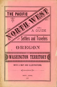
188263407New York NY & St. Paul MN: The Northern Pacific Railroad Co.; Printed by E. Wells Sackett & Rankin 1882. 8vo. 81 1 pp. With double-page frontisp. birds-eye woodcut view of Portland OR stretching out to Mount Rainier south to Mt. Hood 9 woodcut-engraved plates. Pink-tinted printed softcovers decorated lettering minor creasing egewear slight chipping at corners without the folding map still a good reference copy. First edition of this informative land promotion issued by the Northern Pacific Railroad upon completion of its line to the Pacific Northwest from St. Paul MN in conjunction with Jacob Kamm’s Oregon Railway & Navigation Co. The views include the two-panel birdseye of Portland OR as well as views of Astoria a Puget Sound sawmill Commercial Street in Seattle of the Washington Territory and includes a mention of Chinese-Americans employed to build the railroad and now available to take contracts for “grubbing brush land.†The Northern Pacific Railroad Co.; [Printed by] E. Wells Sackett & Rankin, paperback
188250958New York: Land Dept. Northern Pacific Railroad Co. 1882. 1882. PACIFIC NORTHWEST. First edition. 8vo. Printed wrappers 81 pp. introductory illustrated large folding map at the rear. Scarce Western promotional travel guide to the Pacific North-West. Addressed to prospective settlers and travelers alike this guide consists of historical geographical and agricultural information and discusses at length matters such as commerce climate education taxes prices and the regions of the Pacific North-West. Each county is described and suggestions are provided to prospective emigrants such as "In mercantile pursuits the opening is good for men of enterprise and capital; but the chances for mere clerks are not good." Farm labor wages in these parts are recorded as being between $25 and $30 per month and lumber mills wages between $60 and $90 per month for first-class hands. It is also noted that "Chinamen work for the railroads and boards themselves at $1.00 a day and in winter take contracts for grubbing brush land." There are ten full-page illustrations which include a two-page "Bird's Eye View of Portland Oregon" "Saw Mill on Puget Sound W.T." "Astoria Oregon Entrance to Columbia River" "First Street Portland Oregon" and "Commercial Street Seattle W.T." with folding map of the region Unfolded 28 1/2 x 18 inches in the back. Spine and outer edges of wrappers sunned else very good copy. Land Dept., Northern Pacific Railroad Co., 1882. hardcover
186895331868. <p>The Transcontinental Railroad made possible the winning settlement and development of the American West. It led to a revolution in interstate and international trade opening the markets of the west coast and Asia to the east and Europe while bringing products of eastern or European industry to the growing populace west of the Mississippi and beyond. The railroad caused a great production boom and was in a sense America’s first technology corridor. As it encouraged the growth of American trade and business so too did the railroad impact the nation's public discourse and intellectual life by making it possible to come and go across the length of the continent in just over a week. Now for the first time the beauties and riches of the central part of the continent could be accessed any anyone in days. Nothing was the same afterwards. Many people consider the Transcontinental Railroad the greatest technological feat of the 19th century and one of the most consequential major construction projects ever undertaken.</p><p>Before the advent of the Transcontinental Railroad a journey across the continent to the west coast meant months of careful preparation and acquisition of a conveyance and supplies then a dangerous six month trek over rivers deserts and mountains all the way risking the loss of necessities and encounters with blizzards and Indians. Alternatively a traveler could hazard a three to six month sea voyage around ferociously stormy Cape Horn which proved a graveyard to many ships or sail to Central America and cross the Isthmus of Panama through the jungle in part by pack animal and in part by rail which took five or six weeks risking exposure to any number of deadly diseases in the crossing. So it is no surprise that interest in building a railroad uniting the east and west coasts of the continent began soon after the advent of the locomotive.</p><p><strong>Early Trains in the US and the Idea to Build a Train Connecting East and West Coasts</strong></p><p>The first trains began to run in the U.S. in the 1830s along the East Coast and by the 1840s the nation's railway networks extended throughout the East South and Midwest. The annexation of the western territories including California following the Mexican War the almost immediately subsequent discovery of gold in the region in 1848 the resultant Gold Rush starting in 1849 and statehood for California in 1850 brought momentum to the idea of building a railroad across the nation to the Pacific. Meanwhile thousands of immigrants and miners sought their fortune in the West. During the 1850s Congress sponsored numerous survey parties to investigate possible routes for a transcontinental railroad. No particular route emerged as a clear favorite as the project became yet one more point of contention between the North and South before the Civil War with each wanting the railroad to go through their section.</p><p>Theodore Judah was a civil engineer who helped build the first railroad in California and he became obsessed with the idea of a transcontinental railroad running through Nebraska Wyoming Utah Nevada and California. In 1859 he drew up letters of incorporation for the Central Pacific Railroad Company. Judah surveyed the route creating maps that he used to bolster a presentation of the scheme he made to Congress in October 1861. Many Congressmen were leery of beginning such an expensive venture especially with the Civil War underway but President Abraham Lincoln a long-time supporter of railroads saw in the proposal an important additional opportunity: to help knit California and the West to the Union. He agreed with Judah and on July 1 1862 Lincoln signed the Pacific Railway Act authorizing land grants and government support which amounted to $32000 per mile of track laid to two companies the Central Pacific Railroad and the Union Pacific Railroad. The Central would start at California’s eastern rail point in Sacramento cross the Sierras go through Nevada and into northern Utah where it would meet up with the Union Pacific. The Central Pacific Railroad spiked the first rail on October 26 1863 and its construction crews began building the line east from Sacramento.</p><p>At the eastern end of the project Gen. Grenville Dodge and his assistant Peter Dey surveyed the potential route the Union Pacific would take. They recommended a line that would follow Nebraska’s Platt River along the North Fork would then cross the Continental Divide at South Pass in Wyoming and continue along to Green River then head into Utah. President Lincoln favored this route and made the decision that the eastern terminus of the Transcontinental Railroad would be Council Bluffs Iowa across the Missouri River from Omaha Nebraska.</p><p><strong>The Union Pacific</strong></p><p>Thomas Durant a medical doctor turned businessman gained control of the Union Pacific Railroad Company in July 1863. Though Durant took the office of vice president he was the actual leader of the railroad. In 1864 Congress passed the second Pacific Railway Act which doubled the size of the land grants and allowed the railroads to sell their own bonds. The Union Pacific began to lay tracks at Omaha Nebraska in July 1865. But Durant's management of the actual building of the rail line was sub par and lacked both organization and people with sufficient knowledge and skills to accomplish its ambitious task.</p><p>So as 1866 dawned Durant hired Grenville Dodge as chief engineer of the railroad Dodge began advising Durant immediately although he would not leave the service until May and Dodge insisted up front that Jack Casement and his brother be hired to lay the track and actually construct the Union Pacific line. John S. Jack Casement had worked as a railroad contractor on the Ohio Railroad prior to the Civil War. During the war he rose to the rank of General and Brigade commander and was admired for his bravery management skills and railroad experience. Jack and his brother Daniel had formed the firm of J.S. & D.T. Casement; “General Jack†was construction leader while Daniel handled financial matters.</p><p><strong>Jack and Dan Casement Build the Railroad</strong></p><p>The Casements came to an understanding with Durant and they agreed upon a proposal letter dated February 6 1866. That letter provided that the Casement firm would ""lay and fill the track on the Union Pacific Rail Road for seven hundred fifty dollars per mile on the following terms and conditions. The Rail Road Company to furnish motive power cars wood and water and tracks for boarding cars and pay for delays of over three consecutive days caused by want of material motive power or other default or neglect of Company. The track to be laid in a good and workmanlike manner and filled and surfaced with material taken from the side of the road the whole to be subject to the approval and acceptance of the Engineer of the Company in charge of the work and the track to be accepted on the completion of every twenty miles and approximate estimates to be made by the Engineer in charge and paid monthly. We will lay the track as fast as required not to exceed one mile per day and will at the option of the Company on ten days notice reduce our gang to a force sufficient to lay one half mile per day. We will furnish engineer men and all other help for the trains used in distribution of material and take the materials for track at any point on the Rail Road within one hundred feet of the track and we will furnish oil waste etc for trains in our employ. All trains used in construction or for any purpose by us are to be run subject to the regulations & schedule time of the Company & under the general control of the Superintendent of the Company. We will make no extra charge in cutting and filling in leveling ties unless it exceeds six inches. No extra charge for putting in frogs and switches for all necessary sidings. And we will place the labor of all our men at the disposal of the Company whenever the delays exceed three days and charge for their time as per our payroll. We will commence as soon as the Company requires & will lay track during the whole of the present season and longer if the Company requires.†This proposal was signed “J.S. & D.T. Casement.†Durant responded to the Casements two days later on February 8 1866. His letter stated: “J.S. & D. T. Casement Painesville Ohio. Gentlemen: Your proposition to the Union Pacific Railroad Company under date of Feb. 6 1866 in relation to track-laying is received and has been considered. The Company decides to regard your proposition and this acceptance as the agreement upon the subject. The Company reserves the right to terminate this arrangement in case you do not perform the agreement on your part. Yours truly Thomas C. Durant V. P.""</p><p>Jack Casement was responsible for all matters relating to building the Union Pacific. He hired the workers many of whom were former military personal gathered the materials and supplies and went into the field. As during the war his post was at the front in the construction camps which he ran like an army at the end of the line where the work was being done or in his car at the tail of the work train. Scrappy and hard-working he oversaw not just the laying but the grading of the track as well. As one of the necessities of his job to get to and from the work sites the Union Pacific presented him with annual passes to use their cars.</p><p><strong>Jack Casement’s engraved Union Pacific pass for 1868</strong> used by him to manage and supervise work on the Transcontinental Railroad signed by Company President John D. Perry. This pass was retained by Casement’s descendants until recently when we obtained it directly from them.</p><p>Under Casement’s leadership the Union Pacific laid 1087 miles of track from Fremont Nebraska west to Utah where the Central Pacific and Union Pacific Railroads met to form the transcontinental railroad. His was a magnificent achievement that compares well with the Central Pacific Railroad which laid 690 miles.</p><p>On April 9 1869 with construction work nearing a conclusion and both the Union Pacific and Central Pacific needing a meeting point Congress established it as Promontory Summit north of the Great Salt Lake in Utah. Less than one month later on the morning of May 10 1869 locomotives from the two railroads met nose-to-nose to signal the joining of the two lines. At 12:57 p.m. local time at a ceremony planned to connect the railroads Leland Stanford Governor of California and president of the Central Pacific and Durant as vice-president of the Union Pacific were to pound in the golden spike with silver hammers. Both men proved unable to hit the spike so Jack Casement stepped up to do the job accompanied by much cheering from the workers surrounding him. Telegraphers announced the completion of the Pacific Railway. Canons boomed in San Francisco and Washington. Bells rang and fire whistles shrieked as people celebrated across the country. The nation was indeed united.</p> unknown
18469109London: Charles Knight & Co 1846. First edition. 15x10cm 7 226pp. Frontis folding map at pg. 102. Cream blind stamped cloth with gilt spine lettering. Boards smudged spine darkened. Prelims unopened else clean internally and nearly fine. <br /> <br /> Very nice copy of this book printed for English youth and published the year in which the Treaty of Washington was signed ending the dispute between Great Britain and the U.S. over title to the Oregon Country. Tweney mentions in his Washington Eighty-Nine:<br /> <br /> "This book gives the English side of the Oregon boundary dispute and urges that the northern line of California be the natural boundary between the two countries."<br /> <br /> <br /> Besides presenting arguments the book is also very descriptive in the early settlement of the Pacific Northwest and rise of the fur trade. Not often found in the original cloth in presentable condition.<br /> <br /> Howes N151. Sabin 55251. Smith 7311. Wagner-Camp 122C:1. Washington 89 57.<br /> <br /> <br /> <br /> . Charles Knight & Co unknown
189253290Portland OR: Lewis & Dryden Printing Co. Oct. 1st 1892. Oblong folio. 200 pp. Colour chromolithograph frnts. of the Oregonian building 100s of photos 1 large double-page panorama of Portland OR maps illusts. Original embossed burgundy calf lettered & illustration in gilt on front cover by Meston-Dygert Book Manufacturing Co. expertly rebacked ffep. renewed still a VG copy with very bright gilt image on front cover. First edition of this scarce souvenir album intended to promote the history and economic strength of the Pacific Northwest and to extoll the virtues of Portland. The editors have includes 100s of photos and information about Portland buildings persons of interest sporting areas mountain climbing on Mt. Hood natural landmarks logging orchard farming shipping lines on the Columbia and Willamette industries and more. Of interest are the extensive sections on Washington state cities industries and more. There is also a small section on Idaho including Boise. Lewis & Dryden Printing Co., unknown
187072298Philadelphia: Jay Cooke & Co. ca.1870. First edition Octavo. 46 2 ads pp. Cover printed in red and black. Original printed wrappers with a map of the railroad's line on rear small piece excised but not affecting map and an old center crease. Very good.One of the ads is for development in Montana and bears a letter from Governor Potts. Includes - "Puget Sound-Its Harbors. Climate and Resources."Together withSpecial Report of a Reconnoissance of the Route for the Northern Pacific Railroad between Lake Superior and Puget Sound via the Columbia River Made in 1869 by W. Milnor Roberts U.S. Civil Engineer. Philadelphia: Jay Cooke and Co. ca. 1870. First edition. Octavo. 51 1 4 ads pp. Publisher's printed wrappers. Very good. Jay Cooke & Co. unknown
1870vot622Philadelphia: Jay Cooke & Co. Financial Agents of the Northern Pacific Railroad Company n.d. ca. 1870. Octavo stiff printed wrappers title printed in red & black 46 2 ads pp. Rear cover is a “Map of the Northern Pacific Railroad and Its Connections.†Good; spine is repaired with cloth tape. Jay Cooke & Co., Financial Agents of the Northern Pacific Railroad Company, n.d. [ca. 1870.] hardcover
1871761New York 1871. Good plus. Folding pamphlet 6 x 17 inches. Separated along one fold. A few later pencil annotations. Light wear and tanning. A scarce advertisement for bond investment in the Northern Pacific Railroad issued in 1871 during the first great construction push on the line. Although the company was founded in 1865 ground was only broken on construction in 1870 after considerable backing by Jay Cooke. This pamphlet outlines the plans for the railroad to be built from St. Paul to Portland and Seattle the prospects for passenger and freight business upon completion and the extent of the land grants afforded the railroad by the federal government. The text goes on to describe the financial instruments on offer their advantages over Treasury bonds chiefly a greater yield at 7-8% vs. 5-6% and their security against the commercial and financial assets of the railroad as well as its land grants. With a map of the proposed route on the rearmost panel. A scarce call for investment in the Northern Pacific from its early history. unknown
188900006509Boston: Houghton Mifflin and Company 1889. First edition. Hardcover. Very Good. 8vo. 4 iv-xi 2 2-352 2 pp. Original brown cloth with black illustrations and gold lettering on the front board and the spine; brown topstain. A handsome copy of this 19th century travel narrative. A Very Good book with a few hints of wear to the edges of the boards especially to the top and bottom edges of the backstrip. Houghton, Mifflin and Company hardcover
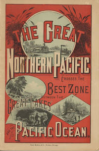
188249882Chicago: Rand McNally & Company 1882. 1882. First edition. 9" x 6" in color pictorial wrappers printed in red blue & black with vignettes of wheat threshing cattle mining and logging on front wrapper. 82pp. plus 2 pp. publisher's ads for Oregon Railway & Navigation Co. Contents. Illustrations. Maps. Uncommon Northern Pacific Railway land promotion detailing the sites and possibilities along the Northern Pacific route at the end of the 19th century. The work details the history of the NPRR divisions branch lines development opportunities for homesteaders and businesses in Western Washington the inner-mountain West Montana Yellowstone National Park the Dakotas Minnesota and specific land grants available from the NPRR in Minnesota and the Dakotas. Large color map attached to inside rear wrapper. Map fine. Light chipping to wrapper edges and with a few small closed tears to wrapper edges along with light soiling and rubbing to spine. Very good. Rand, McNally & Company, 1882. unknown
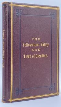
188210945St. Paul MN: The Pioneer Press Co 1882. First Edition First State. 100pp. Octavo 24 cm Presentation binding. Publisher's full grained brown leather with the title gilt stamped on the front board and backstrip. A.E.G. Satin moire endsheets. Near fine. Inscribed on the front free endsheet. 'Mr. Minnie with compliments of the author. Map of the Yellowstone Valley 42 cm x 70 cm and the Plat map of Glendive 40 cm x 56 cm present and both linen backed and in nice condition. Presentation copy. The trade edition of this work was bound in green printed wrappers with 10 pages of advertisements in the front and 3 to 10 pages of advertisements in the rear. Map of transcontinental was attached to the rear free endsheet. Our copy predates the various issues with advertisements and the map attached to the rear free endsheet. Eberstadt and Yale copies and others only list the plat and cattle trails maps. Early Montana promotional item from the Northern Pacific Railroad a year before they opened the Gardiner Gateway at the north end of Yellowstone Park. An important descriptive tract of the new country at the time of its settlement with a fine large map showing the towns and cattle trails. Eberstadt 132: 478. Howes Y8. Rampaging Herd 1535. This is the first time that we've handled or encountered this title. Rare. The Pioneer Press Co unknown
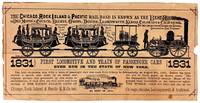
187548055Chicago: Chicago Rock Island & Pacific Railroad Co 1875. Good. Chicago: Chicago Rock Island & Pacific Railroad Co. ca. 1875. Small pictorial broadside flyer. 16.5x33cm printed in black. Stock worn toned and chipped with a few instances of soiling extensive splitting along old folds with tape repair to verso. Good only. <br /> <br /> Promotional broadside for the Chicago Rock Island & Pacific Railroad that operated from roughly 1850-1970 largely in the Midwest. Features a paper-cut illustration that was created on the occasion of the first trip made by steam-powered passenger cars in New York in 1831 before the company's incorporation. This broadside however was not issued until several decades later. The extensive railway inspired the tune "Rock Island Line" covered by country crooners Johnny Cash and Lead Belly. <br /> <br /> No separately cataloged copies in OCLC as of May 2026. Chicago, Rock Island & Pacific Railroad Co unknown